Embed Size (px)
Citation preview
A HOME RULE COMMUNITY
112 Algonquin Road Barrington Hills, IL 60010
847.551.3000 [email protected]
www.vbhil.gov
MEMORANDUM
TO: The Residents of Barrington Hills FROM: Pamela Cools Chairwoman, Plan Commission DATE: June 17, 2019 SUBJECT: Comprehensive Plan - Draft ========================================================================= The document that follows is the culmination of months of work by the Plan Commission of Barrington Hills. The Commission approached the document not with the goal of reinventing it, but to reorganize the document to make it simpler to read and easier to use. This streamlined, modern document will act as a reference for Village Officials, staff and residents, as well as for the greater Barrington community. A comprehensive plan represents a community's vision to guide growth and to help a municipality make decisions regarding future development and redevelopment. The plan helps to set standards regarding land use, infrastructure, transportation, parks and recreation, and community services and facilities. It acts as a blueprint for the future and identifies community values and priorities. In an effort to begin getting feedback as the document moves towards its final form, the document as presented for the public hearing and thus attached is for content. The final document will be formatted differently and include more or different photos and images highlighting our community. The Plan Commission hopes that you will review the document and submit comments to [email protected] or at the public hearing scheduled for July 8, 2019.
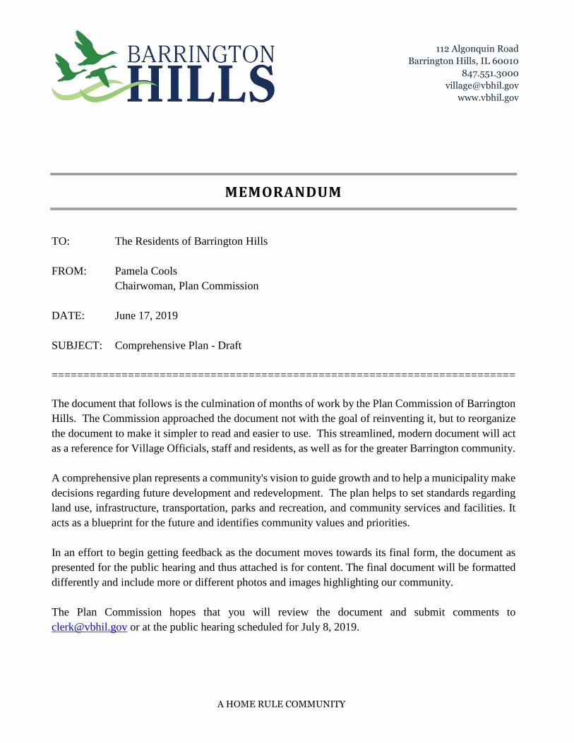
DRAFTTHE
COMPREHENSIVE PLANFOR THE
VILLAGE OF BARRINGTON HILLS
PUBL
ISH
ED 2
019
001
DRAFTCOMPANY NAME
The Comprehensive Plan
PREFACE
A comprehensive plan represents a community's vision to guide growth and to help a municipality make decisions regarding future development and redevelopment. The plan helps to set standards regarding land use, infrastructure, transportation, parks and recreation, and community services and facilities. It acts as a blueprint for the future, and identifies community values and priorities.
This document is known as The Comprehensive Plan for the Village of Barrington Hills. It was first adopted on September 23, 1957. The Comprehensive Plan articulates the Village of Barrington Hills’ goals, objectives, vision and plans for the future. The Village recognizes that planning must be an ongoing process as developmental pressures, environmental evolutions, population growth and migration, regional changes and new discoveries require reconsideration as earlier plans. The Comprehensive Plan has been reevaluated and redrafted in 1978, 1995, 2005 and 2008.
This current version was adopted by the Board of Trustees in 2019. It was the product of the Village Plan Commission with valuable contributions from a number of community groups and organizations including:
• Barrington Area Council of Governments• Flint Creek and Spring Creek Watershed Partnership• Village of Barrington Hills Equestrian Commission
This Comprehensive Plan sets forth the guiding principles for the future development of the Village of Barrington Hills. These principles are based on the Village's goals to preserve scarce and critical natural resources (groundwater in particular), to ensure the long term stability and environmental quality of the local ecology, to retain and promote the unique qualities of a semi-rural, countryside single-family residential community, to protect tranquil open space and scenic vistas with abundant wildlife, to support the keeping of horses and agricultural activities and maintain limited municipal services supplemented by individual resident responsibilities.
Overall, future residential development in Barrington Hills should protect its ecologically sensitive and distinctive, semi-rural environment and sustain the quiet enjoyment of the Village by all the residents.
002
DRAFT
003
DRAFTTABLE OF CONTENTS
PREFACE XX
INTRODUCTION TO THE VILLAGE XX
VISION: GOALS & OBJECTIVES XX
FUTURE LAND USE XX
BEST EQUESTRIAN AND LAND MANAGEMENT PRACTICES XX
ROADS, RAILS AND TRAILS XX
APPENDIX
CURRENT ENVIRONMENTAL CONDITIONS A-1
ENVIRONMENTAL CORRIDORS A-2
ROADWAY JURISDICTIONS A-3
HERITAGE CORRIDORS A-4
GLOSSARY A-5
ADDITIONAL INFORMATION SOURCES A-6
004
DRAFTIn 1833, the Indian Treaty with Chief Blackhawk was signed, and the Native Americans agreed to move across the Mississippi River. The first settlers came to this area bearing the familiar names of Miller, Otis, Bucklin, Waterman, and Jencks. Barrington Center, first called Miller’s Grove, was established where Old Sutton Road crosses Dundee Road/Route 68. It was one of three small settlements which inspired what we know today as the Barrington area.
Rich soils and ample water were the attractions to early migrants who settled this area for farming at the same time that closer-in suburbs such as Oak Park and Evanston were being settled for commuter residences. Since most settlers were from Vermont and Massachusetts, the familiar New England name of Barrington was chosen when it came time to organize a town government in 1850. The first schoolhouse was built at Barrington Center, followed by nearby churches in the 1850’s.
The Chicago & North Western Railroad tracks, now Metra Union Pacific Northwest
Line, were built in 1854 and a station was located in the Village of Barrington. From this time on there were many changes in the Barrington area, but the countryside environment remained paramount.
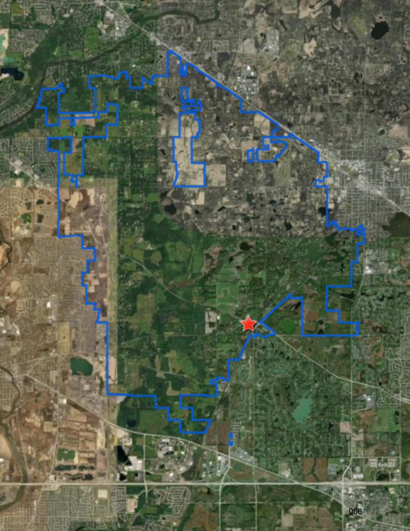
Early residents assumed the responsibility for stewardship in this portion of the area by forming the Countryside Property Owners Association in 1938. It was this group which later provided the nucleus for the eventual incorporation of the Village of Barrington Hills (the "Village") in 1957. The neighboring Village of Middlebury (incorporated in 1953) was annexed to Barrington Hills in December, 1962. Today, the Village covers approximately 28 contiguous square miles in Cook, Lake, Kane, and McHenry Counties.
OVERVIEW
THE ORIGIN OF BARRINGTON HILLS
INTRODUCTION
005
DRAFT
006
DRAFTCOMMUNITY CHARACTER
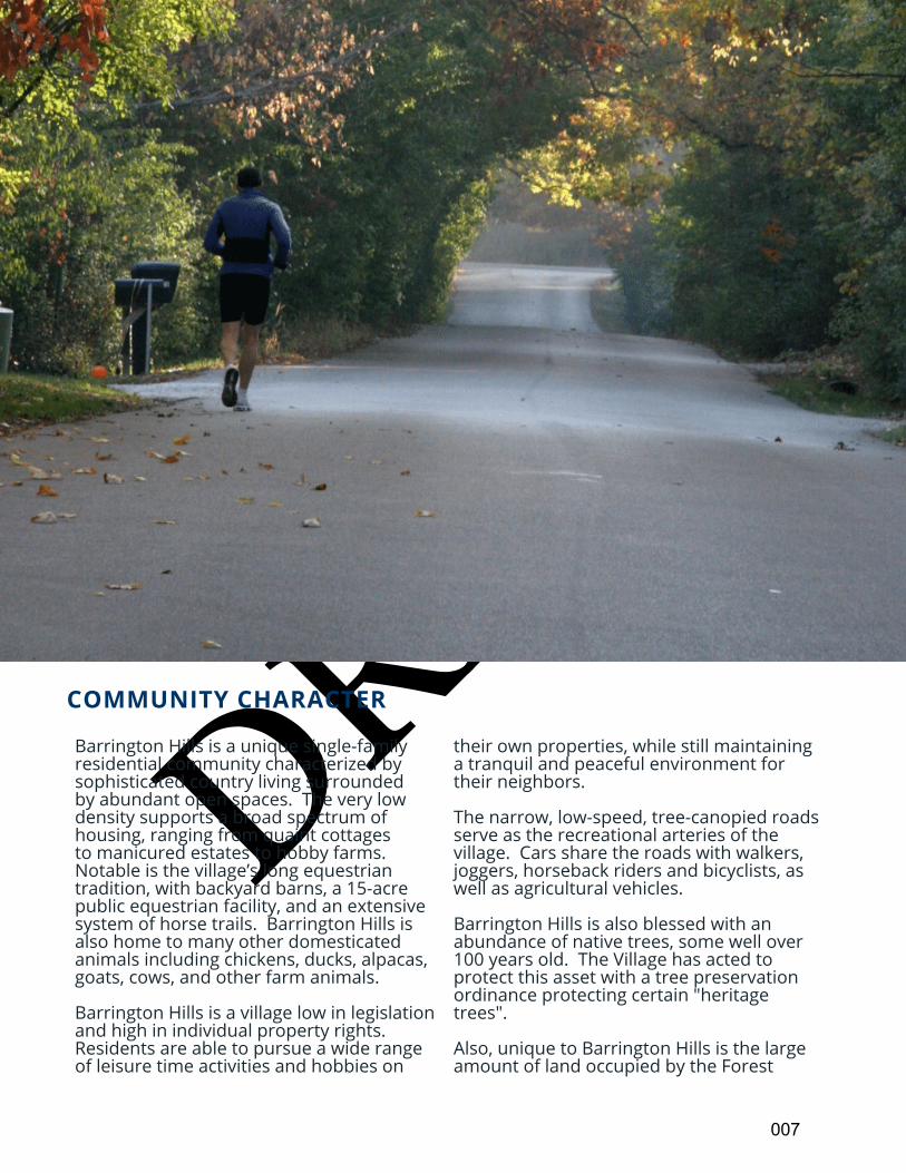
Barrington Hills is a unique single-family residential community characterized by sophisticated country living surrounded by abundant open spaces. The very low density supports a broad spectrum of housing, ranging from quaint cottages to manicured estates to hobby farms. Notable is the village’s long equestrian tradition, with backyard barns, a 15-acre public equestrian facility, and an extensive system of horse trails. Barrington Hills is also home to many other domesticated animals including chickens, ducks, alpacas, goats, cows, and other farm animals.
Barrington Hills is a village low in legislation and high in individual property rights. Residents are able to pursue a wide range of leisure time activities and hobbies on
their own properties, while still maintaining a tranquil and peaceful environment for their neighbors.
The narrow, low-speed, tree-canopied roads serve as the recreational arteries of the village. Cars share the roads with walkers, joggers, horseback riders and bicyclists, as well as agricultural vehicles.
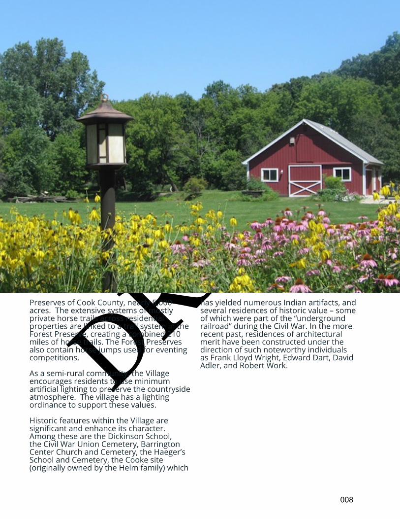
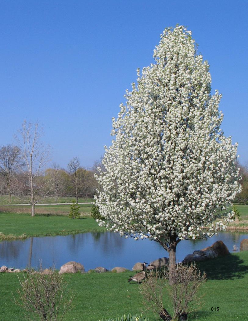
Barrington Hills is also blessed with an abundance of native trees, some well over 100 years old. The Village has acted to protect this asset with a tree preservation ordinance protecting certain "heritage trees".
Also, unique to Barrington Hills is the large amount of land occupied by the Forest
007
DRAFTPreserves of Cook County, nearly 5,000 acres. The extensive systems of mostly private horse trails across residential properties are linked to a trail system in the Forest Preserve, creating a combined 210 miles of horse trails. The Forest Preserves also contain horse jumps used for eventing competitions.
As a semi-rural community, the Village encourages residents to use minimum artificial lighting to preserve the countryside atmosphere. The village has a lighting ordinance to support these values.
Historic features within the Village are significant and enhance its character. Among these are the Dickinson School, the Civil War Union Cemetery, Barrington Center Church and Cemetery, the Haeger’s School and Cemetery, the Cooke site (originally owned by the Helm family) which
has yielded numerous Indian artifacts, and several residences of historic value – some of which were part of the “underground railroad” during the Civil War. In the more recent past, residences of architectural merit have been constructed under the direction of such noteworthy individuals as Frank Lloyd Wright, Edward Dart, David Adler, and Robert Work.
008
DRAFTThe Village of Barrington Hills is a home rule municipality. The current Village Hall was first occupied in 1975 and expanded in 1994. As an almost exclusively residential community, there are limited municipal services and financial resources.
The three principal activities of the Village are law enforcement, road maintenance, and land-use guidance (including planning, zoning and building). The first two activities account for almost 50% of the annual budget.
The residents of Barrington Hills have chosen to assume many responsibilities and costs themselves. For example, water supply, wastewater disposal, and solid waste collection including recycling are contracted privately by residents. The decision to establish and maintain
the community without public water supply and wastewater disposal was and is an intentional decision made by the community. It should be noted that the Village of Barrington provides public water and sanitary service to a limited number of subdivisions on the periphery of Barrington Hills and public sanitary service to the Barrington Hills Country Club.
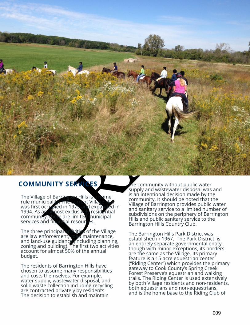
The Barrington Hills Park District was established in 1967. The Park District is an entirely separate governmental entity, though with minor exceptions, its borders are the same as the Village. Its primary feature is a 15-acre equestrian center (“Riding Center”) which provides the primary gateway to Cook County’s Spring Creek Forest Preserve’s equestrian and walking trails. The Riding Center is used extensively by both Village residents and non-residents, both equestrians and non-equestrians, and is the home base to the Riding Club of
COMMUNITY SERVICES
009
DRAFT
Barrington Hills and the Fox River Valley Pony Club. The Park District also maintains a softball field at School District 220’s Countryside School on County Line Road and tennis facilities on land leased from School District 220 adjacent to that school.
Village residents are served by the Barrington Area Library District, the Dundee Township Library District and the Algonquin Area Public Library. Most
properties are located within the Barrington Community Unit School District 220, with a portion being served by School District 300. Fire protection is provided by five separate fire protection districts: Barrington Countryside, Algonquin/Lake in the Hills, Carpentersville, East Dundee Countryside, and Fox River Grove. All residents are served by the Village’s CALEA accredited Police Department.
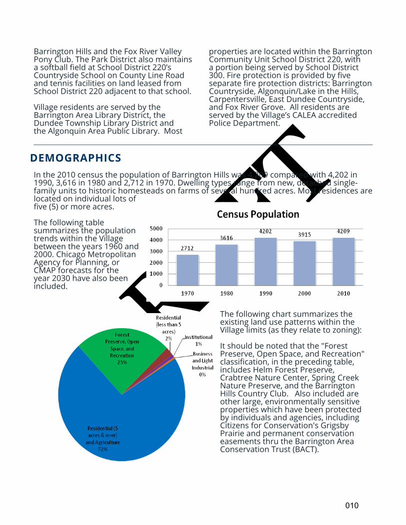
In the 2010 census the population of Barrington Hills was 4,209 compared with 4,202 in 1990, 3,616 in 1980 and 2,712 in 1970. Dwelling types range from new, detached single-family units to historic homesteads on farms of several hundred acres. Most residences are located on individual lots of five (5) or more acres.
The following table summarizes the population trends within the Village between the years 1960 and 2000. Chicago Metropolitan Agency for Planning, or CMAP forecasts for the year 2030 have also been included.
The following chart summarizes the existing land use patterns within the Village limits (as they relate to zoning):
It should be noted that the "Forest Preserve, Open Space, and Recreation" classification, in the preceding table, includes Helm Forest Preserve, Crabtree Nature Center, Spring Creek Nature Preserve, and the Barrington Hills Country Club. Also included are other large, environmentally sensitive properties which have been protected by individuals and agencies, including Citizens for Conservation's Grigsby Prairie and permanent conservation easements thru the Barrington Area Conservation Trust (BACT).
DEMOGRAPHICS
010
DRAFT
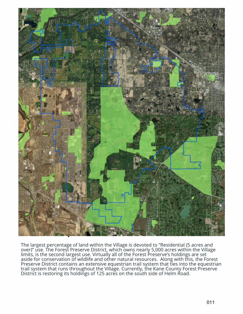
The largest percentage of land within the Village is devoted to “Residential (5 acres and over)” use. The Forest Preserve District, which owns nearly 5,000 acres within the Village limits, is the second largest use. Virtually all of the Forest Preserve’s holdings are set aside for conservation of wildlife and other natural resources. Along with this, the Forest Preserve District contains an extensive equestrian trail system that ties into the equestrian trail system that runs throughout the Village. Currently, the Kane County Forest Preserve District is restoring its holdings of 125 acres on the south side of Helm Road.
011
DRAFT
CURRENT ENVIRONMENTAL CONDITIONS
ACCESSIBILITY
Barrington Hills has long been renowned for its natural features. Its groundwater resources are vital for the region, both as drinking water for humans and as a vital source of water in streams, rivers, lakes and wetlands upon which native plant and animal communities are reliant. Abundant open space, natural areas and limited impervious surface areas (such as pavement and buildings) allow replenishment of the area’s underlying shallow aquifers. In fact, western Barrington Hills serves as a very important recharge area for the entire BACOG region. Protection of the vegetation and wildlife occupying the existing wetland, woodland and prairie ecologies is critical and can only be maintained through prudent and limited development.
In addition, the soil conditions in both the Flint Creek and Spring Creek Corridors are of special note. The wet Flint Creek Corridor soils in the eastern part of the Village can present problems when used for septic fields, primarily due to soil impermeability and low percolation. The use of septic systems at residential densities greater than present would need to be studied to determine if the soils would be over-burdened and endanger the health of the community. These wet compressible soils can also shift when built upon, causing cracks in foundations and walls.
The drier soils in the Spring Creek Corridor in the western portion of the Village generally present better drainage and good platforms for building, but have greater potential for contamination of shallow and deep aquifers by pollutants. Contamination of these water resources would not just impact Barrington Hills, but nearby communities as well.
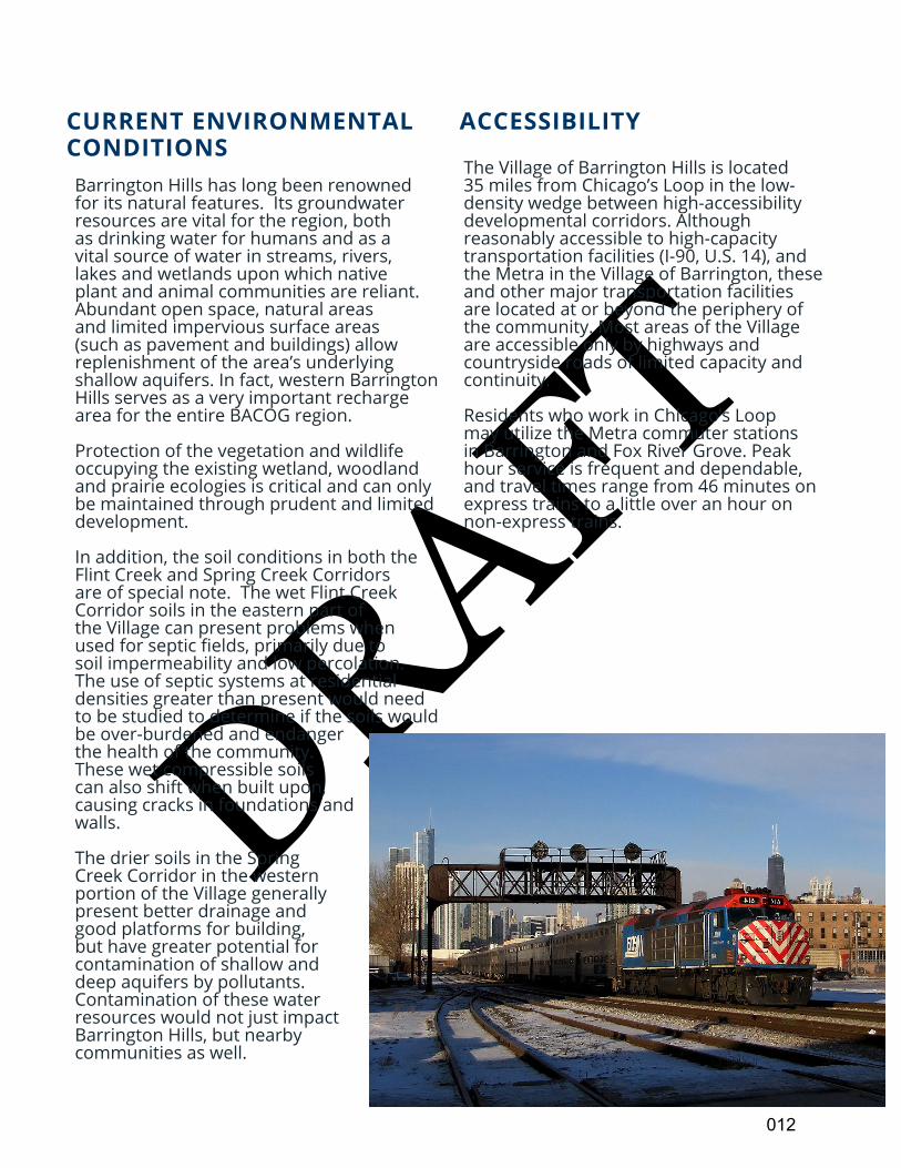
The Village of Barrington Hills is located 35 miles from Chicago’s Loop in the low-density wedge between high-accessibility developmental corridors. Although reasonably accessible to high-capacity transportation facilities (I-90, U.S. 14), and the Metra in the Village of Barrington, these and other major transportation facilities are located at or beyond the periphery of the community. Most areas of the Village are accessible only by highways and countryside roads of limited capacity and continuity.
Residents who work in Chicago’s Loop may utilize the Metra commuter stations in Barrington and Fox River Grove. Peak hour service is frequent and dependable, and travel times range from 46 minutes on express trains to a little over an hour on non-express trains.
012
DRAFT
BARRINGTON AREA TRENDS AND RELATIONSHIPS In response to developmental trends in the area, and pursuant to the goal of conserving natural resources, the Barrington Area Council of Governments (BACOG) was formed in 1970 and is currently comprised of the Villages of Barrington Hills, Barrington, Deer Park, Lake Barrington, North Barrington, South Barrington, Tower Lakes, and the Townships of Barrington and Cuba. The Village of Barrington Hills was a charter member, and Village Presidents have served as the Chairman of BACOG on multiple occasions. This seven-village, two-township body has provided a forum in which diversified growth can be accommodated in BACOG’s 90 square-mile area in harmony with natural resources. Each village provides a uniquely different environment. For example, the Village of Barrington functions as the service, employment, transportation, and multi-family residence center of the area, while the Village of Barrington Hills has the most open space and largest amount of land held by the Forest Preserves.
What one independent BACOG community cannot provide in terms of services, activities or special features, the greater “Barrington Area” community can. In 1965, community and municipal leaders joined together to develop the first regional comprehensive plan for BACOG. The BACOG plan was based on the relationship of land uses to natural resources, and the resources available to support development. The concept of development being limited to naturally sustainable levels has been steadfastly maintained since 1970 through the BACOG comprehensive plan, the municipal comprehensive plans, and other planning policies. The BACOG plan recognizes, as does this plan for Barrington Hills, that demand for groundwater, stormwater management, and regional open-space respect no boundaries. The decision of one community or one property owner may affect the public health, utility,
and enjoyment of property in other jurisdictions. It is therefore incumbent upon these interdependent communities to work together in planning for the future impact on the environment and on watersheds, aquifers, and regional open space.
Thus, the natural resources and character of Barrington Hills are of both metropolitan and area-wide importance. The responsibility of stewardship over this unique and sensitive environment is not simply for the enjoyment of the current residents of the Village, but more broadly, an obligation to future generations and to the metropolitan area.
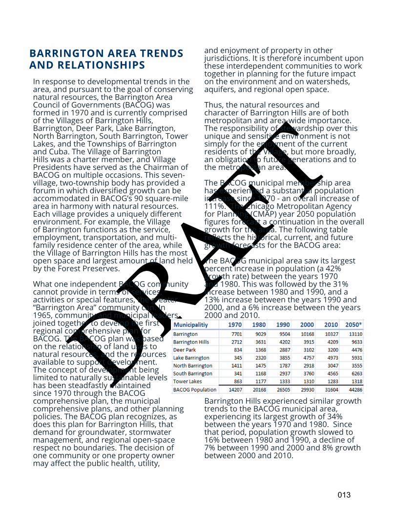
The BACOG municipal membership area has experienced a substantial population increase since 1970 - an overall increase of 111%. The Chicago Metropolitan Agency for Planning (CMAP) year 2050 population figures forecast a continuation in the overall growth for the area. The following table reflects the historical, current, and future growth forecasts for the BACOG area: The BACOG municipal area saw its largest percent increase in population (a 42% growth rate) between the years 1970 and 1980. This was followed by the 31% increase between 1980 and 1990, and a 13% increase between the years 1990 and 2000, and a 6% increase between the years 2000 and 2010.
Barrington Hills experienced similar growth trends to the BACOG municipal area, experiencing its largest growth of 34% between the years 1970 and 1980. Since that period, population growth slowed to 16% between 1980 and 1990, a decline of 7% between 1990 and 2000 and 8% growth between 2000 and 2010.
013
DRAFT
WATER RESOURCES
Barrington Hills is solely dependent on groundwater to meet its water needs. Almost all of this water comes from the shallow aquifer system, which is comprised of saturated sand and gravel materials below ground and the bedrock aquifer they rest upon. In the Barrington Hills area, this aquifer system extends from the land surface down to about 250 feet below ground surface. Even if other sources of water were available, such as water from Lake Michigan or a deep aquifer (800+ feet deep), there is no infrastructure in place to distribute water to residents, businesses, and institutions, and the cost of building such infrastructure would be astronomical.
Assuring a sustainable, adequate supply of safe water for Barrington Hills is a high priority for the Village. Groundwater sustainability means maintaining both sufficient quantity and quality of the resource. This overarching goal is best achieved through combining public policy and the actions of individuals in a concerted effort to guarantee that Barrington Hills’ water needs are met today and in the future.
Detailed information on groundwater, groundwater levels and recharge, including maps, are provided in the Appendix A-2.
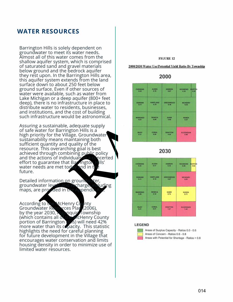
According to the McHenry County Groundwater Resources Plan (2006), by the year 2030, Algonquin Township (which contains all of the McHenry County portion of Barrington Hills) will need 42% more water than its capacity. This statistic highlights the need for careful planning for future development in the Village that encourages water conservation and limits housing density in order to minimize use of limited water resources.
014
DRAFT
015
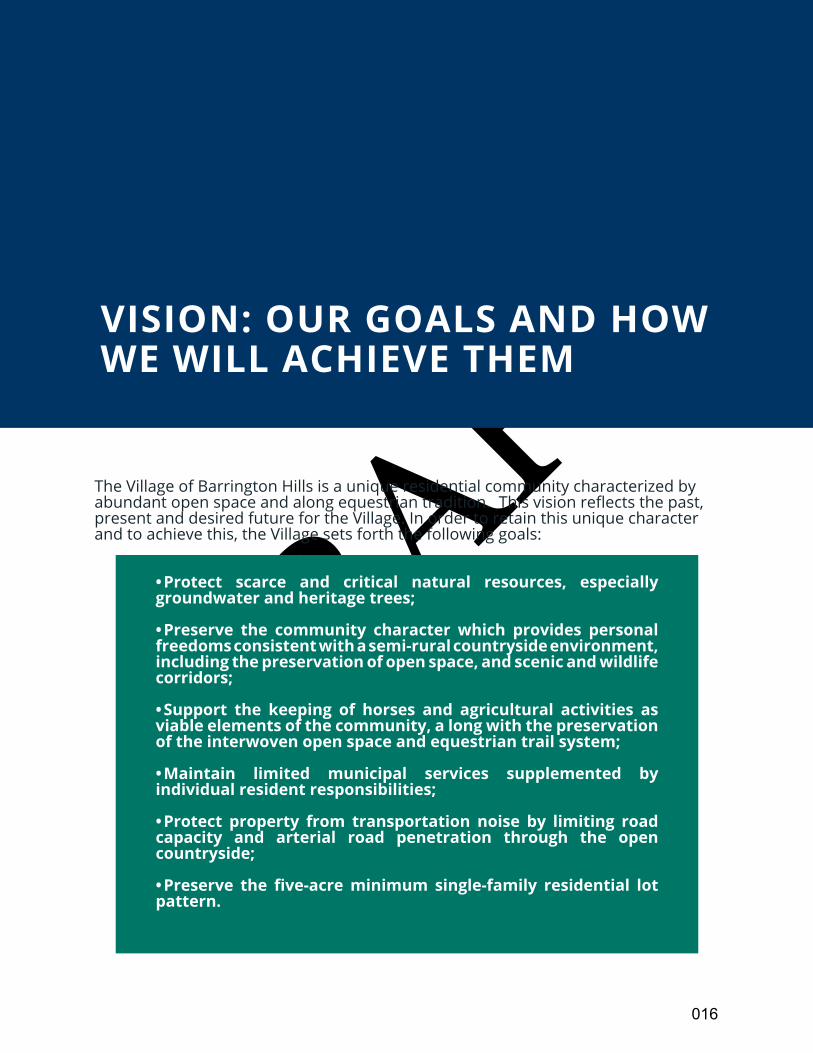
DRAFT• Protect scarce and critical natural resources, especially groundwater and heritage trees;
• Preserve the community character which provides personal freedoms consistent with a semi-rural countryside environment, including the preservation of open space, and scenic and wildlife corridors;
• Support the keeping of horses and agricultural activities as viable elements of the community, a long with the preservation of the interwoven open space and equestrian trail system;
• Maintain limited municipal services supplemented by individual resident responsibilities;
• Protect property from transportation noise by limiting road capacity and arterial road penetration through the open countryside;
•Preserve the five-acreminimum single-family residential lotpattern.
OVERVIEW
VISION: OUR GOALS AND HOW WE WILL ACHIEVE THEM
The Village of Barrington Hills is a unique residential community characterized by abundant open space and along equestrian tradition. This vision reflects the past, present and desired future for the Village. In order to retain this unique character and to achieve this, the Village sets forth the following goals:
016
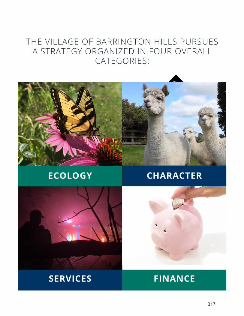
DRAFTTHE VILLAGE OF BARRINGTON HILLS PURSUES
A STRATEGY ORGANIZED IN FOUR OVERALL CATEGORIES:
ECOLOGY CHARACTER
FINANCESERVICES
017
DRAFT
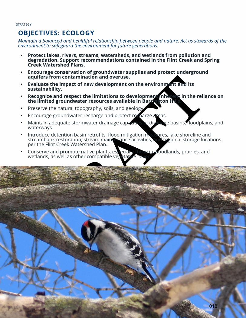
OBJECTIVES: ECOLOGY
• Protect lakes, rivers, streams, watersheds, and wetlands from pollution and degradation. Support recommendations contained in the Flint Creek and Spring Creek Watershed Plans.
• Encourage conservation of groundwater supplies and protect underground aquifers from contamination and overuse.
• Evaluate the impact of new development on the environment and its sustainability.
• Recognize and respect the limitations to development inherent in the reliance on the limited groundwater resources available in Barrington Hills.
• Preserve the natural topography, soils, and geology. • Encourage groundwater recharge and protect recharge areas. • Maintain adequate stormwater drainage capacities of drainage basins, floodplains, and
waterways. • Introduce detention basin retrofits, flood mitigation measures, lake shoreline and
streambank restoration, stream maintenance activities, and regional storage locations per the Flint Creek Watershed Plan.
• Conserve and promote native plants, especially those in woodlands, prairies, and wetlands, as well as other compatible vegetative cover.
STRATEGY
Maintain a balanced and healthful relationship between people and nature. Act as stewards of the environment to safeguard the environment for future generations.
018
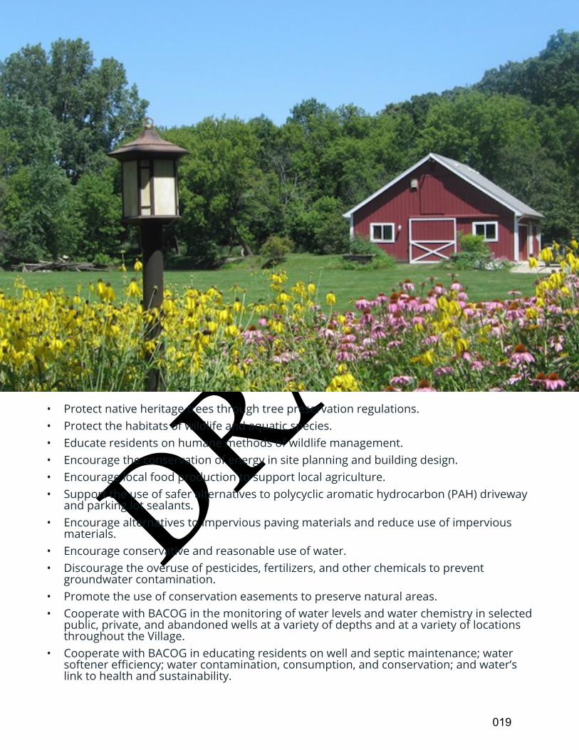
DRAFT• Protect native heritage trees through tree preservation regulations. • Protect the habitats of wildlife and aquatic species.• Educate residents on humane methods of wildlife management. • Encourage the conservation of energy in site planning and building design.• Encourage local food production to support local agriculture.• Support the use of safer alternatives to polycyclic aromatic hydrocarbon (PAH) driveway
and parking lot sealants.• Encourage alternatives to impervious paving materials and reduce use of impervious
materials. • Encourage conservative and reasonable use of water.• Discourage the overuse of pesticides, fertilizers, and other chemicals to prevent
groundwater contamination.• Promote the use of conservation easements to preserve natural areas. • Cooperate with BACOG in the monitoring of water levels and water chemistry in selected
public, private, and abandoned wells at a variety of depths and at a variety of locations throughout the Village.
• Cooperate with BACOG in educating residents on well and septic maintenance; water softener efficiency; water contamination, consumption, and conservation; and water’s link to health and sustainability.
019
DRAFT
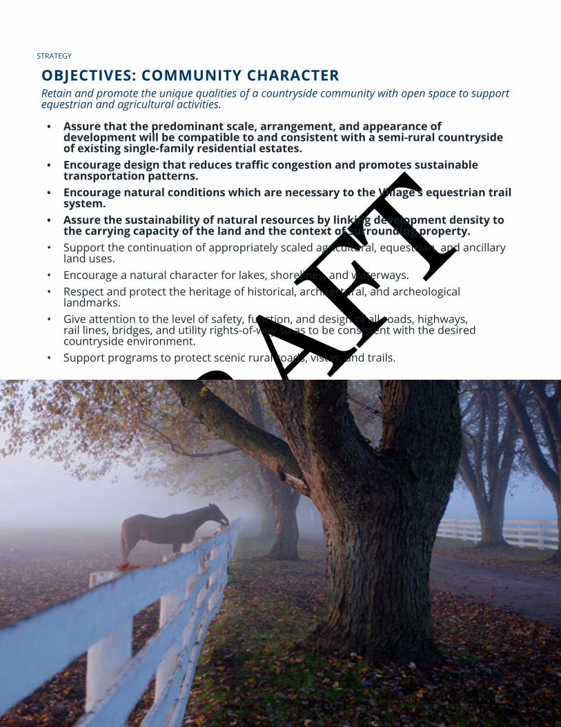
OBJECTIVES: COMMUNITY CHARACTER
• Assure that the predominant scale, arrangement, and appearance of development will be compatible to and consistent with a semi-rural countryside of existing single-family residential estates.
• Encouragedesignthatreducestrafficcongestionandpromotessustainabletransportation patterns.
• Encourage natural conditions which are necessary to the Village’s equestrian trail system.
• Assure the sustainability of natural resources by linking development density to the carrying capacity of the land and the context of surrounding property.
• Support the continuation of appropriately scaled agricultural, equestrian, and ancillary land uses.
• Encourage a natural character for lakes, shorelines, and waterways. • Respect and protect the heritage of historical, architectural, and archeological
landmarks. • Give attention to the level of safety, function, and design of all roads, highways,
rail lines, bridges, and utility rights-of-way so as to be consistent with the desired countryside environment.
• Support programs to protect scenic rural roads, vistas, and trails.
STRATEGY
Retain and promote the unique qualities of a countryside community with open space to support equestrian and agricultural activities.
020
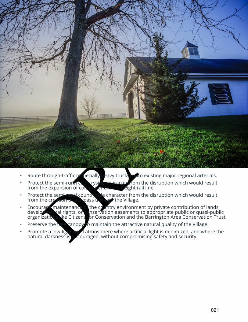
DRAFT• Route through-traffic (especially heavy trucks) onto existing major regional arterials. • Protect the semi-rural countryside character from the disruption which would result
from the expansion of commuter and/or freight rail line. • Protect the semi-rural countryside character from the disruption which would result
from the creation of a bypass through the Village. • Encourage maintenance of the country environment by private contribution of lands,
developmental rights, or conservation easements to appropriate public or quasi-public organizations like Citizens for Conservation and the Barrington Area Conservation Trust.
• Preserve the tree canopy to maintain the attractive natural quality of the Village. • Promote a low-light rural atmosphere where artificial light is minimized, and where the
natural darkness is encouraged, without compromising safety and security.
021
DRAFT
OBJECTIVES: COMMUNITY SERVICES
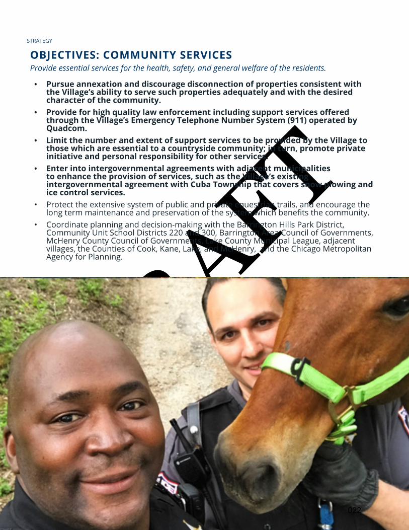
• Pursue annexation and discourage disconnection of properties consistent with the Village’s ability to serve such properties adequately and with the desired character of the community.
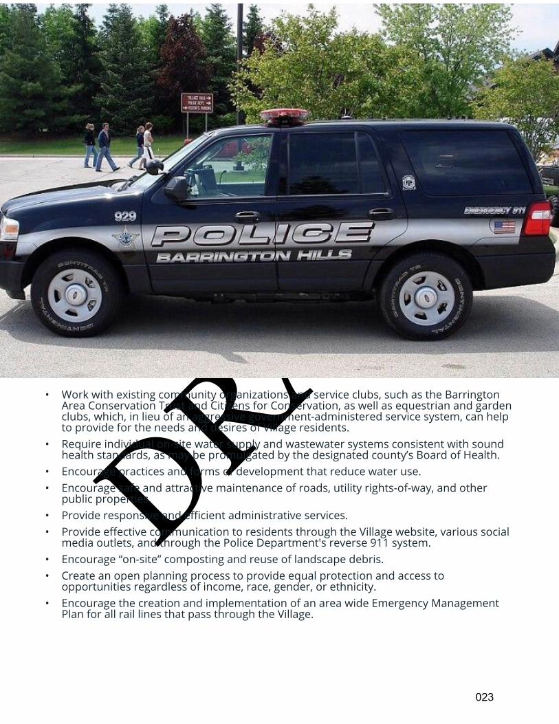
• Provideforhighqualitylawenforcementincludingsupportservicesofferedthrough the Village’s Emergency Telephone Number System (911) operated by Quadcom.
• Limit the number and extent of support services to be provided by the Village to those which are essential to a countryside community; in turn, promote private initiative and personal responsibility for other services.
• Enter into intergovernmental agreements with adjacent municipalities to enhance the provision of services, such as the Village’s existing intergovernmental agreement with Cuba Township that covers snow plowing and ice control services.
• Protect the extensive system of public and private equestrian trails, and encourage the long term maintenance and preservation of the system which benefits the community.
• Coordinate planning and decision-making with the Barrington Hills Park District, Community Unit School Districts 220 and 300, Barrington Area Council of Governments, McHenry County Council of Governments, Lake County Municipal League, adjacent villages, the Counties of Cook, Kane, Lake, and McHenry, and the Chicago Metropolitan Agency for Planning.
STRATEGY
Provide essential services for the health, safety, and general welfare of the residents.
022
DRAFT• Work with existing community organizations and service clubs, such as the Barrington
Area Conservation Trust and Citizens for Conservation, as well as equestrian and garden clubs, which, in lieu of an aggressive government-administered service system, can help to provide for the needs and desires of Village residents.
• Require individual on-site water supply and wastewater systems consistent with sound health standards, as may be promulgated by the designated county’s Board of Health.
• Encourage practices and forms of development that reduce water use. • Encourage safe and attractive maintenance of roads, utility rights-of-way, and other
public properties. • Provide responsive and efficient administrative services. • Provide effective communication to residents through the Village website, various social
media outlets, and through the Police Department's reverse 911 system.• Encourage “on-site” composting and reuse of landscape debris.• Create an open planning process to provide equal protection and access to
opportunities regardless of income, race, gender, or ethnicity. • Encourage the creation and implementation of an area wide Emergency Management
Plan for all rail lines that pass through the Village.
023
DRAFT
OBJECTIVES: FINANCES
• Maintainsoundstandardsandproceduresoffiscalmanagement.• CommittotheuseofbestpracticesinthemanagementofVillageaffairs.• Encourage a future-oriented vision, which looks beyond current needs.• Coordinate growth of the Village with the level of public services that can be provided at
reasonable cost. • Maintain cost-effective, competitive hiring and retention practices, including
compensation and benefit offerings, to assure residents of a quality Village staff and police department.
• Encourage the Police Pension Fund to utilize smart fiscal practices. • Avoid deficit spending. • Consider means to share costs for essential services with other communities and units of
government. • Consider incentives and other economic tools to promote development that does not
overburden Village resources.
STRATEGY
Maintain sound and equitable Village finances.
024
DRAFTCONCLUSION
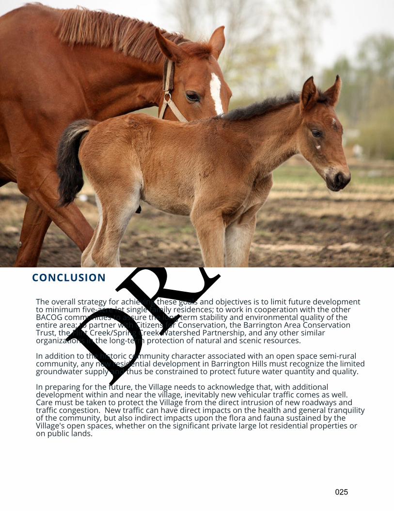
The overall strategy for achieving these goals and objectives is to limit future development to minimum five-acre lot single family residences; to work in cooperation with the other BACOG communities to assure the long term stability and environmental quality of the entire area; to partner with Citizens for Conservation, the Barrington Area Conservation Trust, the Flint Creek/Spring Creek Watershed Partnership, and any other similar organizations in the long-term protection of natural and scenic resources.
In addition to the historic community character associated with an open space semi-rural community, any new residential development in Barrington Hills must recognize the limited groundwater supply and thus be constrained to protect future water quantity and quality.
In preparing for the future, the Village needs to acknowledge that, with additional development within and near the village, inevitably new vehicular traffic comes as well. Care must be taken to protect the Village from the direct intrusion of new roadways and traffic congestion. New traffic can have direct impacts on the health and general tranquility of the community, but also indirect impacts upon the flora and fauna sustained by the Village's open spaces, whether on the significant private large lot residential properties or on public lands.
025
DRAFT
FUTURE LAND USE
From a planning perspective, Barrington Hills is, for the most part, a mature community where change may
occur primarily in the form of infill and redevelopment. Many mature communities promote the retention of
the existing conditions of the majority of properties as the preferred conditions of the future, and through their
planning process, identify properties most likely to be subject to redevelopment pressure. The Barrington Hills
planning area encompasses four general areas, listed below.
• Incorporated and undeveloped properties 20 acres or larger
These properties are governed by the current zoning laws of the Village. They are at the least risk for
deviation from the 5-acre single family detached residence pattern.
• Incorporated properties 20 acres or larger adjacent to the Village’s boundary
While these properties are subject to current zoning regulations, they are at higher risk due to the
possibility of de-annexation. The goals of any development should be compatible and supportive of
Barrington Hills’ community character, low density residential zoning, and should ensure maximum
conservation of limited water resources.
• Unincorporated properties completely surrounded by the Village of Barrington Hills
Although these properties are not subject to Village zoning and instead follow county regulations,
development changes on these properties would greatly impact neighboring Barrington Hills residents.
• Undeveloped properties outside of Barrington Hills, but adjacent to its boundaries
These areas outside of the Village fall within the joint planning jurisdiction of Barrington Hills and the
neighboring county or municipality. Future development of these properties should encourage minimal
density, preservation of open space, and conservation of limited water resources. Whenever possible,
annexation into the Village should be pursued and encouraged.
The Village looks to use the aforementioned planning practices to support the appropriate uses of properties,
particularly those on the periphery of the community adjacent to higher intensity uses, in a way that further
enhances the continued enjoyment of the larger sustainable community environment.
This plan for the future use of property cannot anticipate all the influences on land use decisions made by
property owners, but it can foresee patterns of use most likely to yield long-term compatibility and continuity
with the existing Village character and quality of life. Future private-initiated growth of Barrington Hills’
countryside community must always be governed by nature’s limitations and sustainability.
Guiding principles for future development in the Village should address the following critical elements:
• Protection of the ground water resources.
• Protection of heritage trees.
026
DRAFT
• Incorporation of the existing wetlands, floodplains, woods, and other natural features as site
amenities.
• Maintaining an overall density not to exceed one single-family dwelling per five acres of land.
• Supporting agriculture activities and the keeping of horses.
• Protecting properties from transportation noise from road and rail lines.
• Interconnection of future and existing equestrian trails with supporting private equestrian
easements.
• Stewardship of natural areas.
The Village looks to use the aforementioned planning practices that might support the appropriate uses of these
properties, particularly those on the periphery of the community adjacent to higher intensity uses, in a way that
further enhances the continued enjoyment of the larger sustainable community environment.
Planning Jurisdiction Illinois Municipal Code (65 ILCS 5/Article 11, Division 12) allows for a municipality to plan
for unincorporated areas that are within 1.5 miles of its incorporated boundary. This does not include areas that
are incorporated by other municipalities or areas that are covered by boundary agreements or annexation
agreements.
The Village is aware of the significant susceptibility of undeveloped boundary properties to disconnect into adjacent municipalities or counties, where development inconsistent with the Village’s Comprehensive Plan could occur. It is imperative that Village leaders actively pursue stronger relationships with these neighboring jurisdictions, and help them to better appreciate the vital importance of Barrington Hills’ open spaces and five-acre zoning to the region as a whole. These relationships can be fostered through increased participation by the Village on regional boards, county councils and committees, regional planning groups, as well as through regular contact with IDOT and county departments of transportation. When Barrington Hills retains its current character, the region benefits. To these ends, the Village should continue pursuing new intergovernmental agreements to support this Plan’s vision of the community, and should also strive to strengthen existing boundary agreements. The region benefits from the Village’s low density in terms of preservation of limited water resources and its essential role in groundwater recharge in northeastern Illinois. The Village’s natural resources and environmental conditions also create a limited carrying capacity for the land and can restrict development in terms of soil suitability for building foundations and for septic systems. Low density also helps to keep school enrollments manageable, and traffic levels consistent for nearby communities.
027
DRAFT
BEST EQUESTRIAN AND LAND MANAGEMENT PRACTICES
The Village’s objectives call for a reliance on the individual responsibilities of land owners as a primary approach
to the achievement of community goals. Not the least of those goals is found in the area of the natural ecology
of the Village. As significant land holders, the equestrian community of Barrington Hills may have the greatest
opportunity to assure that horse raising, riding, and associated activities have a positive impact on the
environmental condition of land and water in the Village. Objectives for good horse keeping and land
management include, but are not limited to:
1. Control erosion to keep soil in place
• Keep areas well vegetated and restore bare areas with vegetation. Plant roots, especially those of
grasses, hold soil in place and help water infiltrate into the ground rather than run off. A good indicator
of root mass in grasses is that the above ground growth generally equals the below ground root system.
Shrubs and trees have deeper roots that are either fibrous or taproots that will anchor the soil in place.
Vegetation also dissipates the force of rainwater hitting the ground, which detaches soil particles.
• Keep creek banks vegetated to hold soil in place, trap sediment, and provide valuable wildlife habitat.
• Avoid concentrating water. Concentrated runoff can be highly erosive. Try to disperse runoff by
spreading it out in a thin, shallow “sheet.” Areas to watch are roads, roofs, compacted soil, and other
impermeable surfaces that shed water quickly and increase the amount and velocity of runoff.
• Be respectful in areas such as wetlands, creek banks, meadows, and steep hillsides. Limit access,
especially during wet periods.
• Riparian buffers provide valuable wildlife habitat and should contain a variety of plants including
grasses, forbs, shrubs, and trees.
• Properly construct and maintain roads, trails, and parking areas. Protect earthen surfaces and drainage
ditches from erosion by using properly designed drainage systems, including diversions and culverts. Use
appropriate surfacing materials and techniques.
• Use proper construction techniques. Revegetate areas disturbed by construction. During construction,
install and maintain silt fences or straw bale sediment barriers to trap sediment and slow the movement
of water. Avoid soil-disturbing activities just before and during the rainy season.
2. Keep “clean” water clean
• Divert “clean” water around areas with pollutants. Use berms, grassed waterways, underground pipes,
culverts, or other methods. Consider where water will be diverted to, so as not to create new problems
on the diverted path.
• Locate buildings and confinement areas away from creeks, steep slopes, and floodplains.
• Minimize disturbance to wetlands, riparian areas, and meadows.
• Limit impacts of grading and runoff from roofs and other impermeable surfaces.
• Manage Manure. Remove manure regularly – daily is best. Cover stored manure with a roof, tarp, or
other cover, and direct runoff away from the manure storage area.
028
DRAFT
ROADS, RAILS, AND TRAILS
The roads and trails of Barrington Hills are an integral part of daily life and of the countryside environment. They
serve six basic functions:
• They accommodate commuting, shopping, and other travel needs of local residents.
• They accommodate travel between origins and destinations outside the community; in fact, the majority
of traffic through the Village is non-local traffic.
• They accommodate the delivery of goods and services including first responders such as police, fire, and
emergency medical services.
• They accommodate recreational activity; i.e., walking, bicycling, hiking, horseback riding, and cross-
country skiing.
• They contribute visually to the countryside setting.
• They unify the community through the connection of people and places, for example, in equestrian
activities.
Roads
Residents appreciate the beauty of the two-lane, undulating roads of Barrington Hills. Slow speeds on local
roads contribute to the tranquility of the rural atmosphere. Accordingly, the Village reduced the speed limit to
25 mph on all Village-maintained roads in 2006.
Most traffic utilizing highways and roads in Barrington Hills is non-local and is increasing as nearby municipalities
grow and change. Motorists are likely to use the state highways that pass-through Barrington Hills, because
other routes are congested. Although other roadway modifications may be considered, the Village continues to
oppose future road scenarios that include a bypass through the Village. Such a system would severely disrupt
the semi-rural countryside character and ecology of the Village.
A system of roadways capable of accommodating traffic needs in the Barrington Hills area should reflect these
basic principles:
• Peripheral traffic should be routed on improved regional highways, including Illinois Route 53 and
Quentin Road on the east, Illinois Route 22 on the north, Higgins Road on the south, and Randall Road
west of the Fox River.
• Strategic Regional Arterials (SRA) should permit the continuation of intersecting local service roads with
grade separation and dedicated lanes for turning movements.
• Internal roadways should be improved for traffic safety purposes.
• Village-maintained roads have limited speeds to 25 mph for safety and to limit cut-through traffic.
• Traffic control and law enforcement will require interagency assistance as volume increases.
• Local service roads are intentionally designed without sidewalks or bike lanes.
• The scenic beauty of the narrow tree-canopied roads should be preserved.
• To mitigate the noise generated by vehicular traffic, the Village should continue to establish noise
control setback lines along all state roadways, regional highways, and area service roads in coordination
029
DRAFT
with IDOT noise impact data. Earthen berms and landscaping, which are consistent with the prevailing
community character, should be encouraged.
• The minimum amount of roadway lighting necessary to assure adequate safety should be used.
• The Village should continue to consider the roadway environment and corridor character in the planning
and execution of all roadway and subdivision improvements and maintenance.
• The Village should enter into agreements with the Illinois Department of Transportation and the various
county highway departments to implement environmentally sensitive design standards for highways
and roads as presently enjoyed in Barrington Hills.
• The Village should work with the BACT to designate certain rural residential roads of visual, historical,
and/or cultural significance as Heritage Corridors.
Roadway jurisdictions are classified as Private, Village, County, or State, and are listed in Appendix A-4.
Appendix A-4 also contains a Roadway Jurisdiction map of the Village.
Continued transportation planning and traffic engineering is essential. To the extent feasible, it will be effective
for the Village of Barrington Hills to carry out such activities in coordination with the appropriate State, County,
and Township Highway Departments.
The Barrington Hills road program strives to resurface approximately 3.2 miles of Village-maintained road per
year. Per Resolution 14-21, the Village does not include planning for any multimodal paths on Village Roads.
However, the Village will continue to participate in all levels of planning on roadways within the Village, even in
the event other jurisdictions propose the addition of multimodal paths to their roadway projects.
Rails
The CN rail line passes through Barrington Hills from north to south. The rail line crosses most major roadways in
and around Barrington Hills. From north to south, such crossings occur at County Line Road (at-grade), Otis Road
(at-grade), Route 62/Route 68 (grade separated), Penny Road (at-grade) and Old Sutton Road (at-grade). As
train volumes increase on this line, the Village could be negatively impacted.
The existing at-grade crossings are of greatest concern to the Village if traffic backs up due to stopped, slow-
moving, and potentially derailed trains. Delayed motorists would likely proceed to local streets, which are not
designed and constructed to accommodate the additional traffic which would be forced upon them. School
buses would experience more frequent delays and more safety issues could arise.
In addition, train traffic can cause disruptions in emergency vehicle response time for police, fire, and
ambulance services. An area-wide Emergency Management Plan should be created pertaining to the rail line.
The rail line runs through environmentally sensitive areas, including the Spring Creek Nature Preserve and the
Spring Creek and Flint Creek environmental corridors. Increased pollutants from stormwater runoff and
potential contamination from spills would harm soils and water quality for local aquifers and creeks.
030
DRAFT
Increased traffic from trains could negatively impact enjoyment of residential dwellings, and wildlife habitat
associated with nearby forest preserves and conservation areas. Increased traffic backups and more idling motor
vehicles could significantly increase local emissions and noxious fumes, impacting public health and quality of
life. Potential mitigation measures include noise walls, landscape buffers, and vegetated swales along the rail
right-of-way.
Trails and Pathways
Non-motorized transportation continues to be an integral part of the character of Barrington Hills. With the
absence of sidewalks throughout the Village, the narrow roadways (with minimal, if any, shoulders) function as
its recreational arteries. Walking, bicycling, hiking, horseback riding, and cross-country skiing are enjoyed by
many residents over the course of the year, taking advantage of the scenic qualities and the open space
throughout the community.
Another unique asset to the community is the extensive public and private equestrian trail system. This system
radiates from the Barrington Hills Park District Riding Center and includes about 210 miles of trails. These trails
have been maintained by the Riding Club of Barrington Hills since 1937.
The Village highlights the importance of the equestrian trail system by requiring equestrian easements to be
recorded as part of the subdivision process.
Enjoyment of the trails on public land has been possible in a large part because of the efforts of The Riding Club
of Barrington Hills. The use of the landscape goes hand-in-hand with the protection of the character and value of
the open space and the community of Barrington Hills.
The Village recommends that this system of trails and pathways be preserved, enhanced, and extended, and
that it remain a permanent asset of the community. The Village should continue requiring that land subdivisions
maintain and enhance existing equestrian trails on their properties. In cases where no trails exist, landowners
can be required to comply with Ordinance 05-02, which requires the establishment of an equestrian trail
easement. It is the Village’s policy to encourage private and public efforts to expand the system in a safe and
sensitive manner.
031
DRAFT
Appendix
Current Environmental Conditions A-1
Environmental Corridors A-2
Roadway Jurisdictions A-3
Heritage Corridors A-4
Glossary A-5
Additional Information Sources A-6
032
DRAFT
Appendix A-1
CURRENT ENVIRONMENTAL CONDITIONS
GROUNDWATER RESOURCES
Groundwater – Context
The vast majority of wells in Barrington Hills are private wells serving single-family residences. According to the
Illinois State Geological Survey’s well database, over 700 of 844 Barrington Hills wells are finished at depths
between 100 and 300 feet below ground surface.
Within the shallow aquifer system in the larger region, water generally flows from west to east; in the Barrington Hills area, the groundwater generally flows toward the northeast and then eastward along the east boundary following the slope of the bedrock topography. While the groundwater is the primary source of water for human consumption in Barrington Hills, it is also an
important source of water in streams, rivers, lakes, and wetlands. The ecology of natural areas is dependent on
being supplied by groundwater. If the groundwater levels decline, fens, streams, and tributaries may dry up or
disappear, and plant and animal communities may be changed irreparably.
Groundwater Levels
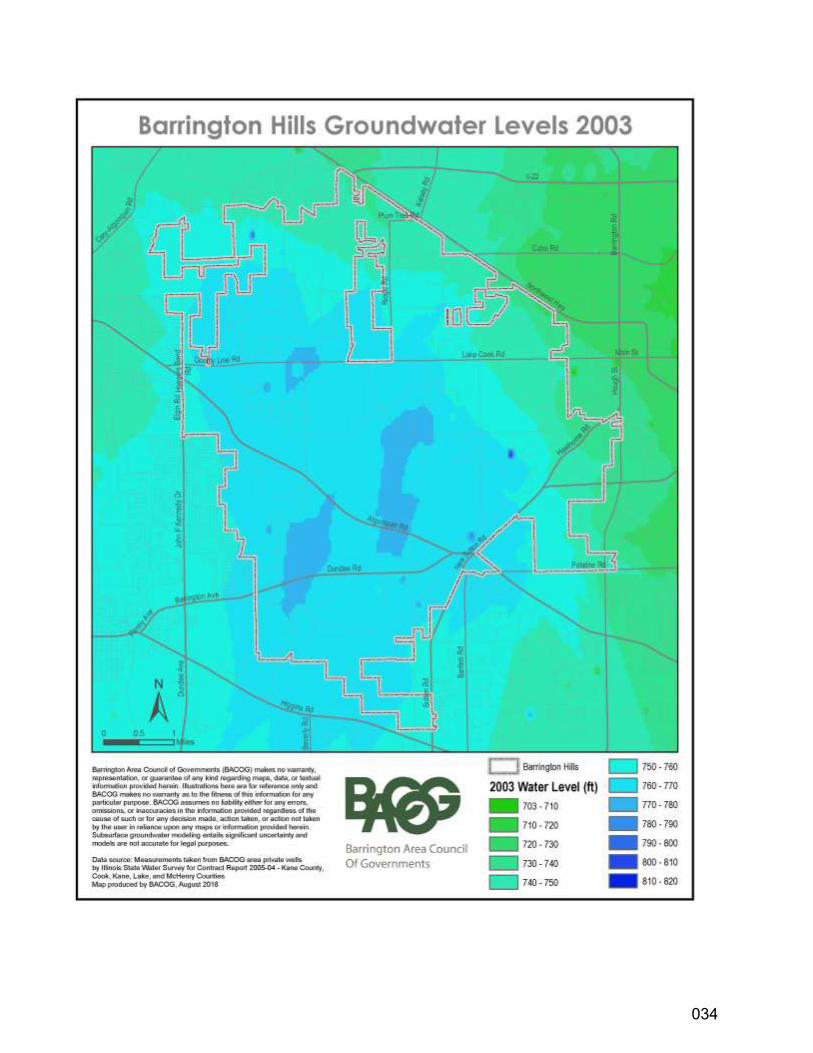
Groundwater levels in 2003 were measured by the Illinois State Water Survey and mapped by the Barrington
Area Council of Governments. The map below describes water levels at that time for the village.
033
DRAFT
034
DRAFT
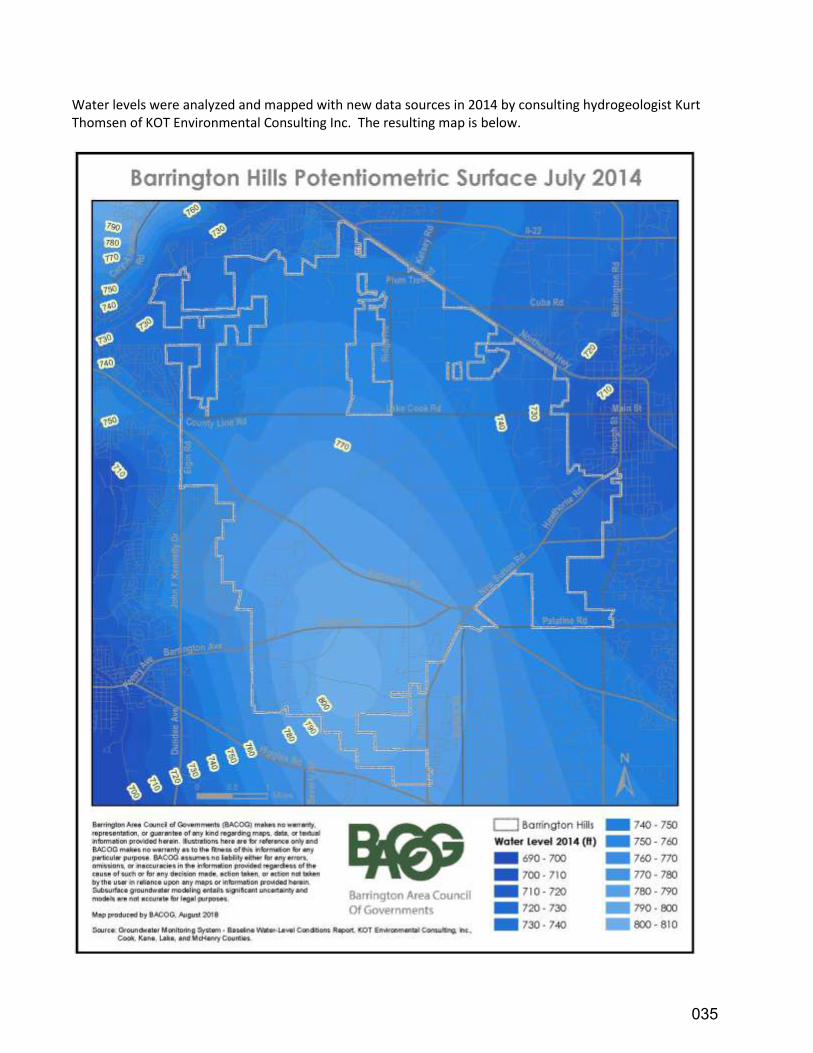
Water levels were analyzed and mapped with new data sources in 2014 by consulting hydrogeologist Kurt Thomsen of KOT Environmental Consulting Inc. The resulting map is below.
035
DRAFT
Both maps illustrate that water levels range from approximately 700 to 810/820 AMSL in the overall area. Any
differences between the 2003 map and the 2014 map of water levels in Barrington Hills are due to the number,
type, and spatial distribution of data sampling locations from different years; collected data influences the shape
of the map contours and complexity of their geometry. Please note that the shallow aquifer water level, also
known as the potentiometric surface, is measured in feet above mean sea level (AMSL), which is an elevation; it
is not a depth below ground surface.
Groundwater Recharge
Aquifer recharge is the process of water from rainfall and snowmelt seeping from the land's surface into the
shallow aquifers, thereby replenishing them. For this reason, the impervious surface areas such as pavement
and buildings reduce the total area where water can enter the ground to replenish the groundwater. Conversely,
preservation of open space and natural areas, increased cultivation of long-rooted native plants and grasses,
retention of stormwater, and the use of permeable pavement alternatives support aquifer sustainability,
especially in sensitive recharge areas.
The same recharge process that carries precipitation to replenish the aquifers also has the potential to carry
human-introduced contaminants to our clean groundwater. Therefore, protection of recharge areas and water
resources from pollutants and contaminants is a critical priority.
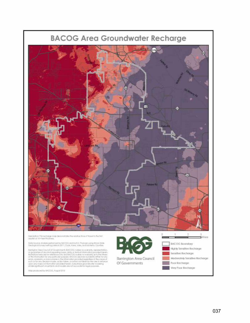
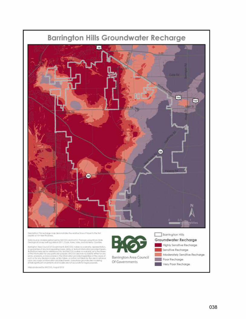
In its study of groundwater resources, BACOG analyzed the ability of soil materials to carry water to the aquifers.
The resulting maps of groundwater recharge areas in the region and in the Barrington Hills area are below. The
maps illustrate differences in recharge between eastern and western portions of Barrington Hills. In the eastern
part, poorer recharge areas are found at higher surface elevations associated with the glacial moraine, which is
largely composed of fine-grained materials such as silts and clays. These materials do not readily transmit water
– a characteristic that defines poor recharge. Western Barrington Hills is part of the most important highly-
sensitive recharge area in the BACOG region, replenishing groundwater in the region’s glacial drift aquifers and
the system’s underlying bedrock aquifer.
036
DRAFT
037
DRAFT
038
DRAFT
WATER QUALITY
Water quality has been the subject of extensive research by CMAP in response to the Federal Clean Water Act.
The quality of Spring Creek, having a mean average flow of 24.6 cubic feet per second, is considered “good”.
Pollution is insignificant relative to ammonia, nitrate, and lack of dissolved oxygen; but phosphate is a potential
problem, especially if water along the stream is to be impounded.
A primary reason for good water quality in Spring Creek, in addition to the absence of major wastewater
dischargers, is the natural ground cover in the area. Wetlands and native vegetation help cleanse runoff and
curtail algae growth in the Creek.
Flint Creek, the mean average flow of which is 41.3 cubic feet per second near its mouth at the Fox River, is less
clean and is considered only “fair” to “poor” in quality. One principal discharger of pollutants has been the
Barrington Sewage Treatment Plant. There are periods when wastewaters exceed sewer system capacity;
untreated and partially treated effluents are discharged directly into Flint Creek east of Old Hart Road.
The Villages of Barrington Hills and Barrington entered into an intergovernmental agreement dated June 26,
1978 which provided for substantial protection of Flint Creek in Barrington Hills. The Barrington Sewage
Treatment Plant continues to expand its service area with ongoing monitoring to meet all required Federal and
State standards. However, phosphates and sediments entering the Creek from properties within Barrington Hills
also require attention.
039
DRAFT
VEGETATION AND ECOLOGY
The vegetative ecology of this area can be divided into three basic communities: wetland, woodland, and prairie.
An important natural feature in Barrington Hills is the wetlands, most of which are located along Flint and Spring
Creeks. These wetlands are where cattails, wild iris, and water hemlock line the water’s edge. Muskrats,
beavers, mink, raccoons, Canada geese, mallard ducks, herons, egrets, and redwing blackbirds live amid this rich
resource. Water retained by wetlands seeps back into the surrounding land and air during dry seasons,
replenishing water resources upon which much of the region depends.
The woodlands throughout the Village are dominated by a variety of oaks and hickories with the White Oak as
the dominant tree. One also finds smaller numbers of Maple, Black Walnut, Hackberry, American Elm, Black
Cherry, Willow, and White Ash. Of these trees, the oak family is most susceptible to injury and elimination by
urban development. The root structure of this tree lies close to the surface and is easily damaged by ground
leveling and soil compaction by heavy construction equipment. Dense-growing lawn grasses also impact the
well-being of these trees by competing for and receiving precipitation and soil nutrients first.
The secondary layer, or understory, in the woodlands consists of younger trees and shrubs which rarely reach
much stature. They include some of the less dominant trees mentioned above, plus Wild Grape, Virginia
Creeper, Gray Dogwood, and Elderberry. Each tree is a valuable resource of nest sites, food, shade, and
protection from the elements for wildlife – including white-tailed deer, red and gray foxes, coyotes, squirrels,
great horned owls, and a wide variety of songbirds, including threatened and endangered species.
Common wildflowers of this community include the Trout Lily, Shooting Star, Prairie Trillium, Wild Geranium,
Solomon’s Seal, and, in mesic (moderately moist) areas, the Great White Trillium.
The prairie community of Barrington Hills, in its primeval state, was dominated by tall grasses which are said to
have grown to at least four feet in height. The vast majority of this community has been destroyed by urban
development, agricultural cultivation, grazing, and gravel mining. What remains of native prairie is exemplified
by two types: the hill prairies, appearing on the west side of glacial moraines and kames along the west ridge of
Spring Creek watershed, and the alkaline fen prairies.
A typical hill prairie would support such plants as the Little Bluestem Grass, Side-oats Grama Grass, Silky Aster,
Stiff Aster, and the Cylindrical Blazing Star. An alkaline fen would support the Ohio Goldenrod, Grass-of-
Parnassus, Turtlehead, White Lady’s Slipper, and Small Fringed Gentian. Typical wildlife includes hawks, wrens,
pheasants, prairie mice, and woodchucks.
Of the few prairies which do exist today in Barrington Hills, two examples are under the protection of the Forest
Preserves of Cook County in conjunction with the Illinois Nature Preserves Commission. Other existing dry hill
prairies on private property are endangered by gravel extraction and construction.
040
DRAFT
Maintenance activities of existing prairies and woodlands are controlled by burning, which replaces the natural
fire burn-off of years past. Fire serves to destroy encroaching nonnative shrubs and trees and also clears away
matted grasses and forbs which die each year, thus enriching the soil. Under an Illinois Environmental Protection
Agency (IEPA) permit, controlled burning is performed yearly by the Forest Preserves of Cook County upon its
prairies and woodlands located within Barrington Hills. Land is managed similarly by Citizens for Conservation on
Grigsby Prairie as well as by individuals on their own properties.
The prairie wetlands of Barrington Hills resulted from grasslands having poor drainage. These may hold water
permanently or only in Spring. The characteristic vegetation of the area is Cattail, Blue-Joint Grass, Swamp
Milkweed, Prairie Cord Grass, and a variety of sedges and forbs.
Steep slopes of over 12 percent are especially sensitive to erosion, and tend to be found in the northern half of
Barrington Hills. Often coinciding with woodlands, these areas are among the most attractive natural settings.
The lake waters of the Village also provide a habitable environment for wildlife. In addition to providing feeding
and breeding grounds for a myriad of amphibians and insects, local water bodies, most notably Spring Lake,
support many fish, including Brook Silversides (90% of the Spring Lake fish population), Black Bullhead, White
Crappie, Largemouth Bass, Yellow Perch, Pumpkinseed Sunfish, Orange-Spotted Sunfish, Northern Pike, and
Black Crappie.
Increasingly, invasive non-native plant species are causing problems with the delicate ecological balance.
Buckthorn grows quickly and forms dense thickets that eventually crowd out native plants and shrubs. This
vigorous growth degrades wildlife habitats and due to its abundant berries, spreads easily.
Other problem vegetation includes teasel, garlic mustard, Canadian thistle, canary reed grass, and the common
reed (Phragmites).
The Monarch butterfly populations in North America have dropped more than 80% in the last 20 years. Most
people value the Monarch for its beauty, but they also fulfill an extremely important role as pollinators in the
ecosystem.
In addition, there has been a serious decline in bee populations across North America. These insects play an
important role as pollinators, helping to sustain agricultural production. These declines are thought to be the
result of pesticide use and loss of habitat.
SOILS
Soil characteristics in Barrington Hills result from glacial activity during the Pleistocene Period 13,500 years ago.
During that period, the land was repeatedly covered by continental ice sheets which scraped and deposited as
much as 300 feet of glacial drift composed of till and outwash soils. Till is an unsorted, ice-deposited sediment
composed of silt, clay and sand. Outwash refers to poorly-sorted to well-sorted sand and gravel deposited by
glacial meltwater taking on a variety of forms: conical hills (kames); elongated ridges (eskers) formed by streams
041
DRAFT
in, on, or under the ice; sheet-like deposits (outwash plains) formed by meltwater running off the front of the
glacier; deposits in valleys (valley trains) formed by debris-laden meltwater.
Generally speaking, Barrington Hills can be divided into two large Corridors defined by soil characteristics. The
eastern half of the Village, or the Flint Creek Corridor, can be described as broad, rolling uplands and plains
created by bulldozing effects and sedimentary deposits of glacial activity. The basic soil type of this sector is
silty-clay till (such as Markham and Morley silt loams) which provides good load-bearing capacities, but is
relatively impermeable to water.
As a result, the lowlands of this sector, being at or near the water table, hold water and sedimentary runoff,
creating peat and muck soil conditions. In contrast to the silt loams, these soils, because of their structure and
high organic content, are highly compressible, have a high shrink-swell potential, and have a poor load-bearing
capacity. Such lowland soils are scattered throughout the eastern half of the Village and are identified by
standing water and hydrophytes.
On the other hand, the western half of the Village, the Spring Creek Corridor, is underlain by sandy till and
extensive deposits of glacial outwash. This difference in soil character can be attributed to glacial streams and
rivers that deposited these sand and gravel materials. These soils are relatively permeable and provide a good
load-bearing capacity for the construction of buildings. These same features make them valuable as construction
material for roadbeds and aggregate for asphalt and concrete.
Dominated by those of the Drummer, Pella, and Ashkune series, other soils in the Spring Creek Corridor provide
the proper combination of slope, moisture, and nutrient levels to merit the U.S. Soil Conservation Service prime
agricultural rating.
The soils of both Corridors present problems when required to accept the demands placed by urban
development. For example, the till soils of eastern Barrington Hills present problems when used for septic
seepage fields, due to soil impermeability, low percolation, and proximity to open surface water drainage
systems. Fortunately, the present five-acre residential zoning which exists in Barrington Hills generally is
adequate for septic seepage fields in these critical areas. The use of septic systems at residential densities
greater than presently exist would warrant close study to establish whether a specific proposed use or density
would unduly burden the soil and endanger the health of the community. Wet peat and muck soils present
further complications, because they do not handle septic effluent well. When built upon, these compressible,
unstable soils often shift, causing cracks in foundations and walls.
Problems also exist in the drier soils of the western portion of the Village. While offering good building platforms
with appropriate drainage, local sands and gravels have the disadvantage of proximity and accessibility to
shallow and deep water aquifers. These water resources are vulnerable to pollutants which might quickly
percolate down to contaminate water supplies not only in Barrington Hills, but in other nearby communities as
well.
042
DRAFT
Appendix A-2
ENVIRONMENTAL CORRIDORS
In many planning processes, a dominant element or characteristic can be identified to serve as a framework
from which a plan can be built. Whereas Chicago focuses on the Loop and the lakefront, it is appropriate for the
Village of Barrington Hills to focus on its own dominant characteristics; i.e., waterways, limited shallow aquifers,
wooded rolling countryside, inter-related ecosystems, and the reliance on individual wells as the sole available
source of water throughout the Village.
An “environmental corridor” is a linear geographic area of interdependent natural features. These features
include waterways, soils, geology, topography, sub-surface hydrology, vegetation, and wildlife. The key to the
natural balance of these elements is the minimum intervention of “man” and his minimized development
activities. But where man-made impacts are unavoidable, it is wise to identify how and where the corridor’s
natural balance might be threatened and to mitigate adverse impacts if possible.
Four environmental corridors exist within the planning jurisdiction of the Village. They focus on Spring Creek,
Flint Creek, Poplar Creek, and other unnamed subsets of watersheds off the Fox River including Chapel, Church,
and Haegers Bend roads. The natural features and man-made elements of each corridor have been inventoried
and divided into segments, or “watershed sub-areas”. Environmental corridors are not land use designations;
even though they affect the use of land. The recommendations for these corridors should be considered an
overlay to the land use recommendations, providing a link to the characteristics of the underlying land and
natural resources.
Common Recommendations
Because of the proximity and similarity of the three Fox River environmental corridors (Spring Creek Corridor,
Flint Creek Corridor, and Poplar Creek Corridor), conditions exist which would generate common planning
recommendations. These overall recommendations include:
• Protect and maintain the natural character of stream channels.
• Use natural measures to control the erosion of stream banks.
• Control stormwater runoff and associated pollutants.
• Regulate development in flood plains and on steep slopes (12% or more).
• Protect sensitive woodlands, native prairies and wetlands.
• Protect the shallow aquifers from over-mining and from contamination.
• Encourage the planting of native buffers along waterways for filtering runoff.
More specific recommendations relating to particular watershed sub-areas of each corridor are included in the
following pages.
043
DRAFT
Spring Creek Corridor
The Spring Creek corridor is the major environmental element in the Village of Barrington Hills. The Creek
extends the length of the Village, from its headwaters near Higgins Road at the southern limits to the most
northern boundary at Plum Tree Road. Although water volume in the Creek is not substantial, the ecosystem it
supports is significant.
The Spring Creek corridor is comprised of woodlands, wetlands, prairies, streams, and lakes. Included within this
corridor are the Spring Lake Nature Preserve (dedicated as an Illinois Nature Preserve) and the Spring Creek
Valley Forest Preserve. These two preserves, controlled by the Illinois Nature Preserves Commission and the
Forest Preserve District of Cook County, respectively, occupy approximately 3,150 acres of the total area of the
Village. Pursuant to Illinois law, they are legislated to be protected in perpetuity.
Watershed sub-area One (R1)
R1 extends from the northern-most portion of the corridor near Plum Tree Road through the Hill ‘n Dale Farm to
County Line Road, including the western tributary of the Creek south of Spring Creek Road. The natural features
of R1 consist of a narrow floodplain, a mixture of steep slopes (12% or more), woodlands, open fields, and
pastures. Land use is predominately agricultural, although residential impact is increasing. Scenic pasture land
exists in the northern-most portion, while cultivated fields exist to the south. Residential development along the
western tributary of the Creek is mature in character and nestles well within the surrounding natural features.
The 221-acre Foxmoor Subdivision just north of Plum Tree Road in Fox River Grove presents the greatest single
threat to water quality in Watershed sub-area One, because of its relatively high density of 2.6 dwelling units
per acre. New subdivisions in Barrington Hills are also of concern, because they include areas of floodplains and
steep slopes. Potential problems associated with residential development in this watershed sub-area include
road debris carried into the Creek by stormwater runoff, soil erosion from steep slopes, sedimentation from
exposed soils during the construction process, and changes in wildlife habitat as the result of developmental
encroachment.
Agricultural areas also pose threats to water quality. Where soil-conserving tillage practices are not
implemented, stormwater run-off can erode topsoil, decreasing the productivity of farmland. Such erosion can
also pollute the Creek waters, not only with sediments, but with chemicals used as fertilizers, pesticides, and
herbicides. Where agricultural land is used for the raising of animals, waste by-products may be washed off the
land into the Creek. In addition to the common recommendations expressed at the beginning of this section, the
following specific recommendations are made in order to preserve and enhance environmental quality in R1.
• Strongly encourage land management practices which induce groundwater recharge and which
minimize the burden on shallow aquifers and other limited-capacity resources.
• Encourage the preservation of open spaces through land conservancy; efforts should be coordinated
with the Barrington Area Conservation Trust (BACT) and Citizens for Conservation.
• Regulate development in the floodplain and on steep slopes.
044
DRAFT
• Prohibit stream channel modification and encourage bank stabilization by various accepted means
of conservation.
• Pursue intergovernmental agreement with Fox River Grove to protect the headwaters of Spring
Creek.
Watershed sub-area Two (R2)
R2 is the largest and best protected watershed sub-area in the Village because it consists of the Spring Lake
Nature Preserve south of County Line Road, between Sutton Road and Bateman Road, and north of the closed
portion of Donlea Road and the entire Spring Creek Valley Forest Preserve, which extends south from the closed
portion of Donlea Road to Illinois Route 72. The outstanding natural features of Watershed sub-area Two
include prime examples of glacial lakes, wetlands, native prairies, and woodlands. All of these natural features
combine to support a wide variety of plants and animals.
Potential man-made threats are nonexistent from within the Spring Lake Nature Preserve. According to the
Illinois Nature Preserves Commission rules, “No measures shall be taken to alter the natural growth or features
for the purpose of enhancing the beauty, neatness, or amenities of the preserve.” Specific objectives for the
Nature Preserve are delineated in the list of objectives included in its master plan. They include the following:
• Preserve and enhance the natural quality of the vegetation, wildlife, and other natural features of the
nature preserve.
• Assure perpetuation of the nature preserve in as nearly a natural condition as possible.
• Facilitate observation and study for education and pleasure in such a manner and to such a degree as
will not modify natural conditions or adversely affect use of the preserve as a wildlife refuge.
• Provide perpetual protection of the nature preserve against intrusions and incompatible uses.
For those natural features of R2 which are located within the Spring Creek Valley Forest Preserve, protection is
provided by Cook County Forest Preserve District policy aimed at “protecting and preserving the flora, fauna,
and scenic beauty within (the preserve) and to restore, restock, protect, and preserve the natural forests and
said land together with their flora and fauna, as nearly as may be, in their natural state and condition, for the
purpose of the education, pleasure and recreation of the public…”
Management techniques being utilized to achieve these objectives include reforestation and prairie restoration
and management.
Watershed sub-area Three (R3)
R3 extends west of Bateman Road between County Line Road to the north and Algonquin Road to the
southwest. Among this area’s unique features is its stream which flows directly into Mud Lake in the Spring Lake
Nature Preserve. Upstream drainage places an added emphasis on the need for protection of the watershed
sub-area’s water quality. The combination of natural features and undulating topography makes R3 one of the
045
DRAFT
most scenic watershed sub-areas of the corridor. Numerous homes are nestled among the wooded slopes
overlooking the wetlands and floodplain of the tributary. The potential of animal-waste pollution exists from
horses that are stabled in the lower portion of the watershed sub-area.
Recommendations for R3 include the following:
• Encourage the preservation and maintenance of scenic vistas overlooking all of the lowland of Spring
Creek.
• Maintain wetlands in their natural conditions.
• Regulate further residential development in areas which have historically exhibited water drainage
problems.
• Control pollution from animal wastes.
Watershed sub-area Four (R4)
R4 is located east of the Spring Creek Valley Forest Preserve and consists of the natural features generally
bounded by Donlea Road to the north, Dundee Road to the south, the Elgin, Joliet and Eastern Railroad tracks to
the east, and Old Sutton Road to the west.
Land uses in R4 include residential development north and south of Otis Road. Environmentally, R4 is one of the
most sensitive watershed sub-areas in the corridor. Its dominant natural feature is Goose Lake, located south of
Otis Road. Along with numerous small lakes north of Otis Road, R4 also contains the 420-acre Royalty Farms
(formerly Horizon Farms). Through the desire of the land owner(s) and efforts of the BACT, the farm is the first
property in the Village to be protected through a conservation easement held by BACT that keeps most of the
farm free from development. The long-term maintenance of the Royalty Farms conservation easement is subject
to a natural areas management plan, with oversight by BACT.
Throughout the remainder of R4 are scattered steep slopes and large areas of flat woodland. Goose Lake and its
surrounding wetlands serve as a significant wildlife habitat for aquatic life as well as for small fur-bearing
animals and birds. The Lake provides a daytime feeding area for the Giant Canada Geese which visit it from the
Crabtree Nature Center. The presence of Goose Lake introduces a special set of concerns. Whereas soil erosion
and stream sedimentation present problems in other watershed sub-areas, they are particularly acute where
water enters this Lake, because soil particles settle out and begin to fill up the lakebed. This infilling process is
often accompanied by an increase in algae blooms and eventual eutrophication of the Lake’s life support
system.
To ensure against the occurrence of these and other problems, the following objectives are recommended:
• Encourage the preservation and maintenance of the shoreland and wetlands associated with Goose
Lake so as to protect wildlife habitats, minimize erosion, and control lake sedimentation.
• Protect and maintain woodlands and associated wildlife habitat.
• Preserve vistas of Spring Creek from Old Sutton Road.
046
DRAFT
Watershed sub-area Five (R5)
R5 is located east of Bateman Road; it crosses Algonquin Road to the north and extends to Penny Road on the
south. The dominant feature of R5 is a tributary and wetland of Spring Creek, most of which lies within the
Spring Creek Valley Forest Preserve.
Another of the unique features in this watershed sub-area is that it has one of the few remaining examples of
native prairie (which once dominated Northeastern Illinois). This prairie remnant is located approximately one
mile west of the point where Spring Creek flows under Dundee Road. Fortunately, the northerly portion of this
natural feature is under the jurisdiction of the Cook County Forest Preserve District. Periodically, the District
burns this parcel of land as part of a maintenance program intended to simulate the periodic natural fires which
repeatedly swept across the prairies of the Midwest, serving to eliminate invasive species. The easterly portion
of the prairie remnant is on privately owned property and is subject to developmental pressures. The
preservation of such a unique landscape is an important link to the natural history of Northeastern Illinois.
The following recommendations are made for R5:
• Protect prairie remnants from development or other adverse impacts.
• Establish continuity within the forest preserve along Spring Creek.
• Regulate development in the floodplain and associated waterways.
Watershed sub-area Six (R6)
R6 consists of the tributary areas east of New Sutton Road near the intersection of Bartlett and Penny Roads. It
contains the headwater areas for the Spring Creek corridor, so that activities here impact the entire downstream
corridor to the north. Accordingly, appropriate land use in R6 becomes critical.
Developmental pressure is encroaching upon the watershed sub-area from the southeast, mostly from the
Villages of Hoffman Estates and South Barrington. The Woods of South Barrington, an approximate 400 unit
single-family residential and commercial development on the former Klemm Nursery site, is currently being
developed by Toll Brothers in the R6 sub-area. In order to minimize the potential impacts of this development
on the Spring Creek corridor and the overall R6 watershed, the Village must assure proper maintenance and
management of the two (2) existing stormwater facilities located within the development site – located east of
Illinois Route 59. For example, long-term exposure of disturbed earth on the development site might fill the
drainageway with silt.
The dominant land uses in R6 are agricultural which, if not preserved, may succumb to developmental pressure.
Therefore, it is recommended that the following objectives be considered and applied whenever feasible:
• Protect Spring Creek headwaters from the degrading impacts of development and construction by
intergovernmental agreement with South Barrington.
• Encourage the use of soil-conserving agricultural practices.
047
DRAFT
• Encourage the retention of open space surrounding the headwaters of Spring Creek.
• Encourage the use of conservation easements.
FLINT CREEK CORRIDOR
The Flint Creek corridor traverses the northeastern portions of the Village. A second branch of Flint Creek drains
Baker’s Lake and then traverses the eastern and northern portions of the Village of Barrington. The Barrington
sewage treatment plant is located on this branch. Both branches meet near Old Hart Road and Oak Knoll Road.
The corridor includes the Crabtree Nature Center at the intersection of Palatine and Algonquin Roads. Following
the Corridor to the north, the Creek fills a series of glacial depressions in the vicinity of Otis and Dundee Roads
which have become Hawley, Keene, and Hawthorne Lakes. Further north, the Creek meanders back and forth
across the Barrington Hills/Barrington municipal boundary between the Elgin, Joliet and Eastern Railroad tracks
and New Hart Road. The Creek turns west in the vicinity of Old Hart and Oak Knoll Roads and flows through
areas of residential development, agriculture, and the Barrington Hills Country Club. The Creek bends sharply
northeast near the intersection of Oak Knoll and Ridge Roads and flows underneath the Union Pacific Railroad
(formerly Chicago & North Western) tracks and Route 14, between Cuba and Kelsey Roads. All steps should be
taken to preserve, protect, and improve the Flint Creek watershed as outlined in the Flint Creek Watershed Plan.
Watershed sub-area Seven (R7)
R7 extends from the southern edge of the wetland on Cuba Road, across Route 14 and the Union Pacific Railroad
(formerly Chicago & North Western) tracks, through the northeast sector of the Village, and southerly along the
common boundary of Barrington and Barrington Hills to a point just north of Hawthorne Lake.
Threats to the environment include the Barrington sewage treatment plant. Although the expansion of the plant
promised to improve downstream water quality, it must be monitored closely as population increases. The
proper operation of the private sewage disposal systems in the industrial park located north of Route 14 in the
Village of Lake Barrington is also of concern with respect to water quality.
In the eastern portion of the watershed sub-area, along the common municipal boundary, the quality of
stormwater run-off from urban Barrington presents a hazard. Potential problems relating to the remainder of R7
include soil erosion, sedimentation, and chemical pollution of the Creek which may be introduced into the
stream by stormwater running off residential and agricultural land and fertilized open space.
Recommendations for R7 include the following:
• Ensure the cleanliness of Barrington sewage treatment plant effluent by frequent and rigorous
water quality monitoring.
• Protect Flint Creek from any industrial septage (seepage) which might escape treatment.
048
DRAFT
• Encourage the use of stormwater detention and irrigation techniques to minimize the impacts of
chemical pollutants entering Flint Creek.
Watershed sub-area Eight (R8)
R8 includes Hawley, Keene, and Hawthorne Lakes and the tributary which extends from Keene Lake to the east
across Barrington Road. R8 marks the highest concentration of open bodies of water within the Village and
focuses attention upon problems peculiar to lakes as opposed to streams.
Potential lake-oriented problems include possible septic infiltration, sedimentation, and the growth of
undesirable aquatic plants which tend to visibly change the appearance of the lake. Algae blooms also tend to
appear in lake waters as biological balances change. Ultimately, the process of eutrophication could end
recreational use of lake waters prematurely unless controlled.
In order to prevent such an occurrence, the following objectives are recommended:
• Maintain flow of fresh water through the lake system.
• Encourage the practice of soil conservation and shoreline stabilization to minimize the amount of
sediments which enter the water bodies.
• Protect and enhance the shoreline of the lakes in order to maintain their visual quality.
• Encourage the use of native plants which have deeper, more extensive root systems.
• Closely monitor the operation of septic systems in close proximity to lake shores.
• Monitor water quality in lakes and encourage appropriate lake management programs.
Watershed sub-area Nine (R9)
R9 includes the Crabtree Nature Center and the area to its east. The watershed sub-area is bounded by Illinois
Route 68 on the north, the eastern extent of the Village’s planning jurisdiction, Bradwell and Palatine Roads to
the south, and Barrington Road to the east. The Cook County Forest Preserve District, through the Crabtree
Nature Center, offers the same protection to the natural environment as mentioned in the District’s policy
statement in the narrative concerning R2. The Center emphasizes the educational aspects of the directive
through environmental research made available to the public. The Center’s principal feature is Crabtree Lake,
home of the Giant Canada Geese and many other species of waterfowl which inhabit the area permanently and
during migration. The Lake is a critical link in the flyway and is worthy of extraordinary protection. Upland oak
and hickory woodlands and wetlands, restored prairie, and associated wildlife are also open to observation by
the general public. The area to the east of the Center is characterized by the narrow floodplain of Flint Creek and
one small lake. Encroaching residential development from the east promises to have significant impact upon the
area in the near future.
049
DRAFT
Given the value of the Nature Center and vulnerability of R9’s eastern sector, the following objectives are
recommended:
• Whenever feasible, and to the greatest extent, minimize developmental encroachment and
environmental threats against the vulnerable natural resources of the Crabtree Nature Center.
• Encourage the implementation of soil-conserving site preparation techniques throughout the
developmental process.
• Support Cook County Forest Preserve District efforts of environmental enhancement via vegetational
sampling, prairie and creek restoration, and reforestation of the Nature Center.
Poplar Creek Corridor
Located in the southeast corner of the Village’s planning jurisdiction, the Poplar Creek corridor consists of only a
portion of Poplar Creek and its associated natural features.
Watershed sub-area Ten (R10)
R10 portion of the Poplar Creek corridor is very significant. Two large wetlands along Palatine Road on either
side of Barrington Road mark the headwaters of Poplar Creek, and opposing land-use philosophies are being
applied to them. The western wetland is located in the southern portion of the forest preserve within which the
Crabtree Nature Center is located. This 30-acre wetland has been identified by the U. S. Department of the
Interior Fish and Wildlife Service as an inland, shallow freshwater marsh. The surrounding land use, both north
and south of Palatine Road, is devoted to feed grain and experimental agriculture and enjoys the protection and
enhancement of the policies established by the Cook County Forest Preserve District.
The second wetland to the east of Barrington Road is called the Palatine Road Marsh. It is designated as an
inland, freshwater, deep marsh. The Palatine Road Marsh is one of the last important wetlands to remain
unprotected from developmental encroachment. It is a mature marsh and it supports a diverse plant population
and abundant wildlife. Residential development which is occurring throughout the surrounding area poses an
immediate threat to the environmental quality of the marsh and the Corridor in general. Permanent changes
have already occurred in its ecosystem as a result of the filling of the marsh’s east end.
The remainder of the Poplar Creek corridor, as it extends south to the Northwest Tollway near Higgins Road, has
as its major natural feature the Creek itself and its narrow floodplain. The Creek is bordered by willow and
cottonwood trees providing good habitat for a variety of small mammals, songbirds, and waterfowl. The
Corridor, interspersed with small wetlands and lakes among residential and agricultural uses, includes additional
idle land. Therefore, the greatest threat to the environment is continual development.
050
DRAFT
The following objectives are offered to help ensure continued environmental quality in this watershed sub-area:
• Encourage the acquisition by an appropriate entity of the Palatine Marsh as recommended in the Poplar
Creek Watershed Environmental Assessment and Floodwater Management Plan prepared under the
authority of the Watershed Protection and Flood Prevention Act.
• Protect existing mature vegetation along creek banks so as to perpetuate an adequate wildlife habitat.
• Maintain continuous stream flow to control undesirable levels of aquatic plants.
• Encourage the use of native plants which have deeper, more extensive root systems.
• Require adequate soil conservation practices during the construction process.
• Pursue intergovernmental agreements with Inverness and South Barrington to protect the headwaters
of Poplar Creek.
051
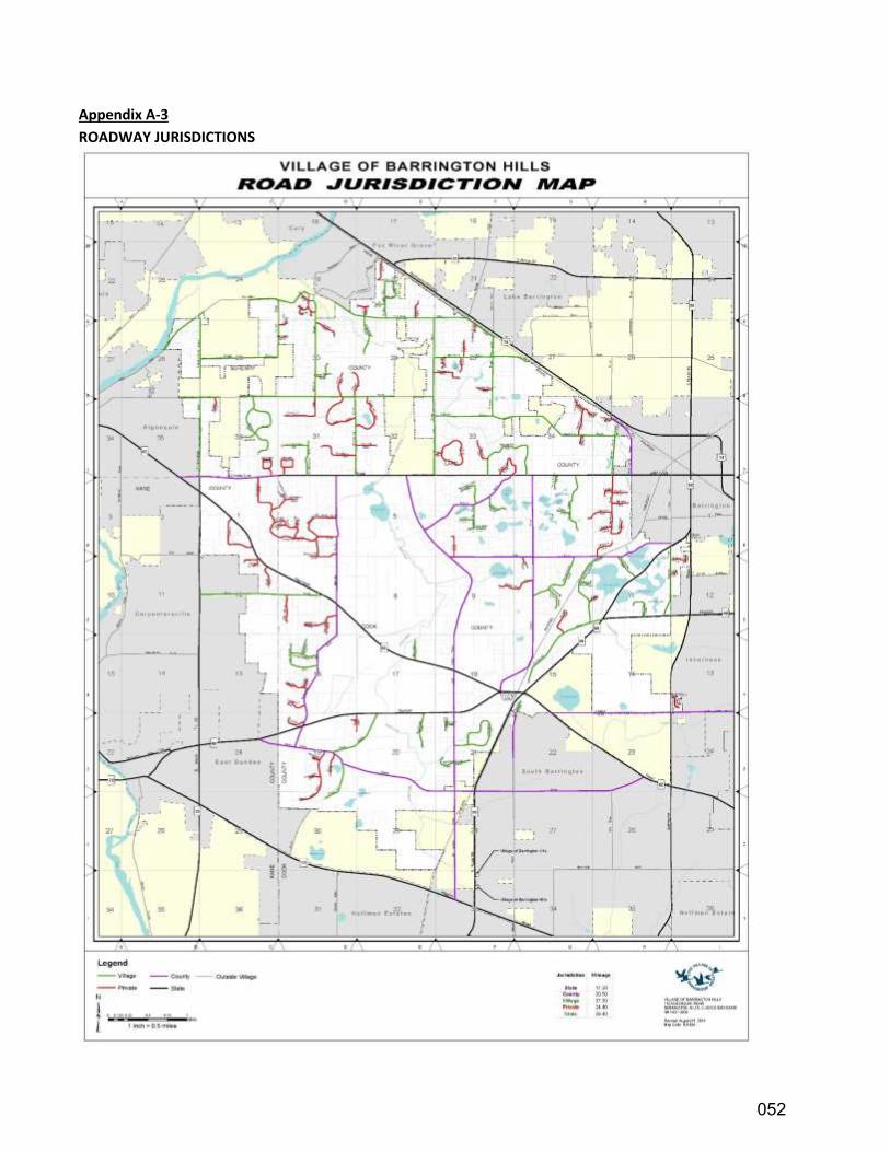
DRAFT
Appendix A-3
ROADWAY JURISDICTIONS
052
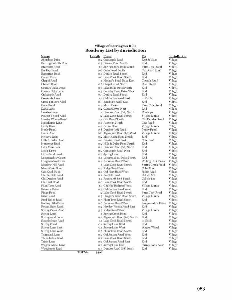
DRAFT
053
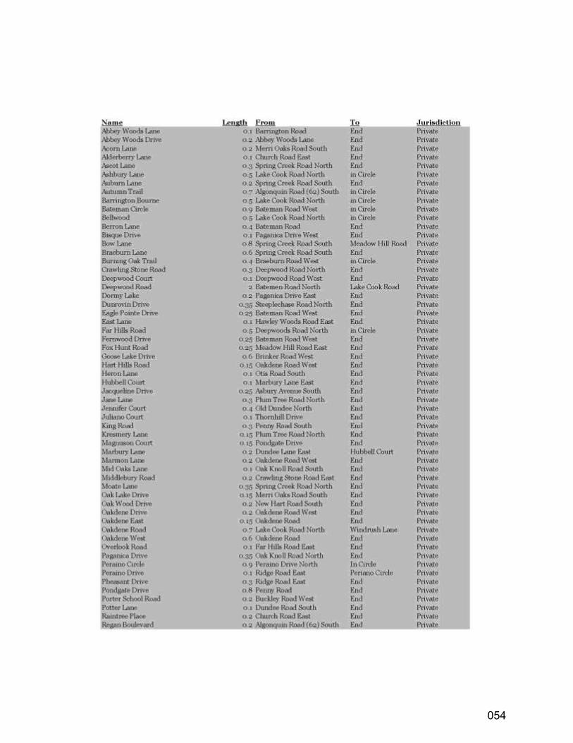
DRAFT
054
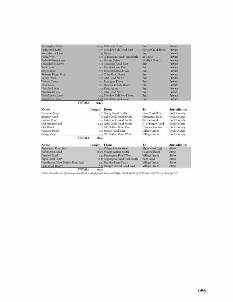
DRAFT
055
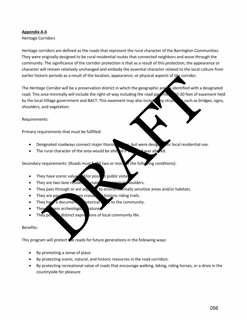
DRAFT
Appendix A-4
Heritage Corridors
Heritage corridors are defined as the roads that represent the rural character of the Barrington Communities.
They were originally designed to be rural residential routes that connected neighbors and wove through the
community. The significance of the corridor protection is that as a result of this protection, the appearance or
character will remain relatively unchanged and embody the essential character related to the local culture from
earlier historic periods as a result of the location, appearance, or physical aspects of the corridor.
The Heritage Corridor will be a preservation district in which the geographic area is identified with a designated
road. This area minimally will include the right-of-way including the road pavement, 10-20 feet of easement held
by the local Village government and BACT. This easement may also include any structures such as bridges, signs,
shoulders, and vegetation.
Requirements:
Primary requirements that must be fulfilled:
• Designated roadways connect major thoroughfares, but were designed for local residential use.
• The rural character of the area would be altered if the road was altered.
Secondary requirements: (Roads must fulfill two or more of the following conditions):
• They have scenic value and/or possess public vistas.
• They are two-lane residential roads with minimal shoulders.
• They pass through or are adjacent to environmentally sensitive areas and/or habitats.
• They are parallel to or are crossed by historic riding trails.
• They have a documented historical value to the community.
• They possess archeological features.
• They possess distinct expressions of local community life.
Benefits:
This program will protect the roads for future generations in the following ways:
• By promoting a sense of place.
• By protecting scenic, natural, and historic resources in the road corridors.
• By protecting recreational value of roads that encourage walking, biking, riding horses, or a drive in the
countryside for pleasure
056

DRAFT
Additional benefits of Heritage Corridors:
• Expansive views
• Unusual land forms
• Woodlands
• Wetlands
• Prairies
• Autumn color
• Rolling Farmland
Architectural features:
• Churches and old cemeteries
• Farmsteads
• Historically significant buildings
• Historical markers
• Rail lines
• Landscapes
• Roadway features, bridges, tunnels, etc.
057
DRAFT
Appendix A-5
GLOSSARY
Agriculture
The use of land for farming, dairying, pasturage, horticulture, floriculture, viticulture, and animal and poultry
husbandry (including the breeding and raising of horses as an occupation), and the necessary accessory uses for
handling or storing the produce.
Aquifer
An underground stratum of porous material, even rock, that contains water usually put to drinking purposes.
Arterials
Arterials are intended to provide a high degree of mobility and function as the primary travel routes for vehicles
entering, leaving, and passing through urban areas. They are generally located about a mile apart to form a grid
street system and are intended to carry high volumes at high operating speeds (35-45 mph) and have adequate
capacity to operate at high levels of service.
Berm
An earthen ridge, used as a technique in landscape design or stormwater management.
Comprehensive Plan
Is the official policy document of the Village of Barrington Hills which represents the community's vision to guide
growth and to help the village make decisions regarding future development and redevelopment. The plan
helps to set standards regarding land use, infrastructure, transportation, parks and recreation, and community
services and facilities. It acts as a blueprint for the future and identifies community values and priorities.
Conservation Easement
“A conservation easement is a legal agreement between a landowner and a land trust or government agency,
that permanently limits uses of the land in order to protect its conservation values. It allows landowners to
continue to own and use their own land, and they can also sell it or pass it on to heirs” (Land Trust Alliance).
Easement
A legal interest in property permitting a defined use or restriction, the former being for access and the later in
terms of conservation.
Equestrian Trail
A travel way, sometimes an easement, dedicated for horse riding; also known as a bridle path.
Floodplain
An area within a watershed which includes the stream, floodway, and beyond to a point that will be covered
with water after a severe storm.
058
DRAFT
Ground Water Recharge Area
A point of access to the aquifer.
Heritage Trees
Trees of a size, genus, and species indigenous to this region, as set forth in section 4-6-8, table A of the
Barrington Hills Village Code, which are determined to be of significant historical and ecological value to the
village.
Home Rule
The authority of general units of government derived directly from the State constitution as opposed to the
State legislation.
Local/Service Roads
Local service roads provide direct land access. Movement on local streets is incidental and involves traveling to
or from a collector facility. Therefore, trip lengths on local streets are typically short and, as a result, volumes
and speeds on these streets are typically low. The local street system is also typically planned to ensure that all
neighborhoods are accessible by at least two (2) routes for emergency and service vehicles. The principal role of
the local street system is to carry traffic and provide for safe and convenient access to housing areas and other
land uses.
Multimodal Path
A dedicated path, separated from a roadway, designed to accommodate bicycles and pedestrians.
Planning Jurisdiction
Illinois Municipal Code (65 ILCS 5/Article 11, Division 12) allows for a municipality to plan for unincorporated
areas that are within 1.5 miles of its incorporated boundary. This does not include areas that are incorporated
by other municipalities or areas that are covered by boundary agreements or annexation agreements.
Prairie
A type of grassland containing few trees and characterized by mixed species of native forbs and dominated by
native grasses.
Seepage Field
An element of a septic system that is after the tank where the effluent flowing through tiles comes in contact
with the soil and is treated by evapotranspiration.
Septic System
Underground wastewater treatment structures, commonly used in rural areas without centralized sewer
systems. They use a combination of nature and proven technology to treat wastewater from household
plumbing produced by bathrooms, kitchen drains, and laundry.
059
DRAFT
Stormwater Runoff
A precipitation component (including snow melt) in a hydrological model for the analysis of a watershed.
Strategic Regional Arterial (SRA)
A roadway(s) which adjoins and contributes to the operational efficiency of the Federal Highway System as so
designated by the passage of the Federal Intermodal Surface Transportation Enhancement Act.
Topography
The three-dimensional arrangement of physical attributes (such as shape, height, and depth) of a land surface in
a place or region. Physical features that make up the topography of an area include mountains, valleys, plains,
and bodies of water. Human-made features such as roads, railroads, and landfills are also often considered part
of a region's topography.
Wastewater
Water that has constituents of human and/or animal metabolic wastes, as well as water that has the residuals
from cooking, cleaning, and/or bathing
Watershed
A specific geographical area defined by topography within which the surface water gathers or accumulates.
Wetland
A transitional area between terrestrial and aquatic systems where the water table is usually at or near the
surface or the land is covered by shallow water. A wetland generally includes but is not limited to areas with
hydrophytes in hydric soils such as those commonly known as marshes, swamps, bogs, and fens.
Woodland
A type of forest containing scattered-to-many trees depending on past disturbances. A woodland usually has a
well-developed shrub layer and diverse herbaceous flora.
060
DRAFT
Appendix A-6
ADDITIONAL INFORMATION
Barrington Area Conservation Trust | bactrust.org
Barrington Area Council of Governments | bacog.org
Barrington Hills Park District | bhillsparkd.org
Citizens for Conservation | citizensforconservation.org
Federal Railroad Administration | fra.dot.gov
Flint Creek/Spring Creek Watersheds Partnership | flintcreekspringcreekwatersheds.org
Forest Preserves of Cook County | fpdcc.com
Illinois Department of Natural Resources | dnr.illinois.gov
Land Trust Alliance | lta.org
McHenry County Council of Governments | mchenrycountycog.org
Riding Club of Barrington Hills | ridingclubofbarringtonhills.com
Village of Barrington Hills | vbhil.gov
061