Embed Size (px)
Citation preview
# 72
07/2
011
Measuring extremeenvironmentsenvironMental Monitoring
Photo
court
esy o
f Han
s W. G
erber,
Argo
Prog
ram, w
ww.ar
go.ne
t
207/2011 #72
ContentsMeasuring extreMe environMents
seA oF oKHotsK BeLUGA WHALes:seAsonAL movements AnD HABitAt Use
ByOlga Shpak and Dimitri Glazov
User proGrAm
soUtHern oCeAn ArGo - tHe FinAL Frontier
User proGrAm User proGrAm
ByEsmee van Wijk
rosAme netWorK oBservAtions in tHe soUtHern oCeAn AnD AntArCtiCA
By Philippe Téchiné and Laurent Testut
4 6 8
ArGos Forum is published by CLs (www.cls.fr) issn: 1638 -315x – publication Director: Christophe vassal – editorial Directors: marie-Claire Demmou; Anne-marie Bréonce; Bill Woodward; Fabienne Jacq editor-in-Chief: marianna Childress [email protected] – Contributors to this issue: Garance Weller [email protected] – Yann Bernard [email protected] - Debbie stakem [email protected]
Design: Couleur Citron – printing: imprimerie Delort certified iso 14001 - printed on recycled paper
Photo courtesy of Olga V. Shpak
Photo courtesy of Alicia Navidad, CSIRO
Photo courtesy of LEGOS/OMP, INSU-CNRS
3 #72 07/2011
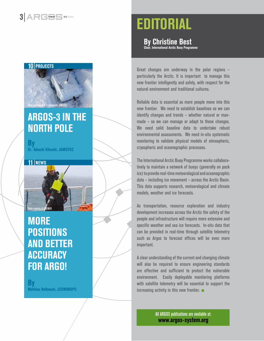
eDitoriALBy Christine BestChair, international Arctic Buoy programme
Great changes are underway in the polar regions – particularly the Arctic. It is important to manage this new frontier intelligently and safely, with respect for the natural environment and traditional cultures.
Reliable data is essential as more people move into this new frontier. We need to establish baselines so we can identify changes and trends – whether natural or man-made – so we can manage or adapt to these changes. We need solid baseline data to undertake robust environmental assessments. We need in-situ systematic monitoring to validate physical models of atmospheric, cryospheric and oceanographic processes.
The International Arctic Buoy Programme works collabora- tively to maintain a network of buoys (generally on pack ice) to provide real-time meteorological and oceanographic data – including ice movement – across the Arctic Basin. This data supports research, meteorological and climate models, weather and ice forecasts.
As transportation, resource exploration and industry development increases across the Arctic the safety of the people and infrastructure will require more extensive and specific weather and sea ice forecasts. In-situ data that can be provided in real-time through satellite telemetry such as Argos to forecast offices will be even more important.
A clear understanding of the current and changing climate will also be required to ensure engineering standards are effective and sufficient to protect the vulnerable environment. Easily deployable monitoring platforms with satellite telemetry will be essential to support the increasing activity in this new frontier. ■
proJeCts
ArGos-3 in tHenortH poLeBy Dr. takashi Kikuchi, JAmsteC
neWs
more positions AnD Better ACCUrACY For ArGo!
10
11
All ARGOS publications are available at:www.argos-system.org
By Mathieu Belbeoch, JCOMMOPS
Photo courtesy of IFREMER
Photo courtesy of Dr. Y. Kawaguchi, JAMSTEC
407/2011 #72
The beluga, or white whale, is a small, toothed whale. This gregarious marine mammal can form groups of thousands of individuals and has a circumpolar distribution occupying the Arctic and subarctic Seas, and is also found as far south as the Gulf of St Lawrence in Canada. In the Sea of Okhotsk (Russia), the southernmost population of belugas in Asia is found. Beluga whales have a very diverse diet: their main food is fish of different species, but they also feed on a wide range of invertebrates. In summer, belugas occupy shallow estuarine waters and in winter their life is tightly connected to ice. As other Arctic marine mammals, belugas are sensitive to changes in high-latitude marine ecosystems, especially ones resulting from man-caused pollution and physical environment destruction, and climate change. Attractive, playful and easy to train, this whale species is often featured in aquarium shows.
stUDYinG BeLUGAs From sAKHALin-AmUr
Since 2005, A.N. Severtsov Institute of Ecology and Evolution of Russian Academy of Sciences (IPEE
RAS) and Utrish Dolphinarium, Ltd. have been conducting a collaborative research on the beluga whale abundance, distribution, and population structure in the Russian waters. Part of this research is the study of seasonal migrations of belugas from Sakhalin-Amur region in the Sea of Okhotsk with the use of satellite telemetry, aerial surveys and radar imagery.
It is known that Okhotsk Sea belugas form three major summer stocks; but where the boundaries between them lie and whether their habitats overlap was not known. Very little information existed on wintering grounds of the Okhotsk Sea beluga population and none – on the winter migration behavior and routes of the separate stocks.
A vAst tAGGinG proGrAm
In 2007-2010, 22 adults and subadults were tagged with ARGOS satellite transmitters in Sakhalinsky Bay, 9 males and 13 females (1 SPOT3, 2 SPOT 5, and 10 SPLASH tags by Wildlife Computers, Inc., USA, and 9 Pulsar tags by closed joint-stock
company ES-PAS, Russia). In 2010, 2 males and 1 female from the third – Northern, or Shelikhov – stock, were also tagged with Pulsar transmitters on the Western Coast of Kamchatka Peninsula.
The results obtained from the analysis of the treks of tagged belugas showed that movement pattern varied with season. On their summer grounds, in warmer shallow bays and river estuaries, belugas were highly residential and performed only small-scale daily
the current abundance of white whales occupying russian seas is unknown. in the past
twenty to thirty years, beluga research has become occasional and of a limited geographical and methodological scale in russia, due to the termination of whaling and the collapse of the soviet Union. A lot of places in the russian Arctic and the Far east are extremely difficult – if not impossible – to access due to logistics; aerial abundance surveys are expensive and also cannot cover the entire beluga range. However, a combination of satellite telemetry, aerial surveys and radar imagery can be very helpful in understanding the seasonal migrations of beluga and their adaptation to climate change, as Dr. olga shpak and Dimitri Glazov, of the A.n. severtsov institute of ecology and evolution of russian Academy of sciences (ipee rAs), explain.
User proGrAm
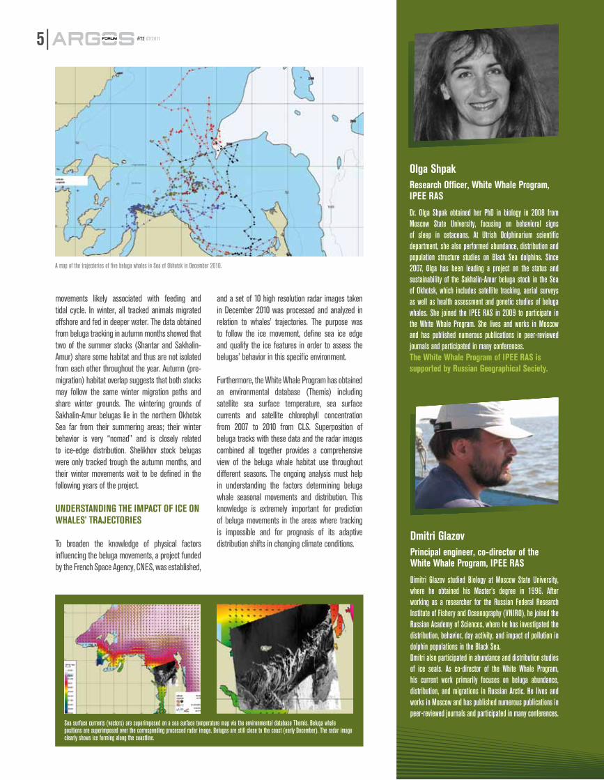
Five of the ten RADARSAT images taken in December 2010 showing the sea-ice cover in the Sea of Okhotsk.
seA oF oKHotsK
BeLUGA WHALes:
seAsonAL movements AnD
HABitAt Use
By Olga Shpak and Dmitri Glazov
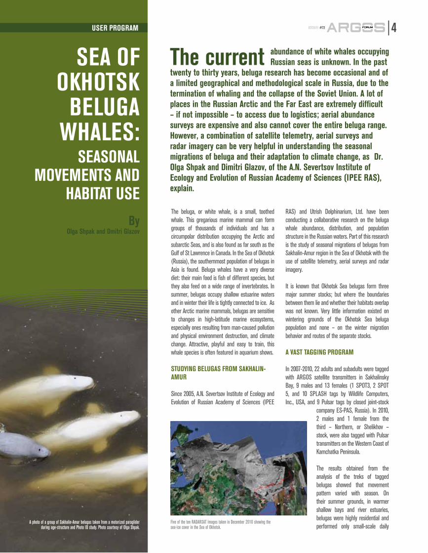
A photo of a group of Sakhalin-Amur belugas taken from a motorized paraglider during age-structure and Photo ID study. Photo courtesy of Olga Shpak.
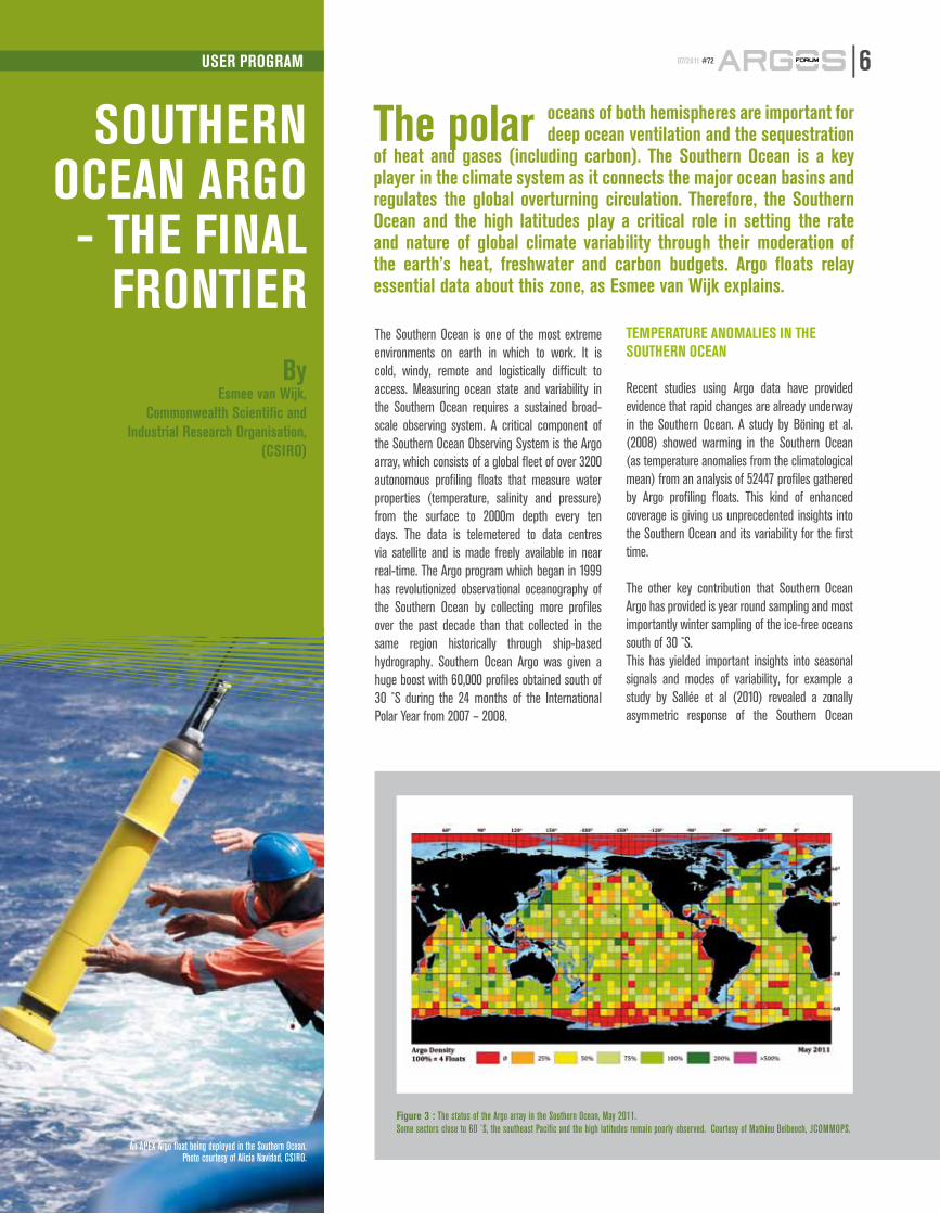
movements likely associated with feeding and tidal cycle. In winter, all tracked animals migrated offshore and fed in deeper water. The data obtained from beluga tracking in autumn months showed that two of the summer stocks (Shantar and Sakhalin-Amur) share some habitat and thus are not isolated from each other throughout the year. Autumn (pre-migration) habitat overlap suggests that both stocks may follow the same winter migration paths and share winter grounds. The wintering grounds of Sakhalin-Amur belugas lie in the northern Okhotsk Sea far from their summering areas; their winter behavior is very “nomad” and is closely related to ice-edge distribution. Shelikhov stock belugas were only tracked trough the autumn months, and their winter movements wait to be defined in the following years of the project.
UnDerstAnDinG tHe impACt oF iCe on WHALes’ trAJeCtories
To broaden the knowledge of physical factors influencing the beluga movements, a project funded by the French Space Agency, CNES, was established,
and a set of 10 high resolution radar images taken in December 2010 was processed and analyzed in relation to whales’ trajectories. The purpose was to follow the ice movement, define sea ice edge and qualify the ice features in order to assess the belugas’ behavior in this specific environment.
Furthermore, the White Whale Program has obtained an environmental database (Themis) including satellite sea surface temperature, sea surface currents and satellite chlorophyll concentration from 2007 to 2010 from CLS. Superposition of beluga tracks with these data and the radar images combined all together provides a comprehensive view of the beluga whale habitat use throughout different seasons. The ongoing analysis must help in understanding the factors determining beluga whale seasonal movements and distribution. This knowledge is extremely important for prediction of beluga movements in the areas where tracking is impossible and for prognosis of its adaptive distribution shifts in changing climate conditions.
A map of the trajectories of five beluga whales in Sea of Okhotsk in December 2010.
5 #72 07/2011
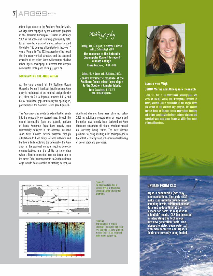
Sea surface currents (vectors) are superimposed on a sea surface temperature map via the environmental database Themis. Beluga whale positions are superimposed over the corresponding processed radar image. Belugas are still close to the coast (early December). The radar image clearly shows ice forming along the coastline.
olga shpakresearch officer, White Whale program, ipee rAs
Dr. Olga Shpak obtained her PhD in biology in 2008 from Moscow State University, focusing on behavioral signs of sleep in cetaceans. At Utrish Dolphinarium scientific department, she also performed abundance, distribution and population structure studies on Black Sea dolphins. Since 2007, Olga has been leading a project on the status and sustainability of the Sakhalin-Amur beluga stock in the Sea of Okhotsk, which includes satellite tracking, aerial surveys as well as health assessment and genetic studies of beluga whales. She joined the IPEE RAS in 2009 to participate in the White Whale Program. She lives and works in Moscow and has published numerous publications in peer-reviewed journals and participated in many conferences.the White Whale program of ipee rAs is supported by russian Geographical society.
Dmitri Glazovprincipal engineer, co-director of the White Whale program, ipee rAs
Dimitri Glazov studied Biology at Moscow State University, where he obtained his Master’s degree in 1996. After working as a researcher for the Russian Federal Research Institute of Fishery and Oceanography (VNIRO), he joined the Russian Academy of Sciences, where he has investigated the distribution, behavior, day activity, and impact of pollution in dolphin populations in the Black Sea. Dmitri also participated in abundance and distribution studies of ice seals. As co-director of the White Whale Program, his current work primarily focuses on beluga abundance, distribution, and migrations in Russian Arctic. He lives and works in Moscow and has published numerous publications in peer-reviewed journals and participated in many conferences.
the polar oceans of both hemispheres are important for deep ocean ventilation and the sequestration
of heat and gases (including carbon). the southern ocean is a key player in the climate system as it connects the major ocean basins and regulates the global overturning circulation. therefore, the southern ocean and the high latitudes play a critical role in setting the rate and nature of global climate variability through their moderation of the earth’s heat, freshwater and carbon budgets. Argo floats relay essential data about this zone, as esmee van Wijk explains.
soUtHern oCeAn ArGo - tHe FinAL
FrontierBy
Esmee van Wijk,Commonwealth Scientific and
Industrial Research Organisation,(CSIRO)
An APEX Argo float being deployed in the Southern Ocean.Photo courtesy of Alicia Navidad, CSIRO.
607/2011 #72
The Southern Ocean is one of the most extreme environments on earth in which to work. It is cold, windy, remote and logistically difficult to access. Measuring ocean state and variability in the Southern Ocean requires a sustained broad-scale observing system. A critical component of the Southern Ocean Observing System is the Argo array, which consists of a global fleet of over 3200 autonomous profiling floats that measure water properties (temperature, salinity and pressure) from the surface to 2000m depth every ten days. The data is telemetered to data centres via satellite and is made freely available in near real-time. The Argo program which began in 1999 has revolutionized observational oceanography of the Southern Ocean by collecting more profiles over the past decade than that collected in the same region historically through ship-based hydrography. Southern Ocean Argo was given a huge boost with 60,000 profiles obtained south of 30 ˚S during the 24 months of the International Polar Year from 2007 – 2008.
temperAtUre AnomALies in tHe soUtHern oCeAn
Recent studies using Argo data have provided evidence that rapid changes are already underway in the Southern Ocean. A study by Böning et al. (2008) showed warming in the Southern Ocean (as temperature anomalies from the climatological mean) from an analysis of 52447 profiles gathered by Argo profiling floats. This kind of enhanced coverage is giving us unprecedented insights into the Southern Ocean and its variability for the first time.
The other key contribution that Southern Ocean Argo has provided is year round sampling and most importantly winter sampling of the ice-free oceans south of 30 ˚S. This has yielded important insights into seasonal signals and modes of variability, for example a study by Sallée et al (2010) revealed a zonally asymmetric response of the Southern Ocean
User proGrAm
Figure 3 : The status of the Argo array in the Southern Ocean, May 2011. Some sectors close to 60 ˚S, the southeast Pacific and the high latitudes remain poorly observed. Courtesy of Mathieu Belbeoch, JCOMMOPS.
mixed layer depth to the Southern Annular Mode. An Argo float deployed by the Australian program in the Antarctic Circumpolar Current in January 2005 is still active and returning good quality data. It has travelled eastward almost halfway around the globe (120 degrees of longitude) in just over 7 years (Figure 1). The 233 observed profiles reveal the fine-scale vertical structure and the seasonal evolution of the mixed layer, with warmer shallow mixed layers developing in summer that deepen with winter cooling and mixing (Figure 2).
mAintAininG tHe ArGo ArrAY
As the core element of the Southern Ocean Observing System it is critical that the current Argo array is maintained at the nominal design density of 1 float per 3 x 3 degrees) between 60 ˚N and 60 ̊ S. Substantial gaps in the array are opening up, particularly in the Southern Ocean (see Figure 3).
The Argo array also needs to extend further south into the seasonally ice covered seas, through the use of ice-capable floats and acoustic tracking of floats. Numerous floats have already been successfully deployed in the seasonal ice zone (and have survived several winters) through adaptations to float design of both software and hardware. Fully exploiting the potential of the Argo array in the seasonal ice zone requires two-way communications and the ability to store data when a float is prevented from surfacing due to ice cover. Other enhancements to Southern Ocean Argo include floats capable of profiling deeper, as
significant changes have been observed below 2000 m. Additional sensors such as oxygen and bio-optics have already been deployed on Argo floats and sensors for pH, nitrate, wind and rainfall are currently being tested. The next decade promises to bring exciting new developments in both float technology and enhanced understanding of ocean state and processes.
7 #72 07/2011
esmee van WijkCsiro marine and Atmospheric research
Esmee van Wijk is an observational oceanographer who works at CSIRO Marine and Atmospheric Research in Hobart, Australia. She is responsible for the Delayed Mode data stream of the Australian Argo program. Her research interests focus on Southern Ocean observations; including high latitude sampling with ice floats and other platforms and analysis of water mass properties and variability from repeat hydrographic sections.
UpDAte From CLs
Argos-3 capabilities (two-way communications, high data rate) make it possible to provide more sampling levels, additional sensor data and reduce time at the surface for floats, in response to scientists’ needs. CLs has invested in integrating this technology into new generation floats (ice, biogeochemistry, deep water…) with manufacturers and Argos-3 floats are currently being tested.
Figure 1: The trajectory of Argo float # 5900337 drifting in the Antarctic Circumpolar Current for more than seven years.
Figure 2:A vertical section of potential temperature (˚C) returned from a long-lived Argo float. The x-axis is labelled with time (years) on the bottom and profile number along the top.
BibliographyBöning, C.W., A. Dispertt, M. Visbeck, S. Rintoul
and F.U. Schwarzkopf, 2008.the response of the Antarctic Circumpolar Current to recent
climate change. Nature Geoscience, 1:864 – 869.
Sallée, J.B., K. Speer and S.R. Rintoul, 2010a. Zonally asymmetric response of the southern ocean mixed-layer depth
to the southern Annular mode. Nature Geoscience, 3:273-279,
doi:10.1038/ngeo812.
since ancient times, man has been interested in the phenomenon of tides. Among the first sea-level
measuring devices, the tide pole (a graduated level rod placed vertically, on which the observer can read the sea level) has remained a fairly accurate tool, and is still used today to monitor the drift of more sophisticated sensors. in the 1840s, the automatic tide gauge appeared: this was a float tide gauge that would draw on a sheet of paper with a stylus. since that time, techniques have evolved and many types of tide gauges were invented (pressure, ultrasonic, and radar). in the 1980s, the Argos system made it possible to relay these increasingly sophisticated observations in near real-time, and in the 1990s, satellite altimetry made it possible to observe sea level from space.
811/2010 #72
tHe rosAme netWorK in tHe FrenCH soUtHern AnD AntArCtiC LAnDs
Since the 1990s, the ROSAME network (Réseau d’Observation Subantarctique et Antarctique du niveau de la MEr - Subantarctic and Antarctic sea-level observation network) has been used to monitor changes in sea level in the extreme environments of the Southern and Antarctic Oceans.It was officially approved as an Observation Service in 1997 and as an Environmental Research Observatory in 1992, and is part of the Global Sea Level Observing System (GLOSS) network for long-term observation.Its main scientific objectives are the study of ocean tides, the validation of satellite observations, and the observation of secular variations in sea level.The ROSAME network consists of four measuring sites and covers the French Southern and Antarctic Lands where coastal tide gauge stations were put into service in the districts of Kerguelen (Port-aux-Français in April 1993), Saint-Paul/Amsterdam (in October 1994) and Crozet (Possession Island in December 1994), all located in the Indian sector of the Southern Ocean.In February 1997, a coastal station was set up on the Antarctic continent near the French scientific base of Dumont d’Urville.
seA LeveL oBservAtion: meAsUrements trAnsmitteD BY sAteLLite
Coastal tide gauge stations consist of a pressure, temperature, and conductivity sensor immersed in a gauge well (Figure 1). This sensor is connected to an automatic acquisition unit located on the ground, to provide it with power. The unit is equipped with an atmospheric pressure sensor.The measurements, made simultaneously, are stored at each site and are transmitted by satellite to LEGOS. Use of the Argos system in these extreme environments allows data to be received in near real-time and checked quickly to verify that the stations are functioning properly. An onsite visit can then be initiated when the weather conditions permit.The sea level is derived from the measurements, and after validation, the data are sent to the archive center at the University of Hawaii Sea Level Center, (http://uhslc.soest.hawaii.edu/), to be made available to the scientific community. The data are also available at LEGOS.The reliability of the Argos system has allowed us to observe the sea level (Figure 3) continuously for nearly 20 years in these regions that are so difficult to access.
User proGrAm
rosAme netWorK
oBservAtions in tHe soUtHern
oCeAn AnD AntArCtiCA:
An UnCHAnGeD seA LeveL For
135 YeArs At sAint-pAUL isLAnD
By Philippe Téchiné and Laurent Testut
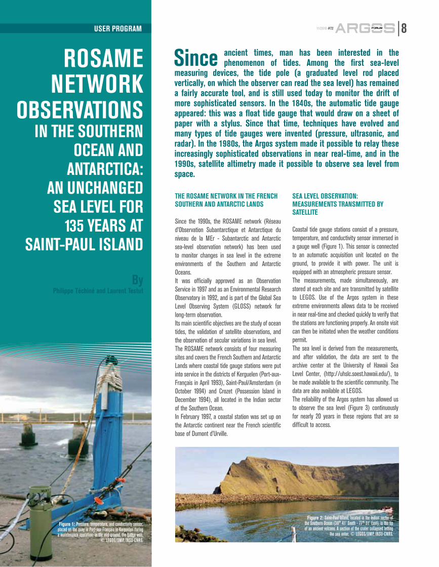
Figure 1: Pressure, temperature, and conductivity sensor, placed on the quay in Port-aux-Français in Kerguelen during a maintenance operation; in the mid-ground, the gauge well.
© LEGOS/OMP, INSU-CNRS.
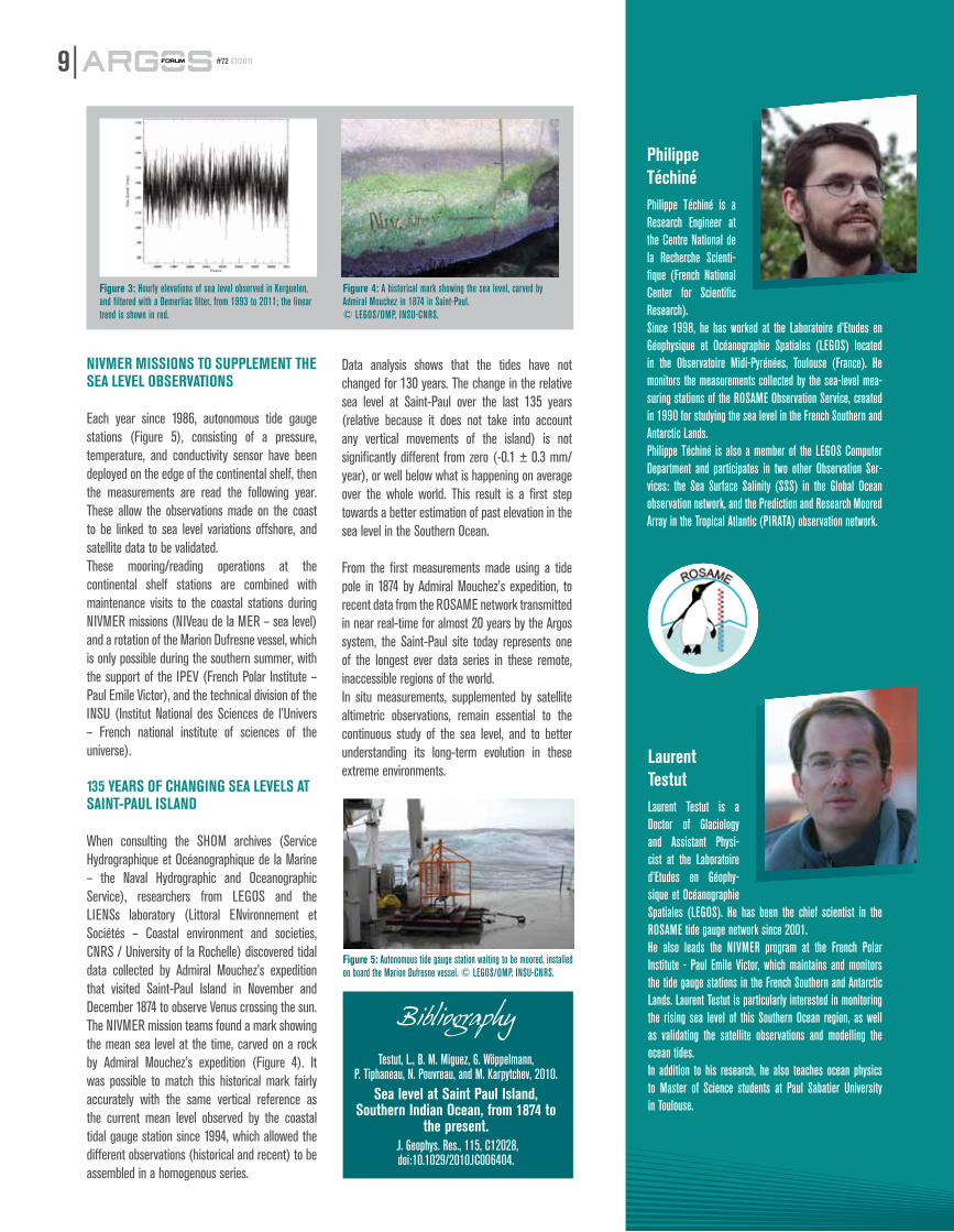
Figure 2: Saint-Paul Island, located in the Indian sector of the Southern Ocean (38° 41’ South - 77° 31’ East), is the tip of an ancient volcano. A section of the crater collapsed letting
the sea enter. © LEGOS/OMP, INSU-CNRS.
nivmer missions to sUppLement tHe seA LeveL oBservAtions
Each year since 1986, autonomous tide gauge stations (Figure 5), consisting of a pressure, temperature, and conductivity sensor have been deployed on the edge of the continental shelf, then the measurements are read the following year. These allow the observations made on the coast to be linked to sea level variations offshore, and satellite data to be validated. These mooring/reading operations at the continental shelf stations are combined with maintenance visits to the coastal stations during NIVMER missions (NIVeau de la MER – sea level) and a rotation of the Marion Dufresne vessel, which is only possible during the southern summer, with the support of the IPEV (French Polar Institute – Paul Emile Victor), and the technical division of the INSU (Institut National des Sciences de l’Univers – French national institute of sciences of the universe).
135 YeArs oF CHAnGinG seA LeveLs At sAint-pAUL isLAnD
When consulting the SHOM archives (Service Hydrographique et Océanographique de la Marine – the Naval Hydrographic and Oceanographic Service), researchers from LEGOS and the LIENSs laboratory (Littoral ENvironnement et Sociétés – Coastal environment and societies, CNRS / University of la Rochelle) discovered tidal data collected by Admiral Mouchez’s expedition that visited Saint-Paul Island in November and December 1874 to observe Venus crossing the sun.The NIVMER mission teams found a mark showing the mean sea level at the time, carved on a rock by Admiral Mouchez’s expedition (Figure 4). It was possible to match this historical mark fairly accurately with the same vertical reference as the current mean level observed by the coastal tidal gauge station since 1994, which allowed the different observations (historical and recent) to be assembled in a homogenous series.
Data analysis shows that the tides have not changed for 130 years. The change in the relative sea level at Saint-Paul over the last 135 years (relative because it does not take into account any vertical movements of the island) is not significantly different from zero (-0.1 ± 0.3 mm/year), or well below what is happening on average over the whole world. This result is a first step towards a better estimation of past elevation in the sea level in the Southern Ocean.
From the first measurements made using a tide pole in 1874 by Admiral Mouchez’s expedition, to recent data from the ROSAME network transmitted in near real-time for almost 20 years by the Argos system, the Saint-Paul site today represents one of the longest ever data series in these remote, inaccessible regions of the world.In situ measurements, supplemented by satellite altimetric observations, remain essential to the continuous study of the sea level, and to better understanding its long-term evolution in these extreme environments.
9 #72 07/2011
Figure 3: Hourly elevations of sea level observed in Kerguelen, and filtered with a Demerliac filter, from 1993 to 2011; the linear trend is shown in red.
Figure 4: A historical mark showing the sea level, carved by Admiral Mouchez in 1874 in Saint-Paul. © LEGOS/OMP, INSU-CNRS.
Figure 5: Autonomous tide gauge station waiting to be moored, installed on board the Marion Dufresne vessel. © LEGOS/OMP, INSU-CNRS.
BibliographyTestut, L., B. M. Miguez, G. Wöppelmann,
P. Tiphaneau, N. Pouvreau, and M. Karpytchev, 2010.sea level at saint paul island,
southern indian ocean, from 1874 to the present.
J. Geophys. Res., 115, C12028, doi:10.1029/2010JC006404.
philippe téchinéPhilippe Téchiné is a Research Engineer at the Centre National de la Recherche Scienti-fique (French National Center for Scientific Research). Since 1998, he has worked at the Laboratoire d’Etudes en Géophysique et Océanographie Spatiales (LEGOS) located in the Observatoire Midi-Pyrénées, Toulouse (France). He monitors the measurements collected by the sea-level mea-suring stations of the ROSAME Observation Service, created in 1990 for studying the sea level in the French Southern and Antarctic Lands.Philippe Téchiné is also a member of the LEGOS Computer Department and participates in two other Observation Ser-vices: the Sea Surface Salinity (SSS) in the Global Ocean observation network, and the Prediction and Research Moored Array in the Tropical Atlantic (PIRATA) observation network.
Laurent testut Laurent Testut is a Doctor of Glaciology and Assistant Physi-cist at the Laboratoire d’Etudes en Géophy-sique et Océanographie Spatiales (LEGOS). He has been the chief scientist in the ROSAME tide gauge network since 2001. He also leads the NIVMER program at the French Polar Institute - Paul Emile Victor, which maintains and monitors the tide gauge stations in the French Southern and Antarctic Lands. Laurent Testut is particularly interested in monitoring the rising sea level of this Southern Ocean region, as well as validating the satellite observations and modelling the ocean tides.In addition to his research, he also teaches ocean physics to Master of Science students at Paul Sabatier University in Toulouse.
Photo courtesy of Dr. Y. Kawaguchi, JAMSTEC
proJeCt
ArGos-3 in tHe
nortH poLeneW DAtA
CoLLeCtion sYstems For A
CHAnGinG ArCtiC environment
By Dr. Takashi Kikuchi,
Arctic Ocean Research Team, JAMSTEC
Understanding climate change in the Arctic region is crucial to understanding
environmental change on a global level. But as climate change modifies this region, new observing systems must be developed in order to study it, explains Dr. takashi Kikuchi, of the Japan Agency for marine science and technology (JAmsteC).
Dramatic melting of sea ice in recent years has made it easier for scientists to deploy observing platforms in the Arctic region, but it also poses new challenges. Data collection platforms must now be designed to float when the ice melts in the summer yet still transmit data from ice in winter conditions.
Dr. Takashi Kikuchi and his team have worked hard to develop a new buoy system toward monitoring the changing Arctic Ocean environment. This system, called PPOP (Portable Polar Observation Platform), was deployed on April 12, 2011, at the North Pole ice camp as part of the NSF(US)-led international project, North Pole Environmental Observatory (NPEO http://psc.apl.washington.edu/northpole/index.html)and the International Arctic Buoy Programme (IABP, http://iabp.apl.washington.edu/).
This system includes a PPOP-01A, manufactured by Cubic-I, the very first platform functioning exclusively with Argos-3 to be deployed in the Arctic region. The results so far are very good. On average, data is relayed to the satellite with only a 50 minute delay from observation time. The PPOP-01A is also very efficient; it is able to send 24 observations with only 30 messages due to satellite rendezvous capability.
The PPOP-01A collects ice temperature data up to 30cm deep, atmospheric pressure, and GPS positions every hour. (See Figure-1 and 2.) After drifting slowly on the ice for the first four weeks, the platform is now drifting toward the Fram Strait very rapidly, mainly due to wind conditions.
Consistent reCorDs For CLimAte AnD environmentAL qUALitY
The sea ice drift, air temperature and barometric pressure data relayed by this platform are posted on the GTS along with other data collected by the observing system (including ocean profiling buoy, ice buoys, and meteorological buoy). These data are crucial for the creation of weather maps over the Arctic.
While the observing system has yet to pass the test of winter and increasingly icy conditions, Dr. Kikuchi hopes that this prototype system will offer a solution for providing reliable and continual observations of the Arctic given the new challenges faced by changing climatic conditions.
Figure 1: Drifting track of PPOP-01A as of 00:00Z May 23, 2011. Each color shows the drifting track for a week.
1007/2011 #72
Figure 2: Time series of ice temperature at 30 cm deep and barometric pressure as of May 23, 2011.
Photo courtesy of IFREMER
Photo
court
esy o
f JAM
STEC
on march 15, 2011, CLs introduced a new technique for Argos location processing based on
Kalman filtering. this technique, available to all users of the Argos system, provides more positions and better accuracy than the traditional least squares processing, as well as automatically corrects unrealistic positions. in order to benefit from these improvements, the Argo community has collectively decided to adopt the Kalman filtering processing technique for all Argo floats as of June 13, 2011.
Before making the decision to adopt the Kalman filtering technique, the Argo community, represented by JCOMMOPS, collaborated closely with CLS to evaluate the advantages of this new processing technique. Data from eighteen Argo floats functioning in nominal conditions but also in extreme conditions (beached or iced over) were reprocessed using both processing techniques between January 1, 2008 and October 1, 2010. More than 20,000 Argos positions were tested and compared.
All results are downloadable on the JCOMMOPS website at this page: ftp://ftp.jcommops.org/Argo/ARGOS.
After analysis, JCOMMOPS and CLS concluded that the new method provides more positions for floats and better accuracy as well.
In particular: • +10% more positions on average can be computed with the new method• More accuracy on Argos positions: twice as many Class 3 locations on average since improvements in Class 1 and 2 locations mean they become Class 3• Mirror positions, like all unrealistic positions, are filtered with the Kalman method• This method is useful for float recovery with only a few messages collected
This new method will also improve the real-time tracking of platforms at JCOMMOPS, using raw Argos real-time locations. Given the results, JCOMMOPS recommended to the Argo user community to switch collectively to the new processing technique, so that all data-sets would be improved and homogenous.
The Kalman filtering location processing technique is promising and Argo will adopt it unanimously.The Argo team thanks CLS for having consulted the community and looks forward to future impro-vements of the Argos system.
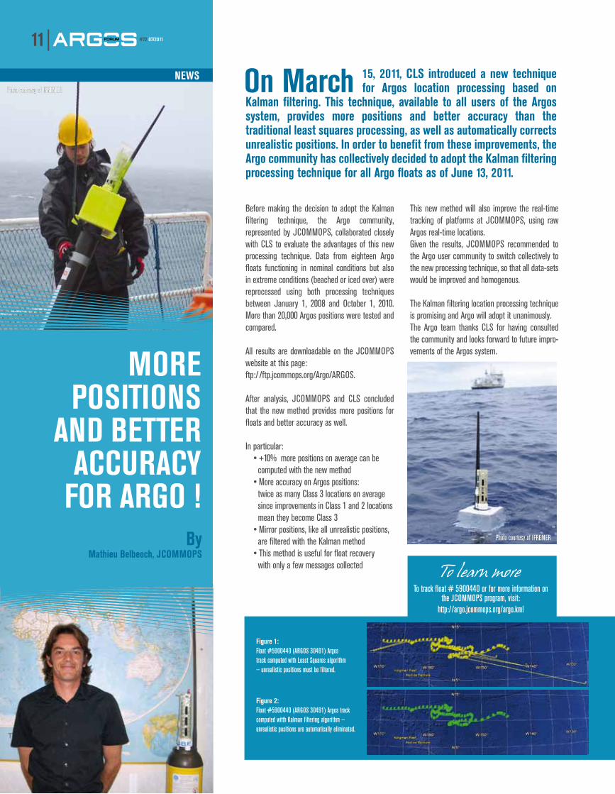
Figure 1: Float #5900440 (ARGOS 30491) Argos track computed with Least Squares algorithm -- unrealistic positions must be filtered.
Figure 2: Float #5900440 (ARGOS 30491) Argos track computed witth Kalman filtering algorithm -- unrealistic positions are automatically eliminated.
more positions
AnD Better ACCUrACY
For ArGo !
To learn moreTo track float # 5900440 or for more information on
the JCOMMOPS program, visit:http://argo.jcommops.org/argo.kml
11 #72 07/2011
neWsPhoto courtesy of IFREMER
Photo courtesy of IFREMERBy Mathieu Belbeoch, JCOMMOPS
We WeLCome YoUr ContriBUtions!We know your work is interesting. Let us publish it! We are currently accepting contributions. Articles (maximum 700 words) should be submitted in French or english.
email: [email protected]
HEADQUARTERS: CLS8-10 rue HermèsParc technologique du Canal31520 Ramonville Saint-Agne,FranceTel. + 33 (0) 5 61 39 47 20Fax + 33 (0) 5 61 39 47 97E-mail: [email protected] NORTH AMERICACLS America4300 Forbes Blvd, Suite 110Lanham, MD 20706, USATel. + 1 301 925 4411Fax + 1 301 925 8995E-mail: [email protected] PERUCLS PerúJr. Trinidad Moran 639, LinceLima, PeruTel. + 51 1 440 2717Fax + 51 1 421 2433E-mail: [email protected] CHILECunlogan SAAlmirante Señoret 70 of.74Valparaiso, ChileTel. + 56 32 225 2843Fax. + 56 32 225 7294E-mail: [email protected] JAPANCubic-I-LtdBluebell bldg 7F2-15-9 Nishi-GotandaShinagawa-KuTokyo 141-0031, JapanTel. + 81 (0) 3 3779 5506Fax + 81 (0) 3 3779 5783E-mail: [email protected] AUSTRALASIA & SOUTH PACIFICSatellite Information TechnologySuite 7061 Queens RoadMelbourne, VIC 3001, AustraliaTel. + 61 (0) 3 9863 9650Fax + 61 (0) 3 9863 9675E-mail: [email protected] SOUTHEAST ASIAPT CLS IndonesiaAdhi Graha, lt 17, Suite 1701Jl Jend Gatot Subroto, Kav 56Kuningan Timur, SetiabudiJakarta Selatan, 12950 IndonesiaTel. + 62 21 526 4266Fax. + 62 21 526 4265E-mail: [email protected][email protected] KOREAKL TradingRoom 328, Obelisk bldg, 492-4,Dapshimni, 5 Dong, Dongdaemun-GuSeoul, Korea 130-805Yongdap-Dong, Seongdong-Ku,Seoul, KoreaTel. + 82 2 2215 7134/5Fax + 82 2 2215 7136E-mail: [email protected] RUSSIAES-PAS15-73 Leningradskoe Chaussée125171 Moscow, RussiaTel. + 7 499 150 0332Fax + 7 499 150 0332E-mail: [email protected] BELGIUMCLS - BrusselsAvenue des Arts 8B-1210 BruxellesBelgiqueTél. +3225068896 Cell. +33 628356606E-mail: [email protected]