Embed Size (px)
Citation preview
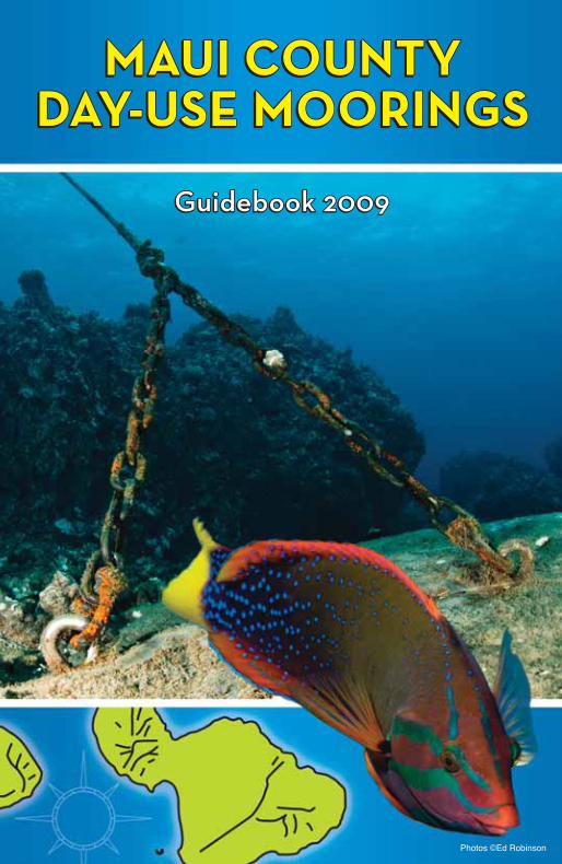
MAUI COUNTYMAUI COUNTYDAY-USE MOORINGSDAY-USE MOORINGS
MAUI COUNTYMAUI COUNTYDAY-USE MOORINGSDAY-USE MOORINGS
Guidebook 2009Guidebook 2009Guidebook 2009Guidebook 2009
Photos ©Ed Robinson
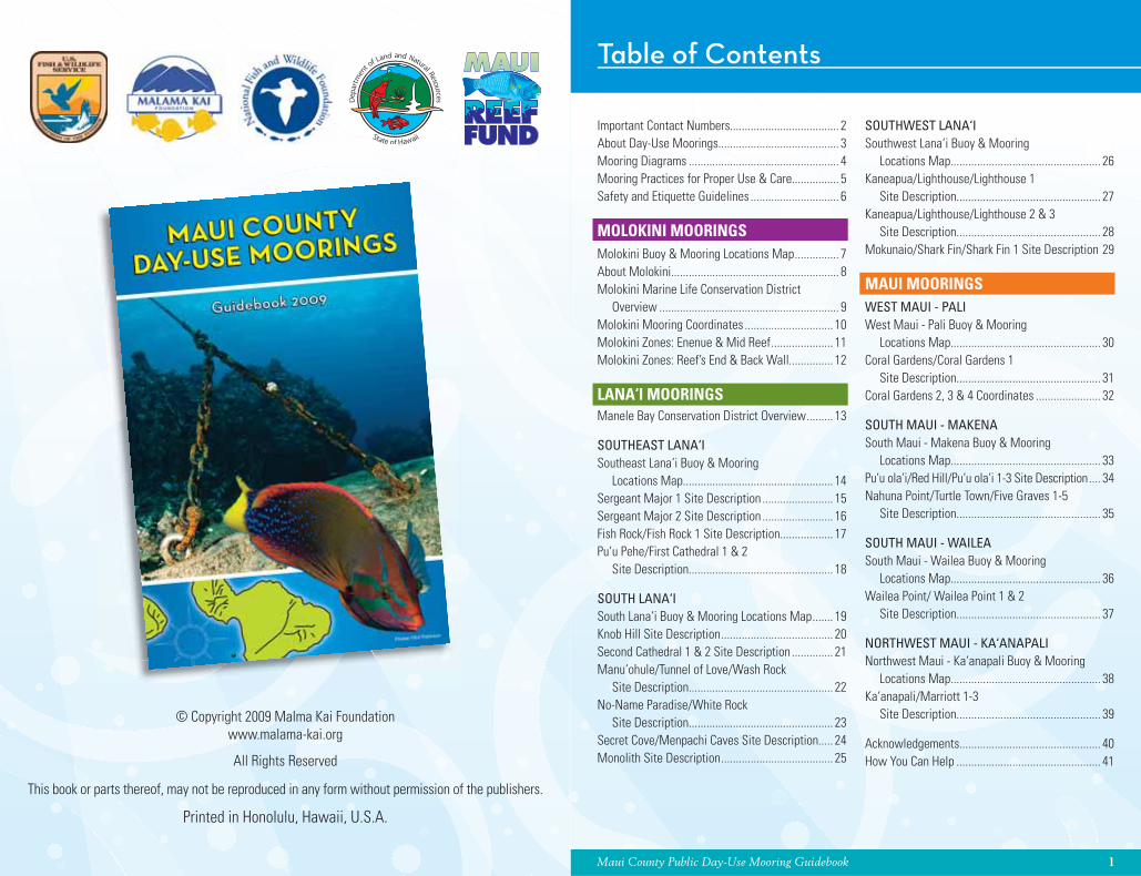
Maui County Public Day-Use Mooring Guidebook 1
Table of Contents
Important Contact Numbers..................................... 2About Day-Use Moorings......................................... 3Mooring Diagrams ................................................... 4Mooring Practices for Proper Use & Care................ 5Safety and Etiquette Guidelines .............................. 6
MOLOKINI MOORINGSMolokini Buoy & Mooring Locations Map ............... 7About Molokini......................................................... 8Molokini Marine Life Conservation District Overview ............................................................. 9Molokini Mooring Coordinates .............................. 10Molokini Zones: Enenue & Mid Reef ..................... 11Molokini Zones: Reef’s End & Back Wall............... 12
LANA‘I MOORINGSManele Bay Conservation District Overview ......... 13
SOUTHEAST LANA‘ISoutheast Lana‘i Buoy & Mooring Locations Map................................................... 14Sergeant Major 1 Site Description ........................ 15Sergeant Major 2 Site Description ........................ 16Fish Rock/Fish Rock 1 Site Description.................. 17Pu‘u Pehe/First Cathedral 1 & 2 Site Description................................................. 18
SOUTH LANA‘ISouth Lana‘i Buoy & Mooring Locations Map ....... 19Knob Hill Site Description ...................................... 20Second Cathedral 1 & 2 Site Description .............. 21Manu‘ohule/Tunnel of Love/Wash Rock Site Description................................................. 22No-Name Paradise/White Rock Site Description................................................. 23Secret Cove/Menpachi Caves Site Description..... 24Monolith Site Description ...................................... 25
SOUTHWEST LANA‘ISouthwest Lana‘i Buoy & Mooring Locations Map................................................... 26Kaneapua/Lighthouse/Lighthouse 1 Site Description................................................. 27Kaneapua/Lighthouse/Lighthouse 2 & 3 Site Description................................................. 28Mokunaio/Shark Fin/Shark Fin 1 Site Description 29
MAUI MOORINGSWEST MAUI - PALIWest Maui - Pali Buoy & Mooring Locations Map................................................... 30Coral Gardens/Coral Gardens 1 Site Description................................................. 31Coral Gardens 2, 3 & 4 Coordinates ...................... 32
SOUTH MAUI - MAKENASouth Maui - Makena Buoy & Mooring Locations Map................................................... 33Pu‘u ola‘i/Red Hill/Pu‘u ola‘i 1-3 Site Description .... 34Nahuna Point/Turtle Town/Five Graves 1-5 Site Description................................................. 35
SOUTH MAUI - WAILEASouth Maui - Wailea Buoy & Mooring Locations Map................................................... 36Wailea Point/ Wailea Point 1 & 2 Site Description................................................. 37
NORTHWEST MAUI - KA‘ANAPALINorthwest Maui - Ka‘anapali Buoy & Mooring Locations Map................................................... 38Ka‘anapali/Marriott 1-3 Site Description................................................. 39
Acknowledgements................................................ 40How You Can Help ................................................. 41
© Copyright 2009 Malma Kai Foundationwww.malama-kai.org
All Rights Reserved
This book or parts thereof, may not be reproduced in any form without permission of the publishers.
Printed in Honolulu, Hawaii, U.S.A.
2 Maui County Public Day-Use Mooring Guidebook Maui County Public Day-Use Mooring Guidebook 3
About Day-Use MooringsImportant Contact Numbers
To Report Day-Use Mooring Buoy ProblemsContact Department Of Boating & Ocean Recreation (DOBOR) call (808) 243-5824
(808) is the area code for all the Hawaiian Islands
EMERGENCY Fire Department ......................................................................................................................... 911Police Department..................................................................................................244-6400 or 911Coast Guard.......................................................................................................................873-3105Maui Monk Seal Sightings Hotline...................................................................................292-2372Turtle Strandings .......................................................................................... 893-3172 or 893-3050Marine Mammal Entanglement Hotline ................................................................ 1-888-256-9840Chamber - Hyberbaric DAN Hawaii ....................................................................... 1-800-587-3425 HOSPITALSMaui Memorial Medical Center .......................................................................................244-9056Lahaina Clinic ....................................................................................................................662-6900Kihei Clinic ........................................................................................................................891-6800Lana‘i Community Hospital ...............................................................................................565-6411 LICENSING SERVICESBoating Registration .........................................................................................................243-5824Fishing Licenses ................................................................................................................243-5294 OTHER NUMBERS OF INTERESTCoast Guard.......................................................................................................................873-3105Department of Land and Natural Resources (DLNR) ........................................................643-3567Division of Aquatic Resources (DAR) ................................................................................243-5294Division of Boating & Ocean Recreation (DOBOR) ...........................................................243-5824Division of Conservation and Resource Enforcement (DOCARE) .....................................873-3990National Oceanic & Atmospheric Administration (NOAA) Fisheries .................... 1-888-256-9840Kahului Harbor ..................................................................................................................873-3350Lahaina Boat Harbor .........................................................................................................662-4060Ma‘alaea Boat Harbor.......................................................................................................243-5818Manele Boat Harbor..........................................................................................................559-0723Maui Visitors Bureau ............................................................................................. 1-800-525-6284National Marine Fisheries Service ...................................................................................541-2727Natural Area Reserve (NARS) ...........................................................................................873-3506Weather Forecast Information ..........................................................................................877-5111Maui Marine Forecast............................................................................................ 1-866-944-5025
Day-Use Moorings Rules:Day-use moorings are for public use and available on a fi rst-come, fi rst-served basis and
vessels are restricted to a 2.5 hour use per day, if another vessel is waiting (Chapter 13-257, Hawaii Administrative Rules). Overnight mooring is prohibited, except in case of emergency or by enforcement or rescue craft.
Anchoring by other vessels is not allowed within a hundred yards of an established mooring (Chapter 13-257, Hawaii Administrative Rules). Anchoring elsewhere in a day-use mooring zone is permitted in areas of sand, rock, or rubble bottom types where no live corals exist.
*Larger vessels may not be safely moored during moderate to rough sea conditions.
Why Use a Day-Use Mooring?The coral polyps that make up a coral reef are very
delicate animals. Anchors and chains can have a devastating effect on corals, breaking apart in seconds what took decades to build.
Mooring buoys have proven to be an effective system around the world in reducing the damage to coral reefs caused by anchors. They eliminate the need to drop anchor on coral reefs by providing boaters with a convenient and safe means of securing their boats.
Maui County has a total of 59 existing public Day-Use Moorings. A permit application for an additional fi fteen moorings has been submitted and is currently under review.
Threats to the Coral ReefAnchoring can: Destroy corals: Anchors and chain damage coral reefs by crushing and killing the corals they fall on.Prevent new corals from growing: Repeated anchor drops and chain drags will break up the underlying reef (coral substrate) and prevent new corals from developing. Scar and make corals vulnerable to disease: Anchor chains can strip the live tissue off corals, causing widespread scarring, and leaving the injured corals open to infection. Create clouding in the water column: Anchoring can cloud the water with disturbed sediment that can choke corals and limit the amount of sunlight that corals’ symbiotic algae require to make food. Tear up seaweed beds: Anchors and long chains destroy seaweed beds by tearing them up from sandy or soft bottom environments.
Mahalo for doing your part to help limit the threat of damage to our coral reefs!
4 Maui County Public Day-Use Mooring Guidebook Maui County Public Day-Use Mooring Guidebook 5
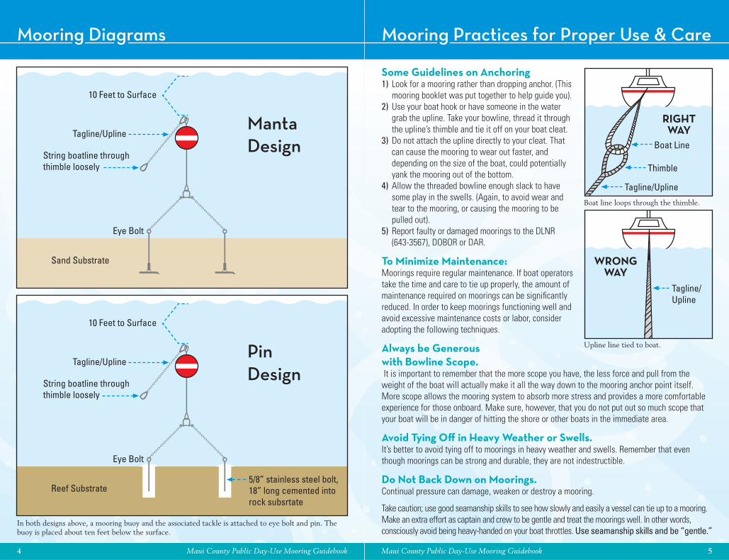
Mooring Practices for Proper Use & CareMooring Diagrams
MantaDesign
PinDesign
10 Feet to Surface
10 Feet to Surface
Eye Bolt
Eye Bolt
Sand Substrate
Reef Substrate5/8” stainless steel bolt, 18” long cemented into rock subsrtate
Tagline/Upline
Tagline/Upline
String boatline through thimble loosely
String boatline through thimble loosely
In both designs above, a mooring buoy and the associated tackle is attached to eye bolt and pin. The buoy is placed about ten feet below the surface.
Some Guidelines on Anchoring1) Look for a mooring rather than dropping anchor. (This
mooring booklet was put together to help guide you).2) Use your boat hook or have someone in the water
grab the upline. Take your bowline, thread it through the upline’s thimble and tie it off on your boat cleat.
3) Do not attach the upline directly to your cleat. That can cause the mooring to wear out faster, and depending on the size of the boat, could potentially yank the mooring out of the bottom.
4) Allow the threaded bowline enough slack to have some play in the swells. (Again, to avoid wear and tear to the mooring, or causing the mooring to be pulled out).
5) Report faulty or damaged moorings to the DLNR (643-3567), DOBOR or DAR.
To Minimize Maintenance: Moorings require regular maintenance. If boat operators take the time and care to tie up properly, the amount of maintenance required on moorings can be signifi cantly reduced. In order to keep moorings functioning well and avoid excessive maintenance costs or labor, consider adopting the following techniques.
Always be Generous with Bowline Scope. It is important to remember that the more scope you have, the less force and pull from the weight of the boat will actually make it all the way down to the mooring anchor point itself. More scope allows the mooring system to absorb more stress and provides a more comfortable experience for those onboard. Make sure, however, that you do not put out so much scope that your boat will be in danger of hitting the shore or other boats in the immediate area.
Avoid Tying Off in Heavy Weather or Swells.It’s better to avoid tying off to moorings in heavy weather and swells. Remember that even though moorings can be strong and durable, they are not indestructible.
Do Not Back Down on Moorings. Continual pressure can damage, weaken or destroy a mooring.
Take caution; use good seamanship skills to see how slowly and easily a vessel can tie up to a mooring. Make an extra effort as captain and crew to be gentle and treat the moorings well. In other words, consciously avoid being heavy-handed on your boat throttles. Use seamanship skills and be “gentle.”
Boat line loops through the thimble.
Upline line tied to boat.
RIGHT WAY
WRONG WAY
Tagline/Upline
Tagline/Upline
Thimble
Boat Line
6 Maui County Public Day-Use Mooring Guidebook Maui County Public Day-Use Mooring Guidebook 7
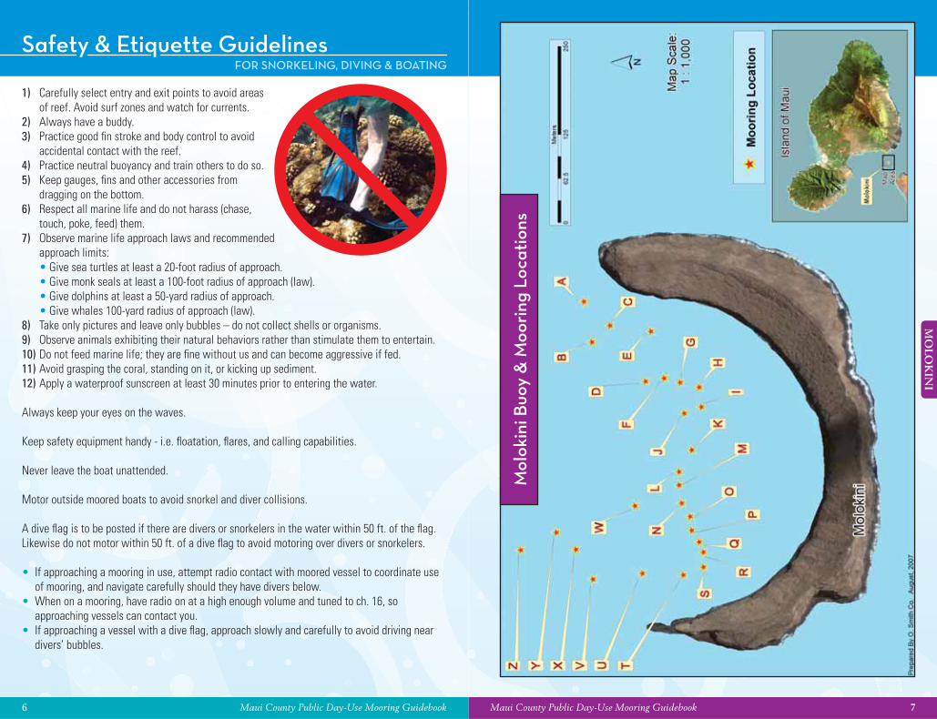
MO
LOK
INI
Safety & Etiquette Guidelines
1) Carefully select entry and exit points to avoid areas of reef. Avoid surf zones and watch for currents.
2) Always have a buddy.3) Practice good fi n stroke and body control to avoid
accidental contact with the reef.4) Practice neutral buoyancy and train others to do so.5) Keep gauges, fi ns and other accessories from
dragging on the bottom.6) Respect all marine life and do not harass (chase,
touch, poke, feed) them.7) Observe marine life approach laws and recommended
approach limits: • Give sea turtles at least a 20-foot radius of approach. • Give monk seals at least a 100-foot radius of approach (law). • Give dolphins at least a 50-yard radius of approach. • Give whales 100-yard radius of approach (law).8) Take only pictures and leave only bubbles – do not collect shells or organisms.9) Observe animals exhibiting their natural behaviors rather than stimulate them to entertain.10) Do not feed marine life; they are fi ne without us and can become aggressive if fed.11) Avoid grasping the coral, standing on it, or kicking up sediment.12) Apply a waterproof sunscreen at least 30 minutes prior to entering the water.
Always keep your eyes on the waves.
Keep safety equipment handy - i.e. fl oatation, fl ares, and calling capabilities.
Never leave the boat unattended.
Motor outside moored boats to avoid snorkel and diver collisions.
A dive fl ag is to be posted if there are divers or snorkelers in the water within 50 ft. of the fl ag. Likewise do not motor within 50 ft. of a dive fl ag to avoid motoring over divers or snorkelers.
• If approaching a mooring in use, attempt radio contact with moored vessel to coordinate use of mooring, and navigate carefully should they have divers below.
• When on a mooring, have radio on at a high enough volume and tuned to ch. 16, so approaching vessels can contact you.
• If approaching a vessel with a dive fl ag, approach slowly and carefully to avoid driving near divers’ bubbles.
FOR SNORKELING, DIVING & BOATING
Mol
okin
i Buo
y &
Moo
ring
Loc
atio
ns
8 Maui County Public Day-Use Mooring Guidebook
MO
LOK
INI
Maui County Public Day-Use Mooring Guidebook 9
MO
LOK
INI
About Molokini Marine Life Conservation District OverviewMOLOKINI MOLOKINI
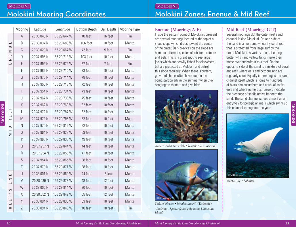
The MLCD is divided into two subzones. Subzone A includes the cove, bounded by a line extending from the end of the submerged rim off Lalil‘ali Point to Pahe‘e o Lono Point. Subzone B extends 100 yards seaward of the islet and of Subzone A.
REGULATIONS:
Permitted Activities:• To fi sh for, take, or possess any fi nfi sh by
trolling in Subzone B only.• To possess in the water any knife and
any shark billy, bang stick, powerhead, or carbon dioxide injector.
• With a permit, to engage in activities otherwise prohibited by law for scientifi c, propagation, or other purposes.
• To engage in commercial activities, excluding the taking of marine life, with a permit.
Prohibited Activities:• To fi sh for, take, or injure any marine life
(including eggs), or possess in the water any device that may be used for the taking of marine life, except as indicated in “Permitted Activities” above.
• To take or alter any sand, coral, or other geological feature or specimen, or possess in the water any device that may be used for the taking or altering of a geological feature or specimen.
• To feed or deliberately introduce any food material, substance, or attractant directly to or in the vicinity of any aquatic organism by any means or for any purpose except for trolling in Subzone B.
• To moor boats for commercial activities, except as provided for by a permit.
• To anchor boats when a day-use mooring system is established by the Department.
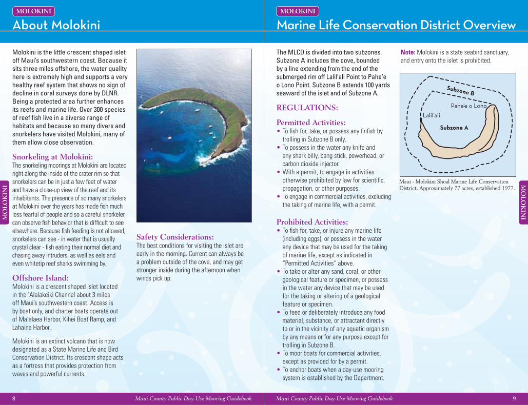
Molokini is the little crescent shaped islet off Maui’s southwestern coast. Because it sits three miles offshore, the water quality here is extremely high and supports a very healthy reef system that shows no sign of decline in coral surveys done by DLNR. Being a protected area further enhances its reefs and marine life. Over 300 species of reef fi sh live in a diverse range of habitats and because so many divers and snorkelers have visited Molokini, many of them allow close observation.
Snorkeling at Molokini:The snorkeling moorings at Molokini are located right along the inside of the crater rim so that snorkelers can be in just a few feet of water and have a close-up view of the reef and its inhabitants. The presence of so many snorkelers at Molokini over the years has made fi sh much less fearful of people and so a careful snorkeler can observe fi sh behavior that is diffi cult to see elsewhere. Because fi sh feeding is not allowed, snorkelers can see - in water that is usually crystal clear - fi sh eating their normal diet and chasing away intruders, as well as eels and even whitetip reef sharks swimming by.
Offshore Island:Molokini is a crescent shaped islet located in the ‘Alalakeiki Channel about 3 miles off Maui’s southwestern coast. Access is by boat only, and charter boats operate out of Ma‘alaea Harbor, Kihei Boat Ramp, and Lahaina Harbor.
Molokini is an extinct volcano that is now designated as a State Marine Life and Bird Conservation District. Its crescent shape acts as a fortress that provides protection from waves and powerful currents.
Safety Considerations:The best conditions for visiting the islet are early in the morning. Current can always be a problem outside of the cove, and may get stronger inside during the afternoon when winds pick up.
Note: Molokini is a state seabird sanctuary, and entry onto the islet is prohibited.
Subzone B
Subzone A
Lalil‘ali
Pahe‘e o Lono
Maui - Molokini Shoal Marine Life Conservation District. Approximately 77 acres, established 1977.
10 Maui County Public Day-Use Mooring Guidebook
MO
LOK
INI
Maui County Public Day-Use Mooring Guidebook 11
MO
LOK
INI
Mooring Latitude Longitude Bottom Depth Ball Depth Mooring Type
A 20 38.043 N 156 29.647 W 40 feet 16 feet Pin
B 20 38.037 N 156 29.680 W 106 feet 10 feet Manta
C 20 38.023 N 156 29.667 W 42 feet 9 feet Pin
D 20 37.996 N 156 29.713 W 103 feet 10 feet Manta
E 20 37.992 N 156 29.672 W 37 feet 7 feet Pin
F 20 37.982 N 156 29.710 W 83 feet 10 feet Manta
G 20 37.970 N 156 29.714 W 78 feet 10 feet Manta
H 20 37.955 N 156 29.718 W 72 feet 10 feet Manta
I 20 37.954 N 156 29.734 W 73 feet 10 feet Manta
J 20 37.967 N 156 29.739 W 75 feet 10 feet Manta
K 20 37.962 N 156 29.769 W 62 feet 10 feet Manta
L 20 37.972 N 156 29.787 W 62 feet 10 feet Manta
M 20 37.972 N 156 29.798 W 62 feet 10 feet Manta
N 20 37.970 N 156 29.812 W 62 feet 10 feet Manta
O 20 37.964 N 156 29.823 W 53 feet 10 feet Manta
P 20 37.963 N 156 29.835 W 49 feet 10 feet Manta
Q 20 37.957 N 156 29.844 W 44 feet 10 feet Manta
R 20 37.954 N 156 29.853 W 41 feet 10 feet Manta
S 20 37.954 N 156 29.865 W 38 feet 10 feet Manta
T 20 37.970 N 156 29.871 W 38 feet 10 feet Manta
U 20 38.001 N 156 29.869 W 44 feet 5 feet Manta
V 20 38.039 N 156 29.873 W 48 feet 12 feet Manta
W 20 38.006 N 156 29.814 W 80 feet 10 feet Manta
X 20 38.052 N 156 29.849 W 55 feet 12 feet Manta
Y 20 38.094 N 156 29.835 W 63 feet 10 feet Manta
Z 20 38.094 N 156 29.849 W 40 feet 10 feet Pin
Molokini Mooring Coordinates Molokini Zones: Enenue & Mid ReefMOLOKINI MOLOKINI
EN
EN
UE
MI
D
RE
EF
RE
EF
’S
E
ND
Enenue (Moorings A-F)Inside the eastern point of Molokini’s crescent are several moorings located at the top of a steep slope which drops toward the center of the crater. Dark crevices on the slope are home to different species of lobsters, octopus and eels. This is a great spot to see large jacks which are heavily fi shed for elsewhere, but are protected at Molokini and patrol this slope regularly. When there is current, gray reef sharks often hover out on the point, particularly in the summer when they congregate to mate and give birth.
Manta Ray • hahalua
©Ed Robinson
Mid Reef (Moorings G-T)Several moorings dot the outermost sand channel inside Molokini. On one side of the sand is an extremely healthy coral reef that is protected from large surf by the rim of Molokini. A variety of coral-eating butterfl yfi sh and yellow tangs make their home over and within this reef. On the opposite side of the sand is a mixture of coral and rock where eels and octopus and are regularly seen. Equally interesting is the sand channel itself which is home to hundreds of black sea cucumbers and unusual snake eels and where numerous furrows indicate the presence of snails active beneath the sand. The sand channel serves almost as an entryway for pelagic animals which swim up this channel throughout the year.
Saddle Wrasse • hinalea lauwili {Endemic}
Antler Coral/Damselfi sh • ko‘a/alo ‘ilo‘ {Endemic}
©Ed Robinson
©Ed Robinson
*Endemic - Species found only in the Hawaiian islands.
12 Maui County Public Day-Use Mooring Guidebook
MO
LOK
INI
Maui County Public Day-Use Mooring Guidebook 13
LA
NA
‘I
Molokini Zones: Reef’s End & Back WallMOLOKINI
Back WallThere are no moorings along the back wall because the bottom is just over 300 feet deep which, among other reasons, would make installing them impractical. This side of the island faces the open ocean and at different times receives large swells and strong winds, so diving is properly done here only when conditions are good. This area is steeply sloped or vertical with some shaded overhangs where black coral and orange cup coral thrive. Deep crevices house many special animals such as pipefi sh, shrimps and crabs. The same large animals such as rays and sharks that are seen on the front of Molokini can be seen here too.
Reef ’s End (Moorings U-Z)This mooring is located right at the tip of the submerged rim of the cone. From here divers can head either down the slope on the outside of the cone or head toward the inside of the crater. There is often current at this mooring and schools of pyramid butterfl yfi sh and damselfi sh occupy the water column feeding on plankton arriving in the current. A large colony of garden eels lives on this point for the same reason and allows divers to get fairly close. Dark ledges create hiding places for moray eels, whitetip reef sharks and nocturnal fi sh tucked away until dusk.
Racoon Butterfl yfi sh • kikakapu
Potter’s Angelfi sh
©Ed Robinson
©Ed Robinson
Peacock Grouper
Pyramid Butterfl yfi sh
©Ed Robinson
©Ed Robinson
Manele Bay Conservation District OverviewLANA‘I
MLCD Overview• Marine Life Conservation Districts are established by the state’s Department of Land and
Natural Resources (DLNR), as authorized by Chapter 190 of the Hawai‘i Revised Statutes. • The purpose of MLCDs is to protect marine life to the greatest extent possible. The taking
of any type of living material (fi shes, eggs, shells, corals, algae, etc.) and non-living habitat material (sand, rocks, coral skeletons, etc.) is generally restricted, if it is permitted at all. This fosters non-consumptive uses of the area, such as swimming, snorkeling and diving.
• Signs located at each MLCD indicate the District’s boundaries and describe regulations for the area. For further information you can consult the current Hawai‘i Fishing Regulations booklet, or contact the nearest DAR offi ce (See phone number page).
Safety considerationsAll areas can have dangerous swells and currents during southern (Kona) storms.
Subzone ASubzone B
Hulupo‘e Bay
Kalaeokahano
Manele Bay
Pu‘u PeheFlat Rock
Kaluako‘i
Manele Bay Conservation District. Approximately 309 acres, established 1976.
14 Maui County Public Day-Use Mooring Guidebook
LA
NA
‘I
Maui County Public Day-Use Mooring Guidebook 15
LA
NA
‘I
Sergeant Major 1 { SOUTHEAST LANA‘I }
LANA‘I
Description of BearingsSergeant Major 1Latitude (GPS) – 20 45.277 NLongitude (GPS) – 156 50.680 WMooring depth – 15 feetBall depth – 10 feetMooring type – single pin
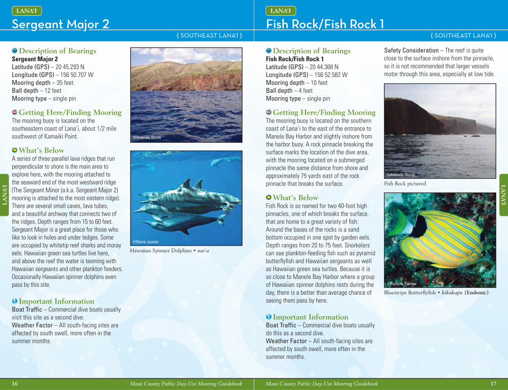
Getting Here/Finding Mooring The buoy is located on the southeastern coast of Lana‘i, about 1/2 mile southwest of Kamaiki Point.
What’s BelowA series of three parallel lava ridges that run perpendicular to shore is the main area to explore here, with the mooring attached to the seaward end of the most westward ridge (The Sergeant Minor (a.k.a. Sergeant Major 2) mooring is attached to the most eastern ridge). There are several small caves, lava tubes, and a beautiful archway that connects two of the ridges. Depth ranges from 15 to 60 feet. Sergeant Major is a great place for those who like to look in holes and under ledges. Some are occupied by whitetip reef sharks and moray eels. Hawaiian green sea turtles live here, and above the reef the water is teeming with Hawaiian sergeants and other plankton feeders. Occasionally Hawaiian spinner dolphins even pass by this site.
Important InformationBoat Traffi c – Commercial dive boats usually visit this site as a second dive.Weather Factor – All south-facing sites are affected by south swell, more often in thesummer months.
Hawaiian Sergeant • mamo {Endemic}
©Steve Juarez
Sout
heas
t Lan
a‘i
Buo
y &
Moo
ring
Loc
atio
ns
Whitetip Reef Shark • mano lala kea
©Ed Robinson
©Ananda Stone©Ananda Stone
16 Maui County Public Day-Use Mooring Guidebook
LA
NA
‘I
Maui County Public Day-Use Mooring Guidebook 17
LA
NA
‘I
Fish Rock/Fish Rock 1Sergeant Major 2 { SOUTHEAST LANA‘I } { SOUTHEAST LANA‘I }
LANA‘ILANA‘I
Description of BearingsFish Rock/Fish Rock 1 Latitude (GPS) – 20 44.368 NLongitude (GPS) – 156 52.582 WMooring depth – 10 feetBall depth – 4 feetMooring type – single pin
Getting Here/Finding Mooring The mooring buoy is located on the southern coast of Lana‘i to the east of the entrance to Manele Bay Harbor and slightly inshore from the harbor buoy. A rock pinnacle breaking the surface marks the location of the dive area, with the mooring located on a submerged pinnacle the same distance from shore and approximately 75 yards east of the rock pinnacle that breaks the surface.
What’s BelowFish Rock is so named for two 40-foot high pinnacles, one of which breaks the surface, that are home to a great variety of fi sh. Around the bases of the rocks is a sand bottom occupied in one spot by garden eels. Depth ranges from 20 to 75 feet. Snorkelers can see plankton-feeding fi sh such as pyramid butterfl yfi sh and Hawaiian sergeants as well as Hawaiian green sea turtles. Because it is so close to Manele Bay Harbor where a group of Hawaiian spinner dolphins rests during the day, there is a better than average chance of seeing them pass by here.
Important InformationBoat Traffi c – Commercial dive boats usually do this as a second dive. Weather Factor – All south-facing sites are affected by south swell, more often in the summer months.
Description of BearingsSergeant Major 2Latitude (GPS) – 20 45.293 NLongitude (GPS) – 156 50.707 WMooring depth – 35 feetBall depth – 12 feetMooring type – single pin
Getting Here/Finding Mooring The mooring buoy is located on the southeastern coast of Lana‘i, about 1/2 mile southwest of Kamaiki Point.
What’s BelowA series of three parallel lava ridges that run perpendicular to shore is the main area to explore here, with the mooring attached to the seaward end of the most westward ridge (The Sergeant Minor (a.k.a. Sergeant Major 2) mooring is attached to the most eastern ridge). There are several small caves, lava tubes, and a beautiful archway that connects two of the ridges. Depth ranges from 15 to 60 feet. Sergeant Major is a great place for those who like to look in holes and under ledges. Some are occupied by whitetip reef sharks and moray eels. Hawaiian green sea turtles live here, and above the reef the water is teeming with Hawaiian sergeants and other plankton feeders. Occasionally Hawaiian spinner dolphins even pass by this site.
Important InformationBoat Traffi c – Commercial dive boats usually visit this site as a second dive. Weather Factor – All south-facing sites are affected by south swell, more often in the summer months.
Safety Consideration – The reef is quite close to the surface inshore from the pinnacle, so it is not recommended that larger vessels motor through this area, especially at low tide.
Hawaiian Spinner Dolphins • nai‘a
©Steve Juarez
Bluestripe Butterfl yfi sh • kikakapu {Endemic}
Fish Rock pictured
©Pauline Fienne
©Ananda Stone
©Ananda Stone
18 Maui County Public Day-Use Mooring Guidebook
LA
NA
‘I
Maui County Public Day-Use Mooring Guidebook 19
LA
NA
‘I
Pu‘u Pehe/First Cathedral 1 & 2 { SOUTHEAST LANA‘I }
LANA‘I
Description of BearingsFirst Cathedral 1 Latitude (GPS) – 20 43.947 NLongitude (GPS) – 156 53.214 WMooring depth – 42 feetBall depth – 10 feetMooring type – single pin
First Cathedral 2Latitude (GPS) – 20 43.952 NLongitude (GPS) – 156 53.188 WMooring depth – 34 feetBall depth – 10 feetMooring type – single pin
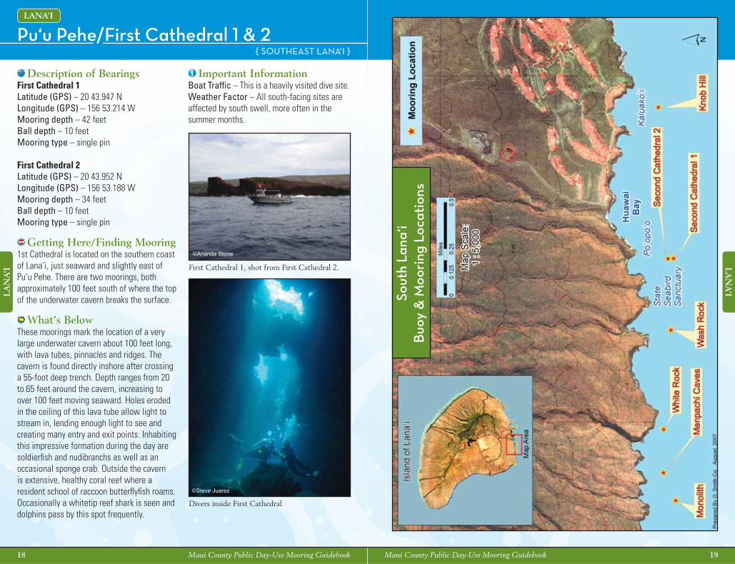
Getting Here/Finding Mooring 1st Cathedral is located on the southern coast of Lana‘i, just seaward and slightly east of Pu‘u Pehe. There are two moorings, both approximately 100 feet south of where the top of the underwater cavern breaks the surface.
What’s BelowThese moorings mark the location of a very large underwater cavern about 100 feet long, with lava tubes, pinnacles and ridges. The cavern is found directly inshore after crossing a 55-foot deep trench. Depth ranges from 20 to 65 feet around the cavern, increasing to over 100 feet moving seaward. Holes eroded in the ceiling of this lava tube allow light to stream in, lending enough light to see and creating many entry and exit points. Inhabiting this impressive formation during the day are soldierfi sh and nudibranchs as well as an occasional sponge crab. Outside the cavern is extensive, healthy coral reef where a resident school of raccoon butterfl yfi sh roams. Occasionally a whitetip reef shark is seen and dolphins pass by this spot frequently.
Important InformationBoat Traffi c – This is a heavily visited dive site. Weather Factor – All south-facing sites are affected by south swell, more often in the summer months.
©Steve Juarez
©Ananda Stone
Sout
h La
na‘i
Buo
y &
Moo
ring
Loc
atio
ns
First Cathedral 1, shot from First Cathedral 2.
Divers inside First Cathedral
20 Maui County Public Day-Use Mooring Guidebook
LA
NA
‘I
Maui County Public Day-Use Mooring Guidebook 21
LA
NA
‘I
Knob Hill Second Cathedral 1 & 2 { SOUTH LANA‘I } { SOUTH LANA‘I }
LANA‘I LANA‘I
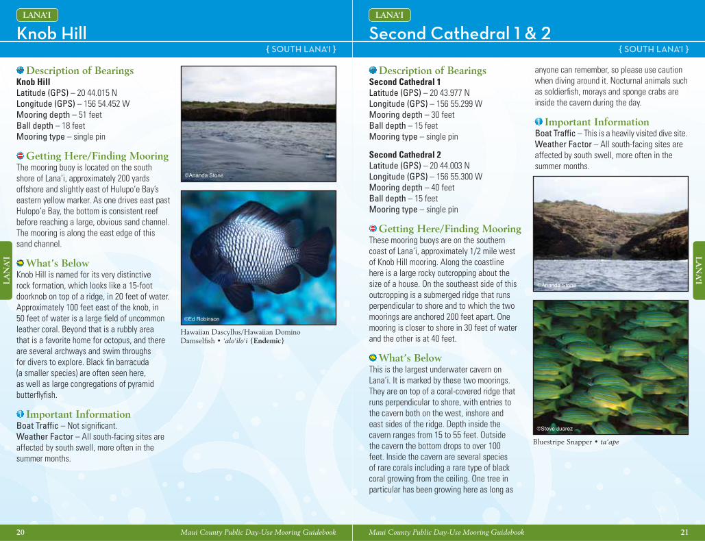
Description of BearingsKnob HillLatitude (GPS) – 20 44.015 NLongitude (GPS) – 156 54.452 WMooring depth – 51 feetBall depth – 18 feetMooring type – single pin
Getting Here/Finding Mooring The mooring buoy is located on the south shore of Lana‘i, approximately 200 yards offshore and slightly east of Hulupo‘e Bay’s eastern yellow marker. As one drives east past Hulopo‘e Bay, the bottom is consistent reef before reaching a large, obvious sand channel. The mooring is along the east edge of this sand channel.
What’s BelowKnob Hill is named for its very distinctive rock formation, which looks like a 15-foot doorknob on top of a ridge, in 20 feet of water. Approximately 100 feet east of the knob, in 50 feet of water is a large fi eld of uncommon leather coral. Beyond that is a rubbly area that is a favorite home for octopus, and there are several archways and swim throughs for divers to explore. Black fi n barracuda (a smaller species) are often seen here, as well as large congregations of pyramid butterfl yfi sh.
Important InformationBoat Traffi c – Not signifi cant.Weather Factor – All south-facing sites are affected by south swell, more often in the summer months.
Description of BearingsSecond Cathedral 1 Latitude (GPS) – 20 43.977 NLongitude (GPS) – 156 55.299 WMooring depth – 30 feetBall depth – 15 feetMooring type – single pin
Second Cathedral 2Latitude (GPS) – 20 44.003 NLongitude (GPS) – 156 55.300 WMooring depth – 40 feetBall depth – 15 feetMooring type – single pin
Getting Here/Finding Mooring These mooring buoys are on the southern coast of Lana‘i, approximately 1/2 mile west of Knob Hill mooring. Along the coastline here is a large rocky outcropping about the size of a house. On the southeast side of this outcropping is a submerged ridge that runs perpendicular to shore and to which the two moorings are anchored 200 feet apart. One mooring is closer to shore in 30 feet of water and the other is at 40 feet.
What’s BelowThis is the largest underwater cavern on Lana‘i. It is marked by these two moorings. They are on top of a coral-covered ridge that runs perpendicular to shore, with entries to the cavern both on the west, inshore and east sides of the ridge. Depth inside the cavern ranges from 15 to 55 feet. Outside the cavern the bottom drops to over 100 feet. Inside the cavern are several species of rare corals including a rare type of black coral growing from the ceiling. One tree in particular has been growing here as long as
anyone can remember, so please use caution when diving around it. Nocturnal animals such as soldierfi sh, morays and sponge crabs are inside the cavern during the day.
Important InformationBoat Traffi c – This is a heavily visited dive site.Weather Factor – All south-facing sites are affected by south swell, more often in the summer months.
©Ananda Stone
©Ananda Stone
©Ed Robinson
©Steve Juarez
Hawaiian Dascyllus/Hawaiian Domino Damselfi sh • ‘alo‘ilo‘i {Endemic}
Bluestripe Snapper • ta‘ape
22 Maui County Public Day-Use Mooring Guidebook
LA
NA
‘I
Maui County Public Day-Use Mooring Guidebook 23
LA
NA
‘I
Manu‘ohule/Tunnel of Love/Wash Rock No-Name Paradise/White Rock { SOUTH LANA‘I } { SOUTH LANA‘I }
LANA‘I LANA‘I
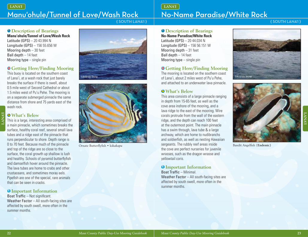
Description of BearingsManu‘ohule/Tunnel of Love/Wash RockLatitude (GPS) – 20 43.994 NLongitude (GPS) – 156 55.656 WMooring depth – 30 feetBall depth – 14 feetMooring type – single pin
Getting Here/Finding Mooring This buoy is located on the southern coast of Lana‘i, at a wash rock that just barely breaks the surface if there is swell, about 0.5 mile west of Second Cathedral or about 1.5 miles west of Pu‘u Pehe. The mooring is on a separate submerged pinnacle the same distance from shore and 75 yards east of the wash rock.
What’s BelowThis is a large, interesting area comprised of a main pinnacle, which sometimes breaks the surface, healthy coral reef, several small lava tubes and a ridge east of the pinnacle that runs perpendicular to shore. Depth range is 0 to 70 feet. Because much of the pinnacle and top of the ridge are so close to the surface, the coral growth up shallow is lush and healthy. Schools of pyramid butterfl yfi sh and damselfi sh hover around the pinnacle. The lava tubes are home to crabs and other crustaceans, and sometimes moray eels. Pipefi sh are one of the special, rare animals that can be seen in cracks.
Important InformationBoat Traffi c – Not signifi cant. Weather Factor – All south-facing sites are affected by south swell, more often in the summer months.
Description of BearingsNo-Name Paradise/White RockLatitude (GPS) – 20 44.034 NLongitude (GPS) – 156 56.151 WMooring depth – 31 feetBall depth – 14 feetMooring type – single pin
Getting Here/Finding Mooring The mooring is located on the southern coast of Lana‘i, about 2 miles west of Pu‘u Pehe, and attached to an underwater lava pinnacle.
What’s BelowThis area consists of a large pinnacle ranging in depth from 15-65 feet, as well as the cove area inshore of the mooring, and a lava ridge to the east of the mooring. Wire corals protrude from the wall of the eastern ridge, and the depth can reach 100 feet at the outermost point. The main pinnacle has a swim through, lava tube & a large archway, which are home to nudibranchs and soldierfi sh, as well as nesting Hawaiian sergeants. The rubbly reef areas inside the cove are perfect nurseries for juvenile wrasses, such as the dragon wrasse and yellowtail coris.
Important InformationBoat Traffi c – Minimal.Weather Factor – All south-facing sites are affected by south swell, more often in the summer months.
©Ananda Stone ©Ananda Stone
©Steve Juarez©Steve Juarez
Ornate Butterfl yfi sh • kikakapu Bandit Angelfi sh {Endemic}
24 Maui County Public Day-Use Mooring Guidebook
LA
NA
‘I
Maui County Public Day-Use Mooring Guidebook 25
LA
NA
‘I
Secret Cove/Menpachi Caves { SOUTH LANA‘I }
LANA‘I
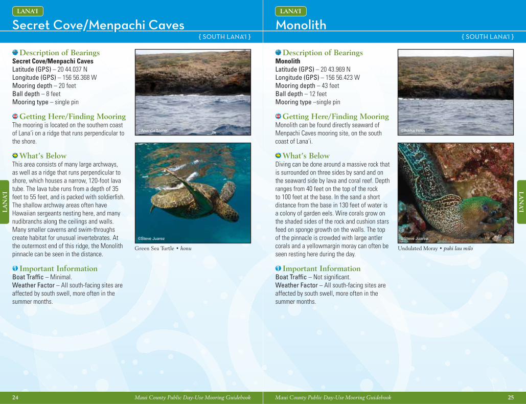
Description of BearingsSecret Cove/Menpachi CavesLatitude (GPS) – 20 44.037 NLongitude (GPS) – 156 56.368 WMooring depth – 20 feetBall depth – 8 feetMooring type – single pin
Getting Here/Finding Mooring The mooring is located on the southern coast of Lana‘i on a ridge that runs perpendicular to the shore.
What’s BelowThis area consists of many large archways, as well as a ridge that runs perpendicular to shore, which houses a narrow, 120-foot lava tube. The lava tube runs from a depth of 35 feet to 55 feet, and is packed with soldierfi sh. The shallow archway areas often have Hawaiian sergeants nesting here, and many nudibranchs along the ceilings and walls. Many smaller caverns and swim-throughs create habitat for unusual invertebrates. At the outermost end of this ridge, the Monolith pinnacle can be seen in the distance.
Important InformationBoat Traffi c – Minimal.Weather Factor – All south-facing sites are affected by south swell, more often in the summer months.
©Ananda Stone
©Steve Juarez
Green Sea Turtle • honu
Monolith { SOUTH LANA‘I }
LANA‘I
Description of BearingsMonolithLatitude (GPS) – 20 43.969 NLongitude (GPS) – 156 56.423 WMooring depth – 43 feetBall depth – 12 feetMooring type –single pin
Getting Here/Finding Mooring Monolith can be found directly seaward of Menpachi Caves mooring site, on the south coast of Lana‘i.
What’s BelowDiving can be done around a massive rock that is surrounded on three sides by sand and on the seaward side by lava and coral reef. Depth ranges from 40 feet on the top of the rock to 100 feet at the base. In the sand a short distance from the base in 130 feet of water is a colony of garden eels. Wire corals grow on the shaded sides of the rock and cushion stars feed on sponge growth on the walls. The top of the pinnacle is crowded with large antler corals and a yellowmargin moray can often be seen resting here during the day.
Important InformationBoat Traffi c – Not signifi cant. Weather Factor – All south-facing sites are affected by south swell, more often in the summer months.
©Ikaika Ross
©Steve Juarez
Undulated Moray • puhi lau milo
26 Maui County Public Day-Use Mooring Guidebook
LA
NA
‘I
Maui County Public Day-Use Mooring Guidebook 27
LA
NA
‘I
Sout
hwes
t Lan
a‘i
Buo
y &
Moo
ring
Loc
atio
ns
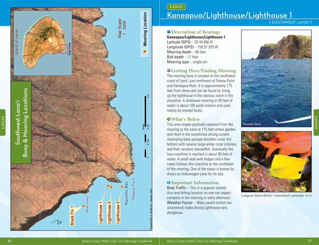
Kaneapua/Lighthouse/Lighthouse 1 { SOUTHWEST LANA‘I }
LANA‘I
Description of BearingsKaneapua/Lighthouse/Lighthouse 1Latitude (GPS) – 20 44.066 NLongitude (GPS) – 156 57.920 WMooring depth – 50 feetBall depth – 17 feetMooring type – single pin
Getting Here/Finding Mooring The mooring buoy is located on the southwest coast of Lana‘i just northwest of Palaoa Point and Kaneapua Rock. It is approximately 175 feet from shore and can be found by lining up the lighthouse in the obvious notch in the shoreline. A shallower mooring in 30 feet of water is about 100 yards inshore and used mainly by snorkel boats.
What’s BelowThis area slopes gradually seaward from the mooring to the sand at 115 feet where garden eels feed in the sometimes strong current. Ascending back upslope boulders cover the bottom with several large antler coral colonies and their resident damselfi sh. Eventually the lava coastline is reached in about 30 feet of water. A small wall with ledges and a few caves follows this coastline to the southeast of the mooring. One of the caves is known by divers as Volkswagen cave for its size.
Important InformationBoat Traffi c – This is a popular snorkel, dive and fi shing location so one can expect company in the morning or early afternoon.Weather Factor – West swells (which are uncommon) make diving Lighthouse very dangerous.
©Ananda Stone
©Steve Juarez
Longnose Butterfl yfi sh • lauwiliwili nukunuku ‘oi‘oi
28 Maui County Public Day-Use Mooring Guidebook
LA
NA
‘I
Maui County Public Day-Use Mooring Guidebook 29
LA
NA
‘I
Kaneapua/Lighthouse/Lighthouse 2 & 3 { SOUTHWEST LANA‘I }
LANA‘I
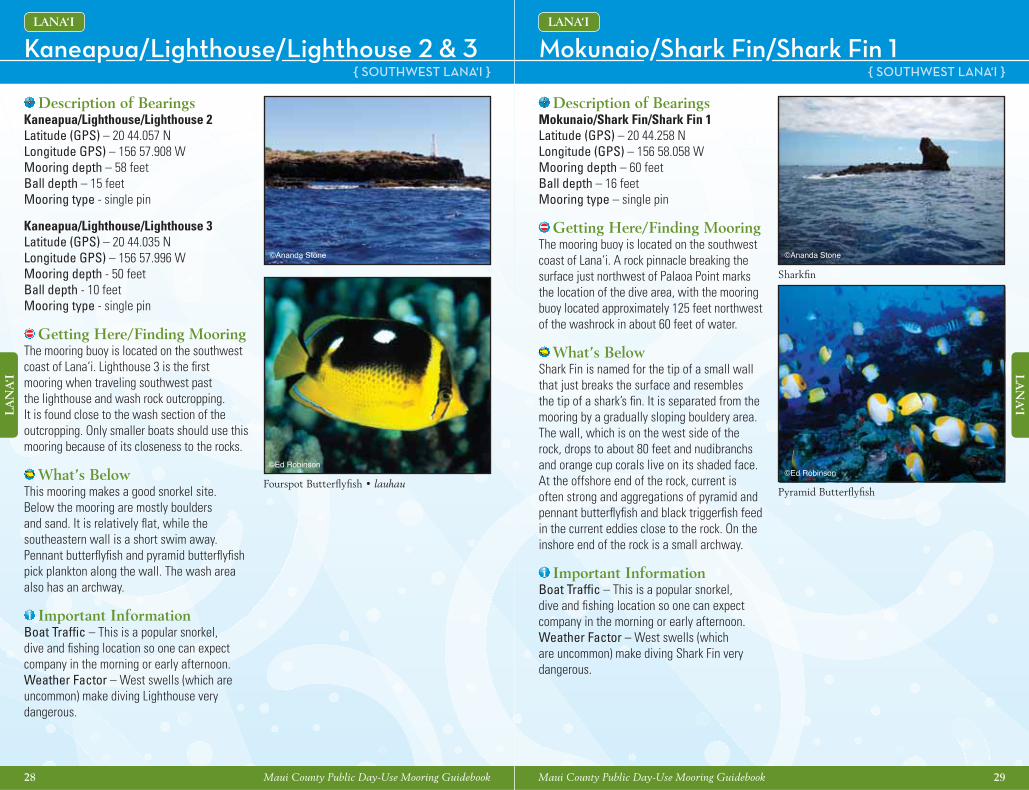
Description of BearingsKaneapua/Lighthouse/Lighthouse 2Latitude (GPS) – 20 44.057 NLongitude GPS) – 156 57.908 WMooring depth – 58 feetBall depth – 15 feetMooring type - single pin
Kaneapua/Lighthouse/Lighthouse 3 Latitude (GPS) – 20 44.035 NLongitude GPS) – 156 57.996 WMooring depth - 50 feetBall depth - 10 feetMooring type - single pin
Getting Here/Finding Mooring The mooring buoy is located on the southwest coast of Lana‘i. Lighthouse 3 is the fi rst mooring when traveling southwest past the lighthouse and wash rock outcropping. It is found close to the wash section of the outcropping. Only smaller boats should use this mooring because of its closeness to the rocks.
What’s BelowThis mooring makes a good snorkel site. Below the mooring are mostly boulders and sand. It is relatively fl at, while the southeastern wall is a short swim away. Pennant butterfl yfi sh and pyramid butterfl yfi sh pick plankton along the wall. The wash area also has an archway.
Important InformationBoat Traffi c – This is a popular snorkel, dive and fi shing location so one can expect company in the morning or early afternoon.Weather Factor – West swells (which are uncommon) make diving Lighthouse very dangerous.
©Ananda Stone
©Ed Robinson
Fourspot Butterfl yfi sh • lauhau
Mokunaio/Shark Fin/Shark Fin 1 { SOUTHWEST LANA‘I }
LANA‘I
Description of BearingsMokunaio/Shark Fin/Shark Fin 1Latitude (GPS) – 20 44.258 NLongitude (GPS) – 156 58.058 WMooring depth – 60 feetBall depth – 16 feetMooring type – single pin
Getting Here/Finding Mooring The mooring buoy is located on the southwest coast of Lana‘i. A rock pinnacle breaking the surface just northwest of Palaoa Point marks the location of the dive area, with the mooring buoy located approximately 125 feet northwest of the washrock in about 60 feet of water.
What’s BelowShark Fin is named for the tip of a small wall that just breaks the surface and resembles the tip of a shark’s fi n. It is separated from the mooring by a gradually sloping bouldery area. The wall, which is on the west side of the rock, drops to about 80 feet and nudibranchs and orange cup corals live on its shaded face. At the offshore end of the rock, current is often strong and aggregations of pyramid and pennant butterfl yfi sh and black triggerfi sh feed in the current eddies close to the rock. On the inshore end of the rock is a small archway.
Important InformationBoat Traffi c – This is a popular snorkel, dive and fi shing location so one can expect company in the morning or early afternoon.Weather Factor – West swells (which are uncommon) make diving Shark Fin very dangerous.
©Ed Robinson
Pyramid Butterfl yfi sh
Sharkfi n
©Ananda Stone
30 Maui County Public Day-Use Mooring Guidebook
MA
UI
Maui County Public Day-Use Mooring Guidebook 31
MA
UI
Wes
t Mau
i - P
ali
Buo
y &
Moo
ring
Loc
atio
nsCoral Gardens/Coral Gardens 1
{WEST MAUI - PALI}
MAUI
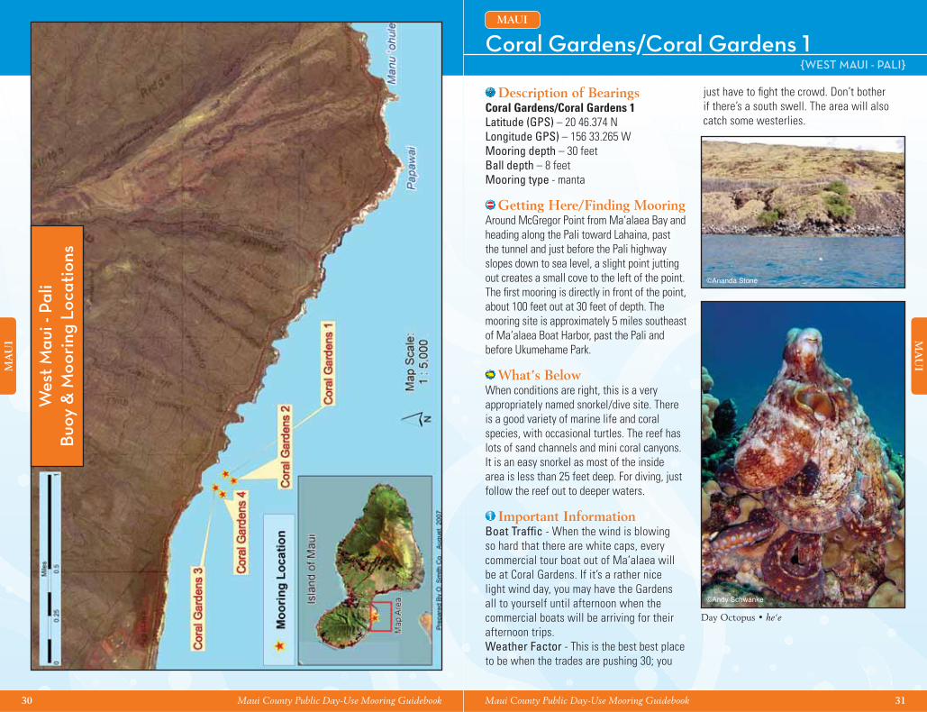
Description of BearingsCoral Gardens/Coral Gardens 1Latitude (GPS) – 20 46.374 NLongitude GPS) – 156 33.265 WMooring depth – 30 feetBall depth – 8 feetMooring type - manta
Getting Here/Finding Mooring Around McGregor Point from Ma‘alaea Bay and heading along the Pali toward Lahaina, past the tunnel and just before the Pali highway slopes down to sea level, a slight point jutting out creates a small cove to the left of the point. The fi rst mooring is directly in front of the point, about 100 feet out at 30 feet of depth. The mooring site is approximately 5 miles southeast of Ma‘alaea Boat Harbor, past the Pali and before Ukumehame Park.
What’s BelowWhen conditions are right, this is a very appropriately named snorkel/dive site. There is a good variety of marine life and coral species, with occasional turtles. The reef has lots of sand channels and mini coral canyons. It is an easy snorkel as most of the inside area is less than 25 feet deep. For diving, just follow the reef out to deeper waters.
Important InformationBoat Traffi c - When the wind is blowing so hard that there are white caps, every commercial tour boat out of Ma‘alaea will be at Coral Gardens. If it’s a rather nice light wind day, you may have the Gardens all to yourself until afternoon when the commercial boats will be arriving for their afternoon trips.Weather Factor - This is the best best place to be when the trades are pushing 30; you
just have to fi ght the crowd. Don’t bother if there’s a south swell. The area will also catch some westerlies.
©Ananda Stone
©Andy Schwanke
Day Octopus • he‘e
32 Maui County Public Day-Use Mooring Guidebook
MA
UI
Maui County Public Day-Use Mooring Guidebook 33
MA
UI
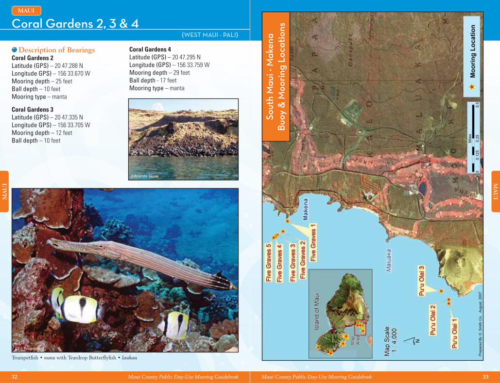
Coral Gardens 2, 3 & 4 {WEST MAUI - PALI}
MAUI
Description of BearingsCoral Gardens 2Latitude (GPS) – 20 47.288 NLongitude GPS) – 156 33.670 WMooring depth – 25 feetBall depth – 10 feetMooring type – manta
Coral Gardens 3Latitude (GPS) – 20 47.335 NLongitude GPS) – 156 33.705 WMooring depth – 12 feetBall depth – 10 feet
Coral Gardens 4Latitude (GPS) – 20 47.295 NLongitude (GPS) – 156 33.759 WMooring depth – 29 feetBall depth - 17 feetMooring type – manta
©Ananda Stone
©Ed Robinson
Trumpetfi sh • nunu with Teardrop Butterfl yfi sh • lauhau
Sout
h M
aui -
Mak
ena
Buo
y &
Moo
ring
Loc
atio
ns
34 Maui County Public Day-Use Mooring Guidebook
MA
UI
Maui County Public Day-Use Mooring Guidebook 35
MA
UI
Pu‘u ola‘i/Red Hill/Pu‘u ola‘i 1-3 {SOUTH MAUI - MAKENA}
MAUI
Description of BearingsPu‘u ola‘i 1Latitude (GPS) – 20 38.281 N Longitude (GPS) –156 27.226 WMooring depth – 42 feetBall depth – 12 feetMooring type – single pin
Pu‘u ola‘i 2Latitude (GPS) – 20 38.424 NLongitude (GPS) – 156 27.059 WMooring depth – 40 feetBall depth – 15 feetMooring type – double manta
Pu‘u ola‘i 3Latitude (GPS) – 20 38.409 NLongitude (GPS) – 156 27.052 WMooring depth – unknownBall depth – 10 feetMooring type – manta
Getting Here/Finding Mooring Follow the coastline south from Makena Landing past Maluaka Point. On the north side of the cinder cone is a small cove next to the lava cliff.
What’s BelowDark sand from the adjacent cinder cone, lava boulders and coral reef make up the bottom in this area. Green sea turtles are fairly common here and they appear comfortable with snorkelers. This is a great nursery area for juvenile reef fi sh.
Important InformationBoat Traffi c - Commercial snorkel and dive boats usually visit this site as a second spot. Weather Factor - Susceptible to currents, typically calm in the morning, and becomes rough and choppy in the afternoon.
©Ananda Stone
©Ed Robinson
Hawaiian Cleaner Wrasse {Endemic}
Nahuna Point/Turtle Town/Five Graves 1-5 {SOUTH MAUI - MAKENA}
MAUI
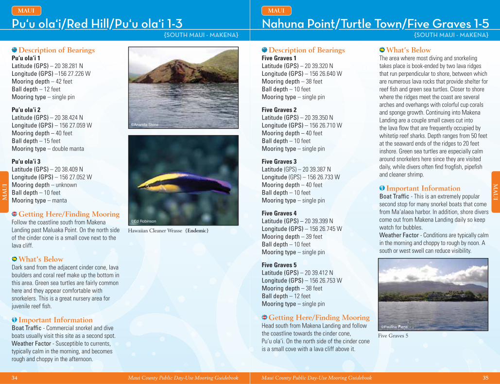
Description of BearingsFive Graves 1Latitude (GPS) – 20 39.320 NLongitude (GPS) – 156 26.640 WMooring depth – 38 feetBall depth – 10 feetMooring type – single pin
Five Graves 2Latitude (GPS) – 20 39.350 NLongitude (GPS) – 156 26.710 WMooring depth – 40 feetBall depth – 10 feetMooring type – single pin
Five Graves 3Latitude (GPS) – 20 39.387 NLongitude (GPS) – 156 26.733 WMooring depth – 40 feet Ball depth – 10 feetMooring type – single pin
Five Graves 4Latitude (GPS) – 20 39.399 NLongitude (GPS) – 156 26.745 WMooring depth – 39 feetBall depth – 10 feetMooring type – single pin
Five Graves 5Latitude (GPS) – 20 39.412 NLongitude (GPS) – 156 26.753 WMooring depth – 38 feetBall depth – 12 feetMooring type – single pin
Getting Here/Finding Mooring Head south from Makena Landing and follow the coastline towards the cinder cone, Pu‘u ola‘i. On the north side of the cinder cone is a small cove with a lava cliff above it.
What’s BelowThe area where most diving and snorkeling takes place is book-ended by two lava ridges that run perpendicular to shore, between which are numerous lava rocks that provide shelter for reef fi sh and green sea turtles. Closer to shore where the ridges meet the coast are several arches and overhangs with colorful cup corals and sponge growth. Continuing into Makena Landing are a couple small caves cut into the lava fl ow that are frequently occupied by whitetip reef sharks. Depth ranges from 50 feet at the seaward ends of the ridges to 20 feet inshore. Green sea turtles are especially calm around snorkelers here since they are visited daily, while divers often fi nd frogfi sh, pipefi sh and cleaner shrimp.
Important InformationBoat Traffi c - This is an extremely popular second stop for many snorkel boats that come from Ma‘alaea harbor. In addition, shore divers come out from Makena Landing daily so keep watch for bubbles. Weather Factor - Conditions are typically calm in the morning and choppy to rough by noon. A south or west swell can reduce visibility.
©Pauline Fiene
Five Graves 5
36 Maui County Public Day-Use Mooring Guidebook
MA
UI
Maui County Public Day-Use Mooring Guidebook 37
MA
UI
Sout
h M
aui -
Wai
lea
Buo
y &
Moo
ring
Loc
atio
nsWailea Point/ Wailea Point 1 & 2
{SOUTH MAUI - WAILEA}
MAUI
Description of BearingsWailea Point 1Latitude (GPS) – 20 40.846 NLongitude (GPS) – 156 26.833 WMooring depth – 27 feetBall depth – 10 feet Mooring type – double pin
Wailea Point 2Latitude (GPS) – 20 40.812 NLongitude (GPS) – 156 26.790 WMooring depth – 32 feetBall depth – 10 feet Mooring type – double pin
Getting Here/Finding Mooring Off the northwesterly end of Wailea Point in Wailea.
What’s BelowThis is an easy site to navigate because the mooring is located on the edge of the lava fl ow that forms Wailea Point. Following the edge of the fl ow in one direction or the other and then turning around will lead you right back to the mooring. Lava rock ridges and formations at the mooring support a good variety of eels and other fi sh including threadfi n butterfl yfi sh and rarely seen lagoon triggerfi sh. Coral coverage is good at the mooring and there are many large antler corals northwest of the mooring. Turtles can also be seen here.
Important InformationWater Quality – Visibility is usually good, but during and after periods of west and south swell, visibility can be so low that diving here is not practical.
©Ed Robinson
©Ed Robinson
Lagoon Triggerfi sh • humuhumu-nukunuku-a-pua‘a
Oval Butterfl yfi sh • kapuhili
©Andy Schwanke
38 Maui County Public Day-Use Mooring Guidebook
MA
UI
Maui County Public Day-Use Mooring Guidebook 39
MA
UI
Nor
thw
est M
aui -
Ka‘
anap
ali •
Buo
y &
Moo
ring
Loc
atio
ns Ka‘anapali/Marriott 1-3 {NORTHWEST MAUI - KA‘ANAPALI}
MAUI
Description of BearingsMarriott 1Latitude (GPS) – 20 54.861 N Longitude (GPS) – 156 41.850 WMooring depth – 32 feetBall depth – 15 feetMooring type – single manta
Marriott 2Latitude (GPS) – 20 54.652 NLongitude (GPS) – 156 41.729 WMooring depth – 38 feetBall depth – 15 feetMooring type – single manta
Marriott 3Latitude (GPS) – 20 54.608 NLongitude (GPS) – 156 41.682 WMooring depth – mooring missing*Ball depth – mooring missing*Mooring type – manta
Getting Here/Finding Mooring These moorings are along the southern coast of Ka‘anapali, near a shoreline surf break in front of the Marriott hotel. Easily accessed from Mala boat ramp. Once leaving the ramp the hotels are visible to the right.
What’s BelowThis area has some very nice shallow coral reef areas that are great for snorkeling.Dive operators like to visit this site as an alternative spot during south swell conditions. Yellow tangs, pufferfi sh, triggerfi sh, schools of whitetail unicorn fi sh, and cornetfi sh are commonly seen. This area has a nice variety of marine life and a great big area to explore.
*At the time of publication, this mooring could not be found.
©Ed Robinson
Flame Angelfi sh
©Ananda Stone
40 Maui County Public Day-Use Mooring Guidebook Maui County Public Day-Use Mooring Guidebook 41
Acknowledgements
Since 1991, Malama Kai Foundation has led the effort to establish a statewide Day-Use Mooring Buoy system to protect Hawaii’s precious coral reefs from anchor damage. This has been made possible by the many contributions of time, resources and expertise from volunteers statewide, as well as the fi nancial and institutional support of government agencies, charitable foundations, individuals and businesses. Malama Kai Foundation has taken the lead role in helping the State secure necessary permits for the day-use mooring buoys, installing moorings on all islands, purchasing supplies needed for repairs, and training volunteers on proper procedures for mooring buoy installation.
This guidebook for the Day-Use Mooring Buoy system in Maui County waters was produced by the Malama Kai Foundation under a grant from the National Fish and Wildlife Foundation that was made possible by the U.S. Fish and Wildlife Service’s Pacifi c Islands Coastal Program. Malama Kai Foundation especially acknowledges the Maui Reef Fund. The production of this guidebook would not have been possible without the invaluable contributions of the Maui Reef Fund and its members. Mahalo for collecting submissions for new day-use mooring sites in Maui County, having trained installers who properly install, repair, and maintain legally permitted moorings, and for the extensive contribution of time and money to make the Maui County public day-use moorings available to the community.
In addition, Malama Kai Foundation wishes to extend a Mahalo to the two state agencies most involved in this work statewide: Hawaii Department of Land and Natural Resources Division of Boating and Ocean Recreation (DOBOR)Hawaii Department of Land and Natural Resources Division of Aquatic Resources (DAR)
Malama Kai Foundation also wishes to thank the many volunteers who have helped with photos, site descriptions, and other input for the Maui County Day-Use Mooring Guidebook including:Photographers Andy Schwanke (Mike Severns Diving), Ed Robinson (Ed Robinson’s Diving Adventures), Erik Stein (Extended Horizons), Pauline Fiene (Mike Severns Diving), Steve Juarez and Tyler Korte (Hawaiian Rafting Adventures), and Victoria Martocci (Extended Horizons).
Site descriptions provided by: Erik Stein (Extended Horizons), Ananda Stone (Maui Reef Fund), Mike Jones (Trilogy Excursions), Pauline Fiene (Mike Severns Diving), Terry Hunt (American Reef), and Victoria Martocci (Extended Horizons). Additional volunteer work provided by: Ananda Stone (Maui Reef Fund), Amy Venema (Maui Reef Fund), Hannah Bernard (Hawaii Wildlife Fund), Don Domingo (Maui Dreams Dive Co.), Geoffrey T. Moore (Silver Moon Art & Design), Orlando Smith (O. Smith Co.), Jeff Strahn (Maui Dive Shop), Jim Walsh (Atlantis Adventures Maui), Liz Foote (Project S.E.A. Link and Coral Reef Alliance), Pauline Fiene (Mike Severns Diving), Terry Hunt (American Reef), Teri Leicher (Jack’s Diving Locker), Carolyn Stewart (Malama Kai Foundation), David Tarnas (Malama Kai Foundation), Terry O’Halloran (Malama Kai Foundation), and Kater Bourdon (Malama Kai Foundation).
How You Can Help
The Hawaii Day-Use Mooring Buoy system is made possible by contributions from people like you! Your donations of time, treasure and talent are needed to install and maintain the day-use mooring buoys in Hawaii. The maintenance and expansion of Hawaii’s public Day-Use Mooring Buoy system depends on private donations and volunteer assistance. The Malama Kai Foundation is a 501(c)(3) organization with a mission to conserve Hawaii’s coastal and marine resources through community action, education, and outreach. The Day-Use Mooring Buoy system has been a primary focus of the Malama Kai Foundation since it was founded in 1991. Malama Kai Foundation is responsible for coordinating the installation and maintenance of the day-use mooring buoys statewide (except Molokini). Donations can be made to Malama Kai Foundation to support the Day-Use Mooring Buoy system statewide, by island, or by buoy through the Adopt-a-Buoy Program!
The Adopt-a-Buoy Program is one way you can help! Butterfl y Fish Class: A $250 contribution will pay for the mooring materials of one Day-Use Mooring. You will receive a pewter pin and a certifi cate of adoption.Triggerfi sh Class: A $500 contribution will pay for the mooring materials and the installation of one Day-Use Mooring Buoy. You will receive a pewter pin and a certifi cate of adoption.Sea Turtle Class: A $750 contribution will pay for the materials and installation of one Day-Use Mooring Buoy, as well as maintenance for fi ve years. You will receive a pewter pin and a certifi cate of adoption. Contributions of any amount are gratefully appreciated whether it’s $10 or $10,000 or more. Please make checks payable to Malama Kai Foundation and note if the donation is for use statewide, or for a specifi c buoy location or a specifi c island and send it to the following address: Malama Kai Foundation: P.O. Box 6882 • Kamuela, HI 96743 Your contribution to Malama Kai Foundation is tax deductible (IRS Tax ID #99-0285490) to the extent allowable by law. The public Day-Use Mooring Buoy system would not exist without the help of dedicated individuals and businesses. Numerous dive shops around the state collaborate with Malama Kai to install, monitor and maintain the buoys. Please show your support for the public Day-Use Mooring Buoy program by patronizing these dedicated businesses. The Maui Reef Fund, administered by the Hawaii Wildlife Fund, works in a partnership with the Malama Kai Foundation on the Maui County public Day-Use Mooring Buoy program. A database for Maui County Day-Use moorings can be accessed through Hawaii Wildlife Fund’s website at www.wildhawaii.org. For additional information on Malama Kai Foundation, its programs, and all Day-Use Moorings statewide go to www.malama-kai.org. Please note that at the time of printing there are additional Day-Use Maui mooring sites that have been identifi ed and included in a statewide DLNR Day-Use Mooring permit application with the US Army Corps of Engineers. Please check the Malama Kai Foundation website at www.malama-kai.org for the latest information on additional Day-Use Moorings available for use statewide. Mahalo!
©Ed Robinson
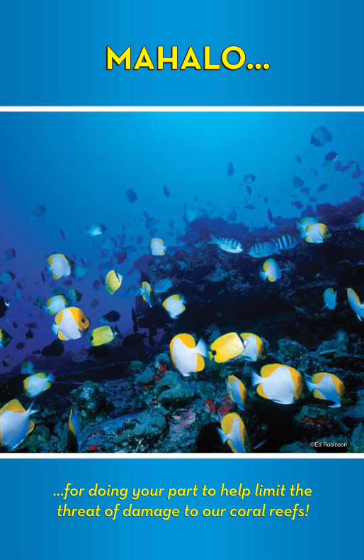
…for doing your part to help limit the threat of damage to our coral reefs!
MAHALO…MAHALO…MAHALO…MAHALO…
…for doing your part to help limit the threat of damage to our coral reefs!