Embed Size (px)
Citation preview
Torres Strait Island Regional Council
Planning SchemePage 429
Part 7: Local Plans
Masig (Yorke) Island
Masig (Yorke) Island
Torres Strait Island Regional Council
Planning SchemePage 430
Torres Strait Island Regional Council
Planning SchemePage 431
Part 7: Local Plans
Masig (Yorke) Island
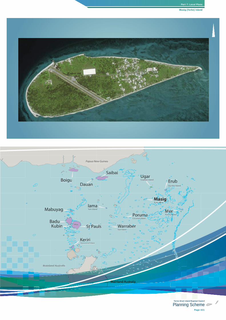
Papua New GuineaPP
Mainland Australiarr
Sue Islandddd
DauanBoigu
Saibai
IamaYam IslandYY
ErubDarnley Island
Yorkeekk Island Islas ns nsIs ns ndssee
PorumammaamCoconut Island
WarraberSt PPaulssBaduKubin
MMMMMMerereMuuurrrray IslandIsl I dd
UgarUStephen Island
Mabuyag
KerriiriHammond Islandon
Moa
MasigggY k I l dlMasMaMMaaMMaaaMaMMMMMMasig
Mainland AustraliaMainland AusustraliaM
Torres Strait Island Regional Council
Planning SchemePage 432
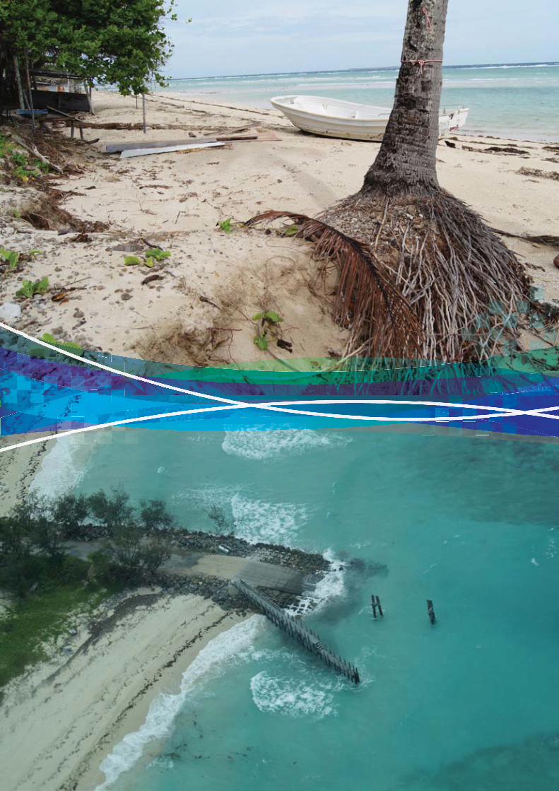
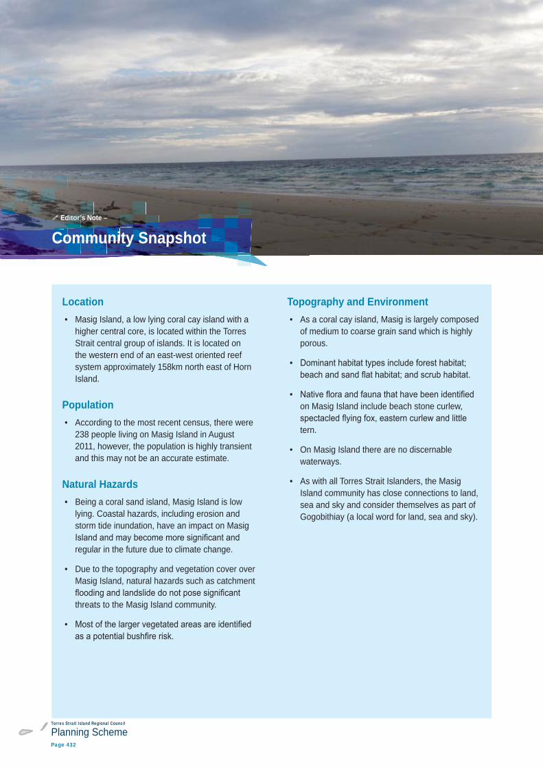
Location • Masig Island, a low lying coral cay island with a
higher central core, is located within the Torres Strait central group of islands. It is located on the western end of an east-west oriented reef system approximately 158km north east of Horn Island.
Population • According to the most recent census, there were
238 people living on Masig Island in August 2011, however, the population is highly transient and this may not be an accurate estimate.
Natural Hazards • Being a coral sand island, Masig Island is low
lying. Coastal hazards, including erosion and storm tide inundation, have an impact on Masig
regular in the future due to climate change.
• Due to the topography and vegetation cover over Masig Island, natural hazards such as catchment
threats to the Masig Island community.
•
Topography and Environment • As a coral cay island, Masig is largely composed
of medium to coarse grain sand which is highly porous.
•
• on Masig Island include beach stone curlew,
tern.
• On Masig Island there are no discernable waterways.
• As with all Torres Strait Islanders, the Masig Island community has close connections to land, sea and sky and consider themselves as part of Gogobithiay (a local word for land, sea and sky).
Community Snapshot Editor’s Note –
Torres Strait Island Regional Council
Planning SchemePage 433
Part 7: Local Plans
Masig (Yorke) Island
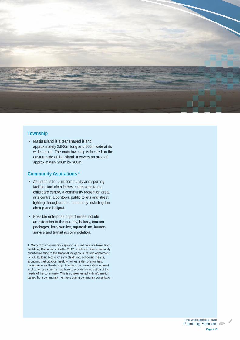
Township • Masig Island is a tear shaped island
approximately 2,800m long and 800m wide at its widest point. The main township is located on the eastern side of the island. It covers an area of approximately 300m by 300m.
Community Aspirations 1 • Aspirations for built community and sporting
facilities include a library, extensions to the child care centre, a community recreation area, arts centre, a pontoon, public toilets and street lighting throughout the community including the airstrip and helipad.
• Possible enterprise opportunities include an extension to the nursery, bakery, tourism packages, ferry service, aquaculture, laundry service and transit accommodation.
1. Many of the community aspirations listed here are taken from
priorities relating to the National Indigenous Reform Agreement (NIRA) building blocks of early childhood, schooling, health, economic participation, healthy homes, safe communities, governance and leadership. Priorities that have a development implication are summarised here to provide an indication of the needs of the community. This is supplemented with information gained from community members during community consultation.
Torres Strait Island Regional Council
Planning SchemePage 434
Local StoryIgowa, head man of Masig, lived on the northern side of the island near mur. He had a
his spear and was so afraid he would blunten the tips he never used it. He took it from its hiding place in the mur bushes and carried it about on the reef at low tide but he only pretended to throw it.
Sometimes the people of Masig used to go
did not accompany them, remaining on Masig to keep on eye on things.
One day when he was alone on Masig he saw some canoes between the outcrop of rocks on the beach at Sau and Umi. So a few days later when he found a drift log he decided to hide behind it and drift down at night to see what was going on.
He saw a markai camp and, later on, markai dancers. In the middle of the night a canoe came in with turtles on board. Two markai came down to help unload and saw the drift log and pushed it out to sea. Igowa came back and stole one of the turtles.
He took it to his people on Kodd and helped them place it in an earth oven. But when they opened the oven in the morning there was no turtle.
‘Who gave you this turtle? the people asked.
Igowa told them about the markai camp and the turtle he had given them there. Igowa said he would go and steal another one.
So the next evening Igowa crept to the markai camp and hid beneath some dry coconut fronds. The markai started to dance but stopped before long because they felt tired – a sign that a person was watching them. The markai leader ordered his men to look for this person.
Editor’s Note –
Torres Strait Island Regional Council
Planning SchemePage 435
Part 7: Local Plans
Masig (Yorke) Island
Soon they found Igowa and beat him with sticks all the way to mur. There Igowa found his spear and fought back but there were too many markai for him and soon he was being beaten and chased all the way to the sandbank between Masig and Kadal. Igowa was a sorry sight when he reached his people and told them what had happened. They tried to give him food but Igowa refused saying that he just wanted to sleep. In the morning, he was dead.
The people wrapped him in a mat and took him by canoe to Sau. They buried him not far from the rocks on the beach.
Source: Primary School, Masig, April 2008.
Torres Strait Island Regional Council
Planning SchemePage 436
7.2.9 Masig (Yorke) Island - local plan code7.2.9.1 Application
of this planning scheme.
When using this code, reference should be made to section 5.3.
7.2.9.2 Purpose
(1) The purpose of the Masig Island local plan code is to guide development on Masig Island in a way that best meets the needs of the community.
(2) The purpose of the Masig Island local plan code will be achieved through the overall outcomes listed on the following pages under the headings of:
(a) Gogobithiay (land, sea and sky)
(b) Natural hazards
(c) Torres Strait people and townships
(d) Ailan kastom and cultural heritage
(e) Getting around
(f) Town infrastructure.
Note – For the purposes of this local plan code, the strategic framework maps in schedule 2 form part of the local plan maps. They contain information referred to in this code.
Editor’s note – To identify where the zones and precincts apply across the local plan area, refer to the maps in schedule 2.
Torres Strait Island Regional Council
Planning SchemePage 437
Part 7: Local Plans
Masig (Yorke) Island
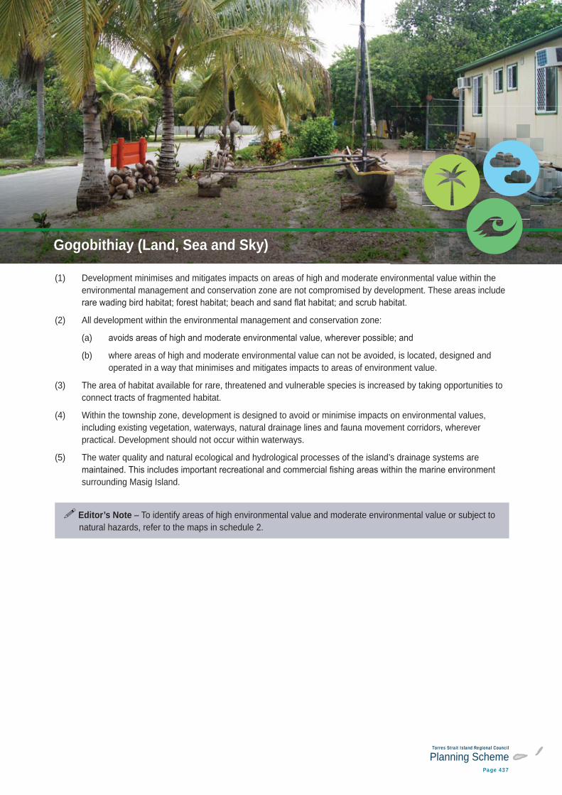
(1) Development minimises and mitigates impacts on areas of high and moderate environmental value within the environmental management and conservation zone are not compromised by development. These areas include
(2) All development within the environmental management and conservation zone:
(a)
(b) where areas of high and moderate environmental value can not be avoided, is located, designed and operated in a way that minimises and mitigates impacts to areas of environment value.
(3) The area of habitat available for rare, threatened and vulnerable species is increased by taking opportunities to connect tracts of fragmented habitat.
(4) Within the township zone, development is designed to avoid or minimise impacts on environmental values, including existing vegetation, waterways, natural drainage lines and fauna movement corridors, wherever practical. Development should not occur within waterways.
(5) The water quality and natural ecological and hydrological processes of the island’s drainage systems are
surrounding Masig Island.
Editor’s Note – To identify areas of high environmental value and moderate environmental value or subject to natural hazards, refer to the maps in schedule 2.
Gogobithiay (Land, Sea and Sky)
Torres Strait Island Regional Council
Planning SchemePage 438
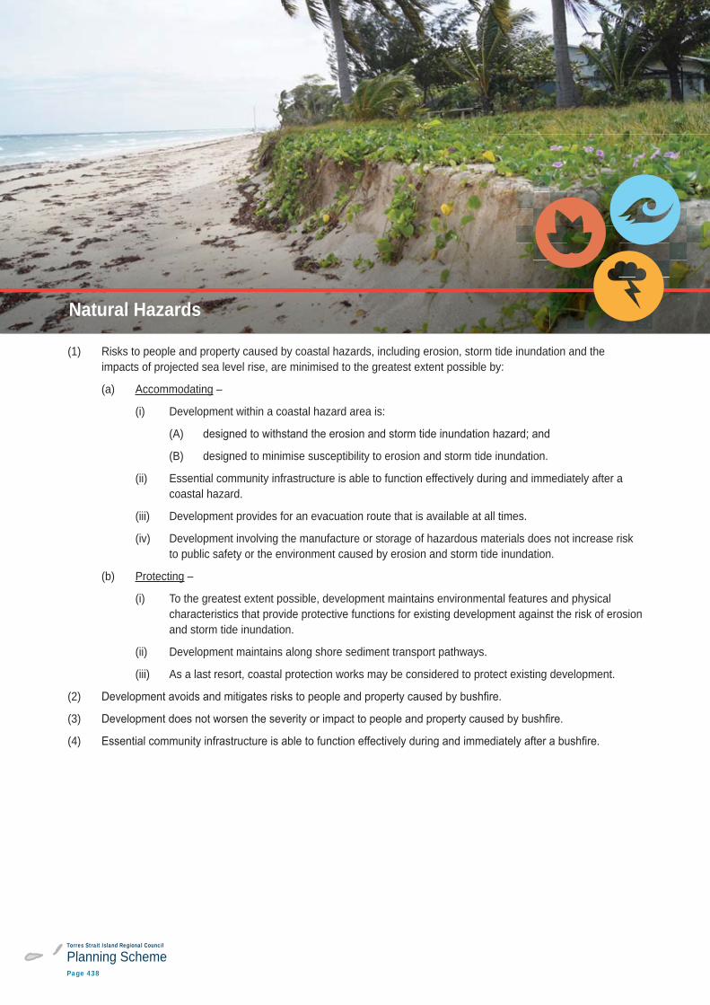
(1) Risks to people and property caused by coastal hazards, including erosion, storm tide inundation and the impacts of projected sea level rise, are minimised to the greatest extent possible by:
(a) Accommodating –
(i) Development within a coastal hazard area is:
(A)
(B) designed to minimise susceptibility to erosion and storm tide inundation.
(ii) Essential community infrastructure is able to function effectively during and immediately after a coastal hazard.
(iii) Development provides for an evacuation route that is available at all times.
(iv) Development involving the manufacture or storage of hazardous materials does not increase risk to public safety or the environment caused by erosion and storm tide inundation.
(b) Protecting –
(i) To the greatest extent possible, development maintains environmental features and physical characteristics that provide protective functions for existing development against the risk of erosion and storm tide inundation.
(ii) Development maintains along shore sediment transport pathways.
(iii) As a last resort, coastal protection works may be considered to protect existing development.
(2)
(3)
(4)
Natural Hazards
Torres Strait Island Regional Council
Planning SchemePage 439
Part 7: Local Plans
Masig (Yorke) Island
Editor’s Note – It is critical that future development in the Torres Strait takes into account potential risks associated with coastal hazards such as erosion and storm tide inundation, both now and in the future as sea
respond to coastal hazards will take time for local communities to thoroughly consider and decide.
This planning scheme takes coastal hazards into account using the best available data (at the time of writing). It is anticipated that, over time, the communities of the Torres Strait will continue to discuss these issues and develop an agreed position on the most appropriate responses at the local level. The outcome of these decisions will need to be incorporated into future amendments or revisions to this planning scheme.
While the best available data has been used in this planning scheme, projections about climate change may alter over time. In addition, circumstances may change which means that previous projections about coastal hazards are no longer valid (for example, if a sea wall is constructed to protect a township, calculations about where sea levels may extend to as a consequence of storm tide inundation and sea level rise will no longer be accurate). These circumstances will be taken into account either through development application processes or through planning scheme amendments.
Note – For the purpose of section 13 of the Building Regulations 2006:
(1)
(2)
Editor’s Note – Dwelling houses and dual occupancies are not made assessable in the township zone under
hazard areas under the planning scheme trigger various requirements under the Building Codes of Australia.
Editor’s Note – Essential community infrastructure is used in this document to describe infrastructure that is critical during and after an emergency and includes land uses such as emergency services, hospitals, health care services, renewable energy facilities, telecommunications facilities, utility installations, substations and
This is different to the term community facilities, which is used in this document to describe facilities which provide important social services to the community. Land use examples of community facilities include cemeteries, child care centres, clubs, community care centres, community residences, community uses, crematoriums, detention facilities, educational establishments, emergency services, health care services, hospitals, places if worship, retirement facilities, residential care facilities and rooming accommodation (see the
Note
includes land covered by very high, high and medium hazard areas as well as the potential impact buffer category.
Torres Strait Island Regional Council
Planning SchemePage 440
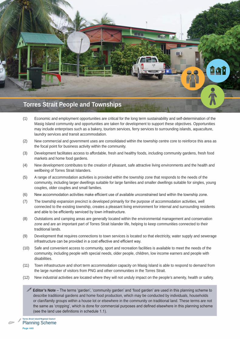
(1) Economic and employment opportunities are critical for the long term sustainability and self-determination of the Masig Island community and opportunities are taken for development to support these objectives. Opportunities may include enterprises such as a bakery, tourism services, ferry services to surrounding islands, aquaculture, laundry services and transit accommodation.
(2) New commercial and government uses are consolidated within the township centre core to reinforce this area as the focal point for business activity within the community.
(3) Development facilitates access to affordable, fresh and healthy foods, including community gardens, fresh food markets and home food gardens.
(4) New development contributes to the creation of pleasant, safe attractive living environments and the health and wellbeing of Torres Strait Islanders.
(5) A range of accommodation activities is provided within the township zone that responds to the needs of the community, including larger dwellings suitable for large families and smaller dwellings suitable for singles, young couples, older couples and small families.
(6)
(7) The township expansion precinct is developed primarily for the purpose of accommodation activities, well connected to the existing township, creates a pleasant living environment for internal and surrounding residents
(8) Outstations and camping areas are generally located within the environmental management and conservation zone and are an important part of Torres Strait Islander life, helping to keep communities connected to their traditional lands.
(9) Development that requires connections to town services is located so that electricity, water supply and sewerage
(10) Safe and convenient access to community, sport and recreation facilities is available to meet the needs of the community, including people with special needs, older people, children, low income earners and people with disabilities.
(11) Town infrastructure and short term accommodation capacity on Masig Island is able to respond to demand from the large number of visitors from PNG and other communities in the Torres Strait.
(12) New industrial activities are located where they will not unduly impact on the people’s amenity, health or safety.
Editor’s Notedescribe traditional gardens and home food production, which may be conducted by individuals, households or clan/family groups within a house lot or elsewhere in the community on traditional land. These terms are not
People and TownshipsTorres Strait People and Townships
Torres Strait Island Regional Council
Planning SchemePage 441
Part 7: Local Plans
Masig (Yorke) Island
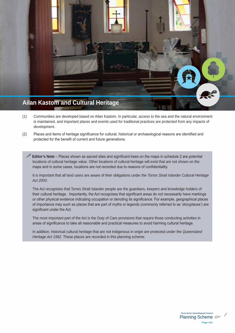
(1) Communities are developed based on Ailan Kastom. In particular, access to the sea and the natural environment is maintained, and important places and events used for traditional practices are protected from any impacts of development.
(2)
Editor’s Notelocations of cultural heritage value. Other locations of cultural heritage will exist that are not shown on the
It is important that all land users are aware of their obligations under the Torres Strait Islander Cultural Heritage Act 2003.
The Act recognises that Torres Strait Islander people are the guardians, keepers and knowledge holders of
The most important part of the Act is the Duty of Care provisions that require those conducting activities in
In addition, historical cultural heritage that are not Indigenous in origin are protected under the Queensland Heritage Act 1992. These places are recorded in this planning scheme.
Ailan Kastom and Cultural HeritageAilan Kastom and Cultural Heritage
Torres Strait Island Regional Council
Planning SchemePage 442
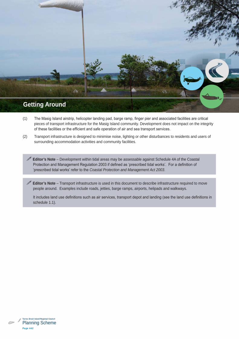
(1) pieces of transport infrastructure for the Masig Island community. Development does not impact on the integrity
(2) Transport infrastructure is designed to minimise noise, lighting or other disturbances to residents and users of surrounding accommodation activities and community facilities.
Editor’s Note – Development within tidal areas may be assessable against Schedule 4A of the Coastal
Coastal Protection and Management Act 2003.
Editor’s Note – Transport infrastructure is used in this document to describe infrastructure required to move people around. Examples include roads, jetties, barge ramps, airports, helipads and walkways.
schedule 1.1).
Getting Around
Torres Strait Island Regional Council
Planning SchemePage 443
Part 7: Local Plans
Masig (Yorke) Island
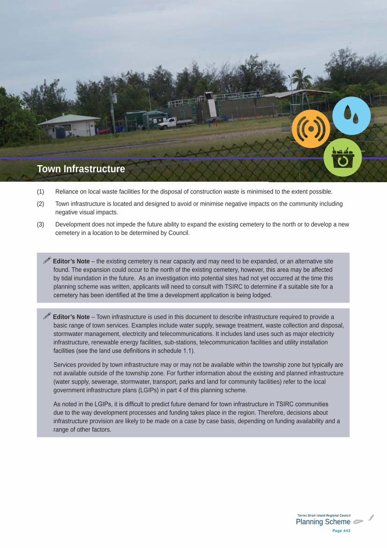
(1) Reliance on local waste facilities for the disposal of construction waste is minimised to the extent possible.
(2) Town infrastructure is located and designed to avoid or minimise negative impacts on the community including negative visual impacts.
(3) Development does not impede the future ability to expand the existing cemetery to the north or to develop a new cemetery in a location to be determined by Council.
Editor’s Note – the existing cemetery is near capacity and may need to be expanded, or an alternative site found. The expansion could occur to the north of the existing cemetery, however, this area may be affected by tidal inundation in the future. As an investigation into potential sites had not yet occurred at the time this planning scheme was written, applicants will need to consult with TSIRC to determine if a suitable site for a
Editor’s Note – Town infrastructure is used in this document to describe infrastructure required to provide a basic range of town services. Examples include water supply, sewage treatment, waste collection and disposal, stormwater management, electricity and telecommunications. It includes land uses such as major electricity infrastructure, renewable energy facilities, sub-stations, telecommunication facilities and utility installation
Services provided by town infrastructure may or may not be available within the township zone but typically are not available outside of the township zone. For further information about the existing and planned infrastructure (water supply, sewerage, stormwater, transport, parks and land for community facilities) refer to the local government infrastructure plans (LGIPs) in part 4 of this planning scheme.
due to the way development processes and funding takes place in the region. Therefore, decisions about infrastructure provision are likely to be made on a case by case basis, depending on funding availability and a range of other factors.
Town Infrastructure
Torres Strait Island Regional Council
Planning SchemePage 444
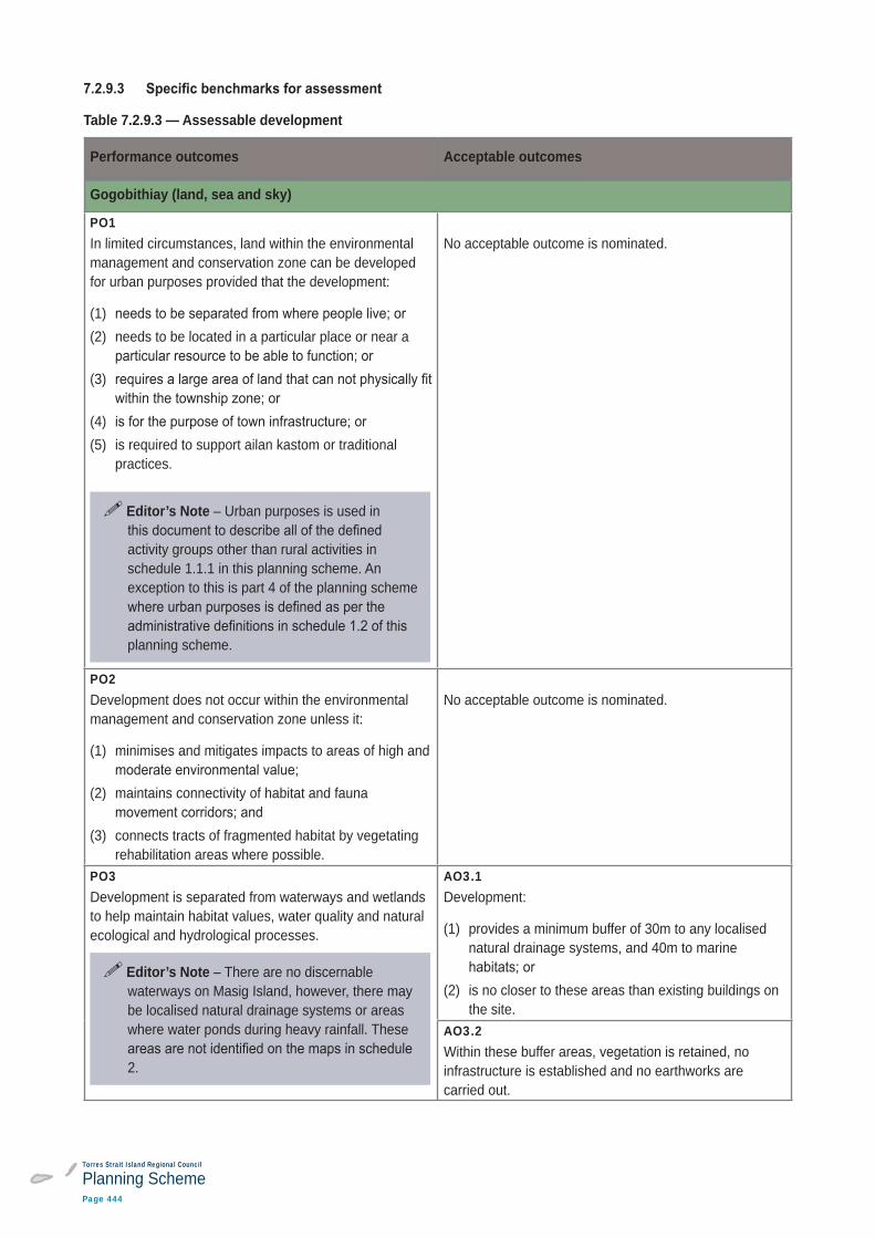
Table 7.2.9.3 — Assessable development
Performance outcomes Acceptable outcomes
Gogobithiay (land, sea and sky)
PO1In limited circumstances, land within the environmental management and conservation zone can be developed for urban purposes provided that the development:
(1) (2) needs to be located in a particular place or near a
(3)
(4) (5) is required to support ailan kastom or traditional
practices.
Editor’s Note – Urban purposes is used in
activity groups other than rural activities in schedule 1.1.1 in this planning scheme. An exception to this is part 4 of the planning scheme
planning scheme.
No acceptable outcome is nominated.
PO2Development does not occur within the environmental management and conservation zone unless it:
(1) minimises and mitigates impacts to areas of high and
(2) maintains connectivity of habitat and fauna
(3) connects tracts of fragmented habitat by vegetating rehabilitation areas where possible.
No acceptable outcome is nominated.
PO3Development is separated from waterways and wetlands to help maintain habitat values, water quality and natural ecological and hydrological processes.
Editor’s Note – There are no discernable waterways on Masig Island, however, there may be localised natural drainage systems or areas where water ponds during heavy rainfall. These
2.
AO3.1Development:
(1) provides a minimum buffer of 30m to any localised natural drainage systems, and 40m to marine
(2) is no closer to these areas than existing buildings on the site.
AO3.2Within these buffer areas, vegetation is retained, no infrastructure is established and no earthworks are carried out.
Torres Strait Island Regional Council
Planning SchemePage 445
Part 7: Local Plans
Masig (Yorke) Island
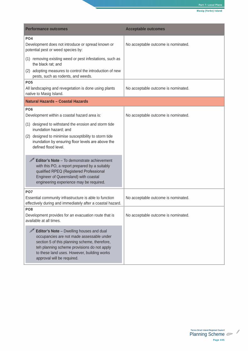
Performance outcomes Acceptable outcomes
PO4Development does not introduce or spread known or potential pest or weed species by:
(1) removing existing weed or pest infestations, such as
(2) adopting measures to control the introduction of new pests, such as rodents, and weeds.
No acceptable outcome is nominated.
PO5All landscaping and revegetation is done using plants native to Masig Island.
No acceptable outcome is nominated.
Natural Hazards – Coastal Hazards
PO6Development within a coastal hazard area is:
(1) designed to withstand the erosion and storm tide
(2) designed to minimise susceptibility to storm tide
Editor’s Note – To demonstrate achievement with this PO, a report prepared by a suitably
Engineer of Queensland) with coastal engineering experience may be required.
No acceptable outcome is nominated.
PO7Essential community infrastructure is able to function effectively during and immediately after a coastal hazard.
No acceptable outcome is nominated.
PO8Development provides for an evacuation route that is available at all times.
Editor’s Note – Dwelling houses and dual occupancies are not made assessable under section 5 of this planning scheme, therefore, teh planning scheme provisions do not apply to these land uses. However, building works approval will be required.
No acceptable outcome is nominated.
Torres Strait Island Regional Council
Planning SchemePage 446
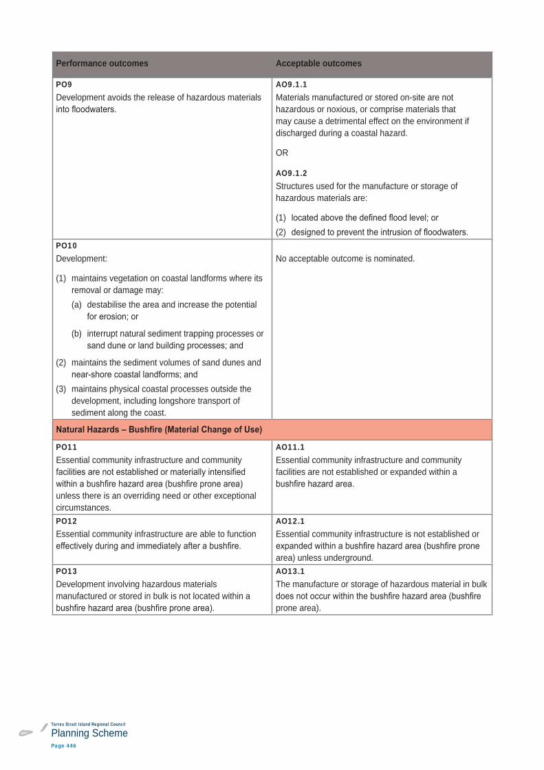
Performance outcomes Acceptable outcomes
PO9Development avoids the release of hazardous materials
AO9.1.1Materials manufactured or stored on-site are not hazardous or noxious, or comprise materials that may cause a detrimental effect on the environment if discharged during a coastal hazard.
OR
AO9.1.2Structures used for the manufacture or storage of hazardous materials are:
(1) (2)
PO10Development:
(1) maintains vegetation on coastal landforms where its removal or damage may: (a) destabilise the area and increase the potential
(b) interrupt natural sediment trapping processes or
(2) maintains the sediment volumes of sand dunes and
(3) maintains physical coastal processes outside the development, including longshore transport of sediment along the coast.
No acceptable outcome is nominated.
PO11Essential community infrastructure and community
unless there is an overriding need or other exceptional circumstances.
AO11.1Essential community infrastructure and community facilities are not established or expanded within a
PO12Essential community infrastructure are able to function
AO12.1Essential community infrastructure is not established or
area) unless underground.PO13Development involving hazardous materials manufactured or stored in bulk is not located within a
AO13.1The manufacture or storage of hazardous material in bulk
prone area).
Torres Strait Island Regional Council
Planning SchemePage 447
Part 7: Local Plans
Masig (Yorke) Island
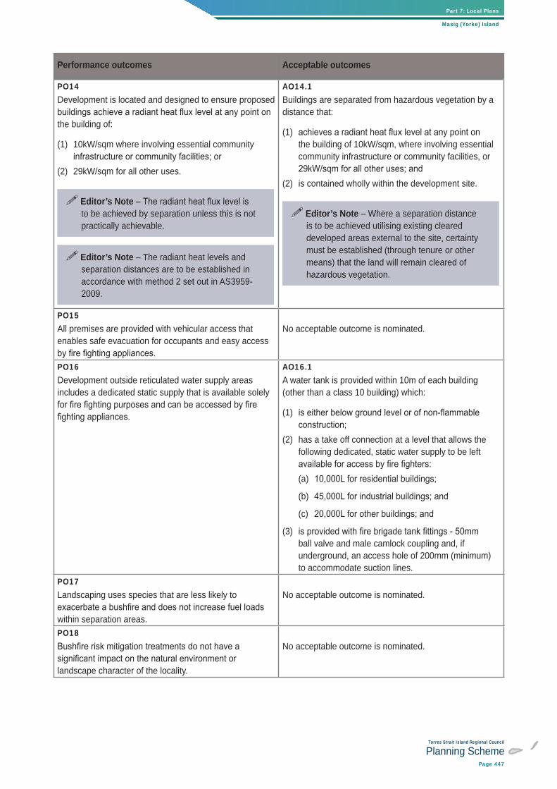
Performance outcomes Acceptable outcomes
PO14Development is located and designed to ensure proposed
the building of:
(1) 10kW/sqm where involving essential community
(2) 29kW/sqm for all other uses.
Editor’s Note to be achieved by separation unless this is not practically achievable.
Editor’s Note – The radiant heat levels and separation distances are to be established in accordance with method 2 set out in AS3959-2009.
AO14.1Buildings are separated from hazardous vegetation by a distance that:
(1) the building of 10kW/sqm, where involving essential community infrastructure or community facilities, or
(2) is contained wholly within the development site.
Editor’s Note – Where a separation distance is to be achieved utilising existing cleared developed areas external to the site, certainty must be established (through tenure or other means) that the land will remain cleared of hazardous vegetation.
PO15All premises are provided with vehicular access that enables safe evacuation for occupants and easy access
No acceptable outcome is nominated.
PO16Development outside reticulated water supply areas includes a dedicated static supply that is available solely
AO16.1A water tank is provided within 10m of each building (other than a class 10 building) which:
(1)
(2) has a take off connection at a level that allows the following dedicated, static water supply to be left
(a)
(b)
(c)
(3) ball valve and male camlock coupling and, if underground, an access hole of 200mm (minimum) to accommodate suction lines.
PO17Landscaping uses species that are less likely to
within separation areas.
No acceptable outcome is nominated.
PO18
landscape character of the locality.
No acceptable outcome is nominated.
Torres Strait Island Regional Council
Planning SchemePage 448
Performance outcomes Acceptable outcomes
PO19Where subdivision is being undertaken for an urban purpose or within the township zone, a separation distance from hazardous vegetation is provided to
boundary of the proposed lots.
Editor’s Note – Urban purposes is used in
activity groups other than rural activities in schedule 1.1.1 in this planning scheme. An exception to this is part 4 of the planning scheme
planning scheme.
Editor’s Note – The radiant heat levels and separation distances are to be established in accordance with method 2 set out in AS3959-2009.
AO19.1.1
OR
AO19.1.2Lots are separated from hazardous vegetation by a distance that:
(1)
(2) is contained wholly within the development site.
Editor’s Note – Where a separation distance is to be achieved utilising existing cleared developed areas external to the site, certainty must be established (through tenure or other means) that the land will remain cleared of hazardous vegetation.
PO20Where subdivision is undertaken for a purpose other than an urban purpose, a building envelope of reasonable dimensions is provided on each lot which achieves a
No acceptable outcome is nominated.
PO21The development design responds to the potential threat
demonstrate an acceptable or tolerable risk to people, by:
(1) minimising the length of the development perimeter
(2) avoiding the creation of potential bottle-neck points in
(3) establishing direct access to a safe assembly/evacuation area in the event of an approaching
(4)
No acceptable outcome is nominated.
Torres Strait People and Townships
PO22New commercial and government uses, other than home based businesses, industrial activities, community facilities and waterfront activities, are consolidated within the township centre core area.
No acceptable solution is nominated.
Torres Strait Island Regional Council
Planning SchemePage 449
Part 7: Local Plans
Masig (Yorke) Island
Performance outcomes Acceptable outcomes
PO23Industrial activities minimise any noise, odour or other emissions and do not impact on the community’s ability to enjoy their lifestyle.
No acceptable outcome is nominated.
PO24Multiple dwellings occur within the township zone and are located, designed and oriented to create pleasant, safe and attractive living environments, including through:
(1) interspersing with lower density forms of
(2) provision of generous outdoor open space suited to
(3) (4) provision of an attractive outlook from individual
(5) (6) provision of main building entrances, verandahs and
(7) screening along site boundaries or dwelling openings to obscure any undesirable views.
No acceptable solution is nominated.
PO25Accommodation activities and community facilities are located and sited so that visual, lighting, noise and other impacts do not unduly affect residents and visitors to the site.
AO25.1Accommodation activities and community facilities are separated from:
(1) existing and future substations by a minimum
(2) existing and future sea and air transport infrastructure by a minimum distance of 100m.
Torres Strait Island Regional Council
Planning SchemePage 450
Performance outcomes Acceptable outcomes
PO26Development within the township expansion precinct:
(1) is primarily for the purpose of accommodation
(2) connects to surrounding streets and parks to allow easy movement for pedestrians and vehicles
(3) minimises runoff, wastage of water and negative impacts on water quality by retaining natural drainage lines, maximising permeable surfaces and, where
(4) provides for building orientation that maximises
(5) includes a local park in a central location that caters to the needs of future residents of the new development and can be easily seen from residential
(6) upgrades to town infrastructure such as roads,
(7) includes landscaping in streets and public areas.
Editor’s Notelocation for park and community garden’ was
should be considered as a possible option in response to (5) above.
No acceptable solution is nominated.
PO27Community facilities, particularly those accommodating child care, educational, training and health services are located within the township zone.
No acceptable solution is nominated.
PO28Development that may be incompatible with or compromise the ongoing operation or expansion of community facilities does not occur near these uses.
No acceptable solution is nominated.
PO29Where possible, community facilities are co-located,
changing needs of the community over time.
No acceptable solution is nominated.
Ailan Kastom and Cultural Heritage
PO30The continued practice of Ailan Kastom is facilitated and not impeded by development.
No acceptable solution is nominated.
Torres Strait Island Regional Council
Planning SchemePage 451
Part 7: Local Plans
Masig (Yorke) Island
Performance outcomes Acceptable outcomes
PO31Development does not cause run off, soil erosion or other
cultural heritage places and sacred sites.
Editor’s Note – Places shown as sacred sites
of cultural heritage value. Other locations of cultural heritage value will exist that are not shown on the maps in schedule 2.
It is recommended that, prior to the commencement of new development:
• consultation with Traditional Owners, the relevant native title prescribed body corporates and TSIRC and is undertaken to identify potential cultural heritage values and
• cultural heritage surveys are undertaken prior to the ground disturbing activities taking
• a local Torres Strait Islander Traditional Owner is employed as a cultural heritage manager and monitor throughout construction works.
No acceptable solution is nominated.
Torres Strait Island Regional Council
Planning SchemePage 452
Performance outcomes Acceptable outcomes
Getting Around
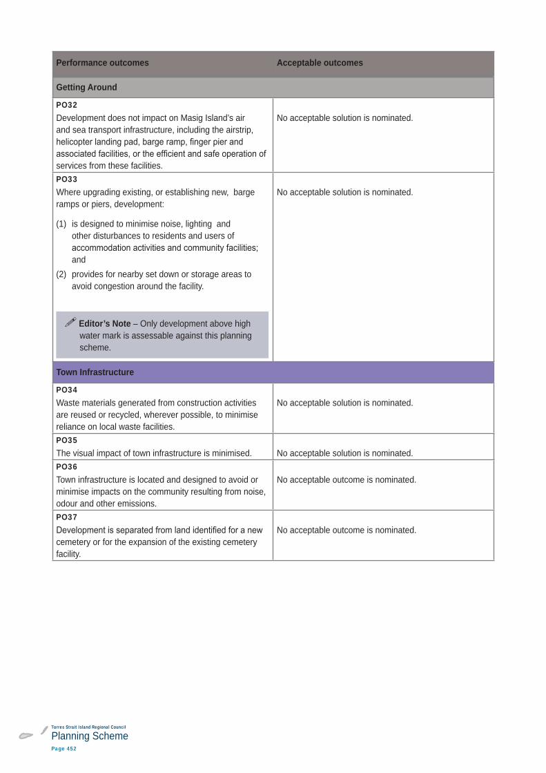
PO32Development does not impact on Masig Island’s air and sea transport infrastructure, including the airstrip,
services from these facilities.
No acceptable solution is nominated.
PO33Where upgrading existing, or establishing new, barge ramps or piers, development:
(1) is designed to minimise noise, lighting and other disturbances to residents and users of
and(2) provides for nearby set down or storage areas to
avoid congestion around the facility.
Editor’s Note – Only development above high water mark is assessable against this planning scheme.
No acceptable solution is nominated.
Town Infrastructure
PO34Waste materials generated from construction activities are reused or recycled, wherever possible, to minimise reliance on local waste facilities.
No acceptable solution is nominated.
PO35The visual impact of town infrastructure is minimised. No acceptable solution is nominated.PO36Town infrastructure is located and designed to avoid or minimise impacts on the community resulting from noise, odour and other emissions.
No acceptable outcome is nominated.
PO37
cemetery or for the expansion of the existing cemetery facility.
No acceptable outcome is nominated.