Embed Size (px)
Citation preview
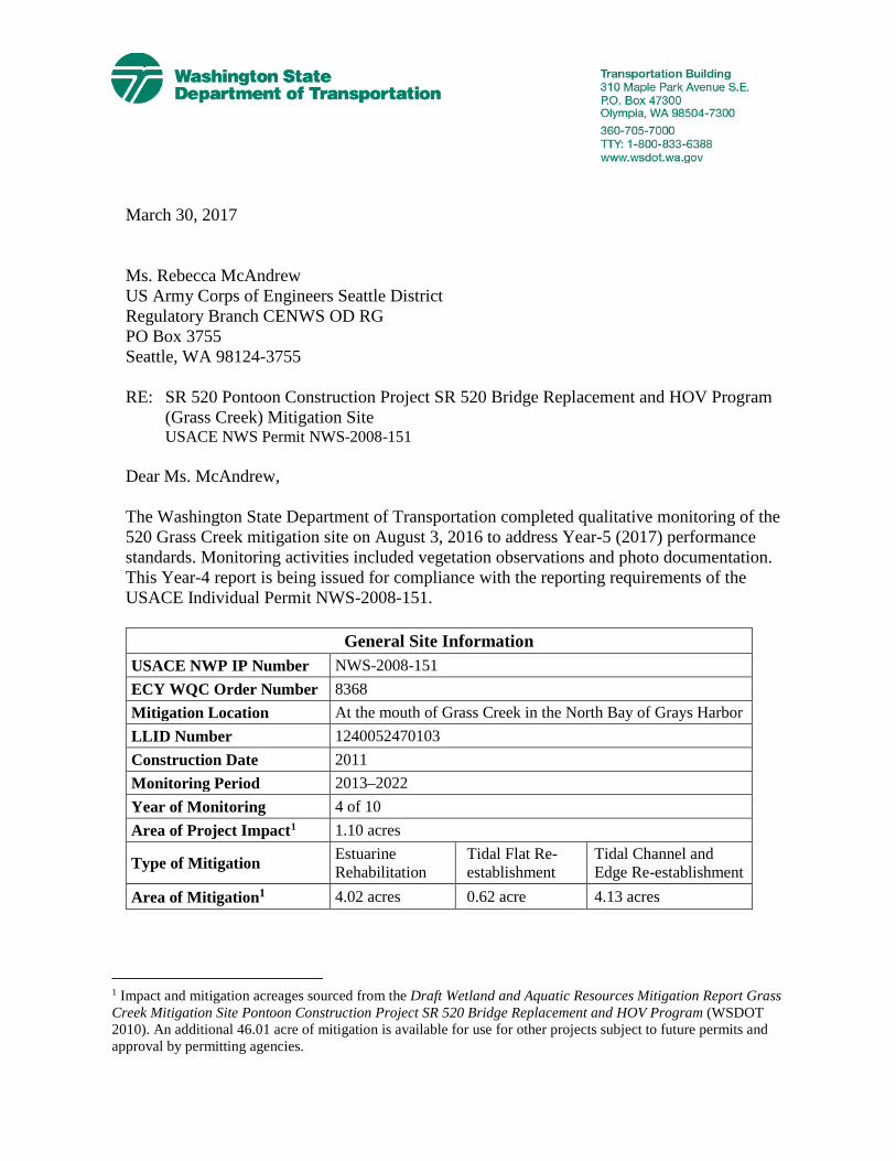
March 30, 2017 Ms. Rebecca McAndrew US Army Corps of Engineers Seattle District Regulatory Branch CENWS OD RG PO Box 3755 Seattle, WA 98124-3755 RE: SR 520 Pontoon Construction Project SR 520 Bridge Replacement and HOV Program
(Grass Creek) Mitigation Site USACE NWS Permit NWS-2008-151
Dear Ms. McAndrew, The Washington State Department of Transportation completed qualitative monitoring of the 520 Grass Creek mitigation site on August 3, 2016 to address Year-5 (2017) performance standards. Monitoring activities included vegetation observations and photo documentation. This Year-4 report is being issued for compliance with the reporting requirements of the USACE Individual Permit NWS-2008-151.
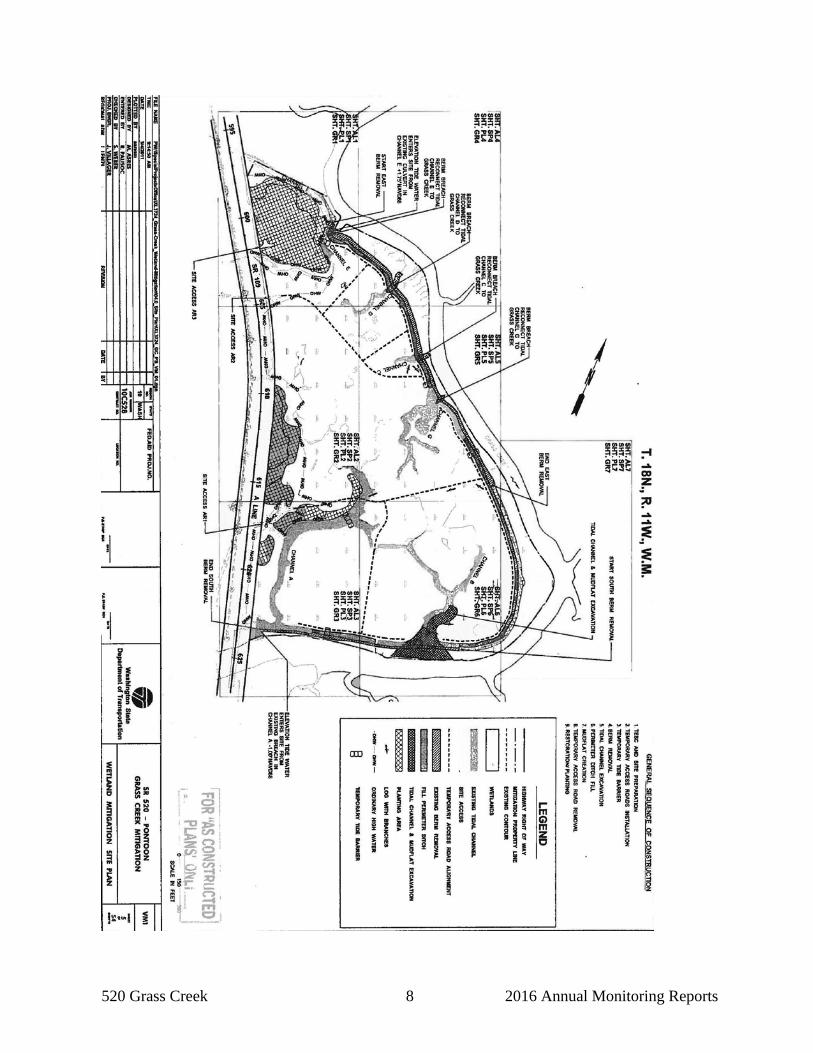
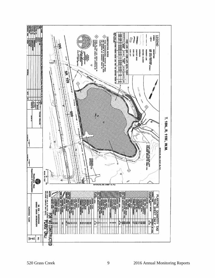
General Site Information USACE NWP IP Number NWS-2008-151 ECY WQC Order Number 8368 Mitigation Location At the mouth of Grass Creek in the North Bay of Grays Harbor LLID Number 1240052470103 Construction Date 2011 Monitoring Period 2013–2022 Year of Monitoring 4 of 10 Area of Project Impact1 1.10 acres
Type of Mitigation Estuarine Rehabilitation
Tidal Flat Re-establishment
Tidal Channel and Edge Re-establishment
Area of Mitigation1 4.02 acres 0.62 acre 4.13 acres
1 Impact and mitigation acreages sourced from the Draft Wetland and Aquatic Resources Mitigation Report Grass Creek Mitigation Site Pontoon Construction Project SR 520 Bridge Replacement and HOV Program (WSDOT 2010). An additional 46.01 acre of mitigation is available for use for other projects subject to future permits and approval by permitting agencies.
520 Grass Creek 2 2016 Annual Monitoring Reports
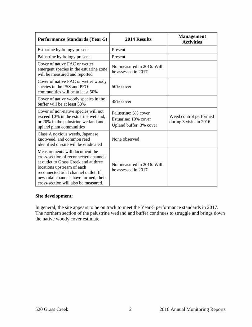
Site development: In general, the site appears to be on track to meet the Year-5 performance standards in 2017. The northern section of the palustrine wetland and buffer continues to struggle and brings down the native woody cover estimate.
Performance Standards (Year-5) 2014 Results Management Activities
Estuarine hydrology present Present Palustrine hydrology present Present Cover of native FAC or wetter emergent species in the estuarine zone will be measured and reported
Not measured in 2016. Will be assessed in 2017.
Cover of native FAC or wetter woody species in the PSS and PFO communities will be at least 50%
50% cover
Cover of native woody species in the buffer will be at least 50% 45% cover
Cover of non-native species will not exceed 10% in the estuarine wetland, or 20% in the palustrine wetland and upland plant communities
Palustrine: 3% cover Estuarine: 10% cover Upland buffer: 3% cover
Weed control performed during 3 visits in 2016
Class A noxious weeds, Japanese knotweed, and common reed identified on-site will be eradicated
None observed
Measurements will document the cross-section of reconnected channels at outlet to Grass Creek and at three locations upstream of each reconnected tidal channel outlet. If new tidal channels have formed, their cross-section will also be measured.
Not measured in 2016. Will be assessed in 2017.
520 Grass Creek 3 2016 Annual Monitoring Reports
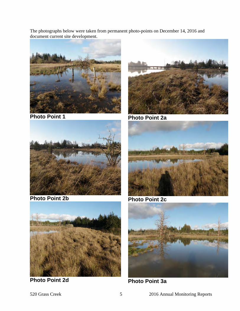
Results for Performance Standard 1 (Estuarine hydrology present): High tides regularly inundate the tidal channels and mudflats with subsequent draining during a receding tide. See below for photos taken on December 14, 2016 during a NOAA predicted 10.32 feet above sea level tide. Results for Performance Standard 2 (Palustrine hydrology present): Three hydrology monitoring visits occurred in 2016, on March 8, March 23, and April 6. During each of these visits, significant surface hydrology was present and readings from the hydrology monitoring well all indicated a water table within 12 inches of the soil surface. Results for Performance Standard 3 (Cover of native FAC or wetter emergent species in the estuarine zone will be measured and reported): Cover of native wetland (facultative and wetter) emergent species in the estuarine zone was not measured during this year’s visit; however, the transition to a salt tolerant vegetative community continues to expand across the site. Results for Performance Standard 4 (Cover of native FAC or wetter woody species in the PSS and PFO communities will be at least 50%): Cover of native wetland (facultative and wetter) woody species (planted and volunteer) in the palustrine forested and scrub-shrub wetland communities was visually estimated at 50 percent. Results for Performance Standard 5 (Cover of native woody species in the buffer will be at least 50%): Cover of native woody species (planted and volunteer) in the buffer was visually estimated at 45 percent. Results for Performance Standard 6 (Cover of non-native species will not exceed 10% in the estuarine wetland, or 20% in the palustrine wetland and upland plant communities): Cover of non-native species was visually estimated at three percent in the palustrine wetland, 10 percent in the estuarine wetland, and three percent in the upland buffer. Results for Performance Standard 7 (Class A noxious weeds, Japanese knotweed, and common reed identified on-site will be eradicated): None of the applicable species were observed on-site. Results for Performance Standard 8 (Measurements will document the cross-section of reconnected channels at outlet to Grass Creek and at three locations upstream of each reconnected tidal channel outlet. If new tidal channels have formed, their cross-section will also be measured.): These measurements will be taken in 2017. High tides regularly inundate and drain from the tidal channels on site.
520 Grass Creek 4 2016 Annual Monitoring Reports
We welcome your questions or comments. Please contact me at 360/570-2579 or by e-mail at [email protected] for questions about these mitigation sites. Sincerely, Doug Littauer Wetlands Program
520 Grass Creek 5 2016 Annual Monitoring Reports
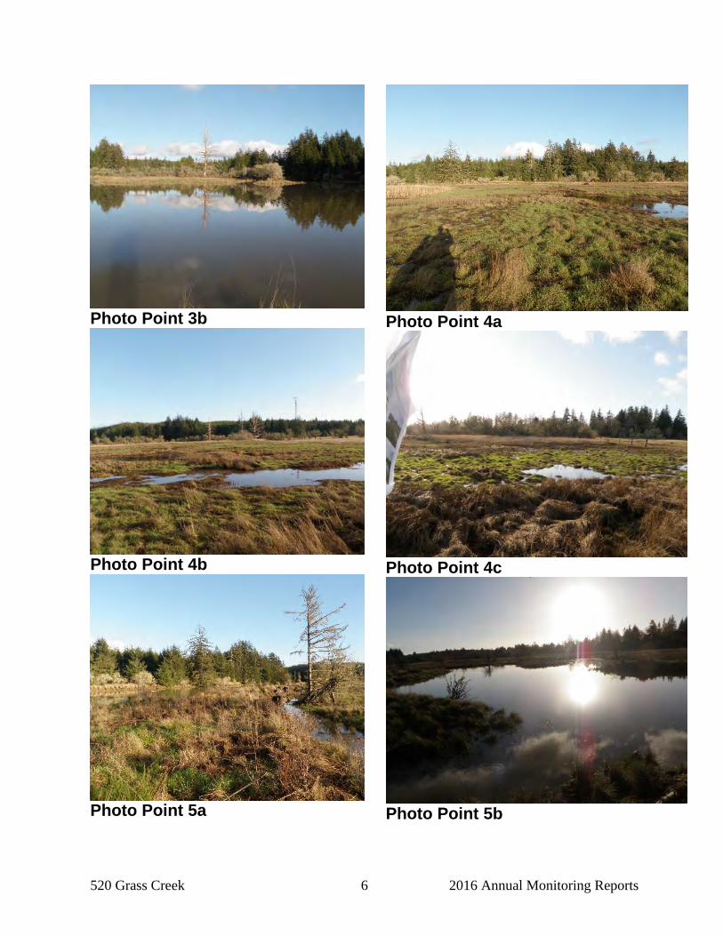
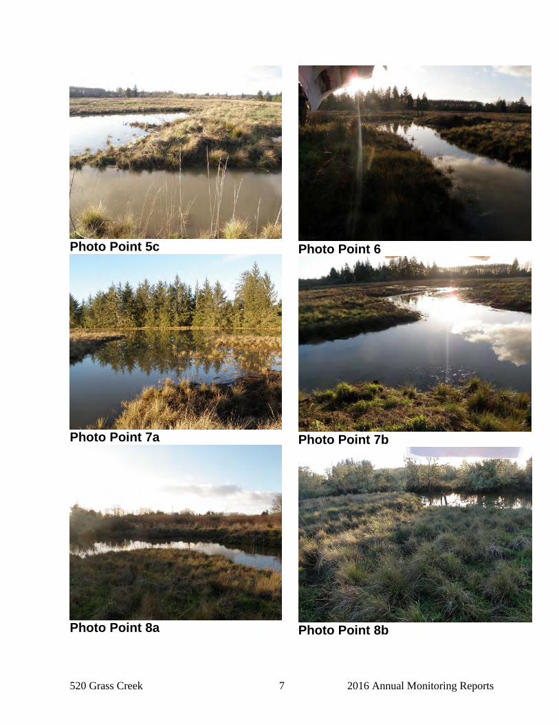
The photographs below were taken from permanent photo-points on December 14, 2016 and document current site development.
Photo Point 1
Photo Point 2b
Photo Point 2d
Photo Point 2a
Photo Point 2c
Photo Point 3a
520 Grass Creek 6 2016 Annual Monitoring Reports
Photo Point 3b
Photo Point 4b
Photo Point 5a
Photo Point 4a
Photo Point 4c
Photo Point 5b
520 Grass Creek 7 2016 Annual Monitoring Reports
Photo Point 5c
Photo Point 7a
Photo Point 8a
Photo Point 6
Photo Point 7b
Photo Point 8b
520 Grass Creek 8 2016 Annual Monitoring Reports
520 Grass Creek 9 2016 Annual Monitoring Reports
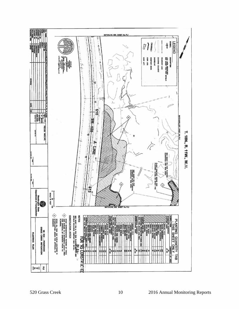
520 Grass Creek 10 2016 Annual Monitoring Reports
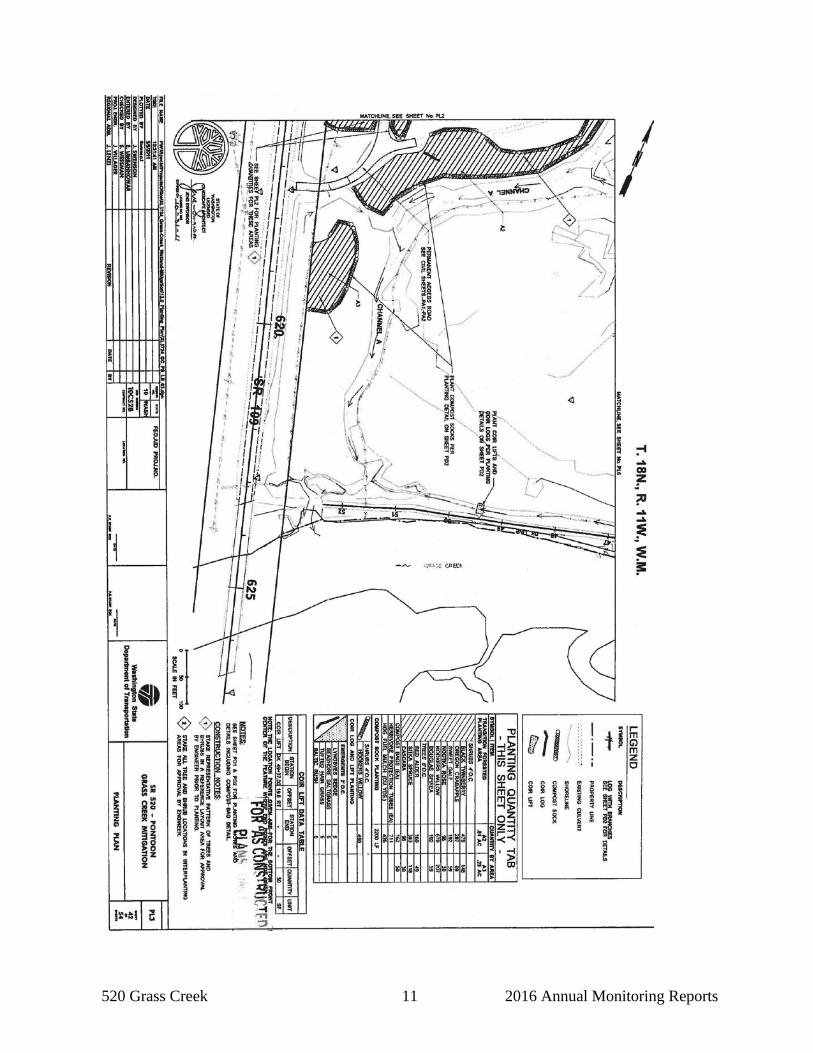
520 Grass Creek 11 2016 Annual Monitoring Reports