Embed Size (px)
DESCRIPTION
works and projects
Citation preview
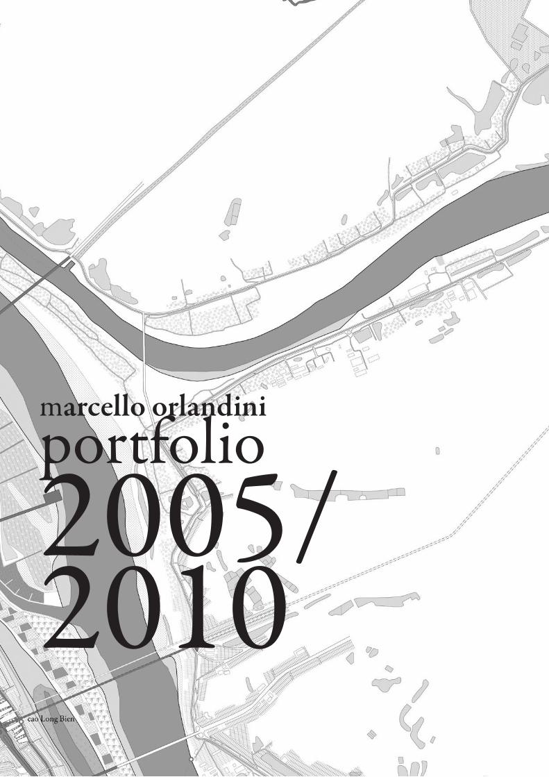
portfolio2005/2010
marcello orlandini

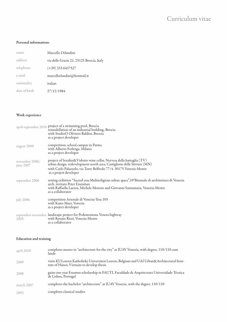
Curriculum vitae
Marcello Orlandini
via delle Grazie 21, 25125 Brescia, Italy
(+39) 333 6437527
italian
27/12/1984
name
address
telephone
nationality
date of birth
Personal informations
Work experience
april-september 2010
august 2009
november 2006/june 2007
september 2006
july 2006
september-november 2005
project of a swimming pool, Bresciaremodellation of an industrial building, Bresciawith StudioO Oliviero Baldini, Bresciaas a project developer
competition, school campus in Parmawith Alberto Ferlenga, Milanoas a project developer
project of Serafini&Vidotto wine cellar, Nervesa della battaglia (TV)urban design, redevelopment north area, Castiglione delle Stiviere (MN)with Carlo Palazzolo, via Torre Belfredo 77/4. 30175 Venezia-Mestre as a projest developer
setting exibition “Sacred you.Multireligious urban space”,10°Biennale di architettura di Venezia arch. invitato Peter Eisenmanwith Raffaella Laezza, Michele Moreno and Giovanni Santamaria, Venezia-Mestreas a collaborator
competition Arsenale di Venezia-Tesa 105with Kuno Mayr, Veneziaas a project developer
landscape project for Pedemontana Veneta highwaywith Renato Rizzi, Venezia-Mestreas a collaborator
Education and training
april 2010
2009
2008
march 2007
2003
completes master in “architecture for the city” at IUAV Venezia, with degree, 110/110 cum laude
visits KULeuven Katholieke Universiteit Leuven, Belgium and UAI Urban&Architectural Insti-tute of Hanoi, Vietnam to develop thesis
gains one year Erasmus scholarship in FAUTL Faculdade de Arquitectura Universidade Técnica de Lisboa, Portugal
completes the bachelor “architecture” at IUAV Venezia, with the degree, 110/110
completes classical studies
Workshops
may 2010
june 2009
september 2008
2006/2007
july 2006
july 2005
march 2005
october 2005
july 2004
“Sealine Brindisi”IUAV Venezia, Università di Ferrara, Politecnico di Bari
“Urban Peri-urban transition in Hanoi Today and Tomorrow”with IUAV Venezia, UNICAM Ascoli Piceno, UNIGE Genova, Kyonggi University of Seoul, Yonsei University of Seoul
“Villard Sud America”with IUAV Venezia, Università Roma Tre, UNIGE Genova, Universidad Nacional de Rosario, Universidad Catolica de Santa Fe, sede Posadas, Universidad Nacional de Asunciòn, Universi-dad Catolica de Asunciòn,
“Villard 8”with IUAV Venezia, UNICAM Ascoli Piceno, UNIGE Genova, Università Roma Tre, Politec-nico di Milano, Università Federico II Napoli, Università di Palermo, University of Patras
“Towers in the park”with Roberto Collovà, University of Palermo
“Patio houses in China”with Sergio Pascolo, IUAV Venezia
“Displacement city” with IUAV Venezia, Bauhaus University Weimar, ETH Zurich e UT Delft
“Carlo Scarpa.Tettonica e costruzione presso”at CISAPalladio Vicenza. With Wolf Tegethoff, Vitale Zanchettin, Bruno Reichlin e Stanislaus Von Moos
“A bird’s house”with Carlos Ferrater, UPC-ETS Barcelona
Pubblications
“Ceci n’est pas une fleuve!/Dove la città si riflette”with Giacomo Gatto and Roberto Segain “Dialoghi Internazionali” n°13 autumn/winter 2010, Bruno Mondadori, Milano
catalogue Villard “Benevento, collinazioni”Città di Benevento, 2008
in process:
“Lisbon 20th century museum of the city”with Pedro Pacheco and Diogo Burnay, FAUTL, Lisboa
essay on Shangaiwith Giacomo Gatto and Roberto Segafor “Dialoghi Internazionali” n°15 autumn/winter 2011, Bruno Mondadori, Milano
Exibitions
Verona
photo collective “Verso Oriente”Chistro dei Tolentini, Venezia, 2009
Villard “Benevento, collinazioni”Benevento 2006
in process:
“Lisbon 20th century museum of the city”with Pedro Pacheco and Diogo Burnay, FAUTL, Lisboa
Languages
mother tongue
other languages
italian
english, good level, spoken and written
portuguese, good level spoken, basic level written
french, basic level spoken and written
Computer skills and competences
advanced knowledge
good knowledge
basic knowledge
archiCad 2D and 3Dartlantis studio
autoCadadobe photoshopadobe indesign
adobe illustratorcinema 4D
Practical skills
good experience in realization of architectural models with different techniques and materialsgood skill in sketch drawinggood experience in urban reportage photograhy
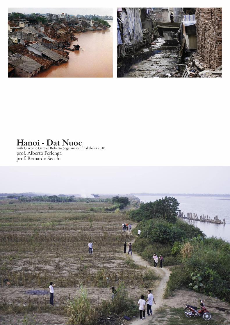
Hanoi - Dat Nuocwith Giacomo Gatto e Roberto Sega, master final thesis 2010prof. Alberto Ferlengaprof. Bernardo Secchi
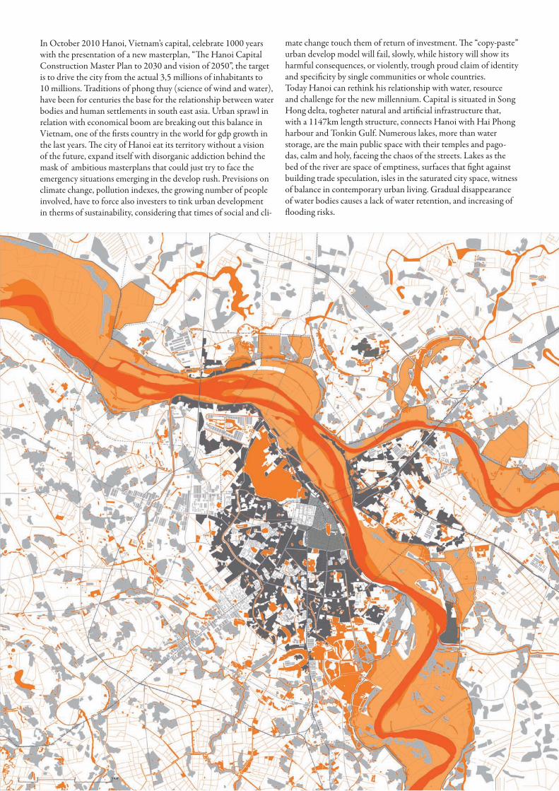
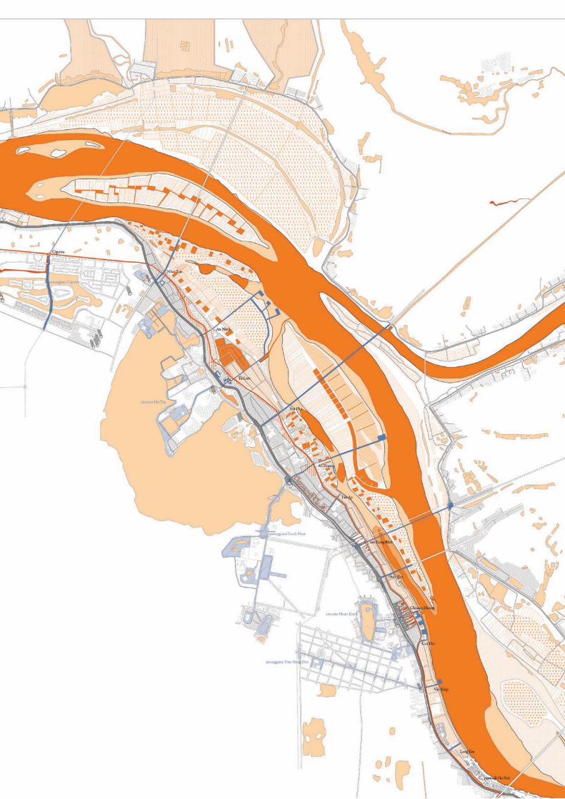
In October 2010 Hanoi, Vietnam’s capital, celebrate 1000 years with the presentation of a new masterplan, “The Hanoi Capital Construction Master Plan to 2030 and vision of 2050”, the target is to drive the city from the actual 3,5 millions of inhabitants to 10 millions. Traditions of phong thuy (science of wind and water), have been for centuries the base for the relationship between water bodies and human settlements in south east asia. Urban sprawl in relation with economical boom are breaking out this balance in Vietnam, one of the firsts country in the world for gdp growth in the last years. The city of Hanoi eat its territory without a vision of the future, expand itself with disorganic addiction behind the mask of ambitious masterplans that could just try to face the emergency situations emerging in the develop rush. Previsions on climate change, pollution indexes, the growing number of people involved, have to force also investers to tink urban development in therms of sustainability, considering that times of social and cli-
mate change touch them of return of investment. The “copy-paste” urban develop model will fail, slowly, while history will show its harmful consequences, or violently, trough proud claim of identity and specificity by single communities or whole countries.Today Hanoi can rethink his relationship with water, resource and challenge for the new millennium. Capital is situated in Song Hong delta, togheter natural and artificial infrastructure that, with a 1147km length structure, connects Hanoi with Hai Phong harbour and Tonkin Gulf. Numerous lakes, more than water storage, are the main public space with their temples and pago-das, calm and holy, faceing the chaos of the streets. Lakes as the bed of the river are space of emptiness, surfaces that fight against building trade speculation, isles in the saturated city space, witness of balance in contemporary urban living. Gradual disappearance of water bodies causes a lack of water retention, and increasing of flooding risks.
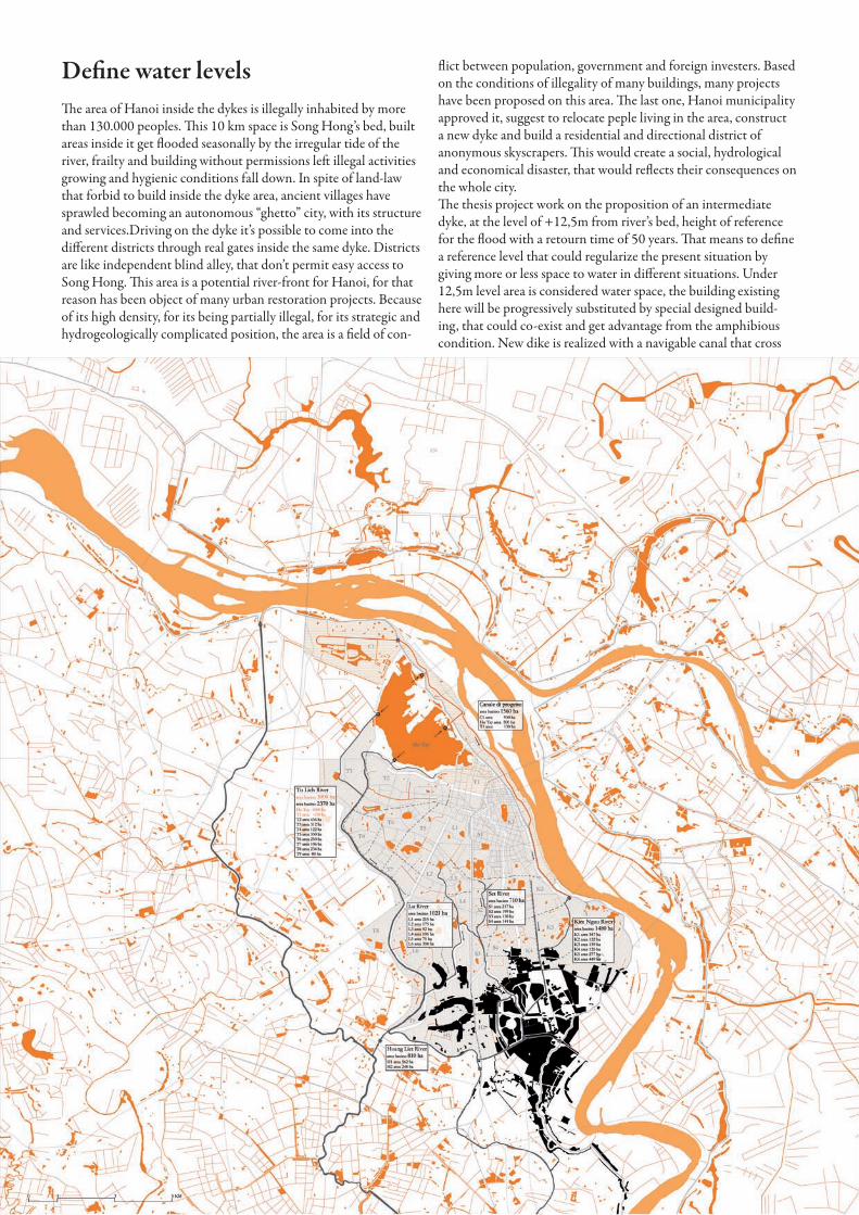
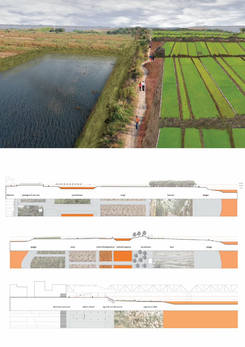
Define water levelsThe area of Hanoi inside the dykes is illegally inhabited by more than 130.000 peoples. This 10 km space is Song Hong’s bed, built areas inside it get flooded seasonally by the irregular tide of the river, frailty and building without permissions left illegal activities growing and hygienic conditions fall down. In spite of land-law that forbid to build inside the dyke area, ancient villages have sprawled becoming an autonomous “ghetto” city, with its structure and services.Driving on the dyke it’s possible to come into the different districts through real gates inside the same dyke. Districts are like independent blind alley, that don’t permit easy access to Song Hong. This area is a potential river-front for Hanoi, for that reason has been object of many urban restoration projects. Because of its high density, for its being partially illegal, for its strategic and hydrogeologically complicated position, the area is a field of con-
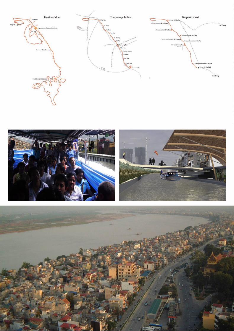
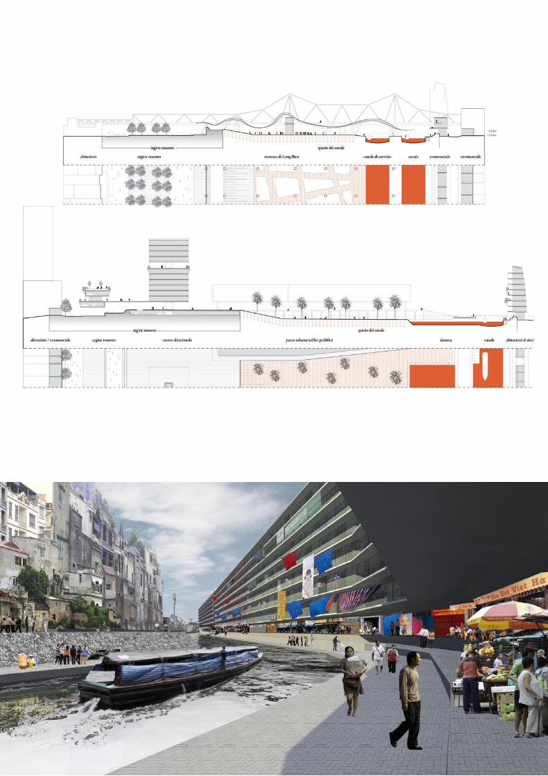
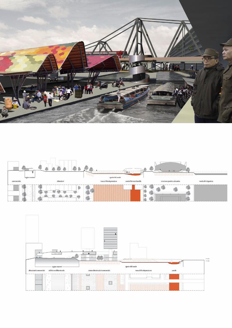
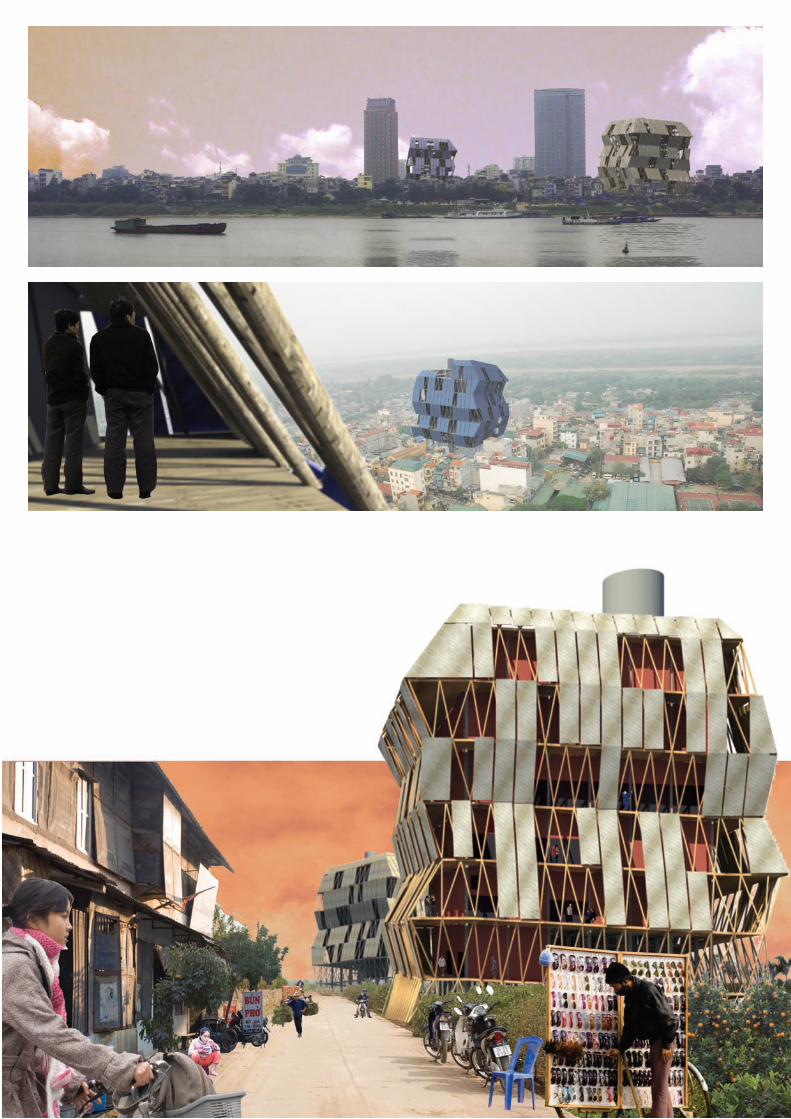
flict between population, government and foreign investers. Based on the conditions of illegality of many buildings, many projects have been proposed on this area. The last one, Hanoi municipality approved it, suggest to relocate peple living in the area, construct a new dyke and build a residential and directional district of anonymous skyscrapers. This would create a social, hydrological and economical disaster, that would reflects their consequences on the whole city.The thesis project work on the proposition of an intermediate dyke, at the level of +12,5m from river’s bed, height of reference for the flood with a retourn time of 50 years. That means to define a reference level that could regularize the present situation by giving more or less space to water in different situations. Under 12,5m level area is considered water space, the building existing here will be progressively substituted by special designed build-ing, that could co-exist and get advantage from the amphibious condition. New dike is realized with a navigable canal that cross
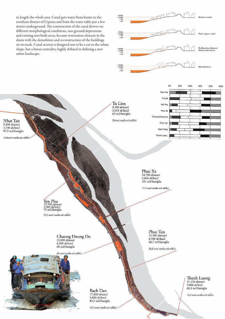
in length the whole area. Canal gets water from basins in the northern district of Ciputra and from the water table just a few meters underground. The construction of the canal derives on different morphological conditions, uses ground depressions and existing non-built areas, became restoration element in the slums with the demolition and reconstruction of the buildings on its track. Canal section is designed not to be a cut in the urban shape, but a linear centrality, highly defined in defining a new urban landscape.

Structure and form
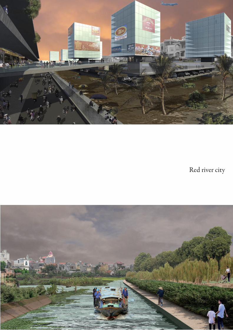
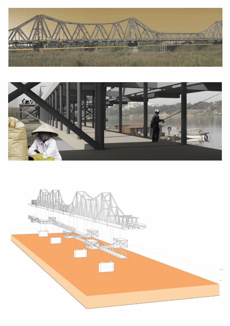
Red river city
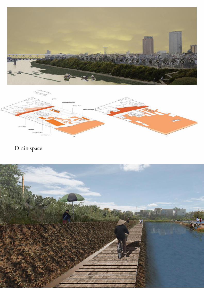
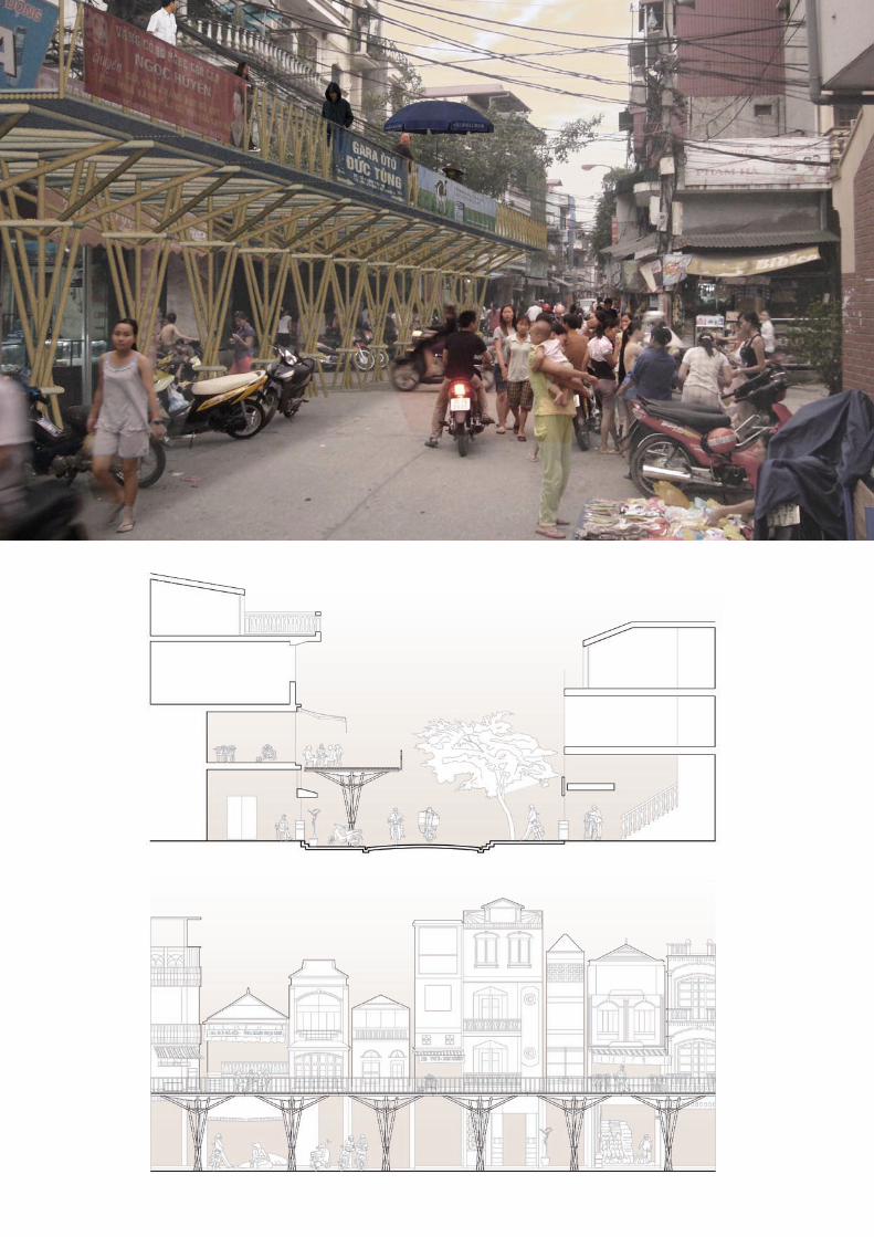
Drain space
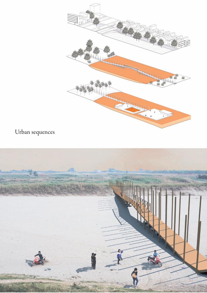
Urban sequences
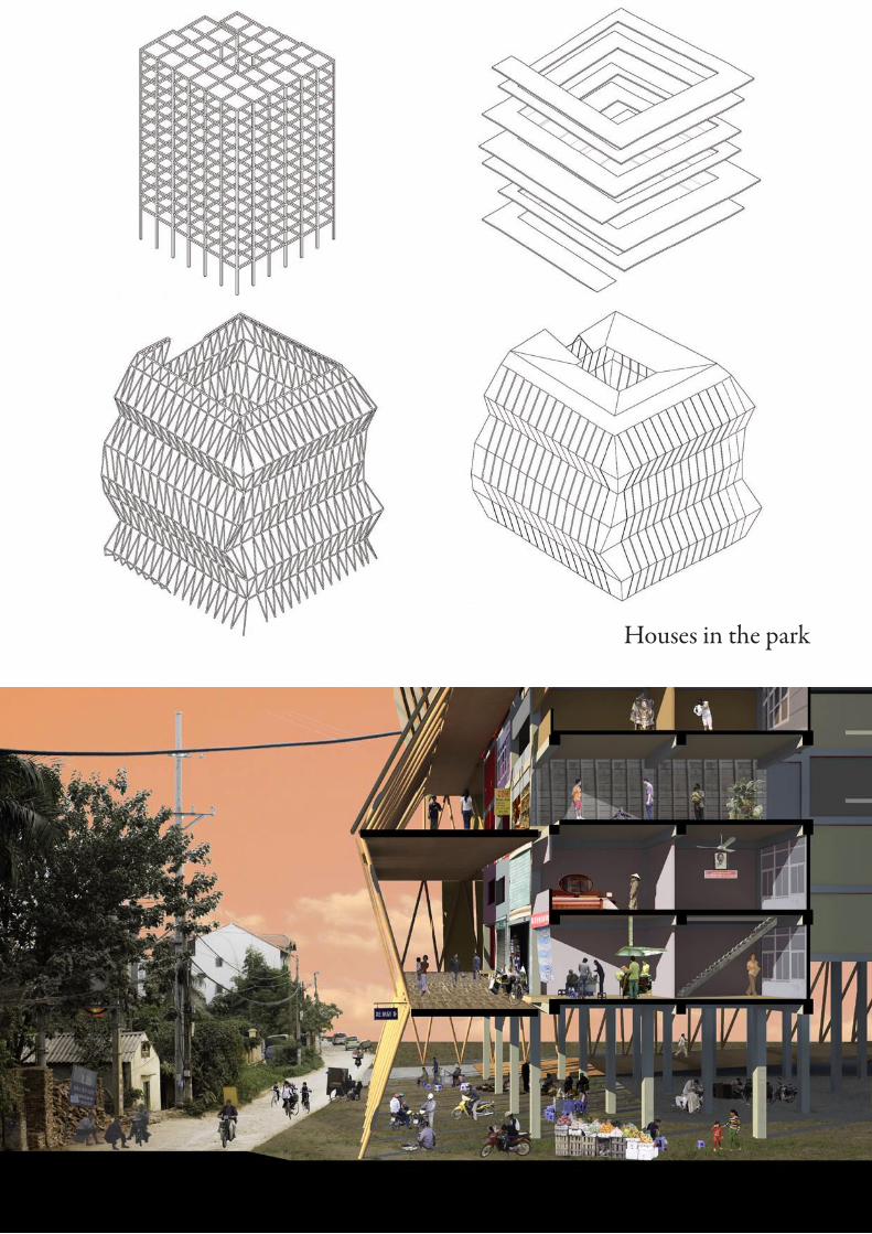
Houses in the park
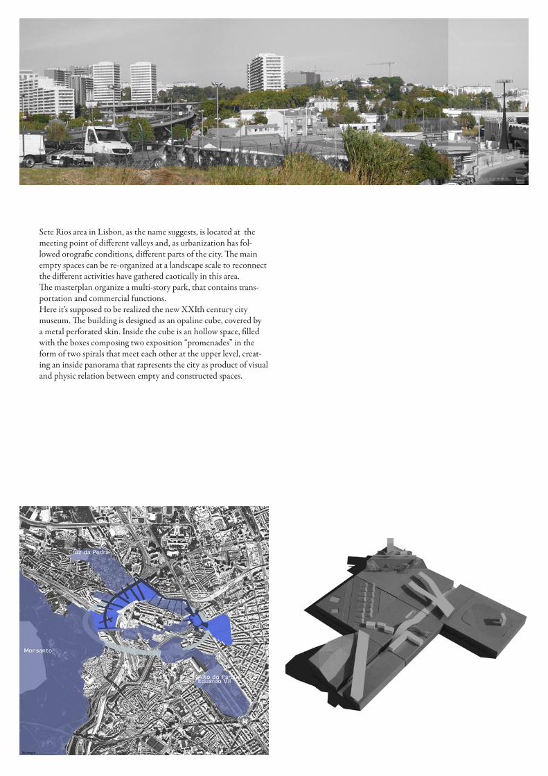
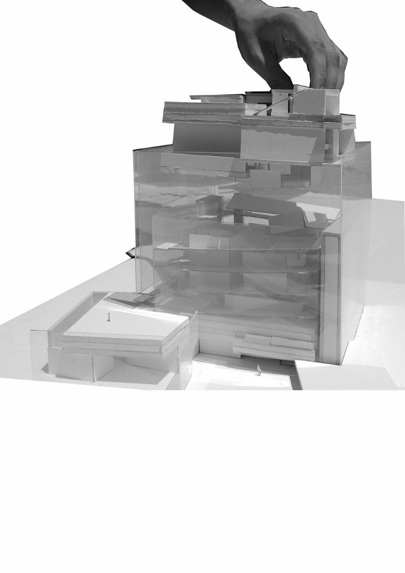
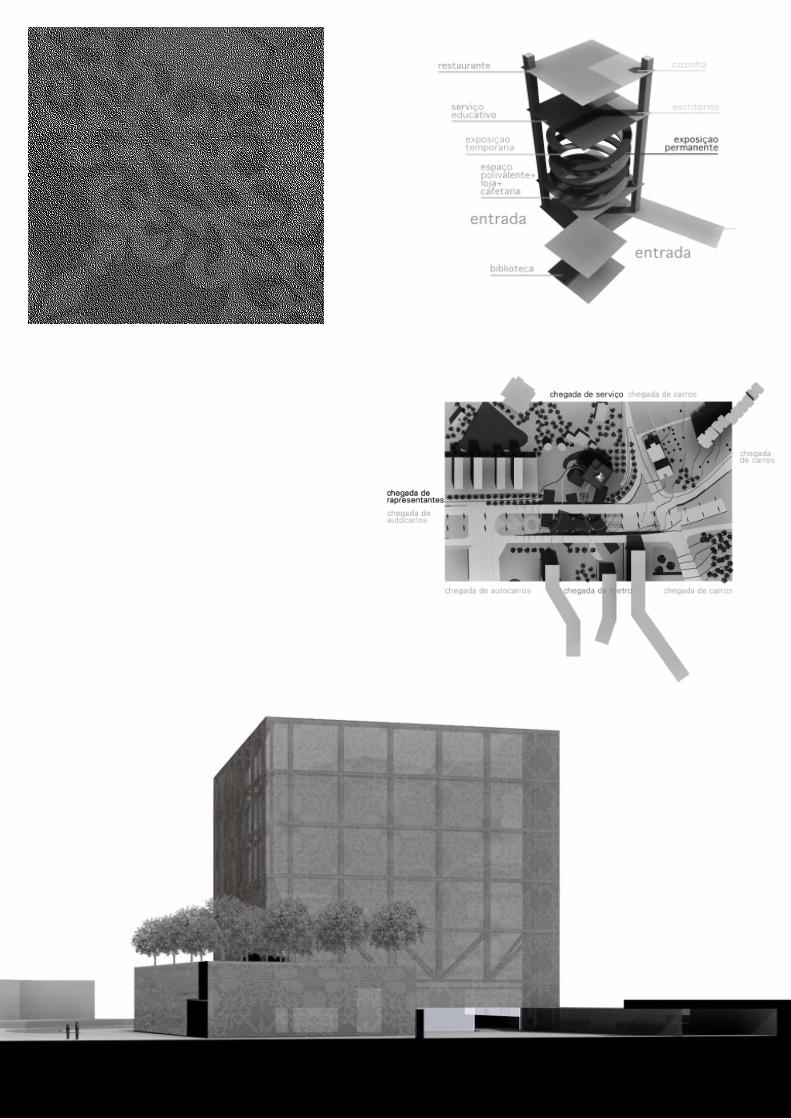
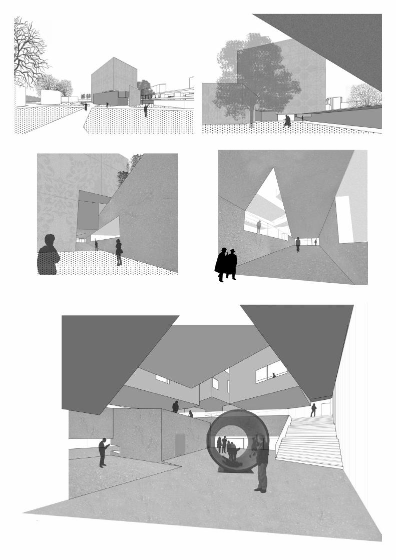
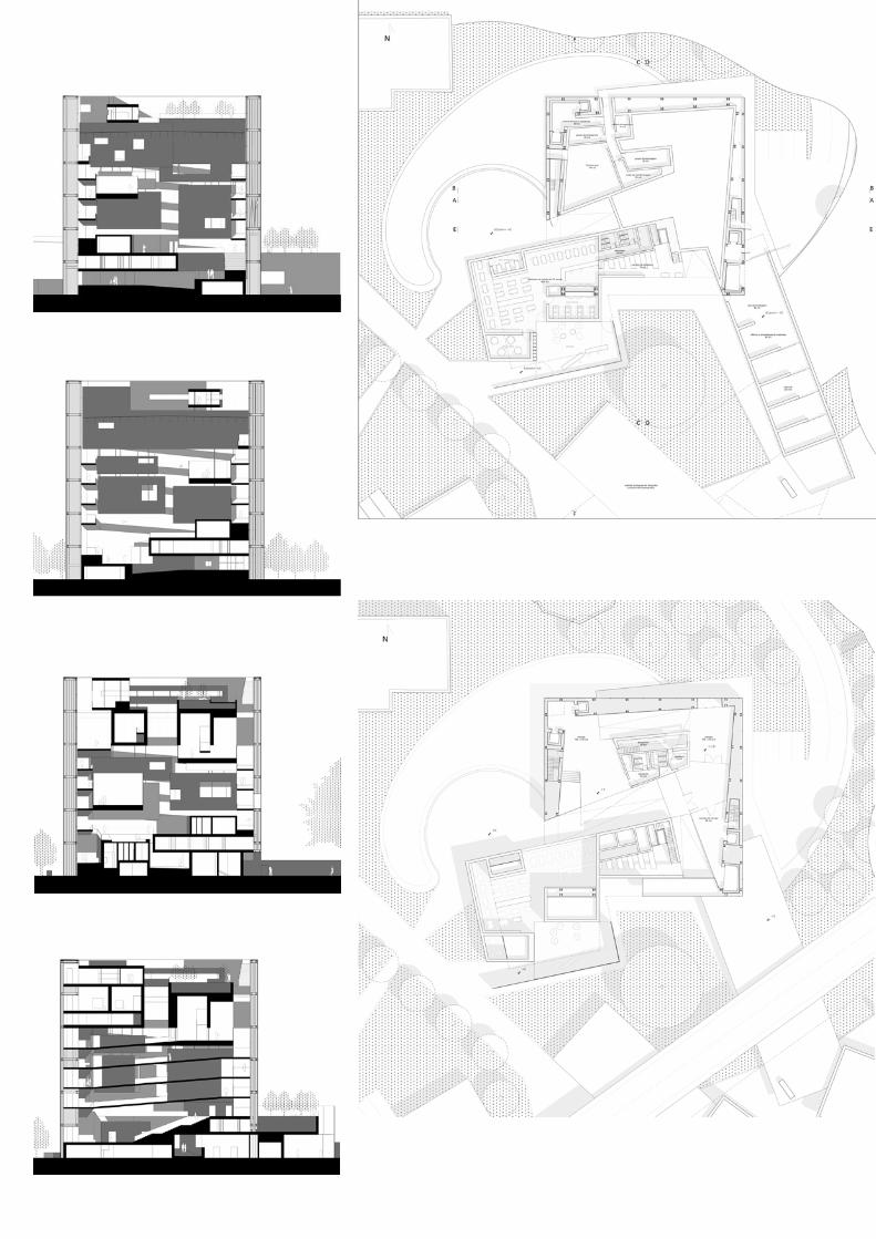
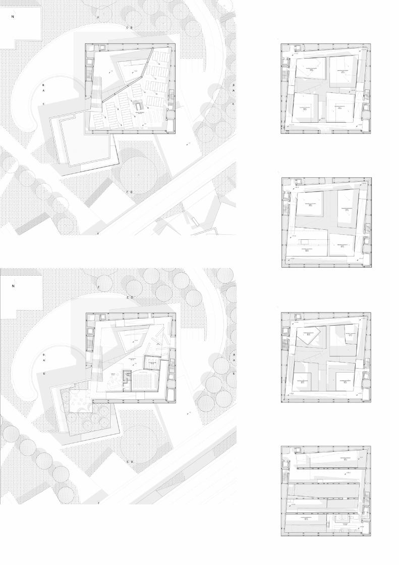
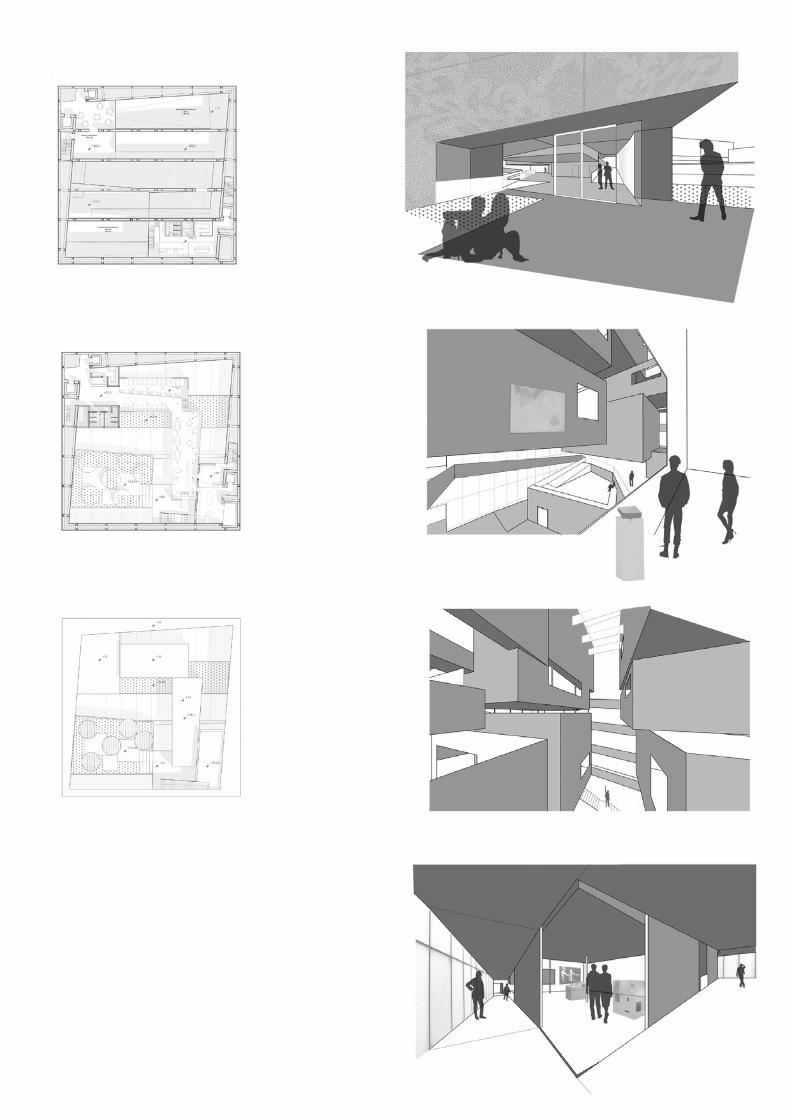
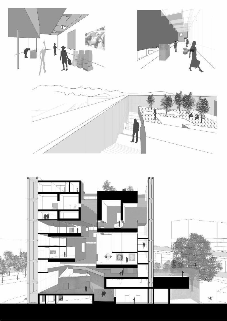
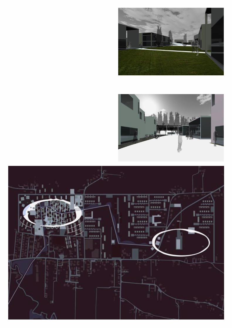
Sete Rios area in Lisbon, as the name suggests, is located at the meeting point of different valleys and, as urbanization has fol-lowed orografic conditions, different parts of the city. The main empty spaces can be re-organized at a landscape scale to reconnect the different activities have gathered caotically in this area.The masterplan organize a multi-story park, that contains trans-portation and commercial functions.Here it’s supposed to be realized the new XXIth century city museum. The building is designed as an opaline cube, covered by a metal perforated skin. Inside the cube is an hollow space, filled with the boxes composing two exposition “promenades” in the form of two spirals that meet each other at the upper level, creat-ing an inside panorama that rapresents the city as product of visual and physic relation between empty and constructed spaces.
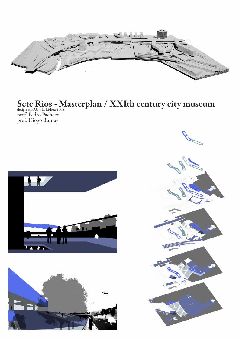
Sete Rios - Masterplan / XXIth century city museumdesign at FAUTL, Lisboa 2008prof. Pedro Pachecoprof. Diogo Burnay
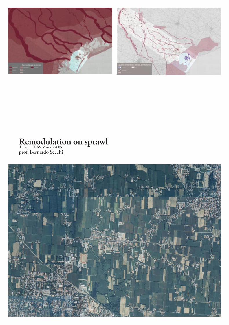
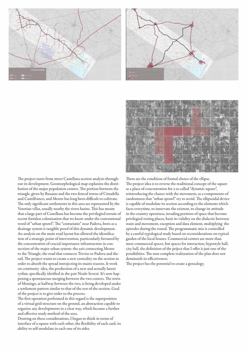
Remodulation on sprawldesign at IUAV, Venezia 2005prof. Bernardo Secchi
Remodulation on sprawldesign at IUAV, Venezia 2005prof. Bernardo Secchi
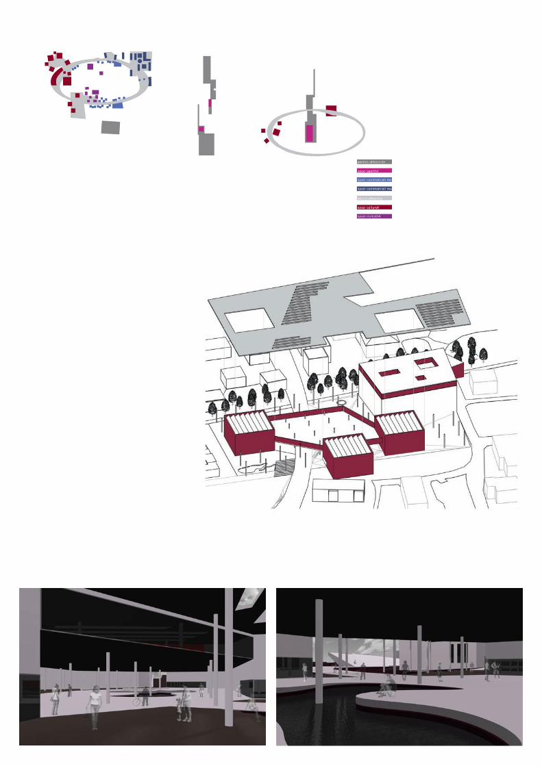
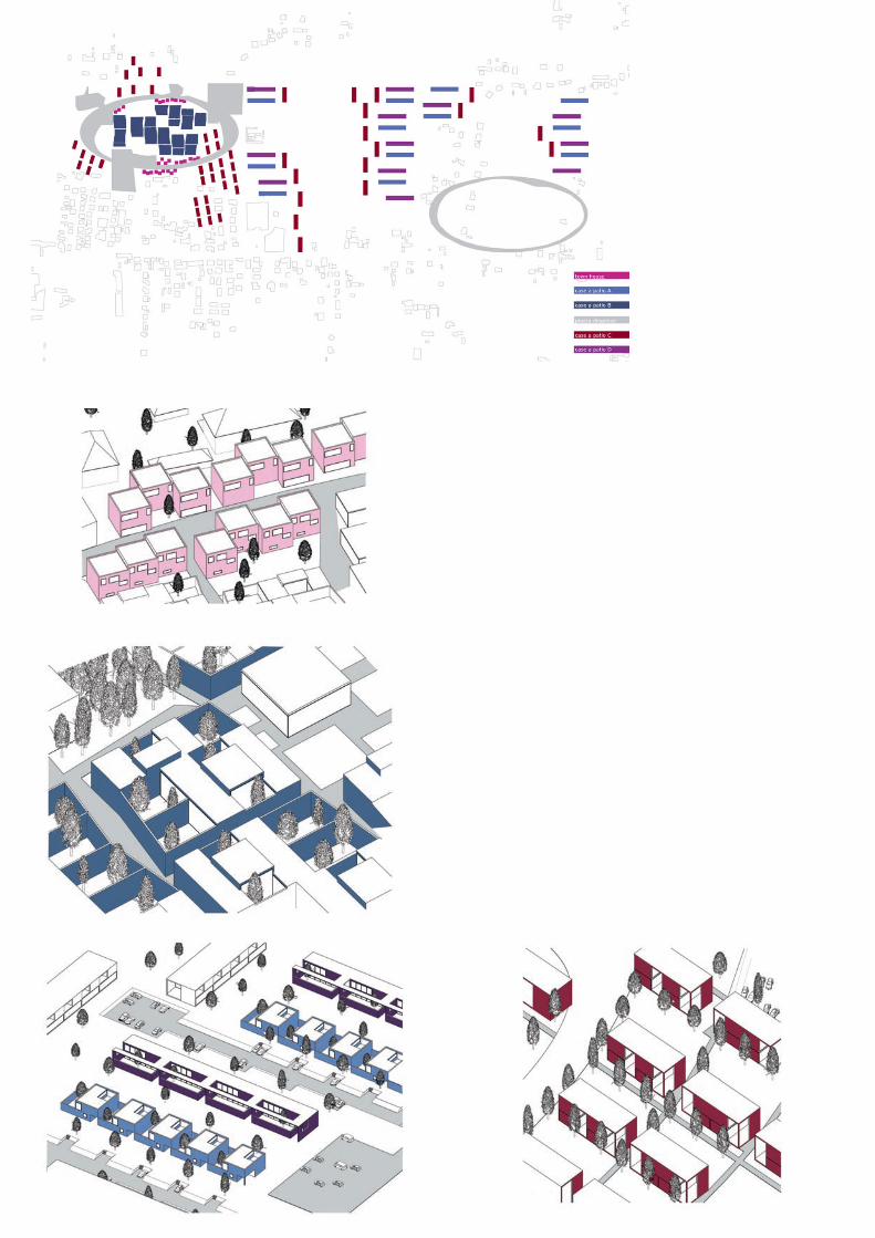
The project starts from street Castellana section analysis through-out its development. Geomorphological map explanins the distri-bution of the major population centers. The portion between the triangle, given by Bassano and the two fenced towns of Cittadella and Castelfranco, and Mestre has long been difficult to cultivate.The only significant settlements in this area are represented by the Venetian villas, usually nearby the rivers basins. This has meant that a large part of Castellana has become the privilegied terrain of recent formless colonization that we know under the conventional word of “urban sprawl”. The “centuriatio” near Padova, born as a drainage system is tangible proof of this dynamic development. An analysis on the main road layout has allowed the identifica-tion of a strategic point of intervention, particoularly favoured by the concentration of crucial importance infrastructure in con-nection of the major urban system: the axis connecting Mestre to the Triangle, the road that connects Treviso to Padova and the rail. The project wants to create a new centrality on the section in order to absorb the spread introjecting its mains reasons. It work on continuity idea, the production of a new and actually latent rythm, specifically idetified in the pair Noale-Scorzé. It’s now hap-pening a spontaneous merging between the two centers. The town of Moniego, at halfway between the two, is being developed under a settlement pattern similar to that of the rest of the section. Goal of the project is to give order to the process.The first operation performed in this regard is the superposition of a virtual grid structure on the ground, an abstraction capable to organize any developments in a clear way, which became a further and effective study method of the area.Drawing on these considerations, I began to think in terms of interface of a square with each other, the flexibility of each card, its ability to self-modulate in each one of its sides.
These are the condition of formal choice of the ellipse.The project idea is to reverse the traditional concept of the square as a place of concentration for a so called “dynamic square”, reintroducing the chance with the movement, as a componento of randomness that “urban sprawl” try to avoid. The ellipsoidal device is capable of modulate its section according to the elements which faces everytime, to innervate the existent, to change its attitude in the country openiness, invading portions of space that become privilegied resting places, basis its validity on the dialectic between stasis and movement, exception and data element, multiplying the episodes during the round. The programmatic mix is controlled by a careful typological study based on reconsiderations on typical garden of the local houses. Commercial centers are more than mere commercial spaces, but spaces for interaction, hypostyle hall, city hall, the definition of the priject that I offer is just one of the possibilities. The non-complete realizzation of the plan does not deminuish its effectiveness.The project has the potential to create a genealogy.
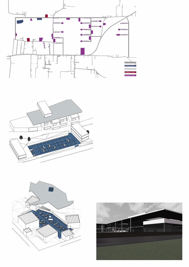
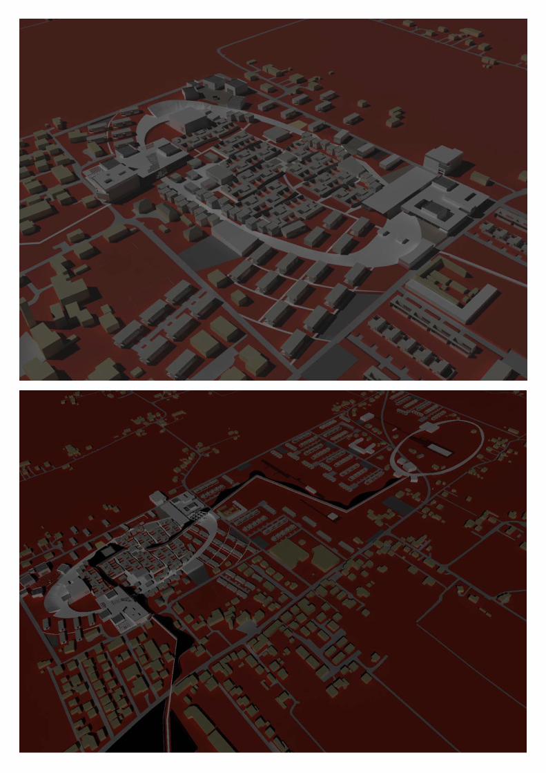
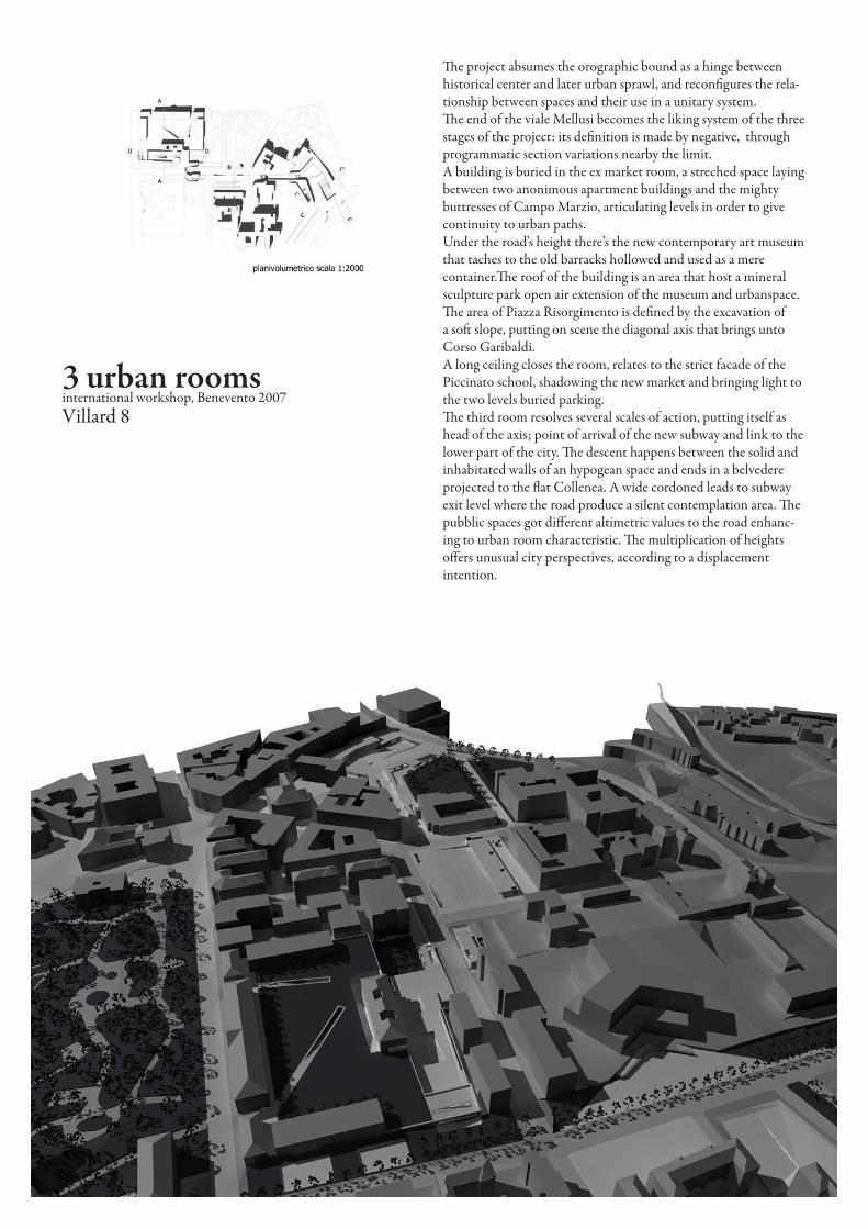
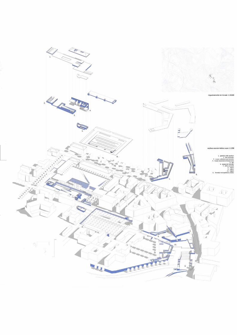
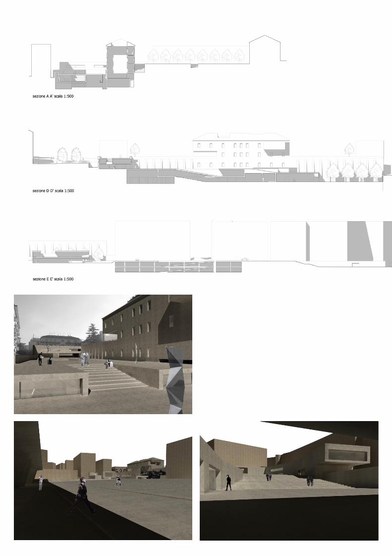
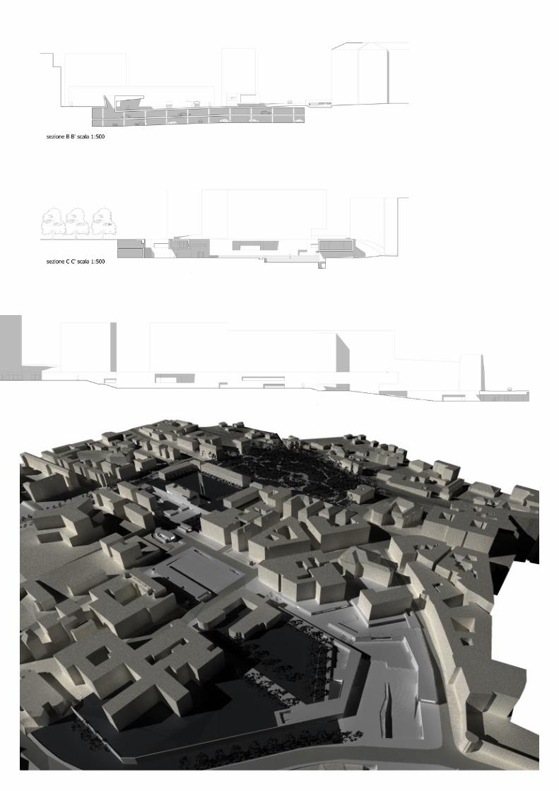
3 urban roomsinternational workshop, Benevento 2007Villard 8
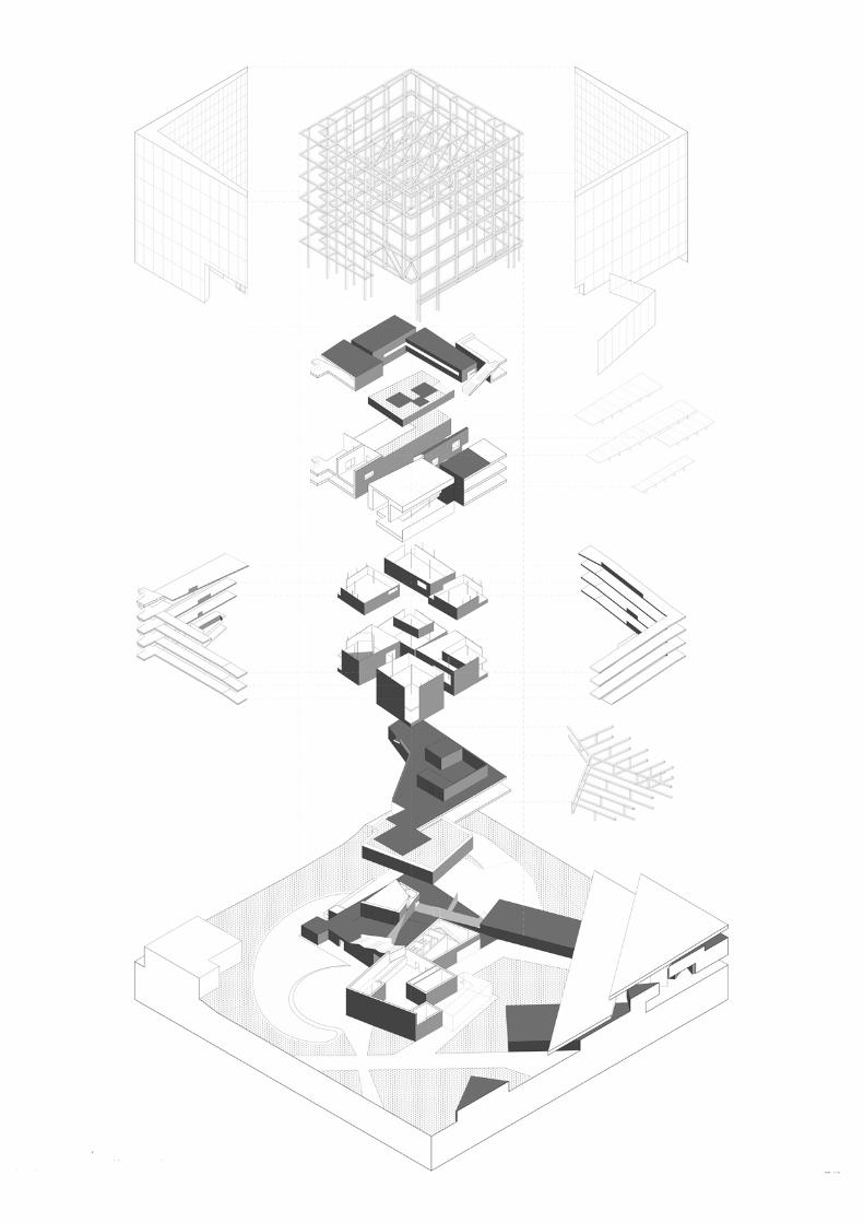
The project absumes the orographic bound as a hinge between historical center and later urban sprawl, and reconfigures the rela-tionship between spaces and their use in a unitary system.The end of the viale Mellusi becomes the liking system of the three stages of the project: its definition is made by negative, through programmatic section variations nearby the limit.A building is buried in the ex market room, a streched space laying between two anonimous apartment buildings and the mighty buttresses of Campo Marzio, articulating levels in order to give continuity to urban paths.Under the road’s height there’s the new contemporary art museum that taches to the old barracks hollowed and used as a mere container.The roof of the building is an area that host a mineral sculpture park open air extension of the museum and urbanspace.The area of Piazza Risorgimento is defined by the excavation of a soft slope, putting on scene the diagonal axis that brings unto Corso Garibaldi.A long ceiling closes the room, relates to the strict facade of the Piccinato school, shadowing the new market and bringing light to the two levels buried parking.The third room resolves several scales of action, putting itself as head of the axis; point of arrival of the new subway and link to the lower part of the city. The descent happens between the solid and inhabitated walls of an hypogean space and ends in a belvedere projected to the flat Collenea. A wide cordoned leads to subway exit level where the road produce a silent contemplation area. The pubblic spaces got different altimetric values to the road enhanc-ing to urban room characteristic. The multiplication of heights offers unusual city perspectives, according to a displacement intention.
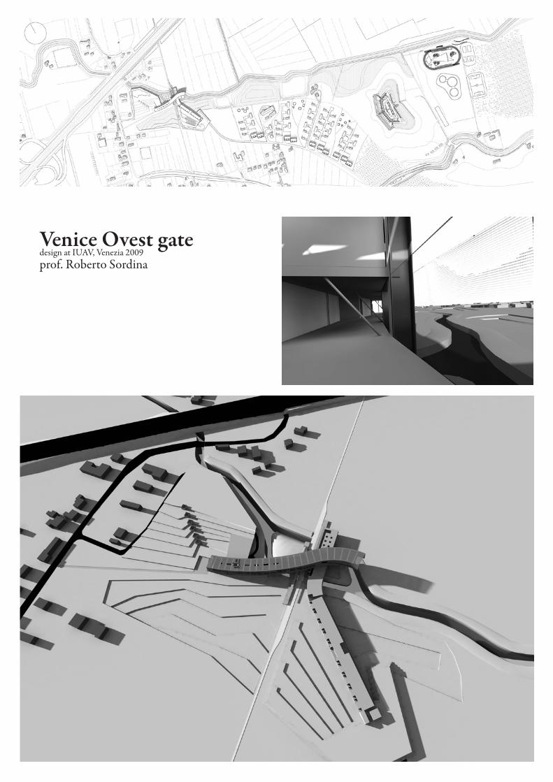
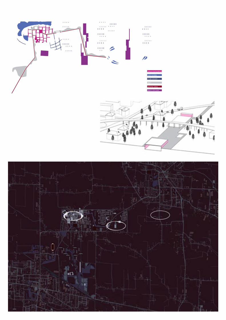
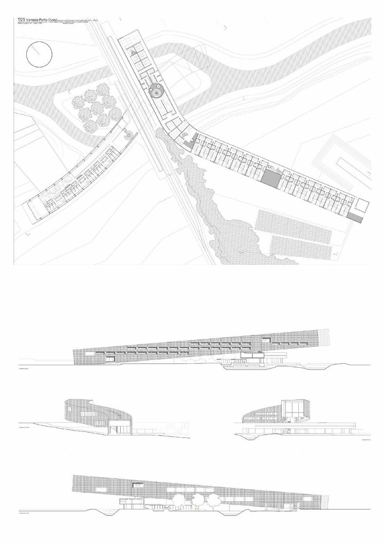
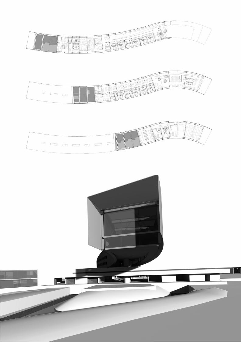
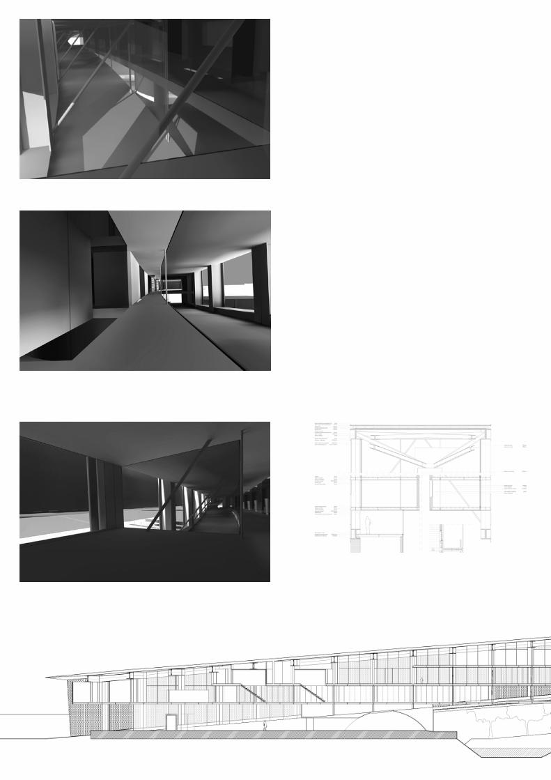
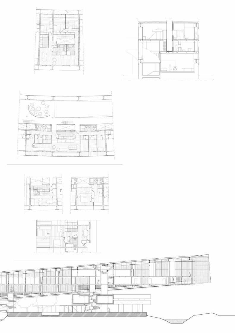
Venice Ovest gatedesign at IUAV, Venezia 2009prof. Roberto Sordina
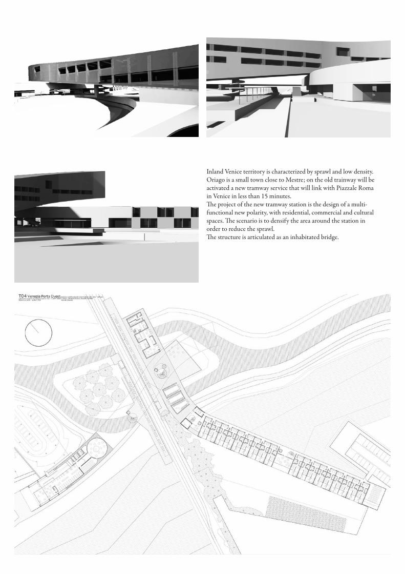
Inland Venice territory is characterized by sprawl and low density.Oriago is a small town close to Mestre; on the old trainway will be activated a new tramway service that will link with Piazzale Roma in Venice in less than 15 minutes.The project of the new tramway station is the design of a multi-functional new polarity, with residential, commercial and cultural spaces. The scenario is to densify the area around the station in order to reduce the sprawl.The structure is articulated as an inhabitated bridge.
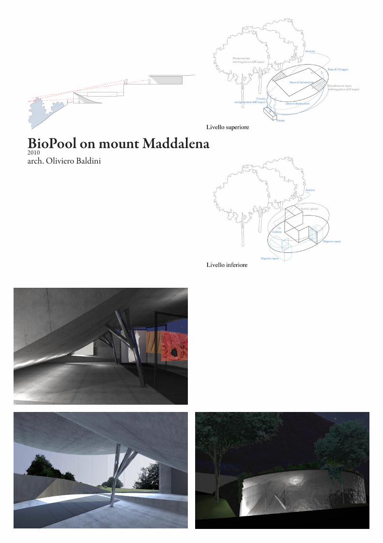
BioPool on mount Maddalena2010arch. Oliviero Baldini
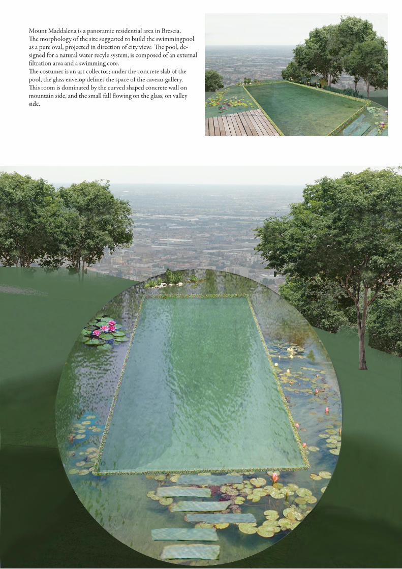
Mount Maddalena is a panoramic residential area in Brescia.The morphology of the site suggested to build the swimmingpool as a pure oval, projected in direction of city view. The pool, de-signed for a natural water recyle system, is composed of an external filtration area and a swimming core.The costumer is an art collector; under the concrete slab of the pool, the glass envelop defines the space of the caveau-gallery.This room is dominated by the curved shaped concrete wall on mountain side, and the small fall flowing on the glass, on valley side.
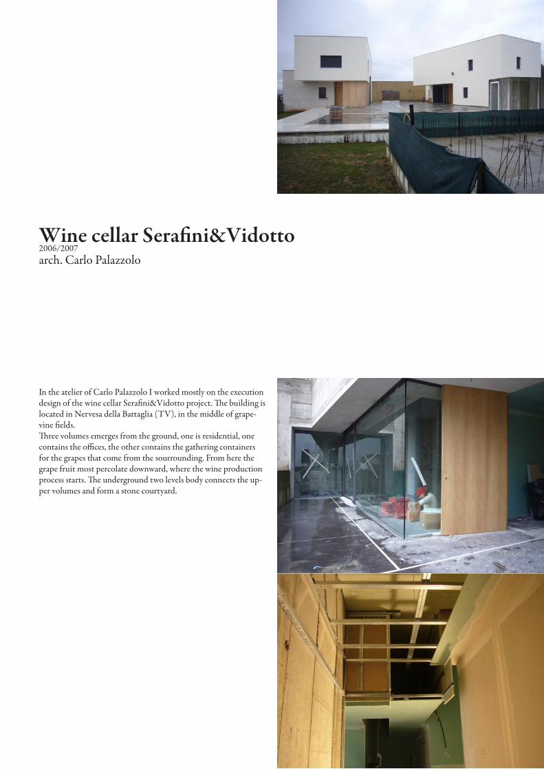
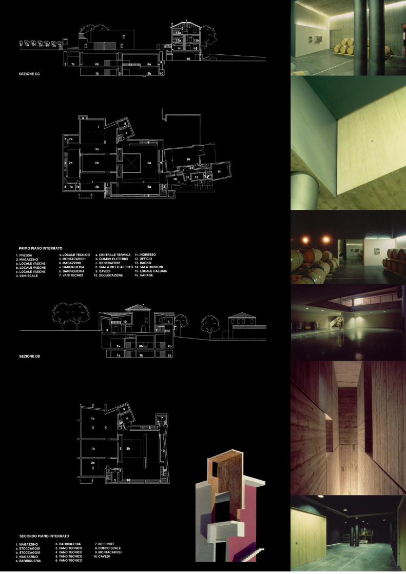
Wine cellar Serafini&Vidotto2006/2007arch. Carlo Palazzolo
In the atelier of Carlo Palazzolo I worked mostly on the execution design of the wine cellar Serafini&Vidotto project. The building is located in Nervesa della Battaglia (TV), in the middle of grape-vine fields.Three volumes emerges from the ground, one is residential, one contains the offices, the other contains the gathering containers for the grapes that come from the sourrounding. From here the grape fruit most percolate downward, where the wine production process starts. The underground two levels body connects the up-per volumes and form a stone courtyard.
portfolio2005/2010
marcello orlandini