Embed Size (px)
Citation preview
Maps
Township and Range

Key Terms
• Map: a flat representation of a globe
• Cartography - the art and science of mapmaking

SCALE
• Scale: the relationship between units on the map and actual distance on the ground
• Verbal Scale: one inch equals one mile
• Linear Scale: |---------|---------|----------|– or Graphic Scale
• Representative Fraction: 1:63,360

Latitude & Distance• Earth’s Circumference 24,840 miles• 24,840 divided by 360 degrees of a circle• One degree equals 69 miles• One degree can be divided into 60 parts or
minutes • 69 miles divided by 60 equals 1.15 miles• Therefore one minute equals 1.15 miles• One minute is a nautical mile (1.15 miles)
Latitude & Distance
• One minute can be further divided into 60 seconds
• One minute or 1.15 miles divided by 60 equals 102 feet
• Therefore one second equals 102 feet
• WHAT IS THE DISTANCE SHOWN ON A 15 MINUTE MAP?

Map Projections• Projection: The system used to transfer
locations from Earth’s surface to a flat map.
– A projection of an image onto another surface
• either a cylinder, a flat plane or a cone– 3 basic types of projections
– cylindrical projection– planular projection (also known as
azimuthal)– conical projection
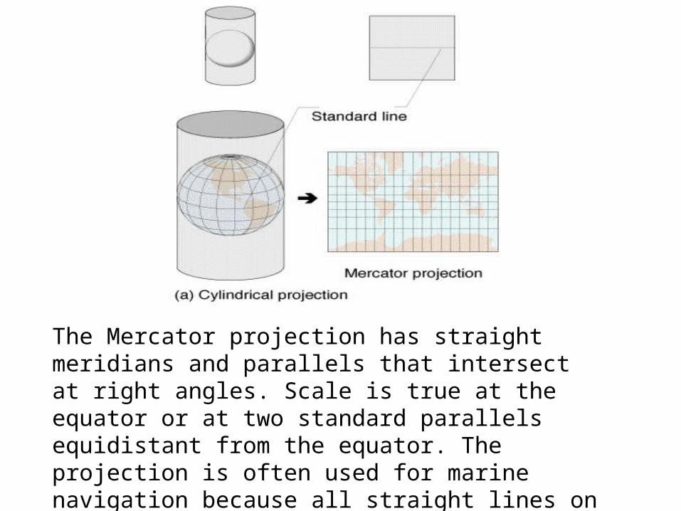
The Mercator projection has straight meridians and parallels that intersect at right angles. Scale is true at the equator or at two standard parallels equidistant from the equator. The projection is often used for marine navigation because all straight lines on the map are lines of constant azimuth.

CYLINDRICAL PROJECTIONused by navigators to show direction
Meridians run north & south
Parallels run east & west
Distortion on a Mercator map increases at Distortion on a Mercator map increases at an increasing rate as one moves toward an increasing rate as one moves toward higher latitudes.higher latitudes.
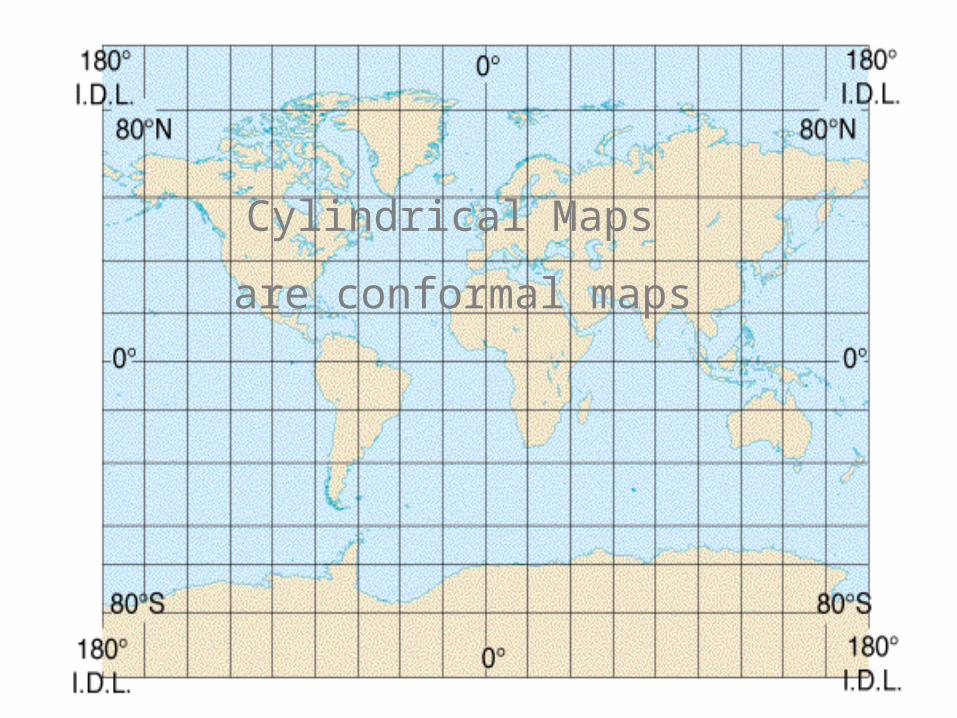
Cylindrical Maps
are conformal maps
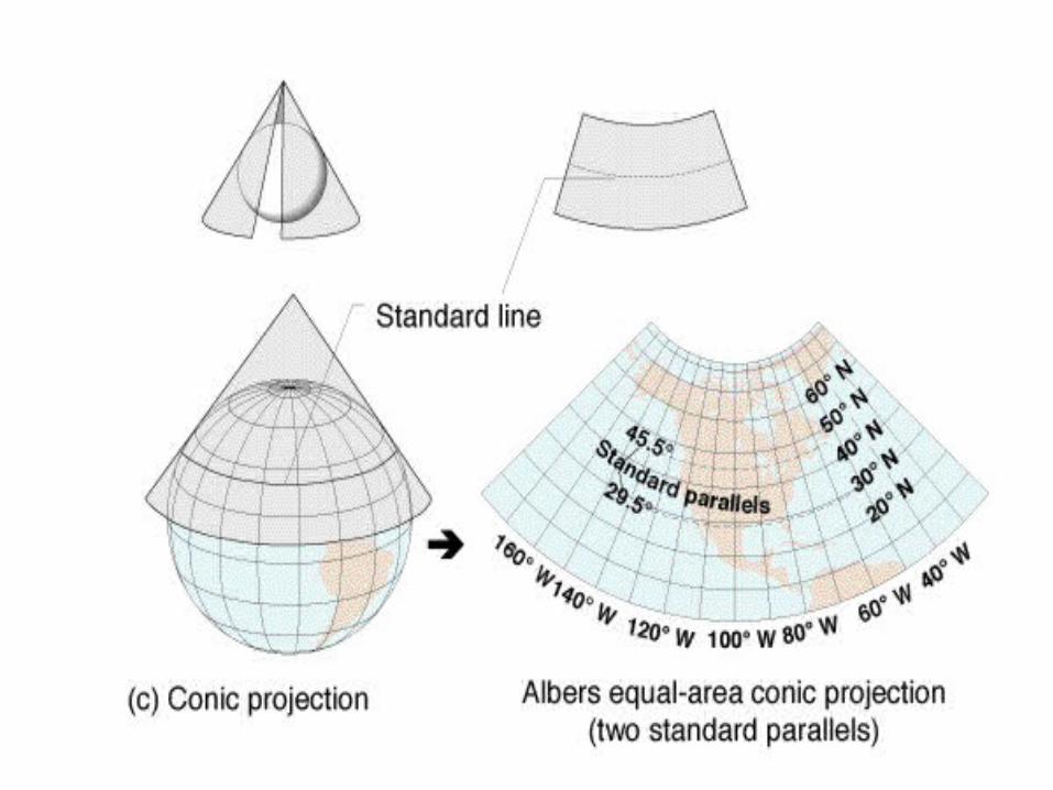

CONICAL PROJECTIONused for Mid-Latitude Maps
Also referred to as equal area maps
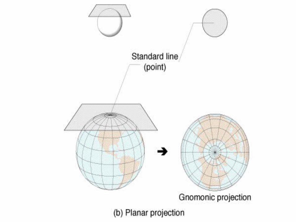

PLANULAR PROJECTIONused by pilots
Shows Great Circle Routes
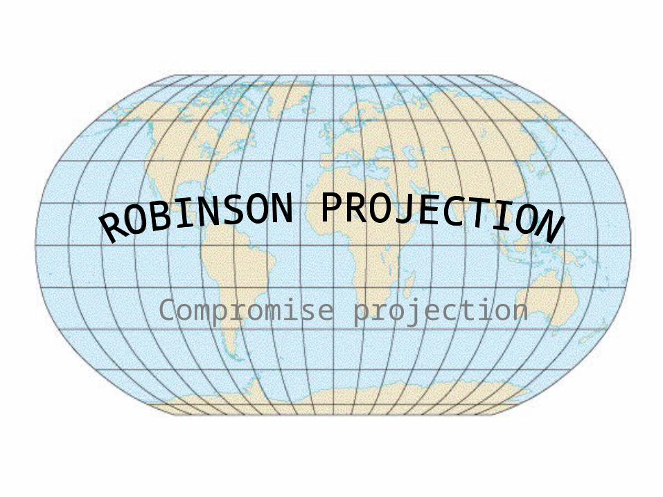
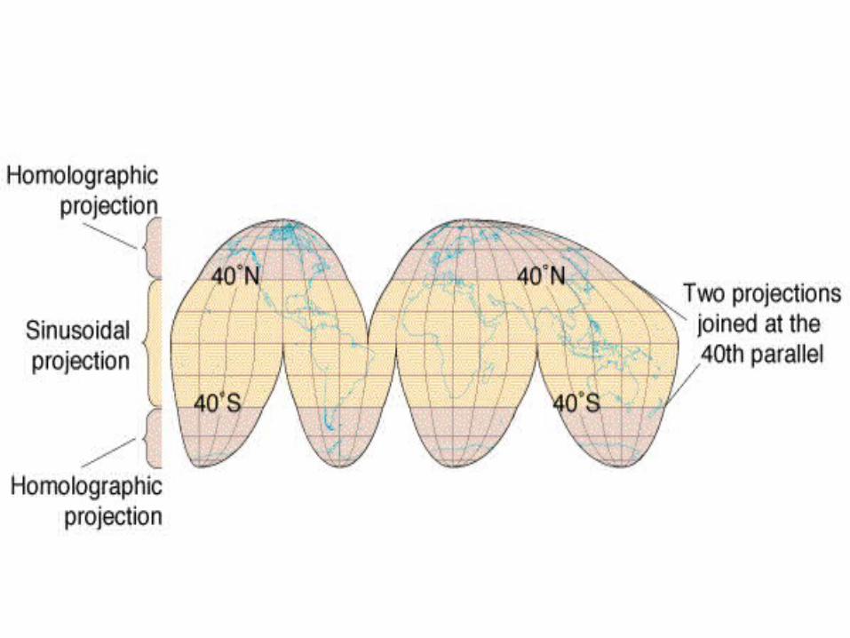
Compromise projection
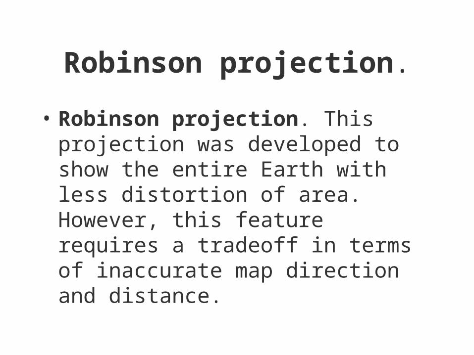
Robinson projection.
• Robinson projection. This projection was developed to show the entire Earth with less distortion of area. However, this feature requires a tradeoff in terms of inaccurate map direction and distance.

This projection is common in maps that require somewhat accurate representation of area. This map projection was originally developed for Rand McNally and Company in 1961.

Magnetic North
• The earth holds a mass of liquid, fluid mass of iron around the solid inner core
• This generates a powerful magnetic field within the earth that is generated into outer space

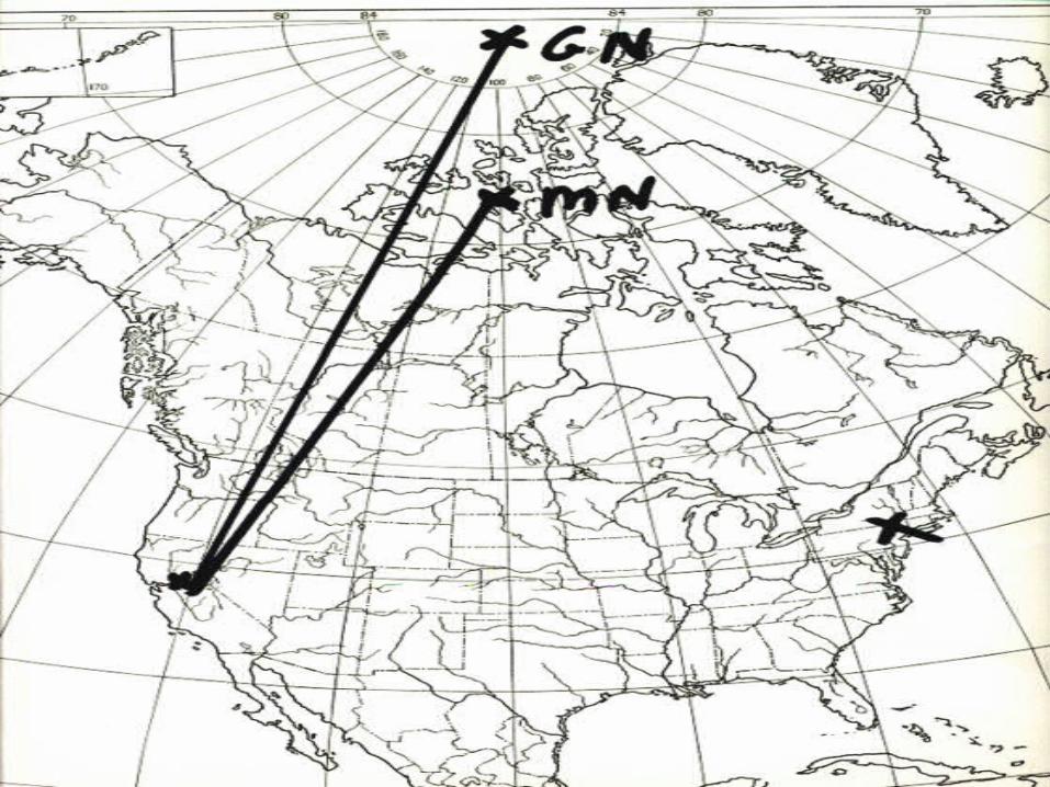
True North = Geographic North or North Pole
Magnetic North = where the compass points to
76N 102 W

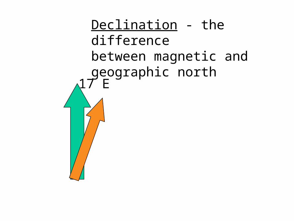
Declination - the difference between magnetic and geographic north
17 E
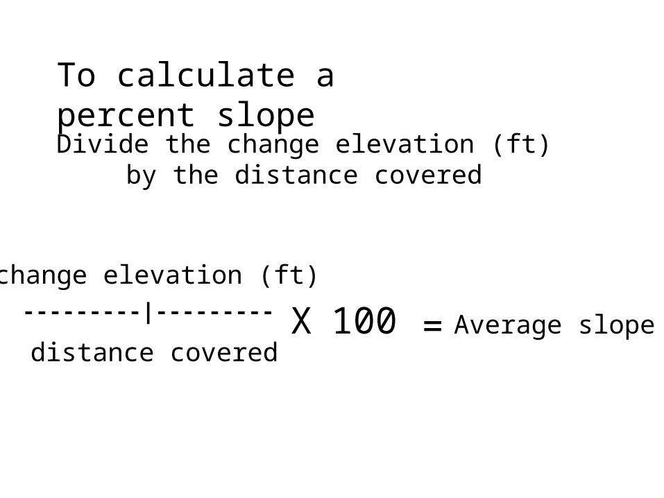
To calculate a percent slope
Divide the change elevation (ft) by the distance covered
---------|---------
change elevation (ft)
distance covered=X 100 Average slope

Township and Range System
The Township and Range system, sometimes called the Public Lands Survey System, was developed to help parcel out western lands as the country expanded.
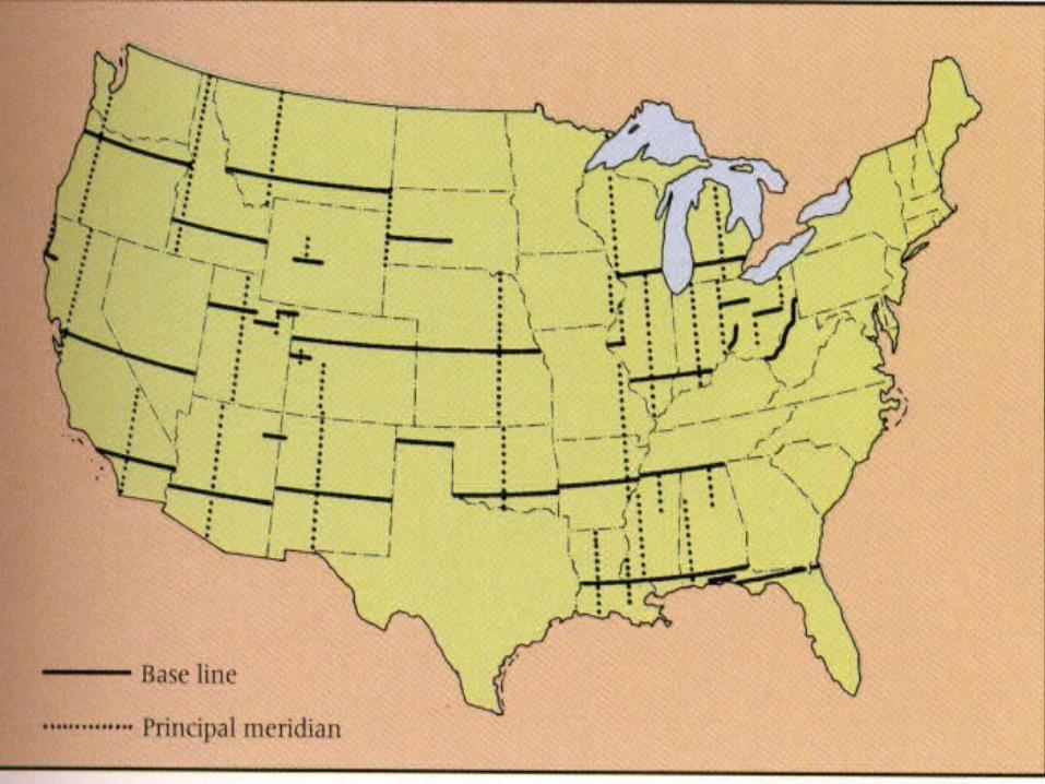
• The system takes many western states and divides them up using a base line and a principal meridian.
• This system divides the land up into townships and ranges that are 36 square miles each.
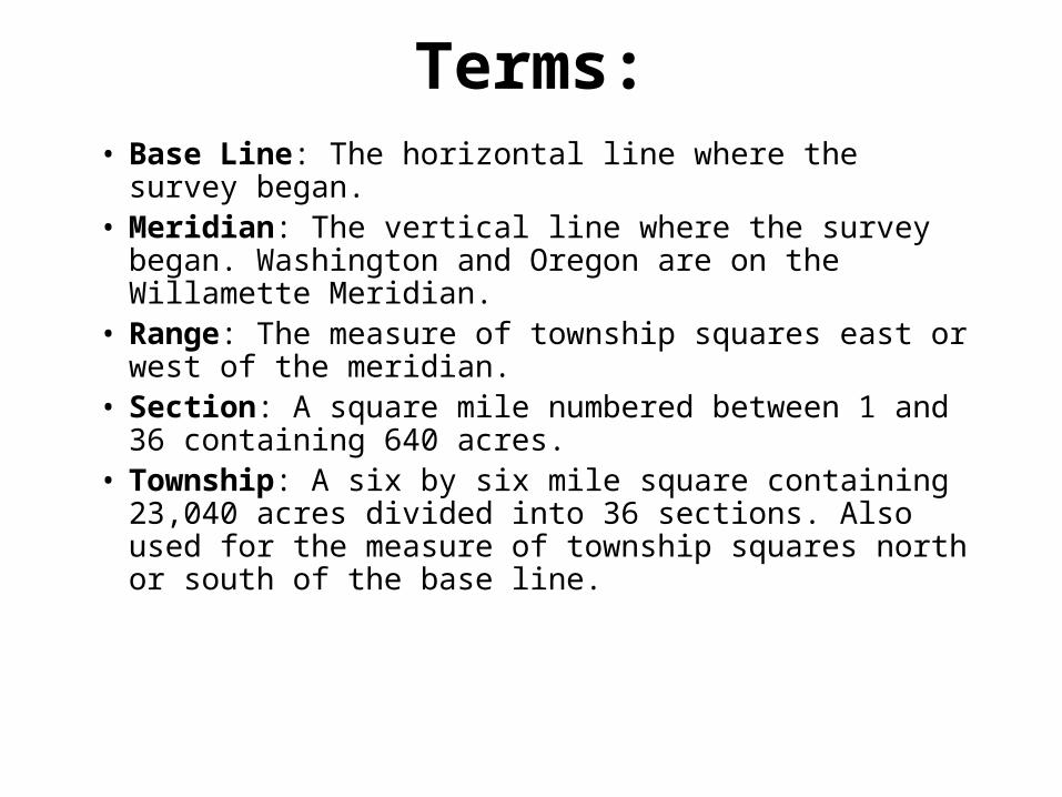
Terms:• Base Line: The horizontal line where the survey began. • Meridian: The vertical line where the survey began.
Washington and Oregon are on the Willamette Meridian.• Range: The measure of township squares east or west of
the meridian. • Section: A square mile numbered between 1 and 36
containing 640 acres. • Township: A six by six mile square containing 23,040
acres divided into 36 sections. Also used for the measure of township squares north or south of the base line.

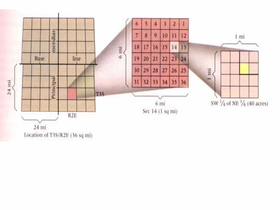
In the diagram, the square with the X in it would be defined as township 2 south (T.2S), range 3 east (R.3E). Each township and range is then subdivided into 36 sections.
• Each section is one mile square. Individual sections are then subdivided into half sections and quarter sections and so on.
• In the map below you can see sections 23, 24, 26 and 25 of T.22N, R.7E.
Township and Range System
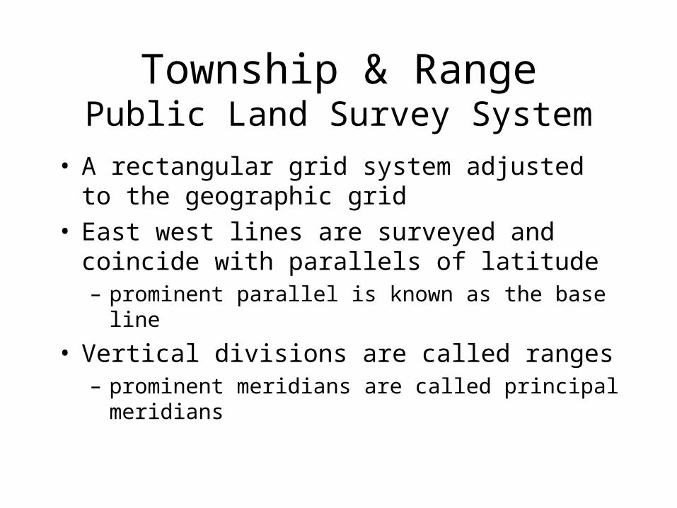
Township & RangePublic Land Survey System
• A rectangular grid system adjusted to the geographic grid
• East west lines are surveyed and coincide with parallels of latitude– prominent parallel is known as the base line
• Vertical divisions are called ranges– prominent meridians are called principal meridians

• Basic unit is the township– Approximately 6 miles square– 36 sections of one square mile– Plus allowances for road access
• Sections– 640 acres, more or less– 4 quarters, 160 acres, more or less– 16 legal subdivisions (lsds), 40 acres
Township & RangePublic Land Survey System
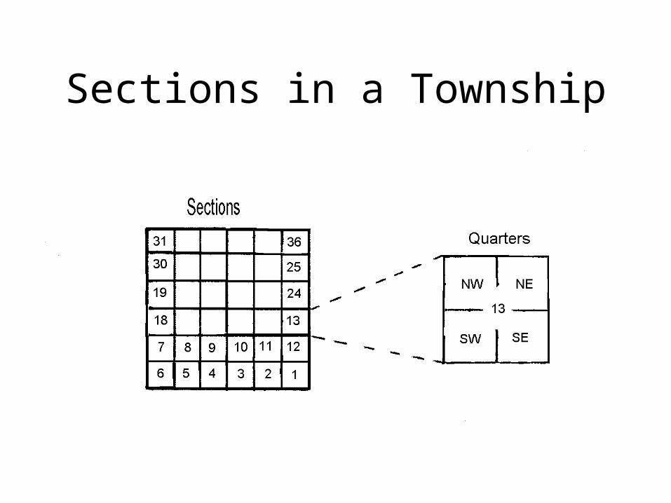
Sections in a Township
Layout of Townships
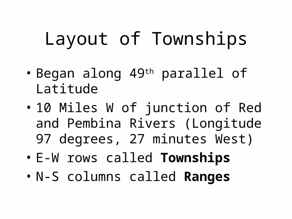
• Began along 49th parallel of Latitude
• 10 Miles W of junction of Red and Pembina Rivers (Longitude 97 degrees, 27 minutes West)
• E-W rows called Townships• N-S columns called Ranges


![RETHINKING CARTOGRAPHY CURRICULUM TO TRAIN THE ... · mapmaking and map use made popular in cartography by the Robinson era communication model [19-21]. Here, mapmaking describes](https://img.pdfslide.us/doc/110x75/5eccf168aac10b3e2304e311/rethinking-cartography-curriculum-to-train-the-mapmaking-and-map-use-made-popular.jpg)