Embed Size (px)
Citation preview

MapsMapsPage 6 in your GREEN
BOOKS—This will begin on Page 3 of your Student
Notebook.

Parts of a Map– Page 8
Title– What is your map telling you MAP KEY-What do the symbols mean? Compass Rose– What direction are things located. Scale– How far is one location to another Grid – What are the coordinates? Latitude and
Longitude? Look at the map on page 64– in your Green Text,
Identify the following parts of the map.

The World Political
Political maps show how people have divided places on the Earth into countries, states, cities and other units for the purpose of governing them.
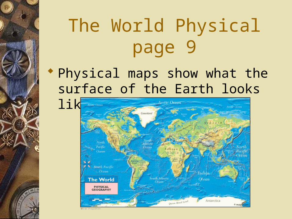
The World Physical page 9
Physical maps show what the surface of the Earth looks like.

Special Purpose Maps—Page 10 Special Purpose Maps are maps that show specific
details about a place or area. Special Purpose Maps can show: Climate—Temperatures in an area Weather: Types of weather Population Density: Population in an area. Natural Resource: Coal, Oil, Diamonds, ect. Historical Information: Example: Religion
Anything SPECIFIC to an area.

Directions
Look at the following maps found in your book on page RA 4 and RA7 of the United States. For Map 1– RA 4 and Map 2 RA 7
For Map 3 look on page 63 World Climate Regions
Answer the questions on your chart in your notebook.

World Religions Religious beliefs help define a people’s
culture, so to understand a people, it is important to consider what religions influence that group.

Mercator Projection Map Mercator Projection Map show correct
shape and directions but distorts distance and size. It is a map used by Navigators.
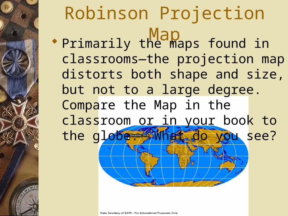
Robinson Projection Map Primarily the maps found in classrooms—
the projection map distorts both shape and size, but not to a large degree. Compare the Map in the classroom or in your book to the globe. What do you see?

Grid Maps A grid map is divided into squares
identified by letter and number to help people locate places or points of interest.
What is found on location C,3?
At what coordiante can you find Doritos? What about Snickers?
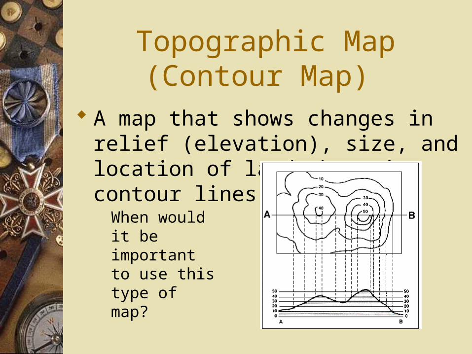
Topographic Map (Contour Map)
A map that shows changes in relief (elevation), size, and location of land, by using contour lines.
When would it be important to use this type of map?

Relief Map
Used to show various elevation of the land in an area. What do you notice about the colors of the relief map? What does this mean?

Map Review What is the purpose of a Political map?
To show borders of countries, states, cities

Map Review What is the purpose of a Physical map? Physical maps show what the surface of
the world looks like

Map Review What are the four major oceans of the
world? Atlantic Pacific Arctic Indian

Map Review Why is it important to understand a
peoples religion? because religion helps shape their culture

Maps and Globes
MAPS: FLAT Projection Lines of Latitude and Longitude Maps are 2-Dimentional Globes are 3-Dimentional

MAPS
Produced at any scale desired—Any size; and the larger the scale, the less the effect of distortion.Maps can provide detailed information and provide topographical data in much more detail that a globe.Maps are easier to prepare, and can be modified as physical or political situations change (road maps, for example)

GLOBES Shape of a sphere No Distortion, you can see how large/small
countries are in comparison. Globes give a good, visual indication of the earth's surface, the shape of the continents, and their relative positions, and gives a true representation;
Lines of Longitude all the way from South Pole to North Pole

Maps Continued….
However; all maps distort the shape or size of landforms; particularly on a global scale. They either distort the shape of the land, or the size of the continents. Greenland may appear to be the same size as Africa on a global map, but it is in fact a lot smaller.

Maps & Globes
Show visual representation of an area. Show space between continents and regional areas Directions are North, South, East, and West Show 4 Major Oceans—Arctic, Pacific, Atlantic,
and Indian Show 7 Major land masses: North America, South
America, Europe, Asia, Africa, Antarctica, and Australia
Show Equator and Latitude and Longitude