Embed Size (px)
Citation preview
Maps & GlobesMaps & Globes
Basic map components, Basic map components, types, & projectiontypes, & projection
Basic Map ComponentsBasic Map Components
Compass Rose- Compass Rose- shows the shows the cardinal cardinal directions: north, directions: north, east, south, east, south, west. west.
Up is not a Up is not a direction on a direction on a map!map!
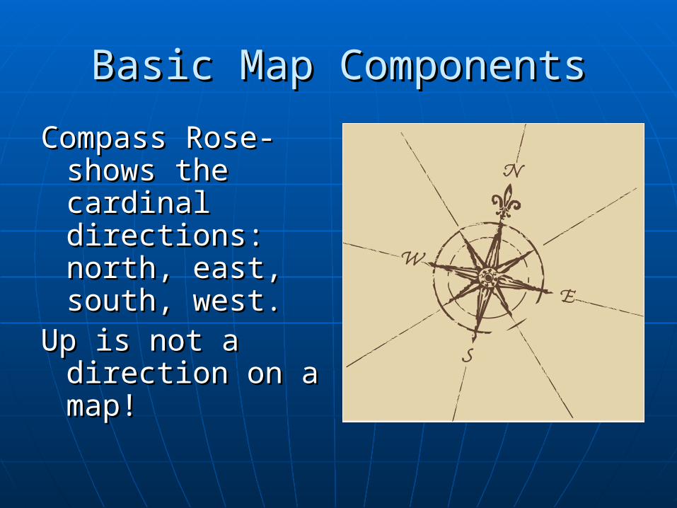
Basic Map ComponentsBasic Map Components
Legend/Key- Legend/Key- shows the shows the meanings of meanings of symbols on a symbols on a map.map.
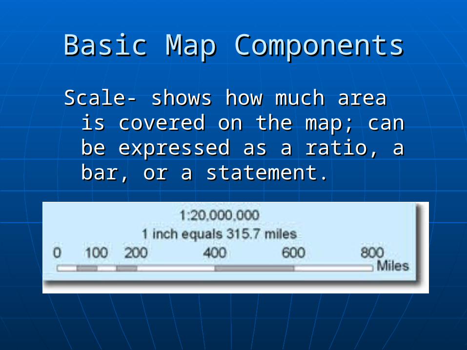
Basic Map ComponentsBasic Map Components
Scale- shows how much area is Scale- shows how much area is covered on the map; can be covered on the map; can be expressed as a ratio, a bar, or a expressed as a ratio, a bar, or a statement.statement.
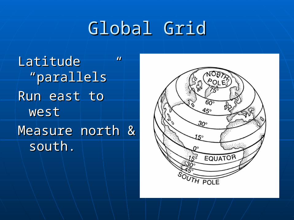
Global GridGlobal Grid
Latitude Latitude “parallels”“parallels”
Run east to westRun east to west
Measure north & Measure north & south.south.
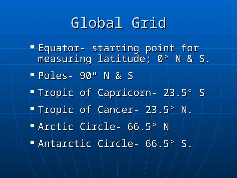
Global GridGlobal Grid
Equator- starting point for Equator- starting point for measuring latitude; 0º N & S.measuring latitude; 0º N & S.
Poles- 90º N & SPoles- 90º N & S
Tropic of Capricorn- 23.5º STropic of Capricorn- 23.5º S
Tropic of Cancer- 23.5º N.Tropic of Cancer- 23.5º N.
Arctic Circle- 66.5º NArctic Circle- 66.5º N
Antarctic Circle- 66.5º S.Antarctic Circle- 66.5º S.
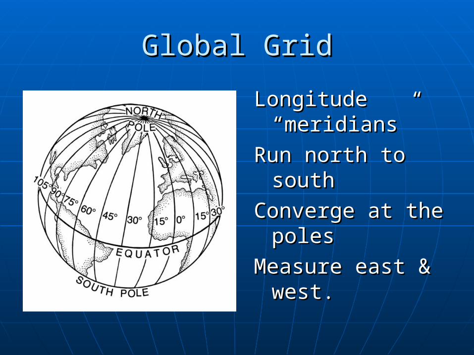
Global GridGlobal Grid
Longitude Longitude “meridians”“meridians”
Run north to southRun north to south
Converge at the Converge at the polespoles
Measure east & Measure east & west. west.
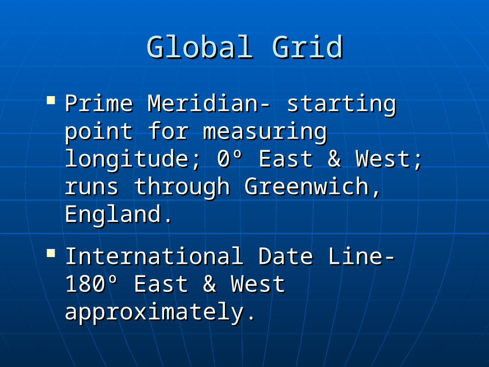
Global GridGlobal Grid
Prime Meridian- starting point Prime Meridian- starting point for measuring longitude; 0º East for measuring longitude; 0º East & West; runs through & West; runs through Greenwich, England.Greenwich, England.
International Date Line- 180º International Date Line- 180º East & West approximately.East & West approximately.
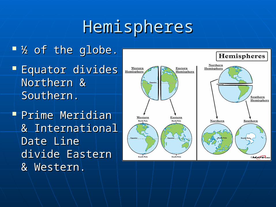
HemispheresHemispheres ½ of the globe. ½ of the globe.
Equator divides Equator divides Northern & Northern & Southern.Southern.
Prime Meridian Prime Meridian & International & International Date Line divide Date Line divide Eastern & Eastern & Western.Western.
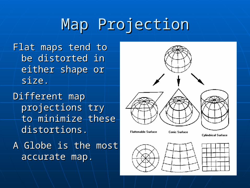
Map ProjectionMap Projection
Flat maps tend to Flat maps tend to be distorted in be distorted in either shape or either shape or size.size.
Different map Different map projections try to projections try to minimize these minimize these distortions.distortions.
A Globe is the most A Globe is the most accurate map.accurate map.
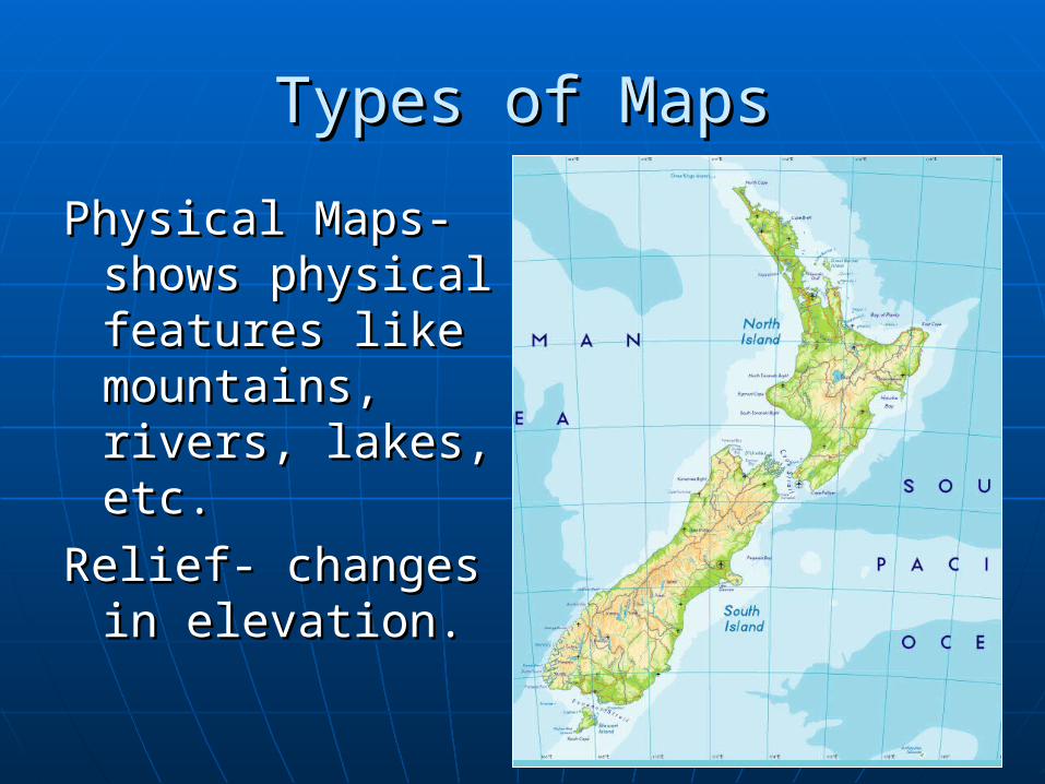
Types of MapsTypes of Maps
Physical Maps- Physical Maps- shows physical shows physical features like features like mountains, mountains, rivers, lakes, etc. rivers, lakes, etc.
Relief- changes in Relief- changes in elevation. elevation.
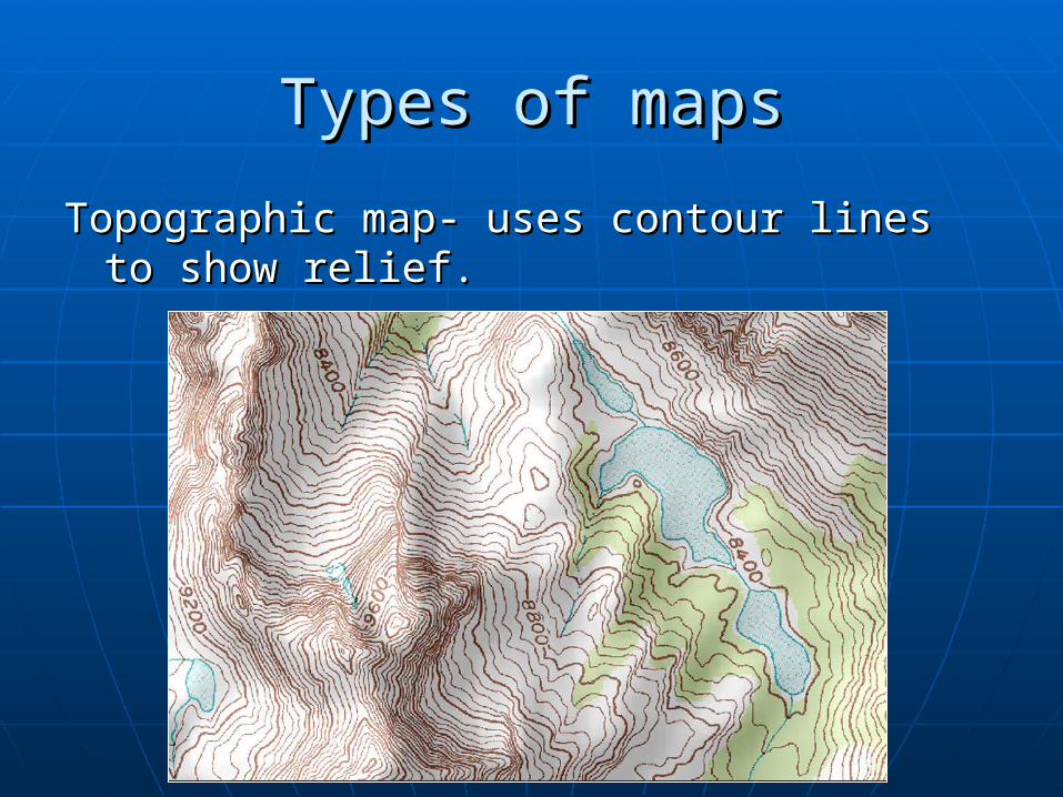
Types of mapsTypes of maps
Topographic map- uses contour lines to Topographic map- uses contour lines to show relief.show relief.
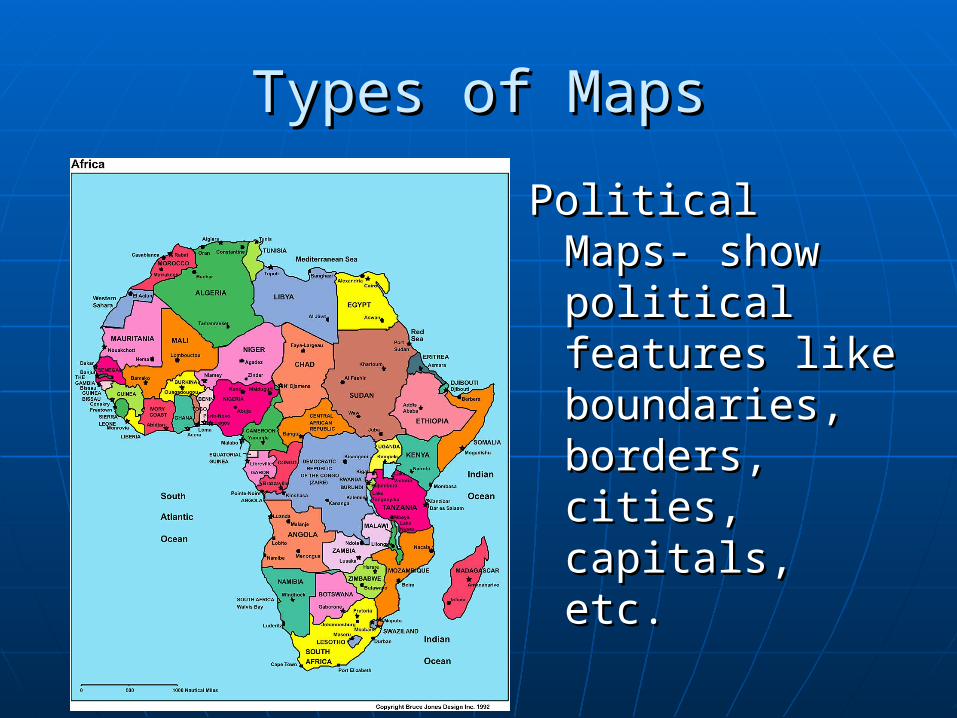
Types of MapsTypes of Maps
Political Maps- Political Maps- show political show political features like features like boundaries, boundaries, borders, cities, borders, cities, capitals, etc.capitals, etc.
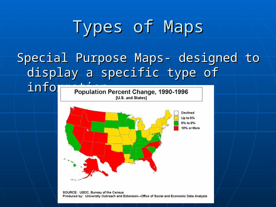
Types of MapsTypes of Maps
Special Purpose Maps- designed to Special Purpose Maps- designed to display a specific type of information.display a specific type of information.
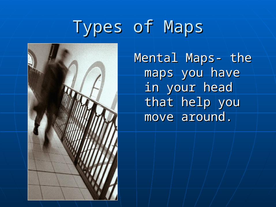
Types of MapsTypes of Maps
Mental Maps- the Mental Maps- the maps you have in maps you have in your head that your head that help you move help you move around.around.
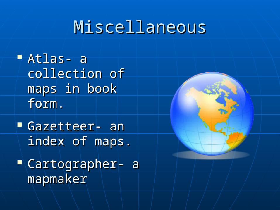
MiscellaneousMiscellaneous
Atlas- a collection of Atlas- a collection of maps in book form.maps in book form.
Gazetteer- an index Gazetteer- an index of maps.of maps.
Cartographer- a Cartographer- a mapmakermapmaker