Embed Size (px)
Citation preview
MM ANG
VA
ÃC
GM
E
IJ
V
A
UC
ISOL
T
TA R
ICOM
RPI
DOO
ADA
O
LC
CO PA
AAG
U R CA
A
OOGOTA
NB A L
BF EME
O A
B
A
NTRO
B O S
A A
A
CE T E
ATÚ
IDADE
L PAN
S
S
O
E
NCOSMETMAI
T
G
Á
Á VE A
AUH
JA
GAL
RDIN BO
L IPANEMA
OTÂ
EBLON
NI C
TEREZATÁCIO
V A
DEAC
T
S
R C ÃN
S
CO
O
RISTÓ
VÃO
S AN
CT U
M BI
A
T O C
C
R IST O
G
LA RV ELHO A N JEI RAS
LÓRF LAME
N GO
I A
DABEN
M
M
ROCH
A
FICA G A
MA
UINH
A
A
A
A A
ISAÍB EL
N
V ILAGUE
PRAÇABANDEI
RADA
IRA
O
A
AC JÚ
R
J AN
OCEAN
OECAN
OE
GUA N AA AÍ
B
B
ARAIRO
NRITE ÓI
ATLÂN T ICO
DE
RWO
A AR
I ISO LBLAGOA DEITAIPÚ
PLAGO
DEA I IIRAT N NG
A
P DE
DE
ÃO
A ÇÚCRA
L
DE
ODRIGOAGOA
RFREITAS
P OO
NTE
N TER
RÓI
II
SAN TA
RAABÁRB
ILHA NITERÓI
BRASIL
DASNXA
AEROPORTOSANTOSDUM
ONTDASE
M.
ATÁ
SÃO
DOM
M
INGOS
CENTRO
P ON T
AILH A D A
CONC EI
OL URENÇO
ÇÃ
SÃO
O
SAN TA
A N
BA RREENGE
NHOCA
J DI
BAL DE
ADOR SANTA
BÁRBARA M ARIAPA
ÃULA
M AT A
PACA
V I LA
PRO
O
G
E SS
MURI
QUI
RI ODO
C
OURO
SE
E
RRGR
R
AA
NDE
ENG E NHOD0
MATO
MARAVISTA
S
S
ANTOA
P
CHARITAS
SÃO FRAN
C I SC O MAC
EIÓ
CAFUBÁJ A CA R ÉCA
NTAGALO
B A DULAV
C
I
IE
CHO
RA
A R
ADOURO
RGODA
BAT AA T
SAPÊITITI OC
C AAR M UJOFONS OLAÇN
GS OOECA
CUBA NGO
JARDIMSA ANT
RVLIT
BRAZ ILA
ICINGÁ ARA ÍOABVIA GE
O SA
JD.FÁT I
AM
PEQUEN O A
J ARDIM
I MB U
ÍJ URU
J UBA I RA
T I N I NGA
CAMBO IHNA
ITAIPÚ
TACO
T IAA
AR
NTÔNIO
D’AREI A
GRAGO
DOE.
VIÇOSO
IR
Maps for Work
Maps Are Going Google
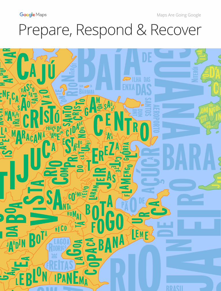
Prepare, Respond & Recover
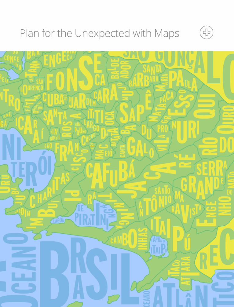
Prepare, Respond & RecoverPlan for the Unexpected with Maps
MM ANG
VA
ÃC
GM
E
IJ
V
A
UC
ISOL
T
TA R
ICOM
RPI
DOO
ADA
O
LC
CO PA
AAG
U R CA
A
OOGOTA
NB A L
BF EME
O A
B
A
NTRO
B O S
A A
A
CE T E
AT
Ú
IDADE
L PAN
S
S
O
E
NCOSMETMAI
T
G
Á
Á VE A
AUH
JA
GAL
RDIN BO
L IPANEMA
OTÂ
EBLON
NI C
TEREZATÁCIO
V A
DEAC
T
S
R C ÃN
S
CO
O
RISTÓ
VÃO
S AN
CT U
M BI
A
T O C
C
R IST O
G
LA RV ELHO A N JEI RAS
LÓRF LAME
N GO
I A
DABEN
M
M
ROCH
A
FICA G A
MA
UINH
A
A
A
A A
ISAÍB EL
N
V ILAGUE
PRAÇABANDEI
RADA
IRA
O
A
AC JÚ
R
J AN
OCEAN
OECAN
OE
GUA N AA AÍ
B
B
ARA
IRO
NRITE ÓI
ATLÂN T ICO
DE
RWO
A AR
I ISO LBLAGOA DEITAIPÚ
PLAGO
DEA I IIRAT N NG
A
P DE
DE
ÃO
A ÇÚCRA
L
DE
ODRIGOAGOA
RFREITAS
P OO
NTE
N TER
RÓI
II
SAN TA
RAABÁRB
ILHA NITERÓI
BRASIL
DASNXA
AEROPORTOSANTOSDUM
ONT
DASE
M.
ATÁ
SÃO
DOM
M
INGOS
CENTRO
P ON T
AILH A D A
CONC EI
OL URENÇO
ÇÃ
SÃO
O
SAN TA
A NBA R
REENGE
NHOCA
J DI
BAL DE
ADOR SANTA
BÁRBARA M ARIAPA
ÃULA
M AT A
PACA
V I LA
PRO
O
G
E SS
MURI
QUI
RI ODO
COURO
SE
E
RRGR
R
AA
NDE
ENG E NHOD0
MATO
MARAVISTA
S
S
ANTOA
P
CHARITAS
SÃO FRAN
C I SC O MAC
EIÓ
CAFUBÁJ A CA R ÉCA
NTAGALOB A DU
LAV
C
I
IE
CHO
RA
A R
ADOURO
RGODA
BAT AA T
SAPÊITITI OCC AAR M U
JOFONS OLAÇNGS OOE
CACUBA NG
O
JARDIMSA ANT
RVLIT
BRAZ ILA
ICINGÁ ARA ÍOABVIA GE
O SA
JD.FÁT I
AM
PEQUEN O A
J ARDIM
I MB U
ÍJ URU
J UBA I RA
T I N I NGA
CAMBO IHNA
ITAIPÚ
TACO
T IAA
AR
NTÔNIO
D’AREI A
GRAGO
DOE.
VIÇOSO
IR
Maps Are Going Google
Plan for the Unexpected with Maps
Imagine you’re the city mayor and staring into the eye of a hurricane. Before the storm hits, how will you communicate with your citizens, getting them to where they need to be — as quickly as possible?
Maps offer a solution.
1 Prepare, Respond & Recover
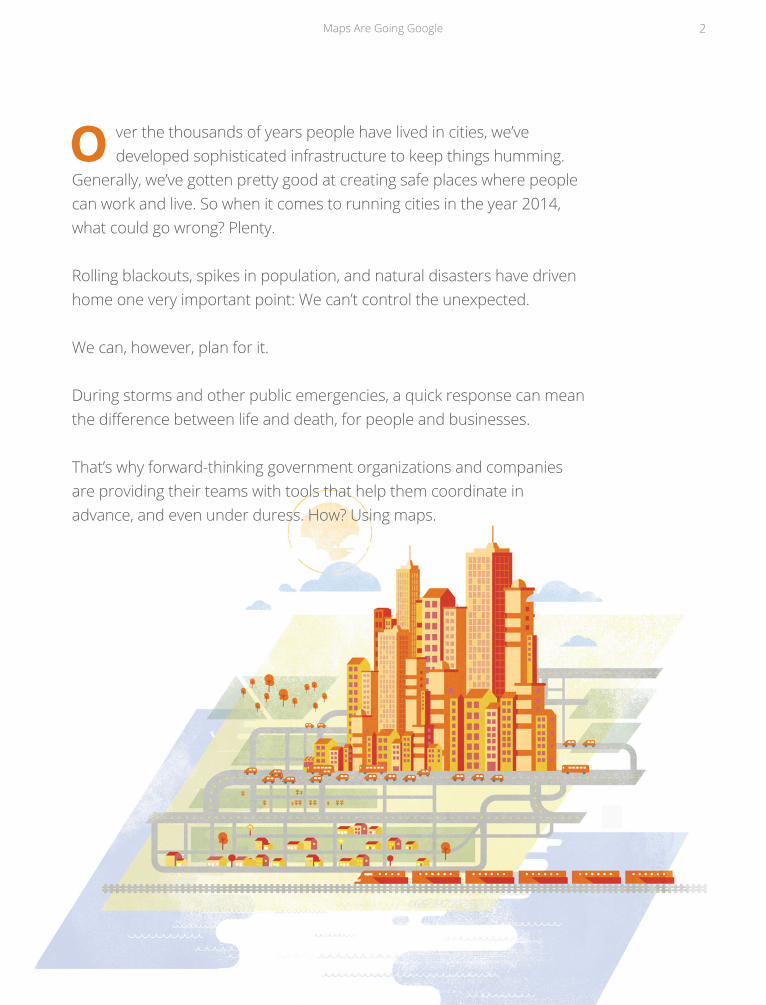
O ver the thousands of years people have lived in cities, we’ve developed sophisticated infrastructure to keep things humming.
Generally, we’ve gotten pretty good at creating safe places where people can work and live. So when it comes to running cities in the year 2014, what could go wrong? Plenty.
Rolling blackouts, spikes in population, and natural disasters have driven home one very important point: We can’t control the unexpected.
We can, however, plan for it.
During storms and other public emergencies, a quick response can mean the difference between life and death, for people and businesses.
That’s why forward-thinking government organizations and companies are providing their teams with tools that help them coordinate in advance, and even under duress. How? Using maps.
Maps Are Going Google 2
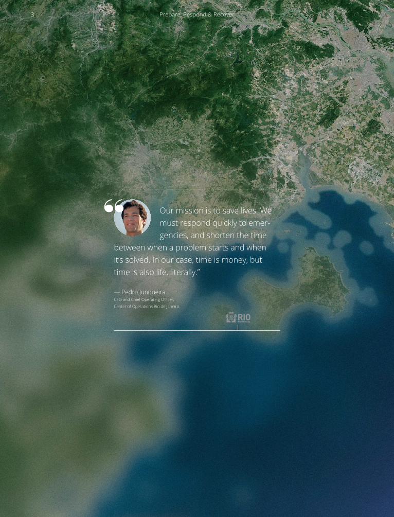
Our mission is to save lives. We must respond quickly to emer-gencies, and shorten the time
between when a problem starts and when it’s solved. In our case, time is money, but time is also life, literally.”
— Pedro Junqueira CEO and Chief Operating Officer,
Center of Operations Rio de Janeiro
3 Prepare, Respond & Recover
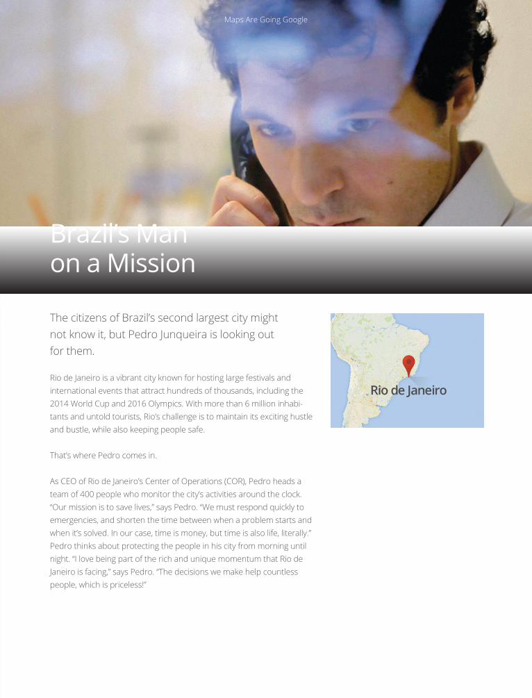
The citizens of Brazil’s second largest city might not know it, but Pedro Junqueira is looking out for them.
Rio de Janeiro is a vibrant city known for hosting large festivals and international events that attract hundreds of thousands, including the 2014 World Cup and 2016 Olympics. With more than 6 million inhabi-tants and untold tourists, Rio’s challenge is to maintain its exciting hustle and bustle, while also keeping people safe.
That’s where Pedro comes in.
As CEO of Rio de Janeiro’s Center of Operations (COR), Pedro heads a team of 400 people who monitor the city’s activities around the clock. “Our mission is to save lives,” says Pedro. “We must respond quickly to emergencies, and shorten the time between when a problem starts and when it’s solved. In our case, time is money, but time is also life, literally.” Pedro thinks about protecting the people in his city from morning until night. “I love being part of the rich and unique momentum that Rio de Janeiro is facing,” says Pedro. “The decisions we make help countless people, which is priceless!”
Brazil’s Man on a Mission
Maps Are Going Google 4
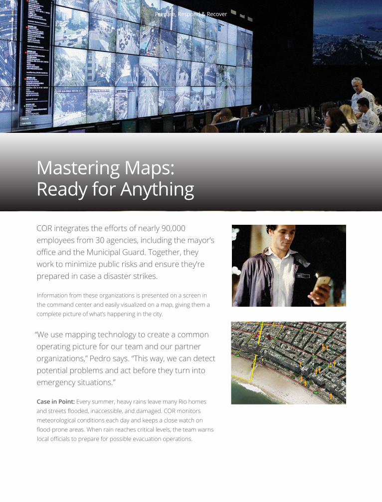
COR integrates the efforts of nearly 90,000 employees from 30 agencies, including the mayor’s office and the Municipal Guard. Together, they work to minimize public risks and ensure they’re prepared in case a disaster strikes.
Information from these organizations is presented on a screen in the command center and easily visualized on a map, giving them a complete picture of what’s happening in the city.
“We use mapping technology to create a common operating picture for our team and our partner organizations,” Pedro says. “This way, we can detect potential problems and act before they turn into emergency situations.”
Case in Point: Every summer, heavy rains leave many Rio homes and streets flooded, inaccessible, and damaged. COR monitors meteorological conditions each day and keeps a close watch on flood-prone areas. When rain reaches critical levels, the team warns local officials to prepare for possible evacuation operations.
Mastering Maps: Ready for Anything
5 Prepare, Respond & Recover

Insight
Knowing the location of a problem is key to a quick response. In Rio, geolocation has changed the way they operate:
Before Location: “If a person smelled fire, she called a local radio station, that would in turn call us. While my team searched for the fire on foot, people were in danger.”
After Location: “Using information from the original caller and the buzz on Twitter, we discern a general location of the fire. Then we can check our cameras in that area and see if local emergency departments have received similar calls. With all this information presented on one map, we can find the precise location of the fire and alert help.”
“By sharing information through a unified map interface, it’s much easier for people across organizations to come together and solve problems quickly.”
Maps Are Going Google 6
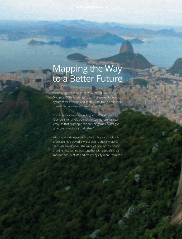
As Rio prepares to host the 2014 World Cup and 2016 Olympics, COR’s challenge is to be prepared for every hypothetical situation and snafu: From traffic accidents to weather conditions to crowd control.
“These games are very exciting for us,” says Pedro. “Our job is to handle behind-the-scenes logistics seam- lessly, so that all people see are the games. Maps give us a common picture to do that.”
With the world’s eyes on Rio, Pedro hopes to not only showcase his beloved city, but also to share what his team is learning about the value of location. “I envision showing how technology, together with specialists, can improve quality of life and make any city more resilient.”
Mapping the Way to a Better Future
7 Prepare, Respond & Recover
Maps Are Going Google 8
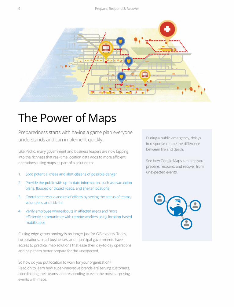
Preparedness starts with having a game plan everyone understands and can implement quickly.
Like Pedro, many government and business leaders are now tapping into the richness that real-time location data adds to more efficient operations, using maps as part of a solution to:
1. Spot potential crises and alert citizens of possible danger
2. Provide the public with up-to-date information, such as evacuationplans, flooded or closed roads, and shelter locations
3. Coordinate rescue and relief efforts by seeing the status of teams,volunteers, and citizens
4. Verify employee whereabouts in affected areas and more efficiently communicate with remote workers using location-based mobile apps
Cutting-edge geotechnology is no longer just for GIS experts. Today, corporations, small businesses, and municipal governments have access to practical map solutions that ease their day-to-day operations and help them better prepare for the unexpected.
So how do you put location to work for your organization? Read on to learn how super-innovative brands are serving customers, coordinating their teams, and responding to even the most surprising events with maps.
During a public emergency, delays in response can be the difference between life and death.
See how Google Maps can help you prepare, respond, and recover from unexpected events.
The Power of Maps
9 Prepare, Respond & Recover
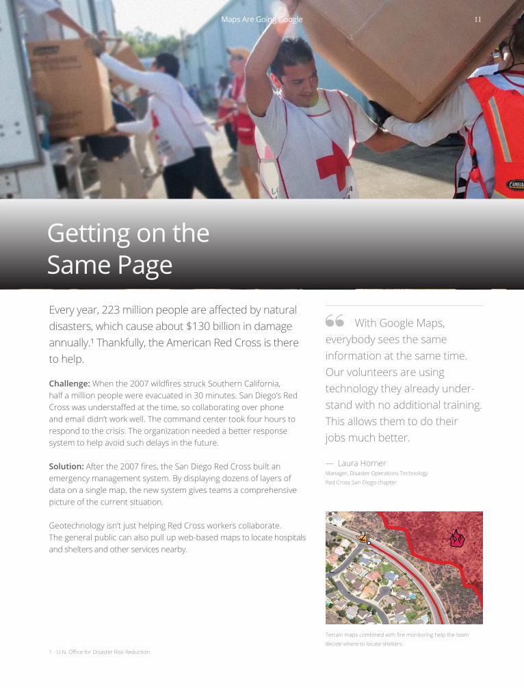
Getting on the Same PageEvery year, 223 million people are affected by natural disasters, which cause about $130 billion in damage annually.¹ Thankfully, the American Red Cross is there to help.
Challenge: When the 2007 wildfires struck Southern California, half a million people were evacuated in 30 minutes. San Diego’s Red Cross was understaffed at the time, so collaborating over phone and email didn’t work well. The command center took four hours to respond to the crisis. The organization needed a better response system to help avoid such delays in the future.
Solution: After the 2007 fires, the San Diego Red Cross built an emergency management system. By displaying dozens of layers of data on a single map, the new system gives teams a comprehensive picture of the current situation.
Geotechnology isn’t just helping Red Cross workers collaborate. The general public can also pull up web-based maps to locate hospitals and shelters and other services nearby.
Terrain maps combined with fire monitoring help the team
decide where to locate shelters.1 - U.N. Office for Disaster Risk Reduction
With Google Maps, everybody sees the same information at the same time. Our volunteers are using technology they already under-stand with no additional training. This allows them to do their jobs much better.
— Laura HornerManager, Disaster Operations Technology
Red Cross San Diego chapter
Maps Are Going Google 11
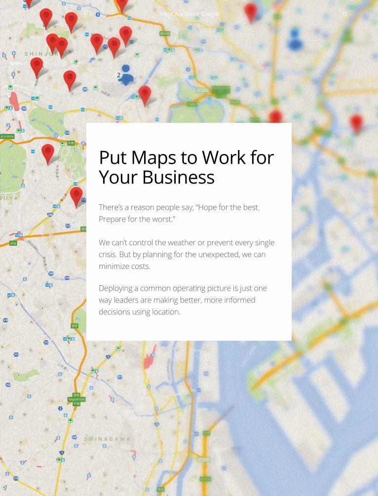
Put Maps to Work for Your BusinessThere’s a reason people say, “Hope for the best. Prepare for the worst.”
We can’t control the weather or prevent every single crisis. But by planning for the unexpected, we can minimize costs.
Deploying a common operating picture is just one way leaders are making better, more informed decisions using location.
Maps Are Going Google 12


![[Android] Google Service Play & Google Maps](https://img.pdfslide.us/doc/110x75/58738cb61a28ab272d8b6f21/android-google-service-play-google-maps.jpg)