Embed Size (px)
Citation preview
Mapping Ocean Surface Topography With a Synthetic-Aperture Interferometry Radar:
A Global Hydrosphere Mapper
Lee-Lueng Fu
Jet Propulsion Laboratory Pasadena, CA, USA
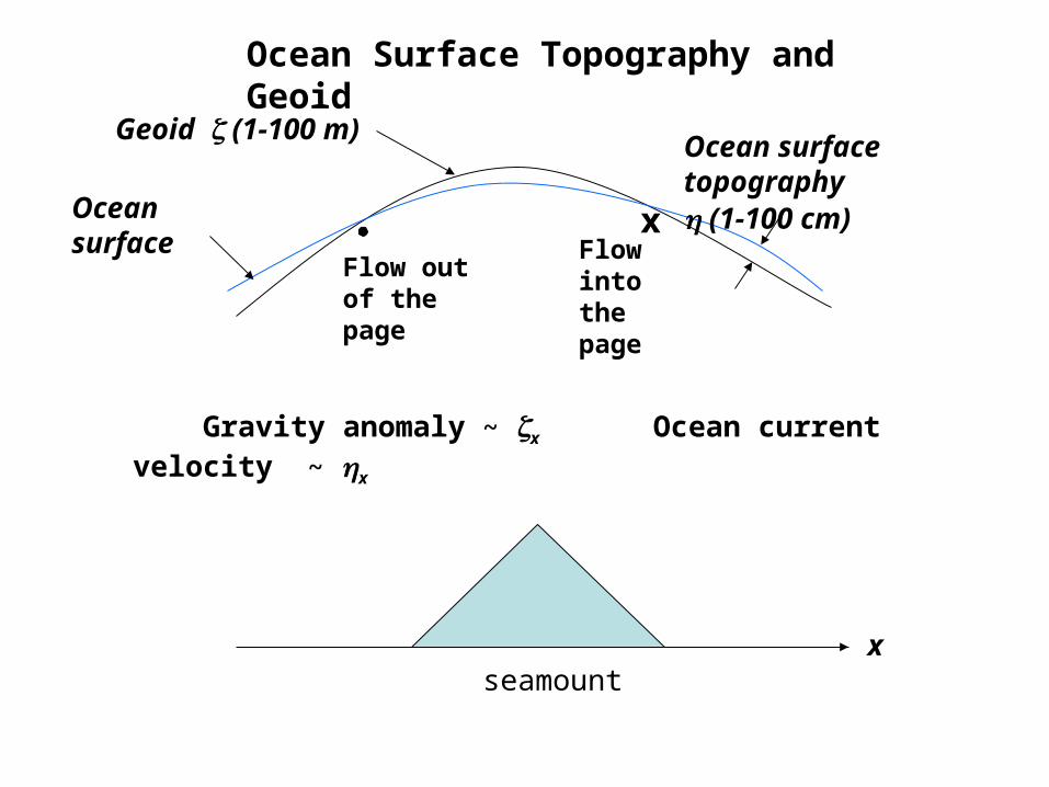
x
seamount
Flow into the pageFlow out of
the page
Geoid (1-100 m)Ocean surface topography (1-100 cm)
Ocean surface
Gravity anomaly ~ x Ocean current velocity ~ x
Ocean Surface Topography and Geoid
x
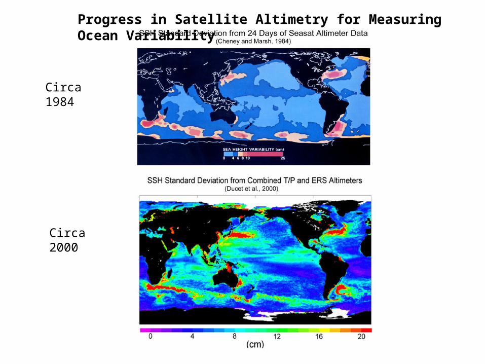
Progress in Satellite Altimetry for Measuring Ocean Variability
Circa 1984
Circa 2000
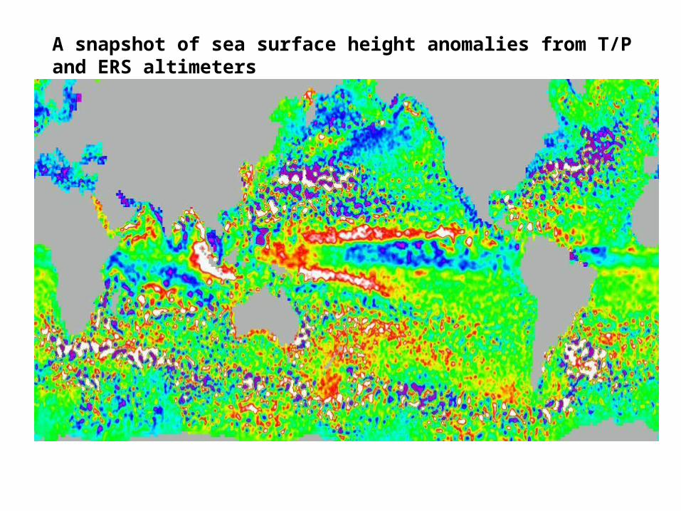
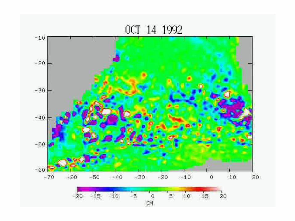
A snapshot of sea surface height anomalies from T/P and ERS altimeters
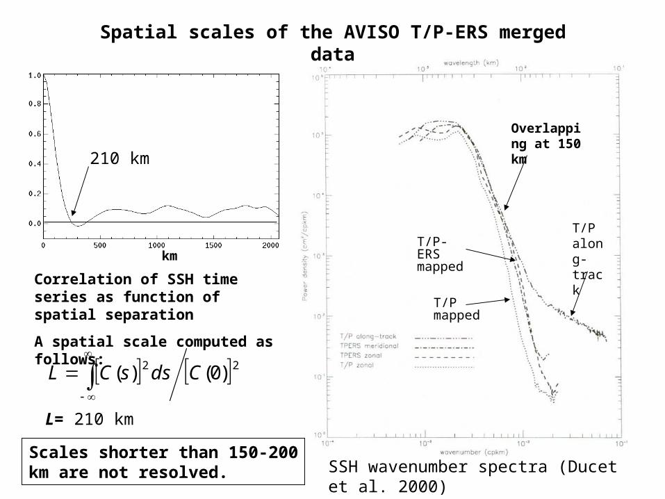
22 )0()( CdssCL
Correlation of SSH time series as function of spatial separation
A spatial scale computed as follows:
km
L= 210 km
SSH wavenumber spectra (Ducet et al. 2000)
T/P along-track
T/P-ERS mapped
T/P mapped
Overlapping at 150 km
Spatial scales of the AVISO T/P-ERS merged data
Scales shorter than 150-200 km are not resolved.
210 km
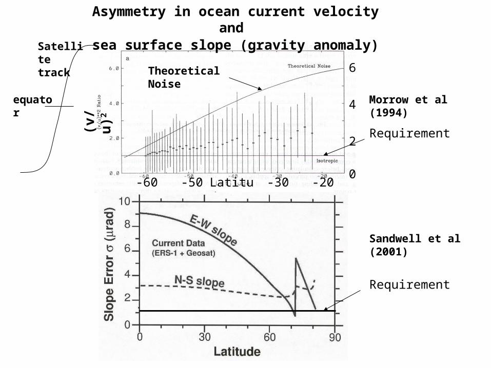
Asymmetry in ocean current velocity and sea surface slope (gravity anomaly)
Latitude
(v/u
)2
-60 -20
2
0
4
6Theoretical Noise
Morrow et al (1994)
Sandwell et al (2001)
Requirement
Requirement
-30-50
Satellite track
equator
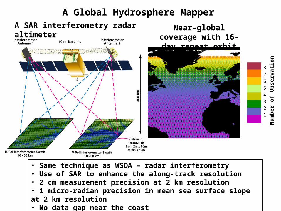
A Global Hydrosphere MapperA SAR interferometry radar altimeter Near-global coverage with
16-day repeat orbit
• Same technique as WSOA – radar interferometry• Use of SAR to enhance the along-track resolution• 2 cm measurement precision at 2 km resolution• 1 micro-radian precision in mean sea surface slope at 2 km resolution • No data gap near the coast
8
7
6
5
4
3
2
1 Nu
mb
er o
f O
bse
rvat
ion
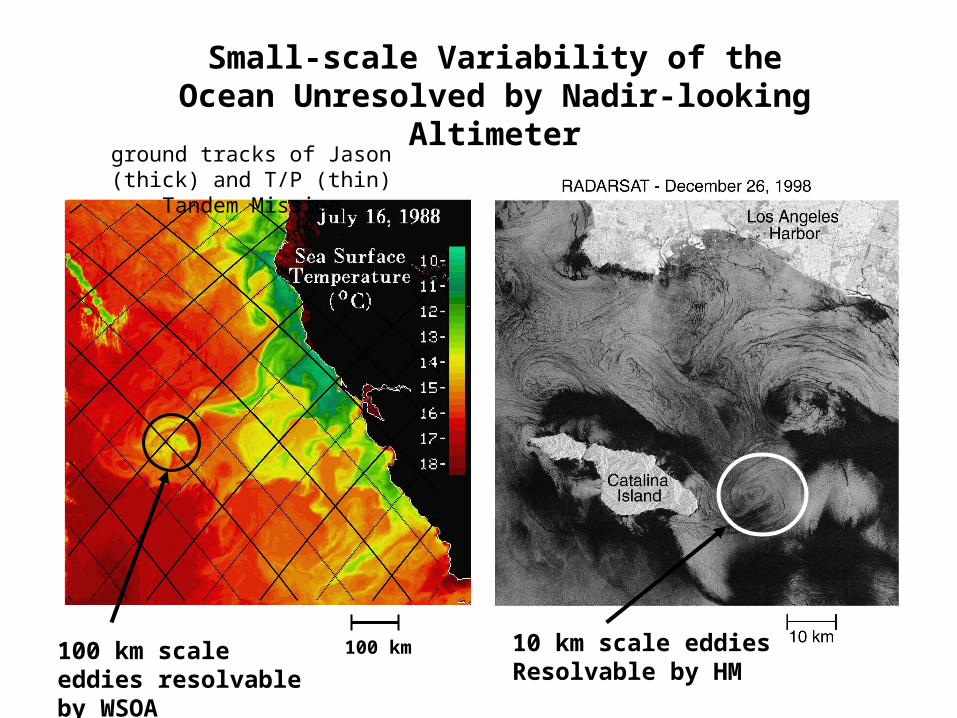
Small-scale Variability of the Ocean Unresolved by Nadir-looking Altimeter
100 km
ground tracks of Jason (thick) and T/P (thin) Tandem Mission
100 km scale eddies resolvable by WSOA
10 km scale eddiesResolvable by HM
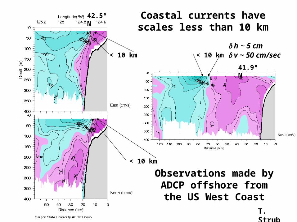
41.9º N
42.5º N
< 10 km
< 10 km
Coastal currents have scales less than 10 km
< 10 km
Observations made by ADCP offshore from the US
West CoastT. Strub
h ~ 5 cm v ~ 50 cm/sec
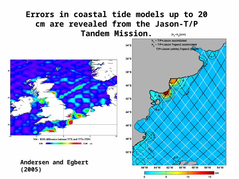
Errors in coastal tide models up to 20 cm are revealed from the Jason-T/P Tandem Mission.
Andersen and Egbert (2005)
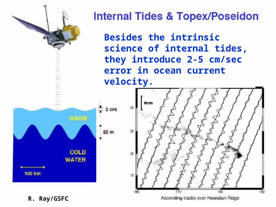
R. Ray/GSFC
Besides the intrinsic science of internal tides, they introduce 2-5 cm/sec error in ocean current velocity.
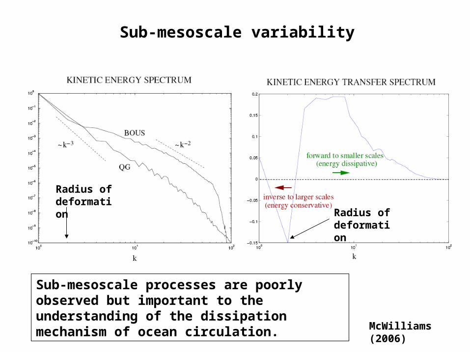
McWilliams (2006)
Sub-mesoscale variability
Sub-mesoscale processes are poorly observed but important to the understanding of the dissipation mechanism of ocean circulation.
Radius of deformation
Radius of deformation
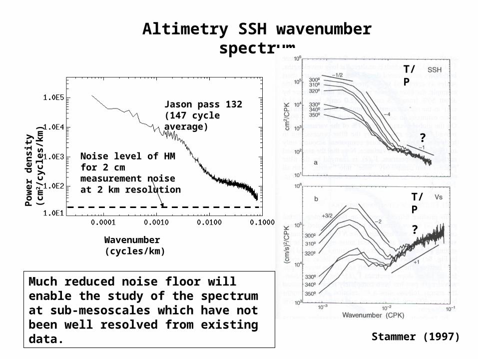
Altimetry SSH wavenumber spectrum
Wavenumber (cycles/km)
Pow
er d
ensi
ty (
cm2 /
cycl
es/k
m)
Noise level of HM for 2 cm measurement noise at 2 km resolution
Jason pass 132 (147 cycle average)
Stammer (1997)
T/P
T/P
?
?
Much reduced noise floor will enable the study of the spectrum at sub-mesoscales which have not been well resolved from existing data.
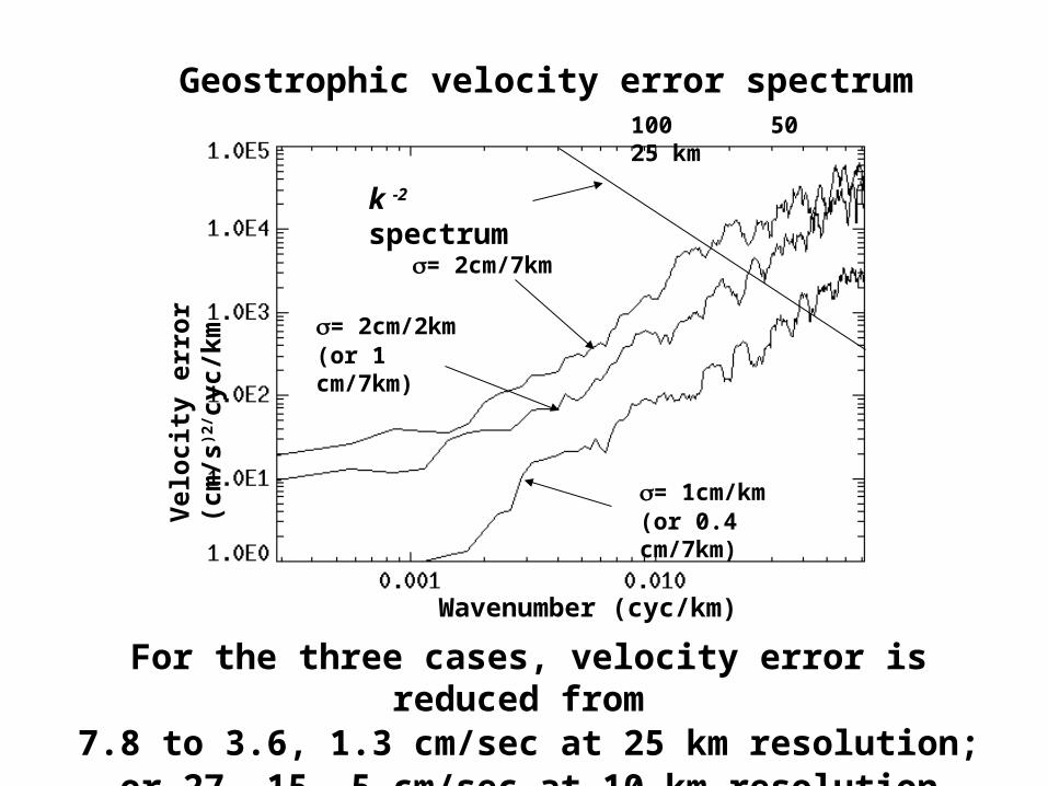
= 1cm/km(or 0.4 cm/7km)
= 2cm/2km (or 1 cm/7km)
= 2cm/7km
For the three cases, velocity error is reduced from 7.8 to 3.6, 1.3 cm/sec at 25 km resolution;
or 27, 15, 5 cm/sec at 10 km resolution
Wavenumber (cyc/km)
Vel
ocit
y er
ror
(cm
/s)2
/ cyc
/km
Geostrophic velocity error spectrum100 50 25 km
k -2 spectrum
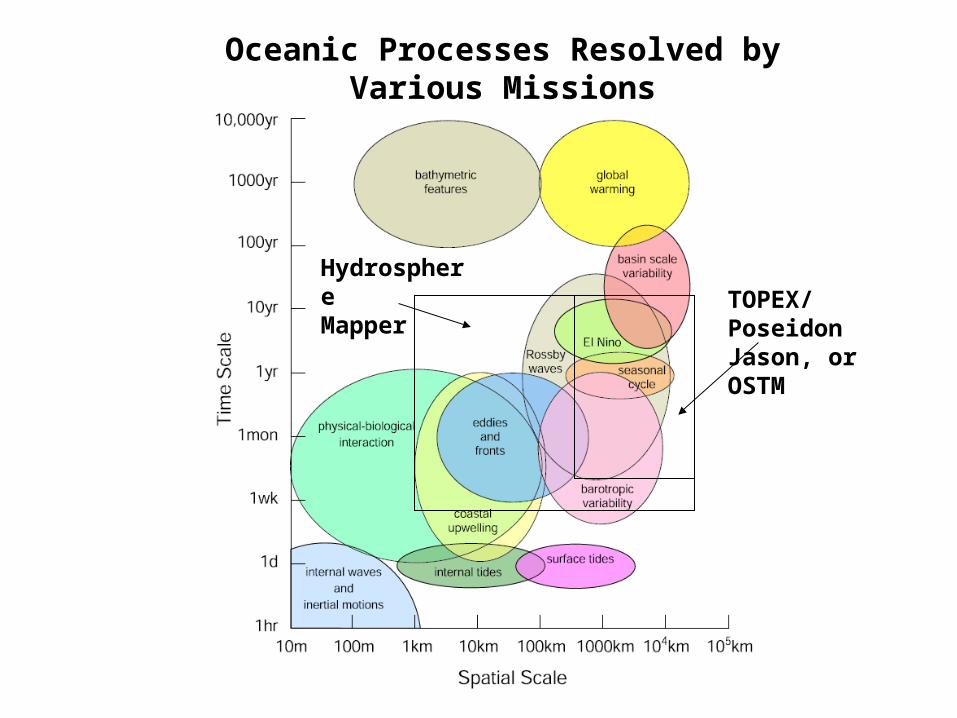
TOPEX/PoseidonJason, or OSTM
HydrosphereMapper
Oceanic Processes Resolved by Various Missions
• SAR interferometry provides the capability of mapping ocean topography approaching 1 km resolution.
• Coastal processes: upwelling, jets, fronts, and biological-physical interactions. Coastal tides must be removed.
• Sub-mesoscale variability: important to the understanding and modeling of the dissipation mechanism for ocean circulation.
• Internal tides: sources of mixing in the ocean which is linked to the overall meridional overturning circulation. Also sources of errors for estimating ocean current velocity if not corrected.
• Determination of ocean current velocity and marine gravity anomalies with much improved accuracy.
• Sun-synchronous orbits should be avoided to ensure the observation of coastal and internal tides.
Conclusions
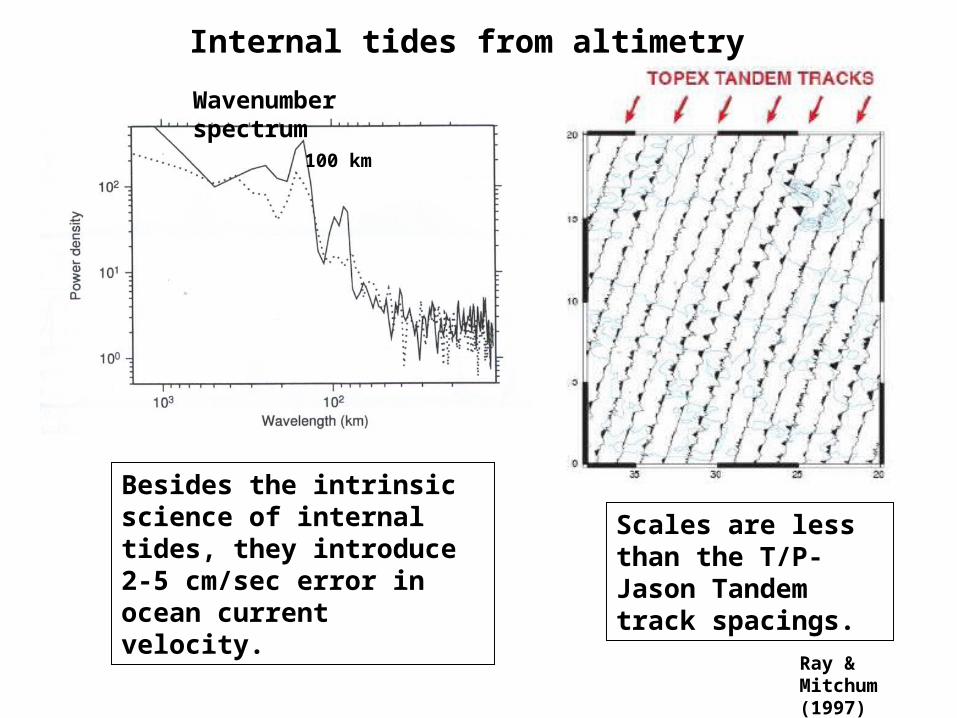
Internal tides from altimetry
Wavenumber spectrum
100 km
Scales are less than the T/P-Jason Tandem track spacings.
Ray & Mitchum (1997)
Besides the intrinsic science of internal tides, they introduce 2-5 cm/sec error in ocean current velocity.
10 km/day
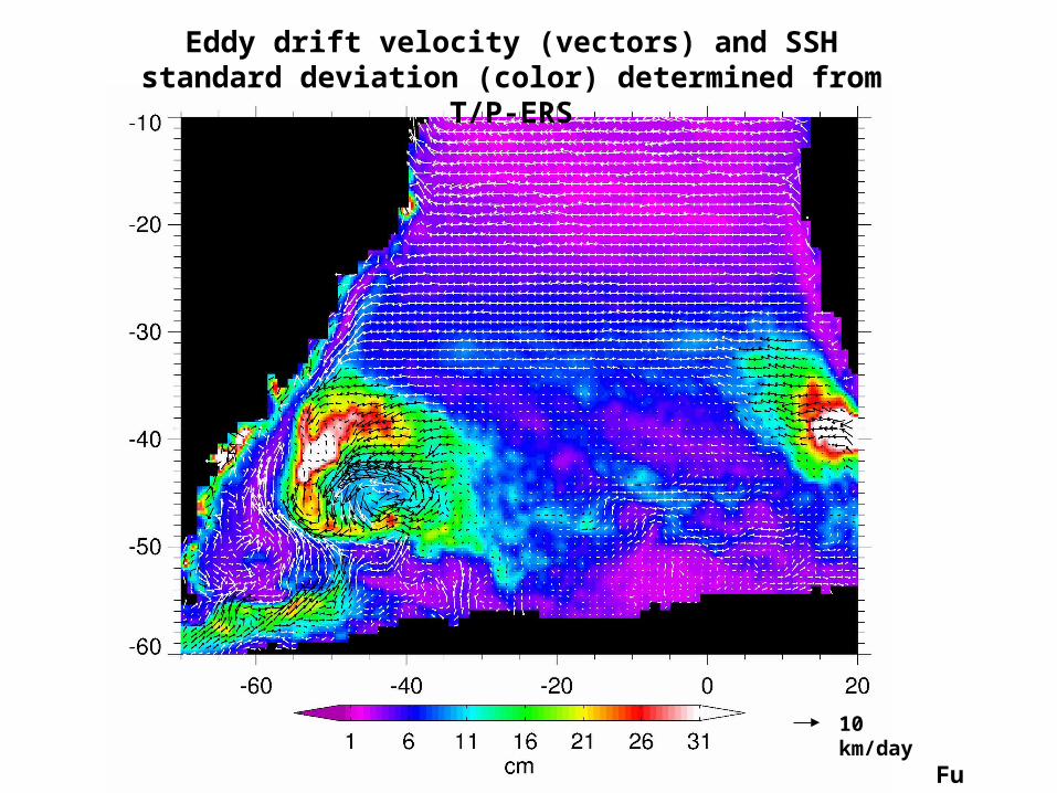
Eddy drift velocity (vectors) and SSH standard deviation (color) determined from T/P-ERS
Fu (2006)
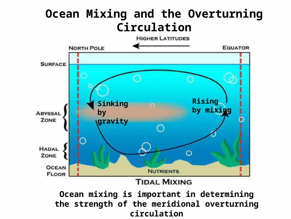
Sinking by gravity
Rising by mixing
Ocean Mixing and the Overturning Circulation
Ocean mixing is important in determining the strength of the meridional overturning circulation