Embed Size (px)
Citation preview
Page|1
ManualforDSS
DecisionSupportSystem
www.fsigeoportal.gov.in/fsidss5kmForestSurveyofIndia
DecisionSupportSystem(www.fsigeoportal.gov.in/fsidss5km)-Manual
Case-1Loginpage 1
Case-2SearchLayertool 3Case-3LegendTool 4
Case-4Layerlisttool 4
Case-5DrawandMeasureToo 5
Case-6IdentityTool 7
Case-7PrintTool 8
Case-8LoadPolygon 8
Case-9SelectPolygon 10
Case-10GetLandCover 12
Case-11GetGrid 13
Case-12GetForestCoverMap 14
Case-13GetForestTypeMap 14
Case-14GetBiologicalrichness 15
Case-15GetLandscapeIntegrity 15
Case-16GetFinalResult 16
Case-17GetFCMResult 16
Case-18GetFTMResult 17
Case-19GetBiologicalRichnessResult 18
Case-20GetLandscapeIntegrityResult 18
Case-21GetDSSResult 19
Case-22GetFCMwithoutGrid 20
Case-23GetFTMwithoutGrid 20
Case-24GetFCMwithoutGridResult 21
Case-25GetFTMwithoutGridResult 21
TableofContents
DecisionSupportSystem(www.fsigeoportal.gov.in/fsidss5km)-Manual
DSS:DecisionSupportSystem
PA:ProtectedArea
RFA:RecordedForestArea
TR:TigerReserve
FCM:ForestCoverMap
FTM: ForestTypeMap
BR: BiologicalRichness
LI:LandscapeIntegrity
Acronyms and Abbreviations
DecisionSupportSystem(www.fsigeoportal.gov.in/fsidss5km)-Manual
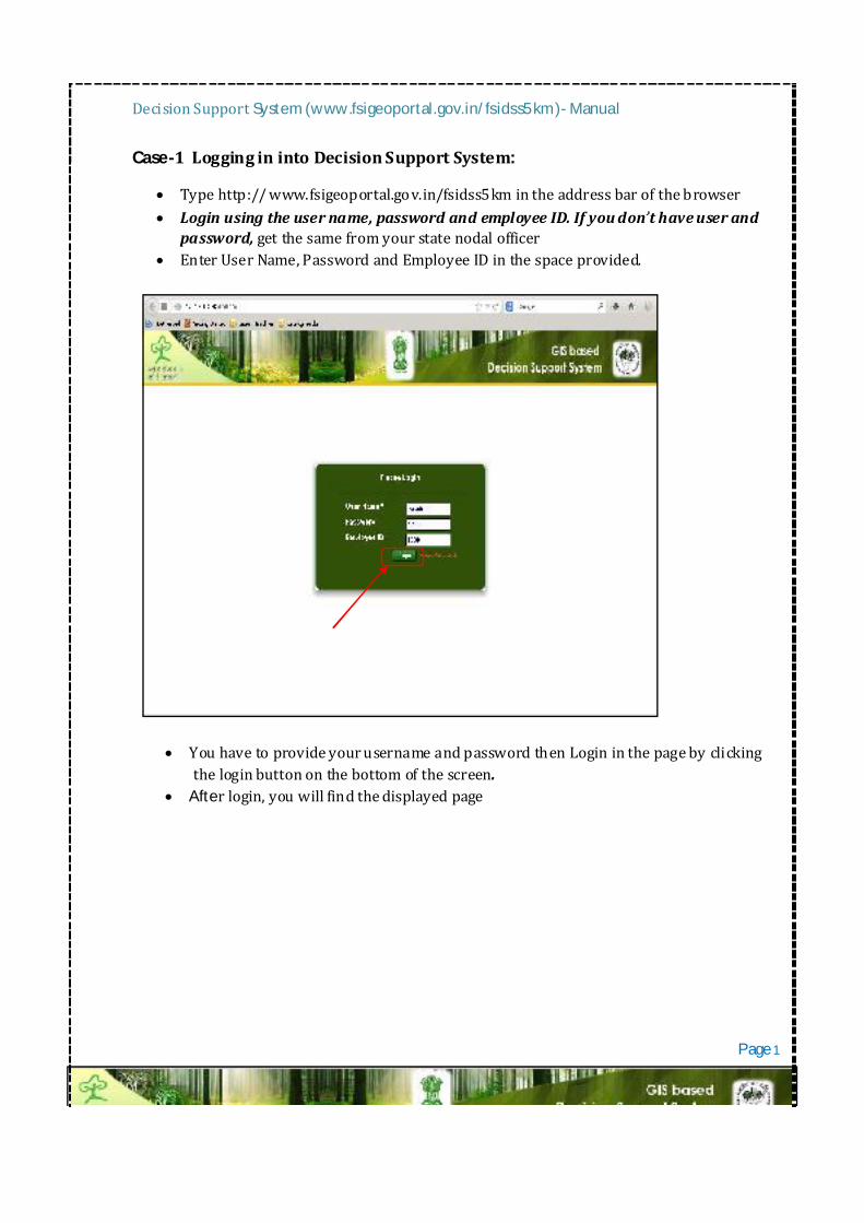
Case-1LogginginintoDecisionSupportSystem:
Typehttp://www.fsigeoportal.gov.in/fsidss5kmintheaddressbarofthebrowser Loginusingtheusername,passwordandemployeeID.Ifyoudon thaveuserand
password,getthesamefromyourstatenodalofficer EnterUserName,PasswordandEmployeeIDinthespaceprovided.
YouhavetoprovideyourusernameandpasswordthenLogininthepagebyclickingtheloginbuttononthebottomofthescreen.
Afterlogin,youwillfindthedisplayedpage
Page1
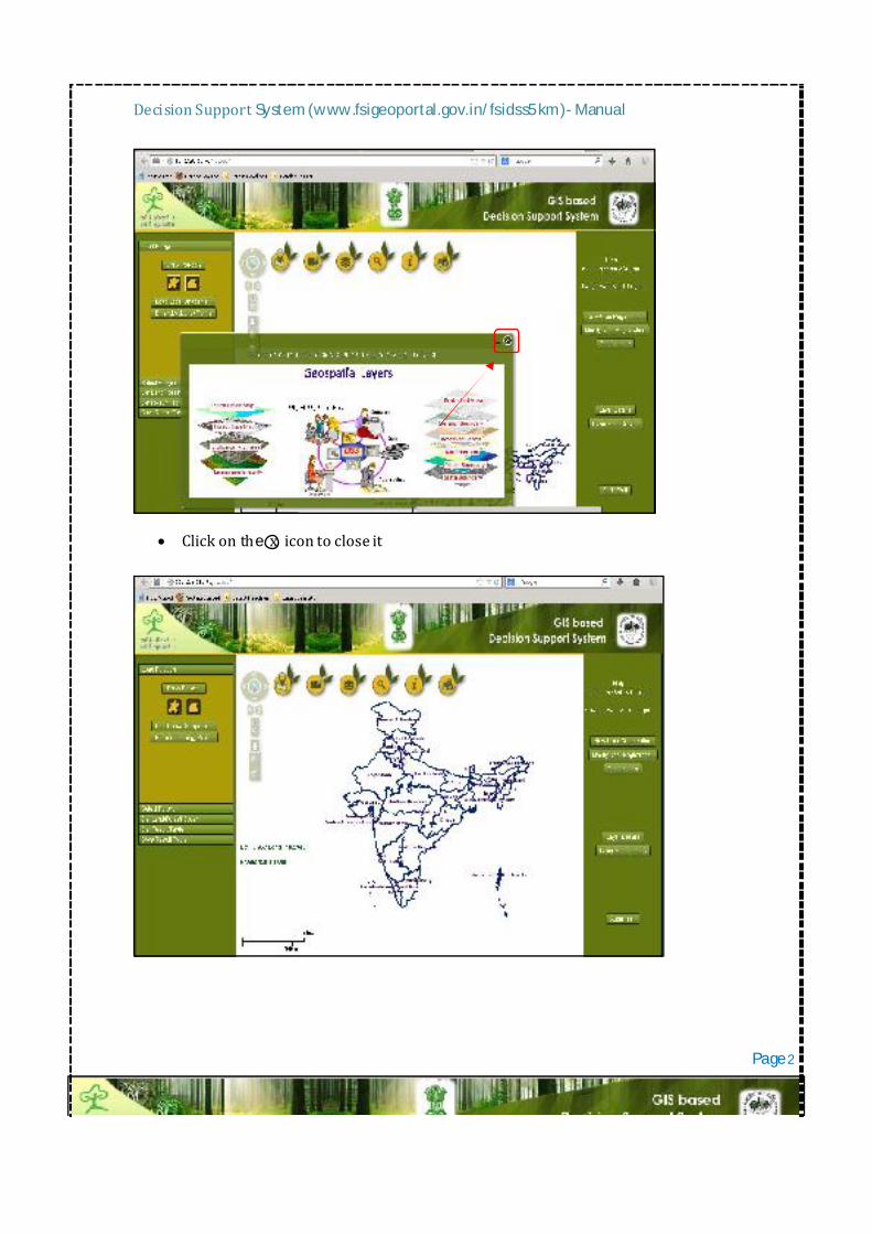
DecisionSupportSystem(www.fsigeoportal.gov.in/fsidss5km)-Manual
Clickonthexicontocloseit
Page2
DecisionSupportSystem(www.fsigeoportal.gov.in/fsidss5km)-Manual
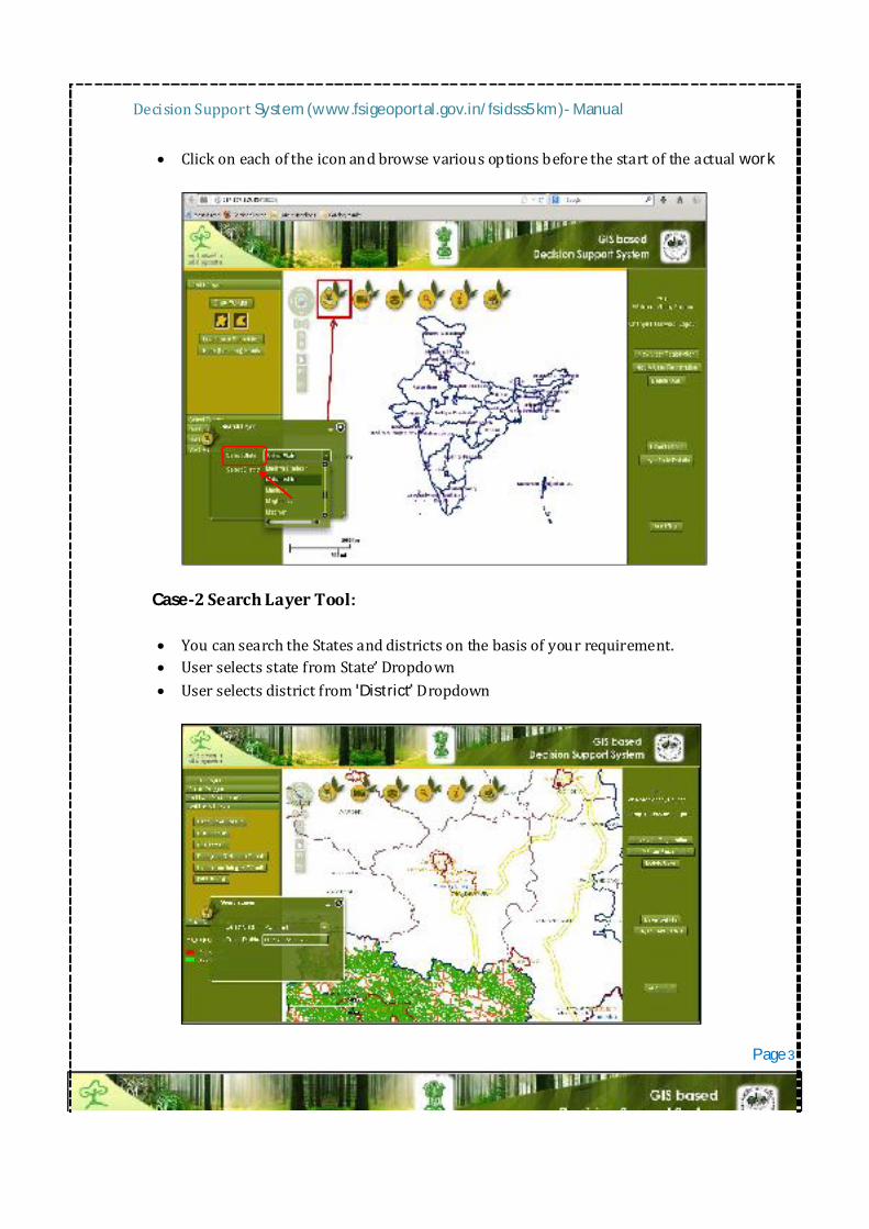
Clickoneachoftheiconandbrowsevariousoptionsbeforethestartoftheactualwork
Case-2SearchLayerTool: YoucansearchtheStatesanddistrictsonthebasisofyourrequirement. UserselectsstatefromState Dropdown Userselectsdistrictfrom District Dropdown
Page3
DecisionSupportSystem(www.fsigeoportal.gov.in/fsidss5km)-Manual
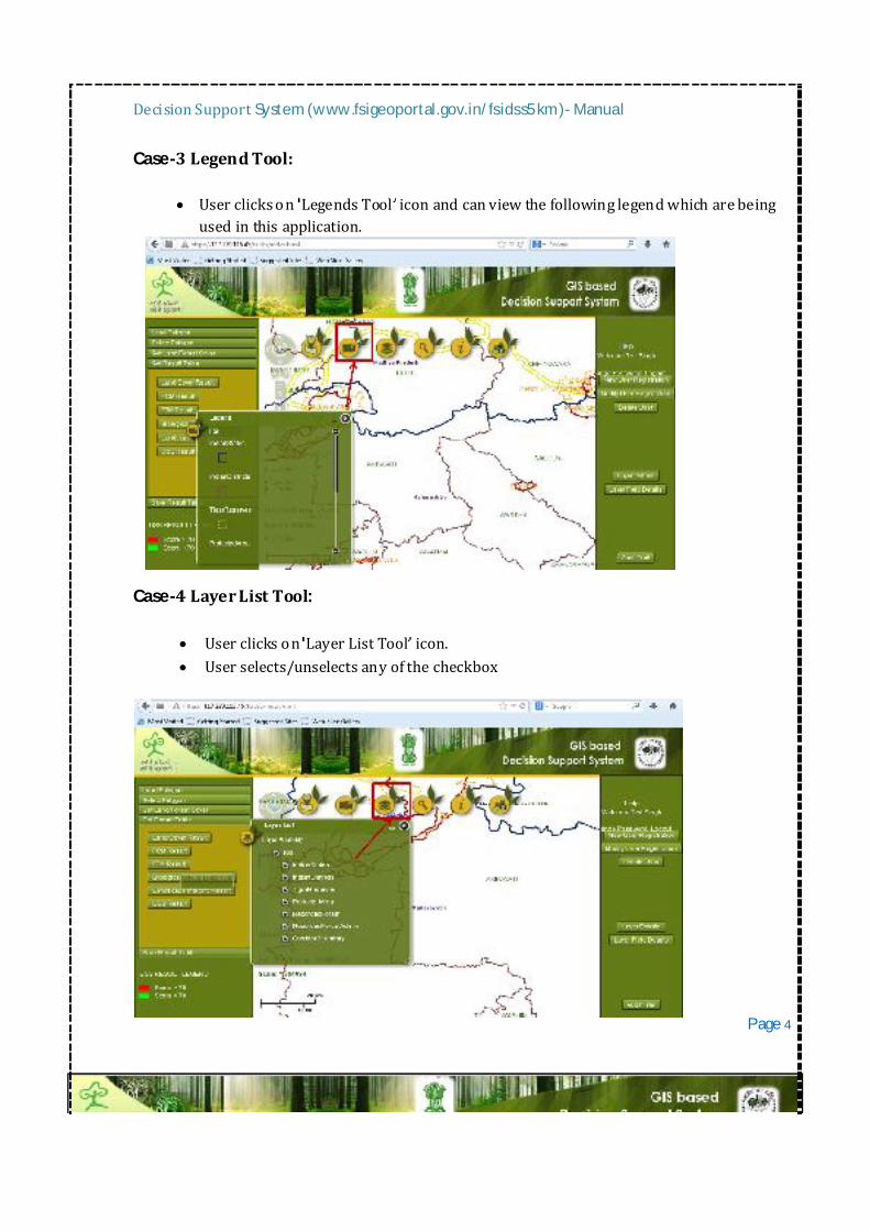
Case-3LegendTool:
Userclickson LegendsTool iconandcanviewthefollowinglegendwhicharebeingusedinthisapplication.
Case-4LayerListTool:
Userclickson LayerListTool icon. Userselects/unselectsanyofthecheckbox
Page4
DecisionSupportSystem(www.fsigeoportal.gov.in/fsidss5km)-Manual
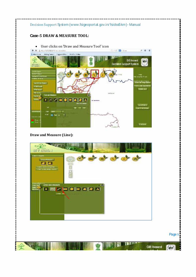
Case-5DRAW&MEASURETOOL:
UserclicksonDrawandMeasureTool icon
DrawandMeasure(Line):
Page5
DecisionSupportSystem(www.fsigeoportal.gov.in/fsidss5km)-Manual
UserclicksonLine icon Userselectslinecolorfrom LineColor colorpicker Userselectsstyle Userenterslinewidth Userselectsalpha. Userselects ShowMeasurement checkbox. Userselectsmeasuringunitsfrom DistanceUnits Dropdown. Drawlineonmap.*Measureddistanceisdisplayedonthewidget
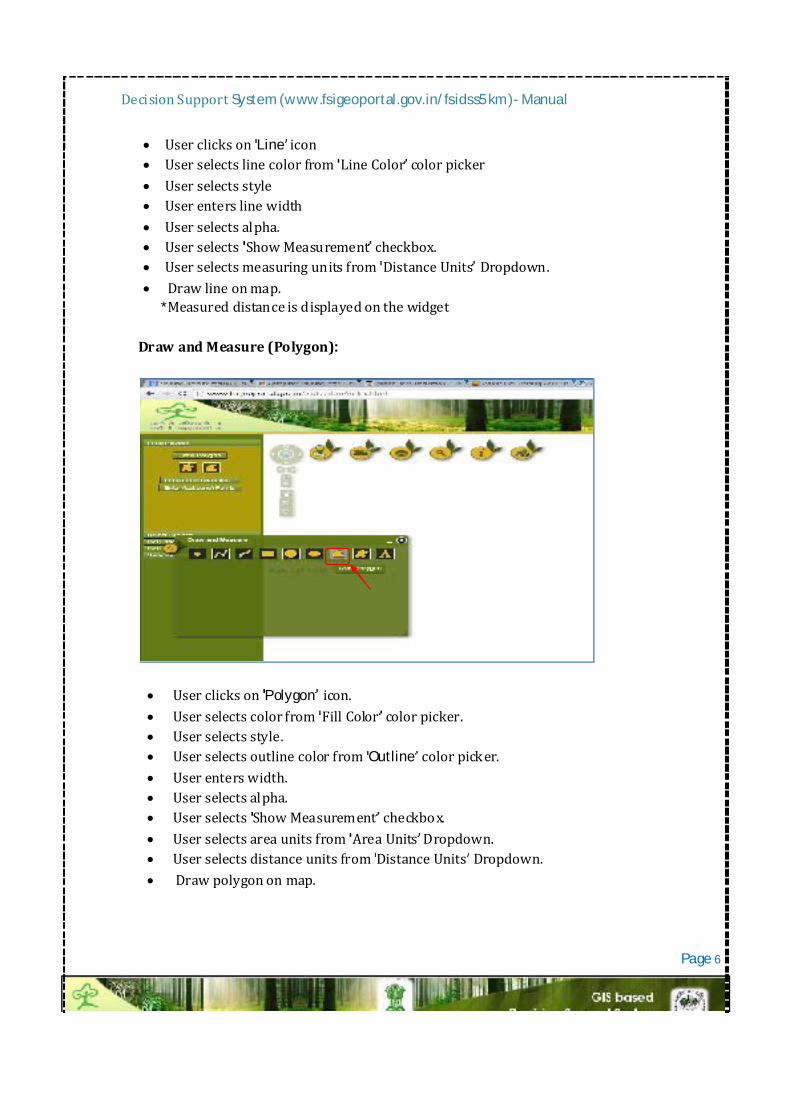
DrawandMeasure(Polygon):
UserclicksonPolygon icon. Userselectscolorfrom FillColor colorpicker. Userselectsstyle. UserselectsoutlinecolorfromOutline colorpicker. Userenterswidth. Userselectsalpha. Userselects ShowMeasurement checkbox. Userselectsareaunitsfrom AreaUnits Dropdown. UserselectsdistanceunitsfromDistanceUnits Dropdown. Drawpolygononmap.
Page6
DecisionSupportSystem(www.fsigeoportal.gov.in/fsidss5km)-Manual
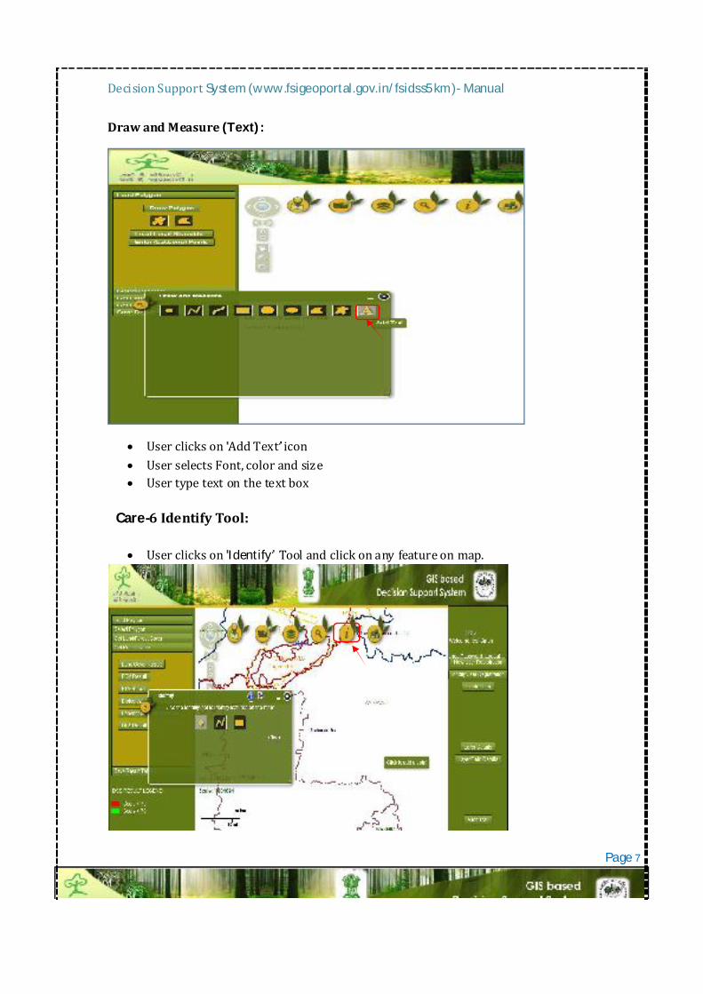
DrawandMeasure(Text):
UserclicksonAddText icon UserselectsFont,colorandsize Usertypetextonthetextbox
Care-6IdentifyTool: Userclickson Identify Tool andclickonanyfeatureonmap.
Page7
DecisionSupportSystem(www.fsigeoportal.gov.in/fsidss5km)-Manual
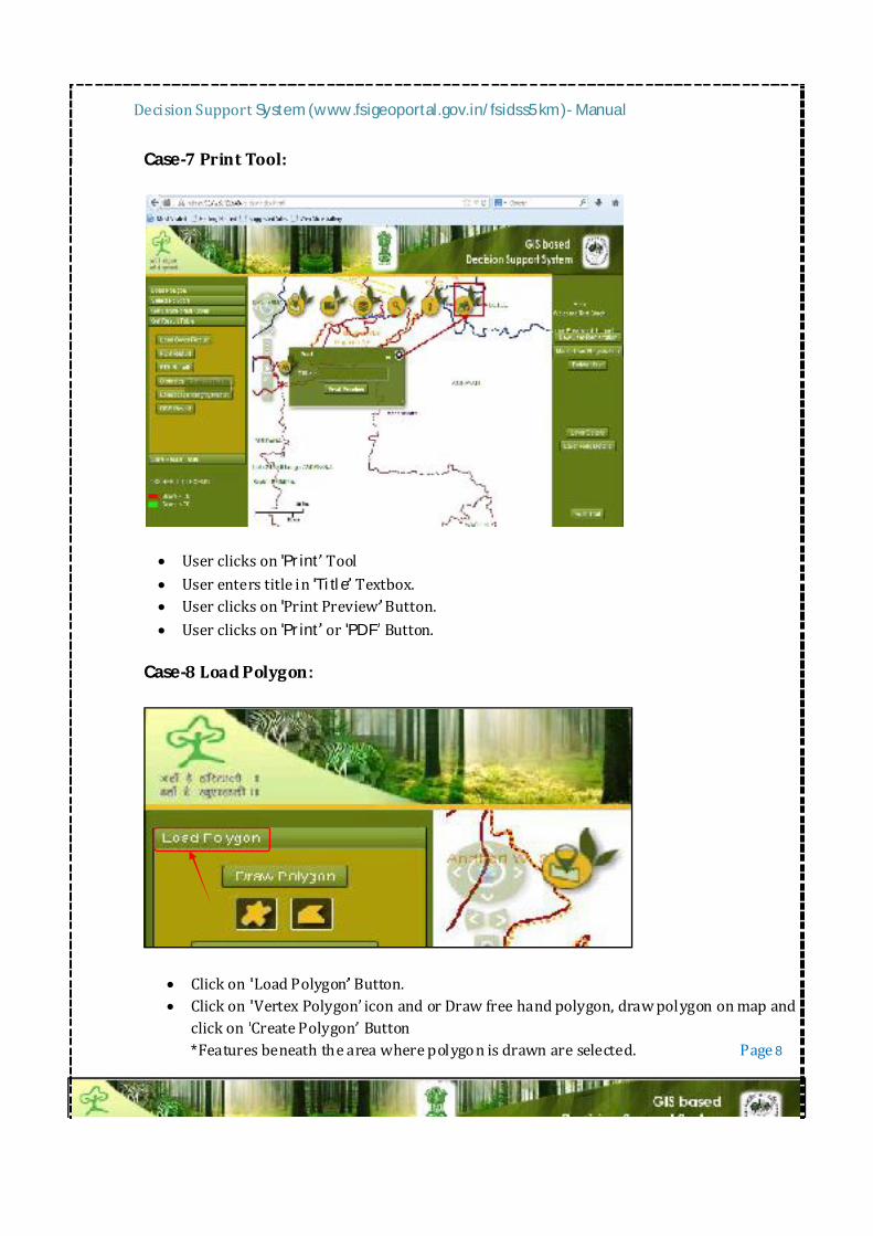
Case-7PrintTool:
UserclicksonPrint Tool UserenterstitleinTitle Textbox. Userclickson PrintPreview Button. UserclicksonPrint orPDF Button.
Case-8LoadPolygon:
Clickon LoadPolygon Button. Clickon VertexPolygon iconandorDrawfreehandpolygon,drawpolygononmapand
clickon CreatePolygon Button*Featuresbeneaththeareawherepolygonisdrawnareselected. Page8
DecisionSupportSystem(www.fsigeoportal.gov.in/fsidss5km)-Manual
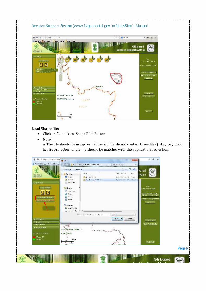
LoadShapefile: Clickon LoadLocalShapeFile Button Note:
a.Thefileshouldbeinzipformatthezipfileshouldcontainthreefiles(.shp,.prj,.dbo).b.Theprojectionofthefileshouldbematcheswiththeapplicationprojection.
Page9
DecisionSupportSystem(www.fsigeoportal.gov.in/fsidss5km)-Manual
Browsetothelocationofthezippedfile,selectitandopenit. Note:Featuresbeneaththeareawhereshapefileisloadedareselected
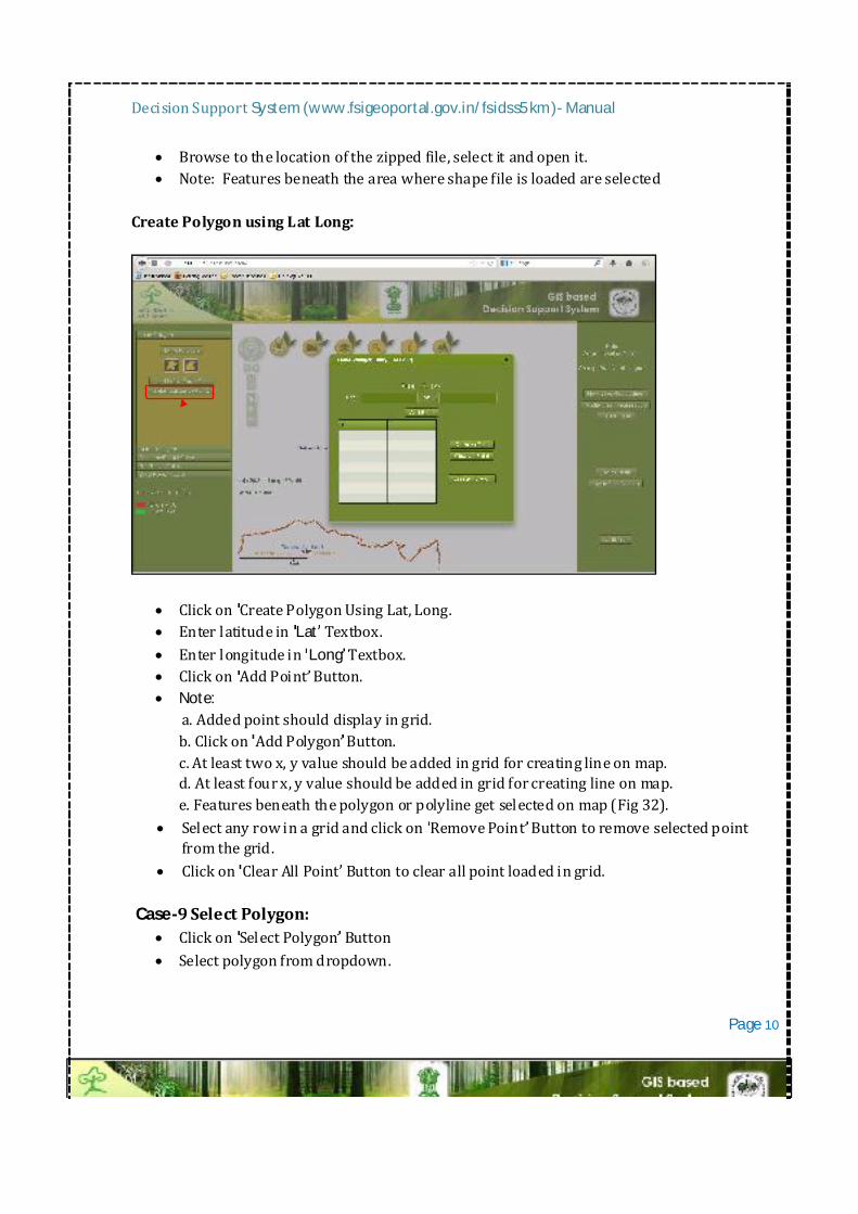
CreatePolygonusingLatLong:
Clickon CreatePolygonUsingLat,Long. Enterlatitudein Lat Textbox. Enterlongitudein Long Textbox. Clickon AddPoint Button. Note:
a.Addedpointshoulddisplayingrid.b.Clickon AddPolygon Button.c.Atleasttwox,yvalueshouldbeaddedingridforcreatinglineonmap.d.Atleastfourx,yvalueshouldbeaddedingridforcreatinglineonmap.e.Featuresbeneaththepolygonorpolylinegetselectedonmap(Fig32).
SelectanyrowinagridandclickonRemovePoint Buttontoremoveselectedpointfromthegrid.
Clickon ClearAllPoint Buttontoclearallpointloadedingrid.
Case-9SelectPolygon: Clickon SelectPolygon Button Selectpolygonfromdropdown.
Page10
DecisionSupportSystem(www.fsigeoportal.gov.in/fsidss5km)-Manual
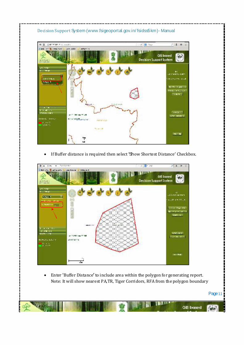
IfBufferdistanceisrequiredthenselect ShowShortestDistance Checkbox.
Enter BufferDistance toincludeareawithinthepolygonforgeneratingreport.Note:ItwillshownearestPA,TR,TigerCorridors,RFAfromthepolygonboundary Page11
DecisionSupportSystem(www.fsigeoportal.gov.in/fsidss5km)-Manual
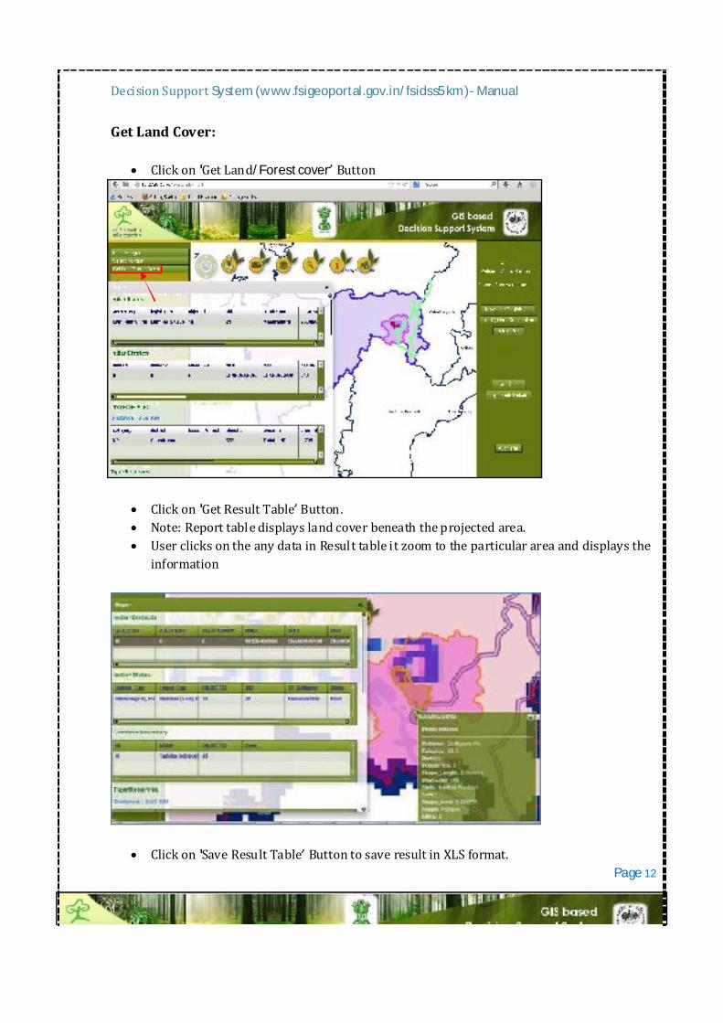
GetLandCover:
Clickon GetLand/Forestcover Button
Clickon GetResultTable Button. Note:Reporttabledisplayslandcoverbeneaththeprojectedarea. UserclicksontheanydatainResulttableitzoomtotheparticularareaanddisplaysthe
information
Clickon SaveResultTable ButtontosaveresultinXLSformat. Page12
DecisionSupportSystem(www.fsigeoportal.gov.in/fsidss5km)-Manual
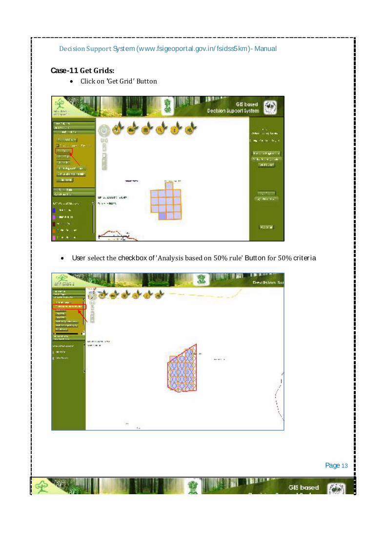
Case-11GetGrids: Clickon GetGrid Button
Userselectthecheckboxof'Analysisbasedon50%rule'Buttonfor50%criteria
Page13
DecisionSupportSystem(www.fsigeoportal.gov.in/fsidss5km)-Manual
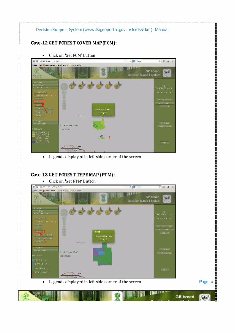
Case-12GETFORESTCOVERMAP(FCM):
Clickon GetFCM Button
Legendsdisplayedinleftsidecornerofthescreen
Case-13GETFORESTTYPEMAP(FTM):
Clickon GetFTM Button
LegendsdisplayedinleftsidecornerofthescreenPage14
DecisionSupportSystem(www.fsigeoportal.gov.in/fsidss5km)-Manual
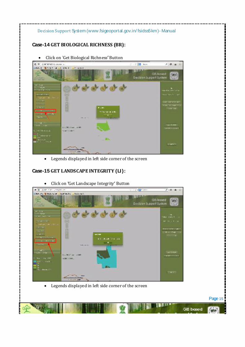
Case-14GETBIOLOGICALRICHNESS(BR):
Clickon GetBiologicalRichness Button
Legendsdisplayedinleftsidecornerofthescreen
Case-15GETLANDSCAPEINTEGRITY(LI):
Clickon GetLandscapeIntegrity Button
Legendsdisplayedinleftsidecornerofthescreen
Page15
DecisionSupportSystem(www.fsigeoportal.gov.in/fsidss5km)-Manual
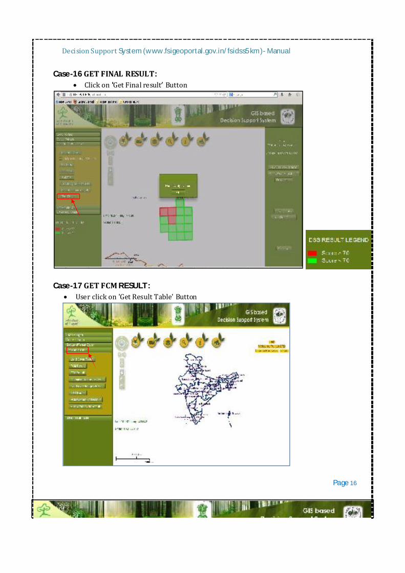
Case-16GETFINALRESULT: Clickon GetFinalresult Button
Case-17GETFCMRESULT:
Userclickon'GetResultTable'Button
Page16
DecisionSupportSystem(www.fsigeoportal.gov.in/fsidss5km)-Manual
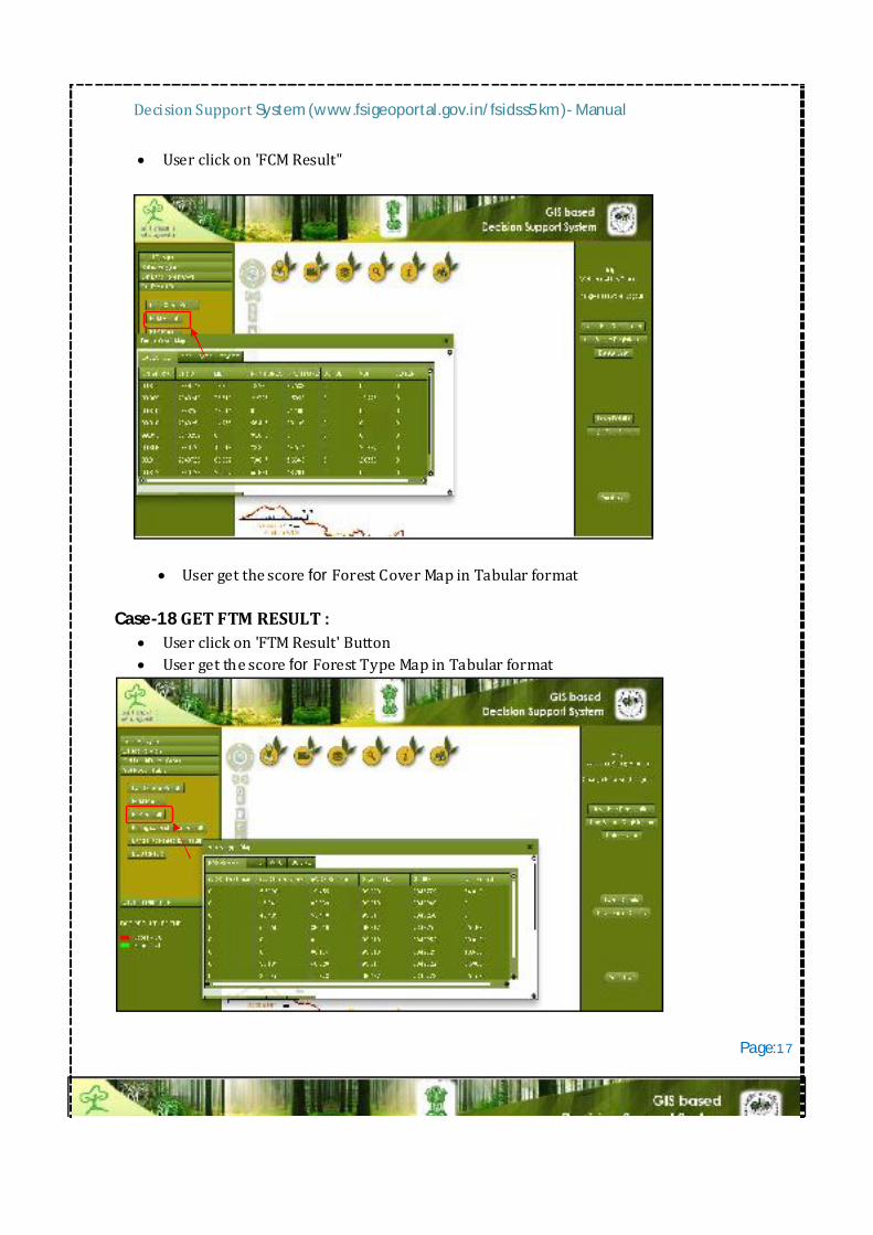
Userclickon'FCMResult"
UsergetthescoreforForestCoverMapinTabularformat
Case-18GETFTMRESULT: Userclickon'FTMResult'Button UsergetthescoreforForestTypeMapinTabularformat
Page:1 7

DecisionSupportSystem(www.fsigeoportal.gov.in/fsidss5km)-Manual
Case-19GETBIOLOGICALRICHNESSRESULT: Userclickon'BiologicalRichnessResult'Button Usergetthescorefor'BiologicalRichnessinTabularformat
Case-20GETLANDSCAPEINTEGRITYRESULT: Userclickon'LandscapeIntegrityResult'Button Usergetthescorefor'BiologicalRichnessinTabularformat
Page:1 8
DecisionSupportSystem(www.fsigeoportal.gov.in/fsidss5km)-Manual
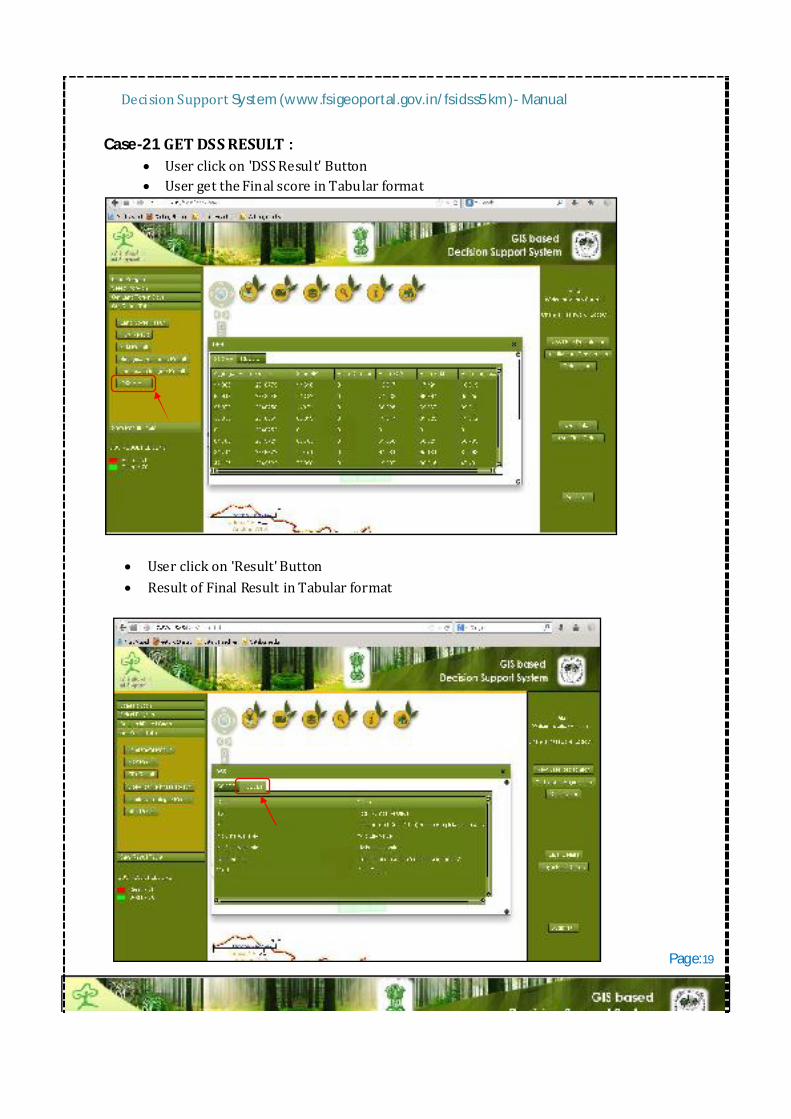
Case-21GETDSSRESULT: Userclickon'DSSResult'Button UsergettheFinalscoreinTabularformat
Userclickon'Result'Button ResultofFinalResultinTabularformat
Page:19
DecisionSupportSystem(www.fsigeoportal.gov.in/fsidss5km)-Manual
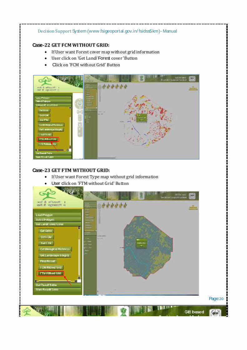
Case-22GETFCMWITHOUTGRID: IfUserwantForestcovermapwithoutgridinformation Userclickon'GetLand/Forestcover'Button Clickon'FCMwithoutGrid'Button
Case-23GETFTMWITHOUTGRID:
IfUserwantForestTypemapwithoutgridinformation Userclickon'FTMwithoutGrid'Button
Page:20
DecisionSupportSystem(www.fsigeoportal.gov.in/fsidss5km)-Manual
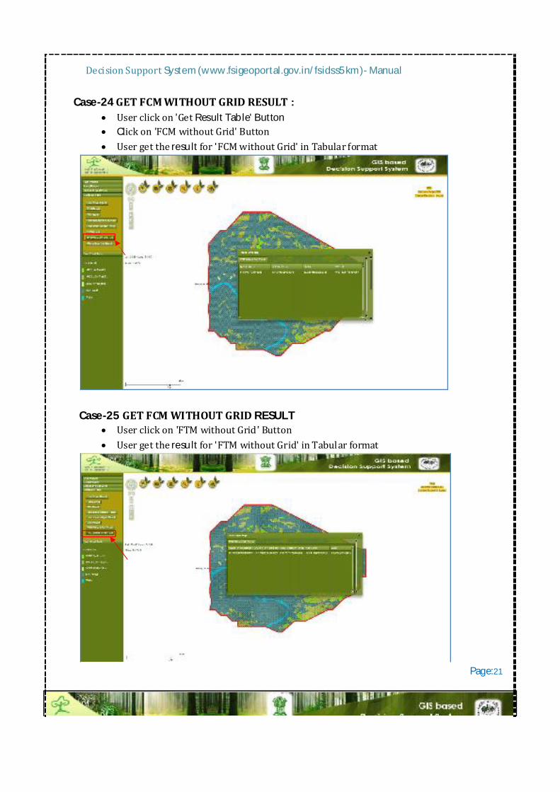
Case-24GETFCMWITHOUTGRIDRESULT: Userclickon'GetResultTable'Button Clickon'FCMwithoutGrid'Button Usergettheresultfor'FCMwithoutGrid'inTabularformat
Case-25GETFCMWITHOUTGRIDRESULT
Userclickon'FTMwithoutGrid'Button Usergettheresultfor'FTMwithoutGrid'inTabularformat
Page:21
DecisionSupportSystem(www.fsigeoportal.gov.in/fsidss5km)-Manual
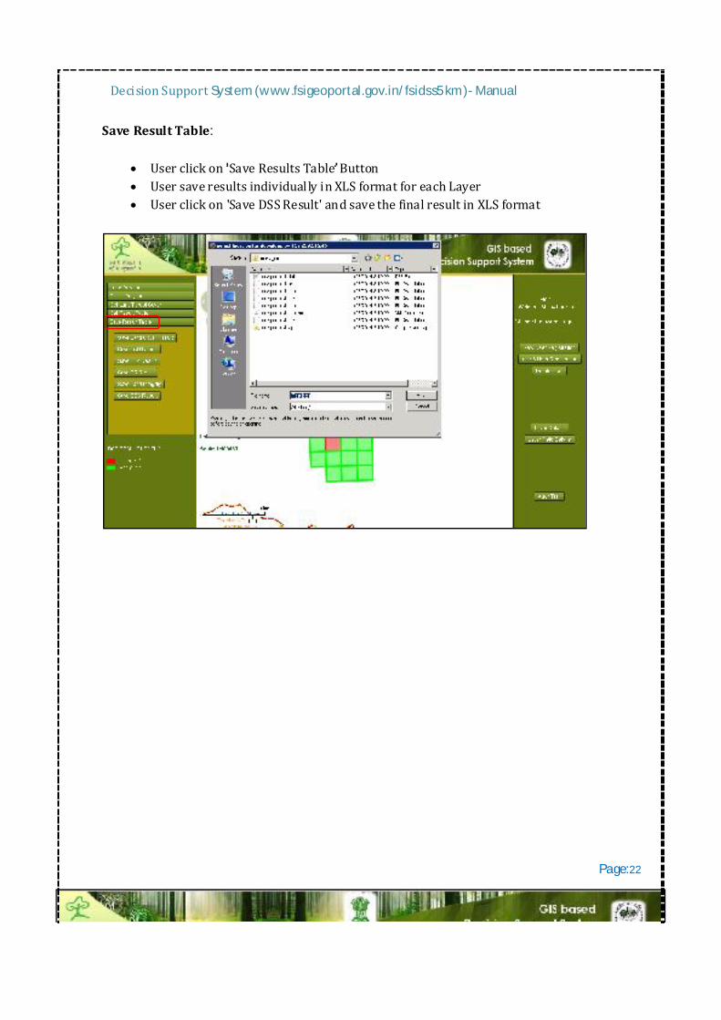
SaveResultTable:
Userclickon SaveResultsTable Button UsersaveresultsindividuallyinXLSformatforeachLayer Userclickon'SaveDSSResult'andsavethefinalresultinXLSformat
Page:22