Embed Size (px)
Citation preview

M. Dharma RajAdditional Surveyor General

The Centre for Survey Training and MapProduction, now known as the Indian Institute ofProduction, now known as the Indian Institute ofSurveying & Mapping(IISM) of Survey of India,was established at Hyderabad on 6 May 1967under technical assistance from United NationsDevelopment Programme ( UNDP).

IISM - BASIC ROLE:
� Basic & Advanced training in the field of Surveying& Mapping ( Geospatial Technologies ).
�Short Term courses in the field of Surveying& Mapping ( Geospatial Technologies ).
� Human Resource Development in this field for Afro -� Human Resource Development in this field for Afro -Asian countries.
� Capacity Building in this field for different levels ofOfficers & Staff of State & Central Govt. Departments andother Public Sector Units.
� Seminars & Workshops on state of art Technology inSurveying and Mapping.

� More than 90 batches of the 2-year courseshave passed out since its inception .
� About 30,000 alumni .
IISM - Important Milestones:
� About 30,000 alumni .
� Alumni from other Afro -Asian Countries - 600.

IISM - Faculties
Faculty of Topographical Surveying & LIS
Faculty of Photogrammetry & Remote Sensing.
Faculty of Cartography, DM & GIS
Faculty of Geodesy
Faculty of Cartography, DM & GIS

�Faculty of Geodesy
Physical & Geometric Geodesy
Geodetic Astronomy
Map Projection
Satellite Geodesy

�Faculty of Topographical Surveying & LIS (TS&LIS)
Topographical
& CadastralSurveying
Surveying using Conventional and Modern Instruments

�Faculty of Photogrammetry & Remote Sensing (P&RS)
Analogue & Digital Photogrammetry
Satellite Image Processing
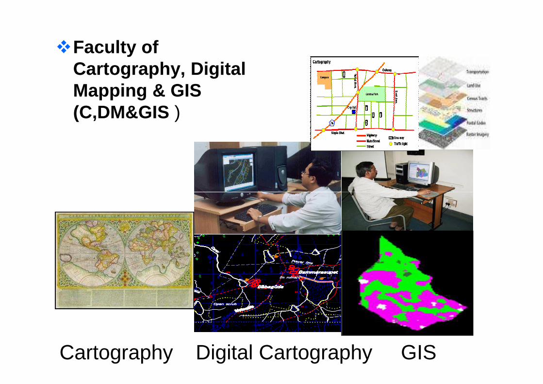
�Faculty of Cartography, Digital Mapping & GIS (C,DM&GIS )
Cartography Digital Cartography GIS

Theory & Demo
Field Exercise
Training Modules:
Exercise
Lab Practical

• Land Resources and Rural Development –NLRMP
• Urban Development – NUIS• Natural Resource Management - NRDMS and
NNRMS
Training Courses For Various Programmes:
NNRMS • Disaster Management• Integrated Coastal Management – ICZM• Infrastructure Development• National Security – For Armed and Para-
Military Forces
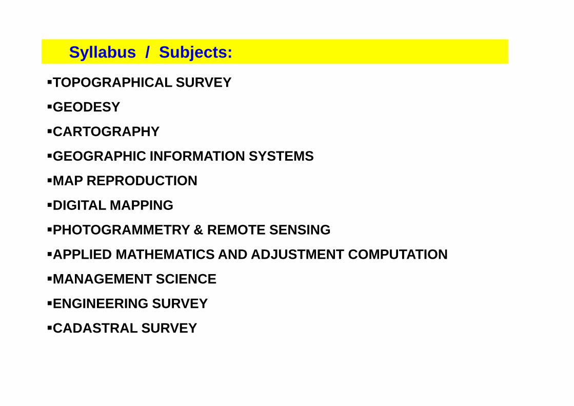
�TOPOGRAPHICAL SURVEY
�GEODESY
�CARTOGRAPHY
�GEOGRAPHIC INFORMATION SYSTEMS
�MAP REPRODUCTION
�DIGITAL MAPPING
Syllabus / Subjects:
�DIGITAL MAPPING
�PHOTOGRAMMETRY & REMOTE SENSING
�APPLIED MATHEMATICS AND ADJUSTMENT COMPUTATION
�MANAGEMENT SCIENCE
�ENGINEERING SURVEY
�CADASTRAL SURVEY

Academic Courses ( In collaboration with JNTU, Hyde rabad )
M.Tech ( Geomatics ) 2 yearsM.Sc ( Geospatial Sciences ) 2 Years
Basic Courses
Surveying Engineer ----------- 2 years
Various Training Programmes:
Surveying Engineer ----------- 2 yearsSurveying Supervisor --------- 2 yearsSurveying Technician --------- 2 years
Advance Courses
Advanced course on GIS --- 12 monthsAdvanced Photogrammetry
& Remote sensing --- 12 monthsAdvanced Geodesy --- 12 months

Specialised / Short Term courses
Fundamental of Survey Engineering -- 12 WeeksControl Survey by GPS and Total Station -- 8 We eksMap Updation by Mobile Mapping -- 2 WeeksDigitisation of Cartographic Documents -- 10 Weeks GIS Applications -- 11 WeeksDigital Photogrammetry & Remote Sensing -- 10 Weeks
Cadastral Survey -- 9 Weeks Office Management -- 6 WeeksOffice Management -- 6 WeeksOffice Procedures -- 6 Weeks
Seminar/Workshops
GIS and modern trends in Mapping ---------------- 1 WeekGPS and Total station Concept & applications - 1 Wee kDatum, Coordinate System ,Map Projection 1 WeekPhotogrammetry for Policy makers------------------- --- 1 WeekModern Survey instruments-------------------------- -------- 1 Week

1st SEMESTER :
1.1 Topographical Surveying and Mapping
1.2 Introduction to Geodesy
1.3 Elements of Photogrammetry
1.4 Remote Sensing
1.5 Object Oriented Programming System & DBMS for GIS
1.6 Lab on OOPS & DBMS
M. Tech(Geomatics) Syllabus:
1.7 Lab on Photogrammetry Remote Sensing
2nd SEMESTER :
2.1 Digital Photogrammetry
2.2 Advanced Geodesy
2.3 Geographical Information System (GIS), Spatial Analysis and Modelling
2.4 Digital Cartography, Visualization and Web GIS
2.5 Project Management and Organizational Development Lab
2.6 Geodesy, Surveying and Geomatics Labs

3rd SEMESTER:
3.1 Elective I- Spatial Data Infrastructures- Cadastre & Land Administration- Natural Resource and Disaster Management- Water Resource Management
3.2 Elective II- Word Wide Web Creation for Spatial Data Dissemination- Urban Planning & Land Administration- Environment Management- Space & Marine Geodesy- Space & Marine Geodesy
3.3 Mini Project
4 th SEMESTER
Final Project at any Industry practical

VARIOUS TYPES OF COURSES RUN AT IIS&M
400
500
600
700
No
. OF
TR
AIN
EE
S
Regular Courses
Special Courses
Short term courses
0
100
200
300
1-4-04 to31-3-05
1-4-05 to31-3-06
1-4-06 to31-3-07
1-4-07 to31-3-08
1-4-08 to31-3-09
1-4-09 to31-3-10
1-4-10 to31-3-11
1-4-11 to31-3-12
YEAR
No
. OF
TR
AIN
EE
S
Short term courses
M.Tech Course

REGULAR COURSES AT IIS&M
250
300
350
400
450
500N
o. O
F T
RA
INE
ES Departmen
tal
Extradepartmental
0
50
100
150
200
1-4-04 to31-3-05
1-4-05 to31-3-06
1-4-06 to31-3-07
1-4-07 to31-3-08
1-4-08 to31-3-09
1-4-09 to31-3-10
1-4-10 to31-3-11
1-4-11 to31-3-12
YEAR
No.
OF
TR
AIN
EE
S
Foreign
Others

SPECIAL COURSES AT IIS&M
250
300
350
400
450N
o. O
F T
RA
INE
ES
Departmental
0
50
100
150
200
1-4-04 to31-3-05
1-4-05 to31-3-06
1-4-06 to31-3-07
1-4-07 to31-3-08
1-4-08 to31-3-09
1-4-09 to31-3-10
1-4-10 TO31-3-11
1-4-11 to31-3-12
YEAR
No.
OF
TR
AIN
EE
S
Extradepartmental
Foreign
Others

SHORT TERM COURSES AT IIS&M
60
80
100
120
140
No.
OF
TR
AIN
EE
S
Departmental
Extradepartmental
Foreign
0
20
40
60
1-4-04 to31-3-05
1-4-05 to31-3-06
1-4-06 to31-3-07
1-4-07 to31-3-08
1-4-08 to31-3-09
1-4-09 to31-3-10
1-4-10 TO31-3-11
1-4-11 to31-3-12
YEAR
No.
OF
TR
AIN
EE
S
Foreign
Others

ACADEMIC COURSE AT IIS&M
14
16
18
No.
OF S
TUD
EN
TS
M.Tech. (Geomatics) conducted in colloboration with JNTU, Hyderabad since 2006 –No. of Students.
0
2
4
6
8
10
12
2006-08 2007-09 2008-10 2009-11 2010-12 2011-13
YEAR
No.
OF S
TUD
EN
TS
DepartmentalSponsoredPrivate

340 – Digitization of Cartographic DocumentsDLR&S, West BengalIntelligence Bureau (MHA)University of KashmirISRO, BangaloreBSFIndian Army
Courses undertaken by various organisations.
Indian ArmyGeology and Mining, JharkhandAF Station, New Delhi
440 – GIS ApplicationsUniversity of KashmirIMD, New DelhiBorder Security ForceGovernment of Afghanistan

690 – Control and Detail Survey by GPS and Total Station
Singareni CollieriesRevenue Department of Government of MizoramESSAR Oil Limited, KolkataArcheological Survey of IndiaGovernment of NagalandGovernment of MeghalayaGovernment of MeghalayaS.V. Polytechnic College, BhopalNHPC, FaridabadGeology and Mining, Dehra DunDLR&S, West BengalNRSC, HyderabadNIT, DurgapurOIL India, Assam
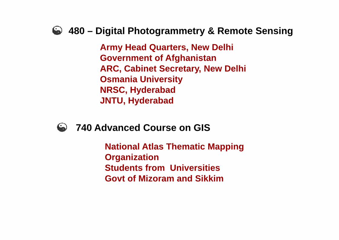
480 – Digital Photogrammetry & Remote Sensing
Army Head Quarters, New DelhiGovernment of AfghanistanARC, Cabinet Secretary, New DelhiOsmania UniversityNRSC, HyderabadJNTU, Hyderabad
740 Advanced Course on GIS
National Atlas Thematic Mapping OrganizationStudents from UniversitiesGovt of Mizoram and Sikkim

GIS & Modern Trends in MappingNational Police AcademySingareni CollieriesMadras CementsUniversity of MumbaiKudremukh Iron OreITBP ITBP L&RS, GwaliorOil India LimitedArcheological Survey of IndiaAtomic EnergyVarious State Government Revenue Officials

Application of GIS for Land UseOsmania UniversityBapatla Engineering CollegeBhadrak Institute of Engineering, OrissaOrissa Engineering CollegeMuffakan jah Engineering College, HyderabadIICT, Gandhinagar
Training to Trainers in SurveyingNational Police Academy, Sivrampally, Hyderabad
Chukka Hydro Power Corporation, Bhutan
Training Designers Sensitive to Geo-informatics Cen treNational Institute of Design, Ahmedabad
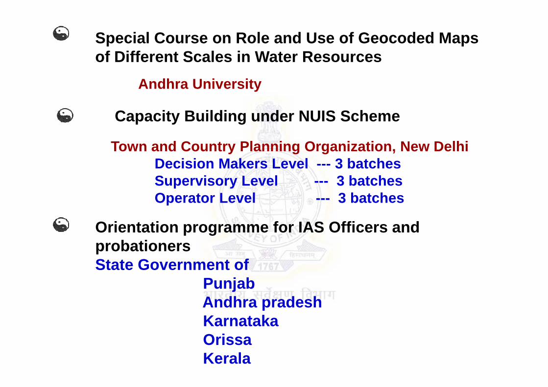
Special Course on Role and Use of Geocoded Maps of Different Scales in Water Resources
Andhra University
Capacity Building under NUIS Scheme
Town and Country Planning Organization, New DelhiDecision Makers Level --- 3 batchesSupervisory Level --- 3 batchesOperator Level --- 3 batchesOperator Level --- 3 batches
Orientation programme for IAS Officers and probationers State Government of
PunjabAndhra pradeshKarnatakaOrissaKerala

Seminar on Photogrammetry and Remote Sensing – AnOverview for Policy Makers
MD University, RohtakAgriculture Engineering Department, Tamil NaduARC, Cabinet Secretary, New DelhiDepartment of Mining and GeologyDLR&S, Andhra PradeshDLR&S, Andhra PradeshDLR&S, Madhya Pradesh

Special Course on GPSNATMO, Kolkata
Seminar on GPS and Total Station – Concepts and Applications
DLR, NagalandNLC Limited, New DelhiForest Survey of India, Dehra DunForest Survey of India, Dehra DunSAIL, RaurkelaShree Cements, ChennaiIrrigation and CAD Department, Andhra PradeshCMRI, DhanbadNMDC
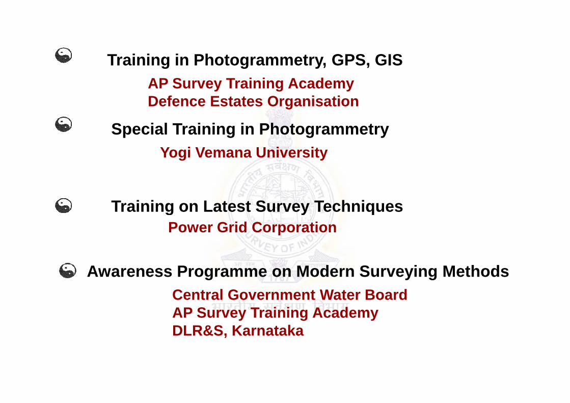
Training in Photogrammetry, GPS, GISAP Survey Training AcademyDefence Estates Organisation
Special Training in PhotogrammetryYogi Vemana University
Training on Latest Survey TechniquesTraining on Latest Survey TechniquesPower Grid Corporation
Awareness Programme on Modern Surveying MethodsCentral Government Water BoardAP Survey Training AcademyDLR&S, Karnataka
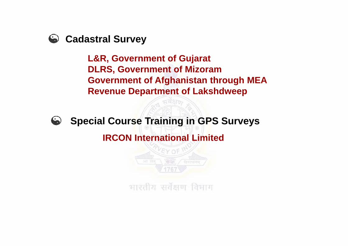
Cadastral Survey
L&R, Government of GujaratDLRS, Government of MizoramGovernment of Afghanistan through MEARevenue Department of Lakshdweep
Special Course Training in GPS SurveysSpecial Course Training in GPS Surveys
IRCON International Limited

Seminar on Modern Survey Instruments and TechniquesGeology and Mining Department GSGS, Army Head Quarters
Special Course on GPS and Total Station
Irrigation and CAD Department, Andhra PradeshSurvey & Settlement, Tamil NaduSurvey & Settlement, Tamil NaduSurvey & Land Records, Kerala
Special Course on Advanced Investigation TechniquesIrrigation and CAD Department, Andhra Pradesh

Furnished Rooms
Non Furnished /
Ordinary
LadiesRooms
FamilyRooms
TOTAL
Mackenzie Hostel(Double
Occupancy)
140 Nil 9 11 160
Lambton Hostel
Non A/C - 34 - - - 34
Hostel Accommodation Available
Hostel(Single)
-do-(Single)
A/C - 5 - - - 5
-do-(Double)
A/C - 16 - - - 16

� Development of skilled manpower� Create adequate infrastructure for education/
training in Geospatial Science & Technologies� Create Awareness about Geospatial Information
among all stakeholders
Need for Building Geospatial Capacity
among all stakeholders � Build Individual and Institutional Capabilities� Effectively Apply Geospatial Information for
Governance, Business and Societal needs.

• Groundwater Prospects and Recharge Zone Mapping
• National Land Records Modernisation Programme (NLRMP)
• National Wastelands Mapping
• National Wetlands Inventory and Assessment
• Snow and Glaciers Studies
• Coastal Regulation Zone Studies
• Forecasting Agricultural output
• Assessment of Irrigation Potential
• National Agricultural Drought Assessment and Monitoring System
• Biodiversity Characterization
• National Urban Information System (NUIS)• National Urban Information System (NUIS)
• Forest Fire Response and Assessment
• Water Resources Information
• Space Based Information System for Decentralized Planning
• Natural Resources Census
• Flood Mapping and Monitoring
• Watershed Monitoring and Development
• Potential Fishery Zone (PFZ) Forecasting
• Defence Preparatory Planning
• Town & Country Planning
• Disaster Management
• Integrated Coastal Zone Management (ICZM)
• Encroachments Detection & Management

Delineation of the
Hazard Line along the
entire coast of India is
part of the many goals
and objectives of the
ICZM project
ICZM seeks, over the
long-term, to balance
environmental, economic,
social, cultural and
recreational objectives, all
within the limits set by
natural dynamics
36

• 0.5 m elevation contour map uptoa width of 7km on 1:10,000 scale
to serve as base map.
• 3-D digital elevation model (DEM).• Tidal data Analysis. • Composite Hazard Line by overlaying Flood Line & Erosion
Line.
37February 4, 2013 Geospatial Forum - 2013

Spatial information helps
in assessing the quantum
of encroached land/water
area
Identified encroachments
can be easily removed
38
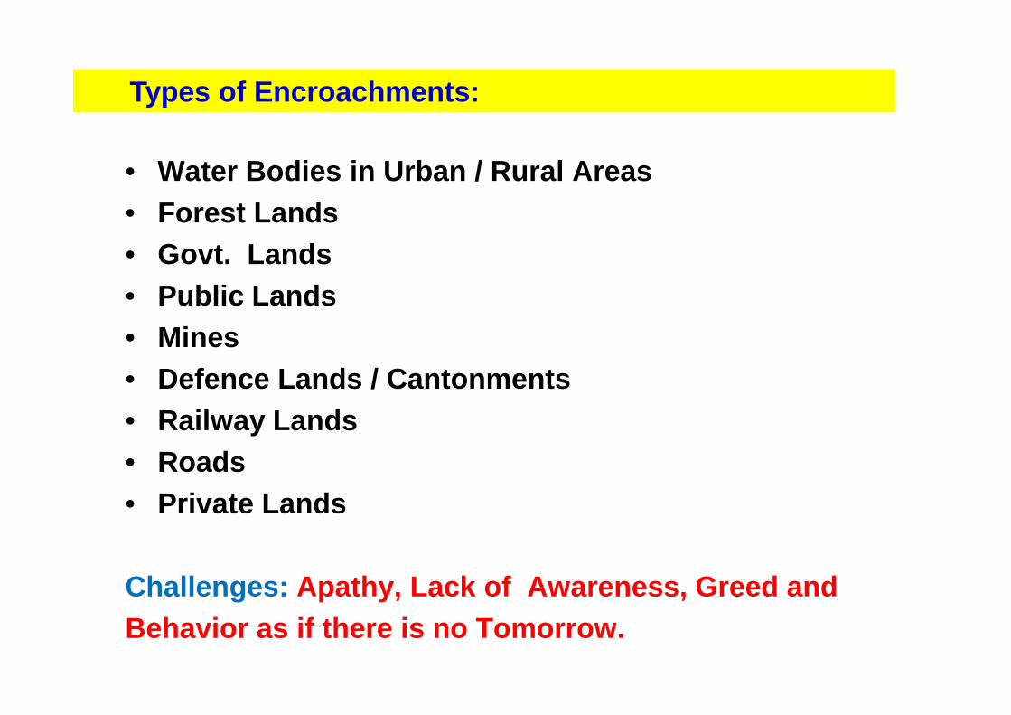
• Water Bodies in Urban / Rural Areas• Forest Lands• Govt. Lands• Public Lands• Mines
Types of Encroachments:
• Defence Lands / Cantonments • Railway Lands• Roads• Private Lands
Challenges: Apathy, Lack of Awareness, Greed andBehavior as if there is no Tomorrow.

• National Map Policy 2005
• Remote Sensing Data Policy 2011
• CRZ Notification 2011
• National Data Sharing and Accessibility Policy 2012
• .
Regulatory Policies Governing Geospatial Sector:
• .
• .
• .
• .
• Right to Spatial Information Policy ??
“Strengthening Tomorrow’s Future”

Thank You
http://soisti.ap.nic.in


![Dharma [EDocFind.com]](https://img.pdfslide.us/doc/110x75/577d2e9b1a28ab4e1eaf8233/dharma-edocfindcom.jpg)