Embed Size (px)
Citation preview

ORANGE
Phased EvacuationDuring a threat of a hurricane, a phased evacuation will be based on geographic location and time in which tropical stormwinds are forecasted to reach the affected areas.
Phased evacuation procedures are for traffic management purposes only. Consult your local Office of Emergency PreparednessDirector for further evacuation information.
Phase III - 30 Hours before onset of tropical storm winds. Includes areas on the East Bank of the Mississippi River in the New Orleans Metropolitan Area which are within the levee protection system but remain vulnerable to a slow-moving Category 3 or any Category 4 or 5 storm. These areas are depicted in YELLOW on the Evacuation Map. During Phase III, certain routes will be directed and the Contraflow Plan implemented.
Phase II - 40 Hours before onset of tropical storm winds. Includes areas south of the Mississippi River which are levee protected but remain vulnerable to Category 2 or higher storms. These areas are depicted in on the Evacuation Map. During Phase II there are no route restrictions.
Phase I - 50 Hours before onset of tropical storm winds. Includes areas south of the Intracoastal Waterway. These areas are outside any levee protection system and are vulnerable to Category 1 and 2 storms. These areas are depicted in RED on the Evacuation Map. During Phase I there are no route restrictions.
59
59
110
55
20
84
49
98
49
49E
51
61
11
84
165
84
171
171
80
165
51
80
8080
10
49
20
Texas
Mississippi
11
90
98
84
45
49
61
51
61
61
19012
12
11
10
10
90
55
84
80
71
190
190
190
90
167
21
41
4639
3923
23
45
1
5557
56
24
20
182
1
1
70182
25
16
6719
1
28
28
8
1326113
26
99
27
109
12
12
339
31
333
8235
13
14
82
10114
2727
82
6
1
1
1
3
2
147
34
15
17
17133
65
65
43
44916
90
21
90
167
3127
3235
1
220
10
55
2
716
79
10
2
Vernon
Winn
Cameron
Rapides
Hinds
Union
Allen
Yazoo
Sabine
Vermilion
Caddo
Amite
Newton
Perry
Jones
Scott
Grant
Bossier
Rankin
LaFourche
Copiah
Calcasieu
De Soto Smith
Jasper
Terrebonne
Jasper
Natchitoches
Beauregard
Bienville
Acadia
Leake
Pike
Iberia
Tensas
Avoyelles
St. Landry
Warren
Madison
Plaquemines
Sabine
Iberville
St. Mary
Lincoln
La Salle
Claiborne
Franklin
Marion Lamar
Stone
Newton
Pearl River
Madison
Webster
Catahoula
Wilkinson
Concordia
Morehouse
Ouachita
Franklin
Jackson
Harrison
Clarke
Simpson
Tangipahoa
Livingston
Wayne
Adams
Forrest
Lincoln
St. Tammany
Neshoba
Richland
Caldwell
St. Martin
Evangeline
Washington
Kemper
Jefferson
Hancock
Shelby
Walthall
Claiborne
Orange
Sharkey
Lawrence
Jefferson Davis
Issaquena
Covington
Red River
Pointe Coupee
Greene
St. Helena
Lauderdale
East Carroll
St. Bernard
Jefferson
Attala
St. Charles
East Feliciana
Assumption
Jackson
Ascension
West Carroll
Lafayette
West Feliciana
Jefferson
Orleans
Jefferson Davis
East Baton Rouge
George
St. James
St. Martin
Iberia
Holmes WinstonHumphreys
NoxubeeUnion
St. John the Baptist
Panola
Ashley
West Baton Rouge
Harrison
San Augustine
CassColumbia ChicotLafayetteMiller Washington
Tyler
Tyler
84
167
90
171
165
71
65
371
61
425
190
79
63
90
71
165
167
79
65
84
167
84
90
84
167
165
371
65
171
190
167
190
49
20
10
55
59
310
510
220
210
110
610
20
LOUISIANA EMERGENCY EVACUATION MAP
Natchez
Vicksburg
Jackson
Hattiesburg
Meridian
0 10 20 30 405Miles
Gulfport
Monroe
Shreveport
Alexandria
Lake Charles LafayetteBaton Rouge
Houma
New Orleans
SlidellCovington
2
Gulf of Mexico
LEGEND
Urban AreasIntracoastal WaterwayMississippi River
US HighwaysInterstate Highways
10 Interstate Highway ShieldUS Highway Shield61
1 Shelter Information PointsState Highway Shield1
Mississippi State Highways
Parishes/Counties
Louisiana Evacuation Routes
2
1
6
53
7
48

Page 1 of 6
EMERGENCY EVACUATION GUIDE I. Information points
LOUISIANA SHELTER TASK FORCE EMERGENCY SHELTER INFORMATION POINTS FOR HURRICANE EVACUATIONS:
EVACUATION AREA OF THE STATE INFORMATION POINT LOCATION ADDRESS
Re-entry from Mississippi on US 65 & US 84
Tourist Welcome Center US 65 & 84 1401 Carter St. (US 84) Vidalia, LA
Re-entry from Mississippi on I-20
Tourist Welcome Center 836 I-20 West Tallulah, LA
From the Southeast area on LA 1 Paragon Casino 711 Paragon Place Marksville, LA
From the Southeast/Central areas on I-49
Sammy’s Truck Stop I-49, Exit 53 3601 LA 115 W Bunkie, LA
From the Southeast/Central areas on US 71
Med Express Office 7525 US 71 Alexandria, LA
From the Southeast/Southwest/Central areas on US 171 and I-49
P.E. Gym LSU-Shreveport
One University Place Shreveport, LA
From the Southwest area on US 171 Pickering High School 180 Lebleu Rd. Leesville, LA
From the Southwest/Central areas on US 165 Mowad Civic Center 5th Ave. and 10th St. 1 blk. off US 165 Oakdale, LA
II. Agency Contact Information
A. American Red Cross (866) GET-INFO or (866) 438-4636 www.preparelouisiana.redcross.org
1. Acadiana Chapter (Lafayette) (337) 234-7371 2. Central Louisiana Chapter (Alexandria) (318) 442-6621 3. Louisiana Capital Area Chapter (Baton Rouge) (225) 291-4533 4. Northeast Louisiana Chapter (Monroe) (318) 323-5141 5. Northwest Louisiana Chapter (Shreveport) (318) 865-9545 6. Southeast Louisiana Chapter (Greater New Orleans) (800) 229-8191 7. Southwest Louisiana Chapter (Lake Charles) (337) 478-5122 8. St. Bernard Parish Chapter (Chalmette) (504) 277-8163
B. Louisiana Department of Transportation and Development (225) 379-1232
www.dotd.state.la.us
C. Louisiana Office of Homeland Security (800) 256-7036 and Emergency Preparedness www.ohsep.louisiana.gov

Page 2 of 6
D. Louisiana State Police Road Closure Information (800) 469-4828 www.lsp.org
1. Troop A (Baton Rouge) (800) 969-2059 2. Troop B (Kenner) (800) 964-8076 3. Troop C (Gray) (800) 659-5907 4. Troop D (Lake Charles) (888) 225-5577 5. Troop E (Alexandria) (800) 256-4160 6. Troop F (Monroe) (866) 292-8320 7. Troop G (Bossier City) (866) 853-6580 8. Troop I (Lafayette) (888) 768-8746 9. Troop L (Covingtion) (888) 339-8659 or dial *LSP (*577) from a cellular phone
E. Federal Emergency Management Agency www.ready.gov
F. National Weather Service www.srh.noaa.gov
G. Louisiana Department of Social Services www.dss.state.la.us
H. Louisiana Department of Health and Hospitals www.dhh.state.la.us III. Public Shelter information Shelters are operated by trained individuals and ensure that the safety, security, and basic needs of its residents are met.
A. What to bring to a shelter Change of clothing, blanket and pillow for each family member Your disaster supply kit, including food, medications, comfort items and special items for infant or elderly family
members.
B. What NOT to bring There are no weapons, drugs, alcohol or pets (service animals excluded) allowed in shelters.
IV. Shelter-in-place information “Sheltering-in-place" is a precaution aimed at keeping citizens safe while remaining indoors. This is not the same thing as evacuating to a shelter and not recommended for hurricanes. When a “shelter-in-place” order is given by either local or state government, citizens within the affected area should take the following protective measures:
Go indoors and close all windows and doors. Turn off all sources of outside air (i.e. air conditioners and ventilation fans/ducts). Remain indoors until notified that it is safe to move outdoors. Stay tuned to your local radio/television station to receive official notices. Limit telephone usage for emergency calls only. This is to prevent the telephone lines from being overloaded with non-
emergency calls. IF YOU MUST BE OUTDOORS Protect your breathing by covering your mouth and nose with a cloth or handkerchief. IF YOU ARE IN YOUR VEHICLE AND CANNOT GET TO A SAFE BUILDING:
Pull over to the side of the road. Turn off the engine and close windows and vents. Listen to the radio regularly for updated advice, instructions and conditions.

Page 3 of 6
V. Family Communications Plan Setting up a communication plan ahead of time will help make sure you and your family can connect as easily and quickly as possible.
Designate an individual outside of the state to serve as a family point of contact. (After a disaster, it’s often easier to call out-of-state than within the affected area.)
Make sure that all family members know who this person is and how to contact him/her.
After a disaster or evacuation, all family members should make contact with the designated individual. Try choosing a certain time for everyone to check in.
VI. Family Disaster Supply Kit There are six basics that you should stock for your disaster supply kit: water, food, clothing and bedding, first aid supplies, tools and emergency supplies and special items. Keep these items in a waterproof container that can be easily transported from your home to your car and your safe place. Assemble your kit now to allow for immediate action during an emergency. Your family’s disaster supply kit should include at least a three-day supply of:
Water - One gallon of water per person per day Non-perishable food - Select food items that are compact and lightweight. Include:
o Ready-to-eat canned meats, fruits and vegetables o Canned juices o High energy foods o Vitamins o Comfort goods o Condiments o Food for infant
Clothing and bedding Include at least one complete change of clothing and footwear per person and the following weather- appropriate items: o Sturdy shoes or work boots o Rain gear o Blankets or sleeping bags o Hat and gloves o Thermal underwear o Sunglasses
First aid supplies - Assemble a first aid kit for your home and one for each car Tools and emergency supplies
o Mess kits, paper cups, plates and plastic utensils o Emergency preparedness manual o Battery-operated radio and extra batteries o Flashlight and extra batteries o Cash or traveler's checks, change o Non-electric can opener, utility knife o Fire extinguisher: small canister ABC-type o Tube tent o Pliers o Tape o Compass o Matches in a waterproof container o Aluminum foil o Plastic storage containers o Signal flare o Paper, pencil o Needles, thread o Medicine dropper o Shut-off wrench to turn off household gas and water o Whistle o Plastic sheeting
Page 4 of 6
o Sanitation supplies o Official DOTD Travel Map o Louisiana Citizen Awareness and Disaster Evacuation Guide
Special items o Infant and medical supplies: Remember supplies for family members with special requirements, such as infants, elderly or disabled persons and persons taking medications. o Entertainment - Games and books o Important family documents
Wills, insurance policies, contracts, deeds, stocks and bonds Passports, social security cards and immunization records Bank account numbers Credit card account numbers and company addresses Inventory of valuable household goods and important telephone numbers Family records (birth, marriage, death certificates)
Store your kit in a convenient place known to all family members. Keep a smaller version of the supply kit in the trunk of your car. Change your stored water supply every six months so it stays fresh. Replace your stored food every six months. Re-think your kit and family needs at least once a year. Replace batteries, update clothes, etc.
VII. Preparing your pets If you are a pet owner, your family’s disaster plan must include your pets. In the event of a disaster, if you must evacuate, the best thing you can do to protect your pets is to evacuate them too.
Identify boarding facilities, veterinarians or hotels outside of the affected areas that can accept your pets. If you have notice of an impending disaster, call ahead for reservations.
Pet-friendly shelters may be opened during an evacuation. This information will be available at shelter information points. Create a disaster readiness kit for your pet including food, water, first aid supplies, feeding dishes, leashes, carrier,
blanket, etc. Make sure all family members are aware of these preparations.
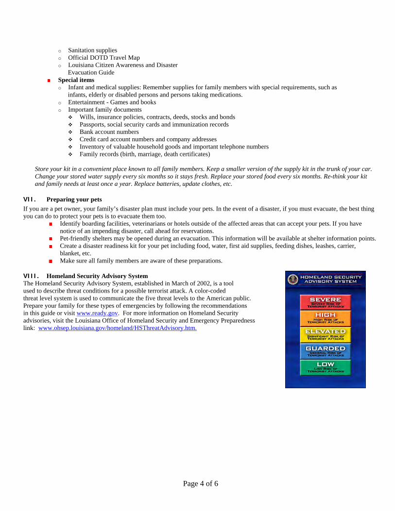
VIII. Homeland Security Advisory System The Homeland Security Advisory System, established in March of 2002, is a tool used to describe threat conditions for a possible terrorist attack. A color-coded threat level system is used to communicate the five threat levels to the American public. Prepare your family for these types of emergencies by following the recommendations in this guide or visit www.ready.gov. For more information on Homeland Security advisories, visit the Louisiana Office of Homeland Security and Emergency Preparedness link: www.ohsep.louisiana.gov/homeland/HSThreatAdvisory.htm.
Page 5 of 6
IX. Radio Frequency System
A. Louisiana Emergency Alert System
The following radio stations are key participants in the Louisiana Emergency Alert System. In the event of an emergency, these stations will broadcast emergency information.
Alexandria AM 970 (KSYL) AM 580/FM 96.9 (KZMZ) FM 93.1(KQID) Baton Rouge AM 1150 (WJBO) FM 102.5 (WFMF) Crowley FM 102.9 (KAJN)
Lafayette AM 1330 (KVOL) FM 99.9 (KTDY) Lake Charles AM 1470 (KLCL) FM 99.5 (KHLA) New Orleans AM 870 (WWL) FM 101.9 (WLMG)
Northeast AM 540/FM 101.9 (KNOE) Ruston AM 1490 (KRUS) FM 107.5 (KXKZ) Shreveport AM 1130/FM 94.5 (KWKH)
B. NOAA Weather Radio NOAA Weather Radio is a nationwide network of radio stations broadcasting continuous weather information direct from a nearby National Weather Service office. NWR broadcasts National Weather Service warnings, watches, forecasts and other hazard information 24 hours a day.
X. Severe Weather Terms to know:
Natural disasters most likely to occur in Louisiana, particularly in low-lying areas bordering the Gulf of Mexico, include hurricanes and flooding due to heavy rains. Residents should be familiar with several terms that describe severe weather conditions:
A. Storm Surge: An abnormal rise of the sea along a shore as the result, primarily, of the winds from a storm. B. Watch: Adverse conditions are possible in the specified area of the WATCH, usually within 36 hours. May be applied to thunderstorms, tornadoes, floods, or hurricanes.
C. Warning: Adverse conditions are expected in the specified area of the WARNING, usually within 24 hours. May be applied to thunderstorms, tornadoes, floods, or hurricanes.
XI. Measuring Hurricane Strength – The Saffir-Simpson Hurricane Scale Category 1: Minimal Damage. Winds 74-95 mph. Storm surge generally 4-5 ft. above normal. Category 2: Moderate Damage. Winds 96-110 mph. Storm surge generally 6-8 ft. above normal Category 3: Extensive Damage. Winds 111-130 mph. Storm surge generally 9-12 ft. above normal. Category 4: Extreme Damage. Winds 131-155 mph. Storm surge generally 13-18 ft. above normal. Category 5: Catastrophic Damage. Winds greater than 155 mph. Storm surge generally greater than 18 ft above normal.

Page 6 of 6
Citizen Corps is a nationwide grass roots movement to actively involve all Americans in making our communities and our nation safer, stronger and better prepared for all hazards and threats. We all have a role in hometown security and Citizen Corps provides local opportunities for everyone to prepare, train and volunteer. At the community level, Citizen Corps activities are coordinated by a Citizen Corps Council. These Councils bring together local leaders, citizen volunteers and the network of first responder organizations, such as fire departments, police departments and emergency medical personnel. Local Citizen Corps Councils:
Promote and strengthen the Citizen Corps programs at the community level; Provide opportunities for special skills and interests; Develop targeted outreach for the community, including special needs groups; Provide training for citizens in first aid and emergency preparedness; Organize special projects and community events; Encourage cooperation and collaboration among community leaders; Capture smart practices and report accomplishments; and Create opportunities for all residents to participate.
The Community Emergency Response Team (CERT) Program educates people about disaster preparedness and trains them in basic disaster response skills, such as fire safety, light search and rescue, and disaster medical operations. Using their training, CERT members can assist others in their neighborhood or workplace following an event and can take a more active role in preparing their community. The program is administered by the Department of Homeland Security (DHS).
The Fire Corps promotes the use of citizen advocates to enhance the capacity of resource-constrained fire and rescue departments at all levels: volunteer, combination, and career. Citizen advocates can assist local fire departments in a range of activities including fire safety outreach, youth programs, and administrative support. Fire Corps provides resources to assist fire and rescue departments in creating opportunities for citizen advocates and promotes citizen participation. Fire Corps is funded through DHS and is managed and implemented through a partnership between the National Volunteer Fire Council, the International Association of Fire Fighters, and the International Association of Fire Chiefs.
An expanded Neighborhood Watch Program (NWP) incorporates terrorism awareness education into its existing crime prevention mission, while also serving as a way to bring residents together to focus on emergency preparedness and emergency response training. Funded by Department of Justice (DOJ), Neighborhood Watch is administered by the National Sheriffs' Association.
The Medical Reserve Corps (MRC) Program strengthens communities by helping medical, public health and other volunteers offer their expertise throughout the year as well as during local emergencies and other times of community need. MRC volunteers work in coordination with existing local emergency response programs and also supplement existing community public health initiatives, such as outreach and prevention, immunization programs, blood drives, case management, care planning, and other efforts. The MRC program is administered by Health and Human Services (HHS).
Volunteers in Police Service (VIPS) works to enhance the capacity of state and local law enforcement to utilize volunteers. VIPS serves as a gateway to resources and information for and about law enforcement volunteer programs. Funded by DOJ, VIPS is managed and implemented by International Association of Chiefs of Police. To Join Citizen Corps contact the Citizen Corps Coordinator at (225) 925-7500