Embed Size (px)
Citation preview
Locating in Fingerprint Space: Wireless Indoor Localization
with Little Human Intervention
Zheng Yang, Chenshu Wu, and Yunhao Liu
Motivations
Solutions
Evaluations
Discussions
Conclusions
Outline
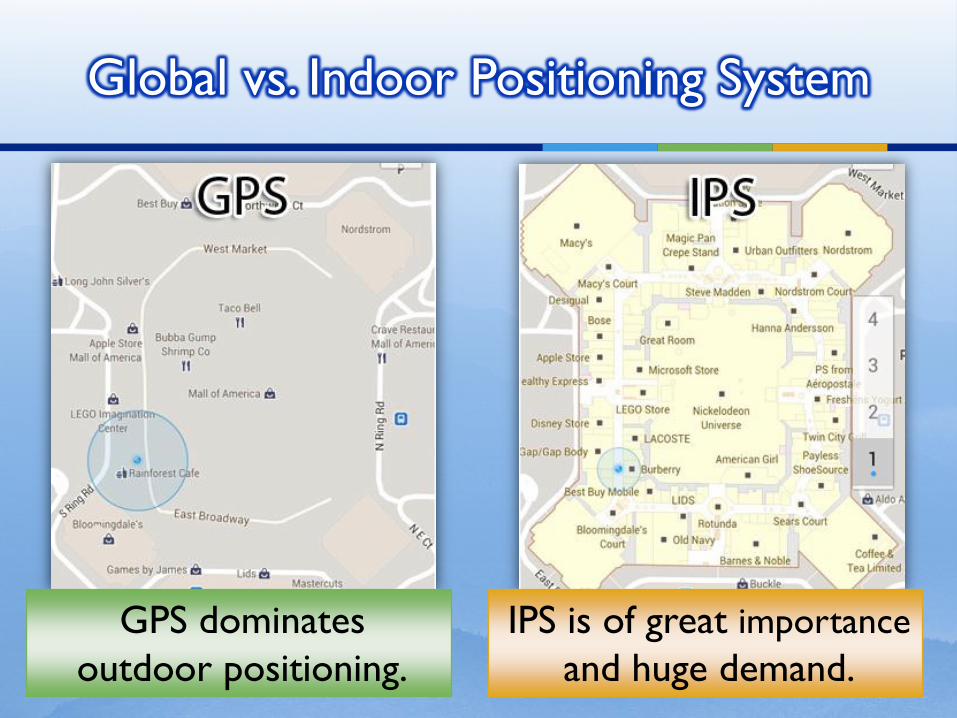
Global vs. Indoor Positioning System
IPS is of great importance
and huge demand.
GPS dominates
outdoor positioning.
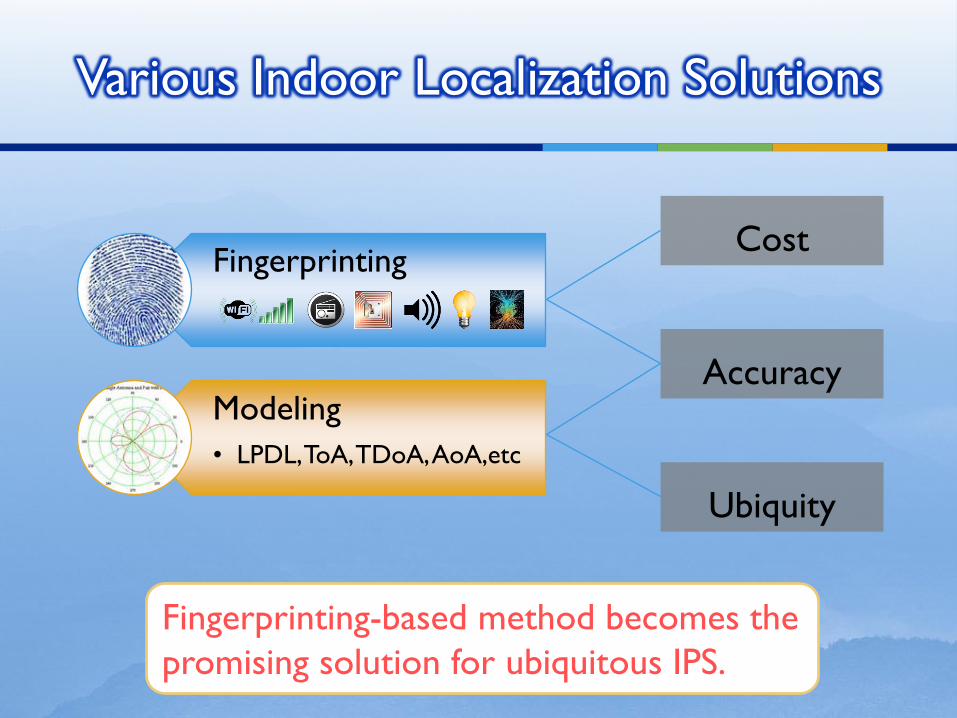
Various Indoor Localization Solutions
Fingerprinting
Modeling
• LPDL, ToA, TDoA, AoA,etc
Accuracy
Cost
Ubiquity
Fingerprinting-based method becomes the
promising solution for ubiquitous IPS.
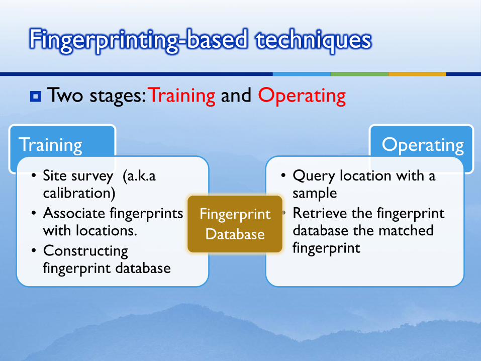
Two stages: Training and Operating
Fingerprinting-based techniques
Training
• Site survey (a.k.a calibration)
• Associate fingerprints with locations.
• Constructing fingerprint database
Operating
• Query location with a sample
• Retrieve the fingerprint database the matched fingerprint
Fingerprint
Database
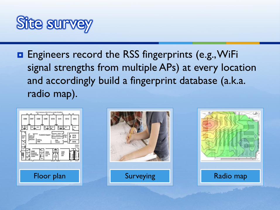
Engineers record the RSS fingerprints (e.g., WiFi
signal strengths from multiple APs) at every location
and accordingly build a fingerprint database (a.k.a.
radio map).
Site survey
Floor plan Surveying Radio map
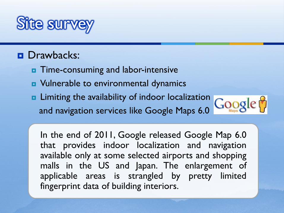
Drawbacks:
Time-consuming and labor-intensive
Vulnerable to environmental dynamics
Limiting the availability of indoor localization
and navigation services like Google Maps 6.0
Site survey
In the end of 2011, Google released Google Map 6.0 that provides indoor localization and navigation available only at some selected airports and shopping malls in the US and Japan. The enlargement of applicable areas is strangled by pretty limited fingerprint data of building interiors.
Motivations
Solutions
Evaluations
Discussions
Conclusions
Outline
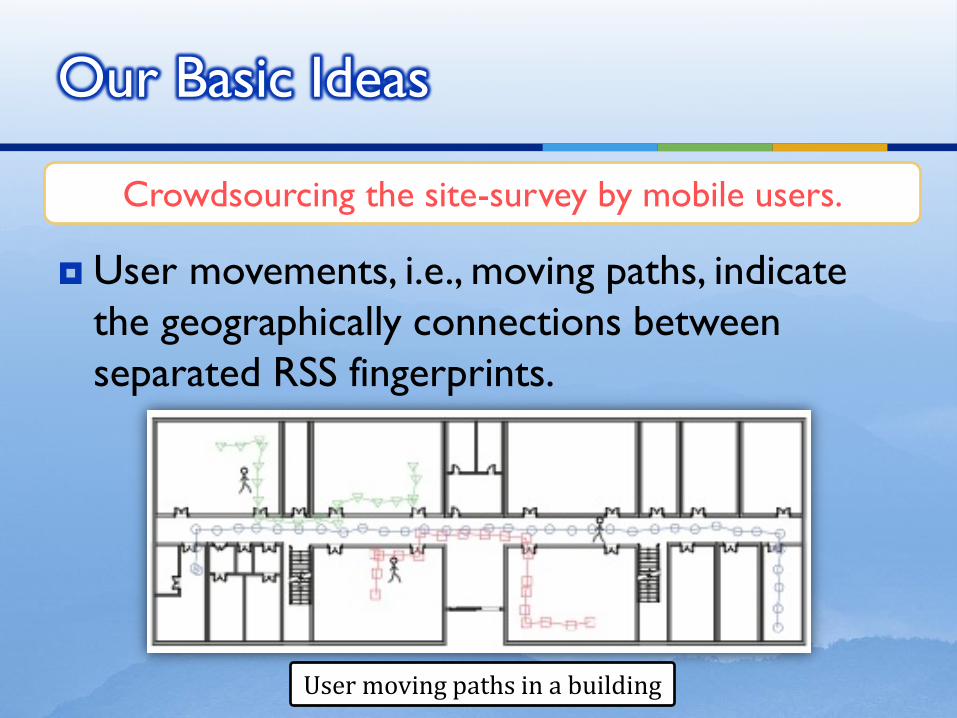
User movements, i.e., moving paths, indicate
the geographically connections between
separated RSS fingerprints.
Our Basic Ideas
Crowdsourcing the site-survey by mobile users.
User moving paths in a building
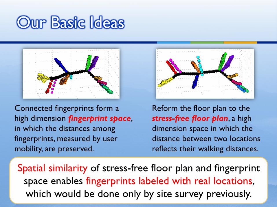
Spatial similarity of stress-free floor plan and fingerprint
space enables fingerprints labeled with real locations,
which would be done only by site survey previously.
Our Basic Ideas
Connected fingerprints form a
high dimension fingerprint space,
in which the distances among
fingerprints, measured by user
mobility, are preserved.
Reform the floor plan to the
stress-free floor plan, a high
dimension space in which the
distance between two locations
reflects their walking distances.
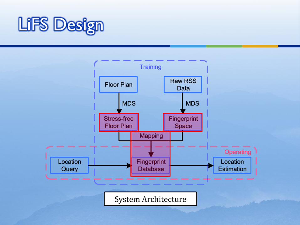
LiFS Design
System Architecture
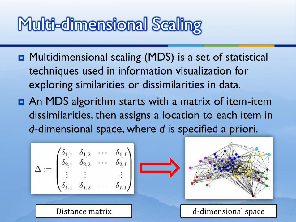
Multi-dimensional Scaling
Multidimensional scaling (MDS) is a set of statistical
techniques used in information visualization for
exploring similarities or dissimilarities in data.
An MDS algorithm starts with a matrix of item-item
dissimilarities, then assigns a location to each item in
d-dimensional space, where d is specified a priori.
Distance matrix d-dimensional space
Motivations
Solutions
Stress-free Floor Plan
Fingerprint Space
Mapping
Evaluations
Discussions
Conclusions
Outline
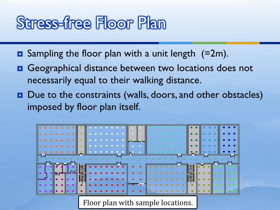
Stress-free Floor Plan
Floor plan with sample locations.
Sampling the floor plan with a unit length (=2m).
Geographical distance between two locations does not
necessarily equal to their walking distance.
Due to the constraints (walls, doors, and other obstacles)
imposed by floor plan itself.
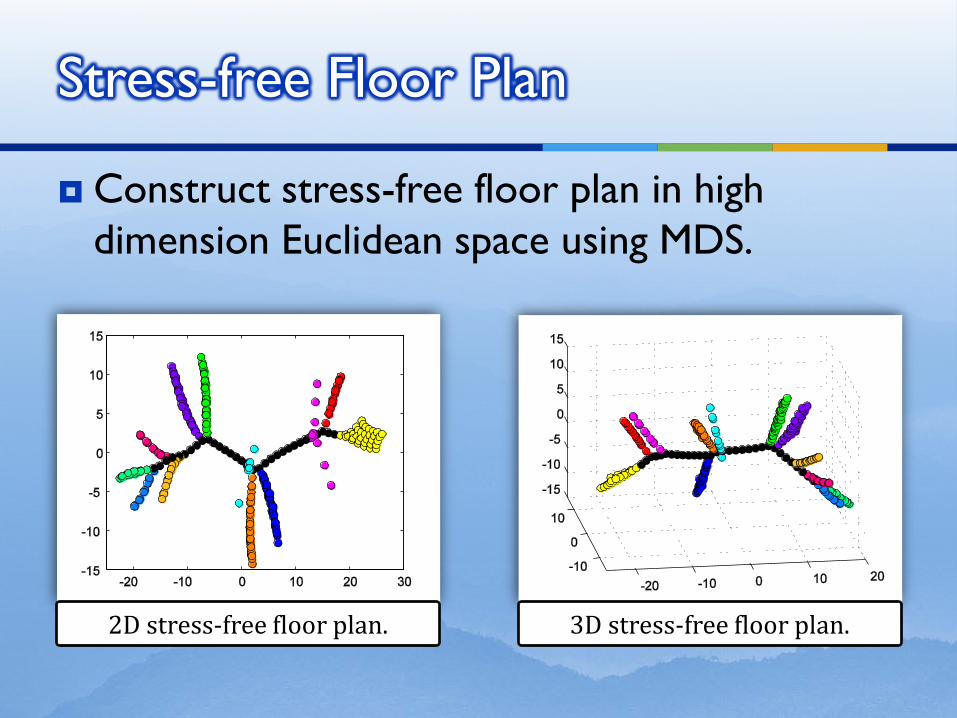
Construct stress-free floor plan in high
dimension Euclidean space using MDS.
Stress-free Floor Plan
2D stress-free floor plan. 3D stress-free floor plan.
Motivations
Solutions
Stress-free Floor Plan
Fingerprint Space
Mapping
Evaluations
Discussions
Conclusions
Outline
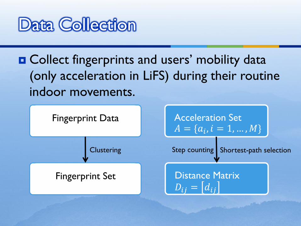
Collect fingerprints and users’ mobility data
(only acceleration in LiFS) during their routine
indoor movements.
Data Collection
Acceleration Set 𝐴 = {𝑎𝑖 , 𝑖 = 1, … , 𝑀}
Fingerprint Data
Fingerprint Set Distance Matrix
𝐷𝑖𝑗 = 𝑑𝑖𝑗
Clustering Step counting Shortest-path selection
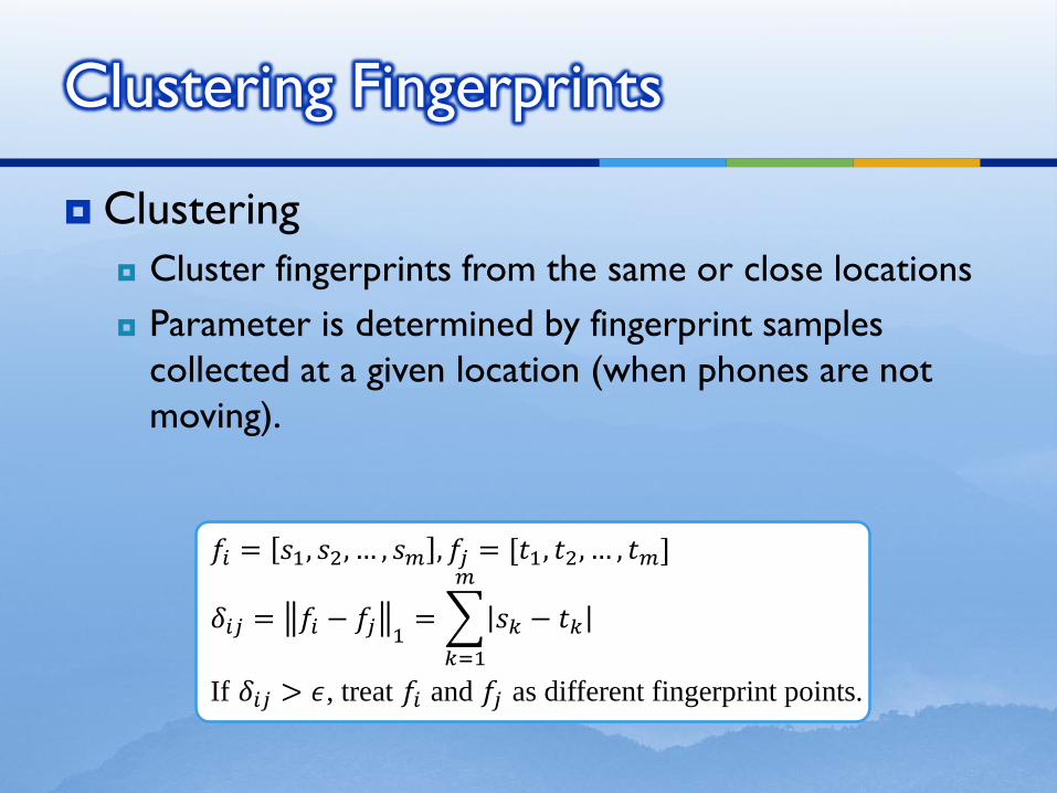
Clustering
Cluster fingerprints from the same or close locations
Parameter is determined by fingerprint samples
collected at a given location (when phones are not
moving).
Clustering Fingerprints
𝑓𝑖 = 𝑠1, 𝑠2, … , 𝑠𝑚 , 𝑓𝑗 = [𝑡1, 𝑡2, … , 𝑡𝑚]
𝛿𝑖𝑗 = 𝑓𝑖 − 𝑓𝑗 1= 𝑠𝑘 − 𝑡𝑘
𝑚
𝑘=1
If 𝛿𝑖𝑗 > 𝜖, treat 𝑓𝑖 and 𝑓𝑗 as different fingerprint points.
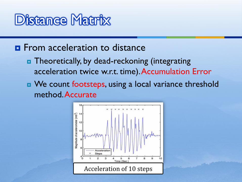
From acceleration to distance
Theoretically, by dead-reckoning (integrating
acceleration twice w.r.t. time). Accumulation Error
We count footsteps, using a local variance threshold
method. Accurate
Distance Matrix
Acceleration of 10 steps
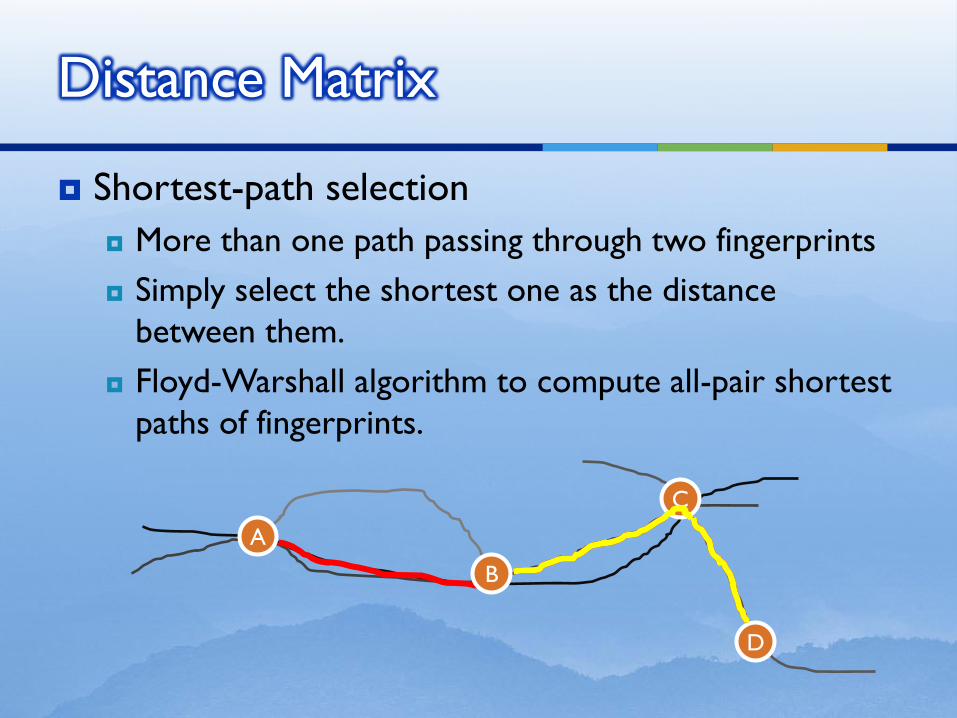
Shortest-path selection
More than one path passing through two fingerprints
Simply select the shortest one as the distance
between them.
Floyd-Warshall algorithm to compute all-pair shortest
paths of fingerprints.
Distance Matrix
A
B
C
D
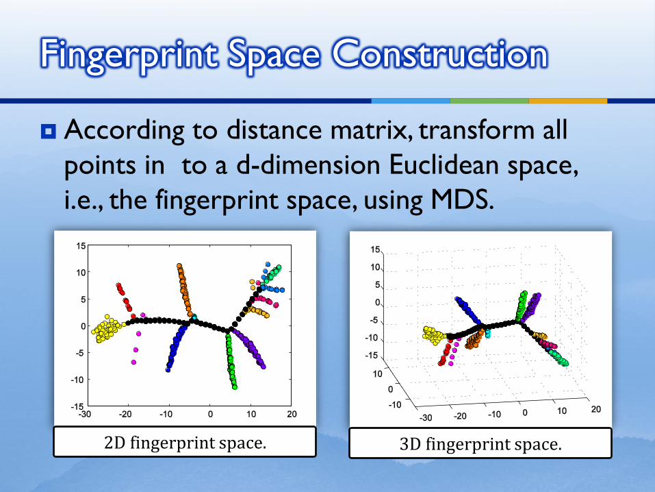
According to distance matrix, transform all
points in to a d-dimension Euclidean space,
i.e., the fingerprint space, using MDS.
Fingerprint Space Construction
2D fingerprint space. 3D fingerprint space.
Motivations
Solutions
Stress-free Floor Plan
Fingerprint Space
Mapping
Evaluations
Discussions
Conclusions
Outline
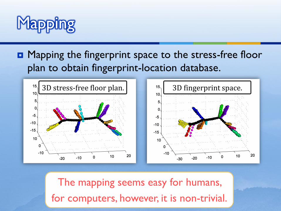
Mapping the fingerprint space to the stress-free floor
plan to obtain fingerprint-location database.
Mapping
3D fingerprint space. 3D stress-free floor plan.
The mapping seems easy for humans,
for computers, however, it is non-trivial.
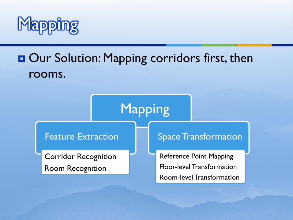
Our Solution: Mapping corridors first, then
rooms.
Mapping
Mapping
Feature Extraction
Corridor Recognition
Room Recognition
Space Transformation
Reference Point Mapping
Floor-level Transformation
Room-level Transformation
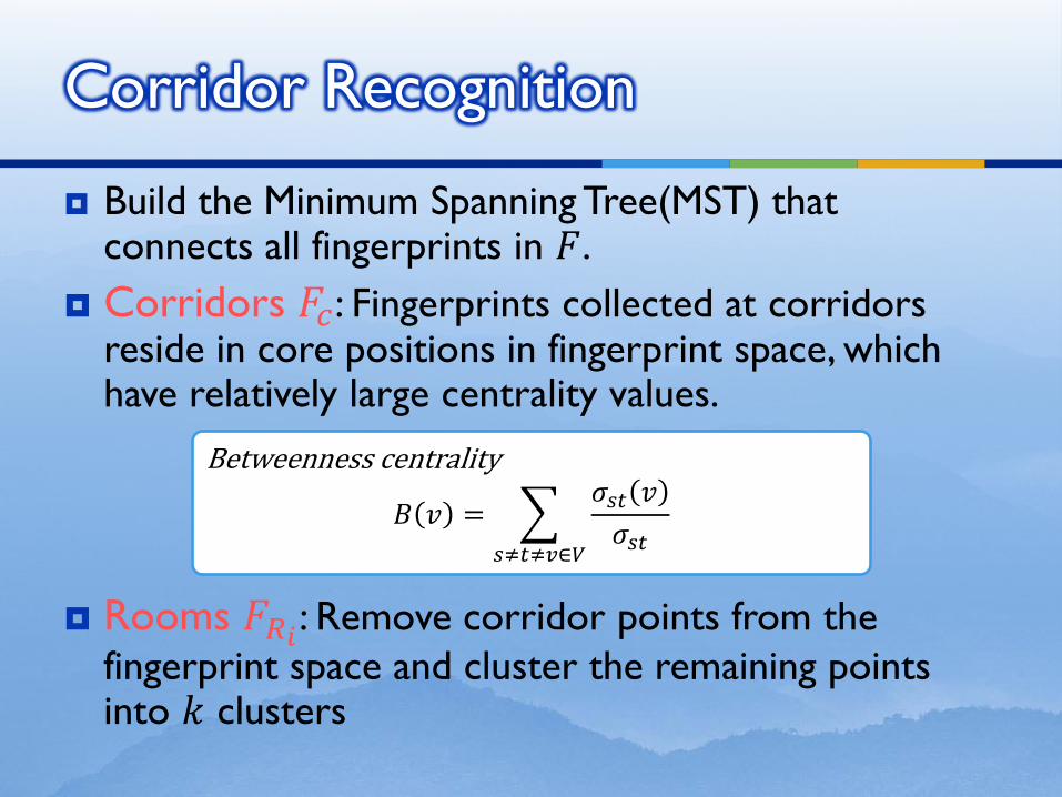
Build the Minimum Spanning Tree(MST) that connects all fingerprints in 𝐹.
Corridors 𝐹𝑐 : Fingerprints collected at corridors reside in core positions in fingerprint space, which have relatively large centrality values.
Rooms 𝐹𝑅𝑖: Remove corridor points from the
fingerprint space and cluster the remaining points into 𝑘 clusters
Corridor Recognition
Betweenness centrality
𝐵 𝑣 = 𝜎𝑠𝑡 𝑣
𝜎𝑠𝑡𝑠≠𝑡≠𝑣∈𝑉
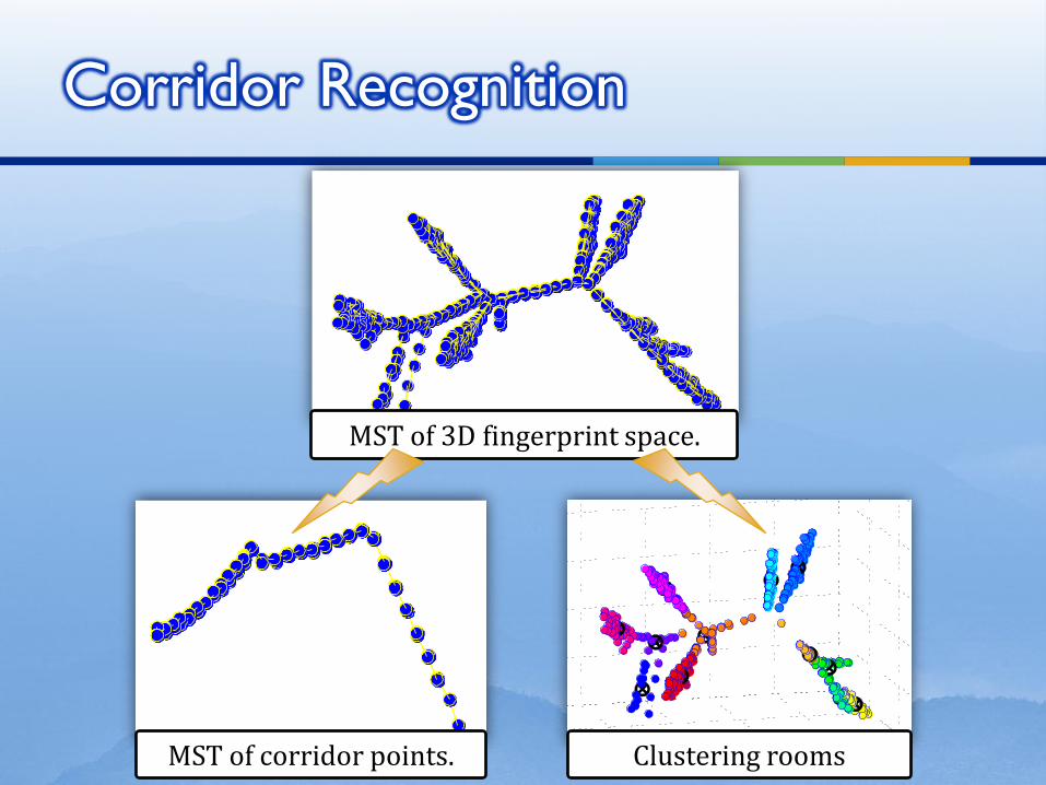
Corridor Recognition
MST of 3D fingerprint space.
MST of corridor points. Clustering rooms
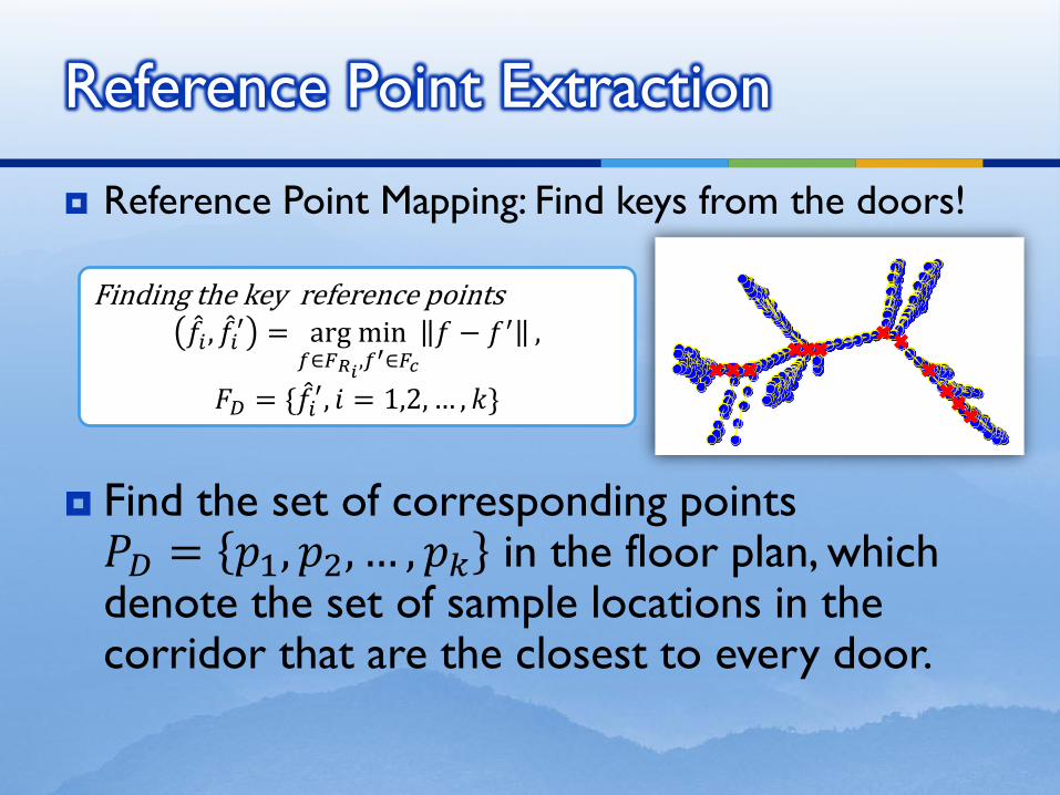
Reference Point Mapping: Find keys from the doors!
Find the set of corresponding points 𝑃𝐷 = 𝑝1, 𝑝2, … , 𝑝𝑘 in the floor plan, which denote the set of sample locations in the corridor that are the closest to every door.
Reference Point Extraction
Finding the key reference points 𝑓 𝑖 , 𝑓 𝑖
′ = arg min𝑓∈𝐹𝑅𝑖
,𝑓′∈𝐹𝑐
𝑓 − 𝑓′ ,
𝐹𝐷 = {𝑓 𝑖′, 𝑖 = 1,2, … , 𝑘}

Mapping 𝐹𝐷 to 𝑃𝐷
Reference Point Mapping
Reference point mapping 𝜎1: 𝑓𝑖 ↦ 𝑝𝑖;
𝜎2: 𝑓𝑖 ↦ 𝑝𝑘−𝑖+1;
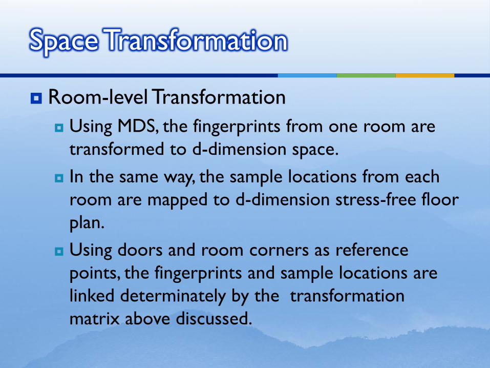
Room-level Transformation
Using MDS, the fingerprints from one room are
transformed to d-dimension space.
In the same way, the sample locations from each
room are mapped to d-dimension stress-free floor
plan.
Using doors and room corners as reference
points, the fingerprints and sample locations are
linked determinately by the transformation
matrix above discussed.
Space Transformation
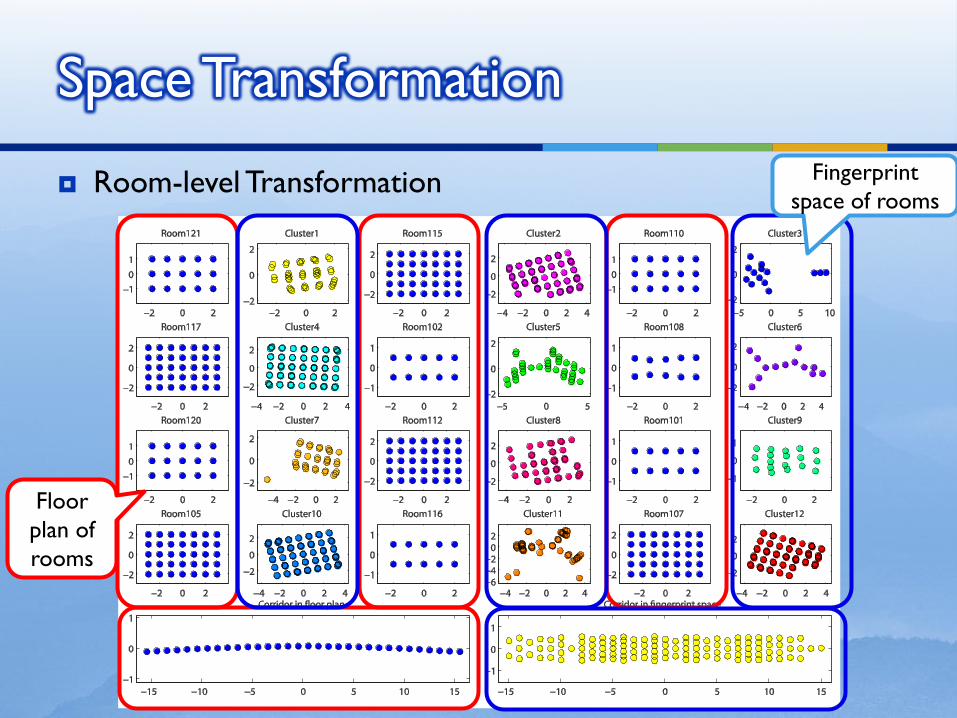
Room-level Transformation
Space Transformation
Floor
plan of
rooms
Fingerprint
space of rooms
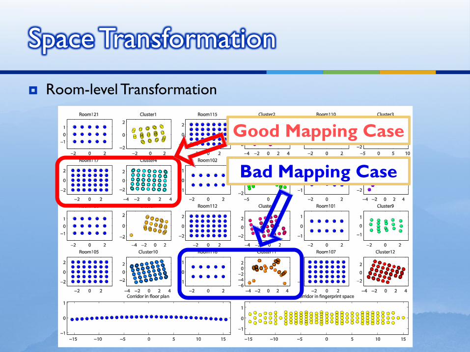
Room-level Transformation
Space Transformation
Good Mapping Case
Bad Mapping Case
Motivations
Solutions
Evaluations
Discussions
Conclusions
Outline
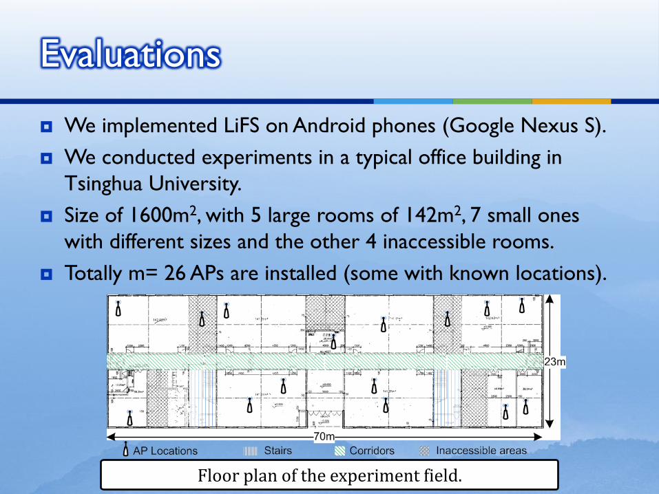
We implemented LiFS on Android phones (Google Nexus S).
We conducted experiments in a typical office building in
Tsinghua University.
Size of 1600m2, with 5 large rooms of 142m2, 7 small ones
with different sizes and the other 4 inaccessible rooms.
Totally m= 26 APs are installed (some with known locations).
Evaluations
Floor plan of the experiment field.
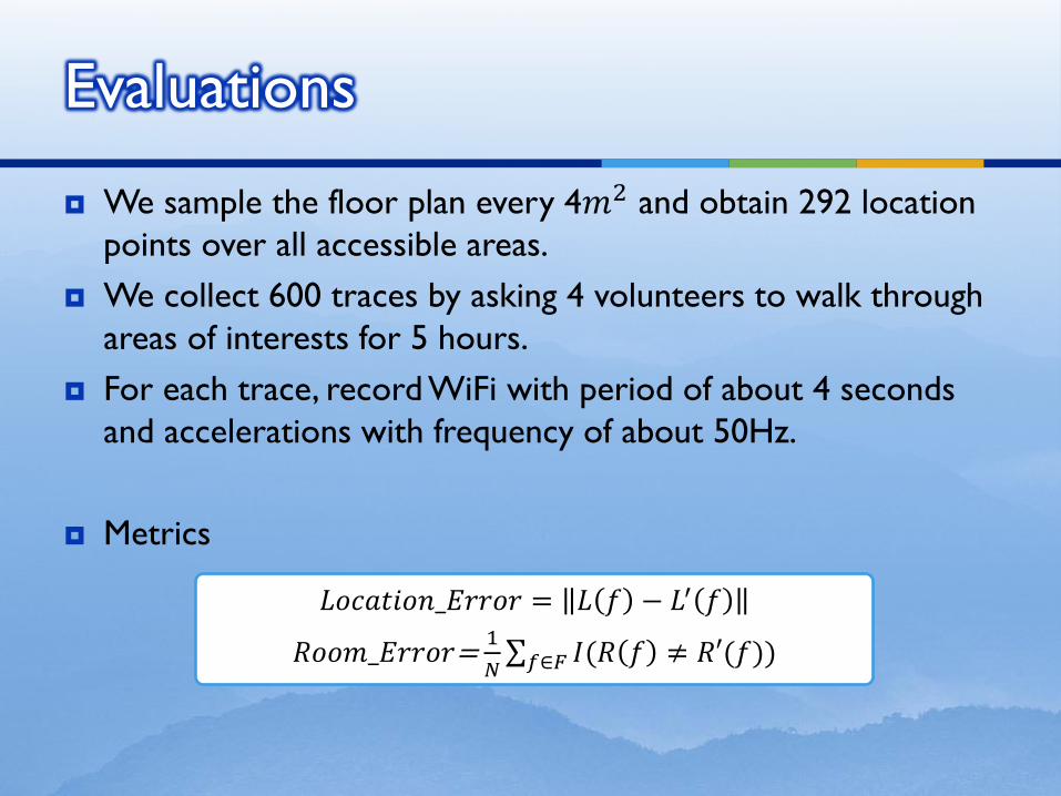
We sample the floor plan every 4𝑚2 and obtain 292 location
points over all accessible areas.
We collect 600 traces by asking 4 volunteers to walk through
areas of interests for 5 hours.
For each trace, record WiFi with period of about 4 seconds
and accelerations with frequency of about 50Hz.
Metrics
Evaluations
𝐿𝑜𝑐𝑎𝑡𝑖𝑜𝑛_𝐸𝑟𝑟𝑜𝑟 = 𝐿 𝑓 − 𝐿′ 𝑓
𝑅𝑜𝑜𝑚_𝐸𝑟𝑟𝑜𝑟= 1
𝑁 𝐼(𝑅 𝑓 ≠ 𝑅′(𝑓))𝑓∈𝐹
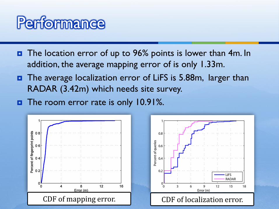
The location error of up to 96% points is lower than 4m. In
addition, the average mapping error of is only 1.33m.
The average localization error of LiFS is 5.88m, larger than
RADAR (3.42m) which needs site survey.
The room error rate is only 10.91%.
Performance
CDF of mapping error. CDF of localization error.
Motivations
Solutions
Evaluations
Discussions
Conclusions
Outline
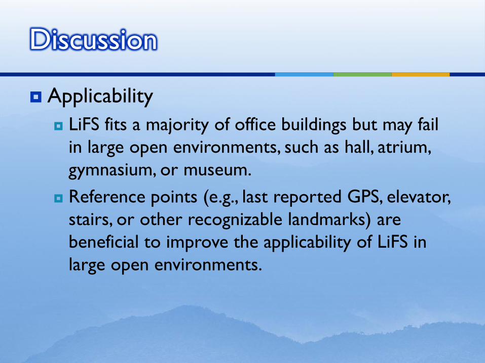
Applicability
LiFS fits a majority of office buildings but may fail
in large open environments, such as hall, atrium,
gymnasium, or museum.
Reference points (e.g., last reported GPS, elevator,
stairs, or other recognizable landmarks) are
beneficial to improve the applicability of LiFS in
large open environments.
Discussion
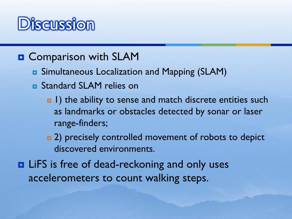
Comparison with SLAM
Simultaneous Localization and Mapping (SLAM)
Standard SLAM relies on
1) the ability to sense and match discrete entities such
as landmarks or obstacles detected by sonar or laser
range-finders;
2) precisely controlled movement of robots to depict
discovered environments.
LiFS is free of dead-reckoning and only uses
accelerometers to count walking steps.
Discussion
Motivations
Solutions
Evaluations
Discussions
Conclusions
Outline
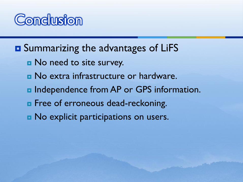
Summarizing the advantages of LiFS
No need to site survey.
No extra infrastructure or hardware.
Independence from AP or GPS information.
Free of erroneous dead-reckoning.
No explicit participations on users.
Conclusion
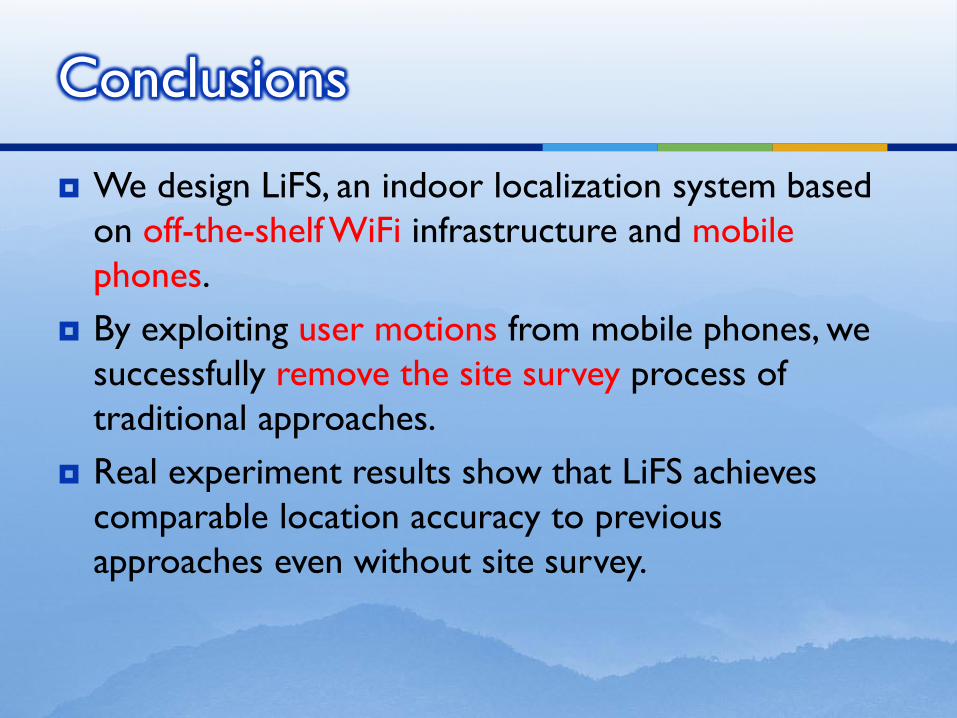
We design LiFS, an indoor localization system based
on off-the-shelf WiFi infrastructure and mobile
phones.
By exploiting user motions from mobile phones, we
successfully remove the site survey process of
traditional approaches.
Real experiment results show that LiFS achieves
comparable location accuracy to previous
approaches even without site survey.
Conclusions