Embed Size (px)
Citation preview
Disclaimer This report was compiled by an ADRC visiting researcher (VR) from ADRC member countries. The views expressed in the report do not necessarily reflect the views of the ADRC. The boundaries and names shown and the designations used on the maps in the report also do not imply official endorsement or acceptance by the ADRC.
A PRELIMINARY STUDY OF THE DROUGHTA PRELIMINARY STUDY OF THE DROUGHT
MITIGATION PRACTICES OF AGRICULTURE SECTOR IN JAPAN AND LOOKING FOR POSSIBILITIES TO APPLY BEST PRACTICES TO SRI LANKAAND LOOKING FOR POSSIBILITIES TO APPLY BEST PRACTICES TO SRI LANKA
Research Report for the Visiting Researcher Program (2011 A)for the Visiting Researcher Program (2011 A)
Asian Disaster Reduction CentreKobe, Japan
W.M.S.B.WANNINAYAKE
, p
Assistant Director (For Kurunegala District)
Disaster Management Centre,
Ministry of Disaster Management, Sri Lanka
2011 August 29
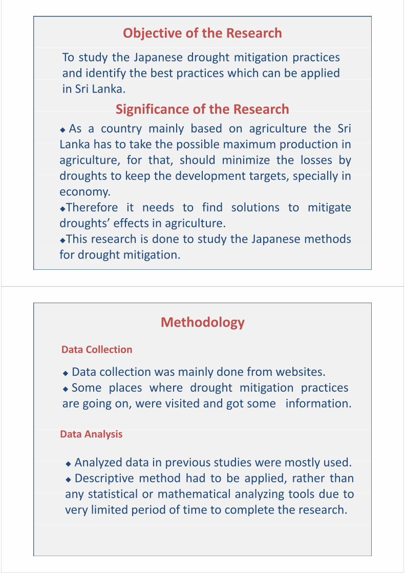
Background of the Research
What is Drought
•Drought can be simply defined as a situation whereDrought can be simply defined as a situation where human demand for water exceeds the available supply.
•Droughts result from a combination of meteorological•Droughts result from a combination of meteorological, physical and human factors.
F t f D ht•Four types of Droughts1. Meteorological drought ‐ Lack of precipitation from normal ,over
some period of timesome period of time
2. Hydrological drought ‐ Deficiencies in surface and subsurface water supplies
3. Agricultural drought – Lack of needed soil moisture of a particular crop at a particular time
4 Socio‐economic drought – Associating with supply of and demand for4. Socio economic drought Associating with supply of and demand for an economic good.
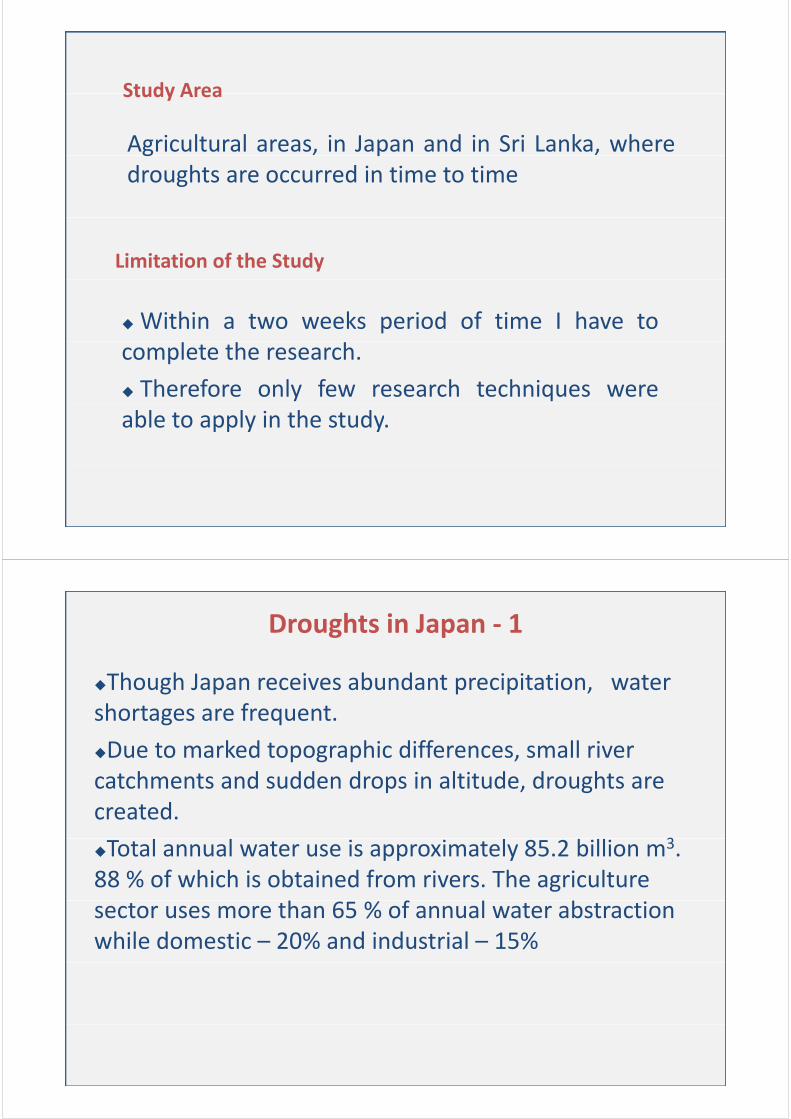
Objective of the Research
To study the Japanese drought mitigation practicesand identify the best practices which can be appliedin Sri Lanka.
Significance of the ResearchSignificance of the Research As a country mainly based on agriculture the SriLanka has to take the possible maximum production inLanka has to take the possible maximum production inagriculture, for that, should minimize the losses bydroughts to keep the development targets specially indroughts to keep the development targets, specially ineconomy.Therefore it needs to find solutions to mitigateTherefore it needs to find solutions to mitigatedroughts’ effects in agriculture.This research is done to study the Japanese methodsThis research is done to study the Japanese methodsfor drought mitigation.
Methodology
Data Collection
Data collection was mainly done from websites. Some places where drought mitigation practicesare going on, were visited and got some information.
Data Analysis
Analyzed data in previous studies were mostly used Analyzed data in previous studies were mostly used. Descriptive method had to be applied, rather thanany statistical or mathematical analyzing tools due toany statistical or mathematical analyzing tools due tovery limited period of time to complete the research.
Study Area
Agricultural areas, in Japan and in Sri Lanka, where
Study Area
g pdroughts are occurred in time to time
Limitation of the Study
Within a two weeks period of time I have tocomplete the research.
Therefore only few research techniques wereable to apply in the study.
Droughts in Japan ‐ 1
Though Japan receives abundant precipitation, water shortages are frequentshortages are frequent.
Due to marked topographic differences, small river catchments and sudden drops in altitude droughts arecatchments and sudden drops in altitude, droughts are created.
3Total annual water use is approximately 85.2 billion m3. 88 % of which is obtained from rivers. The agriculture
h f l bsector uses more than 65 % of annual water abstraction while domestic – 20% and industrial – 15%
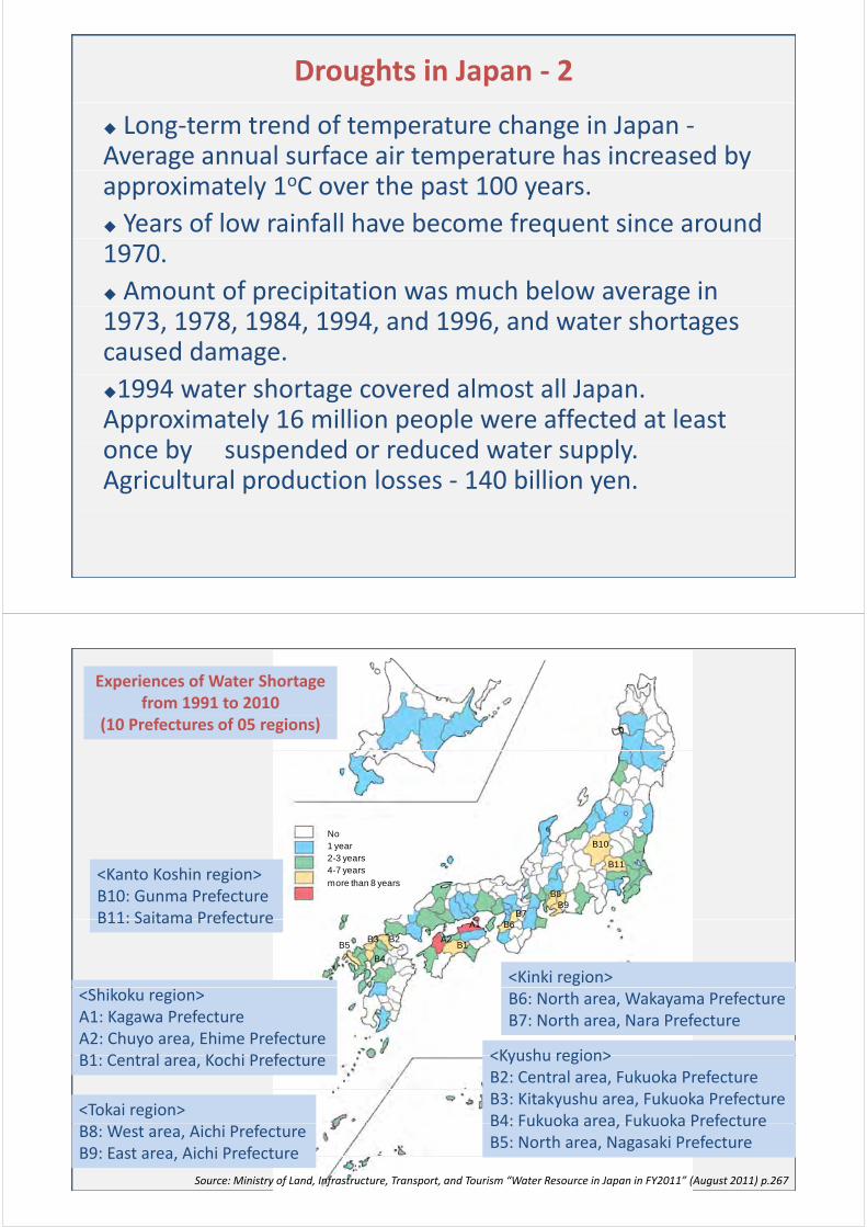
Droughts in Japan ‐ 2
Long‐term trend of temperature change in Japan ‐Average annual surface air temperature has increased by approximately 1oC over the past 100 years.
Years of low rainfall have become frequent since around 1970.
Amount of precipitation was much below average in 1973, 1978, 1984, 1994, and 1996, and water shortages caused damage.
1994 water shortage covered almost all Japan. Approximately 16 million people were affected at least
b d d d d t lonce by suspended or reduced water supply. Agricultural production losses ‐ 140 billion yen.
Experiences of Water Shortage from 1991 to 2010
(10 Prefectures of 05 regions)
B10No1 year
B9B7
B8
B112-3 years4-7 years
more than 8 years<Kanto Koshin region>B10: Gunma PrefectureB11: Saitama Prefecture A1
A2B1
B2
B4
B3B5
B6
<Kinki region>
B11: Saitama Prefecture
<Shikoku region>A1: Kagawa PrefectureA2: Chuyo area, Ehime PrefectureB1 C t l K hi P f t
B6: North area, Wakayama PrefectureB7: North area, Nara Prefecture
<Kyushu region>B1: Central area, Kochi Prefecture <Kyushu region>B2: Central area, Fukuoka PrefectureB3: Kitakyushu area, Fukuoka PrefectureB4: Fukuoka area Fukuoka Prefecture
<Tokai region>B4: Fukuoka area, Fukuoka PrefectureB5: North area, Nagasaki Prefecture
B8: West area, Aichi PrefectureB9: East area, Aichi Prefecture
Source: Ministry of Land, Infrastructure, Transport, and Tourism “Water Resource in Japan in FY2011” (August 2011) p.267
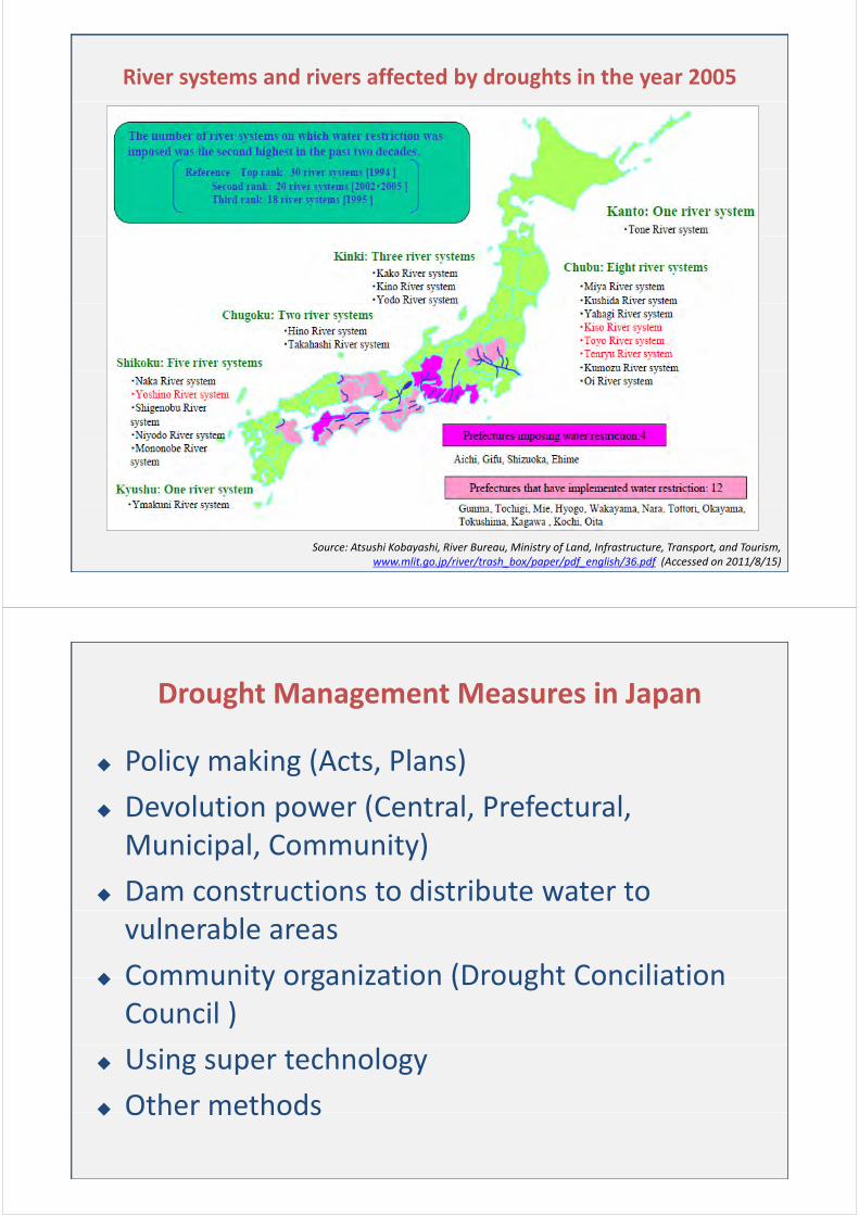
River systems and rivers affected by droughts in the year 2005
Source: Atsushi Kobayashi, River Bureau, Ministry of Land, Infrastructure, Transport, and Tourism, www.mlit.go.jp/river/trash_box/paper/pdf_english/36.pdf (Accessed on 2011/8/15)
Drought Management Measures in Japan
Policy making (Acts, Plans)y g
Devolution power (Central, Prefectural, Municipal Community)Municipal, Community)
Dam constructions to distribute water to vulnerable areas
Community organization (Drought Conciliation Community organization (Drought Conciliation Council )
Using super technology
Other methods Other methods
Community Response to Droughts
Water users first try voluntarily to adjust their water uses. They save water by means of
Water‐sharing (method of distributing water inWater sharing (method of distributing water in accordance with designated times and turns)
Intensification of repeated use
Supplementary irrigation from underground Supplementary irrigation from underground water or water from ponds
I i ti b t ti Irrigation by rotation
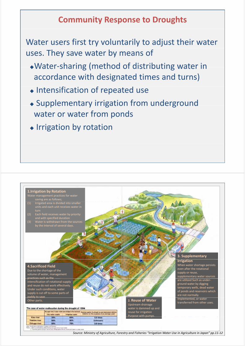
1.Irrigation by RotationWater management practices for water
saving are as follows;(1) Irrigated area is divided into smaller
units and each unit receives water in turn
(2) Each field receives water by priority and with specified duration
(3) W t i ithd f th(3) Water is withdrawn from the sources by the interval of several days.
3. Supplementary
4.Sacrificed FieldDue to the shortage of the volume of water, management practices such as the
Irrigation When water shortage persists even after the rotational supply or reuse, supplementary water sources
practices such as the intensification of rotational supply and reuse do not work effectively. Under such conditions, water supply is cut off to some parts of paddy to save
are utilized Such as under‐ground water by digging temporary wells, dead water of ponds and reservoirs which are not normally
l dpaddy to save Other parts. 2. Reuse of Water
Upstream drainage water is dammed up and reuse for irrigation Purpose with pumps.
Implemented, or water transferred from other uses.
Source: Ministry of Agriculture, Forestry and Fisheries “Irrigation Water Use in Agriculture in Japan” pp.11‐12
p p p

Drought Conciliation Council for Water Use Coordination
By the River Law, the provisions have been made Types of River
SystemNo. of Established
River SystemsNo. of Established
Organizations
Drought water‐use conciliation councils established (as of March 2002)
Drought Conciliation Council's,composed of the river administrator, water users, local government, and other
System River Systems Organizations
Class A 69 103, g ,
concerned agencies, have been established in a lot of river basins.
This council has contributed to water use
Class B 25 25
This council has contributed to water use conciliation during droughts as a forum for mutual consultation among
k h ldstakeholders.
River administrators may make necessary intermediation or arbitration in ycase no agreement is reached in the consultation among water users.
Government’s intervention is the secondGovernment s intervention is the second measurement.
Source: Ministry of Land, Infrastructure, Transport, and Tourism “Rivers in Japan” (September 2006) p.52
Dam Constructions & Drought Mitigation in Japan
Source: Atsushi Kobayashi, River Bureau, Ministry of Land, Infrastructure, Transport, and Tourism, www.mlit.go.jp/river/trash_box/paper/pdf_english/36.pdf (Accessed on 2011/8/15)
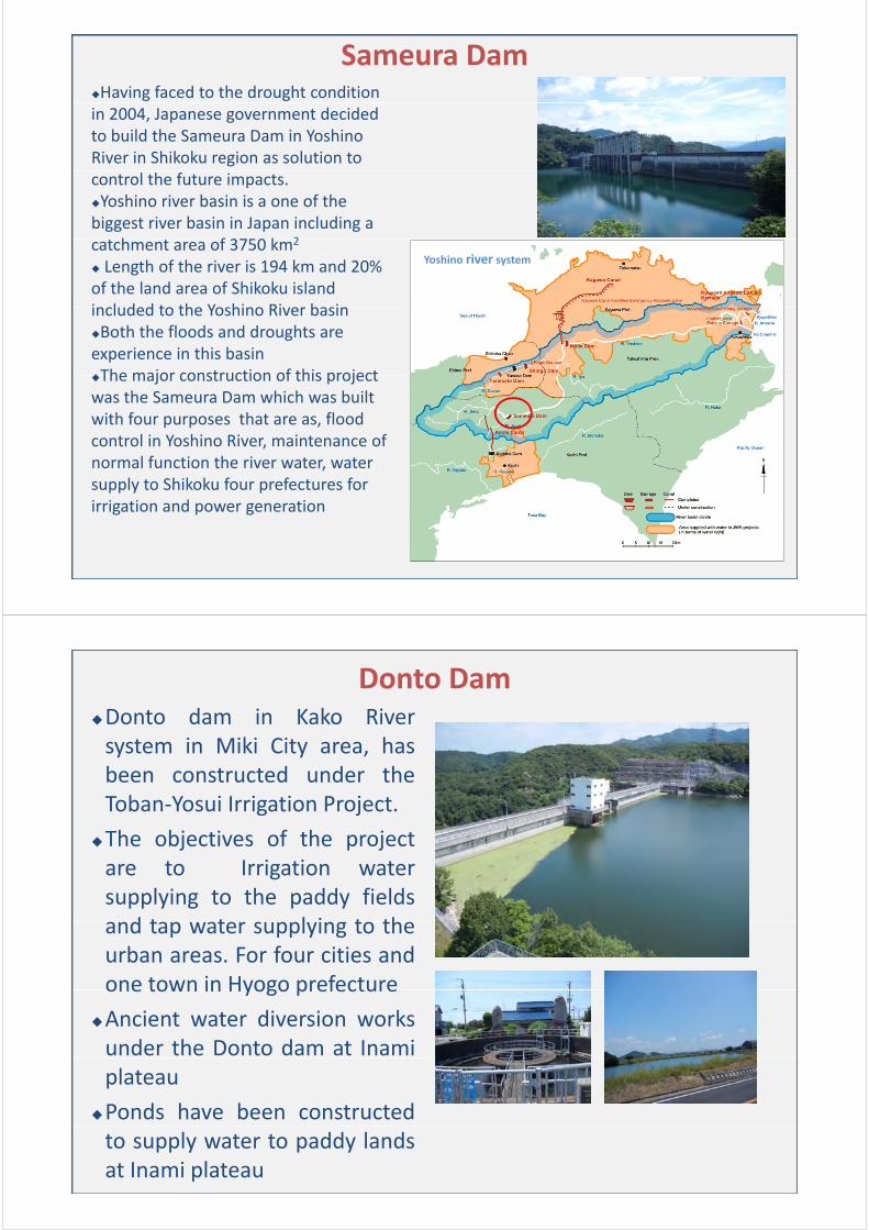
Sameura DamHaving faced to the drought condition in 2004, Japanese government decided to build the Sameura Dam in Yoshino River in Shikoku region as solution to control the future impacts. Yoshino river basin is a one of the biggest river basin in Japan including a
h f 3750 k 2catchment area of 3750 km2
Length of the river is 194 km and 20% of the land area of Shikoku island incl ded to the Yoshino Ri er basin
Yoshino river system
included to the Yoshino River basinBoth the floods and droughts are experience in this basinThe major construction of this projectThe major construction of this project was the Sameura Dam which was built with four purposes that are as, flood control in Yoshino River maintenance ofcontrol in Yoshino River, maintenance of normal function the river water, water supply to Shikoku four prefectures for irrigation and power generationirrigation and power generation
Donto DamDonto dam in Kako RiverDonto dam in Kako Riversystem in Miki City area, hasbeen constructed under theToban‐Yosui Irrigation Project.
The objectives of the projectare to Irrigation watersupplying to the paddy fieldsd t t l i t thand tap water supplying to the
urban areas. For four cities andone town in Hyogo prefectureone town in Hyogo prefecture
Ancient water diversion worksunder the Donto dam at Inamiplateau
Ponds have been constructedto supply water to paddy landsat Inami plateau
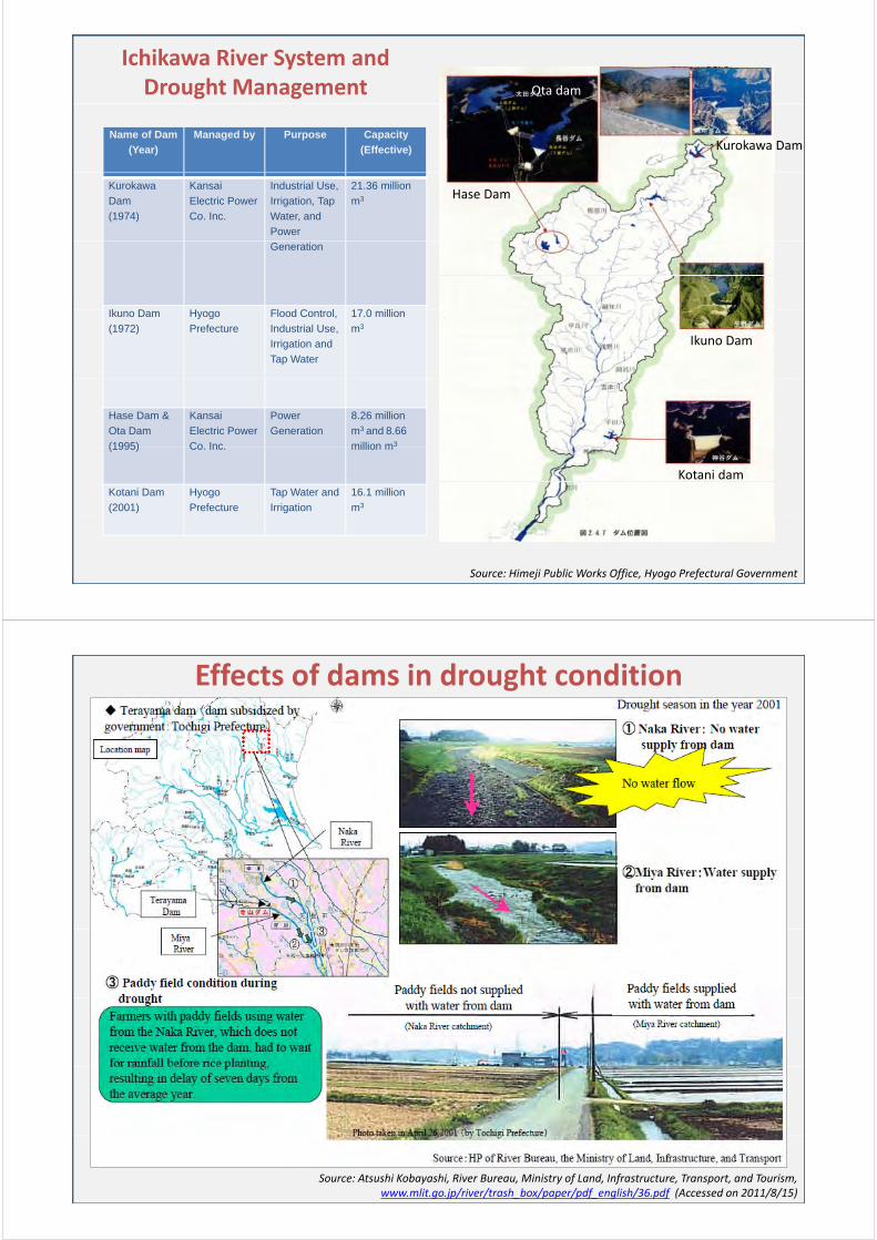
Ichikawa River System and Drought Management Ota dam
Name of Dam
(Year)
Managed by Purpose Capacity
(Effective) Kurokawa Dam
Kurokawa
Dam
(1974)
Kansai
Electric Power
Co. Inc.
Industrial Use,
Irrigation, Tap
Water, and
Power
21.36 million
m3 Hase Dam
Generation
Ik D H Fl d C t l 17 0 illiIkuno Dam
(1972)
Hyogo
Prefecture
Flood Control,
Industrial Use,
Irrigation and
Tap Water
17.0 million
m3
Ikuno Dam
Hase Dam &
Ota Dam
(1995)
Kansai
Electric Power
Co Inc
Power
Generation
8.26 million
m3 and 8.66
million m3(1995) Co. Inc. million m
Kotani Dam
(2001)
Hyogo
Prefecture
Tap Water and
Irrigation
16.1 million
m3
Kotani dam
Source: Himeji Public Works Office, Hyogo Prefectural Government
Effects of dams in drought condition
Source: Atsushi Kobayashi, River Bureau, Ministry of Land, Infrastructure, Transport, and Tourism, www.mlit.go.jp/river/trash_box/paper/pdf_english/36.pdf (Accessed on 2011/8/15)
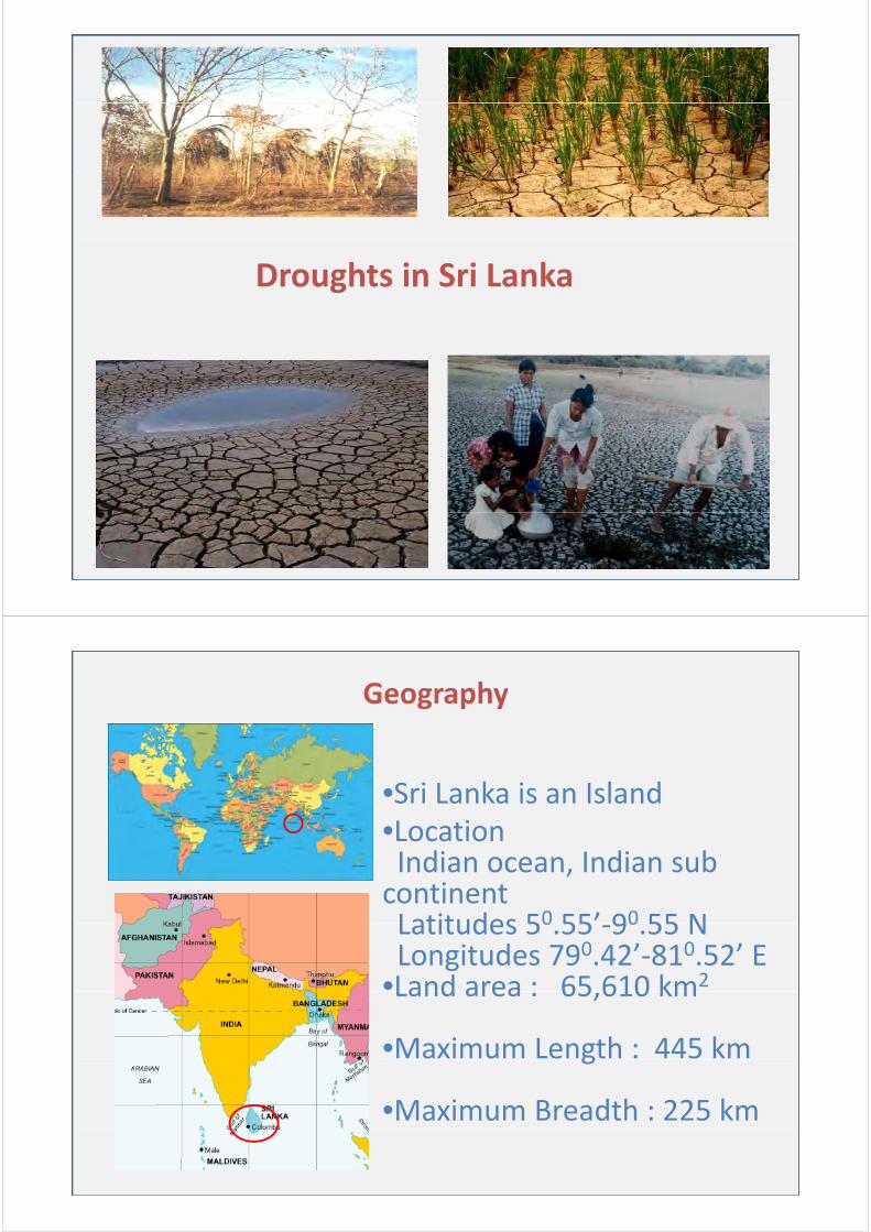
Droughts in Sri Lanka
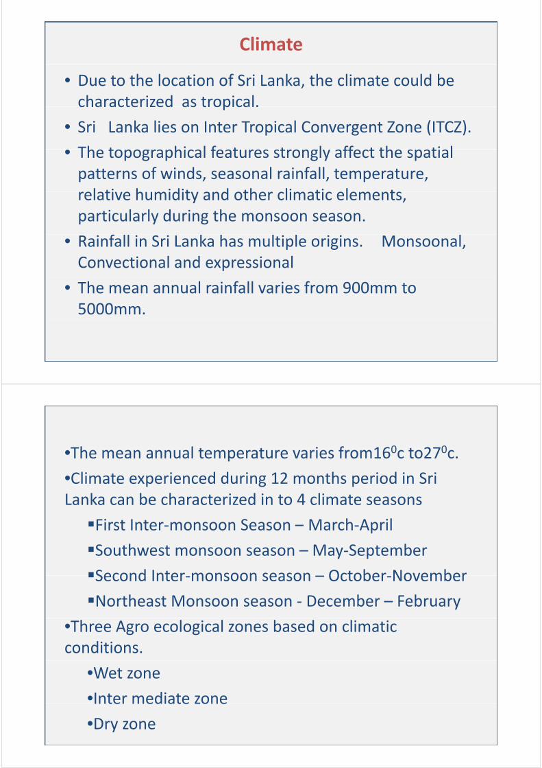
Geography
S i L k i I l d•Sri Lanka is an Island•LocationI di I di bIndian ocean, Indian sub continentLatitudes 50 55’ 90 55 NLatitudes 50.55 ‐90.55 NLongitudes 790.42’‐810.52’ E
•Land area : 65 610 km2Land area : 65,610 km
•Maximum Length : 445 kmg
•Maximum Breadth : 225 km
Climate
• Due to the location of Sri Lanka, the climate could be characterized as tropical.characterized as tropical.
• Sri Lanka lies on Inter Tropical Convergent Zone (ITCZ).
Th t hi l f t t l ff t th ti l• The topographical features strongly affect the spatial patterns of winds, seasonal rainfall, temperature, relati e h midit and other limati elementsrelative humidity and other climatic elements, particularly during the monsoon season.
• Rainfall in Sri Lanka has multiple origins. Monsoonal, Convectional and expressional
• The mean annual rainfall varies from 900mm to 5000mm.
Th l t t i f 160 t 270•The mean annual temperature varies from160c to270c.
•Climate experienced during 12 months period in Sri Lanka can be characterized in to 4 climate seasons
First Inter‐monsoon Season – March‐Aprilp
Southwest monsoon season – May‐September
Second Inter monsoon season – October NovemberSecond Inter‐monsoon season – October‐November
Northeast Monsoon season ‐ December – February
•Three Agro ecological zones based on climatic conditions.
•Wet zone
•Inter mediate zoneInter mediate zone
•Dry zone
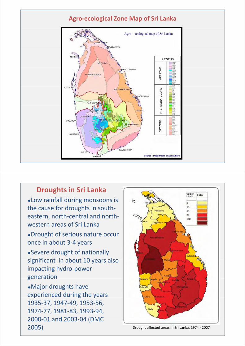
Agro‐ecological Zone Map of Sri Lanka
Droughts in Sri LankaLow rainfall during monsoons isLow rainfall during monsoons is the cause for droughts in south‐eastern, north‐central and north‐western areas of Sri Lanka
Drought of serious nature occur i b 3once in about 3‐4 years
Severe drought of nationally significant in about 10 years alsosignificant in about 10 years also impacting hydro‐power generationgeneration
Major droughts have experienced during the years p g y1935‐37, 1947‐49, 1953‐56, 1974‐77, 1981‐83, 1993‐94,
d (2000‐01 and 2003‐04 (DMC 2005) Drought affected areas in Sri Lanka, 1974 ‐ 2007
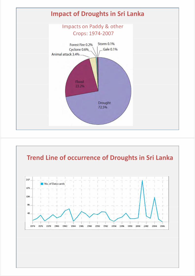
Impact of Droughts in Sri Lanka
Trend Line of occurrence of Droughts in Sri Lankag
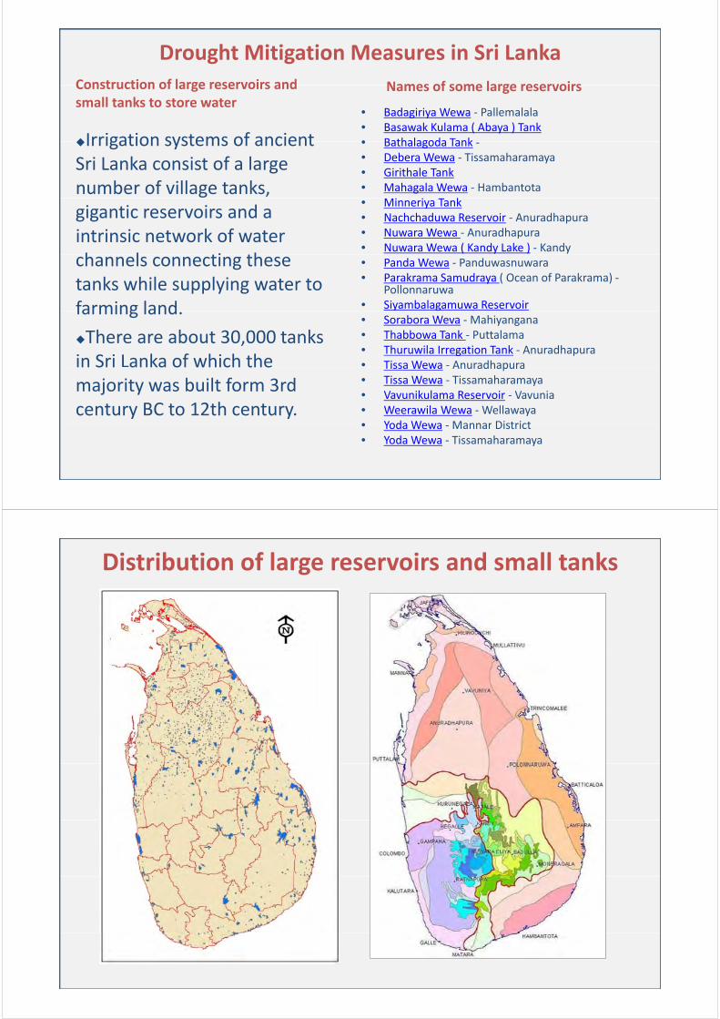
Names of some large reservoirs
Drought Mitigation Measures in Sri Lanka
Construction of large reservoirs and
• Badagiriya Wewa ‐ Pallemalala • Basawak Kulama ( Abaya ) Tank• Bathalagoda TankIrrigation systems of ancient
Names of some large reservoirsConstruction of large reservoirs and small tanks to store water
• Bathalagoda Tank ‐• Debera Wewa ‐ Tissamaharamaya• Girithale Tank • Mahagala Wewa ‐ Hambantota
k
Irrigation systems of ancient Sri Lanka consist of a large number of village tanks,
• Minneriya Tank • Nachchaduwa Reservoir ‐ Anuradhapura • Nuwara Wewa ‐ Anuradhapura • Nuwara Wewa ( Kandy Lake ) ‐ Kandy
gigantic reservoirs and a intrinsic network of water h l i h • Panda Wewa ‐ Panduwasnuwara
• Parakrama Samudraya ( Ocean of Parakrama) ‐Pollonnaruwa
• Siyambalagamuwa Reservoir
channels connecting these tanks while supplying water to farming land
• Sorabora Weva ‐Mahiyangana• Thabbowa Tank ‐ Puttalama• Thuruwila Irregation Tank ‐ Anuradhapura • Tissa Wewa ‐ Anuradhapura
farming land.
There are about 30,000 tanks in Sri Lanka of which the Tissa Wewa Anuradhapura
• Tissa Wewa ‐ Tissamaharamaya• Vavunikulama Reservoir ‐ Vavunia• Weerawila Wewa ‐Wellawaya• Yoda Wewa Mannar District
in Sri anka of which themajority was built form 3rd century BC to 12th century.
• Yoda Wewa ‐Mannar District • Yoda Wewa ‐ Tissamaharamaya
Distribution of large reservoirs and small tanks
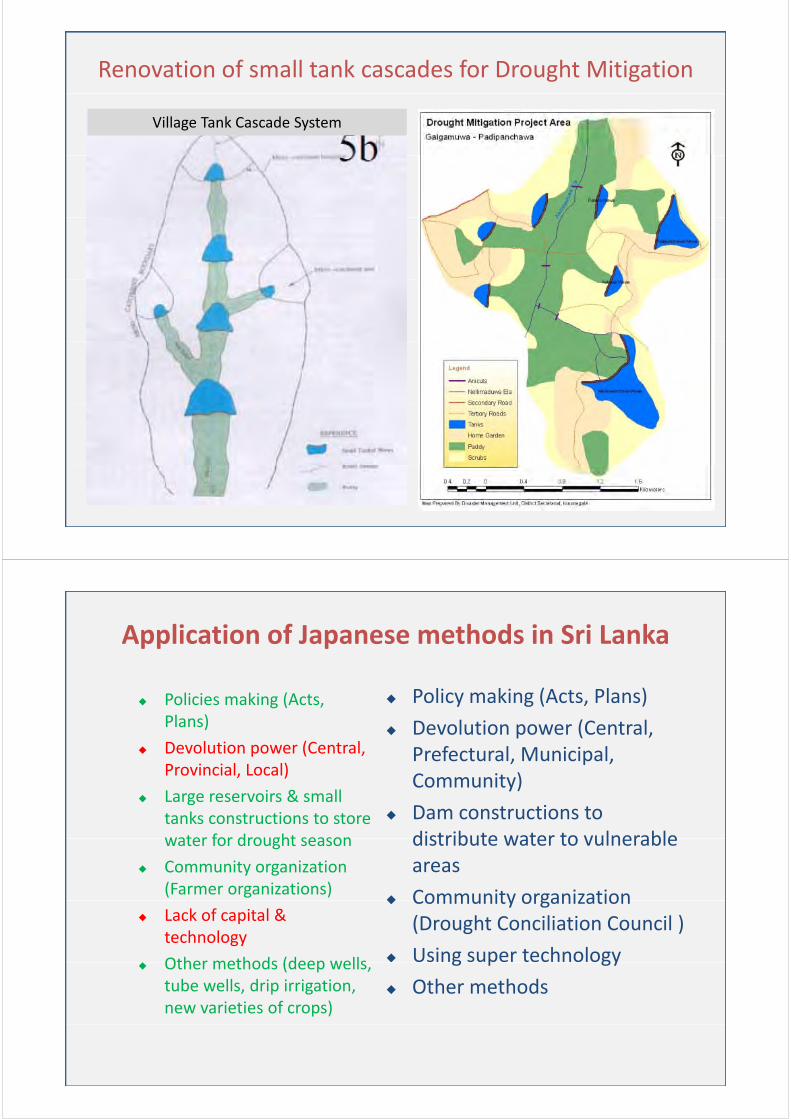
Renovation of small tank cascades for Drought Mitigation
Village Tank Cascade System
Application of Japanese methods in Sri Lanka
Policies making (Acts, l )
Policy making (Acts, Plans)Plans)
Devolution power (Central, Provincial, Local)
Devolution power (Central, Prefectural, Municipal, C it )
, )
Large reservoirs & small tanks constructions to store water for drought season
Community)
Dam constructions to distribute water to vulnerablewater for drought season
Community organization (Farmer organizations)
distribute water to vulnerable areas
Community organization Lack of capital &
technology
Other methods (deep wells
Community organization (Drought Conciliation Council )
Using super technology Other methods (deep wells,
tube wells, drip irrigation, new varieties of crops)
g p gy
Other methods


![AZE CP Emin [互換モード] - adrc.asia · enjoysmild weatherthat averages4°C(39.2°F)inJanuaryand 25°C(77°F)in July. RAINFALL: Most of Azerbaijan receives little rainfall, only](https://img.pdfslide.us/doc/110x75/5e1650bb8b899b02973272b7/aze-cp-emin-fff-adrcasia-enjoysmild-weatherthat-averages4c392finjanuaryand.jpg)