Embed Size (px)
Citation preview

Living at the edgeLocation intelligence in a 5G MEC world

1 Unlocking the full potential of 5G MEC with location intelligence 4 2 Reinventing telecom network planning for 5G MEC 6
3 A leap in positioning accuracy and latency 10
4 Location-enabled edge use cases 11
5 Enabling the data infrastructure for the vehicles of tomorrow 16
6 Location data privacy in the age of 5G MEC 21
7 The HERE platform: supporting businesses on their 5G MEC journey 23

©HERE 2020 | here.com
Executive summary
Consumers, enterprises and governments will benefit greatly as 5G networks and Multi-Access Edge Computing (or MEC, formerly known as Mobile Edge Computing) capabilities are deployed over the next decade. Together, 5G and MEC can deliver the compute and network performance required to serve even the most demanding applications in our emerging autonomous world. Yet getting the most out of these exciting technologies will require the help of another: location intelligence.
The field of location intelligence has developed significantly in recent years. Today, organizations harness highly-accurate geospatial data and advanced location technology to address a wide range of business needs. In this position paper, we consider the vital role location intelligence plays in a 5G MEC world – from building out the infrastructure to enabling a new generation of use cases across industries in both enterprise and consumer. Our hope is that this paper offers useful insights to executives from various sectors, especially those in the telecommunications and automotive industries.
We discuss how location data and technology are indispensable in:
→ Driving higher ROI 5G radio and MEC network planning and deployment
→ Realizing the full benefits of low latency and high throughput applications enabled by 5G MEC, including hyper-personalized experiences and hyper-precise real-time location awareness for people and machines on the move
→ Enabling automotive companies to maximize 5G MEC for safer, automated driving, and
→ Enabling people to manage their privacy in a 5G MEC world
Our views throughout this paper are based on two fundamental beliefs – namely, that in no generation of mobile technology has location intelligence been more critical or precise than in 5G; and that in no business is it more critical than one that is inherently mobile.
3 Want to talk? We do, too. Get in touch here.

©HERE 2020 | here.com
The importance of fast and reliable connectivity has never been more evident than in recent months. With COVID-19 confining people to their homes, communications networks have helped them stay connected and employed, and given countless businesses continued access to the digital infrastructure they need to weather the crisis.
At the same time, modern network technologies also hold the key to a global recovery. In the post-pandemic era, nearly all industries will seek to accelerate their efforts to automate, digitize and enhance their capability to operate remotely. For this, the continued advance of 5G, presently still in the early stages of a multi-year build-out, is critical.
Unlocking the full potential of 5G MEC with location intelligence
Solving the ‘where’ dilemma
Building, operating and leveraging this new infrastructure can be potentially lucrative. According to
Arthur D. Little, some $1.5 trillion of 5G-enabled revenue is up for grabs between now and 2030. The traditional mobile network operators (MNOs) will be vying for a slice of that, along with smaller-scale ‘micro operators’, tower companies, network equipment vendors, system integrators, cloud providers and application developers from various industries. But commercial success is far from assured. 5G MEC requires high upfront investment and comes with significant risks. Cloud processing and storage capabilities will need to be deployed closer to where the consumers, workers, cars, robots and industries of tomorrow will be. The question is where will they be?
But there are other pieces to the puzzle too. In particular, Multi-Access Edge Computing (MEC) technology, which brings cloud computing to the edge of the mobile network, is gaining recognition as a key component of the networks needed in the future. Today, several commercial and pilot deployments are in operation globally. When combined with 5G, MEC promises unprecedented levels of compute and network performance, with high bandwidth data transfers and ultra-low-latency connections – the kind of connectivity that can power the autonomous services of the future.
This is a question that another key technology can help resolve. For a long time, location intelligence has played a mostly peripheral role in enterprise decision-making and application development. In recent years, however, it has exploded with context richness, fueled by affordable, low-powered sensors, big data analytics, and artificial intelligence. This new generation of location intelligence is now at the core of the next wave of digital transformation and helping drive better real-world outcomes.
Its emergence is also perfectly timed to meet the needs of 5G MEC deployment. The physics of millimeter wave spectrum and beamforming technologies require the infrastructure to be different from earlier generations of mobile networks. Instead of today’s
spaced-out cell towers, 5G MEC will leverage a dense and complex network of small cells along with optimally placed edge servers. Fortunately, rich layers of visual and informational geospatial context can now be folded into the process of network planning and optimization. In section two of this paper, we discuss how MNOs and others involved in the deployment of 5G MEC infrastructure can benefit from location intelligence.
4 Want to talk? We do, too. Get in touch here.

©HERE 2020 | here.com
Once deployed, these network technologies open up new horizons for consumers, businesses and governments. Among the major benefits, described in section three, are improved positioning accuracy and latency, which in turn enables a host of new edge services.
Autonomous vehicles, first responders and drones will harness these benefits for attaining real-time positioning and situational awareness. Immersive Augmented Reality user interfaces will use high resolution location data to overlay computer-generated imagery on the world and enhance mobile experiences as well as enable deeper user engagement, richer services and novel advertising models. Gaming studios and brands will add rich location context to business data to deliver
Location data processing moves to the edge
hyper-personalized experiences for users and consumers.
In section four, we outline a few examples, touching on how MNOs and a broader ecosystem of developers can create value, while section five considers the opportunities for automakers and the broader mobility industry to boost safety and autonomy on our roads. In section six, we discuss how privacy-first location intelligence is a requisite in this new world of 5G-enabled positioning, before we conclude with an overview of how HERE Technologies can serve companies eyeing the 5G MEC opportunity.
Figure 1: Location intelligence delivers several customer and consumer benefits in a 5G MEC world
5 Want to talk? We do, too. Get in touch here.

©HERE 2020 | here.com
Moving compute, storage and processing resources from a centralized cloud to the network edge is a tantalizing prospect for 5G use cases. Networks will better handle surges in data traffic and applications that require low-latency traffic can be located physically closer to customers. This reduces transfer costs and the load on central data centers while improving and guaranteeing performance.
A big part of the cost of enabling 5G MEC infrastructure stems from the network planning involved, such as determining the optimal locations for network equipment, performing site surveys, acquiring the real estate that hosts infrastructure, and supporting consumers and businesses in self-install deployments of the fixed-wireless access antenna. Small cells will play an increasingly important role in realizing future
networks. The consequence is that Radio Access Network (RAN) equipment will come down from elevated positions on towers and rooftops into the clutter, residing on new hosts like street furniture. As millimeter waves cannot penetrate obstacles like buildings, trees and billboards, small cells must be deployed in dense clusters to ensure adequate and consistent coverage.
Deciding where to place a small cell is challenging. Aside from considerations resulting from propagation modeling, MNOs need to factor in accessibility, safety, security, cost and aesthetics, not to mention environmental and legal constraints and demands imposed by various local and national authorities and the new hosts of their equipment, be they utility companies, city governments or other entities. Multiply those considerations with the millions of
small cells that will be deployed around the globe in the coming years and the sheer size of the challenge that MNOs and their partners face becomes clear.
Identifying locations for edge servers further adds to the planning headache. Can they be placed at existing cell sites or can they be located deeper into the network at aggregation sites? How do you balance out the network deployment strategy with careful use of millimeter wave, mid-band and low-band 5G to serve the needs of all customers types and profiles? Deploying 5G and edge in indoor-outdoor facilities such as airports, factories, mines and yards may also add to the complexity. For private 5G networks in environments like these, planners may need to create their own indoor and yard map data to ensure their networks meet their location-based service needs.
Choosing where to invest becomes a complex set of tradeoffs between latencies and deployment costs,to be minimized, and device connections and coverage, to be maximized. The process involves resolving several questions with a geospatial dimension. For example, considerations must be made for:
→ The physical distances between current and planned cell sites, street cabinets and edge servers that affect latencies
→ The optimal proximity and distribution of infrastructure in relation to the expected number of users, commercial centers, the road network and administrative boundaries
→ The predicted attenuation and propagation losses of signals at any given site based on surrounding geographical features, such as poles, trees, terrain and buildings, and
→ The expected workloads and computational capacities of edge servers that would affect the density of servers required in different areas.
Reinventing telecom network planning for 5G MEC
6 Want to talk? We do, too. Get in touch here.

Operatordata
Competitivelandscape
Locationintelligence
Customerdemand
©HERE 2020 | here.com
From the field to the desktop
The scale and scope of the job of configuring the building blocks of our future smart cities exceeds the limits of what the human mind is capable of. Increasingly, tasks like radio frequency propagation modeling and line-of-sight simulations must leverage large amounts of location data and processing combined with powerful location-enabled machine learning.
Figure 2 outlines an intelligent data foundation designed to deliver a deep understanding of operator data, demand, the competitive landscape, and location intelligence.
Within the location intelligence category there are several data inputs that can enhance network planning – reducing the number of field surveys and enabling key aspects of the process to be performed using a desktop computer. We summarize these in Figure 3.
When added to the other components of the intelligent data foundation, these data inputs enable powerful 360-degree, HD views that help MNOs and other market participants model deployment and install scenarios.
Various benefits can be realized, including a reduction in the number and length of physical site surveys, more accurate line-of-sight calculations, and faster identification of real estate for acquisition. Additionally, customer self-installations become easier and more accurate, while optimized placement of infrastructure also minimizes the total sites and equipment that need to be run. Finally, with network design tasks taking just a few days, it is quicker to perform upgrades, install new equipment, add capacity, and respond to changes in the environment. Figure 2: The intelligent data foundation for
network planning and optimization Source: Accenture and HERE Technologies
7 Want to talk? We do, too. Get in touch here.

©HERE 2020 | here.com
Harnessing the power of 5G millimeter wave frequencies has a two-fold impact on deployment cost. The propagation characteristics require more hardware to be purchased, increasing CAPEX. Deploying more cells means more truck rolls and field work, increasing OPEX, which is further increased by the work to ensure each small cell site has a clear line of sight to its targeted area.
To help reduce 5G deployment cost, Accenture, a leading global professional services company, uses HERE Geodata Models in its digital twin technology, which enables simulations of planned network site performance from the desktop, without having to install any cells or visit sites.HERE Geodata Models uses terrestrial-
Reducing 5G deployment costs with new geospatial data
based LiDAR to capture digital 3D digital representations of buildings, trees, roadside objects and other infrastructure that can impact 5G radio frequencies. HERE’s vast network of partners integrate HERE Geodata Models into their network planning solutions for centralized, digital field surveys. Our estimates show that, by streamlining network planning and design workflows, the solution can cut OPEX by up to 40%.
Siteselections Site surveys
RFpropagation
Line of sightsimulations
Mapdata
Frequently updated with up to centimeter-level precision in all three dimensions, and covering hundreds of attributes, for informed site migration and expansion planning
3Dgeospatialdata
Enables digital twin capability and minimizes field surveysduring dimensioning phase; provides sub-meter accuracyfor vastly improved calculated coverage; includes accurate3D data objects (poles, trees, buildings) and their attributesfor the next generation of RF propagation modeling andline-of-sight analysis algorithms
Terrainmodels
Support propagation modeling and site identificationwith height, land elevation, and terrain texture maps
Pointsof Interestdata
Aids prioritization of ‘must cover’ sites and includesbuilding shape and boundaries data, which can becombined with movement signals and patterns fromuser devices to identify indoor coverage needs
Cartographiclayers
Provide linear and polygonal data representing land use display class and feature types enables desk-basedcoverage calculations
Tra�cpatterns
Real-time and historical insights for major road networksfor informed site migration and expansion planning
Indoormap data
Provides accurate geospatial indoor space information,including building geometry and entrances and exits,critical for venue coverage planning and the creationof indoor coverage solutions
Figure 3
Di�erent location datasets for 5G MECnetwork planning and deployment
8 Want to talk? We do, too. Get in touch here.

©HERE 2020 | here.com
Next generation planning and design with HERE Geodata Models. 3D city models are the basis for RF propagation modeling and line of sight simulations.
Figure 4
HERE processes large, precise and scalable 3D datasets from terrestrial LiDAR and other remote sensed content. The expertise of HERE in extracting features and 3D derivative objects such as poles, trees, terrain models and buildings lends a new level of precision to RF planning for 5G mmWave networks that far surpasses the accuracy of conventional GIS data.
9 Want to talk? We do, too. Get in touch here.

©HERE 2020 | here.com
A leap in positioning accuracy and latency
Organizations across various industry sectors invariably need to locate something – devices, personnel, goods, vehicles, customers – in order to implement their business model successfully. In some cases, they will need to do so quickly, precisely and continuously. New network technologies make this possible, working in concert with precise mapping to deliver unprecedented levels of positioning accuracy and enable a multitude of new use cases. Positioning technology has been something of an ‘add-on’ feature in previous generations of mobile networks. 4G, for example, has primarily been deployed to serve smartphones and fairly modest positioning requirements. With 5G, however, positioning
technology has been baked into the development of the standard from the beginning. This is no accident: the authors of the 5G standard have sought to ensure that future networks will be able to serve the demanding positioning requirements of a wide range of vertical industry use cases across outdoor and indoor environments. Additionally, they have resolved that future solutions must be able to seamlessly harness multiple positioning technologies to deliver the best possible performance in terms of accuracy, power consumption, cost and scale. After all, not every application will have the same requirements. Accordingly, alongside positioning techniques relying on the new 5G air interface (also known as 5G New Radio), the 5G standard integrates a broad spectrum of positioning
technologies, including 4G, GNSS, Wi-Fi, and Bluetooth LE. 5G NR itself is a welcome addition to the positioning toolset, with the ability to provide greater positioning accuracy and availability than 4G. Much depends on how dense those formations of millimeter wave small cells will be. Industry estimates suggest that building out sufficient coverage of 5G signals could result in between four to ten times as many cell sites per square kilometer compared to 4G networks. That kind of density significantly increases a device’s visibility to multiple beacons, while wider bandwidths especially at high frequencies – together with enhanced antenna solutions – can theoretically enable more accurate location estimations. Positioning accuracy can be further enhanced by algorithms running in MEC servers. 3GPP 5G specifications in Release 16, finalized in mid-2020, aim for positional accuracy of three meters in indoor scenarios and ten meters for outdoor use cases. However, Release 17, which might be ready before 2022, introduces new methodologies for positioning that shoot for sub-meter accuracy, along with 10 ms latency. This would be possible both in indoor and dense urban outdoor environments wherever there is an optimal deployment of different
positioning technologies, including a high density of small cells and Wi-Fi positioning beacons. Most location services today are enabled through a combination of on-device processing of positioning data and the transfer of some data for processing by a server in a remote central cloud. Calculating a position this way tends to involve multiple hops and takes time. While 5G devices can perform calculations to work out their own location, including drawing on terrestrial and satellite signals, doing so can quickly drain the battery. 5G MEC networks allow for the computing effort involved to be offloaded from the device to nearby edge servers. This enables devices to be continuously positioned in real-time by the edge network. By having the network do the processing work, more computationally intensive positioning techniques and algorithms can also be utilized to support novel use cases. Alternatively, devices might use Sidelink, which is emerging as a method of communication for 4G LTE and 5G networks that allows for one device to communicate directly with another, without going through a base station. Either way, the central cloud is taken out of the picture, save for the transfer of any non-time-sensitive data for cumulative record keeping.
Visual positioning with Verizon
HERE has been exploring visual positioning as a proof of concept with Verizon. This advanced technique is similar to the way humans locate themselves; we analyze what we see around us, accessing our visual memories of places. Similarly, visual positioning compares imagery of specific locations to a database of 3D geometry objects, created from LiDAR-captured 3D pixel-point cloud maps and stored on MEC servers for fast access. The computation is aided by machine learning and the provision of an accurate position is performed in real-time. While not native to the 5G positioning standard, visual positioning is complementary to 5G MEC as it does not rely on a remote server and is not hampered by tall buildings, urban canyons or signal deserts.
10 Want to talk? We do, too. Get in touch here.

High importance
Peak data rate 20 Gbit/s
Area tra�ccapacity10 Mbit/s/m2
Network energy e�ciency100x wrt. LTE
Mobility500 km/h
Spectrum e�ciency3x wrt. LTE
User experienced data rate100 Mbit/s
Connection density1 M devices/km2
Latency1 ms
Medium
Low
5G use cases and possible5G positioning technologies
VR/ARHD-GNSS, 3GPP-RAT
Network optimizationNetwork planning
WiFi/BLE, GNSS, 3GPP-RAT
Location-basedadvertising
WiFi/BLE, GNSS
Asset trackingIoT devices
Industrial sensorsWiFi/BLE, HD-GNSS, 5G NR
Autonomous drivingCollision avoidanceSituational awarenessHD-GNSS, sensors, 5G NR
Tra�c management & controlHD-GNSS, sensors, WiFi, 5G NR
High-speed trainsHighways & platooningGNSS, HD-GNSS, 5G NR
Location-based beamformingProactive radioresource managementGNSS, WiFi/BLE, 5G NR
Enhanced Mobile Broadband (eMBB)
Ultra-Reliable and Low-Latency Communications (URLLC)
Massive Machine-Type Commnunications (MMTC)
Figure 5
©HERE 2020 | here.com
As edge-based clouds begin to process large volumes of location data, they can also be opened up to third parties. ETSI, the standards body driving MEC, has defined APIs that provide access to the RAN and expose data for positioning. The positioning data alone has limited value, but location intelligence enables developers to exploit it in the creation of new or rearchitected applications for the new edge computing environment.
Across industry sectors, there are ample opportunities for developers to do this. McKinsey & Company
identified 107 edge use cases in development, ranging from remote monitoring of mines to automated driving and location-based advertising. The real number is likely bigger, but what is striking is how location data is a common theme across these scenarios – and often the key ingredient,
especially where there is a high degree of mobility and autonomy involved. While the latency and throughput needs of edge cases are heterogenous, many are reliant on location precision and context.
In Figure 5, we highlight a few important examples from across the three broad types of use cases that 5G technology will serve:
→ Enhanced Mobile Broadband (eMBB), describing use cases requiring high data rates, such as video streaming and VR. Location can play an enabling role for these kinds of use cases – for example, through location-based beamforming and proactive resource management
→ Ultra-Reliable Low-Latency Communication (URLLC), characterized by delay- and mission-critical use cases, such as intelligent transportation systems and autonomous driving, and
→ Massive Machine Type Communication (mMTC), characterized by industrial and other use cases where millions of IoT sensors spread over geographically small areas require connectivity for tracking, monitoring and reporting.
For each, we also list one or more positioning technologies supported by 5G standards that we deem suitable for that use case.
Location-enabled edge use cases
11 Want to talk? We do, too. Get in touch here.

Features andcapabilitiespowered by5G MEC
Connectivityservices
Visual positioningAR overlayPrecise positioning
Social media companiesGaming appsPublishersSmart glasses (2021+)
Safety services(e.g. 24/7 pinpoint roadsideassistance, accident response)Tracking devices (e.g. pet, car)Car-to-home connectivityservices‘Follow me’ services(e.g. car rental)
Operator charges forMEC servicesPrecise positioningservicesImagery processingservicesQuality of Service/prioritization servicesAdTech stack whichmay be owned by MNO
In network hosting ofpeering and cache serversOn edge network hostingof peering and cache server
5G subscription package(may include/bundledevices to help ARPU)Quintuple Play poweredby 5G: car, phone,voice, Internet, TV
App, service ora�ter market device(end-user facing)
Indirect monetization from
consumers by M
NOs throughecosystem
partnerships
Direct monetization from
consumers by M
NOs(app or partnerships)
Platform andbusiness stackNetwork access
Adsupportedor paid
©HERE 2020 | here.com
Thousands of businesses from across the broader telecommunications ecosystem will be seeking to apply their domain experience and create value in a 5G MEC world. For MNOs themselves, paths to monetization will be varied. Many want to be first to market with MEC networks, with the aim of securing a foothold in new use cases. Location precision will redesign the exchange of value between MNOs and consumers, giving MNOs the ability to own the experience, monetize data, increase ARPU (average revenue per user) and enhance their position in the overall value chain.
By opening their MEC networks to third-party developers, MNOs can also foster an open ecosystem
Opportunities to create value – consumer experiences
Figure 6: Ways for MNOs to monetize consumer experiences in a 5G MEC world
of services at the edge – giving application and service developers more choices than a pure cloud instantiation of their systems ever could. This allows MNOs to monetize access to various location-centric platform services, including those that take advantage of accurate positioning and geometry. Figure 6 summarizes the opportunities for MNOs to directly and indirectly monetize the consumer experience.Accurate, real-time positioning will become a key element in a new generation of consumer experiences. MNOs and other businesses will be able to use positioning data to add valuable context to transactional, user and social information, and enable adaptive applications to
better understand a subscriber’s spatial environment. For many advertisers, content providers, gaming studios and high-footfall venues like malls and stadiums, the ability to understand how people, places and things relate to each other will be worth paying for.
These spatial contextual linkages go to the heart of modern location intelligence. As every piece of data has a location and a timestamp, location graph technologies can help businesses understand the spatial and temporal connections between different datasets. Insights go beyond what can be represented on a map – they can also present themselves as a numerical quantity, outcome or experience.
12 Want to talk? We do, too. Get in touch here.

One area of promise is hyper-targeted consumer engagement within immersive experiences, such as AR-based games, as well as across other out- of-home channels. In an always-on marketplace, consumers expect frictionless experiences and real-time access to information and services. Location data helps connect the dots across foot traffic to various points of interest, illuminating patterns in movement that can enhance the way brands segment and reach audiences. Meanwhile, 5G MEC enables the real-time processing of that data at the edge, supported by rapid data transfers and gigabit-per-second throughputs. Music venues, retail shelves and even entire cities could be turned into digital canvasses for 4K location-based, as-it-happens ad campaigns.
Hyper-targeted, as-it-happens consumer engagement
13 Want to talk? We do, too. Get in touch here. ©HERE 2020 | here.com

©HERE 2020 | here.com
In the world of VR and virtual collaboration, spaces with complex 3D geometry and objects require a lot of heavy graphics rendering, which can prove too much for some hardware. Users with limited internet bandwidth will experience longer loading times and standalone head-mounted displays (HMDs) with less powerful GPUs can suffer serious frame rate reduction or even system crashes. 5G naturally reduces latency and boosts bandwidths but offloading some of the workloads to MEC platforms – something known as split rendering – also helps enhance user experiences and eliminate drops in performance. This gives developers more flexibility in the development of immersive multi-user experiences, such as VR-based training simulations and remote surgery. The addition of location data further widens the possibilities. For example, precise positioning and location context supports spatially unrestricted experiences, where users wearing standalone HMDs roam freely in a real-world environment. Location data captured from 5G MEC networks can also help train
machine learning models used in the generation of realistic virtual simulations of settings whose real-world equivalents might be dangerous or inaccessible – such as research into road safety or virtual exploration of faraway places.
Split rendering is useful in low-latency, real-time gaming too. The use of decentralized, low-cost data centers facilitates streaming of titles in 4K at 60 frames per second, without downloading the games onto their console or device. Rich real-world location data can also be added to enhance the experience. Niantic’s “Pokémon GO”, which overlays physical environments with computer-generated imagery, was the first location-based AR game to achieve mainstream popularity. Other titles like “Harry Potter: Wizards Unite” and “The Walking Dead” take a similar approach, combining positioning data and a device’s camera to enable players to experience fictional worlds in real-world environments. By moving heavy processing to the edge, 5G MEC raises the prospect of location-based AR gaming on steroids, with ever richer graphics, more precise and efficient real-world 3D positioning, and greater AR accuracy.
Location technology and network technology go together in the enterprise and industrial arenas too. Precision positioning supports the advanced tracking and monitoring of personnel and mobile assets, which opens up numerous possibilities. We outline two examples here.
HERE is working with one MNO to provide precise, real-time 3D tracking of emergency response personnel during building sweeps and rescue missions. The solution, which works in both indoor and outdoor environments, boosts safety, expedites response times and improves operational efficiency. Real world scenarios include:
Gaming
Opportunities to create value – enterprise and industrial use cases
First responder edge tracking
→ Locating mobile emergency calls for accurate indoor positioning
→ Advising drivers to pull over upon detection of approaching emergency vehicles
→ Communicating with traffic lights for ‘green waves’, and
→ Overlaying indoor maps with augmented reality graphics to show mission-critical Information, such as accessibility routes, first aid kits, water hose hookups, and the location of people or animals in need of assistance.
Immersive virtual collaboration
14 Want to talk? We do, too. Get in touch here.

©HERE 2020 | here.com
5G Radio Enablers
MEC Service Enablers
MEC services deployment orchestration in 5G base stations MEC services deployment orchestration in private networks AWS, Azure MEC cloud software development platforms MEC in ETSI standard (Micro services, Kubernates, Containers, APIs…)Virtualized & hosted telco operator networks
5G NR SA private networks5G NR SA public networks (mMIMO, URLLC, mMTC, beamforming, slicing, mmWave)Upgrade LTE (4G) to 5G NSA (eMBB)
Location value
Improved UXFaster connectivityProof of concepts
5G location di�erentiationLower latencyImproved service management
Scaled location valueLow cost, low complexityIoT devices
2025+
MEC location pilots
Location forprivate networks
National services Global operations
Although 4G LTE can handle the majority of industrial IOT use cases today, advanced manufacturing systems, logistics hubs and mining facilities have increasingly demanding requirements around latency, reliability, and security. Robust networks and location technology are necessary to run mission-critical operational processes as well as maintain an accurate and trusted real-time and historical record of items across indoor and outdoor environments. To boost reliability, many businesses are also taking advantage of newly-available spectrum and building their own private 5G networks. Location technology can play a vital role in the private domain too – in terms of both realizing networks and in enabling a range of services and applications that reap the benefits of the enhanced connectivity that a private network can bring.
During the next five to ten years, we expect businesses to draw increasing benefits from location data and technology. This is in line with anticipated developments in 5G and MEC, which we summarize in Figure 7.
Smart factory and other Industry 4.0 applications
Figure 7: Location intelligence delivers increasing value as 5G and MEC infrastructure roll out
15 Want to talk? We do, too. Get in touch here.

©HERE 2020 | here.com
One of the most interesting uses of 5G MEC is how it can be incorporated into improving road safety, reducing traffic congestion, cutting pollution, and enabling new vehicle-centric experiences. The vision enabled by 5G is that vehicles can be continually connected to the internet and each other, as well as to traffic lights and road infrastructure. MEC, meanwhile, enables large volumes of data from vehicles and infrastructure in any given area to be rapidly aggregated, analyzed and redistributed. The greater compute and network performance will accelerate vehicle-to-everything (V2X) communication, enable vehicles to tap into their surroundings for greater situational awareness and, if all goes to plan, facilitate the transition to full autonomy on our roads.
Transforming the in-car media and infotainment experienceFrom intermittent to continuous data delivery
Standard 4G LTE wireless networks are generally sufficient for today’s connected vehicle services. Telematics data can typically be cached and communicated later if there is a drop in coverage. Over-the-air updates for non-safety critical system and strategic planning can usually wait for good
Enabling the data infrastructure for the vehicles of tomorrow
network coverage and throughput. Similarly, infotainment systems that offer live traffic-aware routing, surface parking availability, or enable payment at a drive-through coffee house generally do not need round-trip latencies of a few milliseconds. However, there are plenty of ways 5G MEC could transform the in-car experience. One example is in delivering seamless high-definition 3D views and augmented heads-up-displays of the driving environment. 3D maps tend to be highly memory-intensive, restricting their storage in the car. Their size makes downloading them over a 4G network challenging too. 5G MEC solves this problem, enabling rich map tiles and data layers to be cached at the edge and streamed on demand based on the vehicle’s planned route.
16 Want to talk? We do, too. Get in touch here.

©HERE 2020 | here.com
Rich maps as context and insight into vehicle behavior
As vehicles become more automated, rich maps also keep passengers informed of why they make certain decisions – for example, changing lanes to avoid an obstacle on the road ahead, or pulling over to allow an approaching emergency vehicle to pass. The car’s access to a live representation of its environment is enhanced by 5G MEC technology, enabling passengers to be given timely insight into the vehicle’s behavior.
Parking and indoor venue experiences
HERE recently teamed up with ParkHub, the leading B2B parking technology company, to help consumers find convenient parking spots and help automakers create delightful location-enabled user experiences with high definition indoor parking locations. Enabling 5G and MEC can bring precision to vehicles, objects and consumers within parking structures and eventually to the venues they
serve. This precision is delivered virtually over one infrastructure without dedicated hardware.
Connectivity maps for reliable always-on mobility
Just as with today’s networks, connectivity in the era of 5G MEC will not be uniformly robust everywhere. Levels of service will vary across cities and rural areas, owing to anticipated variations in the availability of frequency bands, signal attenuation, and the changing number of end-users and their data traffic load. The operation of some vehicles will require a continual connection to low-latency information and edge compute capabilities. For them, anticipating the level of connectivity will become imperative. Cars, trucks and machinery might even re-route to ensure a continued connection to the resources they need. Such connectivity maps also enable MNOs to anticipate the needs of moving subscribers to better manage their service, drive network efficiencies, and enable, where necessary, context-aware handovers.
Connectivity to support vehicle safety and automation
The biggest impact that 5G MEC and location intelligence will have on road transportation is in terms of vehicle safety and automation. As the automotive industry embraces ZERO vision, including reducing accidents and deaths on the road, it must optimize investment in new technologies that build trust in automated systems. Location data, 5G and MEC infrastructure are critical trust-enablers for such systems. This is because they work to enable a real-time data infrastructure that helps vehicles see and understand their surroundings, know where they are going, and make safe, efficient, and legal driving decisions. The successful introduction of autonomous transportation on our roads will depend on vehicles driving in a way that is acceptable to their occupants.
Today, vehicle ADAS functions are mostly reliant on input from on-board sensors, which have a limited sensing range. As the industry shifts from today’s relatively low levels of automation to greater autonomy, the extended
awareness and visibility location data provides becomes a more critical element of vehicle path and strategy planning. For that, high data volumes must be transmitted fast. A vehicle needs awareness of the road environment in the form of lane configurations, the rules of the road, traffic flows, road construction, hazards, and weather conditions. Data inputs like these enrich the AI-based systems that support decision-making by vehicles. In such a dynamic environment, the speed and accuracy of these inputs are vital. Without it, safety is possible, but far from assured.
17 Want to talk? We do, too. Get in touch here.

Level of safety and automation
Collaborative Safetyfor Driver Awareness
Current status: Leveraginglow throughput sensordata (incident & GPS probe) from multiple OEMs to inform drivers of dangers ahead
HERE Hazard Warnings,HERE Safety Cameras and HERE Real Time Tra�c
3G/4G
In vehicle andcentral cloud
< 25 Mb/s < 50 Mb/s > 200 Mb/s
20-40 s(with high variability)
<20 ms(with some variability)
<20 ms(with low variability)
In vehicle, MECand central cloud
In vehicle andhyperlocal MEC
4G/5G (alternatively Sidelink PC5)
5G
HERE Hazard Warnings,HERE Safety Cameras andHERE Real Time Tra�cHERE Live Sense SDK, HD GNSS
HD location technology(as a system)
Real time Collaborative Safety for ADAS/AD
Development: Low latency C-V2X, vehicles capturing safety critical data and communicating in real time with centimeter precision to other vehicles, infrastructure and pedestrians to prevent collisions
Collaborative Safety for Coordinated Autonomous Driving
Vision: collaborative high throughput data sharing (camera feeds, Lidar, etc), updating the digital environ-ment and communicating intention to forewarnother vehicles/devices tocoordinate moves in real-time
Locationtechnology
Network
Computing
Typical throughput
Round-trip latency
Figure 8:
5G MEC and location technologyare boosting vehicle safety and automation
©HERE 2020 | here.com
Towards collaborative safety with C-V2X V2X powered by cellular networks, known as C-V2X, has emerged as a compelling alternative to Wi-Fi-based Dedicated Short-Range Communication (DSRC or 802.11p) technology in recent years. In the medium-term, it has the potential to gain further favorability amid the growth of 5G and MEC. Several major automakers, including BMW and Ford, have signaled their support for C-V2X, while the expanding membership of the 5G Automotive Association (5GAA) also suggests a large part of the industry is inclined to support 5G cellular connectivity. Regulatory factors also influence rollouts, but the signs are that C-V2X is gaining momentum in most regions as a preferred way for vehicles to communicate with one another and their surroundings. The European Union had diverged from the global trend towards cellular-based V2X connectivity, though is now adopting a technology-neutral stance which allows for C-V2X deployment. The United States is also technology neutral, while China is a strong promoter of both C-V2X and 5G. Sidelink is another important element in the build out of C-V2X.
Within a 5G network, Sidelink will enable direct communication between 5G-equipped vehicles and devices within a certain range.
After decades of development, the expectation now is that V2X, in its C-V2X form, can finally move beyond piecemeal deployments to start fulfilling its key promises: safer roads, greater traffic efficiency, intelligent transport and energy savings. We consider three waves of C-V2X developments – Now, Next and Long – which reflect our core assumption about the increasing impact of improved connectivity and location intelligence on automotive safety and vehicle automation over the next ten years. During this time, vehicles will evolve to become more proactive in their driving strategies, harnessing information shared across the road network to develop a clear and uninterrupted understanding of the environment in which they are traveling. As 5G MEC networks roll out, we anticipate a significant increase in collaborative safety, ultimately laying the ground for coordinated autonomous driving before 2030.
The Now phase is characterized by the use and exchange of low-throughput data to enhance driver awareness. Such services are already being deployed today, providing safety benefits, though none are mission critical. Nor are 5G or MEC technologies required for services to operate as intended. The primary role of location intelligence in this phase is to provide situation awareness and context for drivers and vehicles to plan and react in near real-time to live road conditions.
The Next phase introduces real-time, low-latency V2X communication to support ADAS and highly automated driving use cases in the medium term. In this phase, vehicle-to-vehicle (V2V), vehicle-to-infrastructure (V2I), vehicle-to-cloud or vehicle-to-network (V2N), and vehicle-to-pedestrian (V2P) come into play in a bigger way, with 5G and MEC also featuring in many use cases. Location intelligence becomes a more significant input into the driving experience, supporting vehicles with hyper- precise positioning and path planning for automated driving.
18 Want to talk? We do, too. Get in touch here.
©HERE 2020 | here.com
Below, we describe some of the other use cases we see possible during Next.
→ Reactive and proactive vehicle decision-making (V2V or V2N2V).The ability of a car to instantly communicate its condition and intent to nearby vehicles can provide those vehicles with insight beyond what their own onboard sensors can detect, giving them more response time. This makes for safer reactive, tactical and strategic maneuvering decisions. For example, immediately following an accident at a busy junction, vehicles approaching from different directions and expected to encounter the hazard can be quickly informed about its existence and precise location.
→ Intelligent traffic systems (V2I or V2N2I). Fast two-way communication between vehicles and roadside infrastructure brings several potential safety, efficiency and environmental benefits. Connected traffic signal systems can adapt to traffic conditions in real-time to maximize flow and create ‘green waves’, alert vehicles approaching a red light too fast, and enable emergency responders to override signaling. 5G MEC also enhances other use cases where real-time V2I information flows are useful, such as more intelligent parking and real-time alerts on hazards and nearby construction.
→ Platooning for transport fleets (V2V and V2N). The maturation of V2V technology also offers new opportunities for transportation and logistics (T&L) companies to deploy vehicles that are safer for their drivers and other road users. In controlled environments, such as factories and container terminals, the use of automated vehicles and robotics is already widespread. The Next phase will also see the virtual coupling of trucks in highway driving, enabling them to drive closer together, reducing wind resistance, saving fuel and cutting emissions. V2N communication is used to form a platoon, with V2V (and V2N as a backup channel) used for control during travel.
→ Safety for vulnerable road users (V2P or V2N2P). Vulnerable road users (VRUs) include pedestrians, walkers, runners, people getting on and off buses, cyclists and users of scooters. The primary goal of V2P communication is to improve the safety of VRUs by providing alerts to the driver of the vehicle and/or the VRU of a potential interaction. Significantly less investment has been made in this area of V2X, but the importance of making cities safe for micromobility and pedestrians suggests this will change.
→ Self-healing maps and swarm intelligence (V2N). This is another fundamental mode of V2X communication wherein data is gathered from vehicles in the cloud, with location intelligence helping validate and stitch together the information transmitted to build a real-time picture of the road network from each car’s experience before redistributing relevant information to other vehicles that need it. As cars scan and analyze their surroundings, 5G MEC networks enable the rapid collation and re-use of information, an approach that also forms the basis of some of today’s high-definition self-healing maps.
The LongFinally, the Long phase envisions high throughput sharing of data on 5G MEC networks to enable autonomous vehicles to coordinate driving strategies in real-time. In this phase, location intelligence becomes indispensable to generating a real-time representation of cities and road networks in motion, uniting disparate data streams and harnessing machine learning and advanced platform analytics to orchestrate the delivery of the right information to the right people, devices and vehicles at the right time.
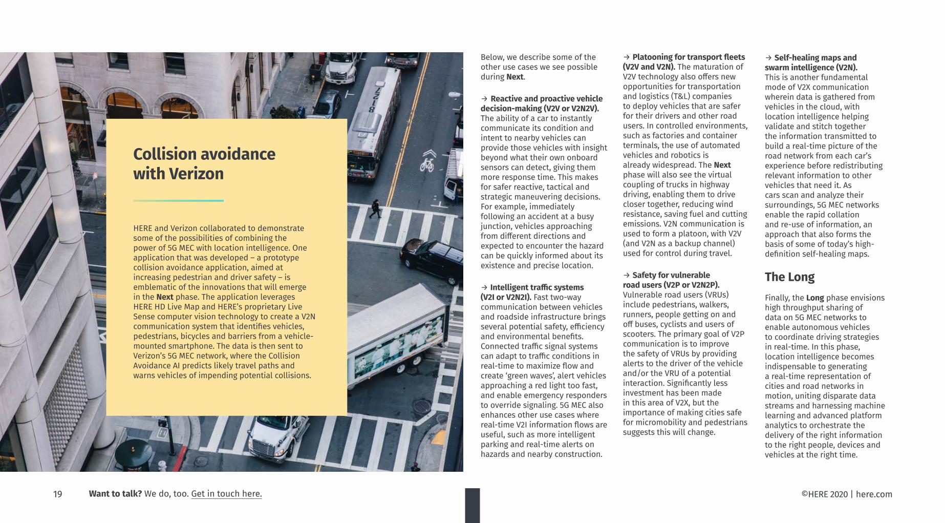
HERE and Verizon collaborated to demonstrate some of the possibilities of combining the power of 5G MEC with location intelligence. One application that was developed – a prototype collision avoidance application, aimed at increasing pedestrian and driver safety – is emblematic of the innovations that will emerge in the Next phase. The application leverages HERE HD Live Map and HERE’s proprietary Live Sense computer vision technology to create a V2N communication system that identifies vehicles, pedestrians, bicycles and barriers from a vehicle-mounted smartphone. The data is then sent to Verizon’s 5G MEC network, where the Collision Avoidance AI predicts likely travel paths and warns vehicles of impending potential collisions.
Collision avoidance with Verizon
19 Want to talk? We do, too. Get in touch here.

©HERE 2020 | here.com
The OEM monetization challenge
Advances in vehicle automation, connectivity and digitalization will help create significant new monetizable opportunities for the automotive industry. Sizing a nascent market is difficult, though ABI Research predicts that sector 5G-enabled services revenue could be worth $5.6 billion by 2025. That will be supported by a projected jump in the number of 5G-ready connected vehicles, fleet telematics devices and in-vehicle toll devices – from a few hundred thousand today to more than 25 million units by 2023, according to
Gartner. As the installed base grows, automakers will be looking for new ways to monetize their customers’ need for mobility – including through services that boost safety, security and convenience. They also recognize the brand value of being first or best at deploying these new capabilities. But the road to monetization is not without risks. Equipping vehicles to take advantage of 5G MEC raises their average cost. Some consumers will be willing to pay for increased safety.
Subscription models that offer an alternative to outright vehicle ownership will also help fan demand. But it is questionable if automakers will be able to pass on the full cost, at least before these new technologies commoditize. Consequently, automakers will be looking to regulations, tax breaks and other government stimulus to help make the market – the expectation being that the costs of those actions will be more than offset by the savings resulting from a safer and more efficient transport infrastructure. Most automakers have already started pilots to evaluate and demonstrate 5G MEC opportunities. While aware of the potential benefits, they are also mindful of the ramifications of any missteps. The wrong technology decisions have a significant cost impact, and that could be debilitating for businesses already hit by the pandemic. Automakers are therefore carefully selecting the partners they work with in devising their connectivity strategy. As we have outlined in this paper, location intelligence must be part of the equation for any automakers looking to turn innovation into a commercial reality. Only with real-time and geo-referenced data and precise positioning will it be possible for industry participants to deliver safer, more enjoyable and more efficient user-centric driving experiences.
20 Want to talk? We do, too. Get in touch here.

©HERE 2020 | here.com
More than two-thirds of people share their location data with application providers at least sometimes, according to our research. People do so for various reasons, ranging from food delivery and hailing a ride to getting the most out of social media. But while people see the benefits, the majority still feel uneasy: some 75 per cent told us that they are concerned about sharing personal information digitally. They do not really know what happens to their information and for what it is used.
The lack of trust is problematic today, but we believe that there could be greater challenges down the road if privacy practices continue to be dominated by a click-to-consent approach. The European Union’s General
Location data privacy in the age of 5G MEC
Data Protection Regulation (GDPR) has sought to expand the ability of people to control their privacy, enabling individuals to grant their consent before their data is processed. In practice, however, for the vast majority of people this has become a mere reflex and consent is seldom informed consent. If our privacy is inherently about control over information relating to ourselves, how then could we control our exposure to others in urban environments where communications are machine-to-machine and time-sensitive and devices can be continuously positioned to within a meter? Already today, we do not just blend into the crowd, especially when our location data is part of the equation. This is because
our mobility habits are unique to us. Our route to the office, from door to door, is different from anyone else’s, and our traces highly identifiable with only a few location data points. Technologies like anonymization offer service providers ways to protect their users’ privacy while retaining enough data to serve some utility. But the challenge is finding that balance, as we discussed in a recent eBook. As regulations tighten and people become more privacy-wary following a spate of privacy and data breach scandals, organizations must get smarter about how they handle data.
21 Want to talk? We do, too. Get in touch here.

©HERE 2020 | here.com
Using location context to manage privacy
For people to enjoy uninterrupted access to new services in a 5G MEC world, a fundamental new approach to managing privacy is needed. Location intelligence has a role to play here. This is because privacy is always about context, and location is an important element in determining context, alongside other parameters such as time of the day, day of the week and type of activity.
Individuals have multiple personas. On the most basic level, we have a work persona and a free-time persona. Privacy expectations differ in each scenario. Beyond that, we can ask: are you moving? Are you in a car or on a bus, train, or bike? In which jurisdiction are you? Is there local or country-based context that is important too? Location drives context in many different scenarios, and contextual thinking can be an important part of helping consumers control how and when their data is shared and used.
Consider a car journey during the Next or Long phase described in section five. Roadside beacons
Towards a system of preference management
In a world of ultra-fast networks and edge computing, privacy goes beyond consent to become a set of multifarious preferences. We therefore think not so much about consent management, but about preference-based privacy management.
A system of preference-based privacy management can resolve the central problem of consent. We envision that we would empower a vehicle or a digital personal agent to act on our behalf, drawing on a set of desired privacy settings as well as spatial, temporal and other information, including our habits, preferred driving routes and locations, parking garages, methods of payment and so on. Machine learning will learn about our consent preferences in different scenarios and places, relieving people from the burden of deciding which data to share, for which purposes, and for which benefits. Additionally, businesses will benefit from efficient anonymization services that integrate location intelligence to effectively assess their data,
quantify privacy risks and remove personal data where necessary.
Successful implementations of preference-based privacy management are likely to also utilize blockchain technology to shift control over personal data from central parties to individual end-users. Blockchain-based solutions enable a single state of truth to be shared across permissioned network participants, where users decide what data they want to share, for what purposes and how long it can be stored. Organizations benefit too. If an enterprise or city is sourcing data that may contain personal data, the ledger stipulates whether or not they have permission to use that data, and operational and planning decisions can be made on the true digital record.
collect information about the vehicle to monitor traffic data, while an edge-hosted application identifies you as a passenger to understand that you are a local commuter. The vehicle connects to your digital task list in the cloud to plan a route for guiding the car on the most efficient path to run all your errands. Parking garages and tolling systems identify the vehicle and charge your account appropriately. Data is exchanged with other vehicles about road hazards and relevant local street conditions. And advertisers request access to your data – such as your age, language, income and recent locations – to offer promotions. A single trip like this involves multiple instances of seamless communication with, and data transfer to, other road users and infrastructure. In situations like these, click-to-consent is an ill-suited mechanism by which to manage privacy – it would be practically impossible for individuals to grant consent, on a truly informed basis, each time before data is processed.
22 Want to talk? We do, too. Get in touch here.

Figure 9:
A high-levelview of theHERE platform
©HERE 2020 | here.com
In this paper, we have discussed how location intelligence is important both in building 5G MEC and getting the most out of the new infrastructure. But how do you access the location data and tools required? In the past, acquiring and working with location data was complex and arduous. This has changed. The proliferation of location-based sensors massively increases data collection, while automated processing of this data and new platform technologies are making it more accessible to businesses. This is fueling the development of new cases, like those we described in sections four and five.
HERE has a long legacy of acquiring and processing location-based data across multiple industries, and we have applied our deep industry experience in the development of a cloud-agnostic location data and technology platform. The platform gives developers access to a wealth of location data, including much of the data types we have referenced in earlier sections of the paper.
Developers can also use the HERE platform to create, build and run their own business applications on 5G MEC infrastructure.
The platform is formed of several blocks that are fully tailored to location intelligence applications. These include:
→ A development environment (HERE Workspace)
→ A data exchange & marketplace (HERE Marketplace)
→ Map creation and visualization capabilities (HERE Studio), and
→ The industry’s largest set of location services (HERE Location Services)
→ The world’s leading global map, with hundreds of attributes (Content)
These capabilities leverage a Platform Foundation that powers any applications built on top with high availability, security
and cloud-agnostic deployment. The HERE platform introduces many essential technological and architectural concepts that are required for services to be run in different computing environments, such as multi-cloud, microservices, containers, security, and billing and accounting. Accordingly, the platform will provide the versatility for full, hybrid, and on-premises edge deployments.
For 5G MEC network planning and deployment, the HERE platform provides access to HERE Geodata Models and other geospatial data. A multitude of data and services available through the platform also enable businesses to exploit 5G MEC infrastructure in the development and operation of location-enabled use cases (see Figure 10). These include data and services such as HERE Lanes and HERE HD Live Map that are designed to support automotive companies building safer and increasingly automated vehicles.
The HERE platform: supporting businesses on their 5G MEC journey
23 Want to talk? We do, too. Get in touch here.

©HERE 2020 | here.com
2025+
ContentHERE Geodata Models SD and HD MapsHERE Road Infrastructure & UsageHERE Road Rules & RegulationsHERE Imagery & TopographyHERE Buildings & StructuresHERE Places & PointsHERE Areas & BoundariesHERE Guidance & RoutingHERE Lanes
EnvironmentsHERE MarketplaceHERE WorkspaceHERE Studio
Developer enablersHERE Live Sense SDK
ApplicationsHERE Navigation On Demand
Location servicesHERE Positioning
HERE Real-Time Tra�cHERE Transit
HERE Geocoding & SearchHERE Routing
HERE Destination WeatherHERE Tracking
HERE Hazard WarningsHERE Connected Vehicle Services
HERE HD Live Map
The HERE data universefor 5G MEC planningand location-centric
innovation
HERE Positioning (see Figure 11 and 12) presently supports a broad range of satellite, cellular, non-cellular radio and sensor positioning technologies. Our future positioning offering will incorporate a range of 5G positioning technologies essential for indoor and outdoor use cases. To meet cost, coverage
and performance needs, business applications will leverage 5G New Radio, HD GNSS, A-GNSS, Wi-Fi, Bluetooth LE and sensor positioning, as well as visual positioning (see section four) for additional localization support in certain scenarios and places, such as urban canyons. Our positioning services can be made to run on MEC infrastructure, thereby ensuring that the latency of positioning is optimal for advanced use cases like real-time positioning of IoT devices and vehicles.
The introduction of MEC will also change the way maps of the radio environment – used to help position devices – are maintained. HERE anticipates that MEC APIs will provide the radio data required for 5G positioning, ending the need for battery-intensive crowdsourcing of such data from devices themselves.
Positioning and localization are also enriched by the HERE Live Sense SDK, a software development kit (SDK) made up of a collection of AI-based perception models that use a forward-facing camera on smartphones, dashcams, personal navigation devices and vehicles to provide drivers greater real-time awareness of their environment. Using vision technology, Live Sense SDK detects different types of objects
HERE roadmap brings full positioning support for 5G MEC
Additionally, HERE is developing a suite of location privacy services, which includes several components: a set of anonymization solutions that service providers can use to protect their users’ privacy while retaining enough data to serve some utility; a privacy diagnostic tool that organizations can use to test how well their anonymized datasets stand up to a reconstruction attack; and blockchain-based consent management technology.
Figure 10
in the driver's environment.
Besides powering new location-centric use cases, modern network technologies provide another major benefit: they enhance HERE's ability to fully automate the creation, storage, and management of geospatial content. 5G and MEC infrastructure are a key part of that effort, supporting rapid feedback loops where changes detected at the edge can be quickly processed and made available for customers and their business applications. The goal is to enable consistent, interoperable map data and location products that meet the most demanding requirements for scale and freshness, setting the stage for further waves of value creation through the platform.
24 Want to talk? We do, too. Get in touch here.

1 cm
1 m
3 m
10 m
100 m
IndustrialStandard
3GPP Rel 9 (2010)
3GPP Rel 16(2019)
3GPP Rel 17(2023)
Precision
HERE 5G Positioningenhancement
HERE A-GNSS(Cell positioning)
HERE SD Wi-Fi
HERE Bluetoothpositioning
HERE HD Wi-Fi
HERE 5GPositioning
Sidelink
6G positioning
5G NRpositioning SLAM,
hybrid
HERE Hi-PrecisionGNSS
Visualpositioning
5G V2X,IoT
5G + MECpositioningenhancement
5G Positioning Technologies(as per 3GPP Rel16 standard)
SatellitepositioningmethodsUse global satellite navigation systems such as GPS, Galileo, GLONASS and Beidou,together with auxiliary datafrom terrestrial networksto increase the performanceand positioning accuracyto sub-meter level.
Non-cellularradio andsensor-based methodsUse radio systems such Wi-Fi, Bluetooth, and embedded sensors to position the devices in urban and indoor environ-ments with navigation-grade performance.
Cellular radio positioningmethodsUse (4G, 5G and 5G NR) cellular radio signals and data to position the devices within the range of cellular networks. The positioning performance depends on the type, quality and density of the measurements and data available for the positioning solution.
A-GNSS
LTE E-CID
LTE OTDOA
NR E-CID
NR Multi-RTT, NR DL-AoD,NR DL-TDOA, NR UL-TDOA,NR UL-AoA
High-Precision GNSS – PPP
High-Precision GNSS - RTK
WLANpositioning
Bluetoothpositioning
Terrestrial Beacon system positioning
Sensor-basedpositioning-Motion
Sensor-basedpositioning–Barometric pressure
HERE IndoorPositioning
HERE Cell Positioning
HERE Cell Positioning
In research
HERE IndoorPositioning
HERE HD Wi-Fi Positioning
HERE Indoor Positioning
HERE HD GNSS
HERE HD GNSS
HERE A-GNSSService
HERE PositioningTechnologies
MEC Ready
(in 2021)
(in 2021)
Figure 11 Figure 12
©HERE 2020 | here.com25 Want to talk? We do, too. Get in touch here.

Consumers, enterprises and governments stand to benefit enormously as 5G and MEC capabilities deploy over the next decade. Yet fully exploiting the transformative potential of these technologies calls for location intelligence.
In this paper, we have sought to provide insights into how location intelligence supports 5G MEC rollouts as well as directly impacts a broad range of critical industries over the long term. Better smartphone connectivity is only the start. 5G MEC networks bring into view a wide array of exciting edge use cases where location data and technology will be an essential ingredient.
To find out how HERE can help your business plan for and thrive in a 5G MEC world, get in touch.
Contact us
HERE, a location data and technology platform, moves people, businesses and citiesforward by harnessing the power of location. By leveraging our open platform, we empower our customers to achieve better outcomes – from helping a city manage its infrastructure or a business optimize its assets to guiding drivers to their destination safely. To learn more about HERE, including our new generation of cloud-based location platform services, visit 360.here.com and www.here.com.
26 Want to talk? We do, too. Get in touch here. ©HERE 2020 | here.com