Embed Size (px)
Citation preview

Little Grand Rapids First Nation
"Ni-Kes" Lands Management Plan
Manitoba Planning Area
October 2012
Prepared by Little Grand Rapids First Nation and Manitoba

2 | P a g e
Table of Contents
Acknowledgements ....................................................................................................................... 4
Dedication ...................................................................................................................................... 5
Introduction ................................................................................................................................... 6
Section 1: Vision, Goals, Objectives and Guiding Principles ................................................... 7
Vision .......................................................................................................................................... 8
Goals ........................................................................................................................................... 9
Objectives ................................................................................................................................... 9
Guiding Principles .................................................................................................................... 10
Section 2: Current Land and Resource Uses ............................................................................ 13
Current Little Grand Rapids First Nation land and resource uses ............................................ 14
Other land uses and tenure ........................................................................................................ 14
Ecological Overview ................................................................................................................. 15
Climate ............................................................................................................................................... 15
Vegetation and Land Cover ................................................................................................................ 15
Waters ................................................................................................................................................ 15
Bedrock and Surficial Geology .......................................................................................................... 15
Wildlife ............................................................................................................................................... 16
Section 3 : Lands Management Direction ................................................................................. 17
Traditional Use and Occupancy ................................................................................................ 18
Atikaki Provincial Park ............................................................................................................. 18
Cabins – community or hunting/trapping ................................................................................. 19
Climate Change ......................................................................................................................... 19
Commercial Trapping ............................................................................................................... 19
Economic development, Dispositions and Resource Allocations ............................................. 19
Species at Risk and of Special Concern .................................................................................... 20
Energy Development and Energy Transmission Corridors ...................................................... 20
Fire Management / Suppression................................................................................................ 20
Fishing....................................................................................................................................... 20
Forestry ..................................................................................................................................... 21
Fuel Caches ............................................................................................................................... 21
Garbage and human waste ........................................................................................................ 21
Hunting ..................................................................................................................................... 21
3 | P a g e
Mineral exploration and mining................................................................................................ 22
Monitoring ................................................................................................................................ 22
Moose Fall Harvest ................................................................................................................... 22
Non-timber forest products (NTFP) .......................................................................................... 22
Special Sites (Cultural, burial, ceremonial etc.) ....................................................................... 22
Tourism ..................................................................................................................................... 22
Transportation (winter, temporary and all-season roads) ......................................................... 23
Research, Interpretation and Education .................................................................................... 23
Waterways and water quality .................................................................................................... 24
Section 4: Land Use Areas ......................................................................................................... 25
Enhanced Management Area .................................................................................................... 26
Commercial Area ...................................................................................................................... 27
Protected Area ........................................................................................................................... 27
Mishipawitigong: Cultural Waterway Protected Area .............................................................. 28
Pigeon River Protected Area ..................................................................................................... 28
Little Grand Rapids Planning Area Portion of Atikaki Provincial Park ................................... 28
Special Sites .............................................................................................................................. 29
Mishipawitigong - Cultural Waterway Management ............................................................... 29
Section 5: Plan Implementation ................................................................................................. 31
Plan Approval Process .............................................................................................................. 32
Little Grand Rapids Stewardship Board ................................................................................... 33
Glossary & Sources ..................................................................................................................... 34
List of Figures Figure 1 Little Grand Rapids Registered Trapline Section / Traditional Use Planning Area Map………….……...........................................................................................................……..12 Figure 2 Little Grand Rapids Lands Management Plan, Land Use Areas Map…………………….30

4 | P a g e
Acknowledgements We would like to thank the following programs, people and organizations: Funding Agencies:
Manitoba Heritage Historic Research Program Manitoba Sustainable Development Innovations Fund Indian and Northern Affairs Canada, Community Economic Opportunity Program Ontario Forestry Futures Trust Program Canadian Boreal Initiative Wabanong Nakaygum Okimawin Inc. MacArthur Grant Foundation Manitoba Government Ontario Government
List of organizations:
Little Grand Rapids First Nation Chief and Council Whelan Enns Associates Inc. Wabanong Nakaygum Okimawin Secretariat Manitoba Conservation and Water Stewardship
Special people who have contributed:
Dr. Peter Kulchyski Dr. Maureen Matthews
List of planning team members:
Little Grand Rapids members: Augustine Keeper (Lands Planning Coordinator), Winston Keeper Jr., Enil Keeper (Lands Planning Coordinator), Martin Owens (Chief 2010 – 2011), Councillor Hilda Crow, Councillor Wendy Leveque, Jared Whelan,
Manitoba members: John Irwin (retired), Joann Hebert, Cheryl Prosser, Alison Haugh (alternate)
And our Elders, whose ancestral and traditional knowledge has helped us understand our past and guide us in the future. Without their contribution we would not have been able to complete this Plan. To other people and organizations not listed here but who have helped us develop this Plan, thank you for your contributions through your research and experience.

5 | P a g e
Dedication
This Lands Management Plan is dedicated to the memory of Frank Duck (Ni-Kes) whose knowledge and way of life continue to be an inspiration to the
people of Little Grand Rapids
Frank Duck (Ni-Kes) was born on a family trapline near Little Grand Rapids on May 12, 1937. Ni-Kes had three sisters and two brothers. Although he never married, he had many nieces and nephews. Frank Duck lived off the land and spent most of the year hunting, trapping and travelling. He would visit the reserve in spring through the summer. He would leave again in the fall. Frank Duck never used motorized boats or vehicles when travelling, hunting or trapping. He was one of the last people from Little Grand Rapids who spent most of their time living off the land year round. Frank Duck built and used two cabins. One was on Rice Lake and the second was on Pickerel Lake. Ni-Kes was very respected as spiritual person and for his traditional knowledge. He used the resources, and plants of the land for making natural medicines. Frank Duck always shared with family and community members the results of his hunting and trapping. Ni-Kes was a very friendly person and liked to play guitar, sing and entertain family and friends. Although he never learned to read and write English, he could sing and play many Country Western songs, especially from Johny Cash and Hank Williams. Frank Duck passed away in Little Grand Rapids in his sleep after a full life and good health in on September 23, 2011.

6 | P a g e
Introduction Little Grand Rapids First Nation has led the preparation of land use direction for areas of ancestral and traditional use in both Manitoba and Ontario. Although there have been necessarily two separate planning processes, one with each province, Little Grand Rapids First Nation has taken a holistic view to planning, which will provide direction that will be meaningful across our traditional use area. However, the Planning Areas themselves do not define the Little Grand Rapids First Nation ancestral and traditional land use area.
We will continue to exercise our Aboriginal, Traditional, Treaty and Constitutional rights on the lands and waters in our traditional area.
For information on our Little Grand Rapids – Ontario Community-Based Land Use Plan please see: http://www.mnr.gov.on.ca/en/Business/FarNorth/2ColumnSubPage/275048.html
In Manitoba, Little Grand Rapids First Nation has worked with Manitoba Conservation and Water Stewardship to prepare this Lands Management Plan for our Planning Area on the east side of Lake Winnipeg. The boundary of our Manitoba Traditional Use Planning Area is based on our trapline section boundaries (see Figure 1) . The partners in the “Protected Areas and First Nation Resource Stewardship: A Cooperative Relationship Accord”; Poplar River First Nation, Little Grand Rapids First Nation, Pauingassi First Nation and Pikangikum First Nation (March 2002) have resolved to establish respective trapline section boundaries as Planning Areas.
The Planning Area does not represent our entire or exclusive ancestral, historical and traditional land use and occupancy area.
A primary reason for Little Grand Rapids First Nation to develop a Lands Management Plan is for the well-being of future generations. This Lands Management Plan document provides strategic direction for both short and long term community priorities, desired uses and principles to guide management of lands and resources within our Planning Area. The Plan reflects a consensus amongst Little Grand Rapids community members and with the Province of Manitoba. The Plan identifies existing and potential land use activities and provides a Land Use Areas zoning framework to support those uses. This direction reflects the consideration of information and knowledge of the land, the resources, and the objectives of both the community and the Province. Both local and broader scale contexts have been taken into consideration. Meegwetch, Little Grand Rapids Planning Team

Section 1: Vision, Goals, Objectives and Guiding Principles
8 | P a g e
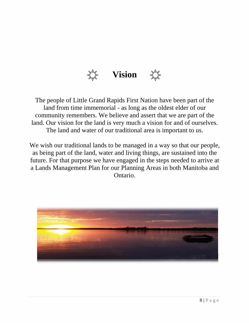
Vision
The people of Little Grand Rapids First Nation have been part of the land from time immemorial - as long as the oldest elder of our
community remembers. We believe and assert that we are part of the land. Our vision for the land is very much a vision for and of ourselves.
The land and water of our traditional area is important to us.
We wish our traditional lands to be managed in a way so that our people, as being part of the land, water and living things, are sustained into the
future. For that purpose we have engaged in the steps needed to arrive at a Lands Management Plan for our Planning Areas in both Manitoba and
Ontario.

9 | P a g e
Goals The goals for managing and protecting the land within the Planning Area are to:
sustain the natural world for present and future generations by protecting traditional land from industrial development and, more specifically, to restrict industrial logging in most of the Planning Area;
identify possible economic developments pursuant to this Plan and to develop an economic strategy which may include but are not limited to mining, tourism, low impact energy developments and other like developments;
manage Little Grand Rapids First Nation ancestral and traditional lands in partnership with the Manitoba Government;
create a new economy and provide training, and jobs for our people while maintaining and protecting the health of our traditional land;
support and sustain ancestral traditional knowledge, traditional land uses, and access to these lands now and for future generations;
uphold and sustain our Aboriginal and Treaty rights under the Canadian Constitution and Treaty 5;
continue to participate in and support the Stewardship Accord signed March 2002 with Pauingassi, Poplar River, Pikangikum, (Bloodvein 2010); and
work in support of the goal of a Pimachiowin Aki World Heritage Site.
Objectives The specific desired outcomes of this Lands Management Plan are listed below.
A Lands Management Plan that is also a communication plan to share information about the relationship of the people of Little Grand Rapids First Nation in all aspects with the land so that it is understood and sustained.
Continued use of traditional lands and to enhance traditional uses by Little Grand Rapids people.
The recording and sharing of Little Grand Rapids ancestral traditional knowledge.
Identification of economic opportunities that are desired and compatible within our Planning Area.
Harmonization of objectives of Little Grand Rapids First Nation and the Government of Manitoba in Crown land use and natural resource management.
Identification of protection zones and other land use area designations.
A plan with the Government of Manitoba that will support the requirements for a World Heritage Site (Pimachiowin Aki).
Upholding the objectives of the 2002 First Nation Stewardship Accord.
Upholding the objectives of the 2007 Wabanong Nakaygum Okimawin (WNO) Accord.

10 | P a g e
Improvement of the relationship between the Government of Manitoba and First Nation communities who have traditional land use areas in Atikaki Provincial Park.
Training of Little Grand Rapids First Nation members for key management and administrative positions in the future management of our traditional area.
Creation of lands management staff positions in the community. These staff will work with Manitoba Conservation and Water Stewardship staff in land use operations and protected areas management.
Guiding Principles
These principles guide the decisions and land use-planning direction for the Little Grand Rapids Traditional Use Planning Area in Manitoba:
In addition to the principles in this section, Little Grand Rapids First Nation and the Manitoba Government acknowledge that the preparation and implementation of this Lands Management Plan will respect Aboriginal and Treaty Rights and rights under the Canadian Constitution, in particular Section 35 and will be consistent with existing provincial legislation.
Little Grand Rapids First Nation will respect the historical and continued shared use of its traditional area by neighbouring communities for traditional activities of hunting, fishing, gathering, travel, etc. There has always been overlap in traditional use areas between communities.
Little Grand Rapids First Nation traditional use and stewardship of traditional lands is respected and recognized. This is a foundation for:
o informed use and management of lands and waters for present and future generations;
o traditional use and resource stewardship traditions and the teachings and practices as part of a conservation approach (providing for care of the land); and
o the continuity of the connection of First Nation people to the land.
Little Grand Rapids First Nation has a duty and interest to use this land in a way that protects and enhances it for future generations.
The Lands Management Plan and planning process respects the connection between the people and land, and takes into account ancestral traditional and local knowledge.
Decision-making relies upon a foundation of traditional values, ancestral teaching methods and knowledge, along with the best available scientific information, to provide the best knowledge currently available in terms of forests, land, water, wildlife, plants, fish, habitat and cultural resource management.
The Management Plan protects, respects and celebrates sacred and ancestral places and values.
The requirement to protect cultural and natural heritage values from negative impacts.

11 | P a g e
Recognition of the importance of encouraging training for youth in the future lands and resources management and opportunities, including building respectful, sharing relationships and relying upon the ancestral and traditional knowledge and teachings of elders.
Recognition that water is the lifeblood of the land and the people. Protection of water sources is of the highest importance, as is management and protection of lakes and river corridors.
Recognition that the area as it is part of the northern boreal forest and its ecological processes have shaped the landscape for millennia. Support the ongoing health of the boreal forest and all living things including provision of healthy watersheds and a continuous supply of fish and wildlife habitat, including habitat for species at risk.
Little Grand Rapids First Nation considers the Planning Area to be its ancestral lands: lands that our people have used since time immemorial.
Land uses can contribute to the growth of a healthy economy in Little Grand Rapids First Nation community and the Province of Manitoba. Identification of opportunities in economic development initiatives that will benefit the First Nation will be encouraged.
Respect for existing stakeholder interests including tourism and other activities. Recreational and tourism uses that sustain healthy lands and waters, the Anishinaabe culture and traditions will be encouraged.
In the face of uncertainty or risk, the precautionary principle will be considered to make decisions about land and resource use and management. The ‘precautionary principle’ involves acting to avoid serious or potential harm to people or the environment where there is traditional knowledge and/or scientific information, or lack thereof, about the likelihood, magnitude, or source of that harm.
The promotion of opportunities to mitigate climate change and store carbon.
Incorporate adaptive management principles into new activities and resource management planning.
Little Grand Rapids and Manitoba recognize that land use activities and management planning need to consider broader geography, e.g., watersheds, cumulative effects of multiple activities, wide-ranging species needs, etc.
This Management Plan and associated community research and planning products are based on community ancestral and traditional knowledge belonging to Little Grand Rapids First Nation.

Figure 1 Little Grand Rapids Registered Trapline Section / Traditional Use Planning Area Map
12lPage

Section 2: Current Land and Resource Uses

14 | P a g e
Current Little Grand Rapids First Nation land and resource uses In the present day, Little Grand Rapids First Nation members spend time on the land and water participating in a variety of activities outside the community site that include traditional and contemporary uses. Examples include:
hunting and fishing (personal and shared use), trapping (personal and shared community use; licensed, non-licensed),
travel by canoe, boat, motorized vehicles, snowmobile, plane, floatplane, and vehicle within the community and on winter roads,
guiding, camping, and staying in cabins, gathering medicinal plants (personal and shared use) and gathering non-timber forest
products (e.g. berries, herbs, mushrooms for personal and shared use), cutting firewood, swimming in lakes and rivers, visiting sacred sites and ceremonial sites, wild rice harvesting (for personal use), and participating in ceremonies, events, and gatherings.
Hunting for woodland caribou is rarely planned and usually occurs by chance. Moose are preferred as a food source because of their reliability and the large quantity of meat that is obtained. Different species are hunted at different times of the year. There are three main waterways that flow through Little Grand Rapids First Nation Planning Area, the Berens River, Keeper River and Pigeon River systems. These waterways are valued travel routes that have been used by the people of Little Grand Rapids First Nation since time immemorial.
Other land uses and tenure There are a number of fishing and hunting lodges and outfitter camps in the Planning Area. There is a winter road that comes from the west along Lake Winnipeg near Bloodvein First Nation and connects our community to the south during the winter months. The hydroelectric transmission line follows a route similar to the winter road corridor to the community of Little Grand Rapids (see figure 2). The nearest community is Pauingassi First Nation. Other neighbouring communities in Manitoba include Poplar River, Berens River, Bloodvein and Hollow Water First Nations. Atikaki Provincial Park is located to the south of the Little Grand Rapids First Nation reserve. The Park overlaps several community traplines, which comprise a portion of our Traditional Use Planning Area. There are quarry withdrawal areas for the East Side Road Authority for the development of the proposed all-season road.

15 | P a g e
There is one mining claim located near Allan Johnson Lake.
Ecological Overview This section provides a brief background on the hydrology, ecology, biology, species, geology and mineral potential in the Little Grand Rapids Traditional Use Planning Area.
Climate The Planning Area is located within the Sub-humid Mid-Boreal Eco-climactic Region. The climate of the area is modified by the maritime influences of Hudson Bay, Lake Superior and Lake Winnipeg. Little Grand Rapids First Nation experiences a warm summer with mean temperatures of 14°C and cold winters with a mean winter temperature of -14.5°C. Mean annual temperature for the area is -0.4C and the average frost-free period ranges from 80-120 days. The region receives on average 400 to 460 mm of precipitation annually. The growing season in the area is between 130 and 170 days.
Vegetation and Land Cover The Planning Area is situated entirely in the Boreal Forest Region. It is dominated by coniferous stands, consisting primarily of jack pine and black spruce. Other tree species found throughout our Planning Area include tamarack, poplar, white birch, white spruce and black ash. In addition to forested areas, there are also numerous wetland complexes where peat bogs, fens and emergent vegetation such as wild rice are found. Herbaceous plants of importance to our community include blueberries and other berries, and plants that are gathered for medicinal and/or ceremonial purposes. Wild rice is also of particular importance to our people.
Waters Waters are the lifeblood of First Nation communities that have existed here for thousands of years, depending on waters for fishing, travel, wild rice plantations, and drinking water. Healthy rivers and lakes are a cultural and spiritual necessity for First Nation communities. In the Planning Area water generally flows from east to west, drainage is generally towards Lake Winnipeg with many lakes, rivers, streams and rapids. Low falls occur where there are bedrock outcrops along rivers and streams.
Bedrock and Surficial Geology The Planning Area is dominated by 2.7 to 3 billion year old granitic rocks of the Canadian Shield and a small area of ancient metamorphosed volcanic rocks (the Horseshoe Lake greenstone belt). The dominantly granitic rocks generally have low mineral potential. However, rare element minerals such as lithium, cesium and rubidium are mined in granitic rocks at Tanco mine near Lac du Bonnet. Parts of Precambrian Shields have potential to host diamondiferous kimberlite pipes, but there is currently no evidence for kimberlites east of Lake Winnipeg. Previous work in the small greenstone belt located in the Horseshoe–Night Owl lakes area indicates there may be mineral potential for gold, silver, copper, and zinc. Preliminary interpretations indicated that pyrrhotite and gold mineralization identified in the clastic sedimentary rocks may be hosted by chemical sediments. Greenstones belts are known to have potential for gold, for example in the Bissett area (MB Geological Survey 2010).

16 | P a g e
Portions of the Planning Area require more detailed geological mapping to provide an accurate analysis of the mineral potential. The first priority in any new geological work would be the Horseshoe Lake greenstone belt. In the area are bogs, fens, and swamp areas where organic (plant) material settles. Organic deposits include peat and some inorganic sediment. There is a thin layer of till that is not continuous over the landscape and may include areas of rock outcrop. Till is sediment, deposited by glaciers, generally consisting of well-compacted material that is layered and contains a mixture of sand, silt, and clay particles and coarse fragments.
Wildlife Fish species, including walleye, northern pike, suckers, whitefish and lake trout can be found throughout the waterways within the Planning Area. Bird species include the spruce grouse, herring gull, and double-crested cormorant, as well as bald eagle, osprey, great horned owl, red-tailed hawk, many species of waterfowl, sharp-tailed grouse, raven, gray jay, among others including many migratory song bird species. Waterfowl, including several species of geese and ducks, are seasonally hunted. Mammal wildlife characteristic of the Planning Area include wolf, lynx, ermine, fisher, mink, moose, black bear, woodland caribou, red squirrel, snowshoe hare, wolverine, otter, marten, beaver, short-tailed weasel, red-backed vole, and least chipmunk. Beaver and muskrat not only provide valuable furs, but also good meat for eating, as do rabbits and “bush chickens” (spruce grouse in particular). Otters, bear, wolf, fox, mink, fisher, ermine, wolverine, squirrel and marten and other fur-bearing mammals are trapped for their furs.
Section 3 : Lands Management Direction

18 | P a g e
Lands Management Direction
Although traplines will be used as planning boundaries, these areas do not reflect the full extent of Little Grand Rapids First Nation traditional area.
Our traditional lands include areas beyond our registered traplines where traditional uses,
including travel, cultural activities and trade have occurred over time.
Little Grand Rapids First Nation will respect the historical and continued shared use of its traditional area by neighbouring communities for traditional activities of hunting, fishing,
gathering, travel etc. There has always been overlap in traditional use areas between communities. This will not change with the formal planning process.
Governments acknowledge that First Nations’ use and occupancy of lands and waters extends beyond trapline areas and planning areas. In many cases, lands traditionally used by First Nations overlap with one another as a result of customary arrangements for access, use and kinship links. Discrete trapline areas show more recent land use patterns established since introduction by the government trapline systems in the 1940s and 1950s in both Manitoba and Ontario. The use of traplines as planning boundaries allows for clear distinction of one First Nation Planning Area from another. With the acknowledgement of the distinction between the Planning Area and traditional territory, the direction provided below applies only to the Little Grand Rapids Traditional Use Planning Area. Little Grand Rapids will continue to be consulted on projects and issues both within and outside of the Planning Area when the duty to consult arises, and Little Grand Rapids acknowledges that their community land and resource management directions and/or project proposals may also require consulting with adjacent First Nations in areas of overlapping interest. The recommendations and direction for activities in all Land Use Areas is consistent with First Nation stewardship and livelihood opportunities. The direction for lands management in this Plan does not include Little Grand Rapids First Nation reserve land.
Traditional Use and Occupancy Little Grand Rapids First Nation will continue to practice traditional activities throughout
the Planning Area and ensure that all other land uses take into account traditional activities by the Little Grand Rapids First Nation.
There are three locations that Little Grand Rapids First Nation would like to use for seasonal summer camps for community use. These are Whitefish Bay, White-eye Lake and Night Owl Lake.
Atikaki Provincial Park Little Grand Rapids First Nation will work with Manitoba Conservation and Water
Stewardship to ensure that our First Nation has meaningful involvement in the

19 | P a g e
management of Park lands within our traditional area. Atikaki Provincial Park will be managed through existing legislation polices and the Park
Management Plan (April 2008).
Cabins – community or hunting/trapping Community members are asked to discuss the location of new cabins with the
Stewardship Board. Existing locations of cabins will be reported to the Stewardship Board. Little Grand Rapids First Nation may consider developing a community cabin policy. Little Grand Rapids First Nation will work toward finding the resources to accurately
map locations of all cabins in the Planning Area. Little Grand Rapids First Nation has the right to build community / hunting or trapping
cabins in the Planning Area as an activity that is reasonably incidental to the exercise of an Aboriginal or Treaty right.
Climate Change Little Grand Rapids First Nation and Manitoba may consider opportunities to contribute
to the mitigation of climate change and incorporate appropriate techniques in management plan implementation;
Little Grand Rapids First Nation will investigate the options around protecting ecological processes and retaining the value of stored carbon in the Boreal Forest and ground.
Commercial Trapping Commercial trapping will continue in the Planning Area. Little Grand Rapids First Nation will work with the Wildlife Branch of Manitoba
Conservation and Water Stewardship on the management of furbearer populations. The Little Grand Rapids First Nation community wants additional control and input on
the management of traplines. We recognize that trapping of fur for sale is a commercial activity and is currently governed by regulations under The Wildlife Act and the provincial fur policy. Consistent with existing Manitoba policies, we will propose a protocol for commercial trapping in which: Little Grand Rapids First Nation would approve any changes in head trapper for each
Manitoba trapline. Little Grand Rapids First Nation would pursue creation of a “Trapping Council” in
the community. The “Trapping Council” would develop management policies consistent with
Manitoba regulations. The “Trapping Council” would sell commercial trapping licenses as an approved
vendor and would determine who the head trappers are for each district. Little Grand Rapids First Nation would like all traplines to be held by community
members. If a trapline is not held by a community member, Little Grand Rapids First Nation would like it to be held in common by the community.
Economic development, Dispositions and Resource Allocations As the Ni-Kes Lands Management Plan is approved, decisions under provincial
legislation, respecting the allocation, disposition or use of Crown land and Crown

20 | P a g e
resources in the Planning Area, and new development proposals in the Planning Area, must take the Plan into account.
Proposed allocations, dispositions or use of Crown land and Crown resources in the Planning Area and new development in the Planning Area, will be reviewed by the Little Grand Rapids Stewardship Board.
The role of the Board does not necessarily fulfill the Crown’s duty to consult.
Species at Risk and of Special Concern Little Grand Rapids First Nation and Manitoba Conservation and Water Stewardship will
discuss future management of endangered and threatened species in the Planning Area, including, but not limited to: woodland caribou (Rangifer tarandus caribou), and wolverine (Gulo gulo).
Little Grand Rapids First Nation, Manitoba Conservation and Water Stewardship and the Department of Fisheries and Oceans Canada may discuss future management of sturgeon and sturgeon habitat in the Planning Area.
Energy Development and Energy Transmission Corridors Little Grand Rapids First Nation will identify potential locations for energy development
that are compatible with the lands management direction. Possible types of energy development may include micro-hydro, wind, solar and
geothermal. Little Grand Rapids First Nation will contribute to the development of additional
management direction for any future energy development activities. Energy development may be considered for local Little Grand Rapids reserve use or in-
place use for buildings in the Planning Area (Community cabins, tourism operations etc.). Little Grand Rapids First Nation intends potential energy development to be for local
reserve use or in-place use associated with community cabins or tourism operations; not for sale or export.
Short transmission lines would be allowed to connect either micro-hydro, wind, solar or geothermal power generation to the reserve or buildings in the Planning Area. An objective is to minimize damaging the natural environment and use the shortest possible transmission line for in-place power generation.
Manitoba Hydro and Conservation and Water Stewardship will consult Little Grand Rapids First Nation about upgrading the current 66 kV power line to a 115 kV power line to Little Grand Rapids reserve and continuing to Pauingassi First Nation, when or if this upgrade is planned or necessary.
Little Grand Rapids First Nation shall be consulted on any new transmission line projects.
Fire Management / Suppression Little Grand Rapids First Nation will work with the appropriate provincial department to
develop a fire management strategy for the Planning Area, which will include Fire Smart Principles (see Glossary for list of Principles).
Fishing Little Grand Rapids First Nation will continue to exercise rights in relation to fishing. It
is also important to sustain fish populations.

21 | P a g e
Recreational fishing can continue in the area and through licensed tourism operations unless conservation measures are required.
Little Grand Rapids may work in partnership with the appropriate government departments to setup a program to monitor fish populations.
Little Grand Rapids First Nation would like to review the issues surrounding fishing with live bait with Manitoba.
Little Grand Rapids First Nation may work with Manitoba Conservation and Water Stewardship to investigate and possibly set limits on fish harvesting.
No fish harvested will be wasted.
Forestry Little Grand Rapids First Nation would like to operate community sustainable forestry for
firewood and local building supplies (e.g. a community saw mill). Community sustainable forestry would be allowed in the Enhanced Management Area
and Commercial Area only. Working with the Forestry Branch of Manitoba Conservation and Water Stewardship, we
will develop guiding direction for the use of forest resources and locations for community sustainable forestry operations within the Enhanced Management Area and Commercial Area.
The viability of community sustainable forestry will be reviewed in the future when the whole plan is reviewed by Little Grand Rapids First Nation and Manitoba and depending on changing economic conditions.
Community sustainable forestry includes operations managed by Little Grand Rapids First Nation for the benefit of the community.
Fuel Caches Fuel caches for existing licensed operations would be maintained as per the current
licence. However, in the future, caches and locations may be reviewed and new conditions may be recommended to follow best practice and protect natural and cultural values.
Garbage and human waste Garbage and human waste guidelines will be developed to reduce and mitigate the impact
on the community and environment. Human waste, garbage, and effluent in the Planning Area will be managed in accordance
with Manitoba Provincial regulations.
Hunting Little Grand Rapids First Nation will continue to exercise our rights in relation to
hunting. It is also important to sustain wildlife populations. Recreational hunting can continue in the area and through tourist operations (outfitters,
outposts, etc.) unless conservation measures are required. There will be no waste of animal or animal parts that have been harvested. Little Grand Rapids First Nation may develop moose management and hunting guidelines
for the community in partnership with Manitoba Conservation and Water Stewardship.

22 | P a g e
Mineral exploration and mining Mineral exploration and mining may occur in the Commercial Area. Mineral exploration and mining is prohibited in the Protected Areas and within Atikaki
Provincial Park. Mineral exploration and mining, except for aggregate extraction for local use, is prohibited from the Enhanced Management Area and Mishipawitigong Cultural Waterway Protected Area.
Additional management direction for any future mineral exploration and mining activities where permitted within the Planning Area may be provided by Little Grand Rapids First Nation and Manitoba Government.
Little Grand Rapids First Nation will pursue impact benefit agreements with any mining company we partner with in the future.
Monitoring Little Grand Rapids First Nation will discuss with Manitoba setting up monitoring
programs for hunting, trapping, observations of changing environment, visitors and possibly climate change and/or any other land, resource or environmental monitoring program deemed necessary.
We would also like to investigate long term environmental monitoring (for example: water, soil, air, species, wildlife, fish).
Moose Fall Harvest Little Grand Rapids First Nation may review the annual moose fall harvest and
recommend the development of policies regarding community moose fall harvest.
Non-timber forest products (NTFP) Little Grand Rapids will investigate future NTFP opportunities. Harvesting non-timber forest products in Atikaki Provincial Park for commercial use is
prohibited.
Special Sites (Cultural, burial, ceremonial etc.) Special sites will be protected, and people other than community members are
discouraged from accessing the sites. Little Grand Rapids First Nation will identify those special sites they wish to have
additional protection. Little Grand Rapids First Nation will discuss the option of protecting special sites under
legislation, such as The Heritage Resources Act. Little Grand Rapids First Nation will ask all visitors to the Planning Area not to disturb
cultural sites. If a new site is located, visitors are asked to please inform Little Grand Rapids First Nation band office with an exact location (GPS) and description if possible.
Tourism Development of tourism opportunities is an important goal which includes development
of recreational hunting, fishing, camping and canoeing opportunities. Snowmobiling and all-terrain vehicles are being used now and may continue to be used. Future management direction may be developed regarding tourism activities and areas.

23 | P a g e
Tourism activities should protect and respect Aboriginal rights, Treaty rights and uses of the land.
Tourism should protect features of cultural and ecological significance, and the relationship of First Nation people to these features, and respect Aboriginal ancestral traditional knowledge and traditional uses.
A proposed tourism plan would recognize an interest in planning new community-based tourism initiatives and promoting First Nation-owned operations for new tourism ventures.
Little Grand Rapids will show respect for existing stakeholder interests and build a positive relationship between existing tourism operations and Little Grand Rapids First Nation community.
New and existing tourism establishments must operate in accordance with environmental standards and regulations. In the future, tourism operations may be required to incorporate enhanced Best Management Practices (BMP’s) for water quality protection (i.e. septic systems).
Little Grand Rapids will be consulted when new tourism activities are proposed within the Planning Area.
Transportation (winter, temporary and all-season roads) Little Grand Rapids shall participate in the identification for the future route of the all-
season road to Little Grand Rapids First Nation and to Pauingassi First Nation. A road corridor across the Pigeon River outside of the Atikaki Provincial Park would be
allowed if this is the best option for a future all-season road. Impacts on the Pigeon River protected area will need to be considered. Whenever possible, roads will be prohibited from the Protected Land Use Areas. All disturbed sites associated with the construction of the all-season road should be
decommissioned and reclaimed once the road is built and operating. Quarry sites that are needed for maintenance of the road would remain. Identify future location of airstrip closer to the community. Little Grand Rapids First Nation will contribute to an evaluation of risks and benefits
associated with a future all-season road. (e.g. habitat loss, cottage development) Manitoba will consult Little Grand Rapids First Nation on the route and activities
(including construction) for the all-season road. Activities allowed in Enhanced Management Area, if they are associated with the all-
season road include construction, operation and maintenance and associated structures include, but are not limited to: installation, replacement and maintenance of crossing structures, road bed construction and maintenance, right of way clearing and grubbing, geotechnical exploration, aggregate extraction and production, development of access roads, borrow areas, work camps/maintenance yards, lay-down areas, snow clearing, and winter road decommissioning.
Research, Interpretation and Education Little Grand Rapids and Manitoba, or other agencies to be identified, will work in
partnership to explore opportunities for joint research projects, gathering information and youth education projects relating to wildlife, fish, the environment and cultural heritage.
24 | P a g e
Waterways and water quality Protection of the water used by the community for home use for drinking, washing and
cooking, is important to the community and guidelines may be developed to assist in keeping the waters clean.
Strategic direction may be provided for protection and conservation of waterways and wetlands for both cultural resources and natural resources.
Further direction regarding waterways protection is provided in Section 4: Land Use Areas under Mishipawitigong (Cultural Waterways).

Section 4: Land Use Areas

26 | P a g e
Lands Management Plan, Land Use Areas
Little Grand Rapids First Nation respects the historical and continued shared use of its traditional area by neighbouring communities for traditional activities of hunting, fishing,
gathering, travel etc. There has always been overlap in traditional use areas between communities.
Land Use Areas are specific zones of the Planning Area that have been designed to best accommodate the activities of the area. The Land Use Areas work together to integrate land uses and the intent of the Lands Management Plan across the Planning Area. Little Grand Rapids First Nation has identified that the Protected Areas (Protected Area, Pigeon River, Mishipawitigong Cultural Waterway Protected Area and Atikaki Provincial Park portion) and the Enhanced Management Area within Little Grand Rapids First Nation Planning Area contribute to the Pimachiowin Aki World Heritage Site nominated area.
Enhanced Management Area Land Use Intent All traditional activities will continue within the Enhanced Management Area unless conservation measures are warranted and consultation has taken place with Little Grand Rapids First Nation. In the Enhanced Management Area, mineral exploration and mining (including peat) will not be permitted. Any mining activity, such as aggregate extraction required for road maintenance or construction, will be managed to protect wildlife, habitats and cultural values. The existing transmission line and winter road corridor pass through the Enhanced Management Area and will be maintained over time, which includes upgrading the distribution lines. Micro-hydro, solar, wind and geo-thermal energy development and distribution lines meant for these activities may be allowed. This plan does not make provision for transmission lines in excess of 115kV. Power generated should be for immediate use. Planning for an all-season road is underway; the corridor is planned through the Enhanced Management Area. Aggregate extraction will be allowed for the purpose of all-season road construction. Quarry sites that are needed for maintenance of the road will remain. If new or additional utility lines for telecommunications are needed they would be permitted preferably in the same corridor as the all-season road. Large scale commercial forestry would be prohibited; however, community-based sustainable forestry may be permitted in the Enhanced Management Area. Wild rice harvesting may be permitted in this area. Extra management precautions may be taken to protect habitat and waterways to reduce impact on all traplines, hunting areas, cabins and special places. Specific guidance for the protection of woodland caribou and their habitat within this area may be developed.

27 | P a g e
Commercial Area Land Use Intent All traditional activities will continue within the Commercial Area unless conservation measures are required and consultation has taken place with Little Grand Rapids First Nation. Mining exploration may be allowed within this area. Any mining activity will be managed to protect natural and cultural values. The existing transmission line passes through this area. All required maintenance and upgrading activities will be permitted. Micro-hydro, solar, wind and geo-thermal energy development and distribution lines meant for these activities may be allowed. Transmission lines in excess of 115kV would not be allowed. Power generated should be for immediate use. If new or additional utility lines for telecommunications or other purposes are needed, they may be permitted. We encourage any new utilities to follow existing infrastructure corridors. Large scale commercial forestry would be prohibited, but community-based sustainable forestry may be permitted in the Commercial Area. Roads may be permitted in this area. Existing corridor maintenance or new corridors will be planned to minimize the impact on natural and cultural values. Extra management precautions may be taken to protect habitat and waterways to reduce impact on all cultural values including traplines, hunting areas, cabins and special places, as well as natural values such as critical woodland caribou habitat and waterways protection. Specific guidance for the protection of woodland caribou and their habitat within this area may be developed. Wild rice harvesting may be permitted in this area.
Protected Area Land Use Intent The Protected Area will be managed to allow and maintain traditional uses, protect cultural and natural lands, and natural resources. The maintenance and construction of community hunting and trapping cabins, the continuation of commercial trapping, the collection of non-timber forest products, wild rice harvesting and recreational activities would continue within this area. The Protected Area will ensure that habitats, wildlife, waterways and cultural values are protected. Commercial forestry, mineral exploration and mining, aggregate and peat extraction, exploration or development of petroleum resources, hydro-electric generation and transmission activities would be prohibited in the Protected Area. Whenever possible, roads will also be prohibited in the Protected Area. Little Grand Rapids would like to provide direction to manage float-plane landing areas in the future within the Protected Area to protect natural and cultural values.

28 | P a g e
Mishipawitigong Cultural Waterway Protected Area Land Use Intent The Little Grand Rapids Mishipawitigong Cultural Waterway Protected Area was created to provide added protection to the Berens River where it traverses our Commercial Area. The Berens River is an important cultural waterway to the people of Little Grand Rapids First Nation. A 150m buffer has been placed on each side of the waterway to protect the socio-economic, cultural, ecological and recreation values of this River. The maintenance and construction of community hunting and trapping cabins, the continuation of trapping, the collection of non-timber forest products, wild rice harvesting and recreational activities would continue within this area. All customary and traditional uses are respected and shall be maintained or enhanced. Commercial forestry, mineral exploration and mining, peat extraction, exploration or development of petroleum resources, and commercial hydro-electric generation would be prohibited in the Mishipawitigong Cultural Waterway Protected Area. Road and utility corridor, and/or the development of other infrastructure shall be permitted only as necessary to serve the needs of the community of Little Grand Rapids and/or adjacent land use developments.
Pigeon River Protected Area Land Use Intent The land use intent for this area is the same as for the Protected Area. All customary and traditional uses are respected and shall be maintained or enhanced. Commercial forestry, mineral exploration and mining, peat extraction, exploration or development of petroleum resources, and commercial hydro-electric generation would be prohibited. Construction of the proposed all-season road and the winter road may be permitted within the Pigeon River Protected Area. This includes activities required to develop and maintain the roads. Extra care will be taken to protect the surrounding areas during construction, maintenance and in marshalling and staging areas. Any proposed all-season road crossing of the Pigeon River Protected Area will be carefully studied and reviewed with Little Grand Rapids First Nation and the Government of Manitoba before construction begins.
Little Grand Rapids Planning Area Portion of Atikaki Provincial Park Land Use Intent Atikaki Provincial Park is located directly south of the Little Grand Rapids First Nation. The community and Manitoba Conservation and Water Stewardship will work together on management of the Park. The intent is that the Little Grand Rapids Protected Areas and Atikaki Provincial Park will provide complimentary direction for the protection and management of natural and cultural values. The Park will be managed in accordance with the Atikaki Management Plan (2008) as well as all existing relevant legislation, regulations and policies. Future management planning for Atikaki will involve the input from Little Grand Rapids and provide specific guidance for protection and management of natural and cultural values, including for example the protection of woodland caribou and their habitat.

29 | P a g e
Areas of Importance but not located on the Land Use Area Map:
Special Sites Special sites are cultural, historical or spiritual sites located in the Planning Area. These sites are important and, in some cases, sacred to Little Grand Rapids community members. Traditional activities may continue as long as sites are not disturbed or destroyed. Through traditional land use and occupancy studies, along with Manitoba historical records, many sites have been identified and documented. In some parts of the Planning Area there are groups of special sites that may need extra management and protection. These sites shall be protected from industrial development and disturbance. Special permission may be required to visit these sites in the Planning Area. Examples of special sites include: burial sites, birth sites, ceremony sites, rock paintings, sacred stones, petroglyphs, Thunderbird Nests, historical sites, trading sites, meeting places, and sacred sites.
Mishipawitigong - Cultural Waterway Management Water is important to Little Grand Rapids First Nation. Waterways and wetlands will be managed to promote protection objectives associated with the cultural and ecological value of water systems. Along the Berens River through the Commercial Area, a 150m Protected Area buffer has been developed to protect the natural and cultural values of that waterway (see Land Use Direction provided above for this Cultural Waterway Protected Area). In all other Land Use Areas of the Little Grand Rapids Traditional Use Planning Area, unmapped 50m buffers from the Ordinary High Watermark (OHW) around and along significant waterways have been identified. Extra management precautions will be taken to protect cultural waterways so as to mitigate potential negative impact of activities. Cultural Waterways are shown as dark blue on the Little Grand Rapids First Nation Land Use Areas Map Figure 2.
Land Use Area Area square kilometers
Percent of Planning Area
Commercial Area 524 11 Enhanced Management Area 1415 30
Protected Area 853 18 Pigeon River Protected Area 31 1
Mishipawitigong Cultural Waterway Protected Area
90 2
Atikaki Provincial Park Area 1773 38 Total Planning Area 4684 100
Table 1: Summary of the Ni-Kes Lands Management Plan Land Use Areas

30 | P a g e
Figure 2 Little Grand Rapids Ni-Kes Lands Management Plan: Land Use Areas Map

Section 5: Plan Implementation
32 | P a g e
Plan Approval Process Little Grand Rapids First Nation Chief and Council have decided to implement the Ni-Kes Lands Management Plan under The East Side Traditional Lands Planning and Special Protected Areas Act. Plan approval process for both Little Grand Rapids First Nation and the Government of Manitoba is described below followed by an overview for the implementation of the Lands Management Plan through the Little Grand Rapids Stewardship Board. Community Approval The Little Grand Rapids First Nation Final Lands Management Plan has been approved and is endorsed by the Little Grand Rapids First Nation. There have been a series of community meetings, workshops and open houses to both seek input from and inform community members during the development of the Lands Management Plan. Government of Manitoba Approval Plan approval requirements under The East Side Traditional Lands Planning and Special Protected Areas Act:
completed lands management plans must be forwarded to the Minister of Conservation (Section 11(1))
the First Nation(s) or aboriginal community(ies) that requested the designation of the Planning Area must provide the Minister with written approval of the plan prior to the plan being forwarded to Cabinet for approval (Section 12(1)(a))
First Nations and aboriginal communities that have traditionally used land in the Planning Area must have the opportunity to consider and comment on the proposed management plan prior to the plan being forwarded to Cabinet for approval (Section 12(1)(b)) NOTE: Consultations under Section 35 of Canada’s Constitution may also be required at this stage if Treaty or Aboriginal rights are or may be affected (Draft Guidelines for Traditional Area Land Use Planning Related to Bill 6, 2009)
the Minister may require the planning team to provide amendments to the proposed management plan prior to the plan being forwarded to Cabinet for approval (Section 11(4))
the Minister must give public notice that a copy of the proposed management plan is available for review in the public registry at least 90 days prior to the issuance of an Order in Council approving a plan (Section 11(2))
there is a 60 day public comment period in which written submissions regarding the proposed management plan can be submitted (Section 11(3))
The Lieutenant Governor in Council (the Lieutenant Governor acting by and with the advice of Cabinet) may, by order, approve the proposed plan and specify its effective date.
An Order in Council approving a community management plan is a formal Cabinet decision that is approved by the Lieutenant Governor.

33 | P a g e
Little Grand Rapids Stewardship Board The process of defining land use direction for Little Grand Rapids First Nation is an important step. Equal in its importance is the implementation phase, consisting of moving forward with the strategy to allow the community to realize its vision. Implementation of the Lands Management Plan will be undertaken by the Little Grand Rapids Stewardship Board (the “Board”). The Little Grand Rapids Stewardship Board has been established consisting of equal number of representatives from Little Grand Rapids First Nation and the Government of Manitoba. The Board will meet at least twice a year. During the first few years more meetings of the Board may be required to outline the Board’s responsibilities and develop policies or guidelines to ensure the direction in the Plan is realized. One of the responsibilities of the First Nation Board members is to keep Chief and Council informed of Board activities and forward information about Crown land activities or developments that are proposed within the Planning Area to Chief and Council so they can review and provide comments to Manitoba through the Board process. The Stewardship Board will review proposed Crown land, resource dispositions, allocations and new development plans for this area and provide comments to Manitoba. Representatives of the Board will provide feedback to their respective organizations on the comments and recommendations that were forwarded to Manitoba by the Board. One of the preliminary priorities of the Stewardship Board will be to develop a cabin policy. Little Grand Rapids has expressed significant concern that the development of the all-season road will open up the area to people wanting to build cabins. There is concern that this may have an impact on Treaty rights, traditional activities and damage the natural landscape and wildlife habitat. A cabin policy will ensure that any development will be undertaken in a manner that protects wildlife and habitat as well as protecting traditional activities. The Board will also look at developing policies for commercial trapping, resource monitoring, waterway protection and fishing, as well as other land and resource management policies as required. The Lands Management Plan is a living document. The Little Grand Rapids Stewardship Board may review the Plan in full every four years to evaluate if the Plan implementation is focused on our shared goals, objectives and principles. If the Plan does not meet expectations, then consideration will be given to amending the Plan.

Glossary & Sources

35 | P a g e
Glossary ‘Pimachiowin Aki’ (‘Atikaki/Woodland Caribou/Accord First Nations’) world heritage site (WHS) nomination. In the Ojibwe language "Pimachiowin Aki" means "the land that gives life". "Micro-hydro" – Micro-hydro is hydro-electric development that generates electricity in a manner that has minimal impact on natural water flow. "Crown" means Her Majesty the Queen in right of the province; "Crown lands" includes land, whether within or without the province, vested in the Crown, and includes "provincial lands" wherever that expression is used in an Act of the Legislature; "disposition" includes an act of the Crown whereby Crown lands or a right, interest, or estate therein are granted, disposed of, or affected, or by which the Crown divests itself of, or creates a right, interest, or estate in, land or permits the use of land; "mineral" means a non-living substance that is formed by natural processes and is found on, in or under the surface of the ground, irrespective of chemical or physical state and before or after extraction, and includes oil, gas, helium, peat, peat moss and substances that are prescribed as minerals under The Mines and Minerals Act but does not include agricultural soil, surface water or ground water other than ground water that is obtained from a well as defined in The Oil and Gas Act; Fire Smart Principles The Seven Disciplines of Fire Smart:
1. Education – educating people living in the wildland/urban interface 2. Fuels Management – thinning, pruning, removing trees, species conversion/management. 3. Legislation – by-laws (no wood shake roofs, home sprinklers etc.) hydro power line
clearing etc. 4. Development – guidelines can be set up by builders and developers for fire resistant
building materials. 5. Planning – Wildfire Pre-Response Plans, Sprinkler Deployment Plans. Community
planning - Road way widths, roadway access, emergency equipment turnarounds, green spaces etc.
6. Training – cross training municipal and wildland firefighters for urban interface firefighting.
7. Inter-Agency Co-operation - bringing all the stakeholders together.
The seven disciplines of FireSmart are what all the various agencies build their FireSmart programs around.
36 | P a g e
Sources Dunning, R. W. 1959. Rules of Residence and Ecology among the Northern Ojibwa. American Anthropologist, New Series, Vol. 61, No. 5, Part 1 (pp. 806-816). http://www.jstor.org/stable/667007 Environment Canada and Agriculture and Agrifood Canada. 1995. MAP – Terrestrial Ecozones and Ecoregions of Canada http://sis.agr.gc.ca/cansis/publications/ecostrat/cas016.zip Government of Manitoba. 2009. The East Side Traditional Lands Planning and Special Protected Areas Act. http://web2.gov.mb.ca/laws/statutes/2009/c00709e.php (accessed July 2009) Government of Manitoba. 2007. Press Release – Landmark Government-to-Government Accord on East Side of Lake Winnipeg Signed Between Province of Manitoba and First Nations http://news.gov.mb.ca/news/index.html?archive=&item=1407 Government of Manitoba. 2007. Backgrounder – Wabanong Nakaygum Okimawin (WNO). http://www.gov.mb.ca/conservation/wno/pdf/wno_accord_backgrounder_april_3_2007.pdf Government of Manitoba. undated. Wabanong Nakaygum Okimawin (WNO). (accessed July 2009) http://www.manitoba.ca/conservation/wno/index.html Government of Ontario. 2009. Bill 191, Far North Act. http://www.ontla.on.ca/bills/bills-files/39_Parliament/Session1/b191.pdf Manitoba Conservation. 2009. Draft Guidelines for Traditional Area Land Use Planning Related to Bill 6 (East Side Traditional Lands Planning and Special Protected Areas Act). Manitoba Conservation, Wildlife and Ecosystem Protection Branch. undated. MAP – Trapping Boundaries. http://www.manitoba.ca/conservation/wildlife/trapping/boundmap.html Manitoba Conservation, Wildlife and Ecosystem Protection Branch. undated. The Registered Trapline System and the Lineholder. http://www.manitoba.ca/conservation/wildlife/trapping/rtl_lines.html (accessed July 2009) Manitoba Forestry Branch. undated. MAP – Manitoba Forest Management Units. http://www.manitoba.ca/conservation/forestry/forest-practices/pdfs/fmuonly.pdf Manitoba Forestry Branch. undated. MAP – Manitoba Forest Sections. http://www.manitoba.ca/conservation/forestry/forest-practices/pdfs/forsectonly.pdf Report of Activities 2010, Manitoba Innovation, Energy and Mines Manitoba Geological Survey, GS12 Re-evaluation of the geology of the Berens River Domain east-central Manitoba by M.T. Corkery, L.A. Murphy and H.V. Zwanzig, pages 135 - 145 Manitoba Protected Areas Initiative. 2007. MAP – Manitoba’s Natural Regions. http://www.gov.mb.ca/conservation/pai/images/maps/natural_region_map.pdf Manitoba Wildlands. 2007. Brief – Land Use Plans (LUP). http://manitobawildlands.org/pdfs/LCBrief-LUP_MWL.pdf

37 | P a g e
Maureen Matthews, D. Phil (Oxon), History, Culture and Anthropology Report for Pauingassi and Little Grand Rapids, 2008 Northern Lights Heritage Services. 2007. The Archaeological Record of the Fort Alexander First Nation. Northern Lights Heritage Services. 2000. Ecoregion 90 Traditional Land Use and Occupancy Study (Poplar River, Little Grand Rapids and Pauingassi). Little Grand Rapids First Nation. 2009. Vision and Goals for Lands Protection and Management. Little Grand Rapids First Nation. 2008. Manitoba – Ontario Traditional Lands Atlas. Pikangikum First Nation. 2006. Keeping the Land – A Land Use Strategy for the Whitefeather Forest and Adjacent Areas. http://www.whitefeatherforest.com/wp-content/uploads/2008/06/land-use-strategy.pdf Pimachiowin Aki Corporation. undated. Pimachiowin Aki World Heritage Project. (accessed July 2009) http://www.pimachiowinaki.org/ Poplar River, Pauingassi, Little Grand Rapids and Pikangikum First Nations. 2002. Protected Areas and First Nation Resource Stewardship – A Cooperative Relationship Accord. http://www.whitefeatherforest.com/pdfs/accord.pdf Report of Activities 2010, Manitoba Innovation, Energy and Mines Manitoba Geological Survey, GS12 Re-evaluation of the geology of the Berens River Domain east-central Manitoba by M.T. Corkery, L.A. Murphy and H.V. Zwanzig, pages 135 - 145 The Precautionary Principle Project. 2003. http://www.pprinciple.net/the_precautionary_principle.html (accessed July 2009) Province of Manitoba, Signatory First Nations. 2004. Broad Area Planning Initiative Memorandum of Understanding. http://www.manitoba.ca/conservation/wno/phase2/mou/mou_espi.pdf Province of Manitoba, Wabanong Nakaygum Okimawin Council of Chiefs. 2007. Wabanong Nakaygum Okimawin (WNO) Council of Chiefs Accord. http://www.gov.mb.ca/conservation/wno/pdf/accord_april_3_2007.pdf Whelan Enns Associates Inc. 2008. Frame of Reference: Community Guide for Pauingassi and Little Grand Rapids First Nations – History and Culture