Embed Size (px)
Citation preview

#INSPIREhackathon
TEAM 6: Streamed sensor data as RDF on the flyTEAM 7: LPIS Linked Data publication
TEAM 8: SPOI dataset enrichment1
Linked Data Projects

#INSPIREhackathon
TEAM MEMBERS AND SUPPORTING PROJECTS
• Raul Palma, PhD : Semantic Technologies Coordinator at Poznan Supercomputing and Networking Center (PSNC), Poland.
• Soumya Brahma: data analyst at PSNC Technical support• Mike, Ondra (UWB): Senslog experts• Raitis Berzins (BOSC): UI experts• Vojta (Lesprojekt): Agri expert• Otakar Čerba (UWB): SPOI generation• Acknowledments to Dr. Peter Haase, and Dr. Johannes Trame (Metaphacts)
• Supported by:
INSPIRE Conference, Antwerp, 19th Sept 2018
#INSPIREhackathon
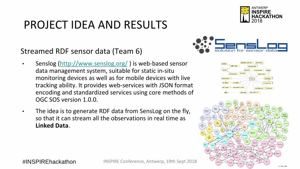
PROJECT IDEA AND RESULTS
Streamed RDF sensor data (Team 6)
• Senslog (http://www.senslog.org/ ) is web-based sensor data management system, suitable for static in-situ monitoring devices as well as for mobile devices with live tracking ability. It provides web-services with JSON format encoding and standardized services using core methods of OGC SOS version 1.0.0.
• The idea is to generate RDF data from SensLog on the fly, so that it can stream all the observations in real time as Linked Data.
INSPIRE Conference, Antwerp, 19th Sept 2018

#INSPIREhackathon
PROJECT IDEA AND RESULTS
Streamed RDF sensor data (Team 6) - Tasks• Define the underlying model for the representation of
RDF sensor data• RDF data cube, QB4ST and SDMX (multi-dimensional and statistical
data), SOSA (entities involved in observation, actuation, sampling)
• Define mapping from PostgreSQL relational model to RDF• Mapping in RDF
• Deploy service enabling access to relational DB as virtual, read-onlyRDF graphs.
• D2RQ
• Link to other dataset• SiLk + (geo)SPARQL
INSPIRE Conference, Antwerp, 19th Sept 2018
http://senslogrdf.foodie-cloud.org/
Public Link

#INSPIREhackathon
PROJECT IDEA AND RESULTS
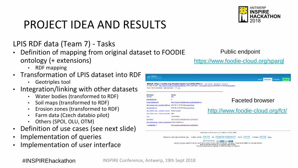
LPIS RDF data (Team 7)
• The idea is to integrate Czech LPIs data with other RDF datasets following LinkedData principles. CZ LPIS is publicly available in vector format (shapefile).
• Data will be represented in RDF using FOODIE ontology as the underlying model. This ontology was generated from FOODIE application schema (UML model), Revision 4.3.2, and translated into an ontology according to ISO/DIS 19150-2
INSPIRE Conference, Antwerp, 19th Sept 2018
#INSPIREhackathon
PROJECT IDEA AND RESULTS
LPIS RDF data (Team 7) - Tasks• Definition of mapping from original dataset to FOODIE
ontology (+ extensions)• RDF mapping
• Transformation of LPIS dataset into RDF• Geotriples tool
• Integration/linking with other datasets• Water bodies (transformed to RDF)• Soil maps (transformed to RDF)• Erosion zones (transformed to RDF)• Farm data (Czech databio pilot)• Others (SPOI, OLU, OTM)
• Definition of use cases (see next slide)• Implementation of queries• Implementation of user interface
INSPIRE Conference, Antwerp, 19th Sept 2018
https://www.foodie-cloud.org/sparql
Public endpoint
http://www.foodie-cloud.org/fct/
Faceted browser

#INSPIREhackathon
PROJECT IDEA AND RESULTS
LPIS RDF data (Team 7) - Tasks• Use Case #1 - buffer zones around water bodies (user
will specify the distance), defining areas within the fieldswith limited/restricted application of agro-chemicals.
• Use Case #2 - select of farm/fields based on the ID_UZ attribute from public LPIS database
• Use Case #3 - visualization of crop species based on the farm data + percentage of crops in graphs
• Use Case #4 - select fields with different soil types• Use Case #5 select fields with certain crop in max
distance from certain point (it could be for logistic, distribution of biomass etc)
• Use Case #6 - show/select erosion zones for specificfarm ID (map + statistics for NEO/MEO/SEO)
INSPIRE Conference, Antwerp, 19th Sept 2018
http://ng.hslayers.org/examples/databio/
#INSPIREhackathon
PROJECT IDEA AND RESULTS
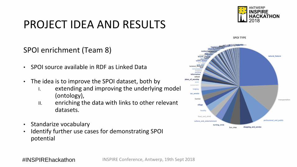
SPOI enrichment (Team 8)
• SPOI source available in RDF as Linked Data
• The idea is to improve the SPOI dataset, both by I. extending and improving the underlying model
(ontology), II. enriching the data with links to other relevant
datasets.
• Standarize vocabulary• Identify further use cases for demonstrating SPOI
potential
INSPIRE Conference, Antwerp, 19th Sept 2018

#INSPIREhackathon
PROJECT IDEA AND RESULTSSPOI enrichment (Team 8) – Tasks (Ontology)• Classes linked to well-known vocabularies and
knowledge bases:• Link property: owl:equivalentClass• Linked resources: Schema.org, Dbpedia, Eurovoc, Gemet, Agrovoc
• Properties: • Reuse well-known vocabularies: RDFS, OWL, FOAF, DC, LOCN,
Geosparql• Definition of non-standard properties in ontology, Linked to well-
known vocabularies and knowledge bases (schema.org, dbpedia)
• SPOI ontology can be extended with additional modules• Annotations (tags): MUTO (Modular Unified Tagging Ontology)
ontology to allow user and/or automatic annotations
• User enrichment (ratings, comments, moderation, etc.): RDF Review Vocabulary

#INSPIREhackathon
PROJECT IDEA AND RESULTSSPOI enrichment (Team 8) – Tasks (dataset Linking/Integration)• Geospatial related datasets:
• Open Land Use (OLU), Open Transport Map (OTM), Corine, Urban Atlas, NUTS, Natural Earth (ToDo)• Transformed to RDF or collected open datasets
• Reviews & ratings: • Yelp.com (academic dataset)• transformed and published as Linked Data
• Statistics:• FADN (Farm Accountancy Data Network) database• transformed and published as Linked Data, linking undergoing
• Eurostat (not available as Linked Data anymore): • tourism-related statistics (crimes per region, regional tourism statistics, capacity
of tourist accommodation establishments, road accidents by region, etc.)• process started
• Others:• Climate data (ToDo)

#INSPIREhackathon
• Map visualisation (SPOI+others): http://ng.hslayers.org/examples/olu_spoi/?hs_panel=info&hs_x=1607799.902082933&hs_y=6462976.717926565&hs_z=16&visible_layers=Base%20layer;Land%20use%20parcels
PROJECT IDEA AND RESULTS

#INSPIREhackathon
• Map visualisation (SPOI+others): http://ng.hslayers.org/examples/olu_spoi/?hs_panel=info&hs_x=1607799.902082933&hs_y=6462976.717926565&hs_z=16&visible_layers=Base%20layer;Land%20use%20parcels
PROJECT IDEA AND RESULTS

#INSPIREhackathon
PROJECT IDEA AND RESULTS
• Metaphactory (https://foodie.grapphs.com/resource/Start )
INSPIRE Conference, Kehl, 5th Sept 2017

#INSPIREhackathon
PROJECT IDEA AND RESULTS
• Metaphactory (https://foodie.grapphs.com/resource/Start )
INSPIRE Conference, Kehl, 5th Sept 2017

#INSPIREhackathon
INPUT OR NEW DATA
• Data used and transformed to Linked data:• EU/Global level (public): OLU, OTM, SPOI, NUTS,
EUROSTAT, FADN• National level (Czech - public): LPIS, soil maps, Water
bodies, erosion zones• Farm level (databio pilot – private, public sample): Crop,
production, yield, etc.
INSPIRE Conference, Antwerp, 19th Sept 2018
https://www.foodie-cloud.org/sparql
http://www.foodie-cloud.org/fct/
#INSPIREhackathon
USED OR GENERATED SOFTWARE/TOOLS
INSPIRE Conference, Antwerp, 19th Sept 2018
• RMLProcessor (transform JSON/CSV data)
• Geotriples (transform shapefiles data)
• D2RQ (transform relational data)
• RDF for the representation of data
• Ontologies (FOODIE, Data cube, QB4ST, SDMX, SOSA, SPOI, OLU, etc.)
• Virtuoso for storing the semantic datasets
• Silk for discovery of links
• (geo)Sparql for querying semantic data
• Hslayers NG for visualisation of data
• Metaphactory for visualisation of data

#INSPIREhackathon
USE OF APIs
• Source data is accessed via SQL or downloaded• Generated data is available as Linked Data via the
Sparql endpoint, faceted search browser, orvirtuoso API
INSPIRE Conference, Antwerp, 19th Sept 2018
https://www.foodie-cloud.org/sparql
http://www.foodie-cloud.org/fct/
#INSPIREhackathon
INSPIRE/GEOSS/COPERNICUS/ RELEVANCE
• This work demonstrate the potential usages and benefits of linked data with geospatial dimension
• The work exploits results from Copernicus and INSPIRE
• The datasets generated are compliant with INSPIRE
INSPIRE Conference, Antwerp, 19th Sept 2018

#INSPIREhackathon
CROSS SECTORAL OR CROSS BOUNDARY INTEROPERABILITY
• Linked Data enables integration of differentdatasets working as federated layer on top of (original) heterogenous datasets
• The generated data can be used for differentdomains and can be integrated to other domainsvia the Open Linked Data cloud
INSPIRE Conference, Antwerp, 19th Sept 2018

#INSPIREhackathon
BUSINESS/INNOVATION
• In future the applications on top of the linked datasets can become commercial services for different stakeholders. For instance
• Real estate agencies could use the datasets to show the land parcels that you are on sale, that lie near big highways and have school nearby
• Tourist agencies can show hotels that lie near some point of interest and have direct connection to airports or train stations
• Farmers can see the most dense land parcels nearby to offer their products
INSPIRE Conference, Antwerp, 19th Sept 2018