Embed Size (px)
Citation preview
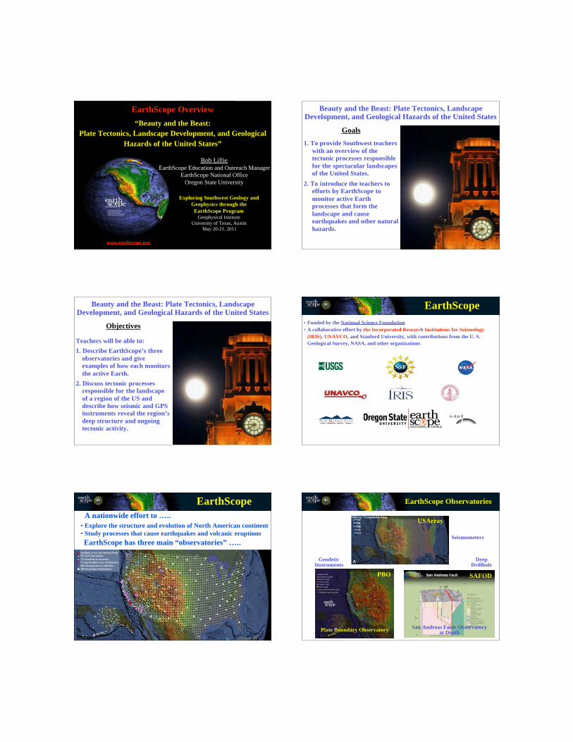
“Beauty and the Beast:
Plate Tectonics, Landscape Development, and Geological
Hazards of the United States”
Bob Lillie
EarthScope Education and Outreach Manager
EarthScope National Office
Oregon State University
Exploring Southwest Geology and
Geophysics through the
EarthScope Program
Geophysical Institute
University of Texas, Austin
May 20-21, 2011
www.earthscope.org
EarthScope Overview Beauty and the Beast: Plate Tectonics, LandscapeDevelopment, and Geological Hazards of the United States
1. To provide Southwest teachers
with an overview of the
tectonic processes responsible
for the spectacular landscapes
of the United States.
2. To introduce the teachers to
efforts by EarthScope to
monitor active Earth
processes that form the
landscape and cause
earthquakes and other natural
hazards.
Goals
Beauty and the Beast: Plate Tectonics, LandscapeDevelopment, and Geological Hazards of the United States
Teachers will be able to:
1. Describe EarthScope’s three
observatories and give
examples of how each monitors
the active Earth.
2. Discuss tectonic processes
responsible for the landscape
of a region of the US and
describe how seismic and GPS
instruments reveal the region’s
deep structure and ongoing
tectonic activity.
Objectives
Acknowledgements
• Funded by the National Science Foundation
• A collaborative effort by the Incorporated Research Institutions for Seismology
(IRIS), UNAVCO, and Stanford University, with contributions from the U. S.
Geological Survey, NASA, and other organizations
EarthScope
A nationwide effort to …..
• Explore the structure and evolution of North American continent
• Study processes that cause earthquakes and volcanic eruptions
EarthScope
Drillhole across San Andreas Fault
875 GPS Instruments
175 Borehole Strainmeters
5 Long-Baseline Laser Strainmeters
400 Seismometers at 2,000 sites
100 Permanent Seismometers
EarthScope
EarthScope has three main “observatories” …..
USArray
SAFODPBO
EarthScope Observatories
Plate Boundary Observatory
Seismometers
GeodeticInstruments
San Andreas Fault Observatoryat Depth
DeepDrillhole
Drillhole across San Andreas Fault
875 GPS Instruments
175 Borehole Strainmeters
5 Long-Baseline Laser Strainmeters
400 Seismometers at 2,000 sites
100 Permanent Seismometers
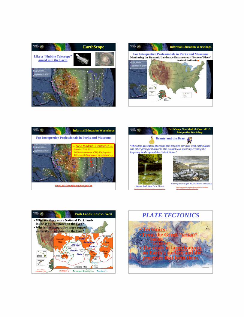
Like a “Hubble Telescope”aimed into the Earth
EarthScope
Drillhole across San Andreas Fault
875 GPS Instruments
175 Borehole Strainmeters
5 Long-Baseline Laser Strainmeters
400 Seismometers at 2,000 sites
100 Permanent Seismometers
National Parklands
For Interpretive Professionals in Parks and Museums
Informal Education Workshops
Monitoring the Dynamic Landscape Enhances our “Sense of Place”
Drillhole across San Andreas Fault
875 GPS Instruments
175 Borehole Strainmeters
5 Long-Baseline Laser Strainmeters
400 Seismometers at 2,000 sites
100 Permanent Seismometers
For Interpretive Professionals in Parks and Museums
Informal Education Workshops
www.earthscope.org/eno/parks
6. New Madrid - Central U. S.• March 17-20, 2011
• 200th Anniversary of Big Earthquakes
• USArray Rolling across the Midwest ….
Beauty and the Beast
“The same geological processes that threaten our lives with earthquakes
and other geological hazards also nourish our spirits by creating the
inspiring landscapes of the United States.”
Starved Rock State Park, Illinois
http://dnr.state.il.us/lands/landmgt/parks/i&m/east/starve/park.htm
Clearing the river after the New Madrid earthquakes
http://franceshunter.wordpress.com/2009/11/19/william-
clark-and-the-new-madrid-earthquakes
EarthScope New Madrid–Central U.S.
Interpretive Workshop
NATIONAL PARKLANDSParks and Plates
©2005 Robert J. Lillie
Park Lands: East vs. West
• Why are there more National Park landsin the West compared to the East?
• Why is the topography more ruggedin the West compared to the East? • Tectonics:
• From the Greek “tecton” - builder
- “architect”
• The study of large featureson Earth’s surface and theprocesses that form them.
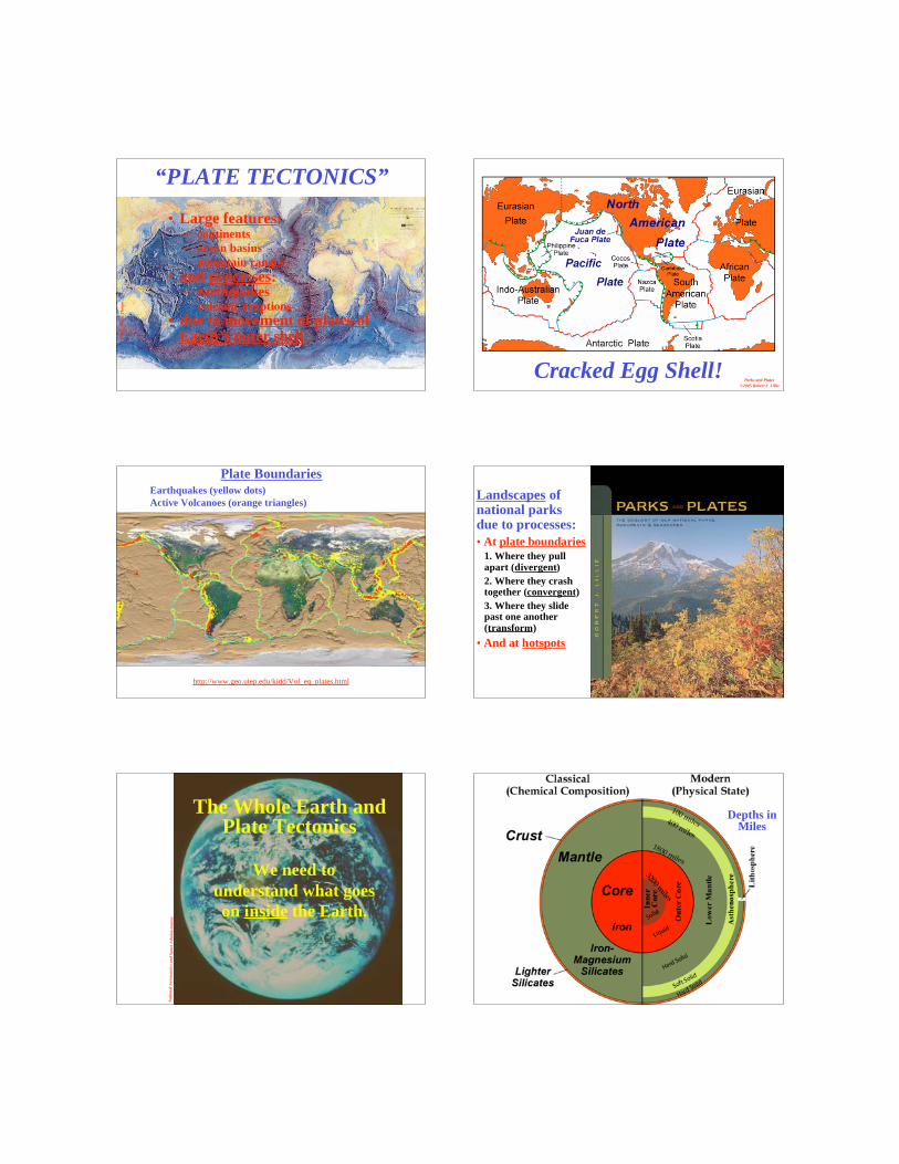
PLATE TECTONICS
©1
97
7,
Ma
rie T
ho
rpe
©1
97
7,
Ma
rie T
ho
rpe
• Large features:– continents
– ocean basins
– mountain ranges
• and processes:– earthquakes– volcanic eruptions
• due to movement of plates ofEarth’s outer shell.
“PLATE TECTONICS”
Cracked Egg Shell!Parks and Plates
©2005 Robert J. Lillie
http://www.geo.utep.edu/kidd/Vol_eq_plates.html
Plate Boundaries
Earthquakes (yellow dots)
Active Volcanoes (orange triangles)Landscapes ofnational parksdue to processes:
• At plate boundaries
1. Where they pullapart (divergent)
2. Where they crashtogether (convergent)
3. Where they slidepast one another(transform)
• And at hotspots
Na
tio
na
l A
ero
na
uti
cs
an
d S
pa
ce A
dm
inis
tra
tio
n
The Whole Earth andPlate Tectonics
We need to
understand what goes
on inside the Earth.
Depths inMiles
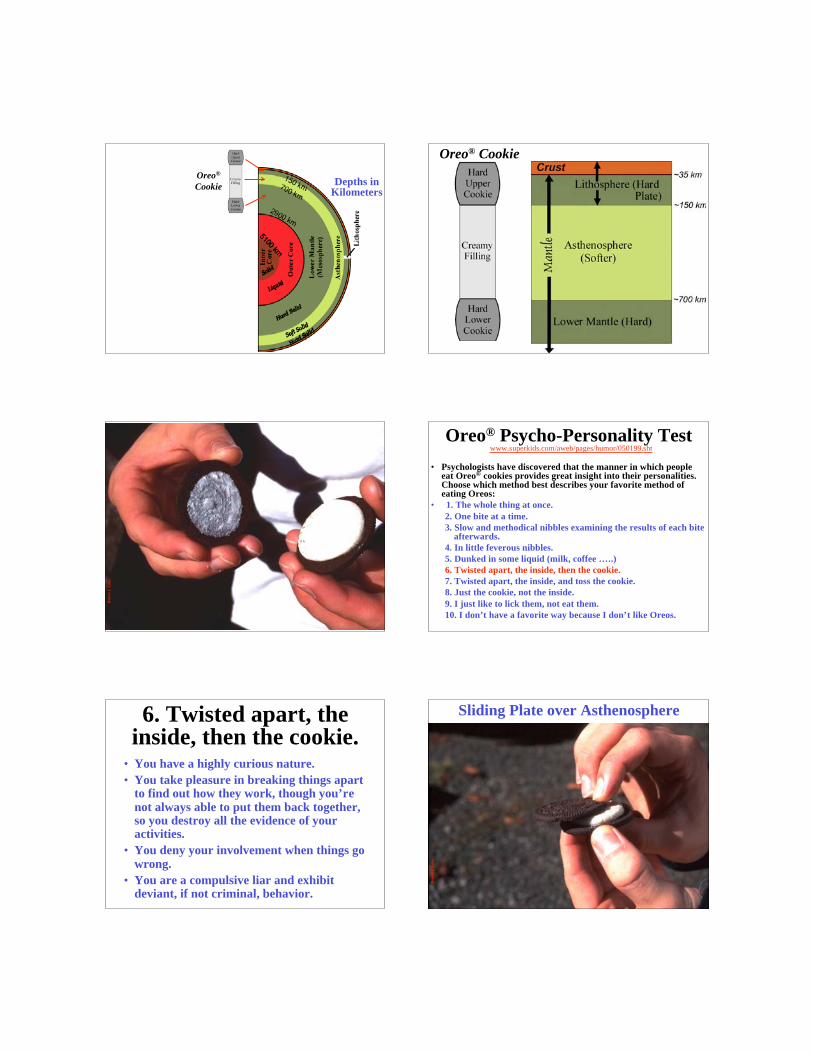
Oreo®
CookieDepths in
Kilometers
Oreo® Cookie
Ro
bert
J.
Lil
lie
Oreo® Psycho-Personality Test www.superkids.com/aweb/pages/humor/050199.sht
• Psychologists have discovered that the manner in which peopleeat Oreo® cookies provides great insight into their personalities.Choose which method best describes your favorite method ofeating Oreos:
• 1. The whole thing at once.
2. One bite at a time.
3. Slow and methodical nibbles examining the results of each biteafterwards.
4. In little feverous nibbles.
5. Dunked in some liquid (milk, coffee …..)
6. Twisted apart, the inside, then the cookie.
7. Twisted apart, the inside, and toss the cookie.
8. Just the cookie, not the inside.
9. I just like to lick them, not eat them.
10. I don’t have a favorite way because I don’t like Oreos.
6. Twisted apart, theinside, then the cookie.
• You have a highly curious nature.
• You take pleasure in breaking things apartto find out how they work, though you’renot always able to put them back together,so you destroy all the evidence of youractivities.
• You deny your involvement when things gowrong.
• You are a compulsive liar and exhibitdeviant, if not criminal, behavior.
Ro
bert
J.
Lil
lie
Sliding Plate over Asthenosphere
Ro
bert
J.
Lil
lie
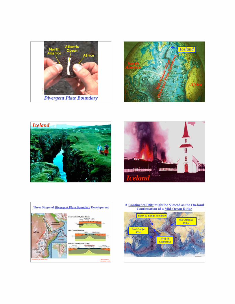
Divergent Plate Boundary
NorthAmerica
Africa
AtlanticOcean
Na
tio
na
l G
eo
gra
ph
ic Mid
-Atl
an
tic
Rid
ge
(Div
ergen
t P
late
Bou
ndary
)
NorthAmerica
Africa
Iceland
Iceland
Iceland
Marshak, EARTH (Norton, 2005) Parks and Plates
©2005 Robert J. Lillie
Three Stages of Divergent Plate Boundary Development
©1
97
7,
Ma
rie T
ho
rpe
East Pacific
Rise
Mid-Atlantic
Ridge
Gulf of
California
A Continental Rift might be Viewed as the On-landContinuation of a Mid-Ocean Ridge
Basin & Range Province
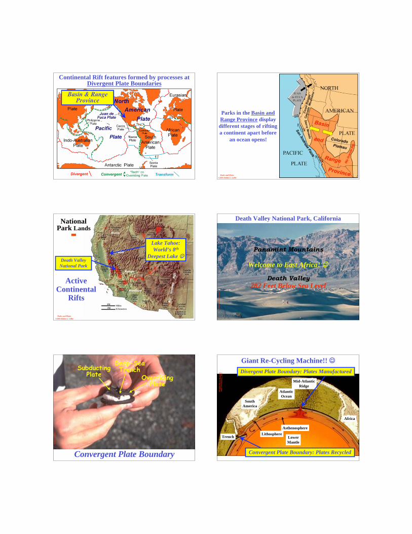
Continental Rift features formed by processes atDivergent Plate Boundaries
Basin & RangeProvince
Parks and Plates
©2005 Robert J. Lillie
Parks in the Basin and
Range Province display
different stages of rifting
a continent apart before
an ocean opens!
Parks and Plates
©2005 Robert J. Lillie
ActiveContinental
Rifts
Death Valley
National Park
NationalPark Lands
Lake Tahoe:
World’s 8th
Deepest Lake
Na
tio
na
l P
ark
Serv
ice
Death Valley National Park, California
282 Feet Below Sea LevelDeath Valley
Panamint Mountains
Welcome to East Africa!
Ro
bert
J.
Lil
lie
Convergent Plate Boundary
SubductingPlate Overriding
Plate
Deep-SeaTrench
Africa
South
America
Core
Lower
Mantle
Atlantic
Ocean
Asthenosphere
LithosphereTrench
Mid-Atlantic
Ridge
Mo
dif
ied
fro
m H
am
bli
na
nd
Ch
rist
ian
sen
, 2
00
1 Divergent Plate Boundary: Plates Manufactured
Convergent Plate Boundary: Plates Recycled
Giant Re-Cycling Machine!!
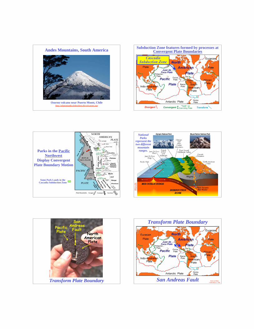
Osorno volcano near Puerto Montt, Chilehttp://whatonearth.olehnielsen.dk/volcanoes.asp
Andes Mountains, South AmericaSubduction Zone features formed by processes at
Convergent Plate Boundaries
CascadiaSubduction Zone
Some Park Lands in theCascadia Subduction Zone
Parks in the Pacific
Northwest
Display Convergent
Plate Boundary Motion
Ro
bert
J.
Lil
lie
Bern
ard
Ga
rcia
NationalParks
represent thetwo different
mountainranges.
Ro
bert
J.
Lil
lie
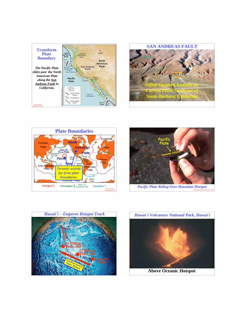
Transform Plate Boundary
PacificPlate
NorthAmerican
Plate
SanAndreasFault
San Andreas Fault Parks and Plates
©2005 Robert J. Lillie
Transform Plate Boundary
Ma
rsh
ak
, E
AR
TH
(N
ort
on
, 2
00
5)
Parks and Plates
©2005 Robert J. Lillie
The Pacific Plate
slides past the North
American Plate
along the San
Andreas Fault in
California.
TransformPlate
Boundary
R.
E.
Wa
lla
ce,
U.
S.
Geo
log
ica
l S
urv
ey
SAN ANDREAS FAULT
Offset Stream Channels on
Carrizo Plain Northeast of
Santa Barbara, California
Parks and Plates
©2005 Robert J. Lillie
Plate Boundaries
Tectonic activity
far from plate
boundaries.
Pacific Plate Riding Over Hawaiian HotspotParks and Plates ©2005 Robert J. Lillie
Ro
bert
J.
Lil
lie
PacificPlate
Hawaiian Island
s
HOTSPOT
Na
tio
na
l G
eo
gra
ph
ic S
ocie
ty FormingToday
45 MillionYears Old
21 MillionYears Old
Northwestward
Plate Motion
Hawai`i – Emperor Hotspot Track
U.
S.
Geo
log
ica
l S
urv
ey ,
Ha
wa
iia
n V
olc
an
o O
bse
rva
tory
Hawai`i Volcanoes National Park, Hawai'i
Above Oceanic Hotspot
Ma
rsh
ak
, E
AR
TH
(No
rto
n,
20
05
)
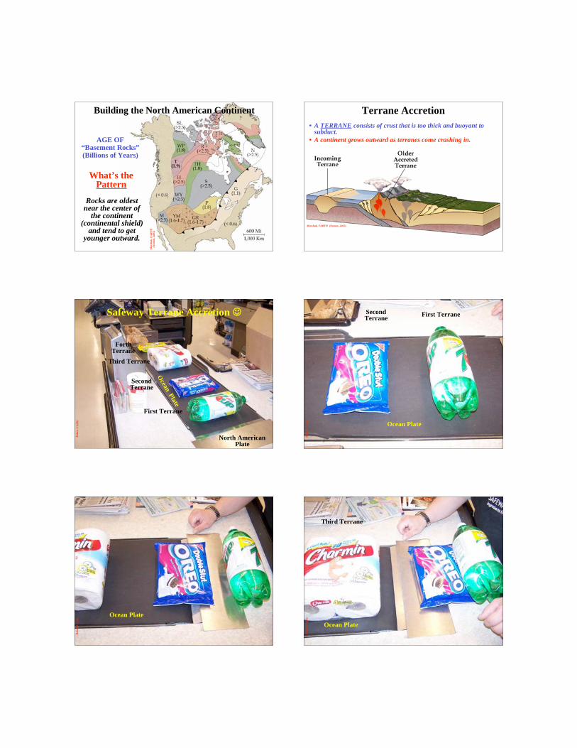
AGE OF“Basement Rocks”(Billions of Years)
Rocks are oldestnear the center of
the continent(continental shield)
and tend to getyounger outward.
What’s thePattern
Building the North American Continent
Marshak, EARTH (Norton, 2005)
Terrane Accretion
• A TERRANE consists of crust that is too thick and buoyant tosubduct.
• A continent grows outward as terranes come crashing in.
Ro
bert
J.
Lil
lie
North AmericanPlate
First Terrane
SecondTerrane
Third Terrane
ForthTerrane
Ocean
Plate
Safeway Terrane Accretion R
ob
ert
J.
Lil
lie
Ocean Plate
First TerraneSecondTerrane
Ro
bert
J.
Lil
lie
Ocean Plate
Ro
bert
J.
Lil
lie
Ocean Plate
Third Terrane
Ro
bert
J.
Lil
lie
Ocean Plate
FourthTerrane
Ro
bert
J.
Lil
lie
North
Am
erican
Pla
te
First T
erran
e
Seco
nd
Terra
ne
Th
ird T
erran
e
Fo
rth
Terra
ne
OceanPlate
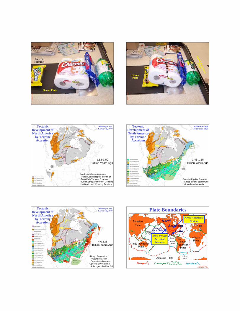
Continued shortening across
Trans Hudson orogen; closure of
Great Falls Tectonic Zone and
Vulcan Zone; accretion of Medicine
Hat Block, and Wyoming Province
1.82-1.80
Billion Years Ago
TectonicDevelopment ofNorth America
by TerraneAccretion
Whitmeyer andKarlstrom, 2007
1.48-1.35
Billion Years Ago
Granite-Rhyolite Province:
A-type plutons stitch much
of southern Laurentia
TectonicDevelopment ofNorth America
by TerraneAccretion
Whitmeyer andKarlstrom, 2007
~ 0.535
Billion Years Ago
Rifting of Argentine
Precordillera from
Ouachita embayment;
Opening of Oklahoma
Aulacogen, Reelfoot Rift
TectonicDevelopment ofNorth America
by TerraneAccretion
Whitmeyer andKarlstrom, 2007
Parks and Plates
©2005 Robert J. Lillie
Plate Boundaries
North American
Craton
Most Recent
Accreted
Terranes
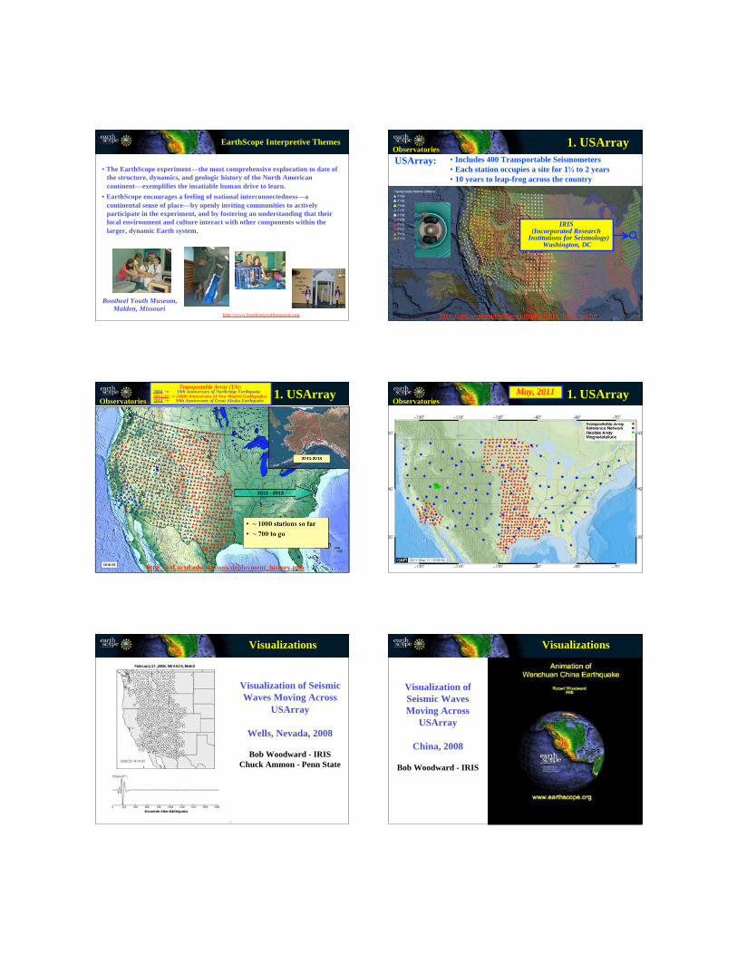
EarthScope Interpretive Themes
Bootheel Youth Museum,
Malden, Missourihttp://www.bootheelyouthmuseum.org
• The EarthScope experiment—the most comprehensive exploration to date of
the structure, dynamics, and geologic history of the North American
continent—exemplifies the insatiable human drive to learn.
• EarthScope encourages a feeling of national interconnectedness—a
continental sense of place—by openly inviting communities to actively
participate in the experiment, and by fostering an understanding that their
local environment and culture interact with other components within the
larger, dynamic Earth system.IRIS
(Incorporated ResearchInstitutions for Seismology)
Washington, DC
USArray: • Includes 400 Transportable Seismometers
• Each station occupies a site for 1 to 2 years
• 10 years to leap-frog across the country
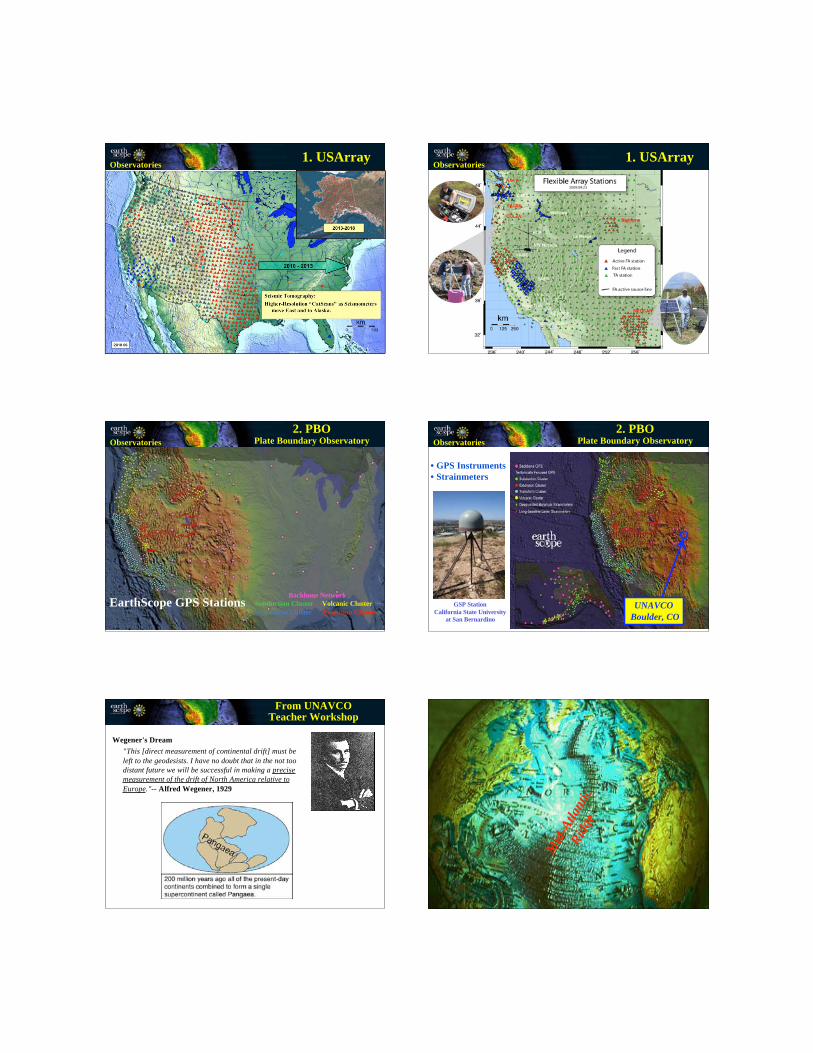
Observatories1. USArray
http://anf.ucsd.edu/stations/deployment_history.php
Transportable Array
• ~ 1000 stations so far
• ~ 700 to go
2013-2018
2010 - 2013
Observatories1. USArray
http://anf.ucsd.edu/stations/deployment_history.php
Transportable Array (TA):2004 10th Anniversary of Northridge Earthquake2011-12 200th Anniversary of New Madrid Earthquakes2014 50th Anniversary of Great Alaska Earthquake Observatories
1. USArrayMay, 2011
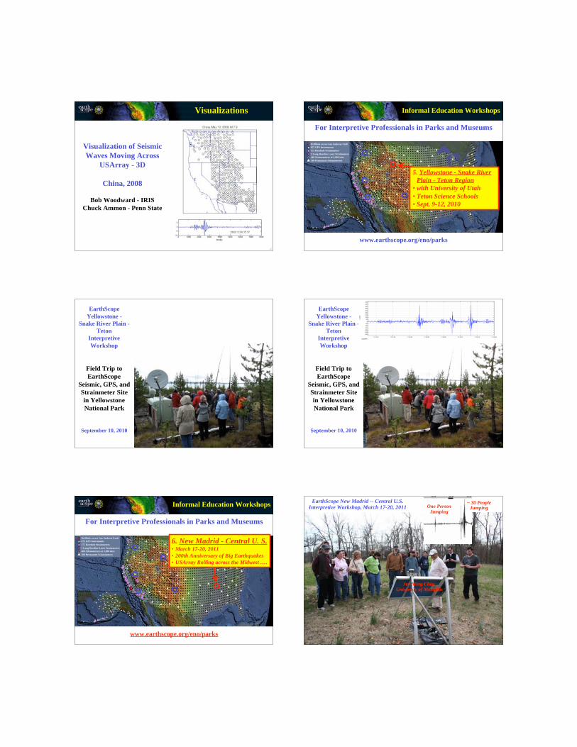
Visualization of Seismic
Waves Moving Across
USArray
Wells, Nevada, 2008
Bob Woodward - IRIS
Chuck Ammon - Penn State
Visualizations
Visualization of
Seismic Waves
Moving Across
USArray
China, 2008
Bob Woodward - IRIS
Visualizations
Visualization of Seismic
Waves Moving Across
USArray - 3D
China, 2008
Bob Woodward - IRIS
Chuck Ammon - Penn State
Visualizations
Drillhole across San Andreas Fault
875 GPS Instruments
175 Borehole Strainmeters
5 Long-Baseline Laser Strainmeters
400 Seismometers at 2,000 sites
100 Permanent Seismometers
5. Yellowstone - Snake River
Plain - Teton Region
• with University of Utah
• Teton Science Schools
• Sept. 9-12, 2010
For Interpretive Professionals in Parks and Museums
Informal Education Workshops
www.earthscope.org/eno/parks
Field Trip to
EarthScope
Seismic, GPS, and
Strainmeter Site
in Yellowstone
National Park
EarthScope
Yellowstone -
Snake River Plain -
Teton
Interpretive
Workshop
September 10, 2010
Field Trip to
EarthScope
Seismic, GPS, and
Strainmeter Site
in Yellowstone
National Park
EarthScope
Yellowstone -
Snake River Plain -
Teton
Interpretive
Workshop
September 10, 2010
Drillhole across San Andreas Fault
875 GPS Instruments
175 Borehole Strainmeters
5 Long-Baseline Laser Strainmeters
400 Seismometers at 2,000 sites
100 Permanent Seismometers
For Interpretive Professionals in Parks and Museums
Informal Education Workshops
www.earthscope.org/eno/parks
6. New Madrid - Central U. S.• March 17-20, 2011
• 200th Anniversary of Big Earthquakes
• USArray Rolling across the Midwest ….
Jer-Ming Chiu,University of Memphis
EarthScope New Madrid -- Central U.S.
Interpretive Workshop, March 17-20, 2011 One PersonJumping
~ 30 PeopleJumping
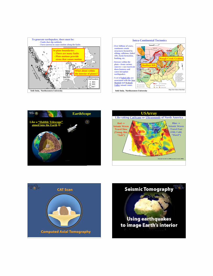
To generate earthquakes, there must be:- Faults that slip suddenly
- Force (stress) to cause motion along the faults
At plate boundaries:
- There are many faults
- Plate motions provide
stress that causes motion
What about within
the interior of plates?
Seth Stein, Northwestern UniversityMap from Steve Marshak
- Over billions of years,
continents retain
structures formed by
rifting, collisions, failed
rifts, basin formation,
faulting, etc.
- Stresses within the
plate—from various
sources—can reactivate
these features and
cause intraplate
earthquakes.
- A set of failed rifts are
associated with the New
Madrid and Wabash
Valley seismic zones.
Intra-Continental Tectonics
Reelfoot Rift
Rough Creek Graben
Seth Stein, Northwestern University
EarthScope
Like a “Hubble Telescope”aimed into the Earth
Like taking CatScans or Ultrasounds of North America
USArray
Blue
Seismic Waves
Travel Fast
(Old, Cold,
“Hard”)
Red
Seismic Waves
Travel Slow
(Young, Hot,
“Soft”)
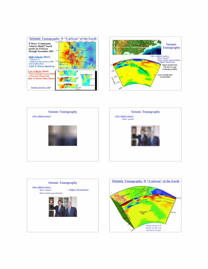
P-Wave “CommunityVelocity Model” basedpartly on USArraythrough November 2007
Seismic Tomography “CatScan” of the Earth
Burdick and others, 2008
High Velocity (Blue):- Eastern U. S.
- Subducted Juan de Fuca (JdF)
and Farallon plates
Cold Waves Speed Up
Low Velocity (Red):- Basin and Range Province (B&R)
- Yellowstone Hotspot (YH)
Hot Waves Slow Down
Lower mantle from
Grand (2002)
Upper mantle from
Van der Lee and
Frederiksen (2005)
Faralon Slab
SeismicTomography
Like a digital camera:More “pixels”More closely-spaced pixels= Higher Resolution
Seismic Tomography
Like a digital camera:
Seismic Tomography
Like a digital camera:
More “pixels”
Seismic Tomography
Like a digital camera:
More “pixels”
More closely-spaced pixels
= Higher Resolution!
Image courtesy of
Suzan van der Lee
and Steve Grand.
Seismic Tomography “CatScan” of the Earth
Transportable Array
2013-2018
2010 - 2013
Observatories1. USArray
Seismic Tomography:
Higher-Resolution “CatScans” as Seismometers
move East and to Alaska.
Flexible ArrayObservatories
1. USArray
EarthScope GPS StationsBackbone Network
Subduction Cluster Volcanic Cluster
Transform Cluster Extension Cluster
2. PBOPlate Boundary ObservatoryObservatories
• GPS Instruments
• Strainmeters
UNAVCO
Boulder, CO
GSP Station
California State University
at San Bernardino
Observatories
2. PBOPlate Boundary Observatory
Wegener's Dream
"This [direct measurement of continental drift] must be
left to the geodesists. I have no doubt that in the not too
distant future we will be successful in making a precise
measurement of the drift of North America relative to
Europe."-- Alfred Wegener, 1929
From UNAVCOTeacher Workshop
Mid
-Atlan
tic
Rid
ge
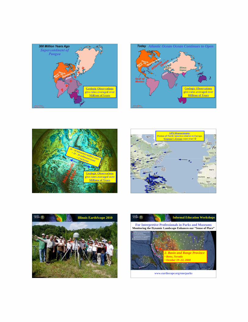
Supercontinent ofPangea
Parks and Plates
©2005 Robert J. Lillie
Geologic Observations
give rates averaged over
Millions of Years
Atlantic Ocean Ocean Continues to Open
Parks and Plates
©2005 Robert J. Lillie
Geologic Observations
give rates averaged over
Millions of Years
20 - 30 kilometers/million years
= 20 - 30 millimeters/year
~ 1 inch/year
Mid
-Atl
an
tic
Rid
ge
Geologic Observations
give rates averaged over
Millions of Years
GPS Measurements:
Motion of North America relative to Europe.
Wegener’s Dream come true!
Illinois EarthScope 2010
Drillhole across San Andreas Fault
875 GPS Instruments
175 Borehole Strainmeters
5 Long-Baseline Laser Strainmeters
400 Seismometers at 2,000 sites
100 Permanent Seismometers
2. Basin and Range Province• Reno, Nevada
• October 19–22, 2008
For Interpretive Professionals in Parks and Museums
Informal Education Workshops
www.earthscope.org/eno/parks
Monitoring the Dynamic Landscape Enhances our “Sense of Place”

Ell
en
Bis
ho
p
University of Nevada – RenoOctober, 2008
Plate Boundary Observatory
GPS Station
Slide Mountain, Nevada
Brian Wernicke, Cal Tech
Basin and Range Workshop
Bo
b R
on
ey
Basin and Range Workshop
University of Nevada – RenoOctober, 2008
Plate Boundary Observatory
GPS Station
Slide Mountain, Nevada
Brian Wernicke, Cal Tech
Ro
bert
J.
Lil
lie
We’re not
standing still …PBO – GPS
Slide Mountain,
Nevada
EarthScope Workshop for Interpretive Professionalsin the Basin and Range Province, 2008
Ro
bert
J.
Lil
lie
PBO – GPS
Slide Mountain,
Nevada
We’re moving away
from Kansas
EarthScope Workshop for Interpretive Professionalsin the Basin and Range Province, 2008
EarthScope GPS StationsBackbone Network
Subduction Cluster Volcanic Cluster
Transform Cluster Extension Cluster
How do stations inthe Basin andRange Province .....
…. move relative to“backbone” stationson the stable Craton?
BASIN AND RANGE PROVINCE
Ma
rsh
ak
, E
AR
TH
(N
ort
on
, 2
00
5)
Basin
Range
Basin
Range
Ro
bert
J.
Lil
lie
EarthScope Workshop for Interpretive Professionalsin the Basin and Range Province, 2008
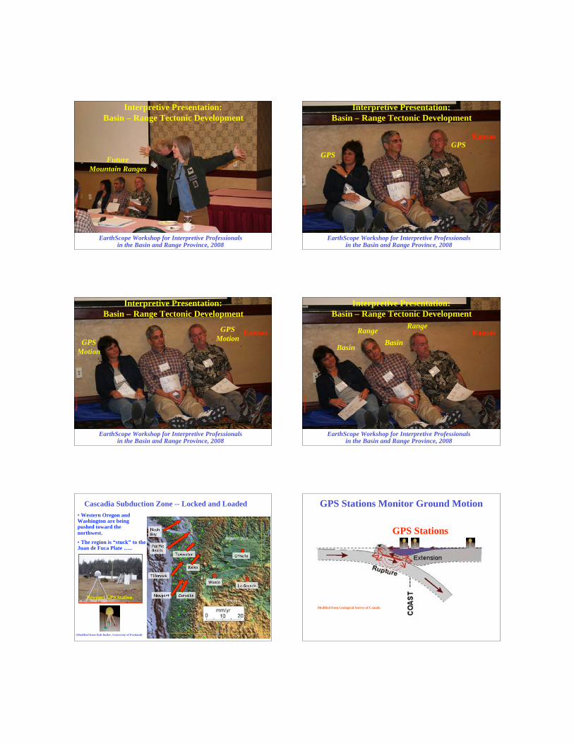
Future
Mountain Ranges
Interpretive Presentation:
Basin – Range Tectonic Development
Ro
bert
J.
Lil
lie
GPS
Interpretive Presentation:
Basin – Range Tectonic Development
GPS
EarthScope Workshop for Interpretive Professionalsin the Basin and Range Province, 2008
Kansas
Ro
bert
J.
Lil
lie
Interpretive Presentation:
Basin – Range Tectonic Development
GPS
Motion
GPS
Motion
EarthScope Workshop for Interpretive Professionalsin the Basin and Range Province, 2008
Kansas
Ro
bert
J.
Lil
lie
Interpretive Presentation:
Basin – Range Tectonic Development
Basin
Range
Basin
Range
EarthScope Workshop for Interpretive Professionalsin the Basin and Range Province, 2008
Kansas
Newport Corvallis
Tillamook
PacificBeach
NeahBay
Kelso
Tumwater Othello
La GrandeWasco
Cascadia Subduction Zone -- Locked and Loaded
(Modified from Bob Butler, University of Portland)
Newport GPS Station
• Western Oregon andWashington are beingpushed toward the
northwest.
• The region is “stuck” to theJuan de Fuca Plate …..
GPS Stations Monitor Ground Motion
GPS Stations
Modified from Geological Survey of Canada
Modified from Geological Survey of Canada
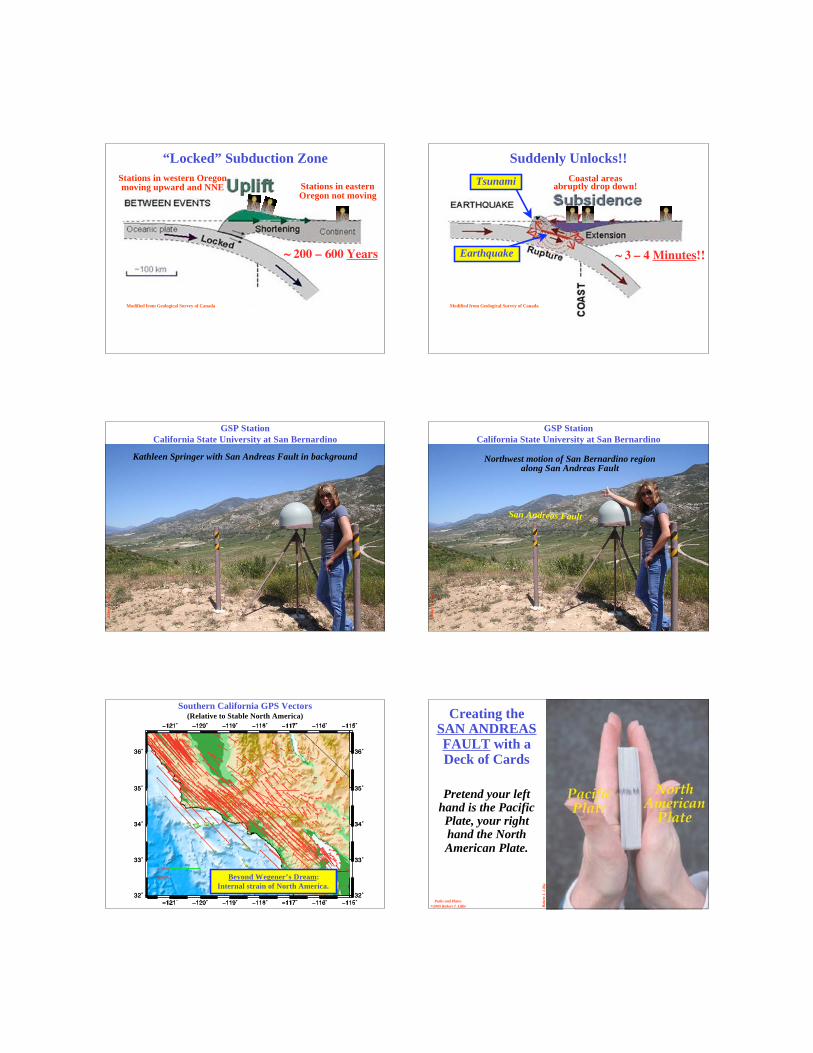
“Locked” Subduction Zone
Stations in western Oregonmoving upward and NNE Stations in eastern
Oregon not moving
~ 200 – 600 Years
Suddenly Unlocks!!
Earthquake
Tsunami Coastal areasabruptly drop down!
Modified from Geological Survey of Canada
~ 3 – 4 Minutes!!
Ro
bert
J.
Lil
lie
Kathleen Springer with San Andreas Fault in background
GSP Station
California State University at San BernardinoR
ob
ert
J.
Lil
lie
GSP Station
California State University at San Bernardino
Northwest motion of San Bernardino regionalong San Andreas Fault
San Andreas Fault
32˚ 32˚
33˚ 33˚
34˚ 34˚
35˚ 35˚
36˚ 36˚
32˚ 32˚
33˚ 33˚
34˚ 34˚
35˚ 35˚
36˚ 36˚
20mm
40mm
Southern California GPS Vectors(Relative to Stable North America)
Beyond Wegener’s Dream:
Internal strain of North America.
Ro
bert
J.
Lil
lie
Parks and Plates
©2005 Robert J. Lillie
Creating theSAN ANDREASFAULT with aDeck of Cards
Pretend your lefthand is the PacificPlate, your righthand the NorthAmerican Plate.
Ro
bert
J.
Lil
lie
Parks and Plates
©2005 Robert J. Lillie
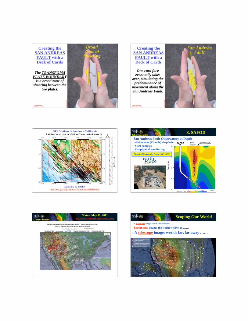
Creating theSAN ANDREASFAULT with aDeck of Cards
The TRANSFORMPLATE BOUNDARY
is a broad zone ofshearing between the
two plates.
Ro
bert
J.
Lil
lie
Parks and Plates
©2005 Robert J. Lillie
Creating theSAN ANDREASFAULT with aDeck of Cards
One card faceeventually takes
over, simulating thepredominance of
movement along theSan Andreas Fault.
Animation by Bill Holt
http://rock.geo.sunysb.edu/~holt/Education/vel6Ma.html
GPS Motions in Southern California3 Million Years Ago to 3 Million Years in the Future
SAFOD
San
An
dre
as F
ault
Zo
ne
Stanford University (now UNAVCO)
3. SAFOD
San Andreas Fault Observatory at Depth• 4 kilometer (2 mile) deep hole
• Core samples
• Geophysical monitoring
Observatories
Observatories
Status: May 11, 2011http://www.earthscope.org/current_status
Drillhole across San Andreas Fault
875 GPS Instruments
175 Borehole Strainmeters
5 Long-Baseline Laser Strainmeters
400 Seismometers at 2,000 sites
100 Permanent Seismometers
- A microscope images worlds smaller than us ……
- EarthScope images the world we live on ……
- A telescope images worlds far, far away ……
Scoping Our World