Embed Size (px)
Citation preview

Liberty Utilities NEPSR Seminar October 21-22, 2014
Underground Facility Record Keeping - GPS
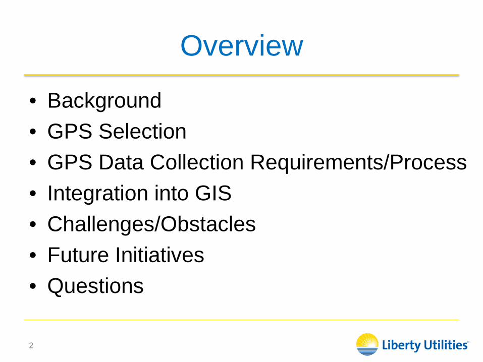
Overview
2
• Background • GPS Selection • GPS Data Collection Requirements/Process • Integration into GIS • Challenges/Obstacles • Future Initiatives • Questions

Corporate Information
3
Liberty Utilities New Hampshire: Electric distribution company with 43,000 customers serving 21 communities. Previous company names: National Grid, Granite State Electric Natural gas distribution company with 90,000 customers serving 30 communities. Previous company names: National Grid, Energy North, Keyspan Parent Company: Algonquin Power and Utilities Corp. Oakville, Ontario, Canada http://algonquinpower.com/static/home.html Liberty Utilities is a regulated water, natural gas and electric transmission and distribution utility, delivering services to nearly half of a million customers across the United States. With a local approach to management, service and support, we deliver efficient, dependable services to meet the needs of our customers. Liberty Utilities currently operates in Arizona, Arkansas, California, Georgia, Illinois, Iowa, Massachusetts, Missouri, New Hampshire and Texas.

Liberty Utilities - NH Service Area
4
New Hampshire Natural Gas Service Area 30 Communities 90,000 Customers Largest Natural Gas provider in NH
New Hampshire Electric Service Area 21 Communities 43,000 Customers

GPS Selection Process
5
• Hardware • Accuracy • Durability • Transportability • External Antenna • Other Capabilities
• Software/Services • Real-time Differential Data Correction
• Immediacy • Can be unreliable • Costly
• Post-processed Differential Data Correction • Better accuracy and reliability • After the fact • Post-processing software
• Automated GIS uploads
• Overall Cost
Trimble GEOXH6000
6
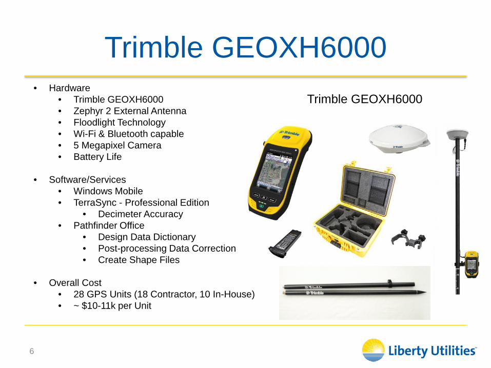
• Hardware • Trimble GEOXH6000 • Zephyr 2 External Antenna • Floodlight Technology • Wi-Fi & Bluetooth capable • 5 Megapixel Camera • Battery Life
• Software/Services
• Windows Mobile • TerraSync - Professional Edition
• Decimeter Accuracy • Pathfinder Office
• Design Data Dictionary • Post-processing Data Correction • Create Shape Files
• Overall Cost
• 28 GPS Units (18 Contractor, 10 In-House) • ~ $10-11k per Unit
Trimble GEOXH6000

Raw Data Post Processed to
Corrected Data
Raw GPS Data Collected from
the Field
GPS Process
7
Raw Data Transferred to
Computer
Convert Corrected Files
to SHP Files
Integrate into GIS

GPS Data Requirements
8
Mains: • Every joint/fuse or 40 feet along the main • Any point where there is a change of direction (Elbows) • Exposed or new crossings of other utility, municipal or other
underground facilities • Clearance less than a 12 inches must be documented
• Valves • Tees • Mechanical Fittings, including repair clamps • Bell Joints • Fusions • Test Stations, including boxes for tracer wire • Tie-ins • End points • Cut-off locations • Welds • Any existing exposed facilities • Protection (Plates, Each end of Casings…)
Services: • All points mentioned above • At least three points required for new/relay services
• Service tees • Service riser or Point of Entry (POE) • Point between service tee and POE • Multiple points should be taken for longer services
• Service stubs

GPS Data Collection
9
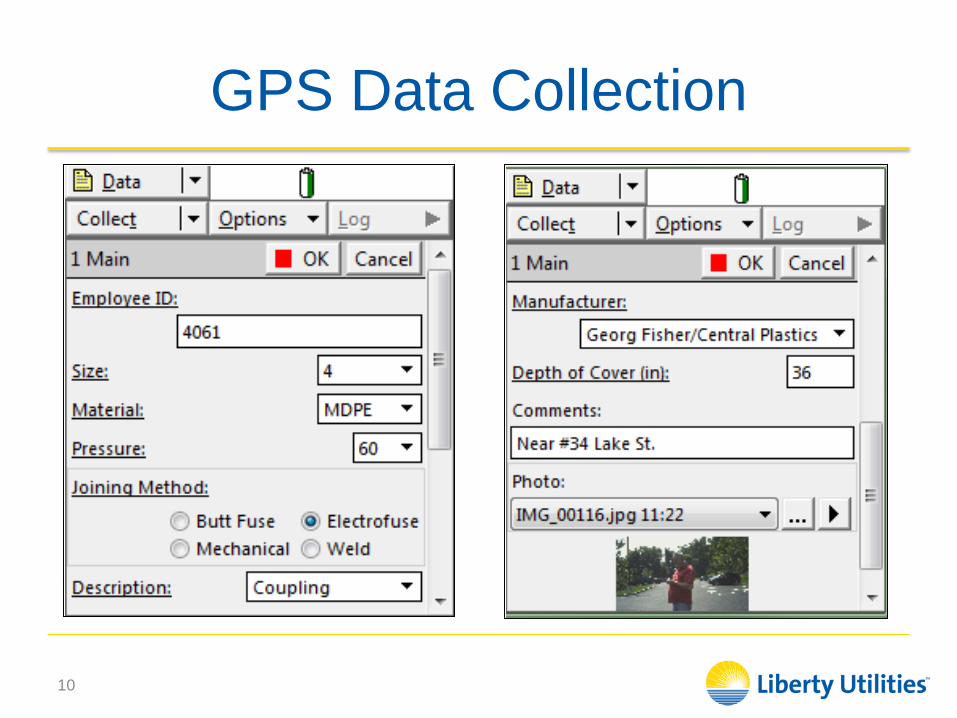
GPS Data Collection
10
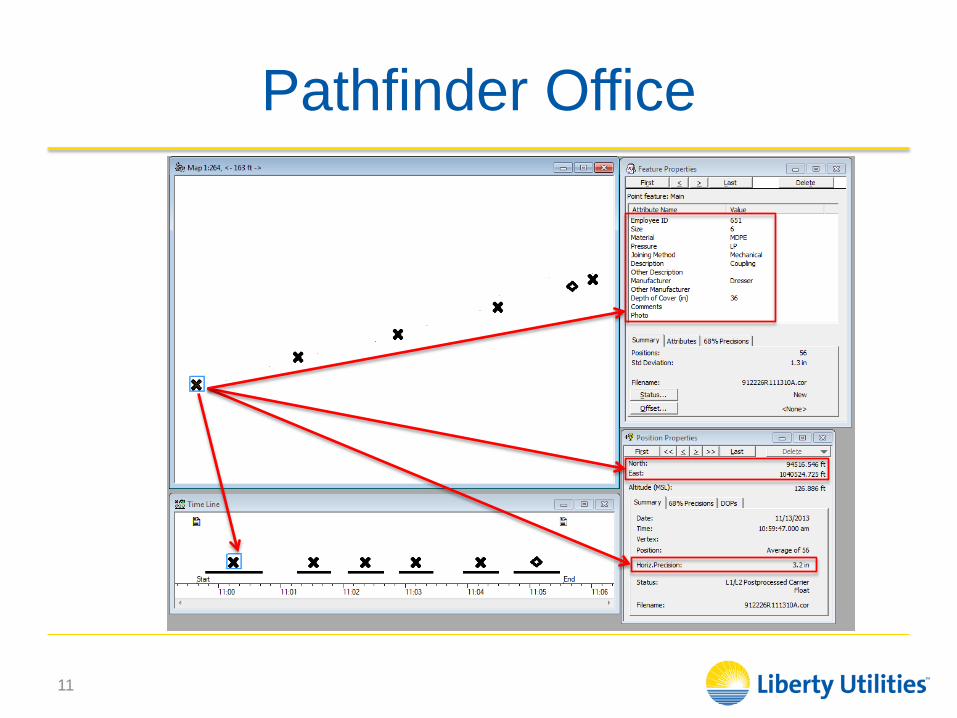
Pathfinder Office
11
12
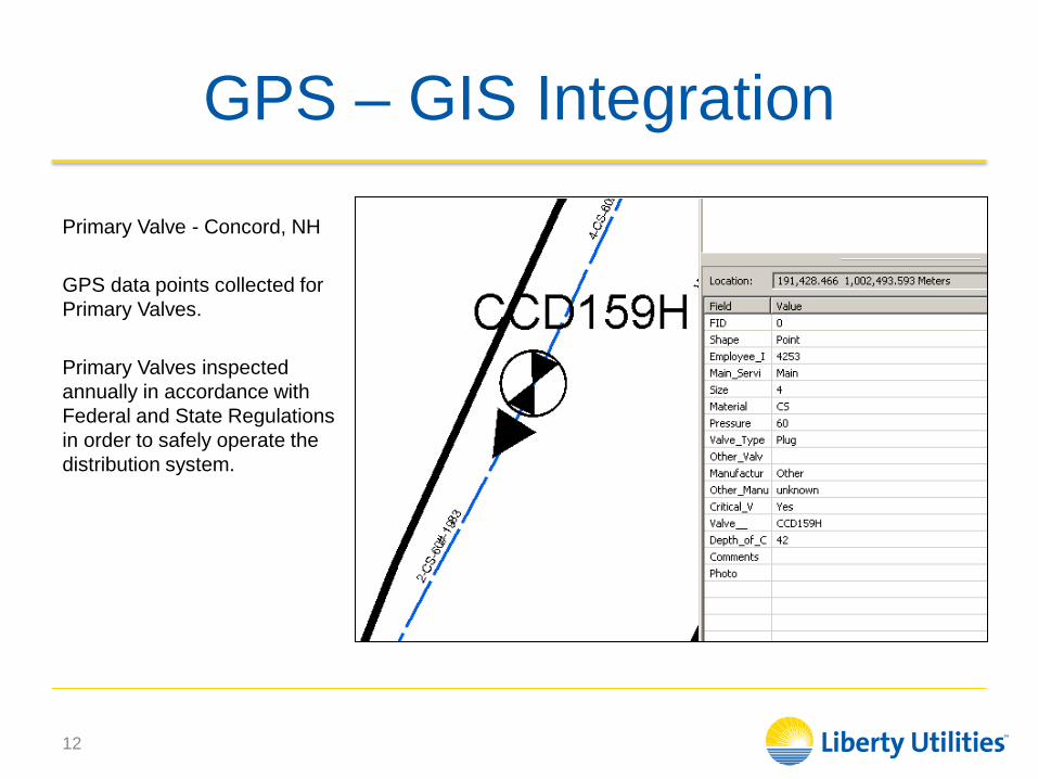
GPS – GIS Integration Primary Valve - Concord, NH GPS data points collected for Primary Valves. Primary Valves inspected annually in accordance with Federal and State Regulations in order to safely operate the distribution system.
13
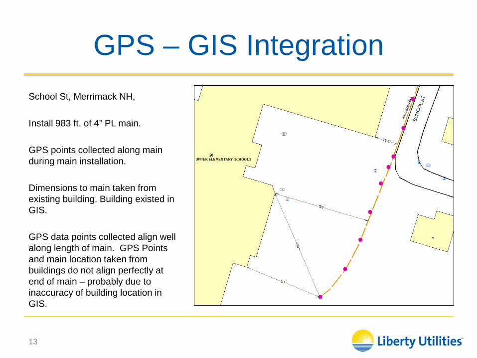
GPS – GIS Integration School St, Merrimack NH, Install 983 ft. of 4” PL main. GPS points collected along main during main installation. Dimensions to main taken from existing building. Building existed in GIS. GPS data points collected align well along length of main. GPS Points and main location taken from buildings do not align perfectly at end of main – probably due to inaccuracy of building location in GIS.
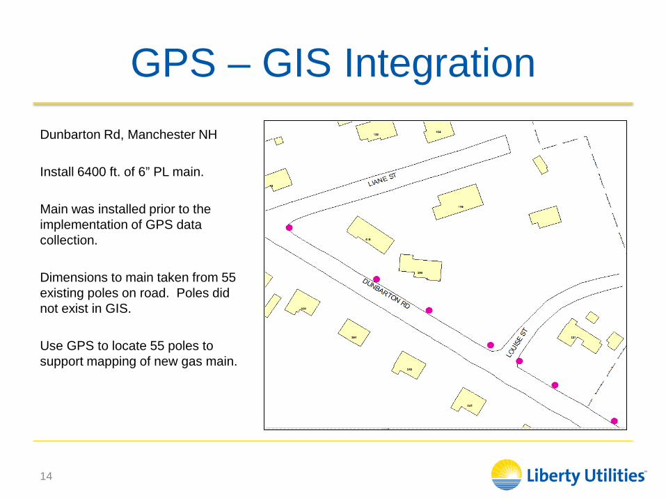
Dunbarton Rd, Manchester NH Install 6400 ft. of 6” PL main. Main was installed prior to the implementation of GPS data collection. Dimensions to main taken from 55 existing poles on road. Poles did not exist in GIS. Use GPS to locate 55 poles to support mapping of new gas main.
14
GPS – GIS Integration

15
GPS – GIS Integration South River Rd, Bedford NH Relay 980 ft. of 4” PL main. Main relay performed in conjunction with street widening. Main was installed prior to the implementation of GPS data collection. Dimensions to main taken from new relocated poles on road. Use GPS to locate new poles and new curb lines to support mapping of relay gas main.
Challenges/Obstacles
16
• Time consuming to manage – collect files, correct files, create shp files and integrate into GIS.
• Further investigate Real-Time Data Correction • Work with field personnel on naming convention and training
– 18 contractor crews and 10 in-house crews in a large territory.
• Expecting increase in workload – requires more GPS units
• System Improvements • Updates need to be loaded into each individual unit
• Data Dictionary Improvement • Feedback from the field • Changing settings

Future Initiatives - Barcoding
17
ASTM F2897-14 - Standard Specification for Tracking and Traceability of Natural Gas Distribution Components
Character Number Source Description of Information Character Information
1 X2 X
3 54 b5 16 e
7 28 R9 A
10 Component material type per Table Material used for component B PE2708
11 112 2
13 314 y15 5
16 www.compnentid.org Reserved for future use 0 Default value
Component size per 5.6Corresponds to size code of 14024 for 1-1/2 inch IPS 0.090" wall pipe
Component size
Component production date code per 5.3
Date of manufacture of given component
Corresponds to production date of 11010, that is, 110th day of 2010
Component Type per Table 4 Component type Pipe - Coiled
www.compnentid.orgName of component manufacturer
Corresponds to list on www.compnentid.org
Component Manufacture's lot codeInformation which can help ascertain relevant traceability information upon request
Corresponds to the mfg lot number 1234000

18
Future Initiatives - Barcoding
Recap
19
• GPS Selection • GPS Data Collection Requirements • GPS Process • Integration into GIS • Challenges/Obstacles • Future Initiatives - Barcoding • Questions