Embed Size (px)
Citation preview
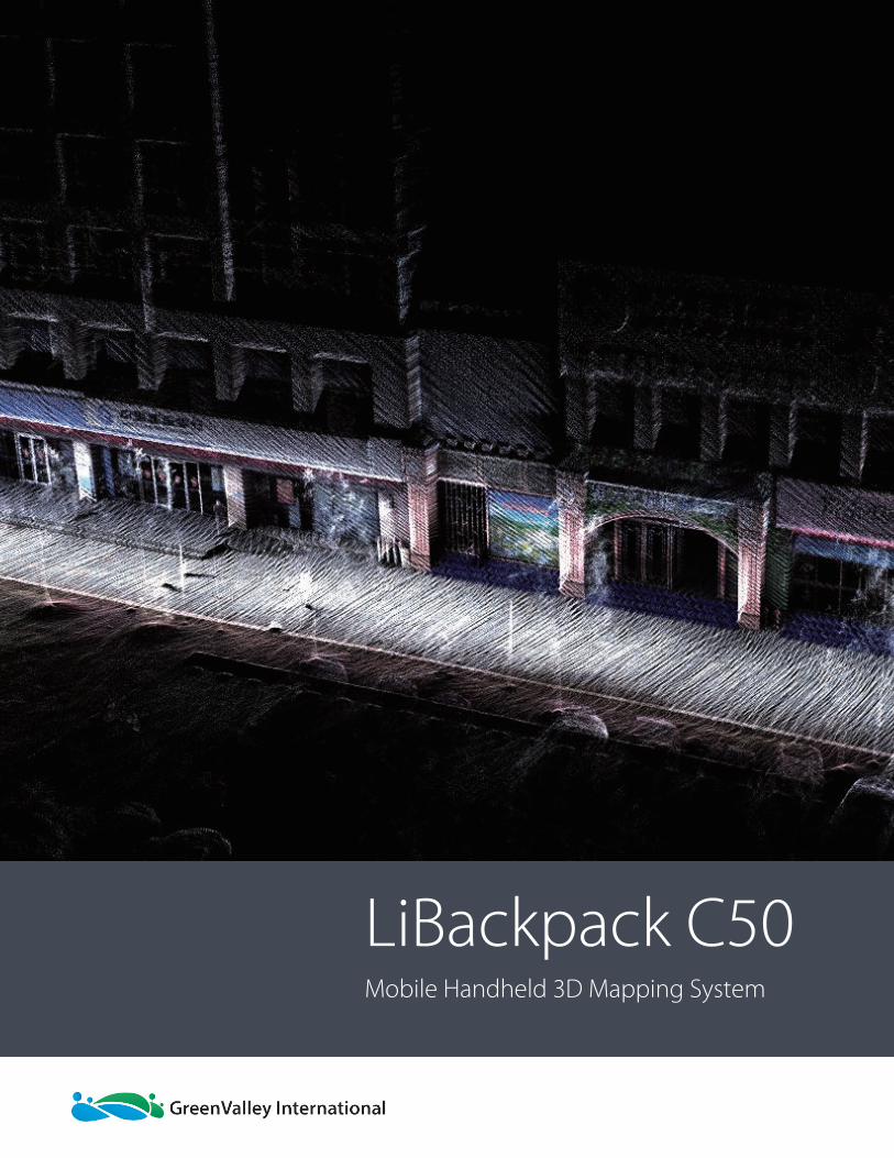
LiBackpack C50Mobile Handheld 3D Mapping System
PA G E 2
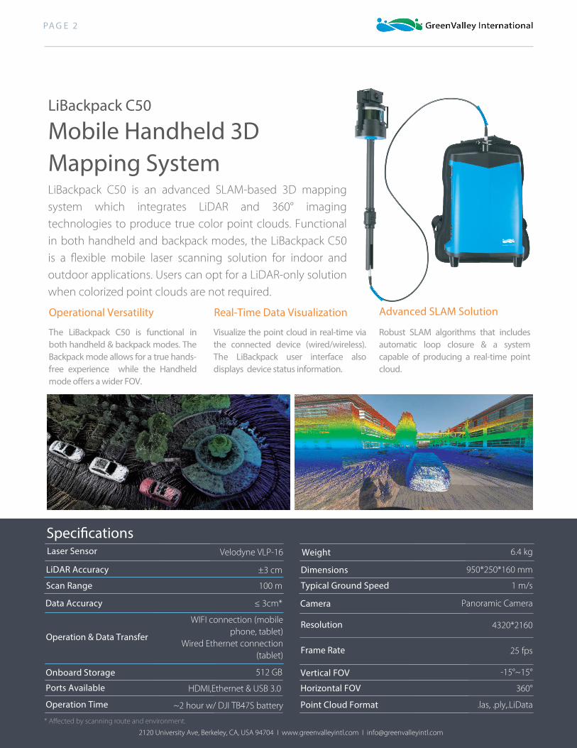
LiBackpack C50
Mobile Handheld 3D Mapping SystemLiBackpack C50 is an advanced SLAM-based 3D mappingsystem which integrates LiDAR and 360° imagingtechnologies to produce true color point clouds. Functionalin both handheld and backpack modes, the LiBackpack C50is a flexible mobile laser scanning solution for indoor andoutdoor applications. Users can opt for a LiDAR-only solutionwhen colorized point clouds are not required.
Advanced SLAM Solution Operational Versatility Real-Time Data Visualization
Speci�cations
Scan Range
Data Accuracy
Operation & Data Transfer
LiDAR Accuracy
Laser Sensor
Onboard Storage
Ports Available
Camera
Resolution
Dimensions
Weight
Vertical FOV
Horizontal FOV
4320*2160
25 fps
950*250*160 mm
6.4 kg
360°
-15°~15°
Panoramic Camera
WIFI connection (mobilephone, tablet)
Wired Ethernet connection(tablet)
±3 cm
100 m
Velodyne VLP-16
HDMI,Ethernet & USB 3.0
512 GB
≤ 3cm*
Frame Rate
Operation Time Point Cloud Format .las, .ply,.LiData~2 hour w/ DJI TB47S battery
Typical Ground Speed 1 m/s
2120 University Ave, Berkeley, CA, USA 94704 I www.greenvalleyintl.com I [email protected]
Visualize the point cloud in real-time via the connected device (wired/wireless). The LiBackpack user interface also displays device status information.
The LiBackpack C50 is functional inboth handheld & backpack modes. TheBackpack mode allows for a true hands-free experience while the Handheldmode o�ers a wider FOV.
Robust SLAM algorithms that includes automatic loop closure & a system capable of producing a real-time point cloud.
* Affected by scanning route and environment.


![F0B4 [C40-30] F0B5 [C40-05] Lenovo C40/C50 Series · Machine type: F0B1 [C50-30] F0B4 [C40-30] F0B5 [C40-05] 2014.08 Lenovo C40/C50 Series User Guide SP40G46523. Important Safety](https://img.pdfslide.us/doc/110x75/5e9ab210b0480907f77c8243/f0b4-c40-30-f0b5-c40-05-lenovo-c40c50-series-machine-type-f0b1-c50-30-f0b4.jpg)