Embed Size (px)
Citation preview

LESSON 2 – EARTHQUAKES AND SEISMIC WAVES
Chapter 2
An earthquake is the shaking and trembling results from the movement of rock beneath Earth’s surface.
The forces of plate movement cause earthquakes. Most earthquakes begin in the lithosphere within
about 100 kilometers of Earth’s surface. The focus is the area beneath Earth’s surface where rock that is under stress breaks, triggering an earthquake. The point on the surface directly above the focus is called the epicenter.
http://www.youtube.com/watch?v=VSgB1IWr6O4
Types of Seismic Waves
Seismic waves carry energy from an earthquake away from the focus, through Earth’s interior, and across the surface.
Like a pebble thrown into a pond, an earthquake produces vibrations called waves.
There are three main categories of seismic waves: P Waves S Waves Surface waves
P waves vs. S Waves
P Waves
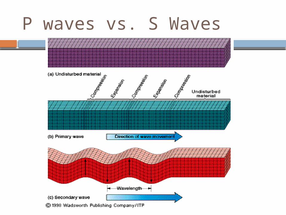
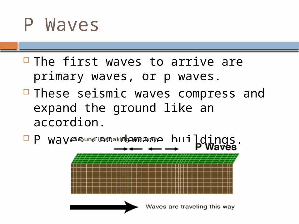
The first waves to arrive are primary waves, or p waves.
These seismic waves compress and expand the ground like an accordion.
P waves can damage buildings.
S waves
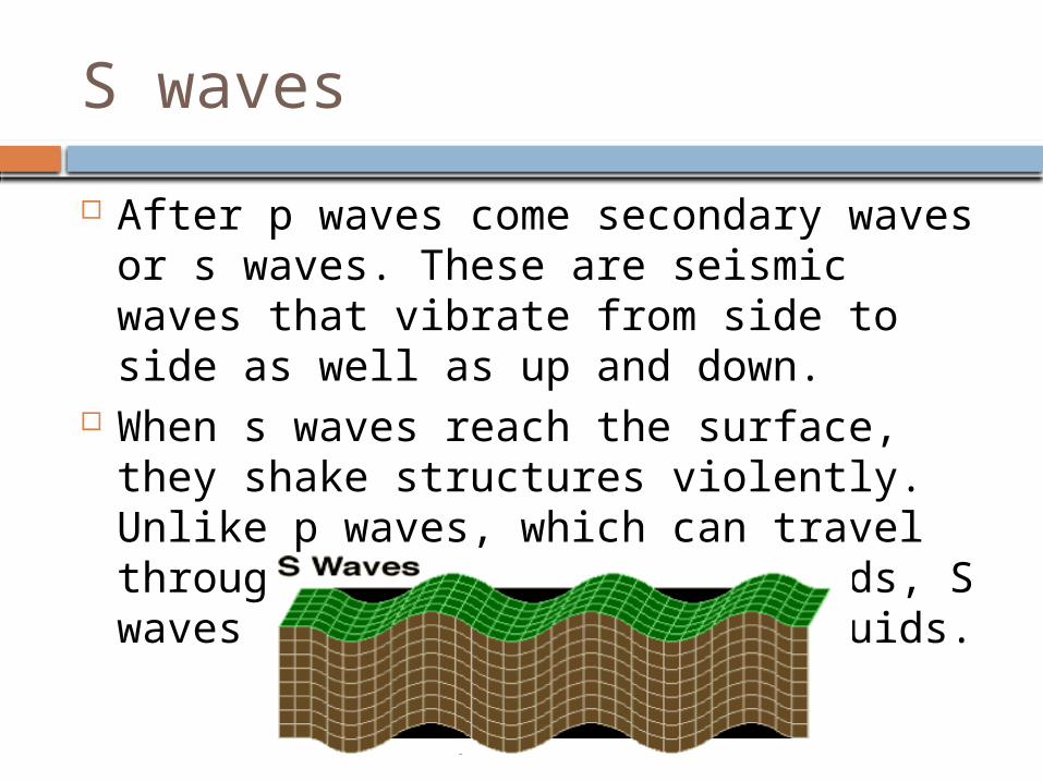
After p waves come secondary waves or s waves. These are seismic waves that vibrate from side to side as well as up and down.
When s waves reach the surface, they shake structures violently. Unlike p waves, which can travel through both solids and liquids, S waves cannot move through liquids.
Surface Waves
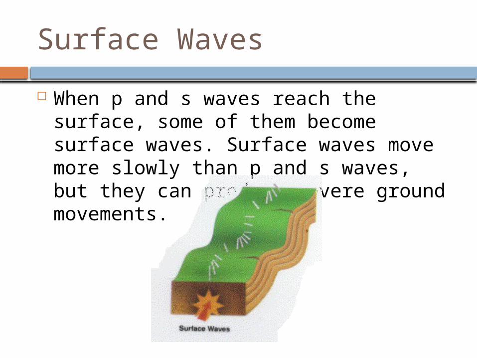
When p and s waves reach the surface, some of them become surface waves. Surface waves move more slowly than p and s waves, but they can produce severe ground movements.
Measuring Earthquakes
Three commonly used methods of measuring earthquakes are the Mercalli scale, the Richter scale, and the moment magnitude scale.
The Mercalli Scale
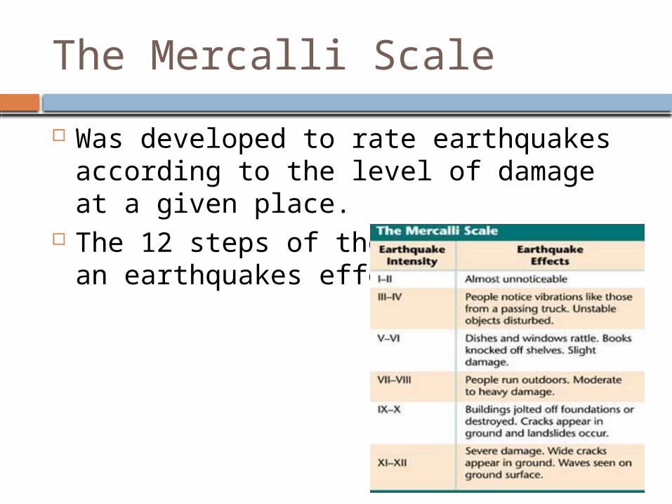
Was developed to rate earthquakes according to the level of damage at a given place.
The 12 steps of the scale describe an earthquakes effects.
The Richter Scale
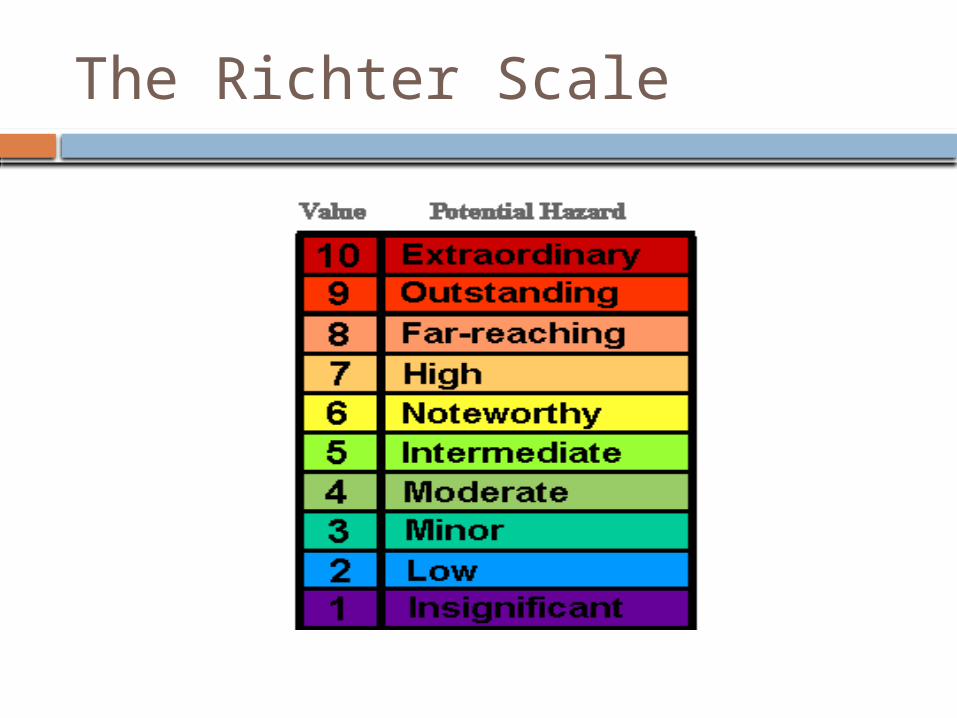
An earthquake’s magnitude is a number the geologists assign to an earthquake based on the earthquakes size.
Geologists determine magnitude by measuring the seismic waves and fault movement that occur during an earthquake.
The seismic waves are measured by a seismograph.
The Richter Scale
The Moment Magnitude Scale Geologists today often use the moment
magnitude scale, a rating system that estimates the total energy released by an earthquake.
To rate an earthquake on the moment magnitude scale, geologists first study data from seismographs. Geologists use all this information to rate the quake on the scale.
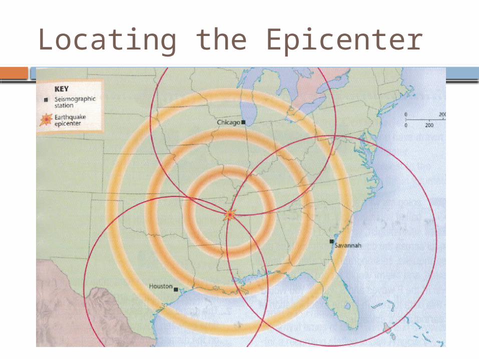
Locating the Epicenter
Geologists use seismic waves to locate an earthquakes epicenter.
Seismic waves travel at different speeds. To tell how far the epicenter is from the
seismograph, scientists measure the difference between the arrival times of the P waves and S waves. The farther away an earthquake is, the greater the time between the arrival of the P and S waves. Geologists than draw 3 circles using the data from the seismographs. The radius of each circle is the distance from the seismograph to the epicenter.
Locating the Epicenter