Embed Size (px)
Citation preview
© 2009 Pearson Prentice Hall
This work is protected by United States copyright laws and is provided solely for the use of instructors in teaching their courses and assessing student learning. Dissemination or sale of any part of this work (including on the World Wide Web) will destroy the integrity of the work and is not permitted. The work and materials from it should never be made available to students except by instructors using the accompanying text in their classes. All recipients of this work are expected to abide by these restrictions and to honor the intended pedagogical purposes and the needs of other instructors who rely on these materials.
Lecture Outlines PowerPoint
Chapter 15
Earth Science, 12e
Tarbuck/Lutgens

Earth Science, Earth Science, 12e12e
The Dynamic OceanThe Dynamic OceanChapter 15Chapter 15
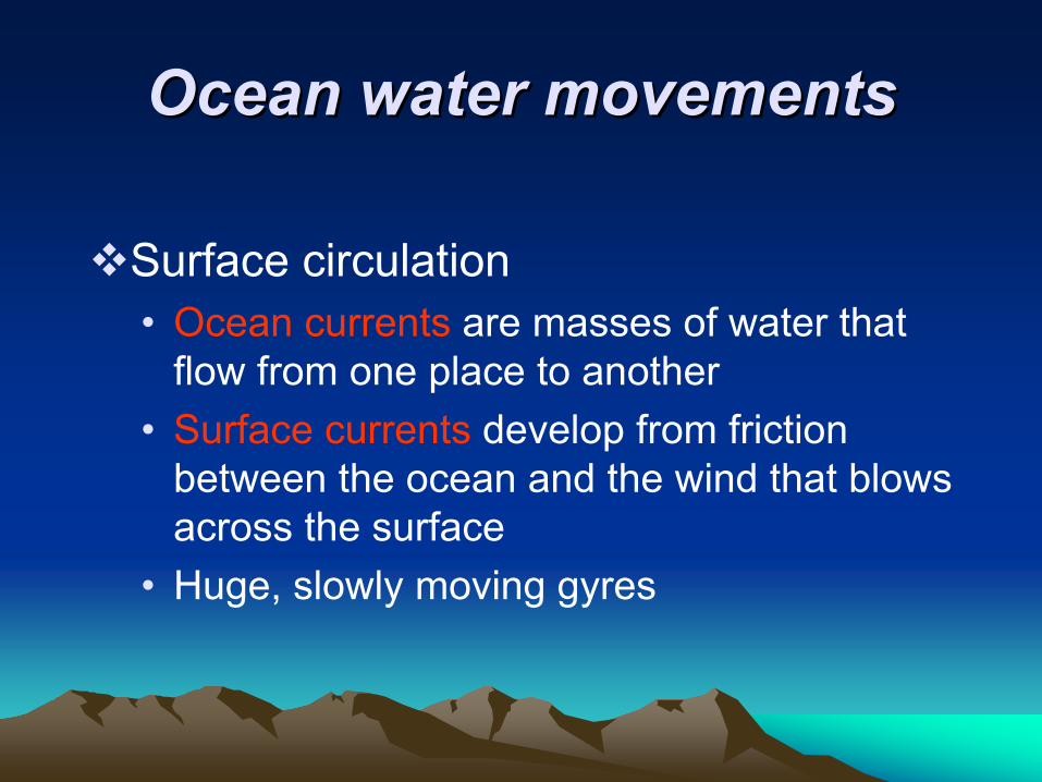
Ocean water movements Ocean water movements
Surface circulation • Ocean currents are masses of water that
flow from one place to another • Surface currents develop from friction
between the ocean and the wind that blows across the surface
• Huge, slowly moving gyres
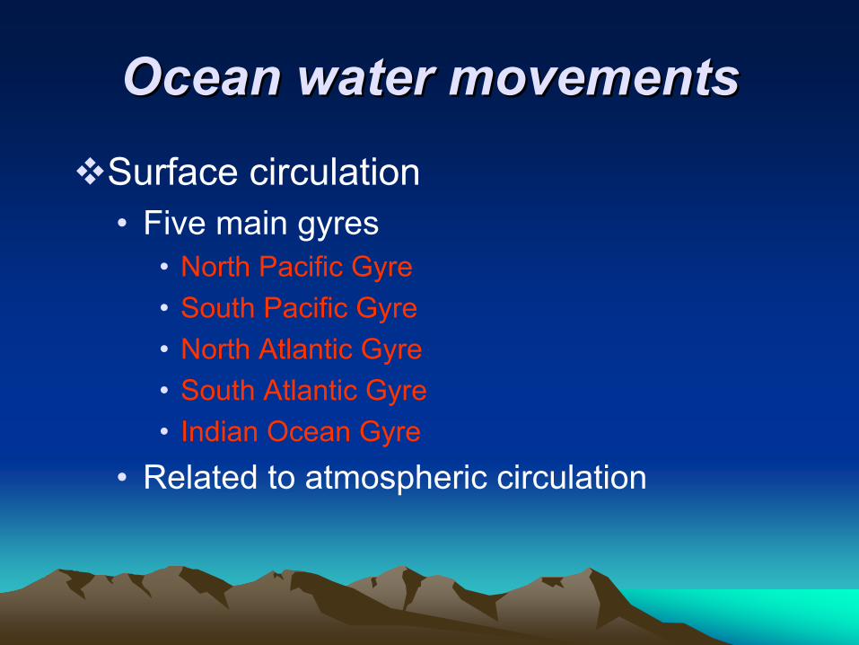
Ocean water movements Ocean water movements Surface circulation • Five main gyres
• North Pacific Gyre • South Pacific Gyre • North Atlantic Gyre • South Atlantic Gyre • Indian Ocean Gyre
• Related to atmospheric circulation
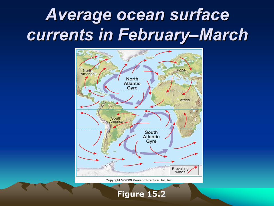
Average ocean surface Average ocean surface currents in currents in FebruaryFebruary––MarchMarch
Figure 15.2
Ocean water movements Ocean water movements Surface circulation • Deflected by the Coriolis effect
• To the right in the Northern Hemisphere • To the left in the Southern Hemisphere
• Four main currents generally exist within each gyre
• Importance of surface currents • Climate
• Currents from low latitudes into higher latitudes (warm currents) transfer heat from warmer to cooler areas
Ocean water movements Ocean water movements Surface circulation • Importance of surface currents
• Climate• Influence of cold currents is most
pronounced in the tropics or during the summer months in the middle latitudes
• Upwelling • The rising of cold water from deeper layers • Most characteristic along west coasts of
continents • Brings greater concentrations of dissolved
nutrients to the ocean surface
Ocean water movements Ocean water movements
Deep-ocean circulation • A response to density differences• Factors creating a dense mass of water
• Temperature – cold water is dense• Salinity – density increases with increasing
salinity
• Called thermohaline circulation
Ocean water movements Ocean water movements
Deep-ocean circulation • Most water involved in deep-ocean
currents begins in high latitudes at the surface
• A simplified model of ocean circulation is similar to a conveyor belt that travels from the Atlantic Ocean, through the Indian and Pacific Oceans, and back again
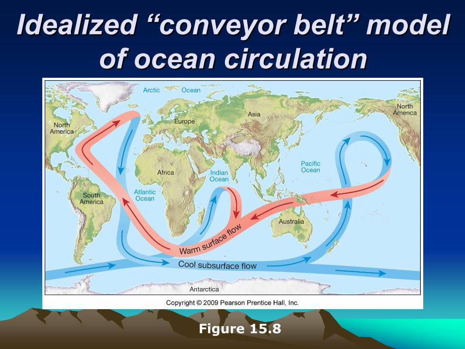
Idealized Idealized ““conveyor conveyor beltbelt”” modelmodelof ocean circulationof ocean circulation
Figure 15.8
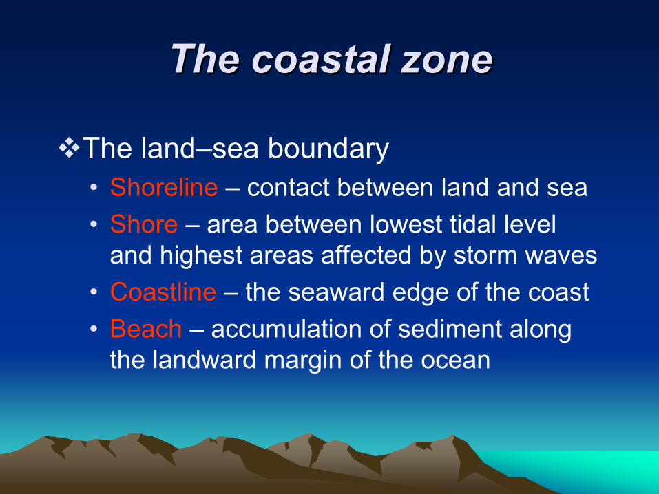
The coastal zone The coastal zone
The land–sea boundary • Shoreline – contact between land and sea• Shore – area between lowest tidal level
and highest areas affected by storm waves• Coastline – the seaward edge of the coast• Beach – accumulation of sediment along
the landward margin of the ocean
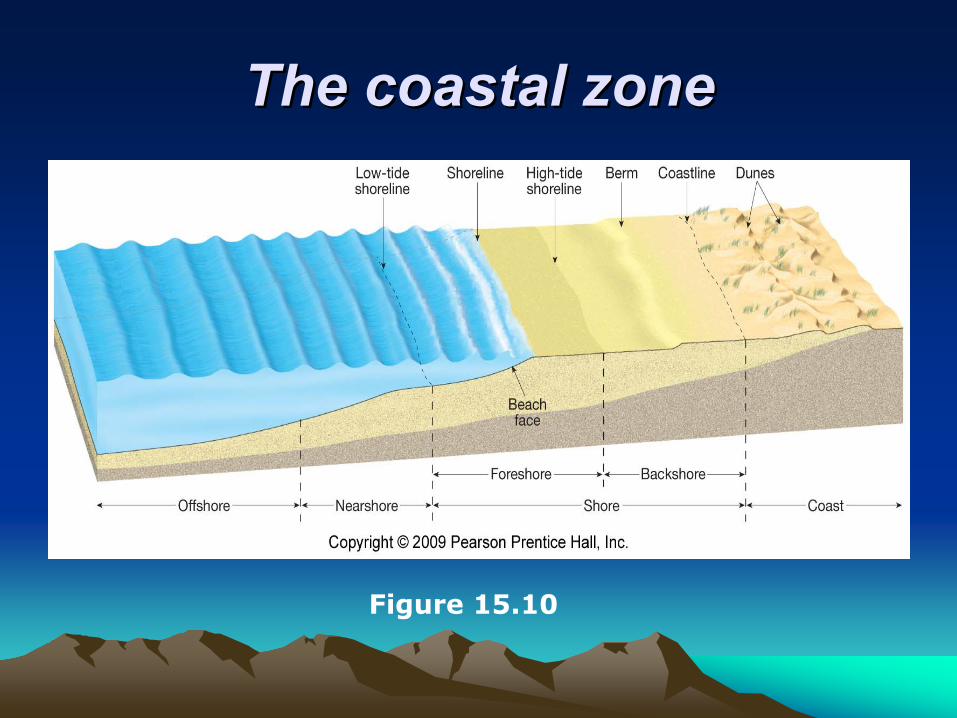
The coastal zoneThe coastal zone
Figure 15.10

Ocean water movements Ocean water movements
Waves • Energy traveling along the interface
between ocean and atmosphere • Derive their energy and motion from wind • Parts
• Crest • Trough
Ocean water movements Ocean water movements
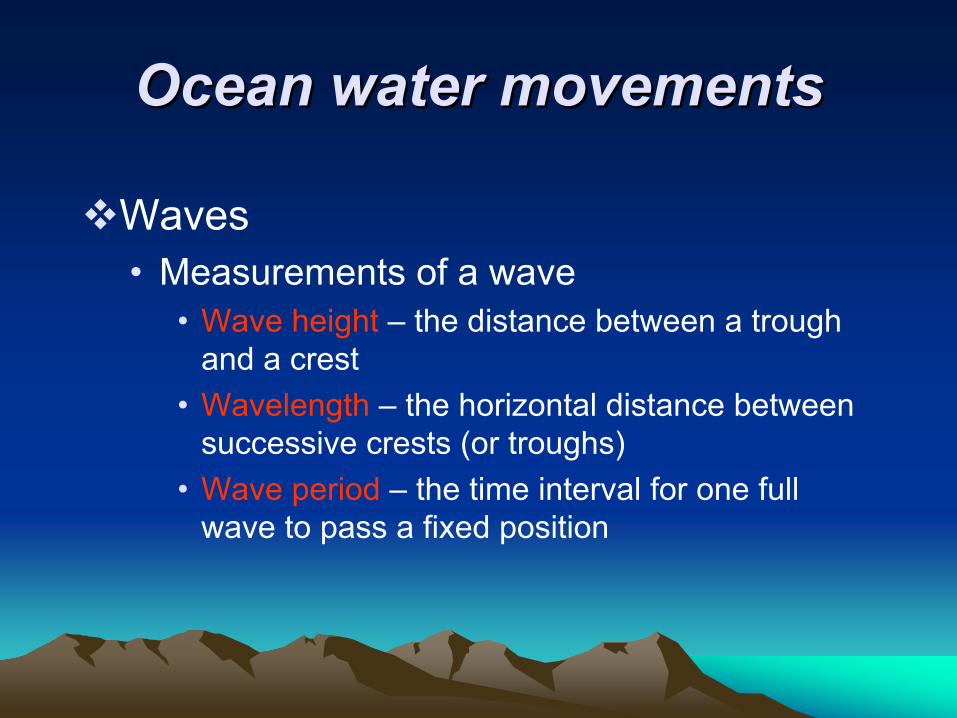
Waves • Measurements of a wave
• Wave height – the distance between a trough and a crest
• Wavelength – the horizontal distance between successive crests (or troughs)
• Wave period – the time interval for one full wave to pass a fixed position
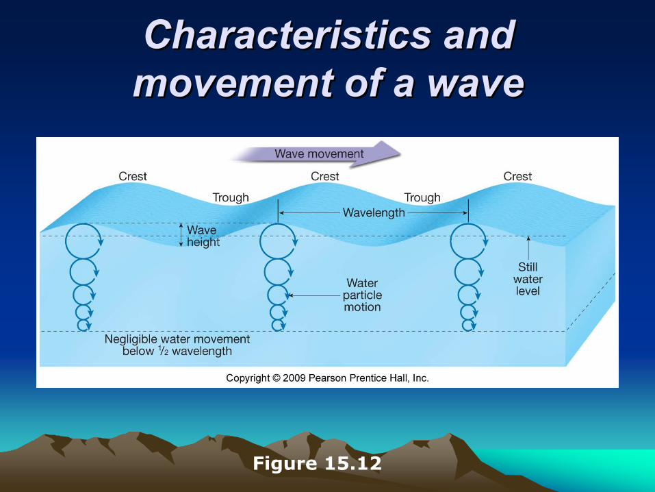
Characteristics and Characteristics and movement of a wavemovement of a wave
Figure 15.12
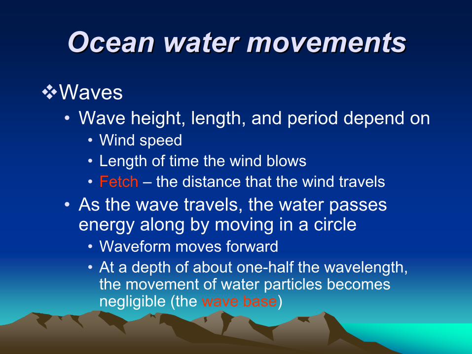
Ocean water movements Ocean water movements Waves • Wave height, length, and period depend on
• Wind speed • Length of time the wind blows • Fetch – the distance that the wind travels
• As the wave travels, the water passes energy along by moving in a circle
• Waveform moves forward • At a depth of about one-half the wavelength,
the movement of water particles becomes negligible (the wave base)
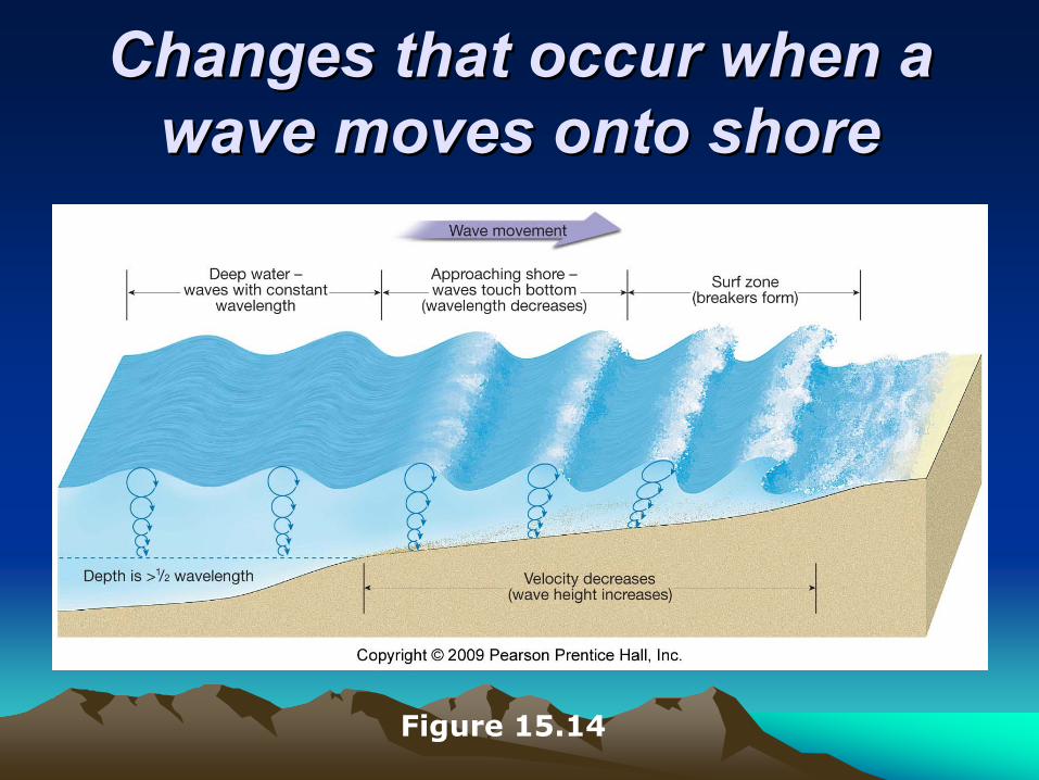
Changes that occur when a Changes that occur when a wave moves onto shorewave moves onto shore
Figure 15.14
Wave erosion Wave erosion
Wave erosion • Caused by
• Wave impact and pressure • Breaks down rock material and supplies sand
to beaches• Abrasion – sawing and grinding action of water
armed with rock fragments

Sand movement on the beach Sand movement on the beach
Beaches are composed of whatever material is available • Some beaches have a significant biological
component • Material does not stay in one place
• Wave energy moves large quantities of sand parallel and perpendicular to the shoreline
Beaches and shoreline Beaches and shoreline processes processes
Wave refraction• Bending of a wave• Wave arrives parallel to shore • Results
• Wave energy is concentrated against the sides and ends of headland
• Wave erosion straightens an irregular shoreline
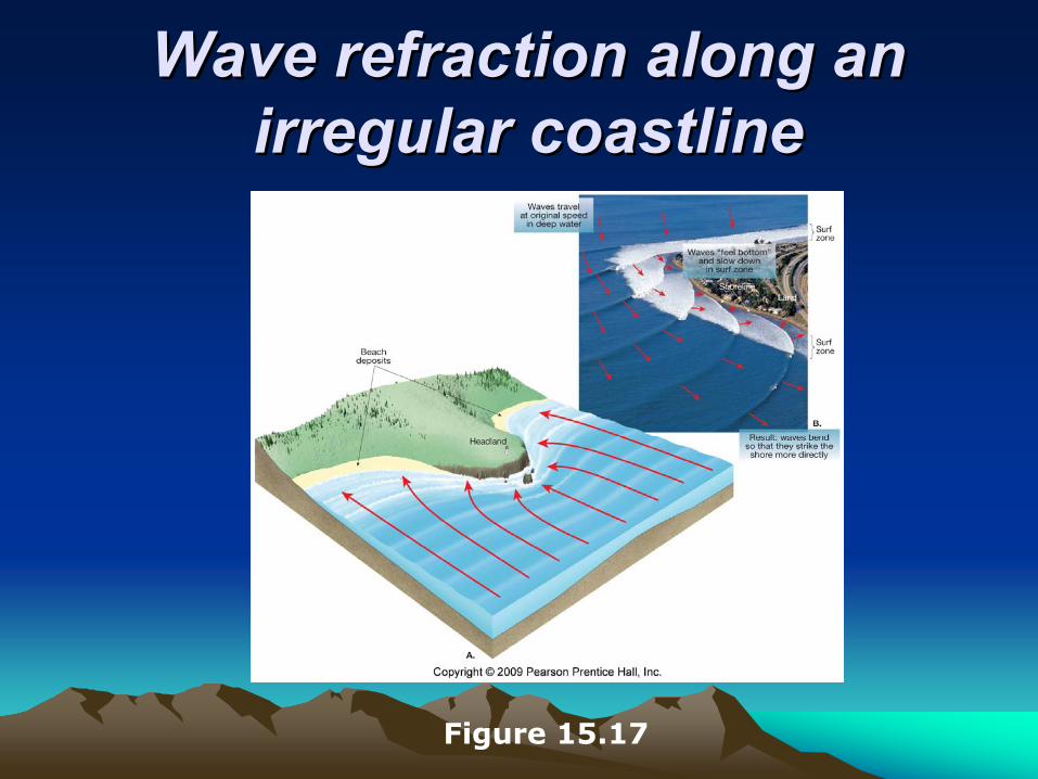
Wave refraction along an Wave refraction along an irregular coastlineirregular coastline
Figure 15.17
Beaches and shoreline Beaches and shoreline processes processes
Longshore transport• Beach drift – sediment moves in a zigzag
pattern along the beach face • Longshore current
• Current in surf zone • Flows parallel to the shore• Moves substantially more sediment than beach
drift

Beach drift and Beach drift and longshore currentslongshore currents
Figure 15.18

Shoreline features Shoreline features
Erosional features • Wave-cut cliff• Wave-cut platform • Marine terraces• Associated with headlands
• Sea arch• Sea stack
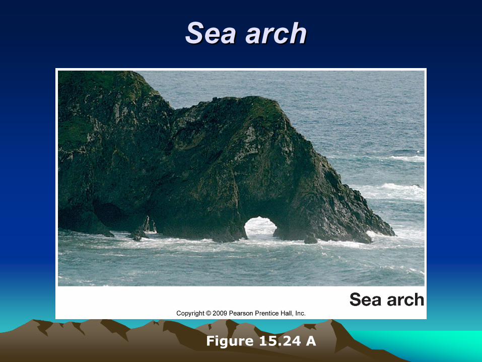
Sea archSea arch
Figure 15.24 A
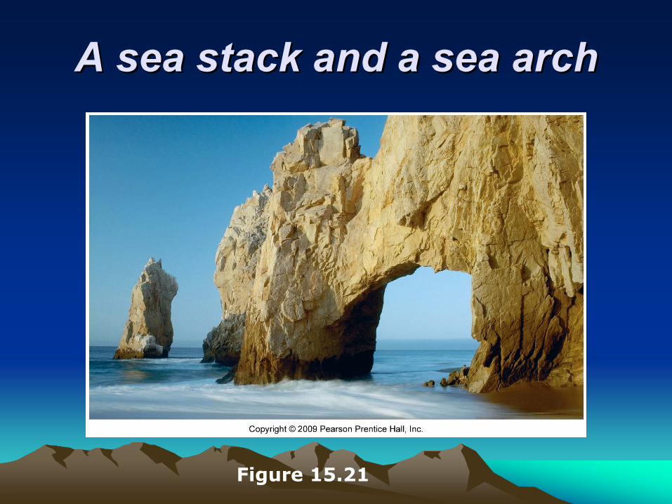
A sea stack and a sea archA sea stack and a sea arch
Figure 15.21

Shoreline features Shoreline features
Depositional features • Spit – a ridge of sand extending from the
land into the mouth of an adjacent bay with an end that often hooks landward
• Baymouth bar – a sand bar that completely crosses a bay
• Tombolo – a ridge of sand that connects an island to the mainland

Aerial view of a Aerial view of a spit and spit and
baymouth bar baymouth bar along the along the
Massachusetts Massachusetts coastlinecoastline
Figure 15.22 A
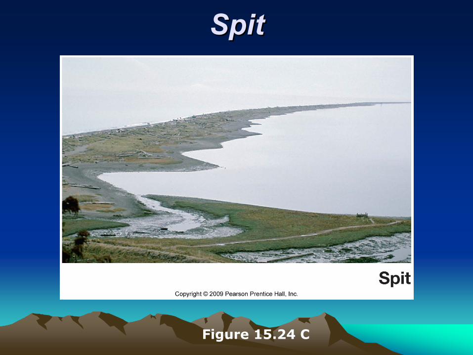
SpitSpit
Figure 15.24 C
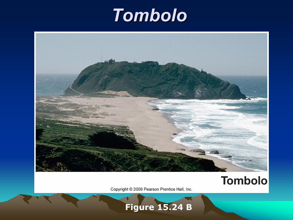
TomboloTombolo
Figure 15.24 B
Shoreline features Shoreline features
Depositional features • Barrier islands
• Mainly along the Atlantic and Gulf Coastal Plains
• Parallel the coast• Originate in several ways
Stabilizing the shore Stabilizing the shore
Shoreline erosion is influenced by the local factors • Proximity to sediment-laden rivers • Degree of tectonic activity • Topography and composition of the land • Prevailing wind and weather patterns • Configuration of the coastline
Stabilizing the shore Stabilizing the shore Responses to erosion problems • Hard stabilization – building structures
• Types of structures • Groins – barriers built at a right angle to the
beach that are designed to trap sand• Breakwaters – barriers built offshore and
parallel to the coast to protect boats from breaking waves
• Seawalls – Armors the coast against the force of breaking waves
• Often these structures are not effective

Stabilizing the shore Stabilizing the shore Responses to erosion problems • Alternatives to hard stabilization
• Beach nourishment by adding sand to the beach system
• Relocating buildings away from beach
Erosion problems along U.S. coasts• Shoreline erosion problems are different
along the opposite coasts
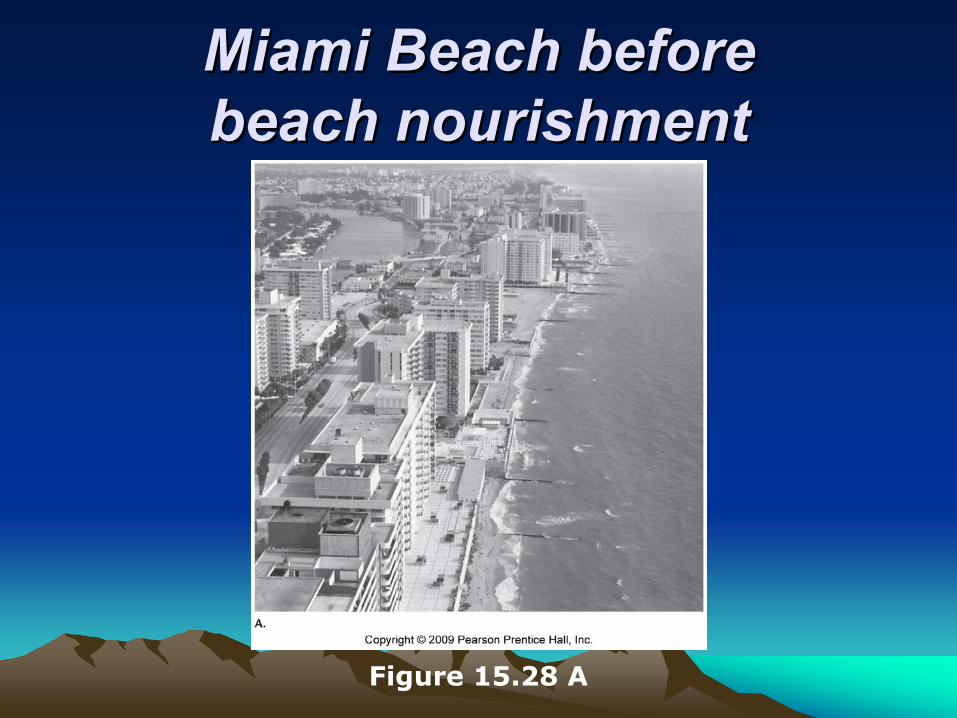
Miami Beach before Miami Beach before beach nourishmentbeach nourishment
Figure 15.28 A
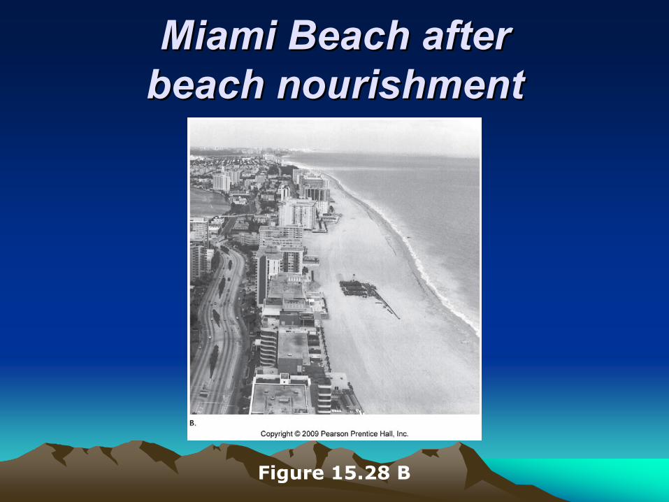
Miami Beach after Miami Beach after beach nourishmentbeach nourishment
Figure 15.28 B

Stabilizing the shore Stabilizing the shore
Erosion problems along U.S. coasts• Atlantic and Gulf Coasts
• Development occurs mainly on barrier islands • Face open ocean • Receive full force of storms
• Development has taken place more rapidly than our understanding of barrier island dynamics

Stabilizing the shore Stabilizing the shore
Erosion problems along U.S. coasts• Pacific Coast
• Characterized by relatively narrow beaches backed by steep cliffs and mountain ranges
• Major problem is the narrowing of the beaches • Sediment for beaches is interrupted by
dams and reservoirs • Rapid erosion occurs along the beaches
Coastal classification Coastal classification
Shoreline classification is difficult Classification based on changes with respect to sea level • Emergent coast
• Caused by • Uplift of the land, or • A drop in sea level
Coastal classification Coastal classification
Classification based on changes with respect to sea level • Emergent coast
• Features of an emergent coast • Wave-cut cliffs • Marine terraces
Coastal classification Coastal classification Classification based on changes with respect to sea level • Submergent coast
• Caused by• Land adjacent to sea subsides, or • Sea level rises
• Features of a submergent coast • Highly irregular shoreline • Estuaries – drowned river mouths
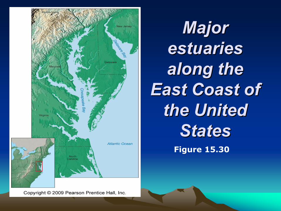
Major Major estuaries estuaries along the along the
East Coast of East Coast of the United the United
StatesStatesFigure 15.30
TidesTides
Changes in elevation of the ocean surface Caused by the gravitational forces exerted upon the Earth by the • Moon, and to a lesser extent by the • Sun
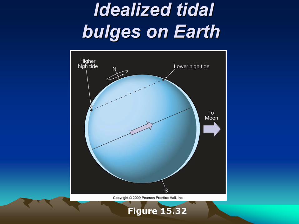
Idealized tidal Idealized tidal bulges on Earthbulges on Earth
Figure 15.32

TidesTides
Monthly tidal cycle • Spring tide
• During new and full moons• Gravitational forces added together • Especially high and low tides • Large daily tidal range
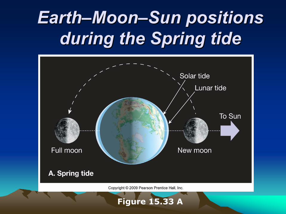
EarthEarth––MoonMoon––SunSun positions positions during the Spring tideduring the Spring tide
Figure 15.33 A
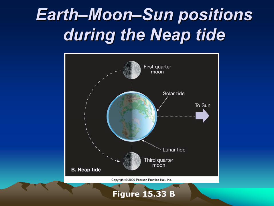
EarthEarth––MoonMoon––SunSun positions positions during the Neap tideduring the Neap tide
Figure 15.33 B

TidesTidesMonthly tidal cycle• Neap tide
• First and third quarters of the Moon • Gravitational forces are offset • Daily tidal range is least
Tidal patterns • Many factors influence the tides
• Shape of the coastline • Configuration of the ocean basin • Water depth

High tide in the Bay of Fundy High tide in the Bay of Fundy along the Nova Scotia coastalong the Nova Scotia coast
Figure 15.31 top
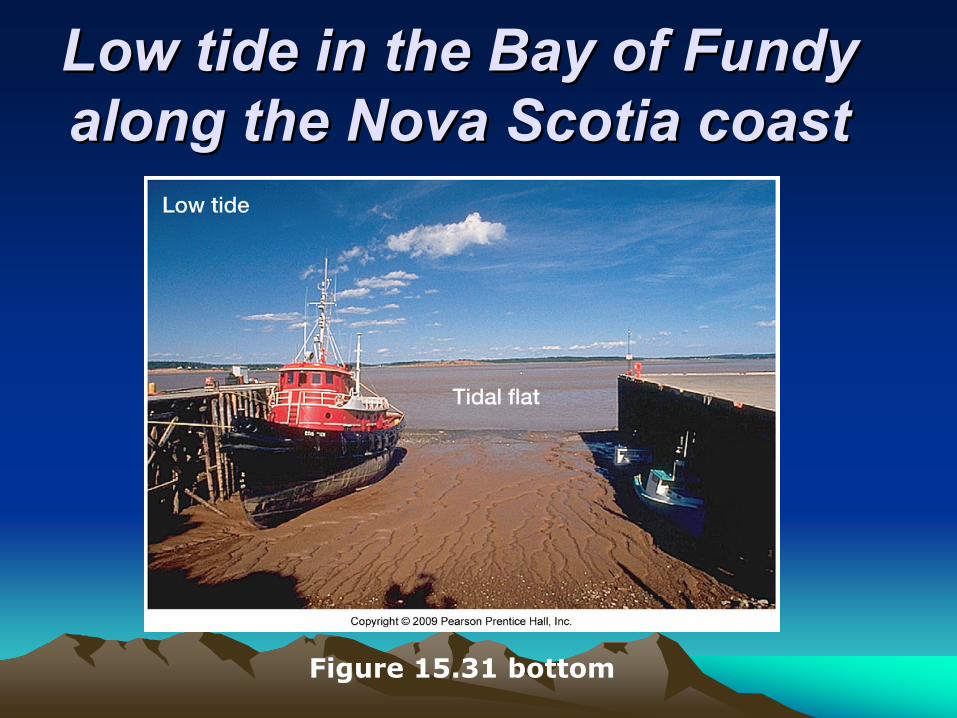
Low tide in the Bay of Fundy Low tide in the Bay of Fundy along the Nova Scotia coastalong the Nova Scotia coast
Figure 15.31 bottom
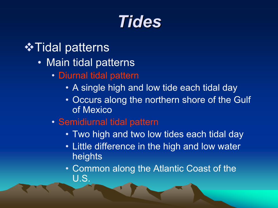
TidesTidesTidal patterns • Main tidal patterns
• Diurnal tidal pattern• A single high and low tide each tidal day • Occurs along the northern shore of the Gulf
of Mexico • Semidiurnal tidal pattern
• Two high and two low tides each tidal day • Little difference in the high and low water
heights• Common along the Atlantic Coast of the
U.S.
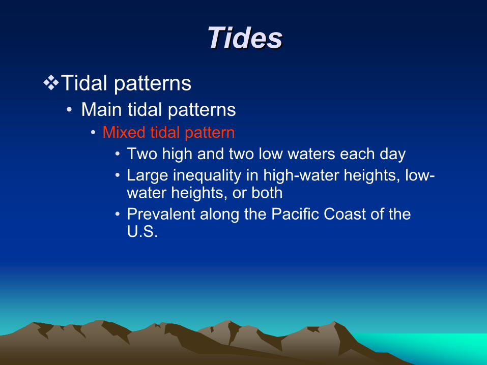
TidesTidesTidal patterns • Main tidal patterns
• Mixed tidal pattern• Two high and two low waters each day • Large inequality in high-water heights, low-
water heights, or both• Prevalent along the Pacific Coast of the
U.S.
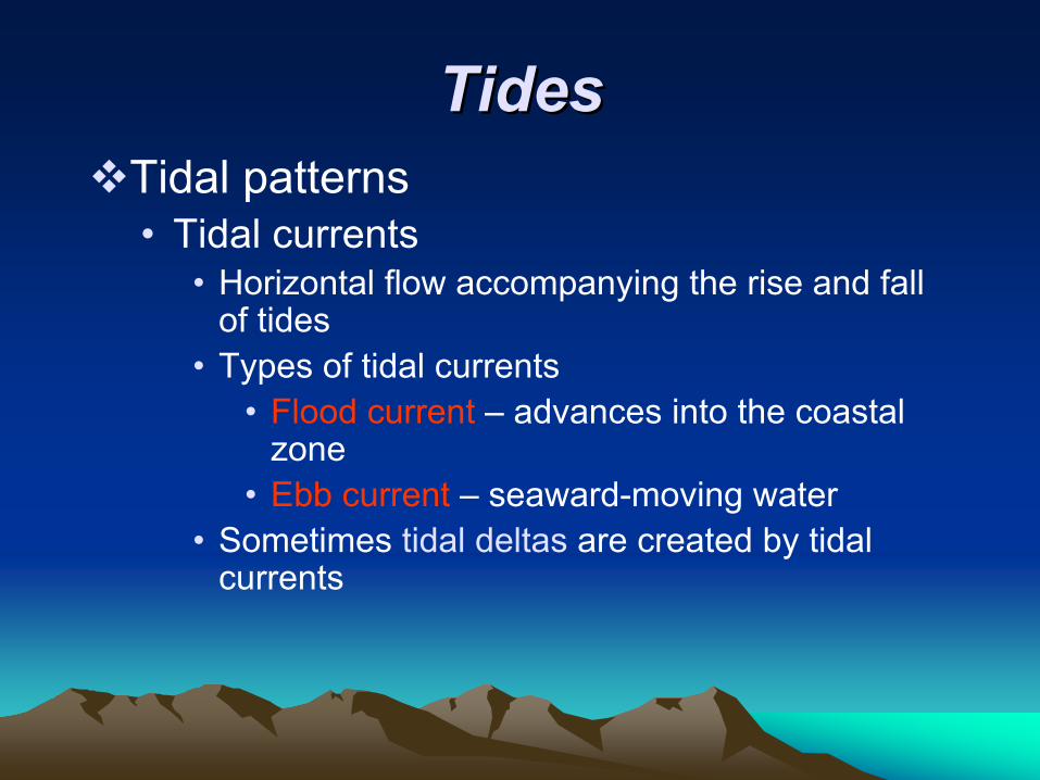
TidesTidesTidal patterns • Tidal currents
• Horizontal flow accompanying the rise and fall of tides
• Types of tidal currents • Flood current – advances into the coastal
zone • Ebb current – seaward-moving water
• Sometimes tidal deltas are created by tidal currents
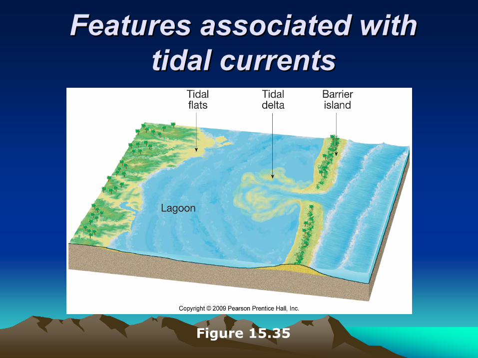
Features associated with Features associated with tidal currentstidal currents
Figure 15.35
End of Chapter 15End of Chapter 15