Embed Size (px)
Citation preview
1
LANDSCAPE AND THE MONTGOMERY CANAL CORRIDOR
Contents
1 General 2
2 Summary of the landscape character 2
2.1 Natural habitats 3
2.2 Historical background 4
2.3 The modern landscape 5
3 Existing landscape designations 8
4 Restoration 9
4.1 Restoration of the channel and associated structures 11
4.2 Improving access to the canal 14
4.3 The provision of nature reserves 16
5 Additional opportunities 17
References 19
Appendices 20
2
1 . General
The restoration of Britain’s waterways is perceived to play a key role in the
regeneration of urban and rural areas which have fallen into decline. It
provides an opportunity for environmental enhancement as well as the
maintenance and conservation of a unique aspect of Britain’s built landscape.
Canals, by their very nature, form an integral part of the landscape through
which they pass and it is thus vital that their restoration is in keeping with the
character of this landscape so that it enhances rather than disrupts the visual
effect.
There are several extant in-depth studies of the landscape corridor through
which the Montgomery Canal passes and this review will briefly summarise
the landscape character identified in these reports and draw conclusions as to
how the restoration of the might affect this landscape. The extent of the
landscape reviewed in this study can be seen on the map at appendix 1.
2 . Summary of the landscape character.
Built between 1794 and 1821 the Montgomery canal runs for some 53km from
its junction with the Llangollen canal at Lower Frankton in Shropshire to
Newtown in Powys, the majority of the canal (36 km) being in Powys. For
much of its length the canal follows the valley of the river Severn, hugging the
western side of the valley before diverging eastwards onto the Shropshire
3
plain after crossing the river Vyrnwy. Somewhat narrow and steep sided at
its southern end near Newtown the valley widens gradually to become flat
bottomed with the river following a meandering course. This valley also
provides the route for A483 trunk road linking the 3 major towns of Oswestry,
Welshpool and Newtown as well as many smaller settlements. The
landscape bordering the canal is rural in character and there are indications
that it has been occupied for several millennia.
2.1 Natural Habitats
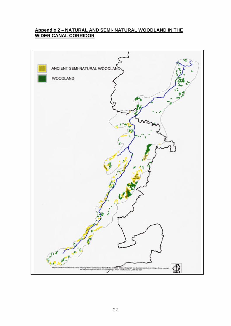
The natural vegetation of the landscape surrounding the canal corridor would
have been woodland except where the land was particularly wet. After many
thousands of years of settlement little remains of the ancient forest on the
valley floor or hilltops, the fragments which remain cling to the steeper slopes
of the valley sides (appendix 2) and consist of sessile oak, ash and wych elm
with some beech, sycamore, field maple, cherry, small leafed lime and silver
birch. Most of the other woodland which is now evident results from human
planting, both of broadleaf and conifers.
Species rich unimproved grassland again only exists as isolated patches.
Most grassland in the valley corridor is the result of agriculture – either as
rough grazing or improved grassland.
The Severn valley supports several important wetland sites and associated
nature reserves and there are a number of small areas of pools, fens and
4
mosses in the Shropshire end of the corridor. It should also be remembered
that the Montgomery Canal and its associated offline reserves is an important
wetland site in its own right with a number of SSSI designations and a cSAC
designation for the stretch in Wales.
2.2 Historical background.
There is archaeological evidence to suggest that the lowland and surrounding
hills through which the canal passes has been inhabited and exploited by
humans since Neolithic times. The Kerry Ridgeway, which forms the
landscape’s southern border, has been and important line of communication
since prehistoric times and the remains of number of early forts on the
surrounding hills is evidence of attempts to control the native population and
their communication routes. Later in prehistory and in the Roman occupation
the signs of farming activity begin to appear and the early medieval period
adds church building and the construction of Offa’s and Wat’s dykes to the
region. Little is known of the time immediately following the Norman
Conquest but the influence of the Normans and the rise of the Marcher
Barons from the 12th C onwards, together with the remains of their numerous
motte and bailey castles, illustrates the attempts to impose a foreign culture
on the landscape. Gradually, villages began to develop around those
churches which had been built in early medieval times. Around the villages
agricultural development gathered pace and to add to this the Cistercian order
founded Strata Marcella Abbey just to the north of what is now Welshpool. In
the post-medieval and early modern periods a number of large estates were
5
founded, and between the 17th and 19th centuries gardens and parklands
were laid out around the mansions of the larger estates. These give the
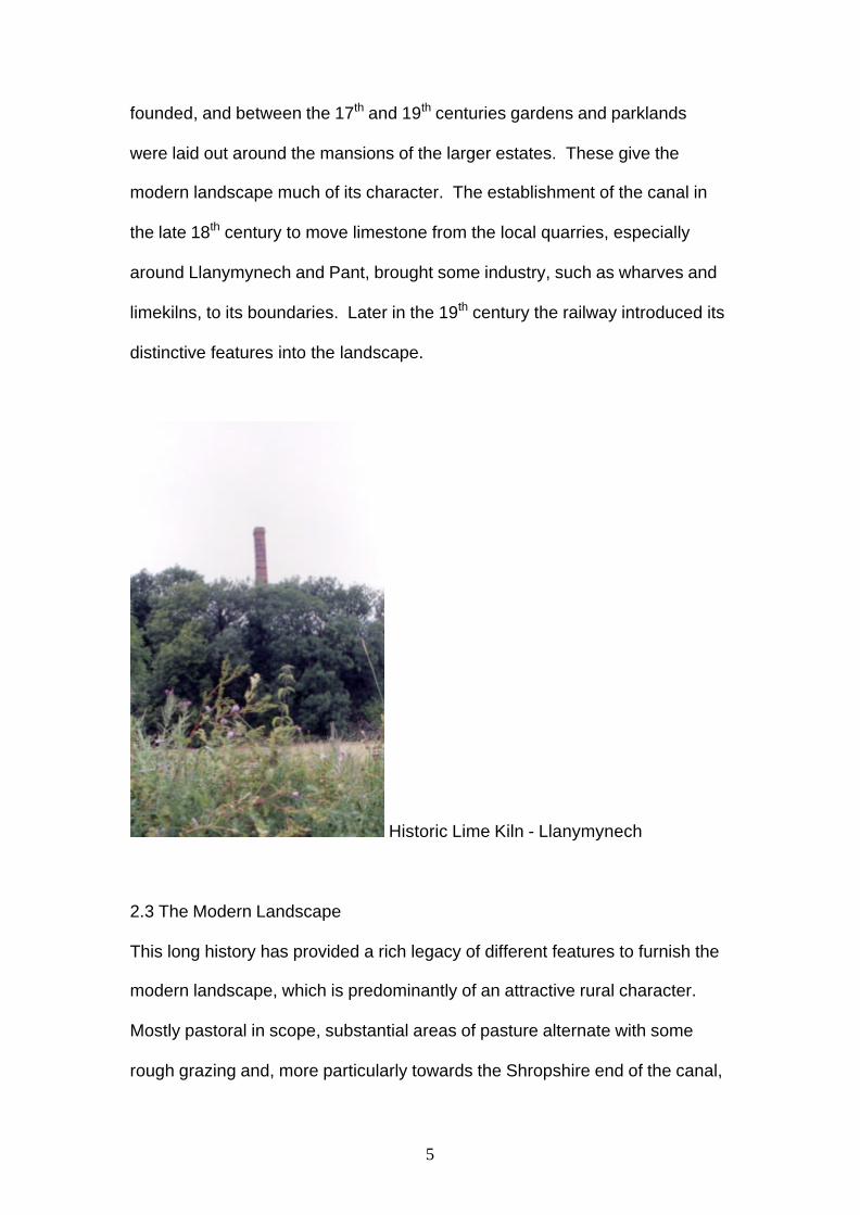
modern landscape much of its character. The establishment of the canal in
the late 18th century to move limestone from the local quarries, especially
around Llanymynech and Pant, brought some industry, such as wharves and
limekilns, to its boundaries. Later in the 19th century the railway introduced its
distinctive features into the landscape.
Historic Lime Kiln - Llanymynech
2.3 The Modern Landscape
This long history has provided a rich legacy of different features to furnish the
modern landscape, which is predominantly of an attractive rural character.
Mostly pastoral in scope, substantial areas of pasture alternate with some
rough grazing and, more particularly towards the Shropshire end of the canal,

6
an admixture of arable farming. In Shropshire the landform can be described
as gently undulating, in contrast with the more hilly landscape of Powys with
the Severn valley becoming narrower and steeper sided as it approaches
Newtown. Of significance, and marking the border between England and
Wales, are the steep and quarry scarred Breidden and Llanymynech hills.
Wooded landscape in the canal corridor
Although there is little natural woodland remaining in the region there is a
“wooded” feel to the landscape with trees in small copses, rows or hedgerows
with some mature “standard” trees in fields. The parkland mentioned above
lends a great deal to this sense of woodedness with fine mature trees lining
roads, as groves or as individual specimens. Although many of these trees
are native a substantial group of Californian Redwood, planted at Leighton
Hall, remains a significant feature of the canal landscape. The tree lined
disused railways around Llanymynech also contribute to this wooded vista.
7
Most farm boundary features are mature hedgerows containing standard
trees, with very little in the way of post and wire. The primary building
material in the region is brick with slate roofing although there are some local
stone buildings around the quarries at Llanymynech and Pant and some black
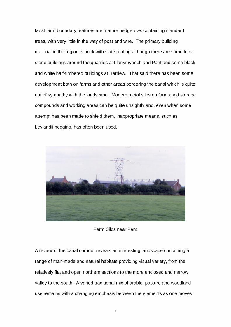
and white half-timbered buildings at Berriew. That said there has been some
development both on farms and other areas bordering the canal which is quite
out of sympathy with the landscape. Modern metal silos on farms and storage
compounds and working areas can be quite unsightly and, even when some
attempt has been made to shield them, inappropriate means, such as
Leylandii hedging, has often been used.
Farm Silos near Pant
A review of the canal corridor reveals an interesting landscape containing a
range of man-made and natural habitats providing visual variety, from the
relatively flat and open northern sections to the more enclosed and narrow
valley to the south. A varied traditional mix of arable, pasture and woodland
use remains with a changing emphasis between the elements as one moves
8
down the canal corridor. The canal complements this landscape and has
attractive features of its own.
3 . Existing landscape designations
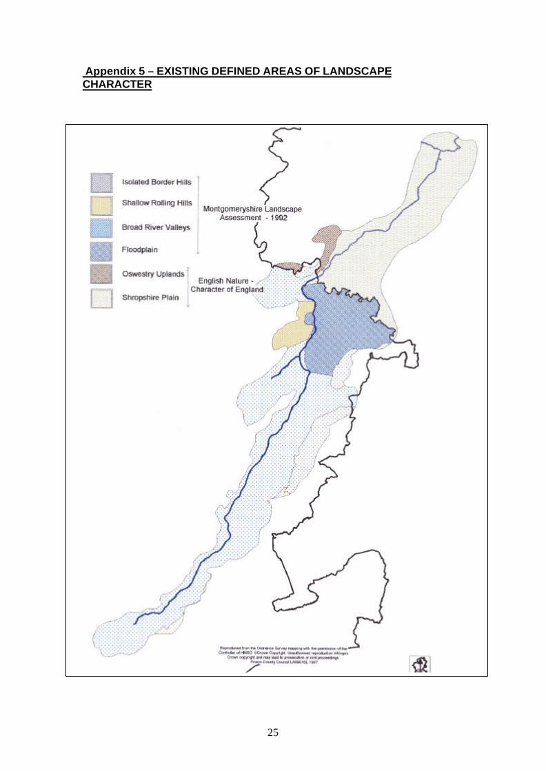
In “The Character of England” the Countryside Commission and English
Nature have defined landscape areas of distinct character. Two of these
character areas are represented in the canal corridor, the Oswestry Uplands
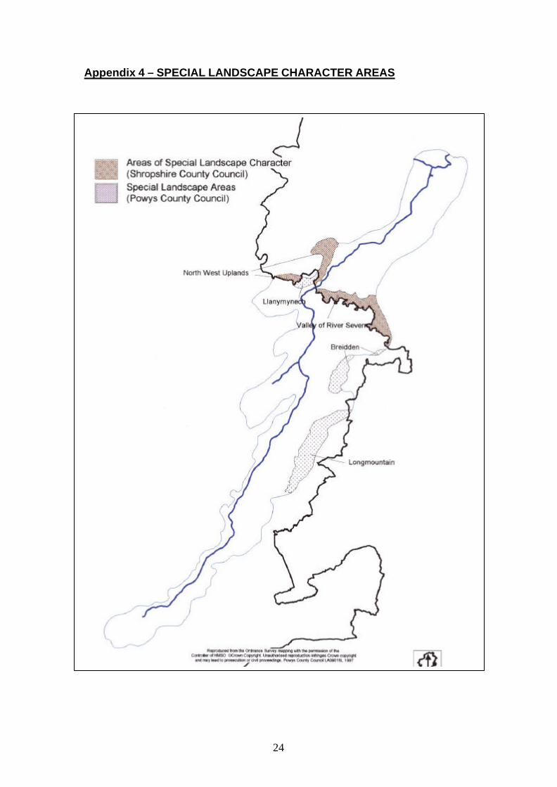
and the Shropshire Plain. In addition Shropshire County Council have
identified the valley of the river Severn as an Area of Special Landscape
Character; this also includes the valley of the Vyrnwy, a tributary of the
Severn (appendix 3 and 4).
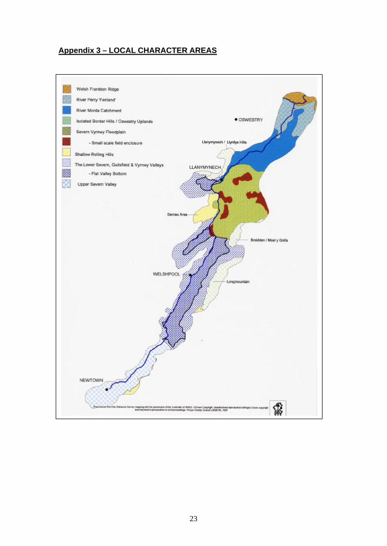
In Wales Powys County Council have identified Llanymynech Hill, The
Breiddins and Long Mountain as Special Landscape Areas within the canal
corridor. In 1992 the then Montgomeryshire District Council also identified a
number of Landscape Character Areas which are still extant (appendix 5). In
the canal corridor these are
The FloodPlain around the lower Severn and Vyrnwy valleys.
Broad River Valley including the Severn, Vyrnwy, Guilsfield, Trewern
and Camlad valleys.
Shallow Rolling Hills near Arddleen, Forden and Llanmerewig.
9
Isolated Border Hills of Llanymynech Hill, The Breiddins and Long
Mountain.
Given the historic and architectural significance of the Montgomery Canal,
support for designation of a conservation area covering the whole canal has
been given in principle by Planning Committees of the relevant Local
Authorities.
4 . Restoration
The canal and its associated historical structures, even in their current
underused state, have been an integral part of the landscape for over 200
years, providing mellow buildings and fringing hedges, trees and emergent
vegetation. Community consultation studies carried out as part of the CMS
have shown that the contribution the canal and its associated buildings make
to the existing landscape is greatly valued, both by local people and visitors to
the area. Consultation also shows that there is substantial support for
sensitive restoration of the canal to navigation and improved access for
informal leisure activities. Considerable opportunity exists for enhancement of
the landscape in the immediate vicinity of the canal, not only by the
restoration of existing structures but by creation of new, desirable, habitat
such as ponds and planting of additional hedges and native trees. A principle,
which should be born in mind when considering restoration is that a frequent
problem encountered during heritage conservation, is that the too-rigid
10
preservation of existing features may not be the best way to maintain the
meaning of a place within an evolving context. Landscapes, like organisms,
evolve over time and thus change is not necessarily a bad thing.
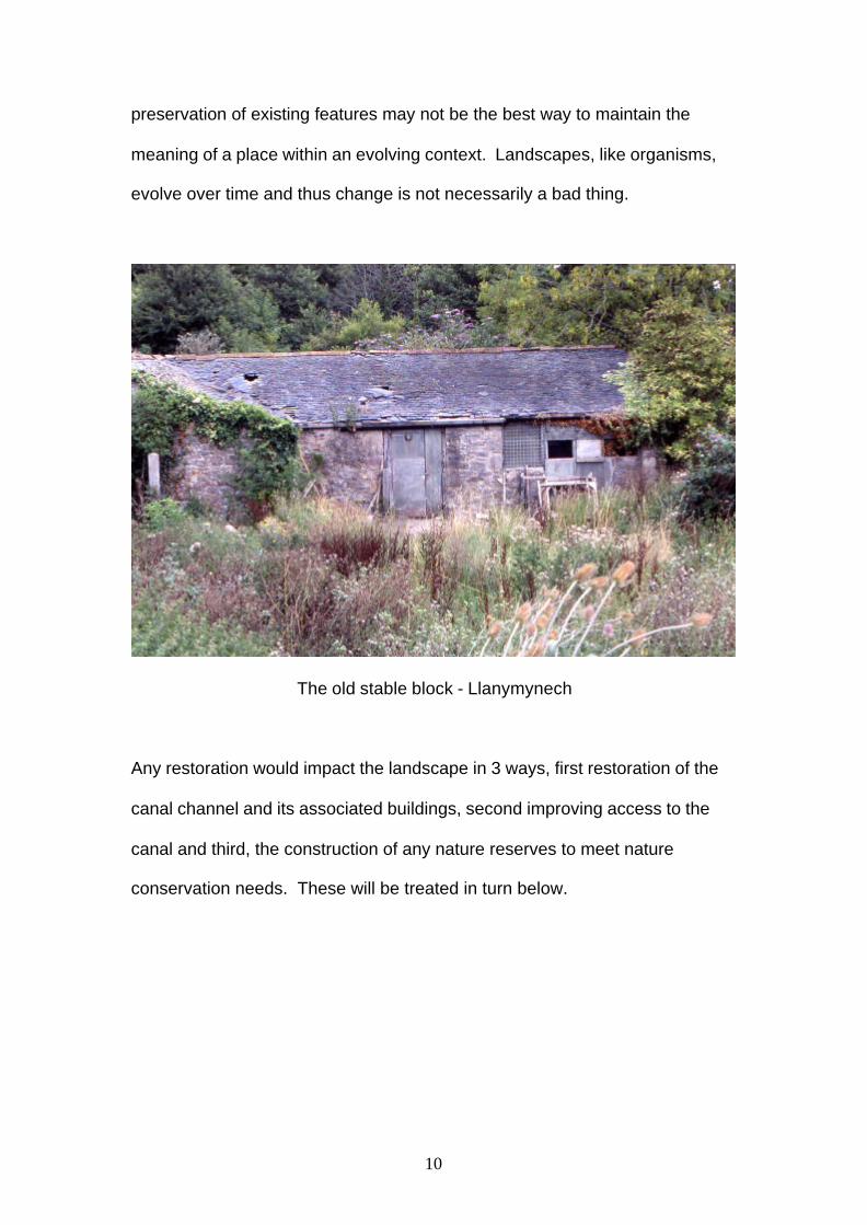
The old stable block - Llanymynech
Any restoration would impact the landscape in 3 ways, first restoration of the
canal channel and its associated buildings, second improving access to the
canal and third, the construction of any nature reserves to meet nature
conservation needs. These will be treated in turn below.
11
4.1 Restoration of the canal channel and associated structures.
As it now stands the canal is, in many areas, effectively invisible; the only sign
of its presence being the sharply humped bridges on narrow side roads.
Unless done badly restoration is unlikely to make the canal structure itself any
more conspicuous and thus perhaps the most obvious effect of canal
restoration will be the re-introduction of the canal boat into the landscape.
The predicted number of boat movements throughout is anticipated to be low
and the aesthetic appeal of colourful narrow boats will, it is felt, add to rather
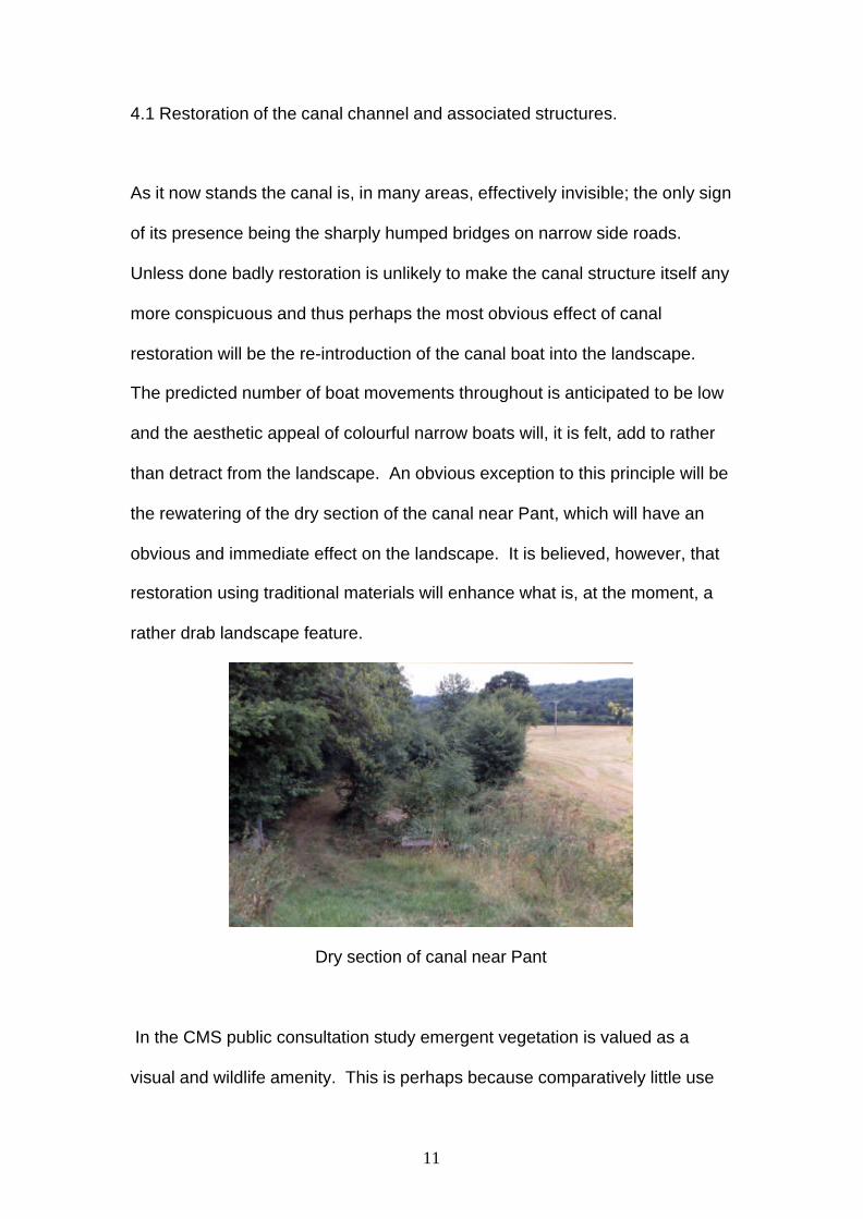
than detract from the landscape. An obvious exception to this principle will be
the rewatering of the dry section of the canal near Pant, which will have an
obvious and immediate effect on the landscape. It is believed, however, that
restoration using traditional materials will enhance what is, at the moment, a
rather drab landscape feature.
Dry section of canal near Pant
In the CMS public consultation study emergent vegetation is valued as a
visual and wildlife amenity. This is perhaps because comparatively little use
12
is made of the canal by fishing interests who, traditionally, dislike anything
which is likely to snag or tangle their equipment. The “Built Heritage”
requirements recommend that the canal channel be restored using a
traditional clay puddle lining which will give ample scope for the growth of
marginal vegetation. There is, however, a potential problem of soft edges
crumbling due to excessive stock poaching in some areas. The introduction
of standard metal reinforcement to these areas would radically change the
look of the bank as it does not normally support emergent vegetation and here
alternatives should be sought. Where access for cattle is essential then
woven brushwood supports could be considered, these provide strength to
the bank whilst trapping silt and thus providing secure rooting for emergent
vegetation. Where animal access is not such an issue then buffer zones
fenced off from stock will be favoured. Whilst additional emergent vegetation
will change the look of the canal in the landscape it would, it is felt, not be
visually out of place as well as providing nesting places for canal side birds
and additional food and shelter for insects and their larvae. It should be
remembered here that the public set great store by the swan population of the
canal.
Where a hard edge is appropriate, such as in urban areas or on the
approaches to bridges or aqueducts, then traditional materials are to be
recommended. Whilst initially somewhat “raw” in appearance natural stone
and brick will mellow over time to provide a pleasing addition to the
landscape. Sheet piling on the other hand is often visible above the surface
of the water and can be very obtrusive.
13
The major feature, which ensures that the canal blends sympathetically with
the surrounding landscape, is the nature of its boundary. For much of its
length the boundary of the Montgomery canal is hedgerow and it is the height
and continuity of this which gives the canal is character both as seen from the
outside and as seen by the user. It is almost always a mixed deciduous
hedge with standard trees, which complements the field hedges of the
surrounding landscape. Any alterations to the boundaries, such as the
creation of buffer zones on the offside, should be fenced by deciduous hedge
laid in accordance with local practice, and where necessary, farmers should
be encouraged to do this. In addition the planting of native trees should
always be considered in any hedge run as, particularly in Wales, they are
greatly desired under the various farm management schemes. This may be
particularly appropriate as a replacement for any willow scrub which has to be
cleared as part of the conservation process. The design and construction
materials of detail features, such as gates and stiles, should also be in
keeping with their surroundings.
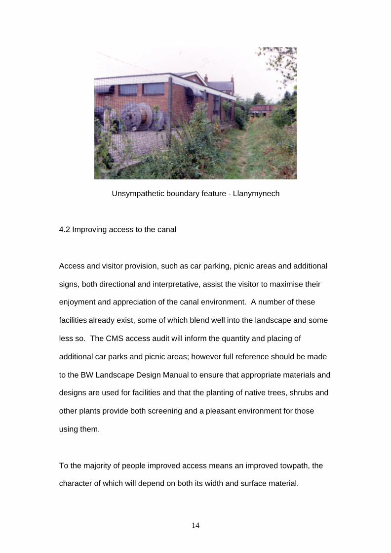
A particular problem arises when boundary features are in private ownership,
many of which may be constructed of unsympathetic materials and/or be in
need of repair. Here consideration should be given to setting aside funds to
help towards repair or replacement with materials more in keeping with the
local landscape. At the same time the opportunity could be take to screen off
unsightly contractors yards or farm outbuildings.
14
Unsympathetic boundary feature - Llanymynech
4.2 Improving access to the canal
Access and visitor provision, such as car parking, picnic areas and additional
signs, both directional and interpretative, assist the visitor to maximise their
enjoyment and appreciation of the canal environment. A number of these
facilities already exist, some of which blend well into the landscape and some
less so. The CMS access audit will inform the quantity and placing of
additional car parks and picnic areas; however full reference should be made
to the BW Landscape Design Manual to ensure that appropriate materials and
designs are used for facilities and that the planting of native trees, shrubs and
other plants provide both screening and a pleasant environment for those
using them.
To the majority of people improved access means an improved towpath, the
character of which will depend on both its width and surface material.
15
Walkers generally require an even surface free from too much irregularity and
regularly mown – this is the situation on most of the towpath at present. To
improve disabled access, and access for those with young children, would
require ramps and a firmer surface, such as crushed stone, giving the towpath
a much harder appearance. This requirement would become even more
apparent were the towpath to be opened to cyclists where width, too,
becomes a serious consideration. The provision of towpath seating, another
desideratum from consultation studies, could be visually intrusive and
individual consideration will have to be given on each section of the canal
where it is installed to ensure that both design and material are in keeping
with local character. Paradoxically, the needs of the boater would have far
less visual effect on the margin as his requirement is just for a hard and stable
mooring with the rest of the canal as appealing as possible.
A more problematic, and potentially intrusive, aspect of improved access is
the provision of marinas and their associated development. A policy decision
will need to be made as to the size and siting of marinas – a presumption in
favour of small marinas and/or offside moorings is recommended. A few large
marinas would probably have most visual effect on the landscape, albeit
confined to just 2 or 3 areas, whereas a larger number of smaller marinas and
moorings would, although probably less individually intrusive, spread the
visual effect over a greater area of the landscape. Large marinas would also
probably attract other development, outside the control of British Waterways,
which could have a significant impact on the landscape. Indeed at least one
major marina development together with associated buildings and a housing
16
development, has already been proposed. This in turn would increase and
concentrate visitors and road traffic. British Waterways should consider
working with local planning authorities to ensure that any development is
tasteful and harmoniously integrated with any planned restoration work.
The visual impact and increased noise arising from changes to roads,
resulting from the need to raise and/or re route lowered bridges, are likely to
be the single most intrusive landscape factor in the project. Much thought and
work with local authorities and the highways agency will be needed to ensure
that this is reduced to a minimum. For example the option of less convenient
but less visually intrusive drop locks may be a solution to some dropped
bridges.
4.3 The provision of nature reserves.
Nature conservation concerns dictate that canal restoration, especially in
Wales, is accompanied by the provision of off-line nature reserves. These will
have a considerable visual effect on the landscape, as they will add several
hectares of additional open water and related vegetation. Provided that such
reserves are fenced in accordance with local practice they cannot but
enhance the landscape, as a number of existing reserves already
demonstrate. Additional open water is a desideratum in farm management
schemes in both England and Wales both to create new Biodiversity sites and
additional landscape features. There is considerable scope here, too, for the
planting of native hardwood trees to screen the reserves and provide an
17
additional landscape resource. The presumption will be that any reserves
which are accessible from the towpath or adjoining roads, are open to the
public and that appropriate access provision will be made. There is scope
here for work with local farmers to allow some farm diversification so that they
can provide additional visitor facilities on reserves.
5 . Additional Opportunities
Farm stewardship schemes along the English section of the canal corridor are
proceeding apace thanks to the work of the Severn Vrnwy Project.
Stewardship generally can improve the look of a landscape and encouraging
farmers with land adjacent to the canal to participate in the scheme could lead
to significant improvements in the canal boundary features as well as
improving the water quality in the canal for wildlife. As indicated above there
will be a requirement to create new wildlife habitat as part of the project and
this could be carried out in conjunction with farmers under a Severn Vrnwy
Project initiative, which encourages farmers who do not wish to take up
stewardship to manage specific fields for wildlife. Although presently confined
to Shropshire, it is the intention to extend the scope of the Severn Vrnwy
initiative to Powys.
At the moment there is less opportunity on the Welsh side of the border to
integrate with Tir Gofal. Most of the uptake for phases 1 and 2 was in
Snowdonia and there has been comparatively little uptake in the canal
corridor in phase 3. In the opinion of the Powys office there will be
18
considerably more scope for local initiatives from phase 5 (2005) onwards. Of
special interest will be the Tir Gofal “Streamside Corridor” scheme; a 7m wide
buffer zone next to watercourses, to be fenced off with hedging. Tir Gofal
also encourages the planting of native hardwoods in fields, which may be of
interest in our nature reserve development.
Although not a direct result of canal restoration one additional proposal which
could have a major impact on the landscape would be the re-creation of
additional wetland habitat. It has been suggested that, in tandem with canal
restoration, funds be made available for the re-creation of up to 30 ha of
wetland habitat on the floodplain of the River Severn. Shallow pools, which
may be scoured by winter flooding, are one of the natural habitats of Luronium
natans, and would be ideal for both breeding and wintering wading birds,
which are becoming of increasing conservation concern due to the loss of a
great deal of their inland habitat. Such work would thus have the dual benefit
of conservation for a variety of species as well as providing more of a
desirable habitat, giving additional variety, and value, to the local landscape.
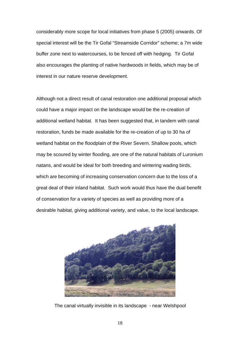
The canal virtually invisible in its landscape - near Welshpool
19
References:
Recent local landscape appraisal studies include:
The Clwyd-Powys Archaeological Trust (2003). LandscapeArchaeology Assessment.
English Nature (2003). Natural areas and their role. 41 OswestryUplands. 42 Shropshire Hills.
Shropshire County Council (2003). Shropshire Landscape CharacterAssessment.
Powys County Council (1998). Landscape appraisal of theMontgomery Canal and its visual corridor.
Evison, S (1997). Oswestry Hills Landscape Study.
Countryside Agency Character Areas
British Waterways Landscape Design Manual – Volume 3
20
Appendices:
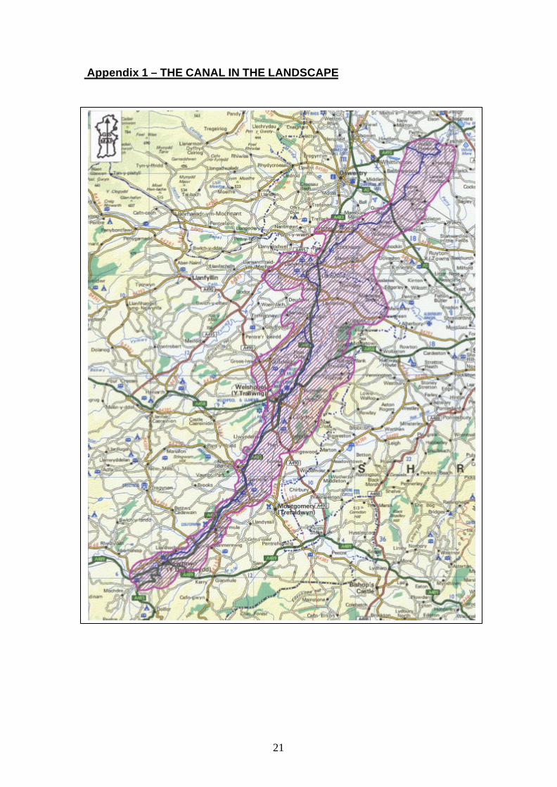
Appendix 1 – THE CANAL IN THE LANDSCAPE
Appendix 2 – NATURAL AND SEMI- NATURAL WOODLAND IN THE WIDERCANAL CORRIDOR
Appendix 3 – LOCAL CHARACTER AREAS
Appendix 4 – SPECIAL LANDSCAPE CHARACTER AREAS
Appendix 5 – EXISTING DEFINED AREAS OF LANDSCAPE CHARACTER
21
Appendix 1 – THE CANAL IN THE LANDSCAPE
22
Appendix 2 – NATURAL AND SEMI- NATURAL WOODLAND IN THEWIDER CANAL CORRIDOR
23
Appendix 3 – LOCAL CHARACTER AREAS
24
Appendix 4 – SPECIAL LANDSCAPE CHARACTER AREAS
25
Appendix 5 – EXISTING DEFINED AREAS OF LANDSCAPECHARACTER


![Download Brochure [PDF/1.1MB]](https://img.pdfslide.us/doc/110x75/588328931a28ab96198bbc7c/download-brochure-pdf11mb.jpg)