Embed Size (px)
Citation preview
U.S. Department of the InteriorU.S. Geological Survey
Fact Sheet 2019–3008 ver. 1.2, April 2020
Quick Facts
Science instruments: OLI–2; TIRS–2OLI–2 built by: Ball Aerospace & Technology CorporationTIRS–2 built by: NASA Goddard Space Flight CenterDesign life: 5 yearsSpacecraft provider: Northrop Grumman Image data: About 750 scenes per dayTarget launch date: Mid-2021Launch vehicle: United Launch Alliance Atlas V 401Orbit: Near-polar, sun-synchronous at an altitude of 438 miles (705 kilometers)Orbital inclination: 98.2 degreesSpacecraft speed: 16,760 miles per hour (26,972 kilometers per hour),Consumables: 10+ years
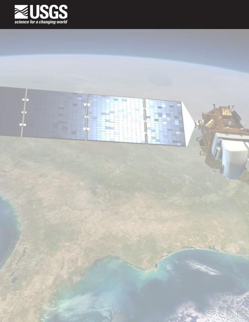
Landsat 9Landsat 9 is a partnership between
the National Aeronautics and Space Administration (NASA) and the U.S. Geological Survey (USGS) that will continue the Landsat program’s critical role of repeat global observations for monitoring, understanding, and manag-ing Earth’s natural resources. Since 1972, Landsat data have provided a unique resource for those who work in agricul-ture, geology, forestry, regional planning, education, mapping, and global-change research. Landsat images have also proved invaluable to the International Charter: Space and Major Disasters, sup-porting emergency response and disaster relief to save lives. With the addition of Landsat 9, the Landsat program’s record of land imaging will be extended to over half a century.
Landsat 9 Spacecraft and Launch Components
The Landsat 9 spacecraft and instruments are being developed towards a launch-readiness date of mid-2021 (fig. 1). Landsat 9, like previous mis-sions, will be launched from Vandenberg Air Force Base, California, onboard a United Launch Alliance Atlas V 401 rocket. Landsat 9 will carry the Opera-tional Land Imager–2 (OLI–2), built by Ball Aerospace & Technologies Corpora-tion, Boulder, Colorado, and the Thermal
Infrared Sensor–2 (TIRS–2), built at the NASA Goddard Space Flight Center, Greenbelt, Maryland. Northrop Grumman is designing and fabricating the space-craft and will be responsible for integrat-ing the two instruments.
NASA is responsible for the space segment (instruments and spacecraft/observatory), mission integration, launch, and on-orbit checkout. The U.S. Depart-ment of the Interior/USGS is responsible for the ground system, flight operations, data processing, and data product distri-bution after NASA completes on-orbit checkout.
After launch, Landsat 9 will move into the current orbit of Landsat 7, which has sufficient fuel to operate into 2021,
and will subsequently be decommis-sioned. Landsat 9 will image the Earth every 16 days in an 8-day offset with Landsat 8. Landsat 9 will collect as many as 750 scenes per day, and with Land-sat 8, the two satellites will add nearly 1,500 new scenes a day to the USGS Landsat archive. Landsat 9 will increase the volume of the USGS archive by imaging all global landmasses and near-shore coastal regions, including islands at solar elevation angles greater than 5 degrees that were not always routinely collected prior to Landsat 8.
Phase A
Key decision point D
Key decision point E
Launch
Key decision point B
Key decision point C
Phase CLaunch+3 months:
Operational datacollection begins
Landsat 9 design life: 5 years
End of consumables:≥10 years
Thermal Infrared Sensor–2 (TIRS–2) Instrument development
Operational Land Imaging Sensor–2 (OLI–2) Instrument development
Spacecraft development
Ground system and operations development
Observatory integration and testing
Phase B Phase D
Phase E
2015 2016 2017 2018 2019 2020 2021
2015 2016 2017 2018 2019 2020 2021
Figure 1. A timeline of Landsat 9 mission development and life cycle. Image modified from NASA Landsat; used with permission.
Printed on recycled paper

Landsat 9 InstrumentsThe instruments onboard Landsat 9
are improved replicas of those currently collecting data onboard Landsat 8, which are already providing data that is radio-metrically and geometrically superior than instruments on previous generation Landsat satellites.
The OLI–2 will capture observa-tions of the Earth’s surface in visible, near-infrared, and shortwave-infrared bands (table 1; fig. 2) with an improved radiometric precision (14-bit quantization increased from 12 bits for Landsat 8), slightly improving overall signal to noise ratio. The TIRS–2 will measure the thermal infrared radiation, or heat, of the Earth’s surface with two bands that have improved performance over Landsat 8’s thermal bands (table 1; fig. 2). Both OLI–2 and TIRS–2 have a 5-year mission design life, although the spacecraft has 10+ years of consumables.
Landsat 9 Data ProductsData acquired by Landsat 9 will be
consistent with currently archived data in terms of acquisition geometry, calibra-tion, coverage, and spectral character-istics. All Landsat 9 data products will continue to be made available for down-load through the USGS Earth Resources Observation and Science (EROS) Center at no charge.
Table 1. Landsat 9 Operational Land Imager–2 and Thermal Infrared Sensor–2 spectral bands.
Spectral bandWavelength,
in micrometersResolution, in meters
Operational Land Imager–2
Band 1—Ultra blue (coastal/aerosol) 0.435–0.451 30
Band 2—Blue 0.452–0.512 30
Band 3—Green 0.533–0.590 30
Band 4—Red 0.636–0.673 30
Band 5—Near infrared (NIR) 0.851–0.879 30
Band 6—Shortwave infrared (SWIR) 1 1.566–1.651 30
Band 7—Shortwave infrared (SWIR) 2 2.107–2.294 30
Band 8—Panchromatic 0.503–0.676 15
Band 9—Cirrus 1.363–1.384 30
Thermal Infrared Sensor–2
Band 10—Thermal infrared (TIR) 1 10.60–11.19 100a
Band 11—Thermal infrared (TIR) 2 11.50–12.51 100a
aThermal bands are acquired at 100 meters resolution but are resampled to 30 meters.
}}
}
}}
}}MSS
OLI/OLI–2
TIRS/TIRS–2
ETM+
TM
Wavelength, in nanometers
400
Atm
osph
eric
tran
smis
sion
, in
perc
ent
0
1
1
1
1° 2° 3° 4°
2
2
2
3
3
3
4
4
4
5
5
5
96 7
6
6
10 11
7
7
8
8
100
900 1,400 1,900 2,400 10,000 11,000 12,000 13,000
Figure 2. Comparison of Landsat 9’s spectral band regions with Landsat 1–5 Multispectral Scanner System (MSS), Landsat 4-5 Thematic Mapper (TM), and Landsat 7 Enhanced Thematic Mapper Plus (ETM+). The atmospheric transmission values for this graphic were calculated using the MODerate resolution atmospheric TRANsmission model for a summertime midlatitude hazy atmosphere (circa 5-kilometer visibility). Numbered rectangles indicate the band number for that particular instrument. Image modified from NASA Landsat; used with permission.
For More InformationFor additional information or to learn more about Landsat 9, please visit the USGS or NASA websites at https://usgs.gov/landsat or https://landsat.gsfc.nasa.gov/.
Visit https://www.usgs.gov/ for more information about the USGS and https://www.usgs.gov/land-resources/national-land-imaging-program for specifics about the National Land Imaging Program.
Questions about Landsat operations, data products, and data access can be directed to: Landsat User Services U.S. Geological Survey Earth Resources Observation and Science (EROS) Center 47914 252d Street Sioux Falls, SD 57198 Phone: 605–594–6151 or 1–800–252–4547 Email: [email protected] Twitter: @USGSLandsat Facebook: https://www.facebook.com/NASA.Landsat
ISSN 2327-6916 (print)ISSN 2327-6932 (online)https://doi.org/10.3133/fs20193008


![[PPT]PowerPoint Presentation - The Committee on Earth ...ceos.org/document_management/Meetings/Plenary/30... · Web viewNASA GSFC • USGS EROS Landsat 9 KDP-B APMC August 17, 2016](https://img.pdfslide.us/doc/110x75/5aa514a77f8b9a517d8cc7ae/pptpowerpoint-presentation-the-committee-on-earth-ceosorgdocumentmanagementmeetingsplenary30web.jpg)