Embed Size (px)
Citation preview
Land Use Element Page ��
Land Use cottsdale is first and foremost a residential community and Southwest tourist destination where the diversity and arrangement of land uses is designed to enhance quality of life and ensure long-term prosperity. Our land uses must complement each other visually, aesthetically, socially, and economically. We will protect large, unspoiled portions of our mountain and desert areas, as well as view corridors to those areas. We will avoid conflicting, damaging, or otherwise unwanted land uses from compromising the overall character of a site, a neighborhood, or the community. Scottsdale will ensure a variety of living, working, and leisure opportunities through different land uses, vital neighborhoods, thriving business and tourism communities, and open spaces for people to recreate, reflect, and enjoy.
SVI
SION
STAT
EMEN
T
Introduction
Scottsdalehasevolvedandgrownsinceitsfoundinginthelate1800’sanditsincorporationin1951.Startingasasmallresidentialcommunitysprinkledwithfarmsandcitrusgroves,throughgrowthcycles(thataffectedtheentirePhoenixmetroarea),annexationsoflargeareasofunincorporatedlands,preservationofnaturalenvironmentthroughtheHillsideandEnvironmentallySensitiveLandsOrdinances,andconcentrationsofresortuses,arts,tourismandculturalfacilities,Scottsdalehasbecomeacommunitythatfeaturesavarietyoflandusescontributingtoadiverseeconomy,uniquecommunitycharacter,andanationalreputationforquality.
Currently,Scottsdale’splannedandexistinglandusesaredistributedasfollows. (The figures are approximations and don’t equal 100% due to other uses,suchasstreetsandeasements.):
· Residentialuses 54%· OpenSpace 30%· Commercial 2.5%· Cultural/Institutional 2.4%· Employment 1.8%· Office 1%· Resort 1%· Utilities .8%· MixedUse/Downtown .5%
see Introduction section, pages ��-��
Page �� Scottsdale �00� General Plan
Preservation effortsThetremendousgrowthcycleofthemidtolate1990’sledtoastrongcommunitydesiretopreservelargeexpansesofSonoranDesert,particularlyinandaroundtheMcDowellMountains.Duringthistimeperiod,Scottsdaleemergedasaleadingcommunityinthepreservationofnaturalopenspacewiththeanticipationofpreservingonethirdofitslandmassinanaturalpreserve(calledtheMcDowellSonoranPreserve)linkingtheMcDowellMountainswithMcDowellMountainRegionalParktotheeast,theTontoNationalForesttothenorthandthecityofPhoenixopenspacenetworkstothewest.
Regional employment centerInrecentyears,thedevelopmentofthePimaFreeway(101)hascontributedtoamoreconcentratedmixed-uselandusepatternalongthiscorridor.TheScottsdale Airpark has emerged as one of the most significant employment coreswithintheStateofArizona.Theseregionallandusesalongwiththecity’slandpreservationeffortshavecontributedtoScottsdale’sstrongeconomy,whichinturncontributestoahighqualityoflifeforitsresidentsandvisitors.
Employment and retail hubScottsdaleisregardedasasuburbofPhoenix,butunlikethetypicalsuburbancommunity,itisanetimporterofemploymentandservesasaregionalretailcenter.HouseholdsizesaretypicallysmallerthaninothercommunitiesintheValley,andhouseholdincomesarehigherthanmostcommunitiesinthearea.Becauseoftherelativescarcityofservicesinsomeareasadjacenttothecity,residentsoutsideofthecityheavilyuseScottsdale’sretailcenters,parks,employmentcenters,andlibraries.
ResortsScottsdaleisthemajorresortcenterofthemetropolitanarea.Althoughnotalllocalmajorresortsarelocatedinthecity,Scottsdalecontainsthecoreofspecialtyshopping,artgalleries,andrecreationalfacilities,andmanyoftheculturalandsportingeventsthatattractandsustainthelocaltourismindustry.Preservingthequalityofthecity’svisualenvironmentisanimportantcomponentofmaintainingthisindustry.
Land Use PatternsNowandinthefutureitisimportantthatlandusepatternsarefosteredthathelpconservenaturalresources,reducethedependenceontheautomobileandalleviate traffic congestion, contribute to the character of the community, and adequatelyservetheneedsofthecitizens.Landusedecisionsmusttakeintoconsiderationtherelationshipofadjacentlandusestosensitivelyintegrateproposedlanduseswithexistingnaturalandphysicalenvironments.
Land Use Element Page ��
Character-based General PlanningAsaresultofCityShape2020recommendations,ScottsdalehasimplementedCharacter-basedGeneralPlanning.TheCharacter-basedGeneralPlanconsistsoftheSixGuidingPrinciplesandastructurethatcontainsthreedistinctandinterrelatedlevels.TheLandUseElementandalltheElementsoftheGeneralPlanapplytothecitywidelevelofplanning.Citywideplanningincorporatesallpoliciesthatapplytothecityasawhole.MoredetailedplanningisfoundattheCharacterAreaandNeighborhoodplanninglevels.Insomecases,specific land use considerations may be better addressed at the Character andNeighborhoodplanninglevels,insteadofthecitywideGeneralPlanlevel.CharacterareaandNeighborhoodplanningwillensurethatqualityofdevelopmentandconsistencyofcharacterdriveScottsdale’sGeneralPlanattheCharacterPlanandNeighborhoodlevels,withinthecontextofcommunity-widegoalsandthecitywideGeneralPlan.TheLandUseElementgivesbroadgoals,andgeneraldirectionforthecity’slandusedistributionandrelationships.
The Land Use ElementTomaintainacommunitywithahealthyeconomicbaseandprovideservicesforourresidentsandvisitors,adiversityoflandusesshouldbeprovidedthatincludeschools,parks(bothactiverecreationareasandpassiveopenspace)communitycenters,residentialusesfordifferentsocialeconomiclevels,andretail,commercialandemploymentcenterstoservetheseresidentialareas.Publicinfrastructure,suchasstreets,trails,paths,water,sewerandutilities,areneededtoservetheselanduses.TheLandUseElementanditsmapsindicatethegeneraldistribution,location,type,andrelationshipofalloftheselanduses.
TheLandUseElementestablishesthegeneralpolicesforthetypesandlocationoflandusesthroughoutthecity.TheZoningOrdinanceimplementsthesepoliciesbyestablishingthelegalparametersforthedevelopmentofaparcelofland.ThepolicieswithintheLandUseElementfocusonthreedistinctivebutinterrelatedlevels:regionalrelationships,citywiderelationships, and local relationships. This hierarchy helps define Scottsdale’s rolewithinthemetropolitanarea,reinforceScottsdale’squalityoflifeanddefines policies that sensitively integrate and balance land uses into the local naturalandphysicalenvironments.AlthoughtheLandUseElementisoftenthemostvisibleelementoftheGeneralPlan,itisonlyonepartoftheGeneralPlan.CoordinationbetweenandamongalloftheGeneralPlanElementsisrequiredtohaveacomprehensivepolicydocumentthatspeakstothefutureneedsofthecommunity.
TheLandUseElementissimilartootherElementswithintheGeneralPlaninthatitillustratesacommondirectionorvision.Thiscitizen-initiatedvisionmaychangeovertimeduetochangesinamaturingcommunity.TheGeneralPlan must be refined over time to reflect these changing community needs.
see the Scottsdale Values and Vision section
see the Character and Design Element
Page �0 Scottsdale �00� General Plan
Major General Plan AmendmentsIn2000,theArizonaStateLegislaturerevisedthestatutesregardingmajorGeneralPlanamendments.The“GeneralPlan”sectioninthePrefaceoutlinesthecriteriatodetermineifaproposedchangeisa“majoramendment”totheGeneralPlanandwhatprocessisrequiredtomakeamendmentstothePlan.ThefollowingcriteriaformajorGeneralPlanamendmentswereadoptedbytheCityCouncilinFebruary2001.
Criteria for a Major Amendment to the General Plan(City Council approved 2/6/01 and revised to reflect the land use designations of the updated Conceptual Land Use Map)
Scottsdale’s Mission: Inguidingtheformationofthemajoramendmentcriteria,itisimportanttoconsiderthemajormissionelementsofthecity,thesebeing–
a. PreserveScottsdale’suniquesouthwesterncharacter,b. Planforandmanagegrowthinharmonywiththenaturaldesert
surroundings,c. Promotethelivabilityofthecommunity,d. Enhanceandprotectneighborhoods,ande. Ensureandsustainthequalityoflifeforallresidentsandvisitors.
Proposedchangestothelanduseelementofthecity’sGeneralPlanthatcompromisethespiritandintentofthesemissionstatementswillqualifyforconsiderationasamajoramendmenttotheGeneralPlan.
Scottsdale’s Land Use Element: Itisimportantthatasproposalsareconsideredinregardtothefollowingcriteriathatthevaluesandstructureofthelanduseelementbeusedasaguide.Thesevaluesareanimportantpartofthecity’slanduseplan:
a. Landusesshouldrespectthenaturalandman-madeenvironment,b. Landusesshouldprovideforanunsurpassedqualityoflifeforbothits
citizensandvisitors,c. LandusesshouldcontributetotheuniqueidentitythatisScottsdale,d. Landusesshouldcontributetothebuildingofcommunityunityand
cohesiveness,e. Landusesshouldworkinconcertwithtransportationsystemsinorder
topromotechoiceandreducenegativeimpactsuponthelifestyleofcitizensandthequalityoftheenvironment,
f. Landusesshouldbebalancedinordertoallowforthecommunitytoprovideadequatelive,workandplayopportunities,and
g. Land uses should provide opportunities for the design of uses to fit andrespectthecharacter,scaleandqualityofusesthatexistinthecommunity.

Land Use Element Page ��
Itisrecognizedthataproposedchangeoflanduseswithinanygivenportionofthecitymayhaveasubstantialimpactuponthebalanceoflanduseswithinthecityasawhole.TheGeneralPlanLandUseElementwasformulatedandadoptedwithfullconsiderationofthecharacterandbalanceoflandusesthatareappropriatewithinalldistinctareasofthecity.Beyondthislevelofconsideration,theplanconsiderstherelationshipsbetweenandamongthevariousplanningareasandstudiesthathavehelpedtobuildtheplan.Thisleads to a balance and pattern of land uses that reflects the community’s values,aspirationsandthecity’sstatedmission.
Character of Land Uses: Achangeintheplannedlandusesmayhaveasubstantialimpactuponthecitybytransformingthecharacterofthelanduseswithinagivenplanningarea.Thecharacterofthelandusesmaybeindicatedbythephysicalintensityoftheuseintermsofmassing,heightorrelationshipsbetweenuses;theblendingofdifferenttypesofusesandthepatternsandscaleinherenttoeach;ortherelativeamount,typeandplacementofopenspaces.Significant changes in the established land use character will be considered in determiningwhetherornotaproposalisamajoramendment.

Page �� Scottsdale �00� General Plan
To: Group A Group B Group C Group D Group E
From: LandUse PlanCategory Group A Rural Yes Yes Yes Yes Neighborhoods NaturalOpen Space Group B Suburban Yes Yes Yes Neighborhoods
Developed OpenSpace
Cultural/ Institutional orPublicUse
Group C Urban Yes Yes Neighborhoods
Resorts/Tourism
Group D Neighborhood Yes Yes Yes Commercial
Minor Office
Minor Employment
Group E Commercial Yes Yes
Office
Employment
MixedUse
RegionalUse Overlay
1. Change in Land Use Category Achangeinthelandusecategoryonthelanduseplanthatchangesthe
landusecharacterfromonetypetoanotherasdelineatedinthefollowingtable:

Land Use Element Page ��
2a. Area of Change Criteria Achangeinthelandusedesignationthatincludesthefollowinggross
acreages:
*PlanningZonesA,B 10acresormore *PlanningZoneC1,C2,DandE 15acresormore
2b. Acreage Criteria Overriding Incentives Certainexceptionstocriteriacontainedin2aare
consideredtobeintheinterestofthegeneralpublicandinkeepingwiththemissionandvaluesofthecommunity.Aproposalthatincludesanyofthefollowingconditionswillnotbeconsideredamajoramendment:• Apropertyownerinitiateddecreaseinthe
residentiallandusecategoryofunitsplannedbythelanduseelement,or
• Aproposalforachangeinthelandusedesignationthatresultsinnoincreaseintheplannednumberofdwellingunitsandincludesatleast30%moreNaturalAreaOpenSpacethanisrequiredbytheEnvironmentallySensitiveLandsOrdinanceforthepropertyandthatis:- ofsubstantialsize,thatbeingatleastseven
ormorecontiguousacres,andprotectedinsuchamannersoastobedesignatedwiththelandusecategoryofNaturalAreaOpenSpace,
- andwheresuchopenspaceprotectssensitivenaturalfeaturesandisvisuallyand/orphysicallyaccessibletothegeneralpublicanddoesnotincludelandscontainedwithinsceniccorridorsorvistacorridors,or
• AproposaltochangethelandusecategorytoCultural/Institutionalor Public Use with a municipal, public school or non-profit cultural facilitywhensuchaproposedfacilityisnotadjacenttoasingle-familylandusedesignation(designationsofRuralorSuburbanNeighborhoods)ordoesnotsharedirectaccesstoanystreetthathassingle-familyresidentialdrivewayaccesswithinone-half(1/2)mileoftheproposal.
• AproposalwithintheDowntownPlanareathatmaintainsthesamedevelopmentstandardstype(e.g.Type1,Type1.5orType2)andcontains no more than fifteen (15) gross acres or less.
see Planning Zones map on page ��

Page �� Scottsdale �00� General Plan
3. Character Area CriteriaCharacterareashavebeenaddedtothecity’splanningprocessinordertorecognizeandmaintaintheuniquephysical,visualandfunctionalconditionsthatoccurindistinctareasacrossthecommunity.Thecityrecognizesthattheseformacontextthatisimportanttothelifestyle,economicwellbeingandlongtermviabilityofthecommunity.Theseareas are identified by a number of parameters including but not limited tobuildingscale,openspacetypesandpatterns,ageofdevelopmentandtopographicsetting.
Ifaproposaltochangethelandusecategoryhasnotbeenclearlydemonstratedbytheapplicanttocomplywiththeguidelinesandstandardsembodiedwithinanapprovedcharacterareaplan,itwillbeconsideredamajoramendment.(Note:ThecharacterareaplansthatqualifyforconsiderationasofNovember,2000includetheDesertFoothillsPlan,DynamiteFoothillsPlan,CactusCorridorPlanandDowntownPlan.)
4. Water/Wastewater Infrastructure Criteria Ifaproposaltochangetheplannedlandusecategoryresultsinthe
prematureincreaseinthesizeofamasterplannedwatertransmissionorsewercollectionfacility,itwillqualifyasamajoramendment.
Land Use Element Page ��
Scottsdale Values ...
Respectforthenaturalenvironment.
Respectfortheexistingandhistoricalcontextofthebuiltenvironment.
Anunsurpassedqualityoflifeforcitizensandvisitors.
Recognitionofthecommunity’suniqueidentityandreputation.
Landuseandtransportationplanningthatcreates logical and efficient transportation optionsandpatternstohelpconnectpeopletojobs,servicesandamenities.
Arichmixofliving,working,andplayingenvironmentsthatdonotviolateorintrudeuponthevaluesthatmakeeachplaceuniqueorspecial.
Aesthetic design of uses to fit with the surrounding character and scale.
Well-sited mixed-use districts that integrate residential, retail, office, and other uses in specific areas supported by compatible infrastructure.
Goals and ApproachesRegional Context:
1. Recognize Scottsdale’s role as a major regional economic and cultural center, featuring business, tourism, and cultural activities.
• StrengthentheidentityofScottsdalebyencouraginglandusesthatcontributetothecharacterofthecommunityandsustainaviableeconomicbase.
• Encourage land uses that preserve a high quality of life and define Scottsdale’ssenseofplacewithintheregion.

Page �� Scottsdale �00� General Plan
• SupportaregionalopenspacenetworkthatcelebratesScottsdaleidentityasadesertcityandmaintainstheviabilityandconnectivityofthenaturalecosystems.
• Promotelandusesthataccommodatedestinationresortsalongwiththerecreation,retail,residential,andculturalusesthatsupporttourismactivityandsustainaresort-likelifestyle.
2. Coordinate land uses affecting regional networks (mobility, economic, and open space) with adjacent jurisdictions to maintain the integrity and efficiency of each network.
• WorkwithadjacentjurisdictionstounderstandthedynamicsoftheemergingandredevelopingareasonthebordersofScottsdale.
• Supportthelocationofregionallanduses,suchasmajoremploymentcentersalongregionalmobilitynetworks.
• Relateregionaltransportationcorridorstoregionallanduseintensities.• SupporttheregionalopenspacenetworkusingtheMaricopaAssociation
ofGovernmentsDesertSpacesPlan(1995)orfutureupdatesasabaselinetocoordinatewithadjacentjurisdictionsopenspacesystems,recreationopportunities,stormwaterdrainage,andsensitivewildlifehabitatandmigrationroutes.
Citywide Land Use Policies:
3. Encourage the transition of land uses from more intense regional and citywide activity areas to less intense activity areas within local neighborhoods.
• Ensurethatneighborhoodedgestransitiontooneanotherbyconsideringappropriatelanduses,developmentpatterns,characterelementsandaccesstovariousmobilitynetworks.
• Encouragethelocationofmoreintensemixed-usecentersandregionalemploymentcoresalongregionalnetworkswhileincorporatingappropriatetransitionstoadjoininglanduses.
• MaintainthenaturalintegrityofopenspacepreservesbyensuringdevelopmentpatternsandlandusesaresensitivelyintegratedalongtheedgesofthePreserve.
• Locateemploymentuseswhereimpactsonresidentialneighborhoodsarelimitedandaccessisavailableatcitywideandregionallevels.
• Guidegrowthtolocationscontiguoustoexistingdevelopmenttoprovidecity services in a cost effective and efficient manner.
• Encouragetransitionsbetweendifferentlandusesandintensitiesthroughtheuseofgraduallandusechanges,particularlywherenaturalorman-madebuffersarenotavailable.
see Preservation and Environmental
Planning Element
see Growth Areas Element

Land Use Element Page ��
4. Maintain a balance of land uses that support a high quality of life, a diverse mixture of housing and leisure opportunities and the economic base needed to secure resources to support the community.
• Allowforadiversityofresidentialusesandsupportingservicesthatprovidefortheneedsofthecommunity.
• EnsurethehighestlevelofservicesandpublicamenitiesareprovidedtothecitizensofScottsdaleatthelowestcostsintermsofpropertytaxesandtraveldistances.
• Supportjobs/housingbalancebyintegratinghousing,employment,andsupportinginfrastructureinmixed-usecenterslocatedatappropriatelocations.
• Provideavarietyofhousingtypesanddensitiesandinnovativedevelopmentpatternsandbuildingmethodsthatwillresultingreaterhousingaffordability.
• Maintainacitywidebalanceoflandusesthatsupportchangesincommunityvision/dynamics(establishedbyfuturecommunityvisioningprocesses)overtime.
5. Develop land use patterns that are compatible with and support a variety of mobility opportunities/choices and service provisions.
• Integratethepatternoflandusesandmobilitysystemsinwaysthatallowforshorterandfewerautomobiletripsandgreaterchoicesformobility.
• Encouragenon-motorized(pedestrianandbicycle)access/circulationwithinandtomixed-usecenterstoreducerelianceontheautomobile.
• Provideabalanceoflive,work,andplaylandusesanddevelopmentintensitiesthatenableconvenientnon-automotivetrips(pedestrianandcyclingandtransit)whereenvironmentallyandphysicallyfeasible.
• Supportthephysicalintegrationofresidentialuseswithretailusestoprovideopportunitiesforpedestrianorienteddevelopment.
• EnsureScottsdale’stransportationchoicesrespondtothelandusepatternsandlocalneighborhoodlifestyles.
• Provideaninterconnectedopenspacesystemthatisaccessibletothepublic,includingpedestrianandequestrianlinks,recreationareas,anddrainageways.
• Ensurethatbasiclevelsofenvironmentalhealthandhumanservicesareprovidedforallsocio-economiclevelswithinthecommunity.
• Encouragethatlanduseswiththehighestintensitybelocatedinareasconducivetoalternativemodesoftransportation.
see also the Community Mobility Element
see the Open Space and Recreation Elementsee the Public Services and Facilities Elementsee the Growth Areas Element
Page �� Scottsdale �00� General Plan
6. Promote land use patterns that conserve resources, such as land, clean air, water, and energy, and serve all people, within the community.
• Supporttheessentialcyclesandlifesupportfunctionsofourecosystemthroughlandusesanddevelopmentactivities.
• RespectandpreservethebiodiversityoftheSonoranDesertenvironmentindevelopment.
• Protectandrestoreessentialecosystemservicesthatmaintainwaterquality, reduce flooding, and enhance sustainable resource development.
• Encourageavarietyofcompatiblemixed-uselandusesthroughoutthecityinappropriatelocationsallowingpeopletolive,work,playandshopinthesamegeneralarea.
• Concentratefuturedevelopmentin“growthareas”andothercentersofactivity,therebydiscouragingsprawl,conservingenergy,andpromotingcommunityidentity.
• Integratelanduseandtransportationpoliciestopromoteadecreaseinvehiclemilestraveledtoreduceairpollutionandresourceconsumption,increaseinteractionamongcitizensandprovideastrongersenseofcommunity.
• Protectandrevitalizeestablishedareas/neighborhoodsbypromotingnewdevelopmentandtheadaptivereuseofexistingcommunityresourcesthatre-energizeanarea.
• Minimizeenvironmentalhazardsandprotectthenaturalcharacterofthedesertbydiscouragingdevelopmentonenvironmentallysensitivelands.
• ImplementtheacquisitionoflandfortheMcDowellSonoranPreserve.
Local Land Use Relationships:
7. Sensitively integrate land uses into the surrounding physical and natural environments, the neighborhood setting, and the neighborhood itself.
• Protectsensitivenaturalfeaturesfromincompatibledevelopment,andmaintaintheintegrityofnaturalsystems.
• Incorporateappropriatelandusetransitionstohelpintegrateintosurroundingneighborhoods.
• Focusintenselandusesalongmajortransportationnetworks(suchasthePimaFreewayandmajorarterialstreets)andinurbancenters(suchasDowntownandtheAirpark).Lessintenselandusesshouldbelocatedwithinmoreenvironmentallysensitivelands.
• Sensitivelyintegrateneighborhoodservices,schools,parks,andothercivicamenitiesintothelocalphysicalandnaturalenvironmentsbyestablishingreasonablebuffersandpreservingtheintegrityofthenaturalterrainandopenspacenetworks.
see also the Preservation and
Environmental Planning Element
see Growth Areas Element
Land Use Element Page ��
• Incorporateopenspace,mobility,anddrainagenetworkswhileprotectingthearea’scharacterandnaturalsystems.
8. Encourage land uses that create a sense of community among those who work, live, and play within local neighborhoods.
• Promotepubliclanduses,suchasparks,schoolsandothercivicusesthatactasthenucleusofneighborhoodsandpromotecommunityinteraction.
• Developandreinforcelinks(i.e.trails,paths,openspace,transit,andstreets)withinandbetweenresidential,retail,employment,recreationalandotherpubliclanduses.
• Promotedevelopmentpatternsandstandardsthatareconsistentwiththesurroundingusesandreinforceanarea’scharacter.
9. Provide a broad variety of land uses that create a high level of synergy within mixed-use neighborhoods.
• Incorporateadiverserangeofresidentialandnon-residentialusesanddensitieswithinmixed-useneighborhoods.
• Promoteresidentialusesthatsupportthescaleandfunctionofretail,commercialandemploymentuseswithintheseneighborhoods,includingthe use of mixed-use structures (retail or office on lower level and residentialusesonupperlevels).
• Encourageredevelopmentthatinvigoratesanareawhilealsorespectingthecharacterofadjacentneighborhoods.
• Encouragecompactmixed-use,pedestrianorienteddevelopmentpatterns,aturbandensities,thatlimitthedemandforparkingandunnecessaryautomobiletrips,andsupportalternativemodesofmobility.
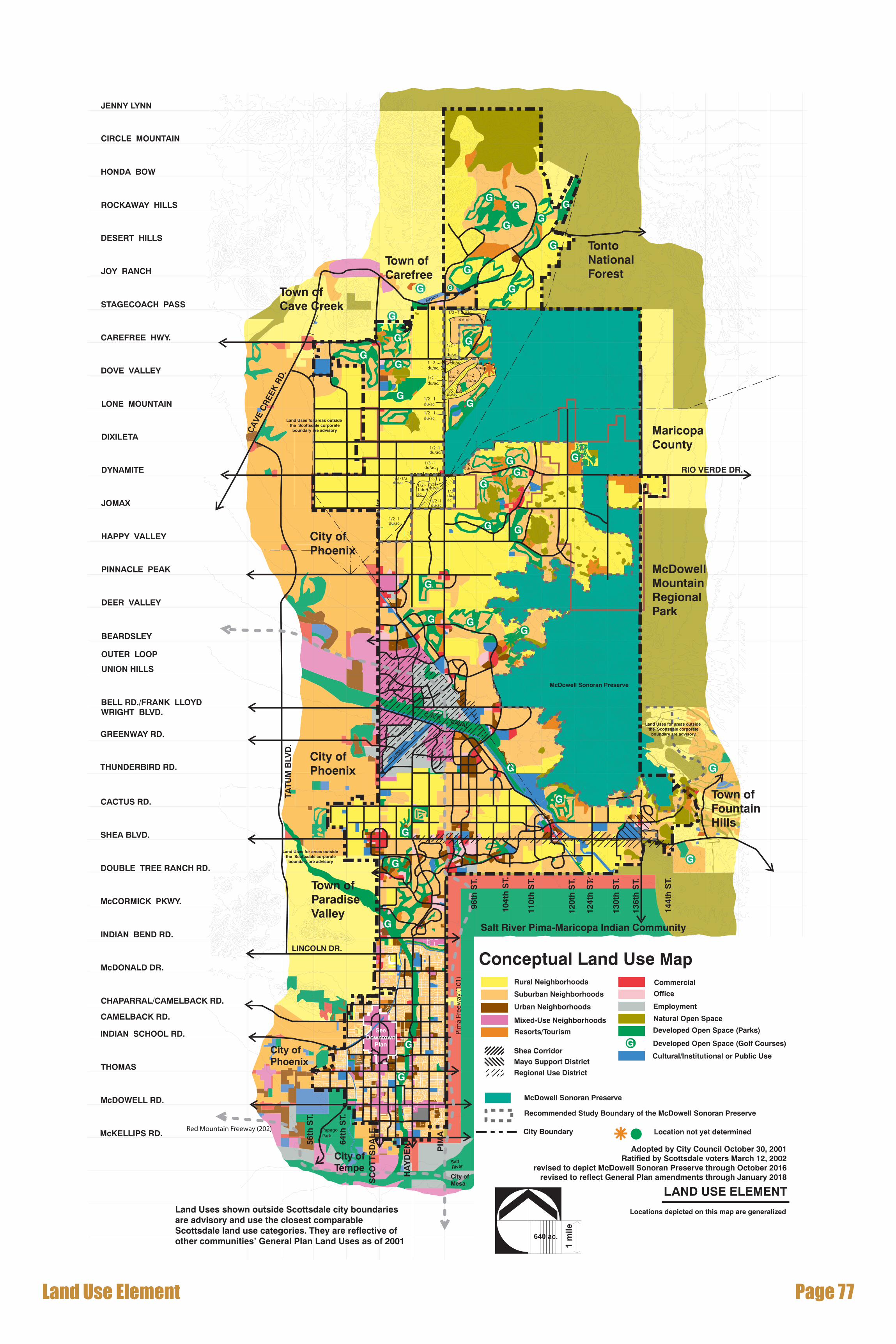
Land Use Map DesignationsThepurposeoftheLandUseElementistoencouragetheorderlyandefficient distribution of land uses in the city. A full range and mix of land uses, includingrural,suburban,andurbanneighborhoods,employment,commercial,andrecreational,cultural,andpreservationareasareprovidedintheElement.Thefollowingisadescriptionoftheselandusecategories:
“Neighborhoods” focus on a range of mostly residential classifications. Land usesaredesignatedtoaccommodateamixofdwellingtypesanddensitiesforavarietyofneighborhoodandenvironmentalconditions,andotherusesthatsupportresidentiallanduses,suchasshoppingandsmallbusiness.Zoningregulationsalsoallowalimitednumberofnon-residentialuses,suchasplacesofworship,neighborhoodparks,schools,etc.,thatprovidecommunityassets

Page �0 Scottsdale �00� General Plan
andservicesessentialtobalancedresidentialareas.Specialcareshouldbetakentoprovideadequatetransitionsbetweenusesthathavedifferentintensitiesofdevelopment.
Inthepast,manymasterplanneddevelopmentswereapprovedandbuiltinScottsdale.Master-planneddevelopmentsincludeavarietyofresidentialdensitiesordwellingtypes,buttheoveralldensityiscomparableonagrossacreagebasistothedensitiesshownontheLandUsemap.Individuallotsizesmayvaryinmaster-planneddevelopmentsduetoclusteringofdwellingsandthepreservationofsensitiveenvironmentalfeatures.Inthefuture,developmentinnewerpartsofthecitywilltendtobecomelessfocusedonmaster-plannedcommunities,sincemostlargerparcelswillalreadybecommitted.Assemblingofsmallerpropertiestoaccommodatealargermasterplanned community is still possible, however, infill development will become more significant, and redevelopment will become a major focus of activity in thecommunityinthefuture.
RURALNEIGHBORHOODS:Thiscategoryincludesareasofrelativelylargelotsingle-familyneighborhoods.DensitiesinRuralNeighborhoodsareusuallyonehouseperoneacre(ormore)ofland.Nativedesertvegetationpredominatesmanyareasandspecialcareisrequiredtopreservethearea’sopendesertcharacterandenvironmentalfeatures.Muchoftheterrainincludesgentletomoderateslopesandrollingground,intersectedbyseveralwashes.Gradingoftenrequiresextracareinareaswithmoderateslopes.Clusteringisencouragedtopreservedesertvegetation,washes,andnaturalfeatures.Someoftheseareasweredevelopedwithone-acrelotsunderMaricopaCountystandardspriortoannexationbyScottsdale.Equestrianusesandprivilegesmay exist in the flatter areas as many lots are large enough for horses and severalexistingdevelopmentspermithorsecorrals.SouthoftheC.A.P.Canal,theseneighborhoodstakeonarural,equestriancharacterwhencomparedtosurroundingareasthathavesmaller,suburbanlots.
SUBURBANNEIGHBORHOODS:Thiscategoryincludesmediumtosmall-lotsingle-familyneighborhoodsorsubdivisions.DensitiesinSuburbanNeighborhoodsareusuallymorethanonehouseperacre,butlessthaneighthousesperacre.Thiscategoryalsoincludessometownhousesandcanalsobeusedforsmalllotsingle-familyhomes,suchaspatiohomes.ItcanbeincorporatedintoneighborhoodsneartheDowntownareaandinoradjacenttoothernon-residentialactivitycenters.Theseusesmaybeusedasatransitionbetweenlessintenseresidentialareasandnon-residentialareas,such as offices or retail centers. The terrain should be relatively flat, or gently sloping,toaccommodatethisdensity.Preservationofenvironmentalfeatures(particularly
Land Use Element Page ��
indesertsettingsnearthemountains)isakeyconsiderationandinthepasthasoftenbeenaccommodatedthroughmaster-plannedcommunitiesorclustering.
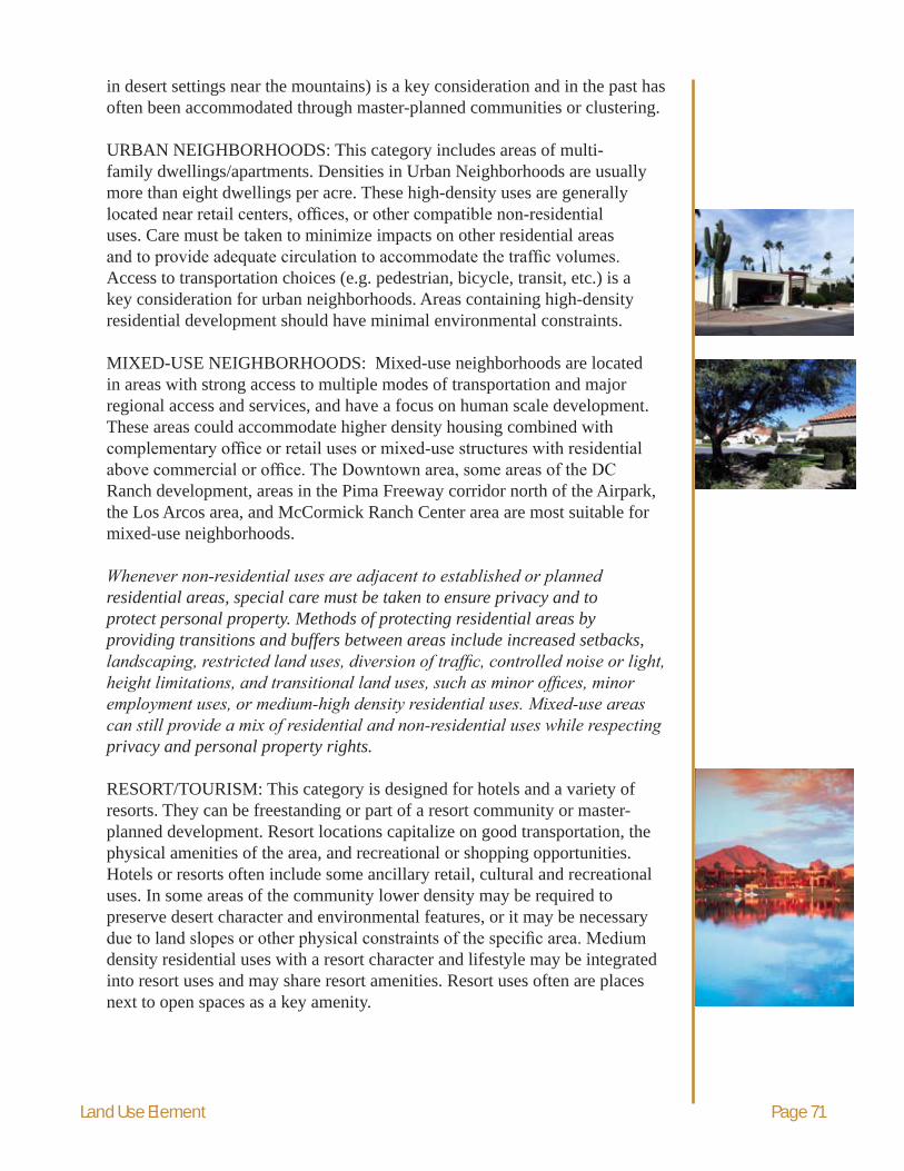
URBANNEIGHBORHOODS:Thiscategoryincludesareasofmulti-familydwellings/apartments.DensitiesinUrbanNeighborhoodsareusuallymorethaneightdwellingsperacre.Thesehigh-densityusesaregenerallylocated near retail centers, offices, or other compatible non-residential uses.Caremustbetakentominimizeimpactsonotherresidentialareasand to provide adequate circulation to accommodate the traffic volumes. Accesstotransportationchoices(e.g.pedestrian,bicycle,transit,etc.)isakeyconsiderationforurbanneighborhoods.Areascontaininghigh-densityresidentialdevelopmentshouldhaveminimalenvironmentalconstraints.
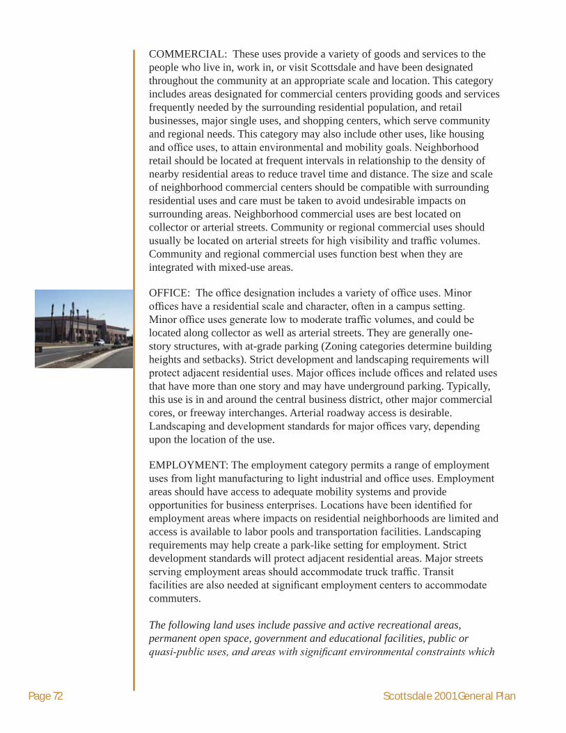
MIXED-USENEIGHBORHOODS:Mixed-useneighborhoodsarelocatedinareaswithstrongaccesstomultiplemodesoftransportationandmajorregionalaccessandservices,andhaveafocusonhumanscaledevelopment.Theseareascouldaccommodatehigherdensityhousingcombinedwithcomplementary office or retail uses or mixed-use structures with residential above commercial or office. The Downtown area, some areas of the DC Ranchdevelopment,areasinthePimaFreewaycorridornorthoftheAirpark,theLosArcosarea,andMcCormickRanchCenterareaaremostsuitableformixed-useneighborhoods.
Whenever non-residential uses are adjacent to established or planned residential areas, special care must be taken to ensure privacy and to protect personal property. Methods of protecting residential areas by providing transitions and buffers between areas include increased setbacks, landscaping, restricted land uses, diversion of traffic, controlled noise or light, height limitations, and transitional land uses, such as minor offices, minor employment uses, or medium-high density residential uses. Mixed-use areas can still provide a mix of residential and non-residential uses while respecting privacy and personal property rights.
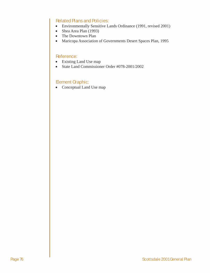
RESORT/TOURISM:Thiscategoryisdesignedforhotelsandavarietyofresorts.Theycanbefreestandingorpartofaresortcommunityormaster-planneddevelopment.Resortlocationscapitalizeongoodtransportation,thephysicalamenitiesofthearea,andrecreationalorshoppingopportunities.Hotelsorresortsoftenincludesomeancillaryretail,culturalandrecreationaluses.Insomeareasofthecommunitylowerdensitymayberequiredtopreservedesertcharacterandenvironmentalfeatures,oritmaybenecessarydue to land slopes or other physical constraints of the specific area. Medium densityresidentialuseswitharesortcharacterandlifestylemaybeintegratedintoresortusesandmayshareresortamenities.Resortusesoftenareplacesnexttoopenspacesasakeyamenity.
Page �� Scottsdale �00� General Plan
COMMERCIAL:Theseusesprovideavarietyofgoodsandservicestothepeoplewholivein,workin,orvisitScottsdaleandhavebeendesignatedthroughoutthecommunityatanappropriatescaleandlocation.Thiscategoryincludesareasdesignatedforcommercialcentersprovidinggoodsandservicesfrequentlyneededbythesurroundingresidentialpopulation,andretailbusinesses,majorsingleuses,andshoppingcenters,whichservecommunityandregionalneeds.Thiscategorymayalsoincludeotheruses,likehousingand office uses, to attain environmental and mobility goals. Neighborhood retailshouldbelocatedatfrequentintervalsinrelationshiptothedensityofnearbyresidentialareastoreducetraveltimeanddistance.Thesizeandscaleofneighborhoodcommercialcentersshouldbecompatiblewithsurroundingresidentialusesandcaremustbetakentoavoidundesirableimpactsonsurroundingareas.Neighborhoodcommercialusesarebestlocatedoncollectororarterialstreets.Communityorregionalcommercialusesshouldusually be located on arterial streets for high visibility and traffic volumes. Communityandregionalcommercialusesfunctionbestwhentheyareintegratedwithmixed-useareas.
OFFICE: The office designation includes a variety of office uses. Minor offices have a residential scale and character, often in a campus setting. Minor office uses generate low to moderate traffic volumes, and could be locatedalongcollectoraswellasarterialstreets.Theyaregenerallyone-storystructures,withat-gradeparking(Zoningcategoriesdeterminebuildingheightsandsetbacks).Strictdevelopmentandlandscapingrequirementswillprotect adjacent residential uses. Major offices include offices and related uses thathavemorethanonestoryandmayhaveundergroundparking.Typically,thisuseisinandaroundthecentralbusinessdistrict,othermajorcommercialcores,orfreewayinterchanges.Arterialroadwayaccessisdesirable.Landscaping and development standards for major offices vary, depending uponthelocationoftheuse.
EMPLOYMENT:Theemploymentcategorypermitsarangeofemploymentuses from light manufacturing to light industrial and office uses. Employment areasshouldhaveaccesstoadequatemobilitysystemsandprovideopportunities for business enterprises. Locations have been identified for employmentareaswhereimpactsonresidentialneighborhoodsarelimitedandaccessisavailabletolaborpoolsandtransportationfacilities.Landscapingrequirementsmayhelpcreateapark-likesettingforemployment.Strictdevelopmentstandardswillprotectadjacentresidentialareas.Majorstreetsserving employment areas should accommodate truck traffic. Transit facilities are also needed at significant employment centers to accommodate commuters.
The following land uses include passive and active recreational areas, permanent open space, government and educational facilities, public or quasi-public uses, and areas with significant environmental constraints which

Land Use Element Page ��
impact development. The locations for these activities are interspersed within residential and non-residential areas.
In some cases, the city does not control the location of special uses, such as schools or major transmission lines, and the state and federal government can preempt local land use authority. However, the city can work with other jurisdictions and agencies on decisions regarding land use. Every effort will be made to mitigate negative impacts, including visual impacts.
NATURALOPENSPACE:Thenaturalopenspacecategoryappliesto locations where significant environmental amenities or hazards may exist. In most cases these areas represent mountainous terrain. Significant environmentalconditionsincludesteepslopes,unstablesoils,boulderfeatures, flood hazard areas, lush desert vegetation, bedrock areas, mountain peaksandridges,naturaldrainagechannelsneededtomaintainriparianvegetation, migration routes, and historic water flows. It is intended that lands inthenaturalopenspacecategoryremainaspermanentopenspace.Thisclassification is often the result of rezoning actions where developers have agreedtoleavepartofapropertyinanaturalconditioninreturnforplacinganagreed-uponintensityinalessenvironmentallysensitivearea.Effortstopreservemountainousareas,washes,andareaswithnativedesertvegetationshouldcontinue.Avarietyofmethodscanbeusedtopreserveenvironmentallysensitiveareas,includingdensitytransfers,easements,dedicationstoaconservancyorpublicagency,andlandacquisition.Lowimpactrecreationalactivitiesaresuitableforthesesensitiveareasandmayincludehiking,equestrian,ormountainbicyclingtrails.TheEnvironmentallySensitiveLandsOrdinance(ESLO)includesdetailedprovisionsforNaturalAreaOpenSpace(NAOS),densitytransfer,andforprotectionofenvironmentallysensitivelands.
THEMcDOWELLSONORANPRESERVE:TheMcDowellSonoranPreserveconsistsofmountainanddesertlandincludedinthecity’sPreserve.Thislandgenerallypossessesoutstandingscenicvalue;valuablewildlifehabitatandmigrationroutes;lushdesertvegetation;significant environmental conditions, such as sensitivewashes,riparianareasandmountainpeaksandvalleys;archaeologicalandhistoricsites;andopportunitiesforappropriatepassiverecreationindesignatedareas.Preservelandwillremainaspermanentopenspacewithlimitedpermanentimprovements.TherecommendedstudyboundaryoftheMcDowellSonoranPreserveincludesmountainanddesertlanddesignatedbytheCityCouncilassuitableforpreservationandsomelandspreservedbyzoningactionasNAOS.

Page �� Scottsdale �00� General Plan
DEVELOPEDOPENSPACE:Developedopenspaceincludespublicorprivaterecreationareas,suchasgolfcoursesandcityparks.Somedevelopedopen space may also be used as drainage facilities for flood control. This designationappliestoIndianBendWash,theCamelbackWalk,andtheTPCandWestworldfacilities.Developedopenspacesprovideamenitiesforbothresidentsandvisitors.Theymayalsoprovidelinksbetweenneighborhoods.Theirdesignshouldintegratewithadjacentneighborhoods.Tourismandpublicusesareencouragedtolocatenexttodevelopedopenspaces.
CULTURAL/INSTITUTIONALORPUBLICUSE:Thiscategoryincludesavarietyofpublicandprivatefacilitiesincludinggovernmentbuildings,schools,privateandpublicutilities,andairports.PrivatefacilitiesincludeTaliesinWest,theMayoClinic,ScottsdaleMemorialandScottsdaleMemorialNorthhospitals.SomeareasnorthoftheC.A.P.Canalmayincludeamixtureofrecreation,tourism,destinationattraction,equestrianfacilities,hotelsorresorts,andculturalusesservingalargearea.Zoningfortheseopportunitiesshouldbebasedonademonstrationthattheprojectcanbesuccessfullycompleted,hasgoodtransportationaccess,andiscompatiblewithsurroundingareas.
OtherLandUseMapDesignations
STAR/CIRCLE:Acircleorstaronthelandusemapsmeansthatanexactlocationfortheusehasnotyetbeendetermined,buttheneedforthatusehasbeen identified in the general area.
REGIONAL USE: The regional use designation provides flexibility for land useswhenitcanbedemonstratedthatnewlandusesareviableinservingaregional market. Regional uses include, but are not limited to, corporate office, regionservingretail,majormedical,educationalcampus,communityservicefacilities,tourism,anddestinationattractionuses.Indeterminingwhetherproposedlandusesareregionalinnature,thecitywillconsiderwhethertheusehasaregionaldraw,implementscurrenteconomicdevelopmentpolicies,enhancestheemploymentcoreandthecity’sattractivenesstoregionalmarkets, benefits from good freeway access, and complements the established characterforthearea.
SHEACORRIDOR:TheSheaCorridorisindicatedalongSheaBoulevard.Within this corridor specific guidelines are in effect. Policies relating to the corridorinclude:
- Enhanceandprotecttheexistingresidentialareaswhileallowingflexibility in residential parcels having Shea frontage
- Allowemployersofferinguses,suchasmedicallyrelatedservices,corporateheadquarters,orhotelaccommodations
- Neighborhoodlevelretailcenters,whichprovideeverydaygoodsandservices,suchasgroceries,drugstores,drycleaning,etc.

Land Use Element Page ��
shouldoccurwithintheneighborhoods,onarterialstreets,andoutsideoftheSheaCorridorsothatconvenientvehicularandpedestrian access can occur, and local traffic will not need to use SheaBoulevard.
Theumbrellagoals,policies,andguidelines(containedintheSheaAreaPlanadoptedJune15,1993)shouldbefollowed.
MAYOSUPPORTDISTRICT:TheMayoSupportDistrictisindicatedforthe area surrounding the Mayo Clinic. For a specific area surrounding the MayoClinic,aMayoClinicSupportDistrictshouldbeestablished.Withinthis district, a flexible approach to locating support uses should be considered. PoliciesforthisareaarealsoincludedintheSheaAreaPlanadoptedJune15,1993.
Page �� Scottsdale �00� General Plan
Related Plans and Policies:• EnvironmentallySensitiveLandsOrdinance(1991,revised2001)• SheaAreaPlan(1993)• TheDowntownPlan• MaricopaAssociationofGovernmentsDesertSpacesPlan,1995
Reference:• ExistingLandUsemap• StateLandCommissionerOrder#078-2001/2002
Element Graphic:• ConceptualLandUsemap
airport
G
G
G
G
scen
ic c
orr
ido
r
scenic corridor
scen
ic c
orr
ido
r
1/2 - 1 du/ac.
1/2 - 1 du/ac.
2 - 4 du/ac.1 - 2du/ac.
1 - 2du/ac.
1/2 - 1du/ac.
1/2 - 1du/ac.
1/5 du/ac.
1/5 du/ac.
1 - 2du/ac.
2 - 4du/ac.
2-4du/ac.
2-4du/ac.
1 - 2du/ac.
1/2 - 1du/ac.
1/5 du/ac.
1/5 du/ac.
1/3 du/ac.1/2 -1
du/ac.
1/2 -1 du/ac.
1/2 -1 du/ac.
1/2 -1 du/ac.
1/3 -1 du/ac.
1/3 -1/2 du/ac.
1-2du/ac.
G
G
G
G
G
GG
G
G
G
G
G
G
G
G
G
G
G
G
GG
G
G
G
G
G
G
G
G
G
G
G
C. A. P.
airport
CANAL
PapagoPark
Pim
a Fr
eew
ay (1
01)
Red Mountain Freeway (202)
104t
h S
T.
96th
ST.
110t
h S
T.
124t
h S
T.
120t
h S
T.
136t
h S
T.
144t
h S
T.
130t
h S
T.
PIM
A
HA
YD
EN
SC
OT
TS
DA
LE
64th
ST.
56th
ST.
THOMAS
OUTER LOOP
BEARDSLEY
JENNY LYNN
CIRCLE MOUNTAIN
HONDA BOW
ROCKAWAY HILLS
DESERT HILLS
JOY RANCH
STAGECOACH PASS
CAREFREE HWY.
DOVE VALLEY
LONE MOUNTAIN
DIXILETA
DYNAMITE
JOMAX
HAPPY VALLEY
PINNACLE PEAK
DEER VALLEY
UNION HILLS
640 ac.
1 m
ile
LAND USE ELEMENT
Locations depicted on this map are generalized
McDowell Sonoran Preserve
City Boundary
McDowell Sonoran Preserve
Recommended Study Boundary of the McDowell Sonoran Preserve
Land Uses shown outside Scottsdale city boundariesare advisory and use the closest comparable Scottsdale land use categories. They are reflective ofother communities’ General Plan Land Uses as of 2001
Adopted by City Council October 30, 2001Ratified by Scottsdale voters March 12, 2002
revised to depict McDowell Sonoran Preserve through October 2016revised to reflect General Plan amendments through January 2018
Conceptual Land Use MapCommercial
Employment
Office
Rural Neighborhoods
Suburban Neighborhoods
Urban Neighborhoods
Mixed-Use Neighborhoods
Resorts/Tourism Developed Open Space (Parks)
Developed Open Space (Golf Courses)
Cultural/Institutional or Public UseShea CorridorMayo Support District
Regional Use District
Natural Open Space
Land Uses for areas outside the Scottsdale corporate
boundary are advisory
Land Uses for areas outside the Scottsdale corporate
boundary are advisory
Land Uses for areas outside the Scottsdale corporate
boundary are advisory
G
LINCOLN DR.
McDowellMountainRegionalPark
Tonto NationalForest
MaricopaCounty
City ofPhoenix
Town ofCarefree
Town ofCave Creek
City ofTempe
City ofPhoenix
City ofPhoenix
Town ofParadiseValley
Town ofFountainHills
Salt River Pima-Maricopa Indian Community
INDIAN SCHOOL RD.
McDONALD DR.
CHAPARRAL/CAMELBACK RD.
INDIAN BEND RD.
McCORMICK PKWY.
DOUBLE TREE RANCH RD.
SHEA BLVD.
CACTUS RD.
THUNDERBIRD RD.
GREENWAY RD.
BELL RD./FRANK LLOYDWRIGHT BLVD.
CAMELBACK RD.
McKELLIPS RD.
McDOWELL RD.
City ofMesa
SaltRiver
RIO VERDE DR.
CA
VE C
REE
K R
D.
TAT
UM
BLV
D.
SeeDowntown
Plan
Location not yet determined
77 egaPLand Use Element