Embed Size (px)
Citation preview
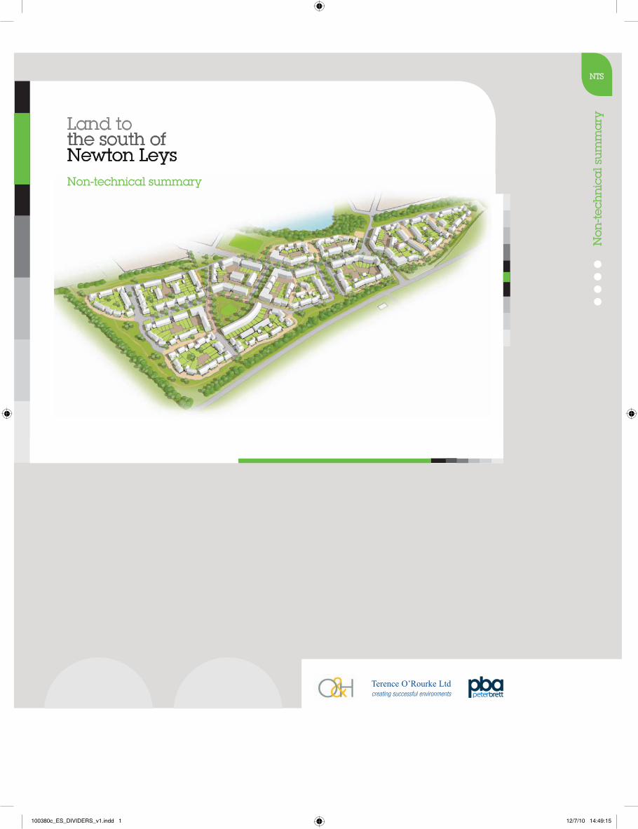
Land to the south of Newton Leys
Non
-tec
hn
ica
l su
mm
ary
Non-technical summary
NTS
100380c_ES_DIVIDERS_v1.indd 1 12/7/10 14:49:15
Land to the south of Newton Leys Non-technical summary O&H (Q6) Ltd
Terence O’Rourke Ltd July 2010 100380
Non-technical summary Introduction NTS.1 O&H (Q6) Ltd has submitted an outline planning application to Aylesbury
Vale District Council for a residential development at land to the south of Newton Leys, in the north east of the district.
NTS.2 An environmental impact assessment (EIA) was required by the council, in
accordance with schedule 2 of the Town and Country Planning (Environmental Impact Assessment) (England and Wales) Regulations 1999, as amended, due to the potential for significant environmental effects. An environmental statement (ES) has been prepared to report the findings and its key elements are summarised in this non-technical summary.
The proposed development site
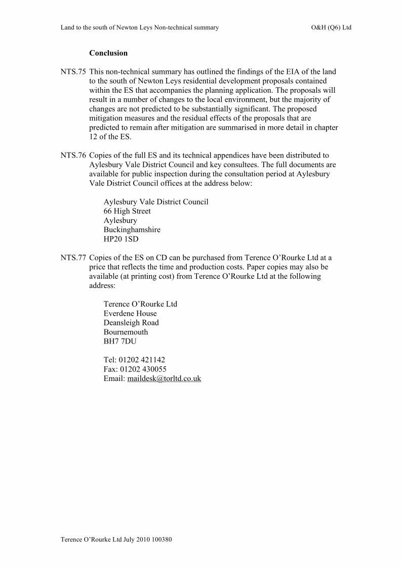
NTS.3 The 15.3 ha site is split into two portions: the main 13.4 ha site and a 1.9 ha
parcel to the north west (figure NTS1). It is located approximately 1.5 km to the south east of the village of Newton Longville in Buckinghamshire and approximately 8 km south of the centre of Milton Keynes. The urban area of Bletchley lies to the north east. The site is currently mainly arable agricultural land, although two roads have been constructed across the main site to provide access to Newton Leys to the north.
NTS.4 The main site is bordered to the south and east by Drayton Road, beyond
which lie Chadwell Farm, the London Euston to Birmingham New Street railway line and fields, and to the west by fields. The northern site boundary is a footpath, beyond which to the north west lie Jubilee Lake, fields and wooded areas (figure NTS1). The smaller portion of the site is bordered by Brookside House to the west, a footpath to the south, Jubilee Brook to the north and a field to the east.
NTS.5 Planning permission for the development of Newton Leys has been granted
on 104 ha of land to the north of the site, and construction of the first phase to the north east of the application site commenced in 2008. Newton Leys will include residential and employment development, a school, community facilities and open space.
The proposals
NTS.6 The proposals are to develop the site for 350 dwellings, 35% of which will
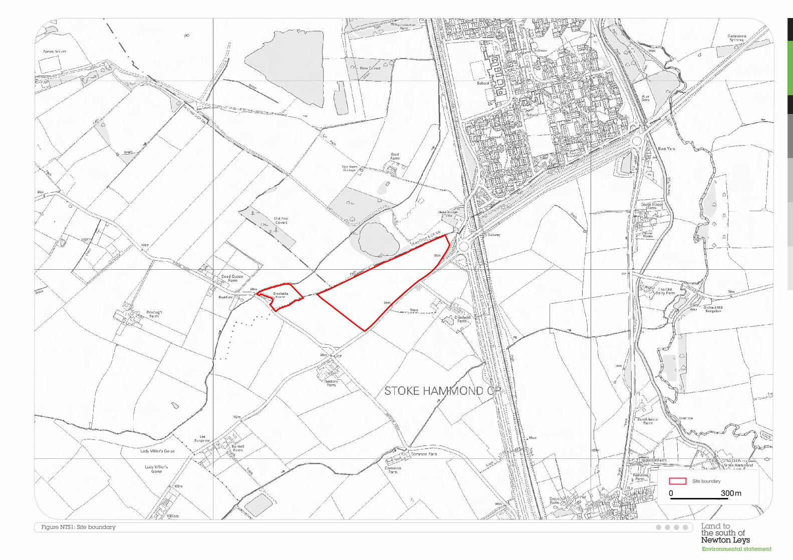
be affordable housing (including social rented, low cost and subsidised properties). In addition, a building for a dental practice will be provided on site. The proposed land use plan is shown in figure NTS2a.
NTS.7 The central area of green space will include a children’s play area, and 0.25
ha of allotments and a playing field are proposed on the 1.9 ha area to the north west of the main site. The green space around the site boundaries allows for landscape planting that will soften the edges of the development,
Land to the south of Newton Leys Non-technical summary O&H (Q6) Ltd
Terence O’Rourke Ltd July 2010 100380
particularly along the highest part of the site adjacent to Drayton Road. ‘Green streets’ will provide space for additional planting to minimise visual impact.
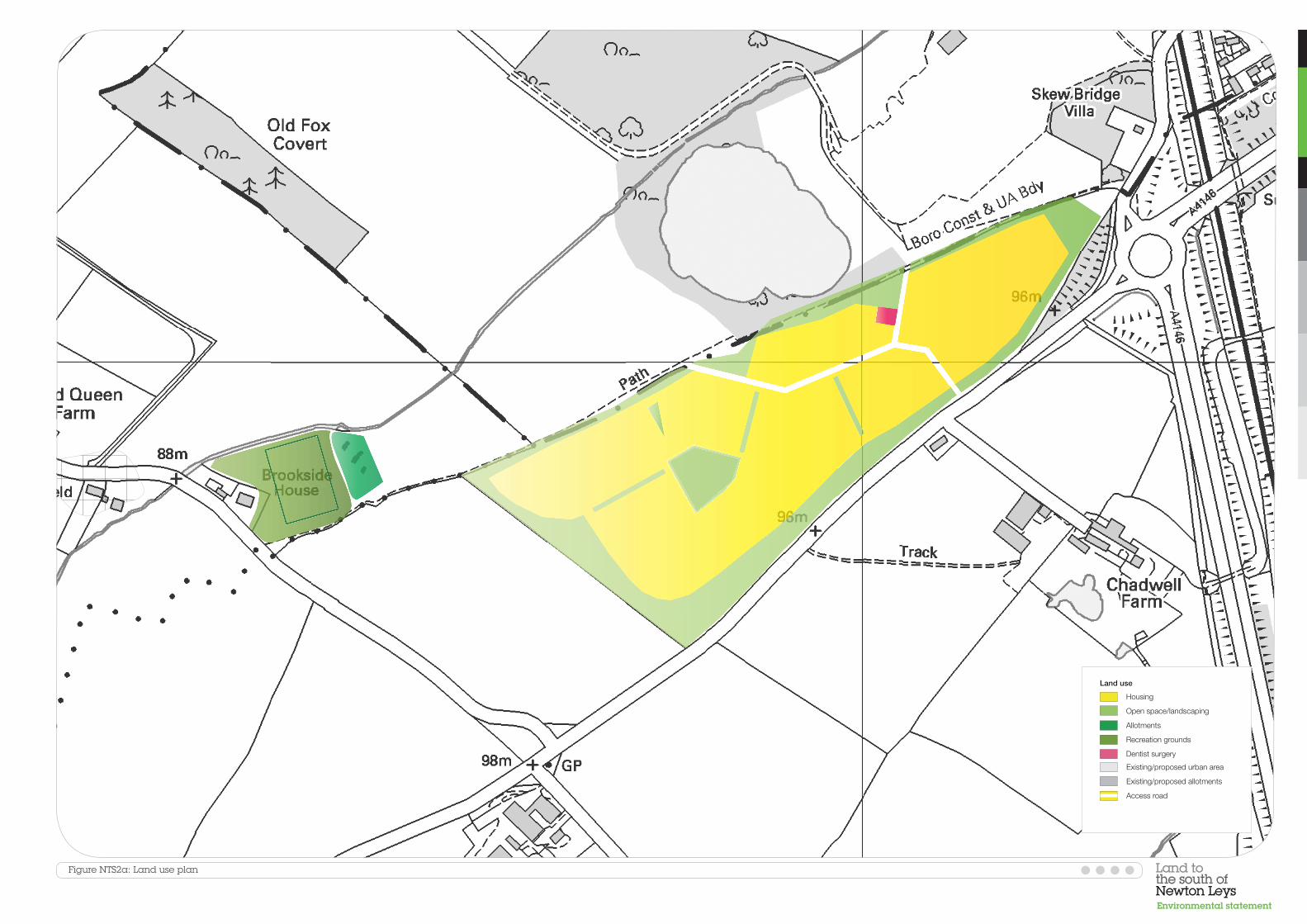
NTS.8 The building heights strategy has been designed with regard to the
importance of the primary road, public space and gateway to the development (figure NTS2b). For the most part, the buildings will be up to two and a half and three storeys high (maximum ridge heights of 8.5 m and 11.5 m respectively), although three and a half storey buildings are proposed at the main entrance to the site and along the primary access route (maximum ridge height of 12.5 m).
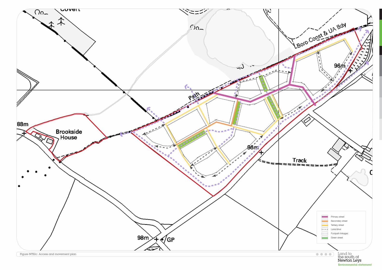
NTS.9 The network of streets will link into the Newton Leys development to the
north, using the existing access road as the primary street with public transport access (figure NTS2c). A new bus stop will be provided on the access road to ensure that the residential area is within 400 m of a bus stop. A network of footpaths and cycleways will be provided through the site to enable links with the facilities proposed as part of Newton Leys to the north.
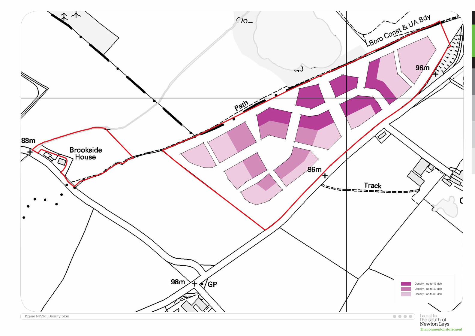
NTS.10 The site will be developed at an average density of 38 dwellings per hectare
(dph), with a range between 35 dph around the edges of the site and up to 45 dph along the primary access route and adjacent to Newton Leys, which has a similar density (figure NTS2d). The lower densities towards the site boundaries will create a more sensitive edge with the adjacent countryside.
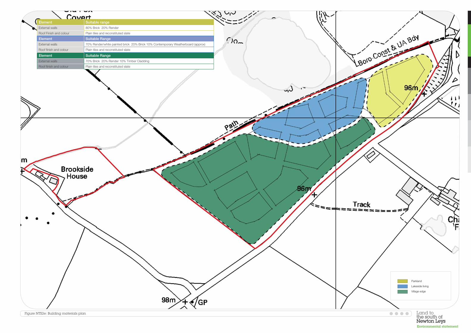
NTS.11 The site will be divided into three character areas, for which different
building materials will be used (figure NTS2e). The dwellings in the ‘village edge’ character area in the west and south west of the site will be predominantly constructed of brick, with small amounts of render and timber cladding, to minimise visual impacts. The dwellings in the ‘lakeside living’ character area in the north of the site will be predominantly render / white painted brick, with small amounts of brick and timber facing. The dwellings in the ‘parkland’ character area in the east of the site will be predominantly constructed of brick, with small amounts of render.
NTS.12 The surface water drainage strategy prepared for the main Newton Leys site
in 2007 included an allowance for surface water run-off from the land to the south of Newton Leys site. As part of the drainage arrangements for Newton Leys, a series of drainage ponds will be constructed to reduce flows before discharging into Jubilee Brook. Jubilee Lake will be used as part of the overall drainage strategy. As part of the ongoing construction works for phases 1 and 2 of Newton Leys, the following works will be undertaken:
• The normal water level of Jubilee Lake will be reduced to increase
available storage • A weir will be installed to allow flood water to pass from Jubilee Brook to
the lake • An outlet structure will be constructed to regulate flows returning to the
brook
Land to the south of Newton Leys Non-technical summary O&H (Q6) Ltd
Terence O’Rourke Ltd July 2010 100380
NTS.13 These works will have been completed prior to the commencement of development at land to the south of Newton Leys. Surface water flows from the proposed development will therefore drain directly to Jubilee Lake, which will provide the required storage.
NTS.14 The master plan has evolved over two years and has been subject to a
number of changes. The main aspects of the master plan where alternatives were considered are:
• Reduction in site area: a field to the west of the site was originally
included within the site boundary, but was removed following the scoping process for commercial reasons
• Reduction in the number of dwellings proposed: in line with the reduction in site area, the number of proposed dwellings was reduced from 500 to 350
• Provision of green space: the proposed allotments were moved from the west of the site to a separate area in the north west to allow greater landscape planting along the site’s western boundary. In addition, a playing field was introduced into the master plan to mitigate potential pressures on public open space as a result of the proposals
• A building for a dental practice was added to the proposals to address an identified shortfall in local NHS dental provision
Assessment methodology
NTS.15 The initial stage of the EIA was the production of a scoping report that
identified the potential environmental effects to be addressed during the process. This was issued to a range of consultees for comment and a number of additional issues were identified.
NTS.16 The various specialist assessments, discussed in more detail below, followed
generally similar methodologies. Baseline desk and / or field studies were undertaken to establish the existing situation. The effects of the proposed development were evaluated using a method that compares the sensitivity and importance of receptors with the likely magnitude of change to establish the significance of the effects.
NTS.17 The level of significance determines the resources that should be put in place
to avoid or reduce (mitigate) an adverse effect and identifies the actual value of a positive effect.
Environmental effects Air quality
NTS.18 The traffic-related pollutants nitrogen dioxide and fine particulate matter
were the main focus of the air quality assessment, although construction dust was also addressed.
Land to the south of Newton Leys Non-technical summary O&H (Q6) Ltd
Terence O’Rourke Ltd July 2010 100380
NTS.19 Current air quality around the site was established from measurements made by Aylesbury Vale District Council and Milton Keynes Council and from modelled data provided by the UK Air Quality Archive. This showed that the national air quality strategy objectives for the traffic pollutants are being achieved in the area around the site.
NTS.20 During the construction process, there is the potential for increased dust
generation from activities such as site preparation, earthworks and transport and storage of materials. A range of best practice mitigation measures has been proposed, including use of water as a dust suppressant, erection of barriers, covering or fencing of stockpiles, use of wheel washes and damping down of haul routes, which will ensure that there is no significant effect on local sensitive receptors from increased dust generation.
NTS.21 The modelling undertaken to predict emissions related to post-construction
traffic activities showed that the national air quality strategy objective limits for the traffic pollutants will not be exceeded and there will be no significant increase in concentrations of these pollutants as a result of the proposed development.
Community and social effects
NTS.22 The provision of new dwellings has the potential to have effects on the
existing local community and services in the surrounding area. In order to assess these effects, current conditions in Great Brickhill ward and Aylesbury Vale district as a whole have been analysed.
NTS.23 Great Brickhill ward’s demography differs from the district and regional
averages, with a higher proportion of retirement age residents and a lower proportion of single person and lone parent households. There is an existing shortage of housing which is affordable for those on lower incomes (affordable housing) in the district as a whole and there is a gap between the amount of new housing provision required in Aylesbury Vale at a regional level and the amount identified to come forward through Aylesbury Vale District Council’s housing policy. Unemployment in Great Brickhill ward and Aylesbury Vale is below the national average.
NTS.24 The site lies on the border between two primary school catchment areas:
Newton Longville Church of England Combined School and High Ash Church of England Combined School. Both these schools currently have spare capacity. Secondary and grammar schools are considered on a district-wide basis, as parental choice is exercised to a greater degree at secondary level. The 11 secondary and grammar schools in Aylesbury Vale currently have spare capacity.
NTS.25 All the GP surgeries in the vicinity of the site are open to new patients, but
only one of the five dental surgeries is registering new NHS patients. There is a range of community facilities in the vicinity of the site, including leisure centres, community halls and public open space.
Land to the south of Newton Leys Non-technical summary O&H (Q6) Ltd
Terence O’Rourke Ltd July 2010 100380
NTS.26 Several new community facilities will be provided in the main Newton Leys development to the north of the site, including a leisure facility, playing fields, community hall and allotments. A GP surgery may also be provided.
NTS.27 It is anticipated that approximately 150 people will be employed on site
across the construction phase. This will be a temporary beneficial effect of slight significance.
NTS.28 There will be a long term increase in population when the site is occupied,
which will lead to a substantial change in the demography of the area. The proposals will lead to an increase in housing provision in the area, which will be of substantial significance, and an increase in the provision of affordable housing. This will be a beneficial effect of moderate significance.
NTS.29 The new dentist surgery proposed as part of the scheme will meet demand
for NHS dental services associated with the proposed development. In addition, it will provide services to the existing population, which will be a beneficial effect of moderate significance.
NTS.30 The increase in population will increase demand for local services, including
schools, GP surgeries and community facilities. Local primary schools will have sufficient spare capacity to accommodate children from the proposed development, as pupils from the site will take priority over pupils from Milton Keynes under the distance criterion of Buckinghamshire County Council’s admission arrangements. No significant effects are therefore predicted on primary school provision.
NTS.31 The increase in demand for other services will be addressed through financial
contributions by the developer to existing services secured by a legal agreement with the council. This will include payments towards secondary school provision, facilities at the community hall to be built at Newton Leys and expansion of the Water Eaton Health Centre. In addition, the proposals include a children’s play area, playing field and allotments to meet demand for public open space. No significant adverse effects are predicted on education provision, GP surgeries and community facilities as a result of the proposed development.
Land use
NTS.32 The potential for effects on land uses off site was scoped out of the
assessment, as it was considered that a development of the nature and scale proposed would not affect surrounding land uses. Therefore, only on site land uses were considered.
NTS.33 The existing land uses on site were established through a desk study. The site
is currently in use as agricultural land, which is broken into three small sections by the new access road into Newton Leys to the north. This has compromised the use of the site for agriculture. A public footpath runs along the northern boundary of the site.
Land to the south of Newton Leys Non-technical summary O&H (Q6) Ltd
Terence O’Rourke Ltd July 2010 100380
NTS.34 During construction, the use of the site for agriculture will cease. The loss of this land is not considered to be significant. The proposed development will introduce new residential, healthcare and public open space land uses to the site, which will be a beneficial effect of moderate significance. No significant effects are predicted on the public footpath that runs along the site’s northern boundary.
Cultural heritage
NTS.35 Archaeological site investigations were undertaken immediately to the north
of the site in relation to the Newton Leys scheme. As part of these works, an excavation was undertaken on the land to the south of Newton Leys to investigate the route of the access road. In addition, archaeological investigations were undertaken to the east of the site as part of the assessment work for the Stoke Hammond bypass. The studies revealed a number of finds, including flints from the Late Neolithic to Bronze Age periods, Iron Age and Romano-British pottery fragments, an Early-Mid Iron Age farmstead and a Middle Iron Age settlement. The investigations along the route of the access road revealed field boundaries and ditches of probable Middle Iron Age origin.
NTS.36 As a result of these findings, further investigations were undertaken on the
application site in 2010. These did not find any evidence of the ditches identified during the excavation of the access road. Evidence of medieval cultivation was present across the entire area, and this may be masking earlier archaeology, if any still exists.
NTS.37 There is the potential for damage to unknown below ground archaeological
features from groundworks during construction. Further archaeological investigation will be undertaken, in the form of an agreed strip, map and record of potentially important areas on site. If archaeological remains are found in these areas, an archaeological watching brief will be put in place on the remainder of the site during site clearance and landscape works. The results of this will add to the area’s archaeological record, which will be a beneficial effect of moderate significance. If archaeological deposits are found, further surveys and an appropriate strategy of preservation will be agreed with the county archaeologist. These measures will ensure that there are no significant adverse effects on archaeological resources.
NTS.38 There are no nationally designated scheduled monuments or listed buildings
on or within 1 km of the site. There are five scheduled monuments within 5 km of the site, all of which are below ground remains of former settlements. The historic centres of the closest villages to the site, Stoke Hammond and Newton Longville, are designated as conservation areas.
NTS.39 The settings of the five scheduled monuments that are within 5 km of the site
are affected by adjacent roads and residential development and the intervening topography will prevent any intervisibility between the application site and the scheduled monuments. No significant effects on the setting of these sites are predicted. The proposed development is not
Land to the south of Newton Leys Non-technical summary O&H (Q6) Ltd
Terence O’Rourke Ltd July 2010 100380
predicted to result in changes to the character or appearance of the conservation areas.
NTS.40 The historic landscape character of the site already differs from the
surrounding landscape. As a result, no significant effects are predicted to occur to the historic landscape character of the area through the development of the site.
Ground conditions
NTS.41 A desk-top study and intrusive investigations were undertaken to establish
the potential for existing contamination at the site. The site was in agricultural use on the earliest map from 1881 and has remained in that use. The only changes have been the introduction of a narrow bund of fill material, possibly associated with the adjacent brickworks, which first appeared on the 1947 Ordnance Survey maps but had disappeared by 1971, and the recent construction of the Newton Leys access road.
NTS.42 A total of 37 soil samples from the site were analysed for a range of
commonly occurring contaminants. Overall the analysis revealed very little evidence of contamination. Concentrations of arsenic in excess of its soil guideline value were found in two of the samples on the main site, but these are likely to be naturally occurring and were not considered significant. A slightly elevated concentration of the metal vanadium was found in one sample on the main site, but this was also considered to relate to slightly elevated natural background levels.
NTS.43 The risk assessment concluded that the risk posed by contamination on the
site to construction workers, the water environment and future buildings is very low and no remedial measures are required for these receptors. The risk to future site occupiers from the elevated concentrations of arsenic and vanadium in the natural soils across the site is categorised as low and it is not considered to pose an unacceptable risk to residential development. As a result, no specific remedial works are required to facilitate the residential development.
NTS.44 A low risk to future site occupiers was also identified from potential
contamination associated with the recent construction of the estate road. Testing of the near surface soils in the vicinity of the construction compound will be carried out once the compound has been vacated, to determine whether any remediation is required. If necessary, such remediation is likely to take the form of excavation and removal of the existing surface around the compound and provision of clean soil cover. The removal of the compounds and remediation, if required, will be a beneficial effect of negligible to slight significance.
NTS.45 Elevated concentrations of vanadium were found in all the samples tested
from the area of land to the west of the main site that is proposed to be used for a playing field and allotments. Given the previously undeveloped nature of this area, it is considered likely that the measured levels of vanadium

Land to the south of Newton Leys Non-technical summary O&H (Q6) Ltd
Terence O’Rourke Ltd July 2010 100380
relate to naturally elevated background levels. However, before the allotments and playing field are created, a detailed site-specific risk assessment in relation to vanadium will be required to identify whether remediation measures are necessary. Any remediation is likely to take the form of excavation and removal of the existing surface and provision of clean soil cover.
Waste
NTS.46 The majority of waste in Aylesbury Vale is currently disposed of in landfills.
Buckinghamshire’s landfill capacity is dwindling and the available capacity is likely to reduce to 727,000 tonnes per year by 2016, which is insufficient to meet the county’s needs.
NTS.47 The Site Waste Management Plan Regulations (2008) require all projects
with a value of more than £300,000 to implement a site waste management plan. This will put in place a system for management of construction materials and will demonstrate how construction waste will be re-used and recycled, and so how disposal of waste to landfill will be reduced. With an effective site waste management plan in place, it is estimated that approximately 75% of construction waste can be re-used or recycled at local facilities. As a result, that amount of waste generated during construction that will be sent to landfill is judged to have a negligible impact on Buckinghamshire’s landfill capacity.
NTS.48 Post-construction, the proposed development will generate waste that
requires management and disposal. The proposals will provide adequate space for the separation, collection and storage of all household waste streams, both internally and externally, as required by the local council. It has been calculated that the predicted volume of waste to be sent to landfill from the proposed development is less than 1% of the annual landfill allowance for Buckinghamshire. Therefore, the proposed development is judged not to lead to significant effects on the county’s landfill capacity.
Water environment
NTS.49 The water environment assessment focused on the quality of surface water
and groundwater bodies and the potential flood risk at the site. The main issues addressed included potential contamination from surface water run-off from areas of hardstanding, contamination of surface water and groundwater during construction, and the need for a drainage system that could accommodate the increase in run-off associated with increasing the impermeable area of the site by the construction of roads and buildings. The principal surface waterbodies assessed included Jubilee Lake, Jubilee Brook and the drainage ditches on site.
NTS.50 The drainage strategy described above has been devised to manage the
additional run-off that will result from the proposals. It is designed to ensure that flood risk is not increased and there will be no significant effects on flood risk from the proposals. The surface water drainage scheme includes
Land to the south of Newton Leys Non-technical summary O&H (Q6) Ltd
Terence O’Rourke Ltd July 2010 100380
the use of measures to minimise pollution levels in run-off and ensure there will be no significant effects on water quality post-construction.
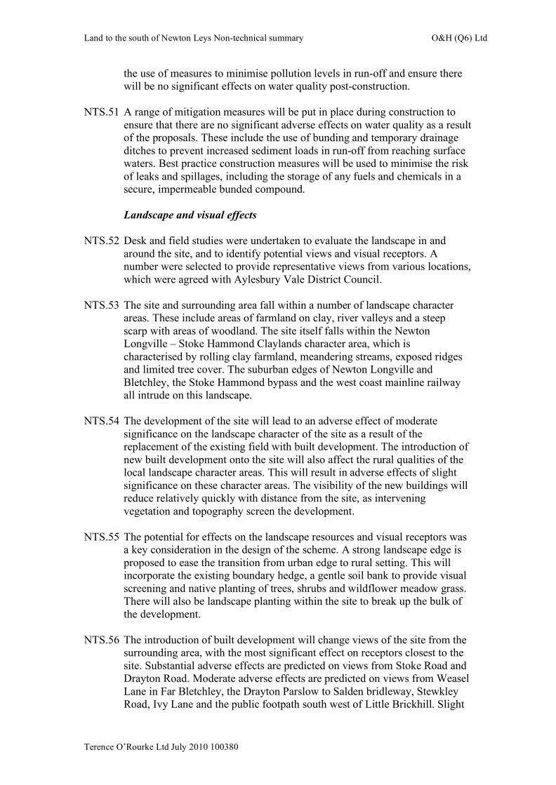
NTS.51 A range of mitigation measures will be put in place during construction to
ensure that there are no significant adverse effects on water quality as a result of the proposals. These include the use of bunding and temporary drainage ditches to prevent increased sediment loads in run-off from reaching surface waters. Best practice construction measures will be used to minimise the risk of leaks and spillages, including the storage of any fuels and chemicals in a secure, impermeable bunded compound.
Landscape and visual effects
NTS.52 Desk and field studies were undertaken to evaluate the landscape in and
around the site, and to identify potential views and visual receptors. A number were selected to provide representative views from various locations, which were agreed with Aylesbury Vale District Council.
NTS.53 The site and surrounding area fall within a number of landscape character
areas. These include areas of farmland on clay, river valleys and a steep scarp with areas of woodland. The site itself falls within the Newton Longville – Stoke Hammond Claylands character area, which is characterised by rolling clay farmland, meandering streams, exposed ridges and limited tree cover. The suburban edges of Newton Longville and Bletchley, the Stoke Hammond bypass and the west coast mainline railway all intrude on this landscape.
NTS.54 The development of the site will lead to an adverse effect of moderate
significance on the landscape character of the site as a result of the replacement of the existing field with built development. The introduction of new built development onto the site will also affect the rural qualities of the local landscape character areas. This will result in adverse effects of slight significance on these character areas. The visibility of the new buildings will reduce relatively quickly with distance from the site, as intervening vegetation and topography screen the development.
NTS.55 The potential for effects on the landscape resources and visual receptors was
a key consideration in the design of the scheme. A strong landscape edge is proposed to ease the transition from urban edge to rural setting. This will incorporate the existing boundary hedge, a gentle soil bank to provide visual screening and native planting of trees, shrubs and wildflower meadow grass. There will also be landscape planting within the site to break up the bulk of the development.
NTS.56 The introduction of built development will change views of the site from the
surrounding area, with the most significant effect on receptors closest to the site. Substantial adverse effects are predicted on views from Stoke Road and Drayton Road. Moderate adverse effects are predicted on views from Weasel Lane in Far Bletchley, the Drayton Parslow to Salden bridleway, Stewkley Road, Ivy Lane and the public footpath south west of Little Brickhill. Slight
Land to the south of Newton Leys Non-technical summary O&H (Q6) Ltd
Terence O’Rourke Ltd July 2010 100380
adverse effects are predicted on views from Home Farm in Newton Longville. There will be no significant effects on views from Milton Grove in Bletchley, as the development will be screened by the intervening topography and the new development at Newton Leys. Natural heritage
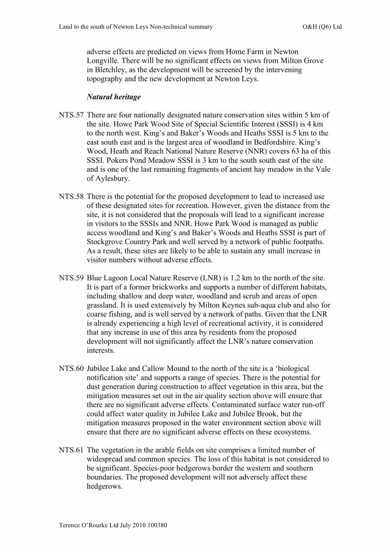
NTS.57 There are four nationally designated nature conservation sites within 5 km of
the site. Howe Park Wood Site of Special Scientific Interest (SSSI) is 4 km to the north west. King’s and Baker’s Woods and Heaths SSSI is 5 km to the east south east and is the largest area of woodland in Bedfordshire. King’s Wood, Heath and Reach National Nature Reserve (NNR) covers 63 ha of this SSSI. Pokers Pond Meadow SSSI is 3 km to the south south east of the site and is one of the last remaining fragments of ancient hay meadow in the Vale of Aylesbury.
NTS.58 There is the potential for the proposed development to lead to increased use
of these designated sites for recreation. However, given the distance from the site, it is not considered that the proposals will lead to a significant increase in visitors to the SSSIs and NNR. Howe Park Wood is managed as public access woodland and King’s and Baker’s Woods and Heaths SSSI is part of Stockgrove Country Park and well served by a network of public footpaths. As a result, these sites are likely to be able to sustain any small increase in visitor numbers without adverse effects.
NTS.59 Blue Lagoon Local Nature Reserve (LNR) is 1.2 km to the north of the site.
It is part of a former brickworks and supports a number of different habitats, including shallow and deep water, woodland and scrub and areas of open grassland. It is used extensively by Milton Keynes sub-aqua club and also for coarse fishing, and is well served by a network of paths. Given that the LNR is already experiencing a high level of recreational activity, it is considered that any increase in use of this area by residents from the proposed development will not significantly affect the LNR’s nature conservation interests.
NTS.60 Jubilee Lake and Callow Mound to the north of the site is a ‘biological
notification site’ and supports a range of species. There is the potential for dust generation during construction to affect vegetation in this area, but the mitigation measures set out in the air quality section above will ensure that there are no significant adverse effects. Contaminated surface water run-off could affect water quality in Jubilee Lake and Jubilee Brook, but the mitigation measures proposed in the water environment section above will ensure that there are no significant adverse effects on these ecosystems.
NTS.61 The vegetation in the arable fields on site comprises a limited number of
widespread and common species. The loss of this habitat is not considered to be significant. Species-poor hedgerows border the western and southern boundaries. The proposed development will not adversely affect these hedgerows.
Land to the south of Newton Leys Non-technical summary O&H (Q6) Ltd
Terence O’Rourke Ltd July 2010 100380
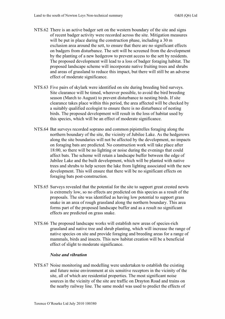
NTS.62 There is an active badger sett on the western boundary of the site and signs of recent badger activity were recorded across the site. Mitigation measures will be put in place during the construction phase, including a 30 m exclusion area around the sett, to ensure that there are no significant effects on badgers from disturbance. The sett will be screened from the development by the planting of a new hedgerow to prevent access to the sett by residents. The proposed development will lead to a loss of badger foraging habitat. The proposed landscape scheme will incorporate native fruiting trees and shrubs and areas of grassland to reduce this impact, but there will still be an adverse effect of moderate significance.
NTS.63 Five pairs of skylark were identified on site during breeding bird surveys.
Site clearance will be timed, wherever possible, to avoid the bird breeding season (March to August) to prevent disturbance to nesting birds. If site clearance takes place within this period, the area affected will be checked by a suitably qualified ecologist to ensure there is no disturbance of nesting birds. The proposed development will result in the loss of habitat used by this species, which will be an effect of moderate significance.
NTS.64 Bat surveys recorded soprano and common pipistrelles foraging along the
northern boundary of the site, the vicinity of Jubilee Lake. As the hedgerows along the site boundaries will not be affected by the development, no impacts on foraging bats are predicted. No construction work will take place after 18:00, so there will be no lighting or noise during the evenings that could affect bats. The scheme will retain a landscape buffer between the edge of Jubilee Lake and the built development, which will be planted with native trees and shrubs to help screen the lake from lighting associated with the new development. This will ensure that there will be no significant effects on foraging bats post-construction.
NTS.65 Surveys revealed that the potential for the site to support great crested newts
is extremely low, so no effects are predicted on this species as a result of the proposals. The site was identified as having low potential to support grass snake in an area of rough grassland along the northern boundary. This area forms part of the proposed landscape buffer and as a result no significant effects are predicted on grass snake.
NTS.66 The proposed landscape works will establish new areas of species-rich
grassland and native tree and shrub planting, which will increase the range of native species on site and provide foraging and breeding areas for a range of mammals, birds and insects. This new habitat creation will be a beneficial effect of slight to moderate significance.
Noise and vibration
NTS.67 Noise monitoring and modelling were undertaken to establish the existing
and future noise environment at six sensitive receptors in the vicinity of the site, all of which are residential properties. The most significant noise sources in the vicinity of the site are traffic on Drayton Road and trains on the nearby railway line. The same model was used to predict the effects of
Land to the south of Newton Leys Non-technical summary O&H (Q6) Ltd
Terence O’Rourke Ltd July 2010 100380
the proposed development on noise levels at the receptors, based on changes to traffic flows.
NTS.68 During the construction process, there is the potential for increased noise
from site preparation, earthworks and building activities. A range of best practice mitigation measures has been proposed, including locating noisy plant as far away from houses as possible, screening plant and use of quiet working methods, which will ensure that there is no significant effect on local sensitive receptors from increased noise during construction. It is not expected that piling will be required on site, so there will be not be significant vibration effects.
NTS.69 No significant increases in noise levels at the sensitive receptors were
predicted post-construction.
Traffic and transport NTS.70 The traffic and transport assessment deals with the effect of the increased
traffic associated with the proposals on traffic flows and sensitive receptors in the vicinity of the site.
NTS.71 The proposals will lead to an increase in the number of car journeys
associated with the site. The transport assessment has shown that this increase will be sufficiently small that there will not be significant effects on the capacity of the existing highway network and junctions.
NTS.72 It is estimated that there will be approximately 40 HGV trips and 72 staff
trips per day during the construction phase. These vehicles will access the site from the road network to the east, via the A4146. No significant effects are predicted on traffic flows on local roads as a result of the construction traffic.
NTS.73 The assessment focuses on the community as a sensitive receptor and
addresses the traffic and transport effects in terms of the severance (for example, being unable to cross the road) and intimidation (for example, being afraid to cycle) that may result from an increase in traffic volumes in close proximity to sensitive receptors, such as residences, post-construction. The assessment found that the increase in traffic flows on the local road network, and associated severance and intimidation effects, will be negligible and there will be no significant effects.
NTS.74 A new bus service will be provided as part of the Newton Leys development
to the north, which will link the site to Bletchley and central Milton Keynes via Skew Bridge. An extra bus stop will be provided on the route as it passes through the land to the south of Newton Leys site as part of the proposed development. A travel plan has been prepared that includes measures to encourage walking, cycling, use of public transport and car sharing.
Land to the south of Newton Leys Non-technical summary O&H (Q6) Ltd
Terence O’Rourke Ltd July 2010 100380
Conclusion NTS.75 This non-technical summary has outlined the findings of the EIA of the land
to the south of Newton Leys residential development proposals contained within the ES that accompanies the planning application. The proposals will result in a number of changes to the local environment, but the majority of changes are not predicted to be substantially significant. The proposed mitigation measures and the residual effects of the proposals that are predicted to remain after mitigation are summarised in more detail in chapter 12 of the ES.
NTS.76 Copies of the full ES and its technical appendices have been distributed to
Aylesbury Vale District Council and key consultees. The full documents are available for public inspection during the consultation period at Aylesbury Vale District Council offices at the address below:
Aylesbury Vale District Council 66 High Street Aylesbury Buckinghamshire HP20 1SD
NTS.77 Copies of the ES on CD can be purchased from Terence O’Rourke Ltd at a
price that reflects the time and production costs. Paper copies may also be available (at printing cost) from Terence O’Rourke Ltd at the following address:
Terence O’Rourke Ltd Everdene House Deansleigh Road Bournemouth BH7 7DU Tel: 01202 421142 Fax: 01202 430055 Email: [email protected]
Land to the south of Newton LeysEnvironmental statement
0 300mFigure NTS1: Site boundary
Site boundary
0 300m
Land to the south of Newton LeysEnvironmental statement
Figure NTS2a: Land use plan
Housing
Open space/landscaping
Allotments
Recreation grounds
Dentist surgery
Existing/proposed urban area
Existing/proposed allotments
Access road
Land use
Land to the south of Newton LeysEnvironmental statement
Figure NTS2b: Building heights plan
Building height - up to 3.5 storey (12.5m)
Building height - up to 3 storey (11.5m)
Building height - up to 2.5 storey (8.5m)
Land to the south of Newton LeysEnvironmental statement
Figure NTS2c: Access and movement plan
Primary street
Secondary street
Tertiary street
Lane/drive
Footpath linkages
Green street
Land to the south of Newton LeysEnvironmental statement
Figure NTS2d: Density plan
Density - up to 45 dph
Density - up to 40 dph
Density - up to 35 dph
Land to the south of Newton LeysEnvironmental statement
Figure NTS2e: Building materials plan
Parkland
Lakeside living
Village edge
Element Suitable Range
External walls 70% Brick 20% Render 10% Timber Cladding
Roof finish and colour Plain tiles and reconstituted slate
Element Suitable range
External walls 80% Brick 20% Render
Roof Finish and colour Plain tiles and reconstituted slate
Element Suitable Range
External walls 70% Render/white painted brick 20% Brick 10% Contemporary Weatherboard (approx)
Roof finish and colour Plain tiles and reconstituted slate