Embed Size (px)
Citation preview

BLM LIBRARY
88068332
LAND TENURE
ADJUSTMENT PROJECT
PREPLANNING ANALYSIS
1986c . 3

United States Department of the Interior
BUREAU OF LAND MANAGEMENT
Barstow Resource Area
IN REPLYREFER TO:
2000 (DOD)
831 Barstow RoadBarstow, CA 92311
(619) 256-3591
Dear Reviewer:
Enclosed for your review and comment is the Preplanning Analysis for aLand Tenure Adjustment Project, jointly proposed by the Bureau of LandManagement and the Department of Defense, specifically Edwards and GeorgeAir Force Bases. The project affects portions of the Barstow andRidgecrest Resource Areas, California Desert District, within easternKern, northeastern Los Angeles, and northern San Bernardino Counties.Within that area, landownership patterns (public and private) are beinganalyzed to determine if and how they can be adjusted to enhance BLM'smanagement effectiveness, to support DoD 1
s mission, and to allow for theutilization and development of private land consistent with applicableCounty General Plans. Proposed adjustments would be accomplished throughvoluntary land exchanges. Plan amendments to the California Desert Planand the San Bernardino County General Plan and development of a CountySafety Overlay are a probable part of this Land Tenure Adjustment Projectproposal
.
This Preplanning Analysis outlines the preliminary issues (concerns),alternatives, and decision criteria to be used by the Bureau of LandManagement and San Bernardino County in the review of the project, planamendments, and safety overlay. These issues, alternatives, and decisioncriteria will be included in the development of an environmental impactstatement/environmental impact report for the project.
Your review of these preliminary issues, alternatives, and decisioncriteria as well as any suggestions regarding additions, deletions, orcorrections are needed. Also, any information you may have on existingresource values would be appreciated.
Four public scoping workshops/meetings are scheduled for June 24, 25, 26and 27, 1986 in San Bernardino, Lancaster, Victorville and Barstow,respectively (exact locations and times to be announced through a FederalRegister Notice and the media at a later date). Representatives from theBureau of Land Management, Edwards and George Air Force Bases, and SanBernardino County will be available at these workshops/meetings to answerquestions and record your comments.
If your organization would like a presentation or an issue-specificdiscussion, please contact the Bureau of Land Management at the addressabove.
Written comments on
than July 7, 1986 to
issues, alternativesabove address.
the Preplanning Analysis must be received no laterbe fully considered in the finalization of the
and decision criteria. Please send comments to the
Sincerely
,
Alden SieversArea ManagerBarstow Resource Area
IT> 280^85321 231
. c
L3
3.3
LAND TENURE ADJUSTMENT PROJECT
PREPLANNING ANALYSIS
June 1986
ci
>3

TABLE OF CONTENTS
LIST OF ILLUSTRATIONS iii
I. INTRODUCTION 1
II. IDENTIFICATION OF ISSUES 4
A. Landownership Pattern 4
B. Multiple Use Classifications 4
C. Land Use Categories 4
D. Public Health and Safety 4
III. TYPES AND LEVELS OF DECISIONS ANTICIPATED 5
A. Landownership Pattern 5
B. Multiple Use Classifications 5
C. Land Use Categories 5
D. Public Health and Safety 5
IV. DECISION CRITERIA 5
V. APPLICABLE STATE/NATIONAL GUIDANCE AND LAWS 8
VI. ALTERNATIVE FORMULATION 8
VII. INVENTORY NEEDS 8
VIII. SCHEDULE FOR ENVIRONMENTAL DOCUMENTATION 19
IX. PUBLIC PARTICIPATION 19
X. SIGNATURES 22
APPENDICES
A. Airspace Corridors A1B. Interagency Agreement BlC. California Desert Plan Multiple Use Classifications
Guidelines ClD. San Bernardino County Land Use Categories . . D1E. San Bernardino County Safety Overlay Districts El
ii

ILLUSTRATIONS
MAPS
1. General Location 2
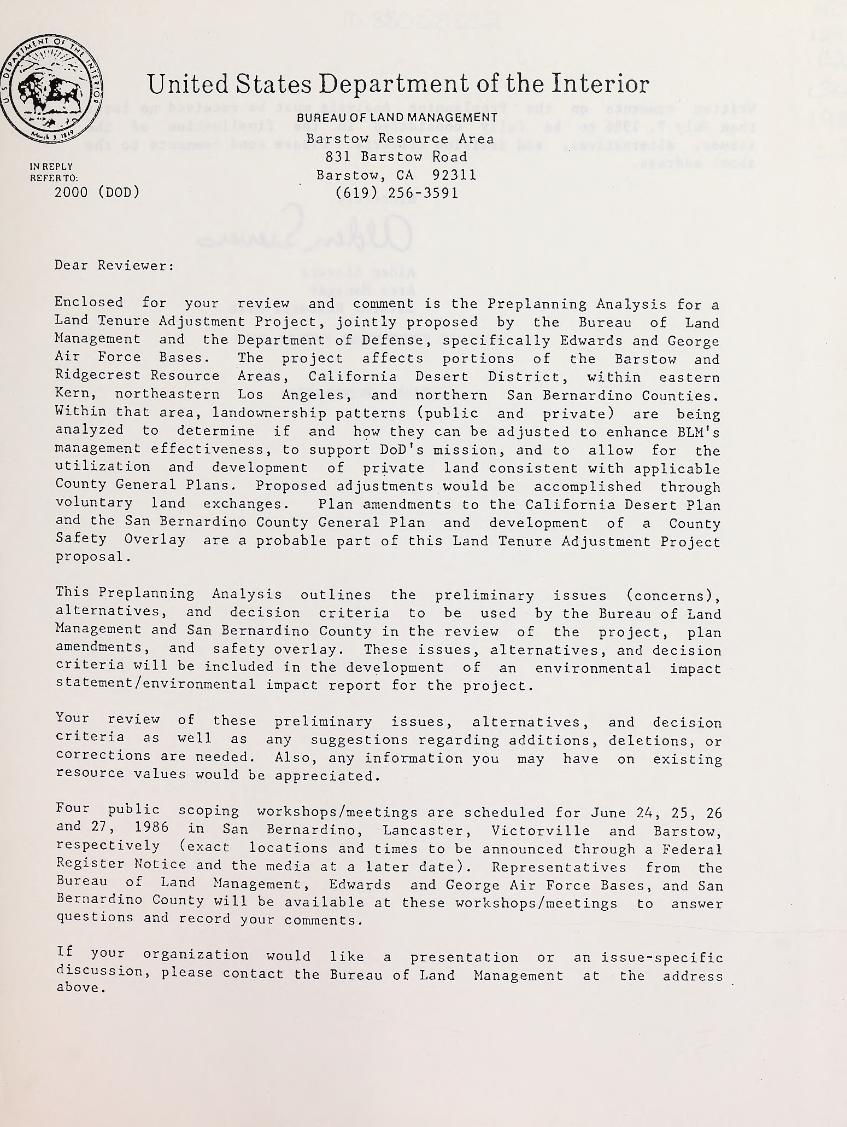
2. Project Area With Corridors 3
3. Preliminary AlternativesA. Alternative I (No Action) 13
B. Alternative II 14
C. Alternative III 15
D. Alternative IV 16
E. Alternative V . 17
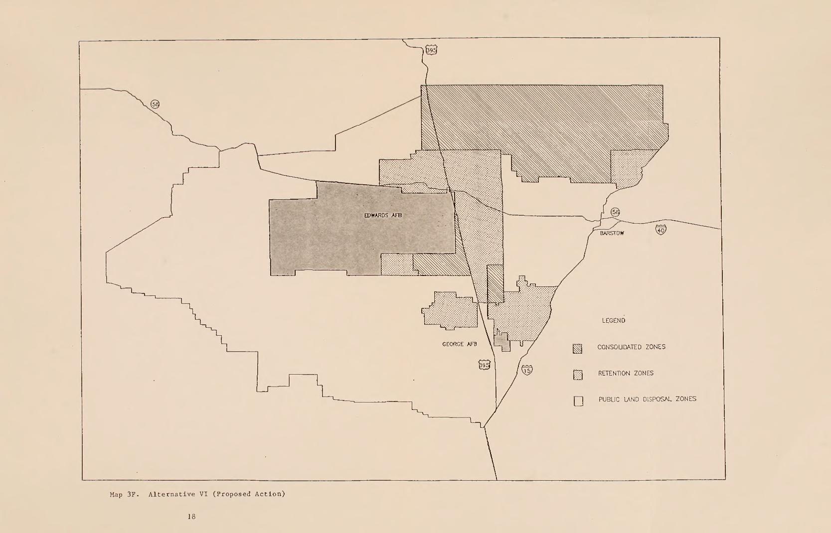
F. Alternative VI (Proposed Action) 18
TABLES
1. Relationship Between Issues, Goals, Legal Requirements,and Decision Criteria 6
2. Alternative Formulation Criteria 9
iii

. ... •
I . INTRODUCTION
This Preplanning Analysis (PPA) describes the level of datacollection and planning anticipated in the development of amendments tothe California Desert Plan and the San Bernardino County General Plan and
a County Safety Overlay as a part of the Land Tenure Adjustment (LTA)Project
.
The PPA was developed in accordance with Bureau of Land Management(BLM) regulations (BLM Manual, Section 1602). Because San BernardinoCounty has no similar requirement, this document serves only as
notification to the public of actions within the County.
The PPA identifies the major issues, types and levels of anticipateddecisions, the decision criteria, preliminary alternatives, inventory anddata collection needs. The PPA also outlines proposed work schedules andpublic participation.
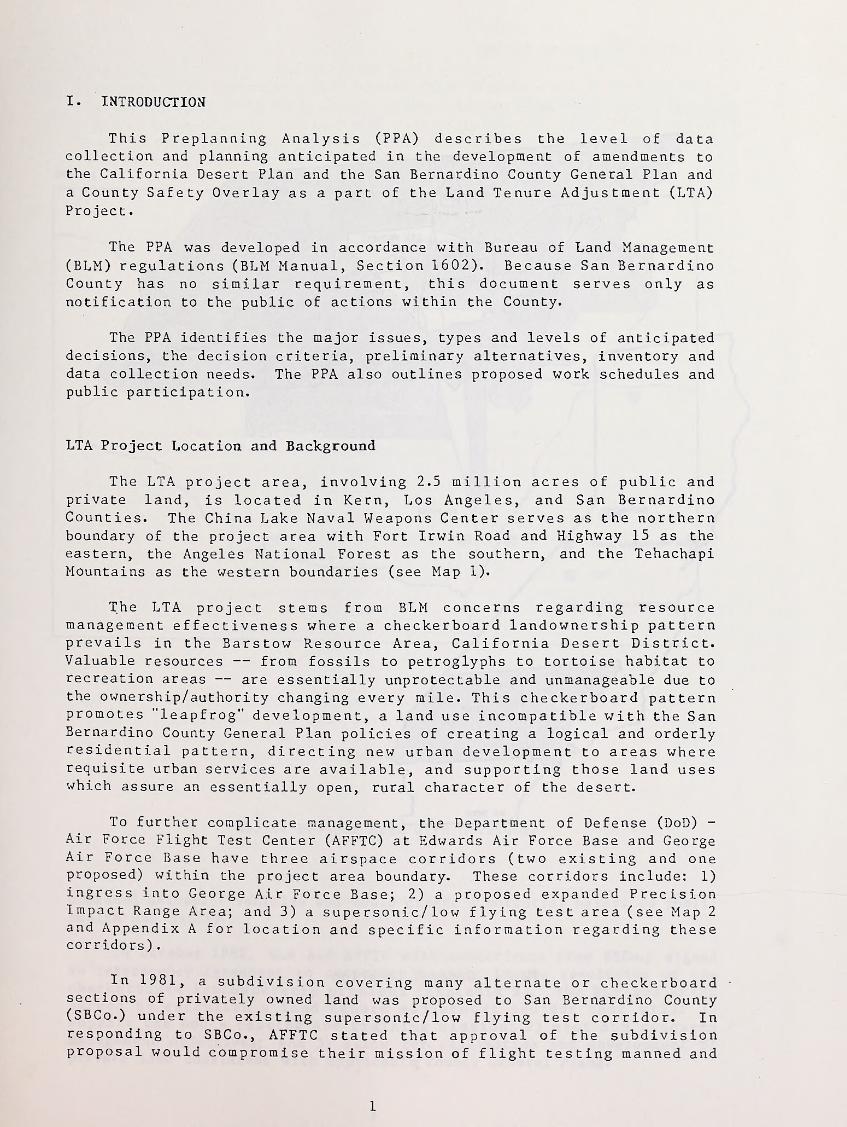
LTA Project Location and Background
The LTA project area, involving 2.5 million acres of public andprivate land, is located in Kern, Los Angeles, and San BernardinoCounties. The China Lake Naval Weapons Center serves as the northernboundary of the project area with Fort Irwin Road and Highway 15 as the
eastern, the Angeles National Forest as the southern, and the TehachapiMountains as the western boundaries (see Map 1).
The LTA project stems from BLM concerns regarding resourcemanagement effectiveness where a checkerboard landownership patternprevails in the Barstow Resource Area, California Desert District.Valuable resources — from fossils to petroglyphs to tortoise habitat torecreation areas — are essentially unprotectable and unmanageable due tothe ownership/authority changing every mile. This checkerboard patternpromotes "leapfrog" development, a land use incompatible with the SanBernardino County General Plan policies of creating a logical and orderlyresidential pattern, directing new urban development to areas whererequisite urban services are available, and supporting those land useswhich assure an essentially open, rural character of the desert.
To further complicate management, the Department of Defense (DoD) -
Air Force Flight Test Center (AFFTC) at Edwards Air Force Base and GeorgeAir Force Base have three airspace corridors (two existing and oneproposed) within the project area boundary. These corridors include: 1)
ingress into George Air Force Base; 2) a proposed expanded PrecisionImpact Range Area; and 3) a supersonic/low flying test area (see Map 2
and Appendix A for location and specific information regarding thesecorridors)
.
In 1981, a subdivision covering many alternate or checkerboardsections of privately owned land was proposed to San Bernardino County(SBCo.) under the existing supersonic/low flying test corridor. Inresponding to SBCo., AFFTC stated that approval of the subdivisionproposal would compromise their mission of flight testing manned and
1
K£HN
iooHrr
Map 1. General Location
2
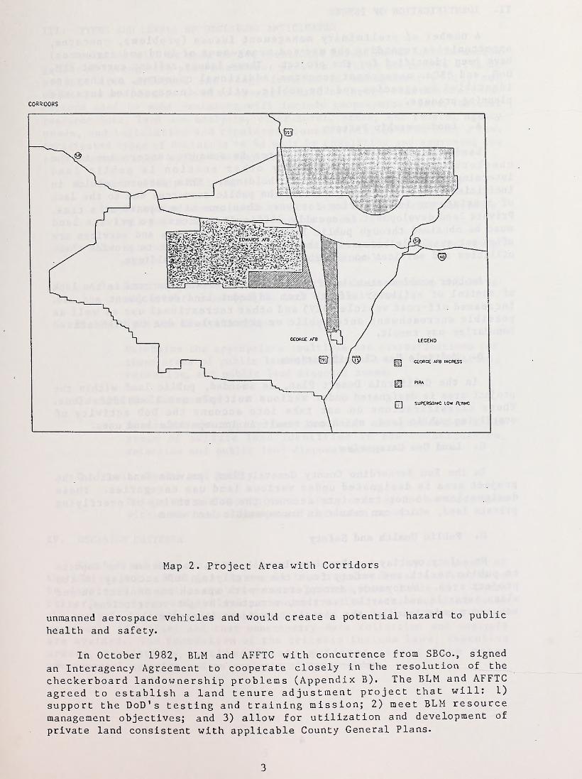
CORRIDORS
Map 2. Project Area with Corridors
unmanned aerospace vehicles and would create a potential hazard to public
health and safety.
In October 1982, BLM and AFFTC with concurrence from SBCo., signed
an Interagency Agreement to cooperate closely in the resolution of the
checkerboard landownership problems (Appendix B). The BLM and AFFTC
agreed to establish a land tenure adjustment project that will: 1)
support the DoD's testing and training mission; 2) meet BLM resource
management objectives; and 3) allow for utilization and development of
private land consistent with applicable County General Plans.
3
II. IDENTIFICATION OF ISSUES
A number of preliminary management issues (problems, concerns,opportunities regarding the use and management of land and resources)have been identified for the project. These issues reflect current BLM,DoD, and SBCo. management concerns. Additional concerns, as they areidentified by agencies and the public, will be incorporated into theplanning process.
A. Landownership Pattern
Landownership in the project area is a major concern due to the
checkerboard pattern where every other section is public landintermingled with private and state holdings. This pattern results in
inefficient and costly management of the public resources due to the lackof consistency in authority for more than one mile square at a time.Private land development is equally difficult. Access to private landmust be obtained through public land. County utilities and services areoften not available because of the high incremental cost to provide theseutilities and services to the dispersed private land holdings.
Another problem stemming from this landownership pattern is the lackof control of spillover effects from adjacent land development and use.
Increased off-road vehicle (ORV) and other recreational use as well aspossible encroachment onto public or private land due to ill-definedboundaries may result.
B. Multiple Use Classifications
In the California Desert Plan, as amended, public land within theproject area is designated under various multiple use classifications.These classifications do not take into account the DoD activity of
overflying public land, which can result in incompatible land uses.
C. Land Use Categories
In the San Bernardino County General Plan, private land within the
project area is designated under various land use categories. Thesedesignations do not take into account the DoD activity of overflyingprivate land, which can result in incompatible land uses.
D. Public Health and Safety
No safety overlay has been developed by SBCo. to address the impactsto public health and safety from the overflying DoD activity in theproject area. Annoyance, interference with speech communication andsleep, startle and startle reaction, structure height restrictions, etc.
may occur under each of the airspace corridors (Appendix A).
4
III. TYPES AND LEVELS OF DECISIONS ANTICIPATED
Decisions will be made on the identified issues based on informationgathered through the plan amendment process. These decisions will be
project area oriented and range from basic management policy andobjective statements to site specific land exchange recommendations.Factors used to make decisions will include geographical data, naturalresource data, land use analysis, other local, state, and federal agencyneeds, and legislative and regulatory constraints, to name only a few.Anticipated types of decisions to be made by completing and approving theplan amendments and safety overlay are as follows:
A. Landownership Pattern
1. Determine where in the project area landownership should be
all public land (consolidation zones).
2. Determine where in the project area existing landownershipshould remain the same (retention zones).
3. Determine where in the project area landownership should be
all private land (public land disposal zones).
B. Multiple Use Classifications
Determine the appropriate multiple use classifications forthose areas of public land identified in the consolidation,retention, and public land disposal zones.
C. Land Use Categories
Determine the appropriate land use categories for thoseareas of private land identified in the consolidation,retention and public land disposal zones.
D. Public Health and Safety
Determine the appropriate safety overlay for private landwithin the consolidation and retention zones.
IV. DECISION CRITERIA
The BLM and SBCo. plan amendments and safety overlay are a part ofthe LTA project. BLM planning regulations require decision criteria tobe developed to guide the amendment process (see Table 1). Thesecriteria are used to establish parameters to limit the scope and focusthe analysis in order to ensure that decisions are tailored to the issuespreviously identified and that unnecessary data collection and analysisare avoided. The foundation of the criteria include laws, executiveorders, regulations, na t i o na 1 / s t a t e guidance, input from othergovernmental agencies and an analysis of data needs.
5
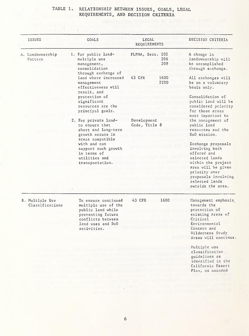
TABLE 1. RELATIONSHIP BETWEEN ISSUES, GOALS, LEGALREQUIREMENTS, AND DECISION CRITERIA
ISSUES COALS LEGAL DECISION CRITERIAREQUIREMENTS
A. Landownership 1. For public land- FLPMA, Secs. 202 A change in
Pattern multiple use 206 landownership willmanagement
,
209 be accomplishedconsolidation through exchange.through exchange of
land where increased A3 CFR 1600 All exchanges willmanagement 2200 be on a voluntaryeffectiveness will basis only.
result, and
protection of Consolidation of
significant public land will be
resources are the considered priorityprincipal goals. for those areas
most important to
2. For private land- Development the management of
to ensure that Code, Title 8 public landshort and long-term resources and the
growth occurs in
areas compatibleDoD mission.
with and can Exchange proposalssupport such growth involving bothin terms of offered and
utilities and selected lands
transportation. within the projectarea will be givenpriority over
proposals involvingselected lands
outside the area.
B. Multiple Use To ensure continued A3 CFR 1600 Management emphasis
Classifications multiple use of the towards the
public land while protection of
preventing future existing Areas of
conflicts between Criticalland uses and DoD Environmentalactivities
.
Concern andWilderness Study
Areas will continue.
Multiple use
classificationguidelines as
identified in the
California Desert
Plan, as amended
6

TABLE 1. (cont)
ISSUES GOALS LEGALREQUIREMENTS
DECISION CRITERIA
will remainunchanged(see Appendix C)
.
No existingauthorized landuses on public landwill be eliminated.
C. Land Use
CategoriesTo ensure long-termgrowth on privateland while avoidingfuture conflictsbetween land
development, DoD
activities, and
resource values.
DevelopmentCode, Title 8
CaliforniaGovernment Code,Title 7
Management emphasisis towards the
continued growth of
the county whererequisite urbanservices areavailable
.
Nearness of
available utilitiesand access willguide developmentemphasis
.
Land use categorydefinitions as
identified in the
San BernardinoCounty General Planwill remainunchanged
.
(see Appendix D).
D. Public Healthand Safety
To ensure that
authorized privateland uses arecompatible withDoD activity.
Development Code,Title 8
Requirements and
standards as setforth in the San
Bernardino CountyDevelopment Codewill remainunchanged
.
(see Appendix !')•
No existingauthorized landuses on privateland will be
eliminated
.
7
V. APPLICABLE STATE /NATIONAL GUIDANCE AND LAWS
Several pieces of legislation may cause conflicts with otherresource utilization due to protective and/or restrictive requirements.The Endangered Species Act of 1973, as amended, requires the protectionof all federally listed threatened and endangered plants and animals.Cooperative agreements with the California state government extendresponsibility for review to state listed plants and animals. TheNational Historic Preservation Act of 1966, as amended, the AmericanIndian Religious Freedom Act of 1978, and the Archaeological ResourceProtection Act of 1979, require that due consideration be given tocultural/historical resources that may be impacted by federal actions.The Federal Land Policy and Management Act of 1976 (FLPMA) requires thatareas of critical environmental concern (ACEC) be given specialmanagement consideration in land use planning and implementation. Underthe Interim Management Policy (IMP) and Guidelines for Lands UnderWilderness Review (IMP - December 12, 1979), wilderness study areas willbe regulated so as not to impair the suitability of these areas forpreservation as wilderness. Each of the above acts may restrict land useallocation and/or management options.
VI. ALTERNATIVE FORMULATION
Background Information
Prior to the development of the alternatives, BLM and DoDseparately prioritized various locations within the project area whichwere, in each agency's opinion, important in the effective management of
existing resources. These priority locations were compared and thencombined through collaborative effort of both agencies (see Table 2).
VII. INVENTORY NEEDS
The project area has been inventoried in part with the developmentof the California Desert Plan and amendments. Numerous site specificplans and projects have been developed in the area, all of which requiredan inventory of the existing resources. A preliminary review of theexisting resource values within the project area has been completed.Overlays depicting the following are available for review at the BarstowResource Area Office: cultural resource sensitivity; desert tortoisedensities; grazing allotments; mining claim locations; sensitive plant
habitat; special designation areas; and wind energy potential. Thisinformation will be further refined and included, as appropriate, in the
Draft Environmental Impact S ta tement /Environmental Impact Report(EIS/EIR). A compilation of that existing data and field verification aswell as data for areas not previously evaluated will be completed. Forany voluntary land exchanges conducted in the project area, site specificfield investigations will be completed in order to prepare a land report,mineral potential report, and environmental analysis.
8
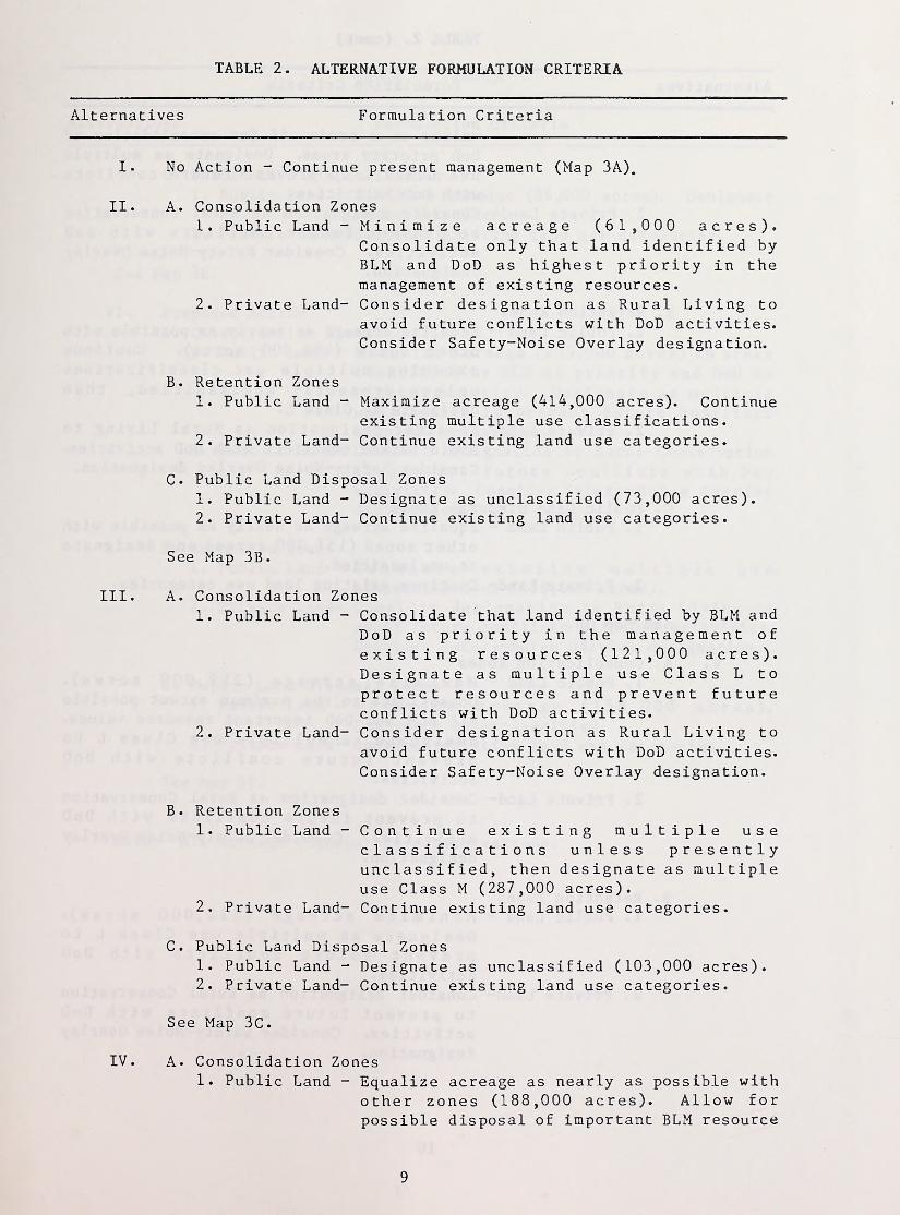
TABLE 2. ALTERNATIVE FORMULATION CRITERIA
Alternatives Formulation Criteria
I. No Action - Continue present management (Map 3A).
II. A. Consolidation Zones1. Public Land - Minimize acreage (61,000 acres).
Consolidate only that land identified byBLM and DoD as highest priority in themanagement of existing resources.
2. Private Land- Consider designation as Rural Living toavoid future conflicts with DoD activities.Consider Safety-Noise Overlay designation.
B. Retention Zones1. Public Land - Maximize acreage (414,000 acres). Continue
existing multiple use classifications.2. Private Land- Continue existing land use categories.
C. Public Land Disposal Zones1. Public Land - Designate as unclassified (73,000 acres).2. Private Land- Continue existing land use categories.
See Map 3B.
III. A. Consolidation Zones1. Public Land - Consolidate that land identified by BLM and
DoD as priority in the management ofexisting resources (121,000 acres).Designate as multiple use Class L toprotect resources and prevent futureconflicts with DoD activities.
2. Private Land- Consider designation as Rural Living toavoid future conflicts with DoD activities.Consider Safety-Noise Overlay designation.
B. Retention Zones1. Public Land - Continue existing multiple use
classifications unless presentlyunclassified, then designate as multipleuse Class M (287,000 acres).
2. Private Land- Continue existing land use categories.
C. Public Land Disposal Zones1. Public Land - Designate as unclassified (103,000 acres).2. Private Land- Continue existing land use categories.
See Map 3C.
IV. A. Consolidation Zones1. Public Land - Equalize acreage as nearly as possible with
other zones (188,000 acres). Allow forpossible disposal of important BLM resource
9
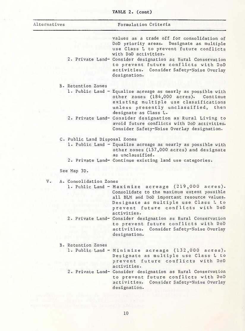
TABLE 2. (cont)
Alternatives Formulation Criteria
values as a trade off for consolidation of
DoD priority areas. Designate as multipleuse Class L to prevent future conflictswith DoD activities.
2. Private Land- Consider designation as Rural Conservationto prevent future conflicts with DoDactivities. Consider Safety-Noise Overlaydesignation.
B. Retention Zones1. Public Land - Equalize acreage as nearly as possible with
other zones (184,000 acres). Continueexisting multiple use classificationsunless presently unclassified, thendesignate as Class L.
2. Private Land- Consider designation as Rural Living to
avoid future conflicts with DoD activities.Consider Safety-Noise Overlay designation.
C. Public Land Disposal Zones1. Public Land - Equalize acreage as nearly as possible with
other zones (157,000 acres) and designateas unclassified.
2. Private Land- Continue existing land use categories.
See Map 3D.
V. A. Consolidation Zones1. Public Land - Maximize acreage (219,000 acres).
Consolidate to the maximum extent possibleall BLM and DoD important resource values.
Designate as multiple use Class L toprevent future conflicts with DoDactivities
.
2. Private Land- Consider designation as Rural Conservationto prevent future conflicts with DoDactivities. Consider Safety-Noise Overlaydesignation.
B. Retention Zones1. Public Land - Minimize acreage (132,000 acres).
Designate as multiple use Class L to
prevent future conflicts with DoDactivities
.
2. Private Land- Consider designation as Rural Conservationto prevent future conflicts with DoDactivities. Consider Safety-Noise Overlaydesignation.
10
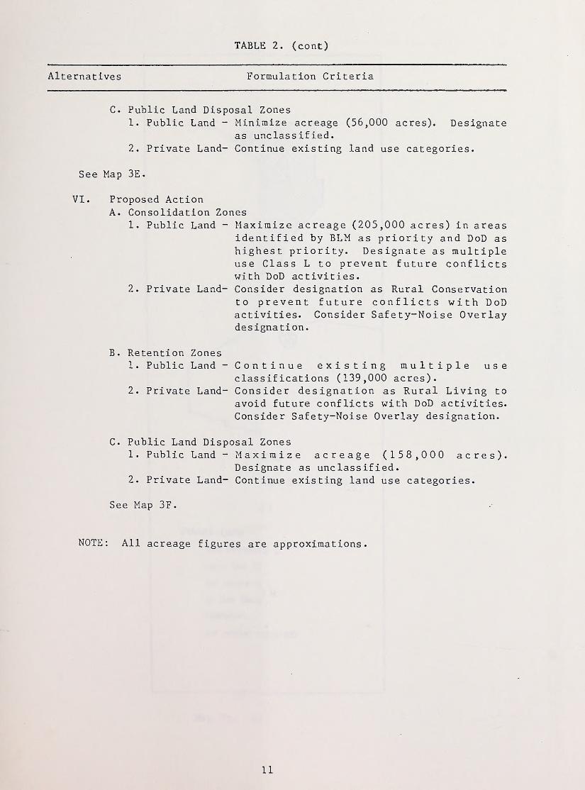
TABLE 2. (cont)
Alternatives Formulation Criteria
C. Public Land Disposal Zones1. Public Land - Minimize acreage (56,000 acres). Designate
as unclassified.2. Private Land- Continue existing land use categories.
See Map 3E.
VI. Proposed ActionA. Consolidation Zones
1. Public Land - Maximize acreage (205,000 acres) in areasidentified by BLM as priority and DoD ashighest priority. Designate as multipleuse Class L to prevent future conflictswith DoD activities.
2. Private Land- Consider designation as Rural Conservationto prevent future conflicts with DoDactivities. Consider Safety-Noise Overlaydesignation.
B. Retention Zones1. Public Land - Continue existing multiple use
classifications (139,000 acres).2. Private Land- Consider designation as Rural Living to
avoid future conflicts with DoD activities.Consider Safety-Noise Overlay designation.
C. Public Land Disposal Zones1. Public Land - Maximize acreage (158,000 acres).
Designate as unclassified.2. Private Land- Continue existing land use categories.
See Map 3F.
NOTE: All acreage figures are approximations.
11

• * . •• •
~
- - • * • ....... •
;
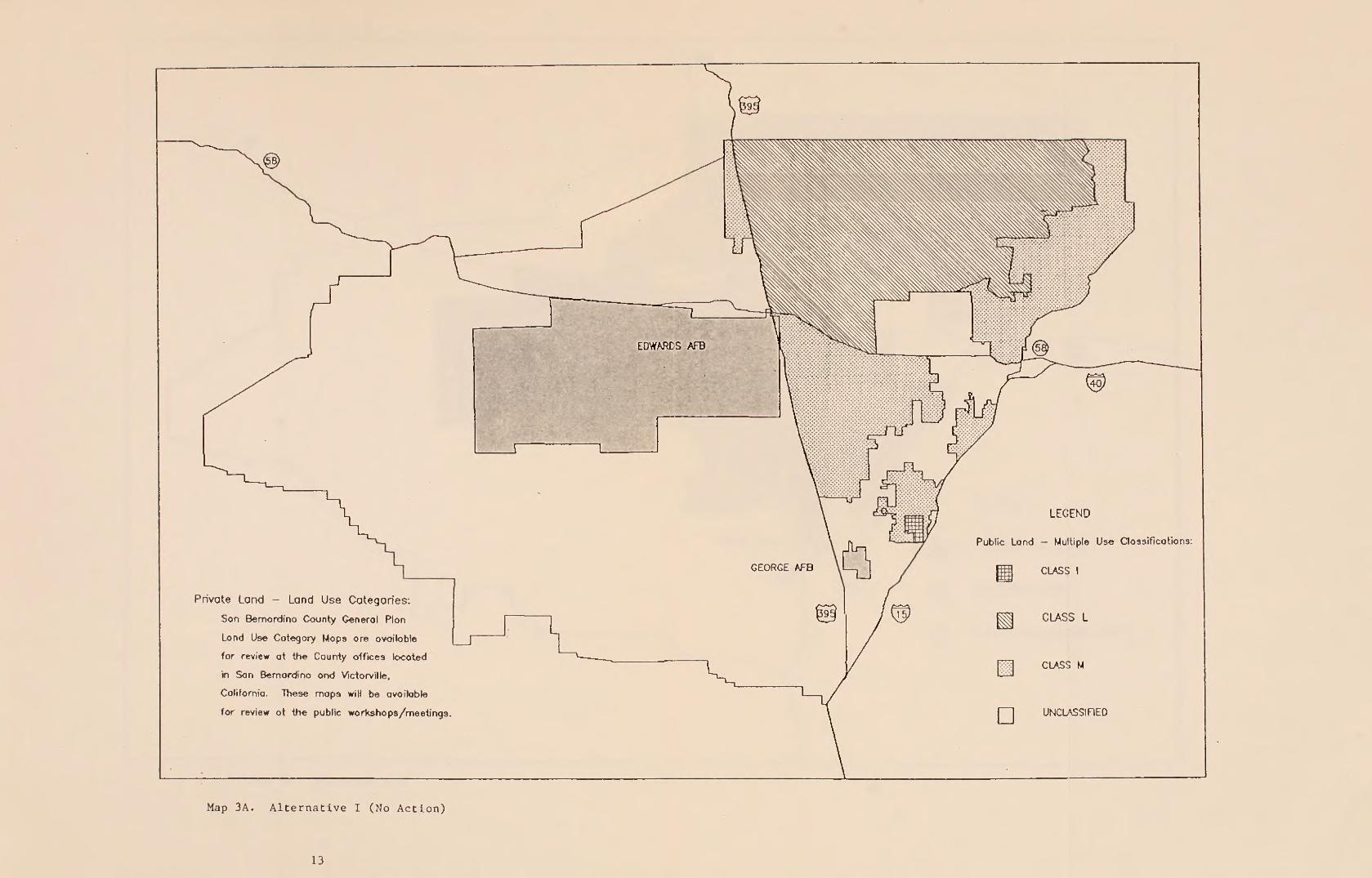
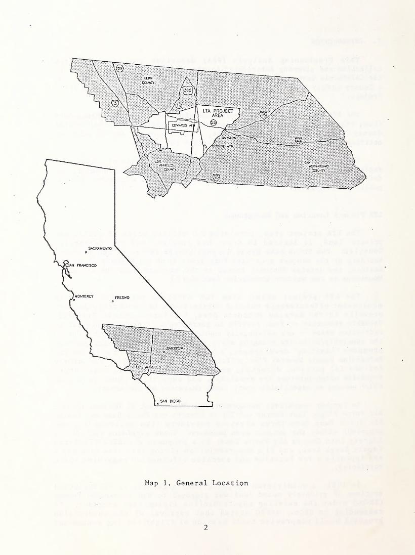
Private Land - Land Use Categories:
Son Bernardino County Generol Plon
Land Use Category Maps are available
for review at the County offices located
'm Son Bernardino and Victorville,
California. These maps will be available
for review at the public workshops/meetings.
Map 3A. Alternative I (No Action)
13

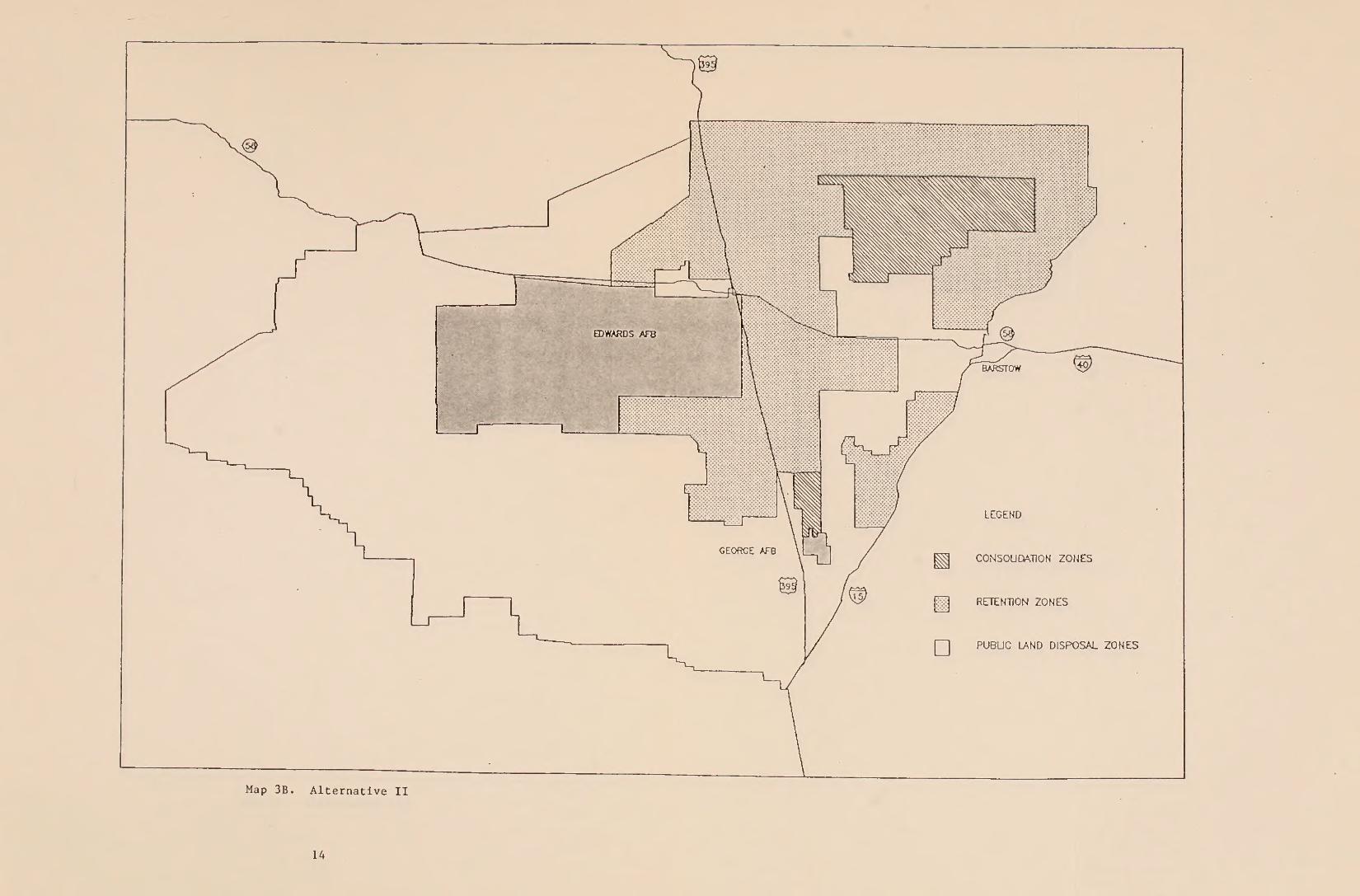
Map 3B. Alternative II
14

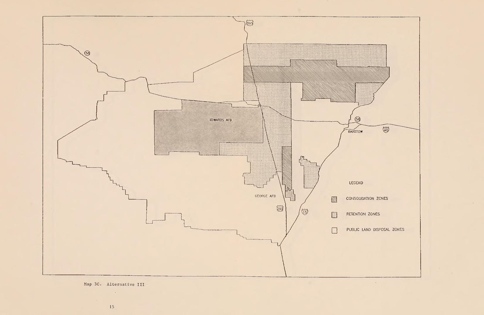
Map 3C. Alternative III
15
PUBLIC LAND DISPOSAL ZONES

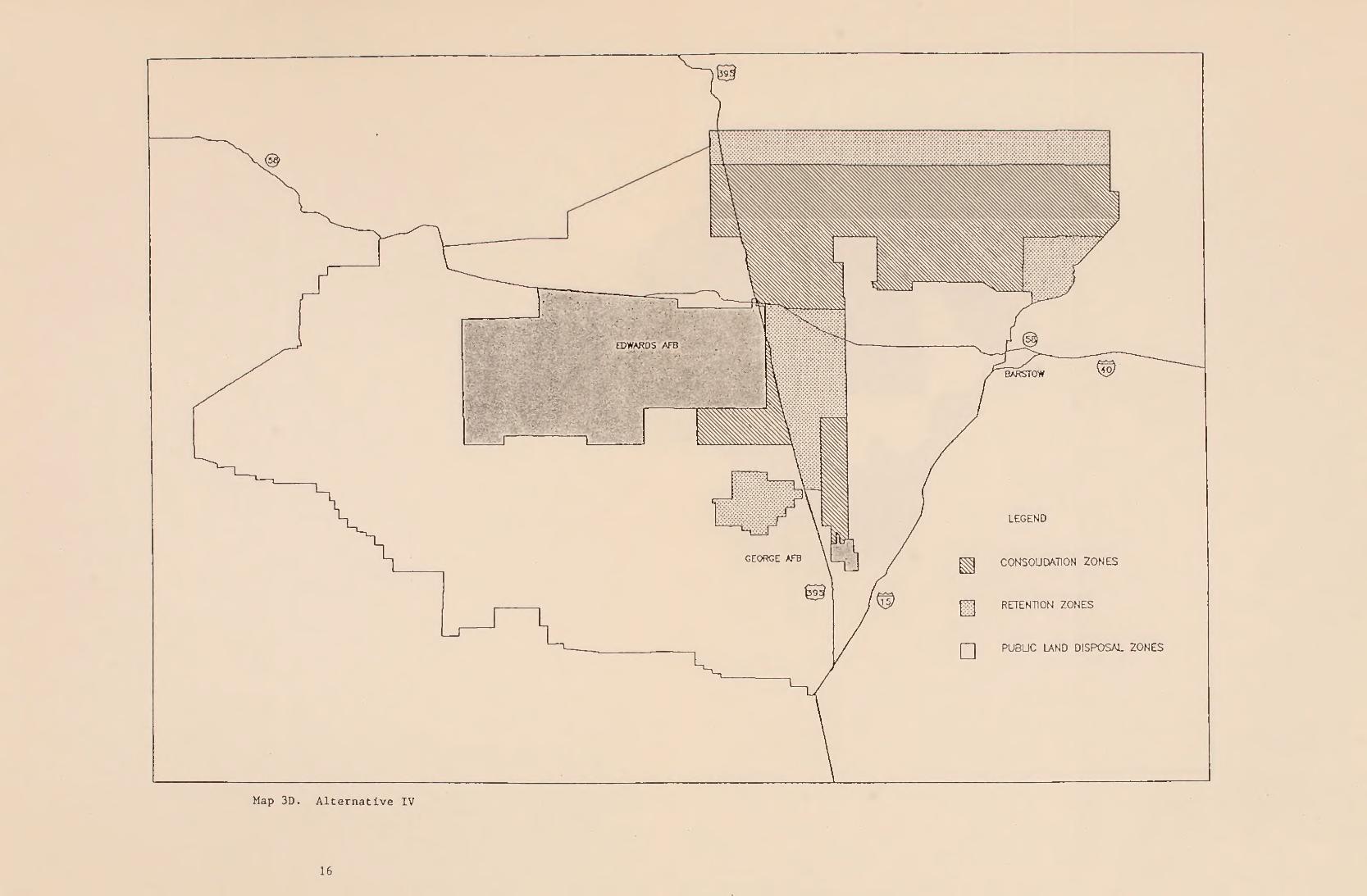
Map 3D. Alternative IV
16

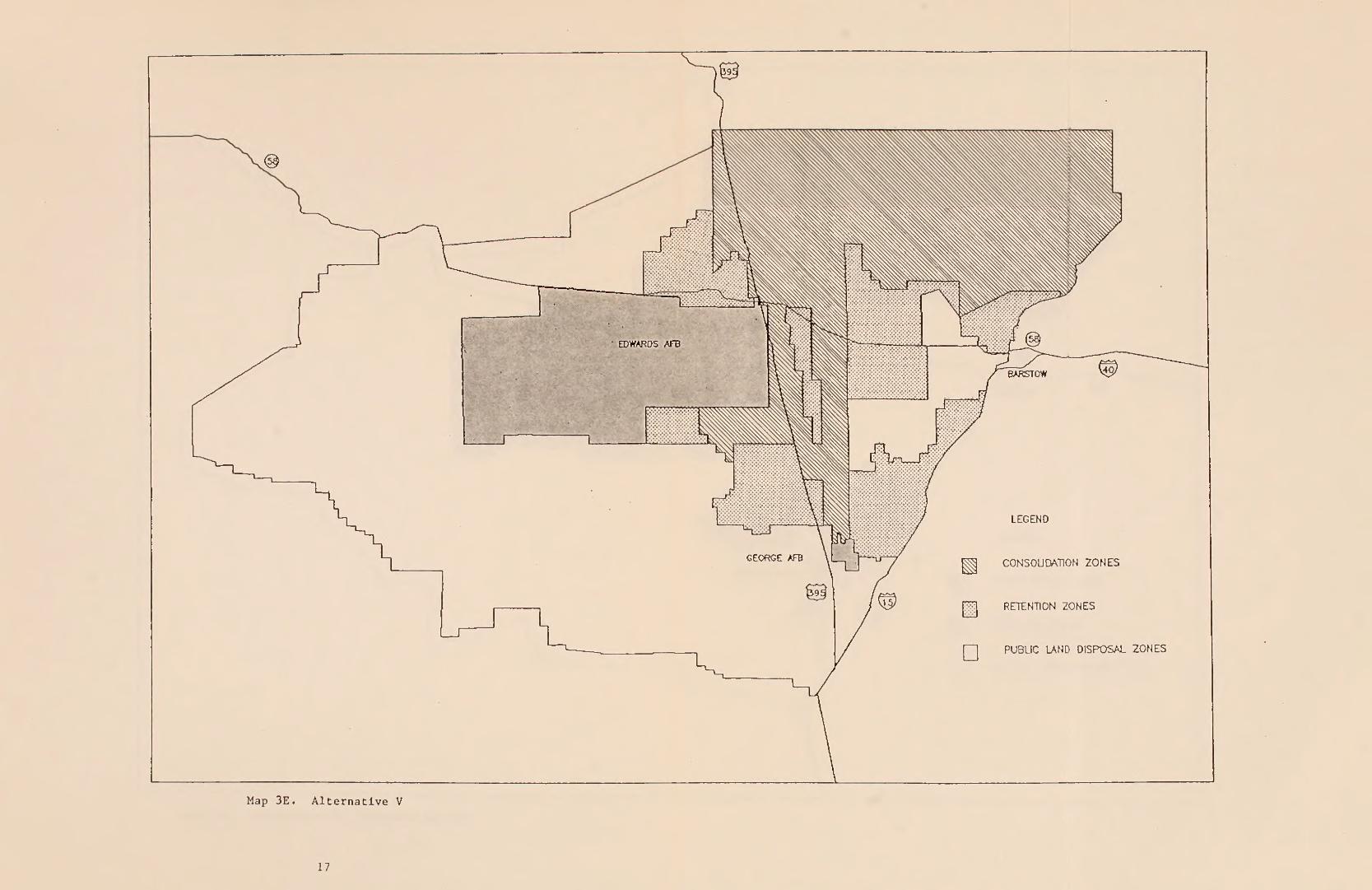
Map 3E. Alternative V
17

18

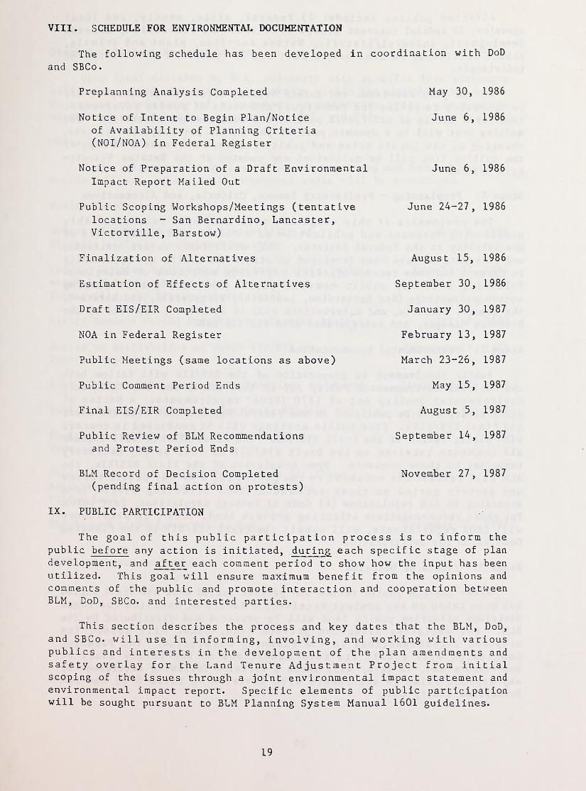
VIII. SCHEDULE FOR ENVIRONMENTAL DOCUMENTATION
The following schedule has been developed in coordination with DoD
and SBCo.
Preplanning Analysis Completed May 30, 1986
Notice of Intent to Begin Plan/Noticeof Availability of Planning Criteria(N0I/N0A) in Federal Register
June 6, 1986
Notice of Preparation of a Draft EnvironmentalImpact Report Mailed Out
June 6, 1986
Public Scoping Workshops/Meetings (tentativelocations - San Bernardino, Lancaster,Victorville, Barstow)
June 24-27
,
1986
Finalization of Alternatives August 15, 1986
Estimation of Effects of Alternatives September 30, 1986
Draft EIS/EIR Completed January 30, 1987
NOA in Federal Register February 13, 1987
Public Meetings (same locations as above) March 23-26, 1987
Public Comment Period Ends May 15, 1987
Final EIS/EIR Completed August 5, 1987
Public Review of BLM Recommendationsand Protest Period Ends
September 14, 1987
BLM Record of Decision Completed November 27, 1987
(pending final action on protests)
IX. PUBLIC PARTICIPATION
The goal of this public participation process is to inform the
public before any action is initiated, during each specific stage of plan
development, and after each comment period to show how the input has beenutilized. This goal will ensure maximum benefit from the opinions and
comments of the public and promote interaction and cooperation betweenBLM, DoD, SBCo. and interested parties.
This section describes the process and key dates that the BLM, DoD,
and SBCo. will use in informing, involving, and working with variouspublics and interests in the development of the plan amendments andsafety overlay for the Land Tenure Adjustment Project from initialscoping of the issues through a joint environmental impact statement and
environmental impact report. Specific elements of public participationwill be sought pursuant to BLM Planning System Manual 1601 guidelines.
19
Affected publics include: 1) federal, state, county, and localagencies; 2) special interest groups that include, recreation, mineraldevelopment, cu
1
1 ur a 1 / hi s t o r ic,Native American, plant and animals,
public utilities, to name only a few; and 3) concerned and interestedindividuals
.
As the plan amendment and safety overlay effort progresses, it maybe necessary to revise the techniques and dates of public involvementidentified herein as additional publics and concerns are identified. Themailing list will be a dynamic part of the public participation process,
changing as new inputs arise and public interest increases. A copy of
the mailing list will be maintained and updated at the Barstow ResourceArea Office.
Stage 1: Preplanning - Preliminary Issues, Criteria, and Alternatives
The components of this stage are initiated upon release of thispreplanning document and publication of a Notice of Intent/Notice ofAvailability in the Federal Register. Only preliminary issues, criteria,and alternatives have been developed to afford the public the opportunityto comment and make recommendations regarding additions or deletions.Following a 30-day public comment period and four public scopingworkshops/meetings (San Bernardino, Lancaster, Victorville, and Barstow),the issues, criteria, and alternatives will be finalized, approved by the
District Manager, and incorporated into the EIS/EIR.
Stage 2: Environmental Documentation
Public involvement in preparation of the EIS/EIR will follow boththe National Environmental Policy Act of 1969 (NEPA) and the CaliforniaEnvironmental Quality Act of 1970 (CEQA) requirements. A Notice of
Availability will be published in the Federal Register for both the Draftand Final EIS/EIRs. Four public meetings will be conducted in concertwith public review of the Draft EIS/EIR. The Final EIS/EIR will includeall comments received on the Draft EIS/EIR as well as any necessaryresponses to those comments. Upon completion of the Final EIS/EIR, the
BLM will release the document to the public for a 30-day public reviewand protest period on those recommendations affecting public landaccording to BLM regulations (43 Code of Federal Regulations, Part 1610).
For those recommendations affecting private land, SBCo., in accordancewith CEQA requirements, will submit the Final EIS/EIR to the PlanningCommission for certification.
Stage 3: Record of Decision
After the BLM public review and protest period ends and final action
has been taken on any protest received, a Record of Decision for thosedecisions affecting public land will be prepared and distributed by the
BLM. For decisions affecting private land, SBCo. will submit itsproposed recommendations to the Planning Commission. The PlanningCommission will submit its recommendations to the County Board of
Supervisors who, in turn, will issue a decision following settlement of
any appeals filed in accordance with Division 4, Title 8 of the SanBernardino County Code.
20
Stage 4: Project Implementation
Upon final decision by BLM, voluntary site specific land exchangeswill be conducted with private landowners within the consolidation zones.
To assure consistency of management in retention zones, cooperativeagreements will be sought between BLM, DoD, and SBCo.
Media Contacts
Media releases will be issued for each mailing and Federal RegisterNotice. Direct contact with interested media will be encouraged.
Public Involvement Timetable
Notice of Intent/Notice of Availability of
Planning Analysis in Federal RegisterJune 6, 1986
Public Scoping Workshops/Meetings (tentativelyscheduled for San Bernardino, Lancaster,Victorville, and Barstow, California)
June 24-27, 1986
Public Comment Period Ends for Preplanning Analysis July 7, 1986
Notice of Availability of Draft EIS/EIR in
Federal RegisterFebruary 13, 1987
Public Meetings/Hearings (same locations as above) March 23-26, 1987
Public Comment Period Ends for Draft EIS/EIR May 15, 1987
Notice of Availability of Final EIS/EIR inFederal Register
August 14, 1987
Public Review and Protest Period Ends for ThoseRecommendations in Final EIS/EIR AffectingPublic Land
September 14, 1987
BLM Record of Decision Mailed Out November 27, 1987
NOTE: Subject to Revision
21
X. SIGNATURES
Prepared by:
>rt T V T '1.1 -1 T T /-V /% HWendy L. Waiwood
Land Use Planner
^ /V. H8GDateJ
Recommended by:
Barstow Resource Area Manager)ate
<^> . fuQ-V-itricia E. McLean \
^
—
Igecrest Resource Area Manager
Following Review of Public Comments
Approved by:
Gerald E. Hillier DateCalifornia Desert District Manager
22
APPENDICES

APPENDIX AAIRSPACE CORRIDORS
Ingress Into George Air Force Base (AFB)
This area serves as the approach corridor for aircraft landing at GeorgeAFB. As aircraft near the runway, it can be expected that the Day-NightNoise Level (L
(j n ) for the area could exceed 80 L(j n . Also, off the end of
the runway, three areas have been defined where the probability of anaircraft accident is high, and which are subject to special land userecommendations relating to intensity of use and density of people.These three areas are the Clear Zone, the Accident Potential Zone 1, andthe Accident Potential Zone 2. The Clear Zone begins at the runwaythreshold and extends 1500 feet on each side of the runway centerline andout to a distance of 3000 feet. Accident Potential Zone 1 is also 3000feet wide and extends 5000 feet out from the Clear Zone. AccidentPotential Zone 2 is 3000 feet by 7000 feet and begins at AccidentPotential Zone 1. Height of structures within this corridor can be a
safety hazard as aircraft descent is within 150 feet of the ground (see
Height Restrictions included in the Federal Aviation Regulations, Part 77
for further details).
Proposed Expanded Precision Impact Range Area (Edwards AFB)
This corridor is a safety zone, which if ownership is consolidated underpublic ownership, will be subject to infrequent hazardous conditionsduring field testing at the nearby AFB where aircraft are operating withordnance aboard. While ordnance concussion does not normally occur inthis zone, an occasional inadvertent drop is possible due to anelectrical short air turbulence, or other unexpected occurrence. Due to
the infrequency of this condition and the fact that this condition ispredictable as a result of long range scheduling, most land uses arepossible with occasional abandonment of the zone or undergroundprotection.
Supersonic/Low Flying Corridor (Edwards AFB)
This corridor is intended to provide an adequate area of unobstructedairspace in which military training and testing exercises can be safelyconducted. Within this corridor aircraft are flying at levels as low as50 feet and traveling at speeds in excess of 480 knots, which limits therange of compatible ground surface activities. A noise hazard existswith possible sound pressure levels exceeding 69 L^ n . Annoyance,interference with speech communication and sleep, and startle and startlereaction are also factors which affect uses in the zone. This area issubject to numerous sonic booms caused when aircraft in this area areflying at supersonic speeds. Peak pressures from supersonic flight canbe quite high depending on the relationship of the aircraft to thelocation where the overpressure is measured.
A1
- 'w- '
.
.
.
,v.
_
.
.
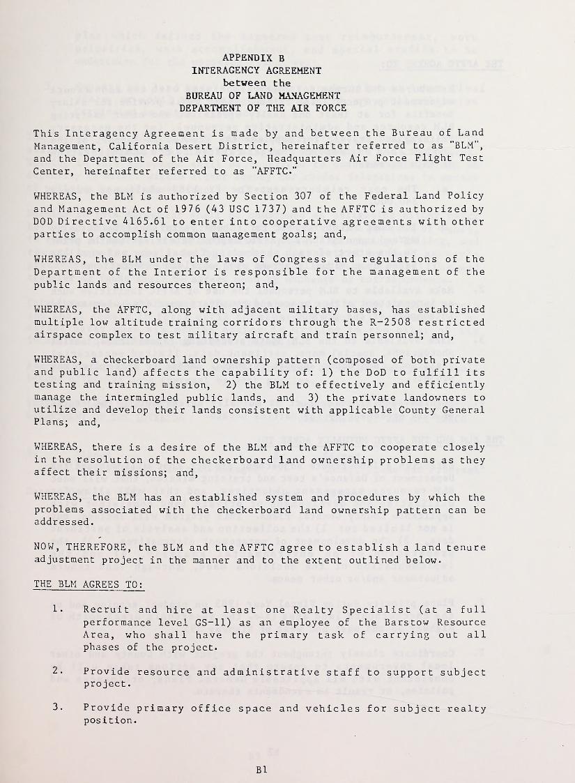
APPENDIX BINTERAGENCY AGREEMENT
between the
BUREAU OF LAND MANAGEMENTDEPARTMENT OF THE AIR FORCE
This Interagency Agreement is made by and between the Bureau of LandManagement, California Desert District, hereinafter referred to as "BLM",
and the Department of the Air Force, Headquarters Air Force Flight Test
Center, hereinafter referred to as "AFFTC."
WHEREAS, the BLM is authorized by Section 307 of the Federal Land Policy
and Management Act of 1976 (43 USC 1737) and the AFFTC is authorized byDOD Directive 4165.61 to enter into cooperative agreements with otherparties to accomplish common management goals; and,
WHEREAS, the BLM under the laws of Congress and regulations of theDepartment of the Interior is responsible for the management of the
public lands and resources thereon; and,
WHEREAS, the AFFTC, along with adjacent military bases, has establishedmultiple low altitude training corridors through the R-2508 restrictedairspace complex to test military aircraft and train personnel; and,
WHEREAS, a checkerboard land ownership pattern (composed of both privateand public land) affects the capability of: 1) the DoD to fulfill itstesting and training mission, 2) the BLM to effectively and efficientlymanage the intermingled public lands, and 3) the private landowners to
utilize and develop their lands consistent with applicable County GeneralPlans; and,
WHEREAS, there is a desire of the BLM and the AFFTC to cooperate closelyin the resolution of the checkerboard land ownership problems as theyaffect their missions; and,
WHEREAS, the BLM has an established system and procedures by which theproblems associated with the checkerboard land ownership pattern can beaddressed
.
NOW, THEREFORE, the BLM and the AFFTC agree to establish a land tenureadjustment project in the manner and to the extent outlined below.
THE BLM AGREES TO:
1. Recruit and hire at least one Realty Specialist (at a fullperformance level GS-11) as an employee of the Barstow ResourceArea, who shall have the primary task of carrying out allphases of the project.
2. Provide resource and administrative staff to support subjectproject
.
3. Provide primary office space and vehicles for subject realtyposition.
Bl
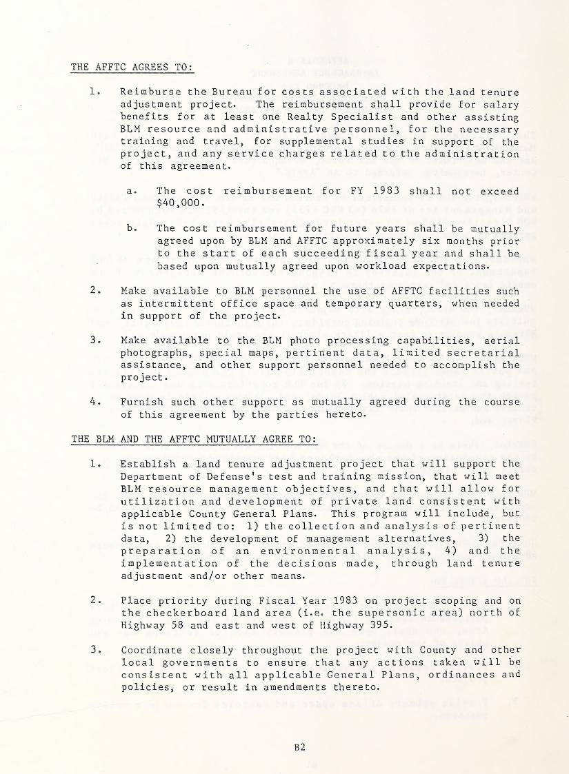
THE AFFTC AGREES TO:
1. Reimburse the Bureau for costs associated with the land tenureadjustment project. The reimbursement shall provide for salarybenefits for at least one Realty Specialist and other assistingBLM resource and administrative personnel, for the necessarytraining and travel, for supplemental studies in support of theproject, and any service charges related to the administrationof this agreement.
a. The cost reimbursement for FY 1983 shall not exceed$40,000.
b. The cost reimbursement for future years shall be mutuallyagreed upon by BLM and AFFTC approximately six months priorto the start of each succeeding fiscal year and shall bebased upon mutually agreed upon workload expectations.
2. Make available to BLM personnel the use of AFFTC facilities such
as intermittent office space and temporary quarters, when neededin support of the project.
3. Make available to the BLM photo processing capabilities, aerialphotographs, special maps, pertinent data, limited secretarialassistance, and other support personnel needed to accomplish the
project
.
4. Furnish such other support as mutually agreed during the course
of this agreement by the parties hereto.
THE BLM AND THE AFFTC MUTUALLY AGREE TO:
1. Establish a land tenure adjustment project that will support the
Department of Defense's test and training mission, that will meet
BLM resource management objectives, and that will allow for
utilization and development of private land consistent withapplicable County General Plans. This program will include, but
is not limited to: 1) the collection and analysis of pertinentdata, 2) the development of management alternatives, 3) the
preparation of an environmental analysis, 4) and theimplementation of the decisions made, through land tenureadjustment and/or other means.
2. Place priority during Fiscal Year 1983 on project scoping and on
the checkerboard land area (i.e. the supersonic area) north of
Highway 58 and east and west of Highway 395.
3. Coordinate closely throughout the project with County and other
local governments to ensure that any actions taken will be
consistent with all applicable General Plans, ordinances andpolicies, or result in amendments thereto.
B2
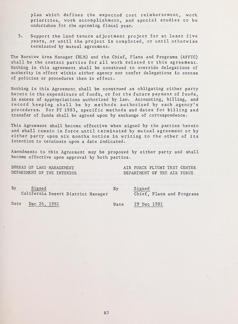
plan which defines the expected cost reimbursement, workpriorities, work accomplishment, and special studies to beundertaken for the upcoming fiscal year.
5. Support the land tenure adjustment project for at least fiveyears, or until the project is completed, or until otherwiseterminated by mutual agreement.
The Barstow Area Manager (BLM) and the Chief, Plans and Programs (AFFTC)shall be the contact parties for all work related to this agreement.Nothing in this agreement shall be construed to override delegations of
authority in effect within either agency nor confer delegations in excessof policies or procedures then in effect.
Nothing in this Agreement shall be construed as obligating either partyhereto in the expenditure of funds, or for the future payment of funds,in excess of appropriations authorized by law. Accounting, billing, andrecord keeping shall be by methods authorized by each agency'sprocedures. For FY 1983, specific methods and dates for billing andtransfer of funds shall be agreed upon by exchange of correspondence.
This Agreement shall become effective when signed by the parties heretoand shall remain in force until terminated by mutual agreement or byeither party upon six months notice in writing to the other of itsintention to terminate upon a date indicated.
Amendments to this Agreement may be proposed by either party and shallbecome effective upon approval by both parties.
BUREAU OF LAND MANAGEMENT AIR FORCE FLIGHT TEST CENTERDEPARTMENT OF THE INTERIOR DEPARTMENT OF THE AIR FORCE
By SignedCalifornia Desert District Manager
Date Dec 26, 1982
By SignedChief, Plans and Programs
Date 29 Dec 1982
B3
APPENDIX C
CALIFORNIA DESERT PLAN MULTIPLE USE CLASSIFICATIONSGUIDELINES
Class C - Controlled Use
This class is designed to preserve and protect wilderness values in areas
that meet the criteria of the Wilderness Act of 1964, where BLM willrecommend such areas for formal wilderness designation by Congress. It
is the most preservation-oriented and restrictive of the four classes.
Class L - Limited Use
This class is oriented towards giving priority protection to sensitive,natural, scenic, ecological, and cultural resources while placinglimitations on other uses that may conflict with or degrade these values.
It is the second most restrictive and protection-oriented of the classes.
Class M - Moderate Use
This class provides for a wide variety of present and future uses underthe principles of multiple use and sustained yield of renewableresources. It provides for tradeoffs between uses where conflicts occurand mitigation of damages caused by permitted uses. Management effortssupport what can be termed as "resource use according to the principlesof conservation."
Class I - Intensive Use
This class is designed to provide use of lands and resources to meethuman needs. It permits intensive land uses with reasonable mitigationand protection of sensitive resource values through rehabilitation whennecessary. It is the most consumptive use-oriented class.
Cl
APPENDIX DSAN BERNARDINO COUNTYLAND USE CATEGORIES
Urban Land Use Categories
1. RESIDENTIAL (RES) includes the full range of urban residential land
use densities, differentiated on the regional map by numbers designatingthe maximum number of dwelling units per gross acre for each outlinedarea. Generally, this covers residential neighborhoods with predominantlot sizes of less than 2 1/2 acres. Land uses which may be foundconsistent with this regional map category include those permitted withinthe single residential and multiple residential districts of theCommunity Plans or their equivalent districts under the zoning ordinance.In some instances this category may also include supportive non-residential land uses such as schools, churches, libraries, rest homes,offices and neighborhood shopping centers, provided such uses generallyserve a neighborhood service-related purpose. The primary featuredistinguishing this category from other regional map categories, such as
rural living or agriculture, is the commitment of a full range of urbanpublic services, e.g., water, sewers, street systems, flood control,fire, police, schools, parks, libraries and ambulances, etc., wherenecessary
.
2. COMMERCIAL (COM) includes all commercial activities normallyassociated with urban areas and requiring a wide range of publicservices. Examples include downtown areas, community centers, highwaycommercial areas, regional shopping and specialized centers. Land useswhich may be found consistent with this regional map category includethose permitted within the limited commercial, general commercial andservice commercial districts in the Community Plans or their equivalentcommercial districts under the zoning ordinance. In some instances this
category may also include related light industrial uses and publicfacilities, provided these uses can function in harmony with thepredominant commercial use.
3. INDUSTRIAL (IND) includes all industrial activities normallyassociated with urban areas, requiring many of the essential publicservices needed for urban areas and requiring many of the essentialpublic services needed for urban residential and commercial categories.Examples include light assembly plants, electronics firms, industrialparks, equipment storage yards, transportation terminals, basicmanufacturing and salvage yards. Land uses which may be found consistentwith this regional map category include those permitted within thelimited industrial and general industrial districts of the CommunityPlans or their equivalent districts under zoning ordinance. In someinstances this category may also include related commercial uses andpublic facilities provided these uses can function in a supportive mannerwith the predominant industrial use.
Certain areas shown in the industrial category on the regional mapcontain pockets of existing residential use. It is the intent of theGeneral Plan to encourage transition of these areas to industrial use assoon as possible in order to improve living conditions and reduce presentconflicts between industrial and residential land uses. For this same
Dl
reason, none of the residential districts of the Community Plans or their
equivalents under the zoning ordinance could be found consistent withthe industrial category of the regional maps.
4. PUBLIC AND QUASI-PUBLIC (PUB) includes a variety of public andprivately owned facilities and lands which provide a service to thegeneral public. Examples include civic centers, high schools, regionalparks, hospitals, lakes and defense Installations. These uses may beeither associated with or separated from urban residential, commercialand industrial categories and are labeled in many instances to indicatetheir general function. The outlines of areas in this category on theregional land use map do not necessarily show the exact boundaries of
public or private land ownerships involved, but instead, graphicallydepict the general relationship of existing or proposed facilities to
other land use categories.
Rural Land Use Categories
5. RURAL LIVING (RUL) includes a wide variety of rural residentialresorts and light agricultural settings together with limited publicservice, commercial and employment facilities. Examples include smallfarms, rural subdivisions with parcels of 2-1/2 acres or greater(however, selected parcels as small as 1 acre may be found consistentwith this category), scattered homes on large acreages, resorts and smallrural settlements serving the needs of agriculture, mining and thetraveling public. Land uses which may be found consistent with thiscategory include those permitted within the rural residential and limitedagricultural districts of the Community Plan or their equivalentdistricts under the zoning ordinance. In some instances this categorymay also include supportive non-res idential land uses, such as localmarkets, supply stores, restaurants and storage yards, provided theyserve functions related to the maintenance of a rural setting.
The primary feature distinguishing this category from other regional mapcategories is the limitation of public services and improvements to thosewhich are designed for a rural area and which can be financiallysupported by a rural population. There is, therefore, a very limitedavailability of services commonly found in urban residential, commercialand industrial categories. Some of the areas in this category areincluded within the Williamson Act Agricultural Preserves, delineated onthe health and safety map for each region.
6. AGRICULTURE (AGR) includes a wide variety of agriculturalactivities, including those which are least compatible with urban uses.
Examples include orchards, row crops and grazing, as well as dairies,feed yards, calf nurseries and hog ranches. Land uses which may be foundconsistent with this category include those permitted within the limitedagriculture and general agriculture districts of the Community Plans or
their equivalents under the zoning ordinance.
In some instances this category may include supportive nonagriculturalactivities such as feed and equipment stores, tractor repair stations androadside stands for products primarily grown on site, provided they arerelated to the predominant agricultural use and do not detract from its
viability. This category is also distinguished from the urban categories
D2
by the presence of very limited public services and improvements. Manyof the areas in this category are included within the Williamson ActAgricultural Preserves, delineated on the health and safety map for eachregion.
Rural Conservation Land Use Category
7. RURAL CONSERVATION (RCN) includes a wide variety of publicly andprivately owned land which by its location, access limitations, naturalresources or scenic qualities, lends itself to uses of very low intensityand limited human habitation. Examples include National Forest andBureau of Land Management holdings, camps, wilderness areas, agriculture,mining, houses on lots of 40 acres or greater and other public andprivate activities which preserve the predominant open space character of
the category. Land uses which may be found consistent with this categoryinclude those within the rural conservation district of the CommunityPlans or the equivalent district under the zoning ordinance. Thiscategory is distinguished from all other categories by the absence of anyof the public services and improvements associated with urban areas.
Mountain-Desert Land Use Map Designations
8. MOUNTAIN AND DESERT COMMUNITY includes communities for whichregional land use categories have not previously been identified throughthe preparation and adoption of a Community General Plan. This specialdesignation primarily reflects residential land uses with supportingcommercial and industrial areas*
When a Community Plan is developed for a Mountain Community or a DesertCommunity, the regional land use maps will be amended to indicate theappropriate land use categories for the area.
9. DESERT SPECIAL SERVICE CENTER may be commercial service to highwaytravelers along the highway; it may be a convenience center forrecreation activities along the Colorado River, or it may be a self-contained community within a military base, providing special services to
the resident population. In some cases, special service centers areshown to indicate the location of activities which provide a specialservice to the surrounding resident population. This special designationwill also be replaced by appropriate regional land use categories asCommunity Plans are prepared.
D3

:
'
.
.
'
.
APPENDIX E
SAN BERNARDINO COUNTYSAFETY OVERLAY DISTRICTS
OYERLAY DISTRICTS 85.0525
85.0525 Safety (S) Overlay Districts.
(a) INTENT.
(1)
Safety Overlay Districts are intended to identify natural or
man-made conditions which are a potential threat to the public health and safety
and to formulate requirements to mitigate that threat. Districts have been
established for significant earthquake ground shaking or liquefaction areas, areas
prone to brush fires and flooding, areas prone to high noise levels, and for areas
adjacent to airports.
(b) LOCATIONAL REQUIREMENTS.(1) Safety — Geologic (S-G) Overlay.
(A) The S-G Overlay shall be designated in areas which are on or
adjacent to active earthquake fault traces. The S-G overlay shall implement the
requirements of the Alquist-Priolo Special Studies Zones Act of 1972.
(B) The S-G Overlay shall be designated in areas where landslides
are prevalent.
(C) The S-G Overlay shall be designated in areas where lique-
faction of the soil is associated with earthquake activity.
(2) Safety — Fire (S-F) Overlay.
(A) The S-F Overlay shall be designated in high fire hazard
areas as mapped on the County General Plan Health and Safety Maps with the
locations derived from the California Department of Forestry and U.S. Forest
Service.
(3) Safety — Flood (S-FL) Overlay.
(A) The S-FL Overlay shall apply to those areas contained within
any 100-year flood plain shown on the General Plan and as may be designated on
maps prepared by the U.S. Army Corps of Engineers, the County Flood Control
District or the Federal Flood Insurance Administration.
(B) The S-FL Overlay identifies flood hazard areas in order to
maintain eligibility for the receipt of Federal Flood Insurance from the Federal
Flood Insurance Administration and thereby protect the public health, welfare and
safety. It should be noted that floodways are designated and mapped as separate
land use districts having a list of permitted land uses and development standards.
(4) Safety — Airports (S-A) Overlay.
(A) The S-A Overlay as defined within this section should apply to
those airports that are publicly owned or licensed for public use.
(B) The S-A Overlay as defined in this section shall not apply to
major civilian and military installations such as Ontario International, George Air
Force Base and Norton Air Force Base. In these instances, an Airport Land Use
Plan should be prepared and adopted by an Airport Land Use Commission and
incorporated into the appropriate community plan.
(C) The boundary of the S-A Overlay District shall be determined
as follows:
(I) Wherever an Airport Land Use Plan has been prepared
and adopted by an Airport Land Use Commission or an Airport Installation
Compatible Use Zone (AICUZ) study has been completed around a military airport,
the boundary may be as defined by those studies. Provided, however, that in any
8 — 247 (2/ 1
1
/85]
El
85.0525 DEVELOPMENT CODE
.case where said studies are proven wrong by an independent study completed by a
qualified engineer and accepted by the Planning Commission, the boundary of the
S-A Overlay District shall conform to the boundary as determined during the course
of the project analysis.
(II) In all other cases, the District may include all that area
within the “imaginary surfaces” as defined in the Federal Aviation Regulations,
Part 77.
(5) Safety — Noise (S-N) Overlay.
(A) The S-N Overlay should be applied to those areas where the
Community Noise Equivalency Level (CNEL) is 65 decibels or greater (65dB[Aj).
(B) Community noise acoustical reports may be required during
developmental processes to determine actual noise levels and contours.
(C) Certain land uses may not be compatible at 65 CNEL (dB[A])
or greater.
(c) DEVELOPMENT STANDARDS.(1) Safety — Geologic (S-G) Overlay. When a land use is proposed
within an S-G Overlay, the following standards shall apply:
(A) Development of all structures used for human occupancy,
other than single-story wood frame structures, shall take place Fifty (50) feet or
further from any active earthquake fault traces. Active fault traces are those
delineated on the Alquist-Priolo Special Studies Zones Maps or on maps contained
within the County General Plan.
(B) Development of all structures used for critical facilities shall
take place one hundred fifty (150) feet or further from any active earthquake fault
trace as indicated within maps contained in the County General Plan or as
delineated on the Alquist-Priolo Special Studies Zones Maps. Critical facilities shall
include dams, reservoirs, fuel storage facilities, power plants, nuclear reactors,
police and Fire stations, schools, hospitals, rest homes, nursing homes and
emergency communication facilities.
(C) The following conditions may apply to areas subject to
periodic landslides and soil liquefaction as indicated on the community plan:
(I) Siting. All facilities and streets should be sited so as to
minimize the erosion potential.
(II) Vegetation. Natural vegetation should be retained and
protected where possible. Where inadequate vegetation exists, additional land-
scaping should be provided. Any additional landscaping should be compatible with
the local environment and capable of surviving with a minimum of maintenance and
supplemental water.
(III) Exposure of Bare Land. The smallest practical area of
land should be exposed at any one time during development. When land is exposed
during development, the exposure should be kept to the shortest practical duration
and should be protected with temporary vegetation or mulching, where practical.
(IV) Run-off. The development should be designed to
minimize water run-off. Provisions should be made to effectively accommodate any
increased run-off.
p/ll/85] 8 — 248
E2
OVERLAY DISTRICTS 85.0525
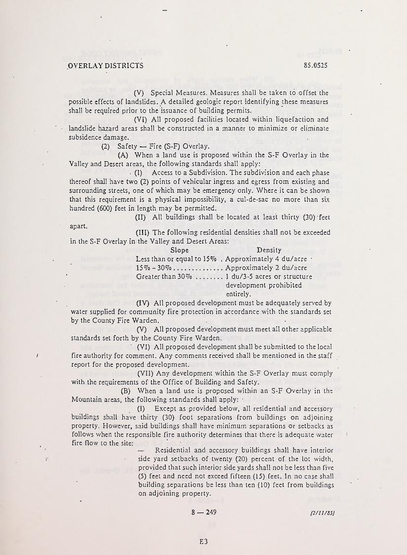
(V) Special Measures. Measures shall be taken to offset the
possible effects of landslides. A detailed geologic report identifying these measures
shall be required prior to the issuance of building permits.
(VI) All proposed facilities located within liquefaction and
landslide hazard areas shall be constructed in a manner to minimize or eliminate
subsidence damage.
(2) Safety — Fire (S-F) Overlay.
(A) When a land use is proposed within the S-F Overlay in the
Valley and Desert areas, the following standards shall apply:
• (I) Access to a Subdivision. The subdivision and each phase
thereof shall have two (2) points of vehicular ingress and egress from existing and
surrounding streets, one of which may be emergency only. Where it can be shown
that this requirement is a physical impossibility, a cul-de-sac no more than six
hundred (600) feet in length may be permitted.
(II) All buildings shall be located at least thirty (30) 'feet
apart.
(III) The following residential densities shall not be exceeded
in the S-F Overlay in the Valley and Desert Areas:
Slope Density
Less than or equal to 15% . Approximately 4 du/acre •
15% - 30% Approximately 2 du/acre
Greater than 30% 1 du/3-5 acres or structure
development prohibited
entirely.
(IV) All proposed development must be adequately served by
water supplied for community Fire protection in accordance with the standards set
by the County Fire Warden.
(V) All proposed development must meet all other applicable
standards set forth by the County Fire Warden.
(VI) All proposed development shall be submitted to the local
Fire authority for comment. Any comments received shall be mentioned in the staff
report for the proposed development.
(VII) Any development within the S-F Overlay must comply
with the requirements of the Office of Building and Safety.
(B) When a land use is proposed within an S-F Overlay in the
Mountain areas, the following standards shall apply: •
(I) Except as provided below, all residential and accessory
buildings shall have thirty (30) foot separations from buildings on adjoining
property. However, said buildings shall have minimum separations or setbacks as
follows when the responsible fire authority determines that there is adequate water
Fire flow to the site:
— Residential and accessory buildings shall have interior
side yard setbacks of twenty (20) percent of the lot width,
provided that such interior side yards shall not be less than five
(5) feet and need not exceed fifteen (15) feet. In no case shall
building separations be less than ten (10) feet from buildings
on adjoining property.
8 — 249 p/1 1/85]
E3
85.0525 DEVELOPMENT CODE
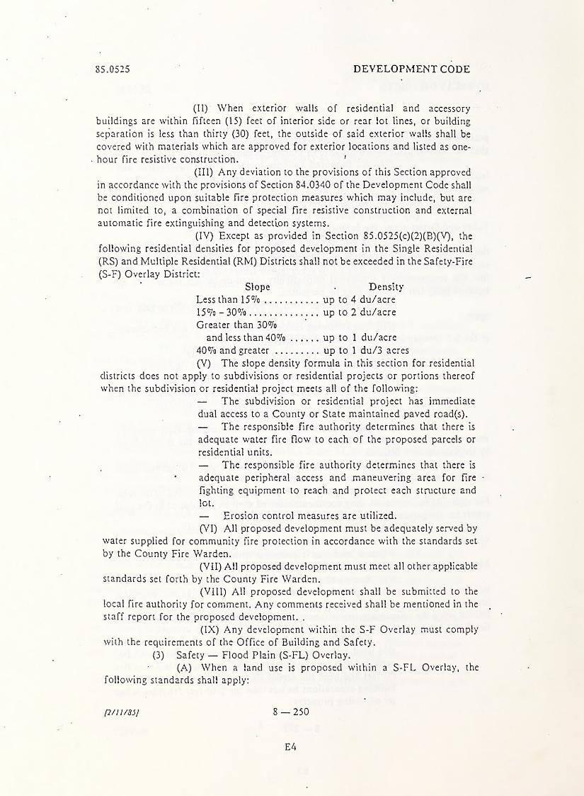
(II) When exterior walls of residential and accessory
buildings are within fifteen (15) feet of interior side or rear lot lines, or building
separation is less than thirty (30) feet, the outside of said exterior walls shall be
covered with materials which are approved for exterior locations and listed as one-
hour fire resistive construction. '
(III) Any deviation to the provisions of this Section approved
in accordance with the provisions of Section 84.0340 of the Development Code shall
be conditioned upon suitable fire protection measures which may include, but are
not limited to, a combination of special fire resistive construction and external
automatic fire extinguishing and detection systems.
(IV) Except as provided in Section 85.0525(c)(2)(B)(V), the
following residential densities for proposed development in the Single Residential
(RS) and Multiple Residential (RM) Districts shall not be exceeded in the Safety-Fire
(S-F) Overlay District:
Slope • Density
Less than 15% up to 4 du/acre
15% - 30% up to 2 du/acre
Greater than 30%and less than 40% up to 1 du/acre
40% and greater up to 1 du/3 acres
(V) The slope density formula in this section for residential
districts does not apply to subdivisions or residential projects or portions thereof
when the subdivision or residential project meets all of the following:
— The subdivision or residential project has immediate
dual access to a County or State maintained paved road(s).
— The responsible fire authority determines that there is
adequate water fire flow to each of the proposed parcels or
residential units.
— The responsible fire authority determines that there is
* adequate peripheral access and maneuvering area for Fire •
fighting equipment to reach and protect each structure and
lot.
— Erosion control measures are utilized.
(VI) All proposed development must be adequately served by
water supplied for community fire protection in accordance with the standards set
by the County Fire Warden.
(VII) All proposed development must meet all other applicable
standards set forth by the County Fire Warden.
(VIII) All proposed development shall be submitted to the
local fire authority for comment. Any comments received shall be mentioned in the
staff report for the proposed development. .
(IX) Any development within the S-F Overlay must comply
with the requirements of the Office of Building and Safety.
(3) Safety — Flood Plain (S-FL) Overlay.
(A) When a land use is proposed within a S-FL Overlay, the
following standards shall apply:
p/11/85] 8 — 250
E4
OVERLAY DISTRICTS 85.0525
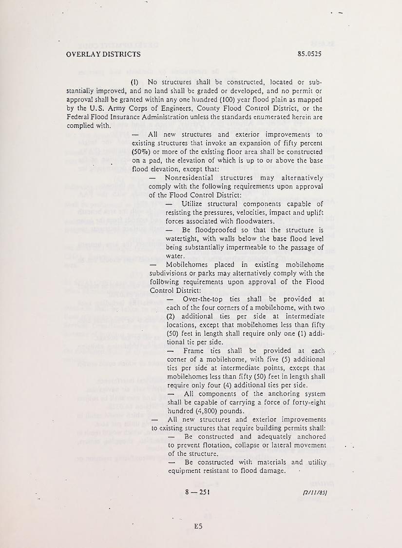
(I) No structures shall be constructed, located or sub-
stantially improved, and no land shall be graded or developed, and no permit or
approval shall be granted within any one hundred (100) year flood plain as mappedby the U.S. Army Corps of Engineers, County Flood Control District, or the
Federal Flood Insurance Administration unless the standards enumerated herein are
complied with.
— All new structures and exterior improvements to
existing structures that invoke an expansion of fifty percent
(50%) or more of the existing floor area shall be constructed
on a pad, the elevation of which is up to or above the base
flood elevation, except that:
— Nonresidential structures may alternatively
comply with the following requirements upon approval
of the Flood Control District:
— Utilize structural components capable of
resisting the pressures, velocities, impact and uplift
forces associated with floodwaters.
— Be floodproofed so that the structure is
watertight, with walls below the base flood level
being substantially impermeable to the passage of
water.
— Mobilehomes placed in existing mobilehome
subdivisions or parks may alternatively comply with the
following requirements upon approval of the Flood
Control District:
— Over-the-top ties shall be provided at
each of the four corners of a mobilehome, with two
(2) additional ties per side at intermediate
locations, except that mobilehomes less than fifty
(50) feet in length shall require only one (1) addi-
tional tie per side.
— Frame ties shall be provided at each
corner of a mobilehome, with five (5) additional
ties per side at intermediate points, except that
mobilehomes less than fifty (50) feet in length shall
require only four (4) additional ties per side.
— All components of the anchoring system
shall be capable of carrying a force of forty-eight
hundred (4,800) pounds.
— All new structures and exterior improvements
to existing structures that require building permits shall:
— Be constructed and adequately anchored
to prevent flotation, collapse or lateral movementof the structure.
— Be constructed with materials and utility
equipment resistant to flood damage.
8 — 251 p/11/85]
E5

85.0525 DEVELOPMENT CODE
— Be constructed by methods and practices
that minimize flood damage.
— All on-site water supply and waste disposal
systems shall be constructed and located to minimize
infiltration of floodwaters and to avoid impairment to,
or contamination to, or from utilities during flooding.
(4) Safety — Airports (S-A) Overlay. When a land use is proposed
within an S-A Overlay, the following standards and criteria shall apply:
(A) Any proposed structures should not exceed the height
limitations provided by the requirements of Federal Aviation Regulations (FAR),
Part 77. Existing topographic elevations as compared to the deviation of the
centerline of the runway (primary surface) should be considered in determining the
permitted height of an affected structure.
(B) The Airport Safety Areas shall be defined as follows:
(I) Airport Safety Area 1 corresponds with the FAAApproved Clear Zone (per FAR Part 152) for each runway end.
(II) Airport Safety Area 2 corresponds with the area beneath
the FAR Part 77 approach surface for each runway end and extends from the outer
limit of the Clear Zone to the point where the approach surface intersects the
horizontal surface.
(III) Airport Safety Area 3 encompasses the area beneath
the FAR Part 77 horizontal and conical surface.
(C) Within Safety Area 1, the following land uses should not be
permitted:
(I) Residential Development.
(D) Within Safety Area 1, the following land uses shall be subject
to a Site Approval in accordance with the provisions of Section 84.0320:
(I) Permanent structures (not necessarily including such
items as roads, railroads or underground vaults).
(II) Any use which may result in short- or long-term con-
centration of people.
(III) Hazardous installations such as oil or gas storage.
(IV) Uses resulting in a distracting or confusing emission
or reflection of light.
(V) Uses which could generate smoke or which could attract
large concentrations of birds.
(VI) Uses which would generate electrical interference.
(VII) Uses which may otherwise affect safe air navigation.
(E) Within Safety Area 2 the following land uses shall be subject
to a Site Approval in accordance with the provisions of Section 84.0320:
(I) Any new residential development which would result in
a population density greater than two (2) one-family dwelling units per acre.
(II) Any use, depending upon location, which would result in
large concentrations of people such as, but not limited to, shopping centers,
restaurants, schools, factories, hospitals or stadiums.
(III) Uses resulting in a distracting or confusing emission or
reflection of light.
(2/11/851 8 — 252
E6
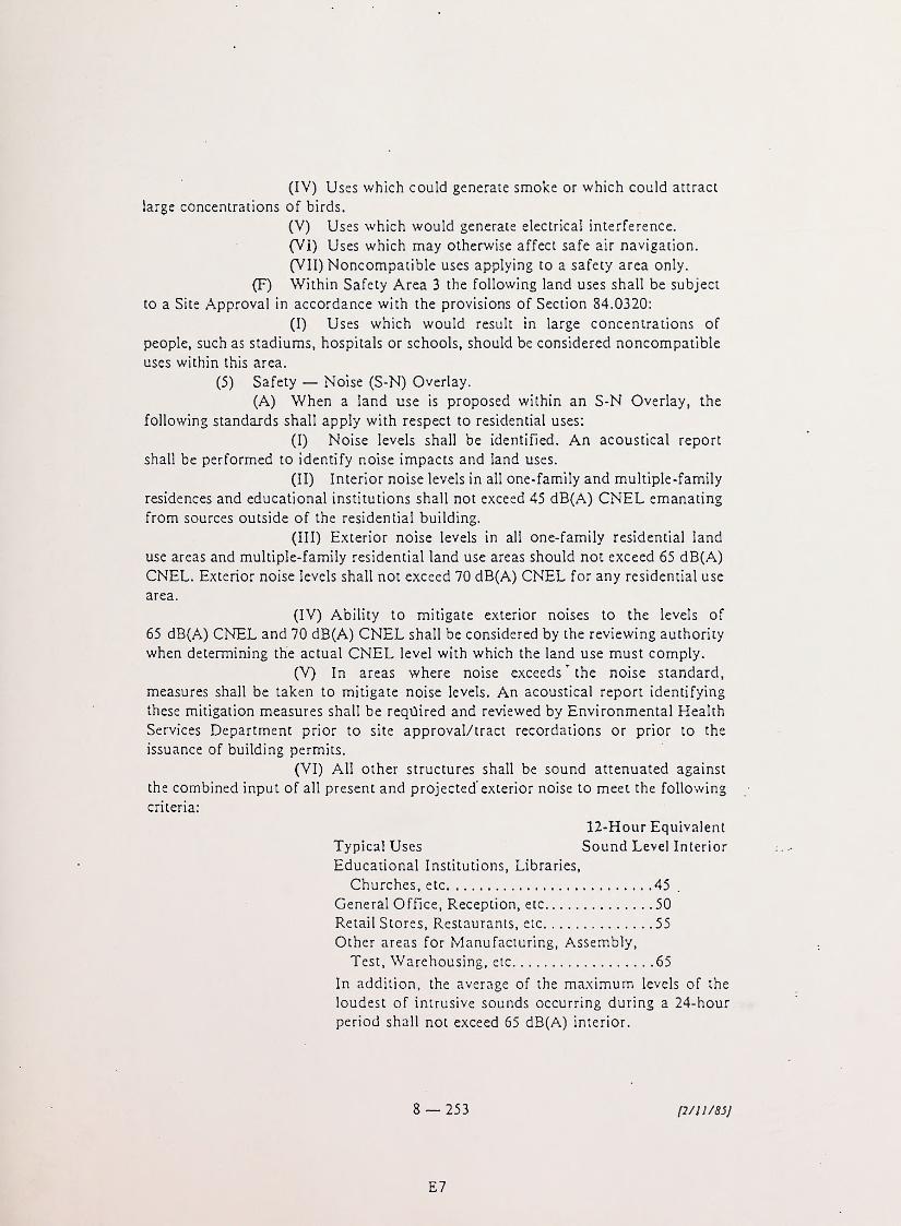
(IV) Uses which could generate smoke or which could attract
large concentrations of birds.
(V) Uses which would generate electrical interference.
(VI) Uses which may otherwise affect safe air navigation.
(VII) Noncompatible uses applying to a safety area only.
(F) Within Safety Area 3 the following land uses shall be subject
to a Site Approval in accordance with the provisions of Section 84.0320:
(I) Uses which would result in large concentrations of
people, such as stadiums, hospitals or schools, should be considered noncompatible
uses within this area.
(5) Safety — Noise (S-N) Overlay.
(A) When a land use is proposed within an S-N Overlay, the
following standards shall apply with respect to residential uses:
(I) Noise levels shall be identified. An acoustical report
shall be performed to identify noise impacts and land uses.
(II) Interior noise levels in all one-family and multiple-family
residences and educational institutions shall not exceed 45 dB(A) CNEL emanating
from sources outside of the residential building.
(III) Exterior noise levels in all one-family residential land
use areas and multiple-family residential land use areas should not exceed 65 dB(A)
CNEL. Exterior noise levels shall not exceed 70 dB(A) CNEL for any residential use
area.
(IV) Ability to mitigate exterior noises to the levels of
65 dB(A) CNEL and 70 dB(A) CNEL shall be considered by the reviewing authority
when determining the actual CNEL level with which the land use must comply.
(V) In areas where noise exceeds ’ the noise standard,
measures shall be taken to mitigate noise levels. An acoustical report identifying
these mitigation measures shall be required and reviewed by Environmental Health
Services Department prior to site approval/tract recordations or prior to the
issuance of building permits.
(VI) All other structures shall be sound attenuated against
the combined input of all present and projected' exterior noise to meet the following
criteria:
12-Hour Equivalent
Typical Uses Sound Level Interior
Educational Institutions, Libraries,
Churches, etc 45
General Office, Reception, etc 50
Retail Stores, Restaurants, etc 55
Other areas for Manufacturing, Assembly,
Test, Warehousing, etc 65
In addition, the average of the maximum levels of the
loudest of intrusive sounds occurring during a 24-hour
period shall not exceed 65 dB(A) interior.
8 — 253 [2/11/85]
E7
.


...