Embed Size (px)
Citation preview
Land off Cricklade Road Cirencester
Gloucestershire
Archaeological Watching Brief
June 2014
for
on behalf of Turley
Aldi Stores Ltd
CA Project: 4797 CA Report: 14277
Land off Cricklade Road Cirencester
Gloucestershire
Archaeological Watching Brief
CA Project: 4797 CA Report: 14277
prepared by Luke Brannlund, Supervisor Designate
date 24 June 2014
checked by Cliff Bateman, Principal Fieldwork Manager
date
approved by Simon Cox, Head of Fieldwork
signed
date 15 July 2014
issue 01
This report is confidential to the client. Cotswold Archaeology accepts no responsibility or liability to any third party to whom this report, or any part of it, is made known. Any such party relies upon this report entirely
at their own risk. No part of this report may be reproduced by any means without permission.
© Cotswold Archaeology
Cirencester Milton Keynes Andover Building 11 Unit 4 Stanley House Kemble Enterprise Park Cromwell Business Centre Walworth Road Kemble, Cirencester Howard Way, Newport Pagnell Andover, Hampshire Gloucestershire, GL7 6BQ MK16 9QS SP10 5LH t. 01285 771022 t. 01908 218320 t. 01264 347630 f. 01285 771033
© Cotswold Archaeology
1
Land off Cricklade Road, Cirencester, Gloucestershire: Archaeological Watching Brief
CONTENTS
SUMMARY ..................................................................................................................... 2
1. INTRODUCTION ................................................................................................ 3
2. RESULTS (FIGS. 2-4) ........................................................................................ 5
3. DISCUSSION ..................................................................................................... 5
4. CA PROJECT TEAM .......................................................................................... 5
5. REFERENCES ................................................................................................... 6
APPENDIX A: CONTEXT DESCRIPTIONS .................................................................... 7
APPENDIX B: OASIS REPORT FORM........................................................................... 9
LIST OF ILLUSTRATIONS
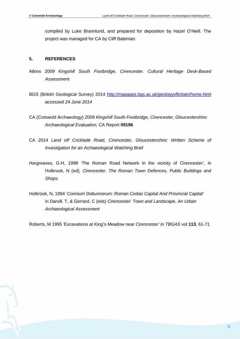
Fig. 1 Site location plan (1;25,000)
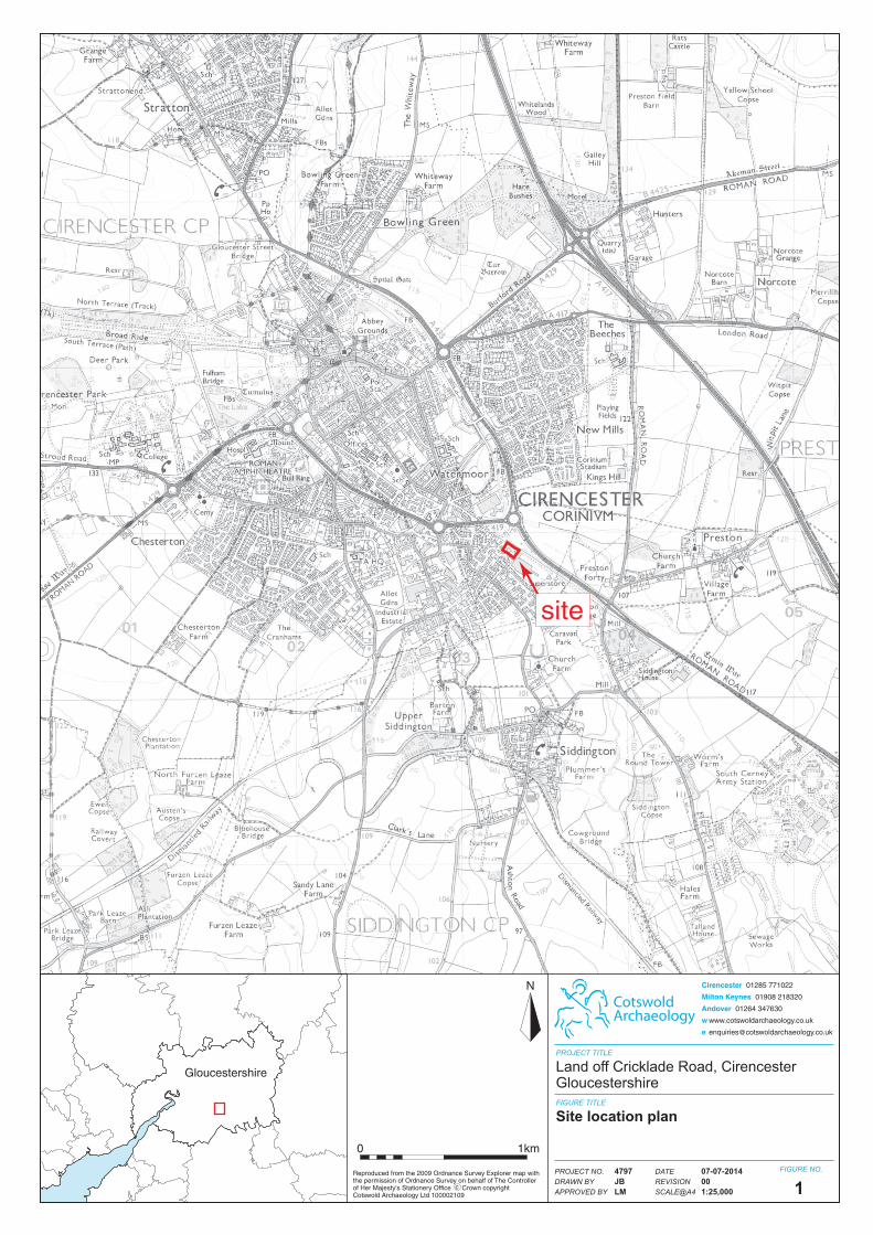
Fig. 2 The site, showing location of observed groundworks (1:350 and 1:5000).
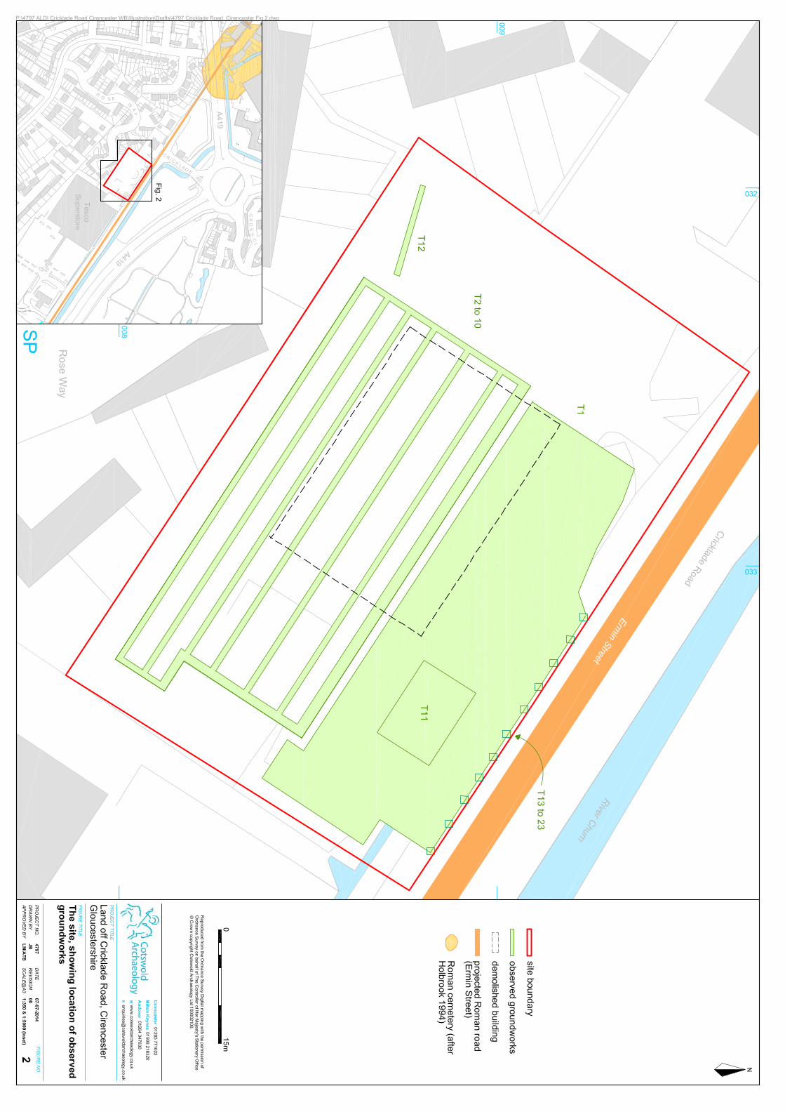
Fig. 3 Photograph: Trench 12 looking north-east
Fig. 4 Photograph: Trench 10, looking north-west.
© Cotswold Archaeology
2
Land off Cricklade Road, Cirencester, Gloucestershire: Archaeological Watching Brief
SUMMARY
Project Name: Land off Cricklade Road
Location: Cirencester, Gloucestershire
NGR: SP 03292 00886
Type: Watching Brief
Date: 26 May- 10 June 2014
Planning Reference: CDC/13/04365/FUL; condition 9
Location of Archive: Corinium Museum
Site Code: ACRC 14
An archaeological watching brief was undertaken by Cotswold Archaeology during
groundworks associated with the demolition of existing buildings and the construction of a
new Aldi store at land off Cricklade Road, Cirencester.
No features or deposits of archaeological interest were observed during groundworks, and
no artefactual material pre-dating the modern period was recovered.
© Cotswold Archaeology
3
Land off Cricklade Road, Cirencester, Gloucestershire: Archaeological Watching Brief
1. INTRODUCTION
1.1 In May and June 2014 Cotswold Archaeology (CA) carried out an archaeological
watching brief for Turley, on behalf of Aldi Stores Ltd, on land off Cricklade Road,
Cirencester, Gloucestershire (centred on NGR: SP 03292 00886; Fig. 1). The
watching brief was undertaken to fulfil a condition attached to planning consent for
the demolition of an existing car showroom and the construction of a new Aldi Store
with associated parking an landscaping (Cotswold District Council (CDC) Planning
ref: CDC/13/04365/FUL, condition 9).
1.2 The watching brief was carried out in accordance with a detailed Written Scheme of
Investigation (WSI) produced by CA (2014) that was approved by CDC acting on the
advice of Charles Parry, Archaeologist, Gloucestershire County Council. The
fieldwork also followed the Standard and guidance for an archaeological watching
brief (IfA 2009), the Statement of Standards and Practices Appropriate for
Archaeological Fieldwork in Gloucestershire (GCC 1995), the Management of
Archaeological Projects 2 (English Heritage 1991), and the Management of
Research Projects in the Historic Environment (MORPHE): Project Manager’s Guide
(EH 2006).
The site 1.3 The development area is approximately 0.4ha in extent and was formerly a car
showroom. It is bounded to the north-east by Cricklade Road, by commercial
properties to the south-east and north-west and by residential properties to the
south-west (Fig. 2). The site lies at approximately 106m AOD.
1.4 The underlying solid geology of the area is mapped as Forest Marble Formation of
the Jurassic era with overlying deposits of alluvium, comprising clay, silt, sand and
gravel, of the Quaternary period (BGS 2014). During groundworks the natural
gravels were typically encountered 0.8m below the present ground level (bpgl).
Archaeological background 1.5 The site lies in an area of archaeological interest, being situated approximately
400m beyond the south-east of the Silchester Gate of the Roman town of Corinium
and adjacent to a main Roman road, Ermin Street (Hargreaves 1998).

© Cotswold Archaeology
4
Land off Cricklade Road, Cirencester, Gloucestershire: Archaeological Watching Brief
1.6 Eighteenth-century and later discoveries of Early Roman burials south of the Roman
town, extending along Ermin Street, identify the presence of a Roman cemetery
approximately 200m north-west of the current site (Holbrook 1994). Previous
archaeological recording undertaken at the adjacent Tesco superstore revealed a
possible Roman field boundary, as well as a possible cremation pyre and two
possible cremations (Roberts 1995).
1.7 A desk-based assessment and subsequent evaluation trenching prior to the
construction of the Kingshill South Footbridge suggested that the area in close
proximity to the current site was cleared in the later prehistoric period and was
subjected to repeated ploughing and flooding events throughout the Roman period,
with Roman levels subsequently sealed by a deep layer of alluvium (Atkins 2009).
The subsequent archaeological evaluation revealed no archaeological features,
although Iron Age and Roman pottery sherds were recovered from the surface of the
natural gravels, which were overlain by an alluvial deposit, attesting to prehistoric
and Roman activity in the wider vicinity (CA 2009).
Archaeological objectives 1.8 The objectives of the archaeological works were:
• to monitor groundworks, and to identify, investigate and record all significant buried
archaeological deposits revealed on the site during the course of the development
groundworks;
• at the conclusion of the project, to produce an integrated archive for the project work
and a report setting out the results of the project and the archaeological conclusions
that can be drawn from the recorded data.
Methodology
1.9 The fieldwork followed the methodology set out within the WSI (CA 2014). An
archaeologist was present during intrusive groundworks comprising general ground
reduction for a new car park (Trench 1) the excavation of foundation and service
trenches (Trenches 2-10 inclusive and 12), the excavation of an attenuation tank
(Trench 11) and a series of postholes along the Cricklade Road frontage (Trenches
13 to 23 inclusive: see Fig. 2 for locations and extent).

© Cotswold Archaeology
5
Land off Cricklade Road, Cirencester, Gloucestershire: Archaeological Watching Brief
1.10 Where archaeological deposits were encountered written, graphic and photographic
records were compiled in accordance with CA Technical Manual 1: Fieldwork
Recording Manual (2013).
1.11 The archive from the watching brief is currently held by CA at their offices in Kemble
and will be deposited with Corinium Museum. A summary of information from this
project, set out within Appendix B will be entered onto the OASIS online database of
archaeological projects in Britain.
2. RESULTS (FIGS. 2-4)
2.1 Natural gravels with sand and clay were typically revealed throughout the site at an
average depth of 0.8m bpgl. This was overlain by a series of re-deposited clay and
modern concrete rubble layers, averaging 0.6m in thickness, which was in turn cut
by the foundation and services trenches for the former car showroom. These
deposits were sealed by modern demolition rubble.
2.2 No features or deposits of archaeological interest were observed during the
groundworks and, despite visual scanning of spoil, no artefactual material pre-dating
the modern period was recovered.
3. DISCUSSION
3.1 Despite the archaeological potential of the application area (see archaeological
background above), the watching brief identified no archaeological remains within
the area of observed groundworks. The identification of modern deposits
immediately sealing the natural gravels suggests that the site may have previously
been truncated. It therefore remains undetermined whether the current findings are
an accurate reflection of the paucity of archaeological deposits throughout the site or
whether such deposits were previously truncated during the modern period.
4. CA PROJECT TEAM
Fieldwork was undertaken by Luke Brannlund. The report was written by Luke
Brannlund. The illustrations were prepared by Jon Bennett. The archive has been
© Cotswold Archaeology
6
Land off Cricklade Road, Cirencester, Gloucestershire: Archaeological Watching Brief
compiled by Luke Brannlund, and prepared for deposition by Hazel O’Neill. The
project was managed for CA by Cliff Bateman.
5. REFERENCES
Atkins 2009 Kingshill South Footbridge, Cirencester. Cultural Heritage Desk-Based
Assessment
BGS (British Geological Survey) 2014 http://mapapps.bgs.ac.uk/geologyofbritain/home.html
accessed 24 June 2014
CA (Cotswold Archaeology) 2009 Kingshill South Footbridge, Cirencester, Gloucestershire:
Archaeological Evaluation; CA Report 09196 CA 2014 Land off Cricklade Road, Cirencester, Gloucestershire: Written Scheme of
Investigation for an Archaeological Watching Brief
Hargreaves, G.H, 1998 ‘The Roman Road Network in the vicinity of Cirencester’, in
Holbrook, N (ed), Cirencester. The Roman Town Defences, Public Buildings and
Shops.
Holbrook, N, 1994 ‘Corinium Dobunnorum: Roman Civitas Capital And Provincial Capital’
in Darvill, T, & Gerrard, C (eds) Cirencester: Town and Landscape. An Urban
Archaeological Assessment
Roberts, M 1995 ‘Excavations at King’s Meadow near Cirencester’ in TBGAS vol 113, 61-71

© Cotswold Archaeology
7
Land off Cricklade Road, Cirencester, Gloucestershire: Archaeological Watching Brief
APPENDIX A: CONTEXT DESCRIPTIONS
Trench No.
Context No.
Type Fill of Context interpretation
Description L (m) W (m)
Depth/thickness (m)
100 Layer Demolition Layer
Tarmac and rubble 0.4
101 Layer Demolition Layer
Type 1 stone and rubble 0.3
102 Cut Cut of modern service trenches and foundations
Modern foundation and services trenches
n/a
103 Fill 102 Fill of modern service trenches and foundations
Rubble Type 1 stone and clay n/a
104 Layer Re-deposited natural
Gravel and sand n/a
200 Layer Demolition layer Rubble and Type 1 stone 0.4
201 Cut Modern services and foundation trenches
Modern foundation and services trenches
n/a
202 Fill 201 Fill of modern services and foundation trenches
Rubble Type 1 stone and clay n/a
203 Layer Made ground Mid yellow-brown clay with modern rubble
0.6
204 Layer Natural Sand and gravel n/a
300 Layer Demolition layer Rubble and Type 1 stone 0.4
301 Cut Modern services and foundation trenches
Modern foundation and services trenches
n/a
302 Fill 201 Fill of modern services and foundation trenches
Rubble Type 1 stone and clay n/a
303 Layer Made ground Mid yellow-brown clay with modern rubble
0.6
304 Layer Natural Sand and gravel n/a
400 Layer Made ground Rubble and stone with lenses of clay
n/a
401 Cut Former concrete petrol tanks
1.8
402 Fill 401 Fill of former petrol tanks
Contaminated black clay and concrete rubble
1.8
500 Layer Demolition layer Concrete rubble 0.4
501 Layer Made ground Grey-black clay 0.8
502 Layer Made ground Rubble and clay 0.6
503 Layer Natural Gravel and clay n/a
600 Layer Demolition layer Rubble stone and Type 1 0.3
601 Layer Made ground Black/yellow-brown clay 0.7
602 Layer Natural Gravel n/a
603 Cut Foundation and service trenches
n/a
604 Fill 603 Fill of foundation and service trenches
Rubble and clay n/a
700 Layer Demolition layer Concrete rubble 1
701 Layer Made ground Mid brown clay 0.9
702 Layer Made ground Concrete rubble in clay 0.6
703 Layer Natural Gravel and clay n/a

© Cotswold Archaeology
8
Land off Cricklade Road, Cirencester, Gloucestershire: Archaeological Watching Brief
800 Layer Demolition layer Concrete rubble 1
801 Layer Made ground Mid brown clay 1
802 Layer Made ground Concrete rubble in clay 1.2
803 Layer Natural Gravel and clay n/a
900 Layer Demolition layer Type 1 and concrete rubble 0.4
901 Layer Made ground Type 1 with gravel 0.5
902 Layer Made ground Mid yellow-brown clay 0.5
903 Layer Natural Gravel and sand n/a
904 Cut Foundation and service trenches
n/a
905 Fill 904 Fill of foundation and service trenches
Rubble and clay n/a
1000 Layer Demolition layer Type 1 and concrete rubble 0.4
1001 Layer Made ground Black-brown clay 0.4
1002 Layer Made ground Mid yellow-brown clay 0.4
1003 Layer Natural Gravel with sand n/a
1101 Layer Demolition layer Concrete rubble 0.4
1102 Layer Made ground Black organic silt clay 0.6
1103 Layer Made ground Mid brown clay with gravel 0.6
1104 Layer Made ground Brown clay 0.8
1105 Fill Culvert Concrete culvert still in use n/a
1106 Layer Natural Gravel n/a
1107 Fill Fill of culvert Large stones and silt packing 1
1108 Cut Cut of culvert Linear in plan with a rectangular profile
1
1200 Layer Made ground Type 1 and concrete rubble 0.3
1201 Layer Made ground Mid yellow-brown clay 0.2
1202 Layer Natural Gravel n/a
Post Holes (trench numbers 13-23) -00 Layer Demolition layer Concrete rubble and Type 1 0.2
-01 Layer Made ground Dark grey-brown clay silt 0.4
-02 Layer Natural Gravel n/a

© Cotswold Archaeology
9
Land off Cricklade Road, Cirencester, Gloucestershire: Archaeological Watching Brief
APPENDIX B: OASIS REPORT FORM
PROJECT DETAILS Project Name Land off Cricklade Road, Cirencester, Gloucestershire
Short description
An archaeological watching brief was undertaken by Cotswold Archaeology during groundworks associated with the demolition of existing buildings and the construction of a new Aldi store at land off Cricklade Road, Cirencester. No features or deposits of archaeological interest were observed during groundworks, and no artefactual material pre-dating the modern period was recovered.
Project dates 26 May- 10 June 2014 Project type( Watching Brief Previous work None Future work Unknown
PROJECT LOCATION Site Location Cricklade Road, Cirencester, Gloucestershire Study area (M2/ha) 0.4ha Site co-ordinates (8 Fig Grid Reference) SP 03292 00886
PROJECT CREATORS Name of organisation Cotswold Archaeology Project Brief originator Project Design (WSI) originator Cotswold Archaeology
Project Manager Cliff Bateman Project Supervisor Luke Brannlund MONUMENT TYPE None SIGNIFICANT FINDS None PROJECT ARCHIVES Intended final location of archive Content Physical None None Paper Corinium Museum Trench Sheets, Photo
registers Digital Corinium Digital photos BIBLIOGRAPHY
CA (Cotswold Archaeology) 2014 Land off Cricklade Road, Cirencester, Gloucestershire: Archaeological Watching Brief. CA typescript report 14277
site
Gloucestershire
CotswoldArchaeology
Cirencester 01285 771022
Milton Keynes 01908 218320
Andover 01264 347630
w www.cotswoldarchaeology.co.uk
N
PROJECT TITLE
FIGURE TITLE
FIGURE NO.DATEREVISIONSCALE@A4
PROJECT NO.DRAWN BYAPPROVED BY
0 1km
Reproduced from the 2009 Ordnance Survey Explorer map with the permission of Ordnance Survey on behalf of The Controller of Her Majesty's Stationery Office Crown copyright Cotswold Archaeology Ltd 100002109
c
07-07-2014001:25,000
4797JBLM 1
Land off Cricklade Road, CirencesterGloucestershire
Site location plan
CotswoldArchaeology
Cirencester 01285 771022
Milton Keynes 01908 218320
Andover 01264 347630
w www.cotswoldarchaeology.co.uk
PROJECT TITLE
FIGURE TITLE
FIGURE NO.DATEREVISIONSCALE@A4
PROJECT NO.DRAWN BYAPPROVED BY
3
07-07-201400N/A
4797JBLM 3
Land off Cricklade Road, CirencesterGloucestershire
Photograph
3 Trench 12, looking north-east (scale 1m)
CotswoldArchaeology
Cirencester 01285 771022
Milton Keynes 01908 218320
Andover 01264 347630
w www.cotswoldarchaeology.co.uk
PROJECT TITLE
FIGURE TITLE
FIGURE NO.DATEREVISIONSCALE@A4
PROJECT NO.DRAWN BYAPPROVED BY
4
07-07-201400N/A
4797JBLM 4
Land off Cricklade Road, CirencesterGloucestershire
Photograph
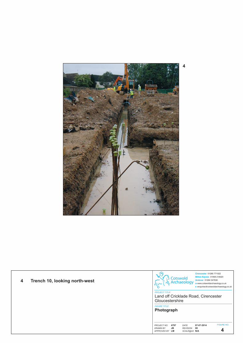
4 Trench 10, looking north-west