Land Management Framework – BHI Board Presentation
14 February 2007
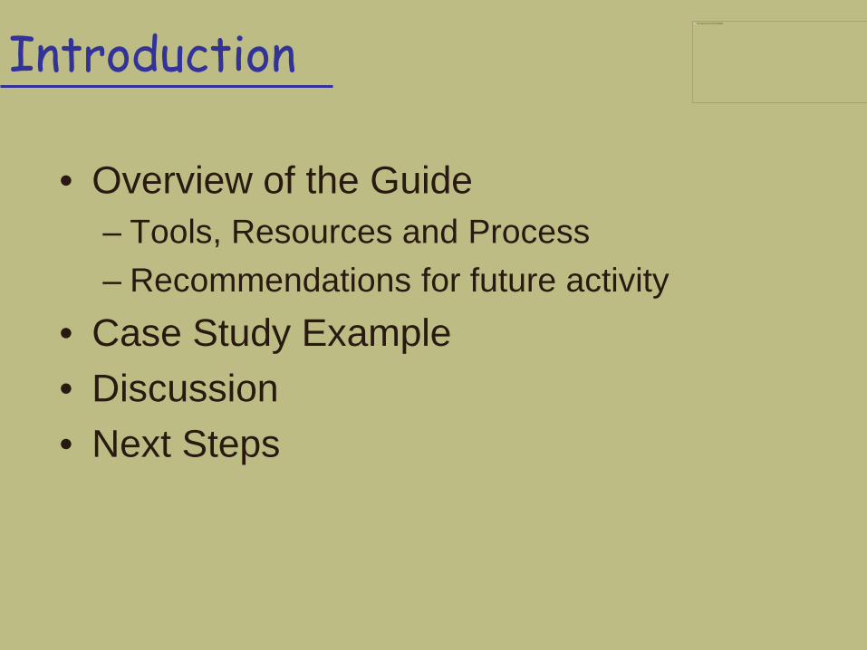
Introduction
• Overview of the Guide – Tools, Resources and Process – Recommendations for future activity
• Case Study Example • Discussion • Next Steps
This image cannot currently be displayed.
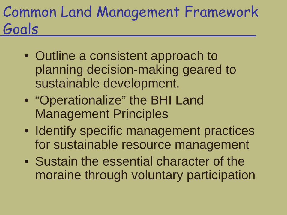
Common Land Management Framework Goals
• Outline a consistent approach to planning decision-making geared to sustainable development.
• “Operationalize” the BHI Land Management Principles
• Identify specific management practices for sustainable resource management
• Sustain the essential character of the moraine through voluntary participation
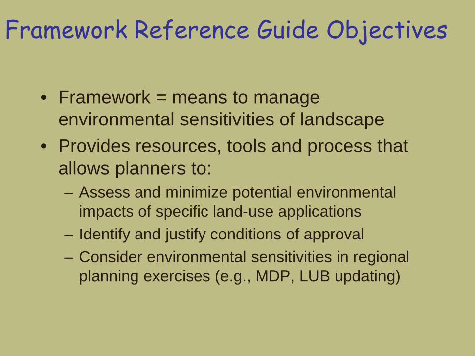
Framework Reference Guide Objectives
• Framework = means to manage environmental sensitivities of landscape
• Provides resources, tools and process that allows planners to: – Assess and minimize potential environmental
impacts of specific land-use applications – Identify and justify conditions of approval – Consider environmental sensitivities in regional
planning exercises (e.g., MDP, LUB updating)
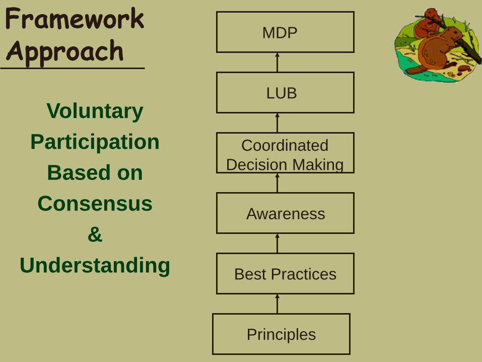
Framework Approach
Voluntary Participation
Based on Consensus
& Understanding
MDP
LUB
Coordinated Decision Making
Awareness
Best Practices
Principles
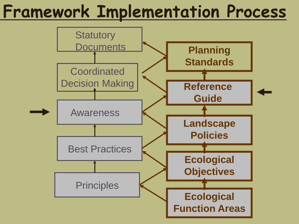
Statutory Documents
Coordinated Decision Making
Awareness
Best Practices
Principles
Planning Standards
Reference Guide
Landscape Policies
Ecological Objectives
Ecological Function Areas
Framework Implementation Process
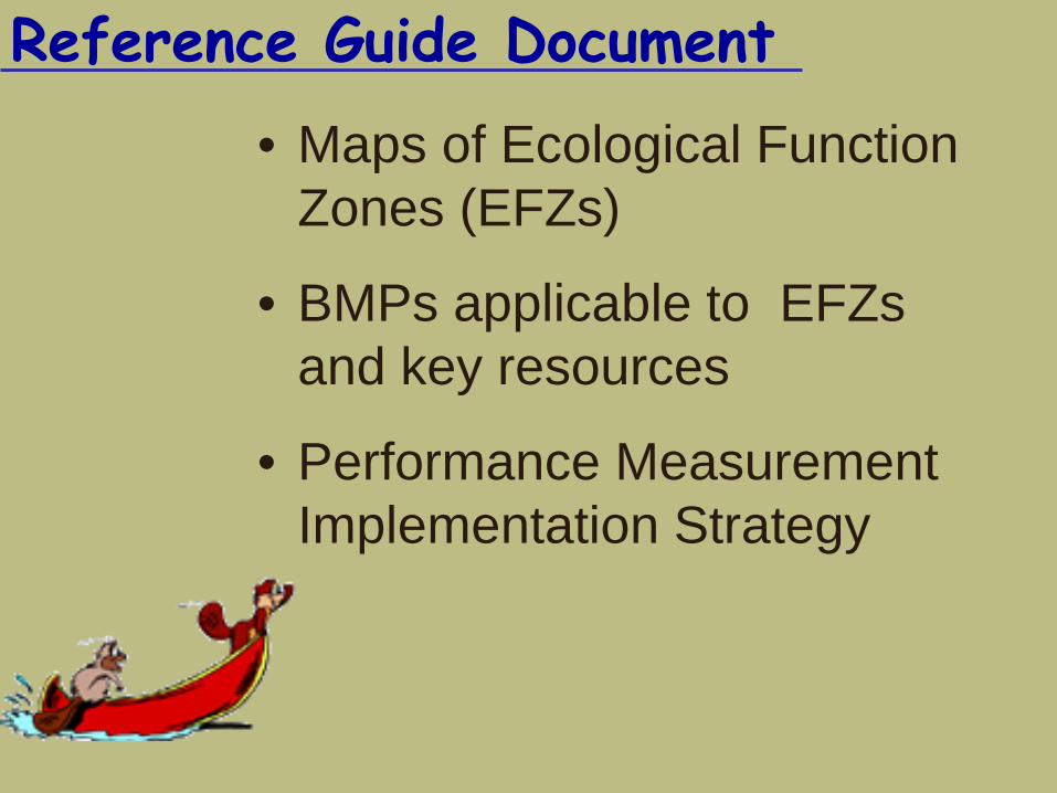
Reference Guide Document • Maps of Ecological Function
Zones (EFZs)
• BMPs applicable to EFZs and key resources
• Performance Measurement Implementation Strategy
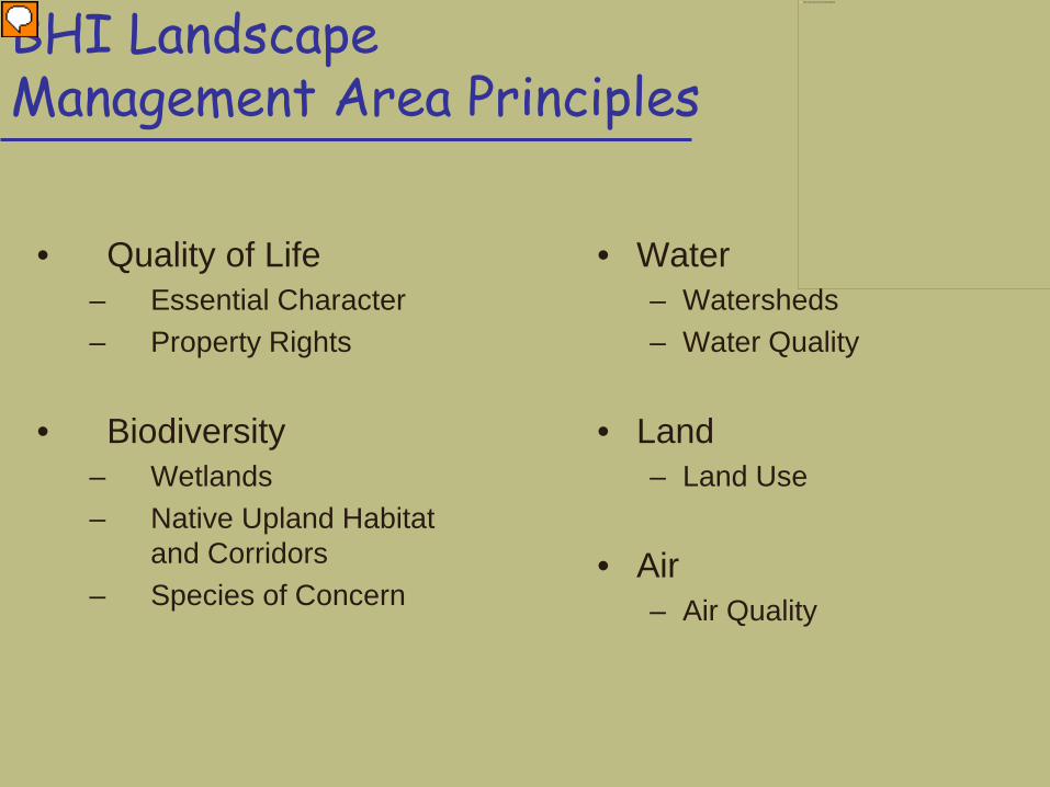
BHI Landscape Management Area Principles
• Quality of Life – Essential Character – Property Rights
• Biodiversity – Wetlands – Native Upland Habitat
and Corridors – Species of Concern
• Water – Watersheds – Water Quality
• Land – Land Use
• Air – Air Quality
This image cannot currently be displayed.
Presenter
Presentation Notes
Specifically, the Framework was intended to provide the tools to help planners manage each of the 5 focal areas identified in the Landscape Management Area Principles that accompanied the LMA mapping
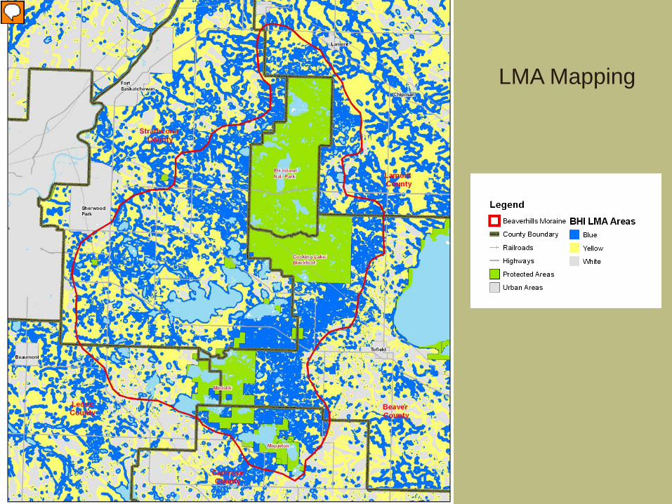
LMA Mapping
Presenter
Presentation Notes
Key management areas related to those resources were mapped out previously by the BHI, which highlighted areas requiring potential management attention. The difficulty with the LMA map is that this is a summary map that uses locations of all of the resources to identify areas of high sensitivity – it does not identify the location of the specific resources or interpret the level of risk. One of the goals of the Framework project, and the EFZ mapping specifically, was to deconstruct this map into it’s constituent resources, and identify areas of high sensitivity, where management might be required.
Reference Guide Document
• Introduction - Links to existing BHI policies: – BHI Vision, Mission and Guiding Principles – LMA Principles Principles for Sustainable Land Use Mgmt
• Ecological Function Zones – Management Considerations EFZ GIS Model Results (Zone
characteristics)
Land Management Framework Document
• Tools for EFZ management: General management guidelines BMPs
• Planning review level • Municipal policy level
• Performance Indictor Monitoring System Based on existing information sources and
monitoring programs
Land Management Framework Document
• Summary and Recommendations Recommendations for municipalities and
BHI Short-term and long-term goals Maximizes opportunities for cooperation
with other BHI partners Highlights additional services the BHI could
provide (e.g., additional data, awareness programs, technical advice)
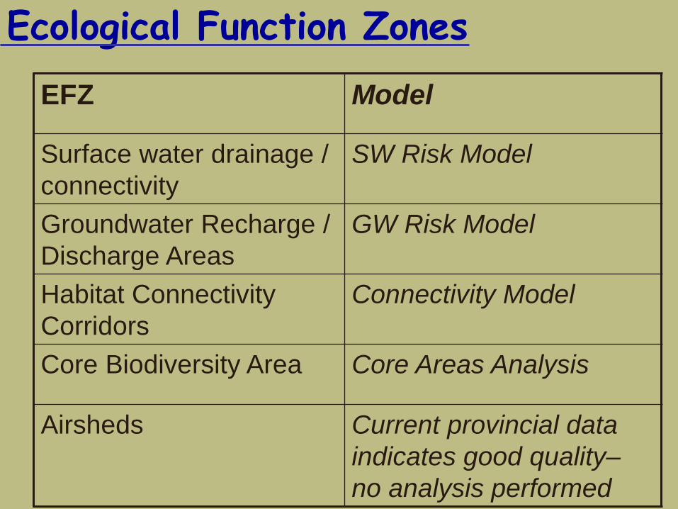
Ecological Function Zones EFZ Model
Surface water drainage / connectivity
SW Risk Model
Groundwater Recharge / Discharge Areas
GW Risk Model
Habitat Connectivity Corridors
Connectivity Model
Core Biodiversity Area Core Areas Analysis
Airsheds Current provincial data indicates good quality– no analysis performed
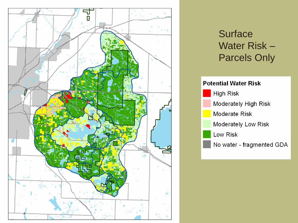
Surface Water Risk – Parcels Only
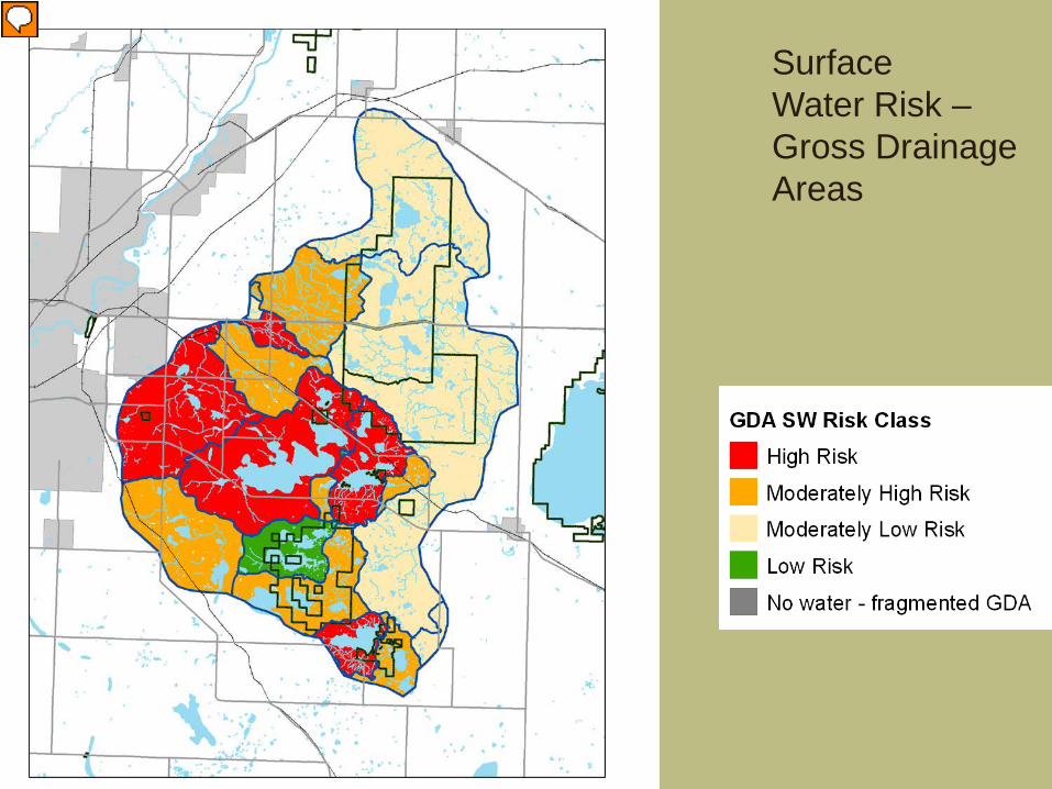
Surface Water Risk – Gross Drainage Areas
Presenter
Presentation Notes
Zone Characteristics: driven by two factors – abundance of water or extent of development within the drainage basin Cooking Lake, Hastings Lake and Miquelon GDAs = high risk, driven by area of water relative to landbase in drainage area Two high risk areas southeast of Sherwood Pk and SE of Highway 16 – due to extent of current development Although a parcel might have a moderate rating (driving factors are similar at that level too), it’s location within a highly sensitive GDA increases the level of sensitivity, and management, required
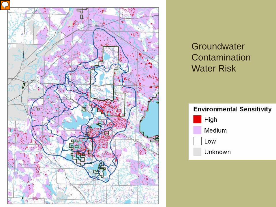
Groundwater Contamination Water Risk
Presenter
Presentation Notes
Higher sensitivity related to presence of surface water, coarse soils or GW recharge/discharge areas. As a result, highest sensitivity tended to be around waterbodies. Moderate zones largely indicate coarse soils over sensitive GW areas. Note this is based on relatively coarse data, and site-specific information should be requested for subdivision/development permitting reviews.
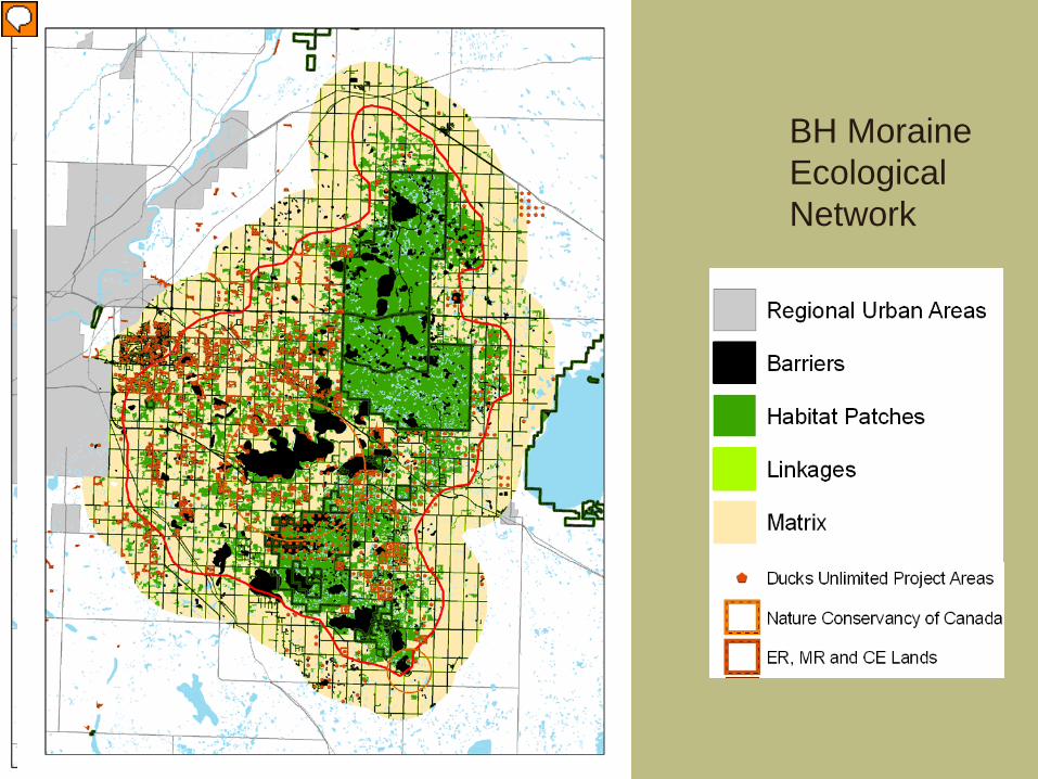
BH Moraine Ecological Network
Presenter
Presentation Notes
Ecological Network- habitat between the EINP/Blackfoot area and Ministik and Miquelon provides a potential link between these protected areas. Also a band that curves out to west, into Strathcona/Leduc Some barriers – lakes are the largest and most obvious, but highways and railways are also significant and bisect the area separating the two sets of protected areas This map corresponds well to the LMA map, and indicates the strong relationship between habitat and other natural features of value in the moraine (surface and groundwater sources, biodiversity) and the functions that maintain them (water quality protected by vegetative buffers)
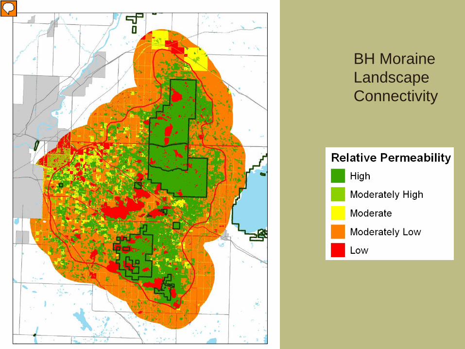
BH Moraine Landscape Connectivity
Presenter
Presentation Notes
Permeability mapping shows the level of connectivity within the network and reaffirms the pattern shown in the network diagram – there are strong corridors north-south between the protected areas, and through the lands west of the park as well.
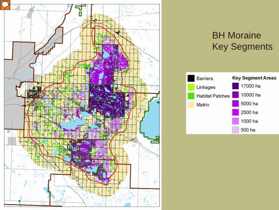
BH Moraine Key Segments
Presenter
Presentation Notes
Barriers like major roads can disrupt or sever connectivity – the key segment analysis identifies the longest/largest areas of habitat patches and linkages within the network. Blackfoot/Cooking Lake and the south part of EINP form the largest Key Segment – the north part of EINP comprises 3 separate segments due to fragmentation by the parkway. Ministik area another significant sized segment, due to the lack of development within the park, and on the adjacent lands (especially in Beaver and Camrose). The larger key segments can support species with large home ranges, and can ensure that habitat patches remain connected (b/c the linkages also contribute to the segments) – key component of the network!
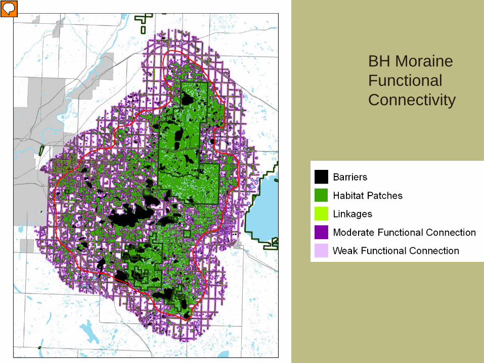
BH Moraine Functional Connectivity
Presenter
Presentation Notes
Habitat patches in a developed landscape are always separated by a gap of some distance. As the gap increases, the number of forest animals willing to cross that gap becomes smaller. Functional connection refers to the effect of the gap on plants and animals. Their ability or willingness to cross that gap determines whether adjacent habitat is accessible, and therefore connected. Here, we assumed that as the gap increased, functional connection became weaker. At the largest gap distance (250 m), weak connection allows most of the habitat to be accessible, but only to larger bodied species and plants capable and tolerant of wider open gaps. At the moderate level (100 m gaps), more species could cross, but less of the network is connected. At the high level (20 m) only small clusters of habitat would be accessible, to a relatively large suite of species. At the parcel scale, this map can help identify areas where habitat enhancement might link adjacent habitat patches and critical elements of the ecological network At the regional scale, this map indicates the importance of landscaping and other efforts to retain or introduce vegetation on connectivity within the moraine
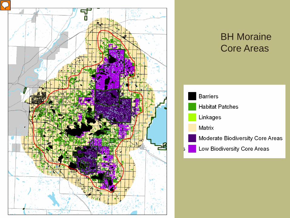
BH Moraine Core Areas
Presenter
Presentation Notes
Lastly, the core areas map assessed the capacity of the moraine to sustain, over the long-term, biologically viable populations representative of 3 levels of biodiversity. In order to survive over the long term, a species must have a population of 500 individuals contained within an connected landscape, so that these individuals can reproduce, disperse and thrive over a sufficient landbase. Our core area analysis basically assessed the area required to sustain that target population of 500 individuals – based on the home range or territory required. We identified a group of umbrella species found in the moraine with small, moderate and large home range and territory sizes could represent small, moderate and high levels of biodiversity. As the area requirements of the reference species increases, more species with smaller area requirements can also be accommodated – so that the area required to sustain deer or coyote could also support a broad range of small mammals, birds, owls, frogs and other species. Of the over 4000 habitat patches within the moraine, only 28 met the area required for low biodiversity (low Biodiversity Core Areas) – includes the north part of EINP and lands around Miquelon. Only 2 habitat patches had sufficient area to qualify as Moderate Biodiversity Core Areas – south EINP and Blackfoot/Cooking Lake which are contiguous and Ministik. Maintaining these core areas is critical to supporting biodiversity through the rest of the network – as is maintaining connectivity through Key Segments and Functional Connections. Although no single habitat patch met the criteria of a High Biodiversity Core Area, the total area of habitat within the moraine (about 825 sq km) is well beyond the area requirement – this emphasizes the importance of functional connections between the habitat patches in the network, if species with large area requirements, like moose, deer and coyote are to be sustained, one of the goals within the BHI’s founding principles and LMA principles
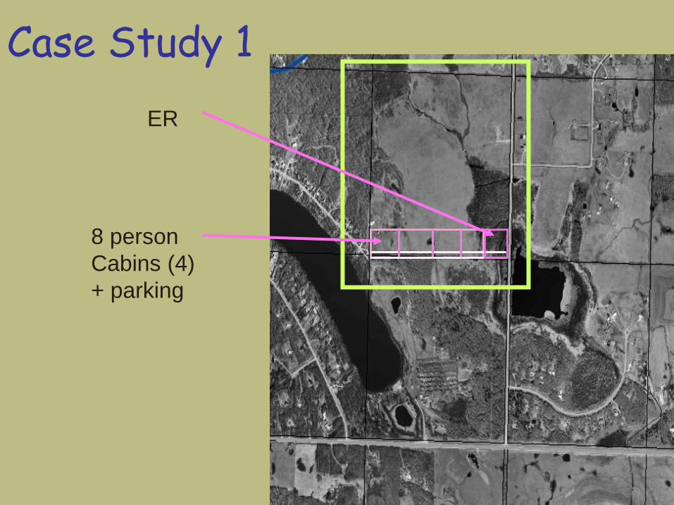
Case Study 1 ER
8 person Cabins (4) + parking
Applying the Framework
• Framework Development Application Review Checklist – Applicant information (including
development description) – Ecological Function Map Review – BMPs Recommended (for each EFZ) – Referrals – Follow-up/Additional Studies Requirements
Proposal Details • Expansion of existing campground into north
quarter section: – Addition of 4 - 8 person cabin sites north of main
campground – Parking at each cabin site
• Wetland identified as ER • Access road off RR215 (gravel) • Sewage directed to existing lagoon in south
quarter section via existing line • Water from existing water license • Stormwater - overland
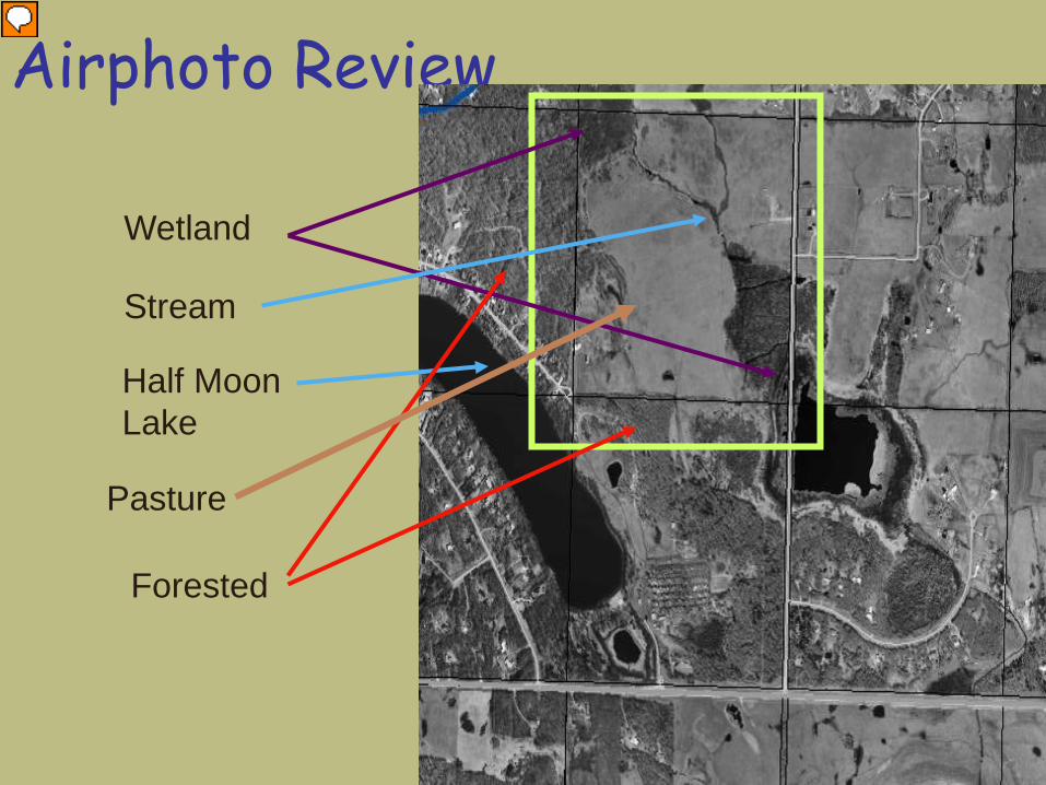
Airphoto Review
Forested
Wetland
Half Moon Lake
Stream
Pasture
Presenter
Presentation Notes
CR subdivision application in this quarter section What would the BMPs be for SW, to minimize risk to water quality and quantity?
EFZ Summary
• SW Risk (GDA): – High risk (Cooking Lake drainage) – Stream and wetland cross through parcel
• SW Risk (Parcel): Moderately low risk – Limited development but adjacent waterbodies
• GW Risk: Medium throughout parcel, High around lake and wetland
• Protected areas: wetland previously claimed as ER and is larger than in proposed layout
This image cannot currently be displayed.
Recommended BMPs – SW & GW
• Minimize or avoid watercourse and wetland disturbance – access road crosses through wetland
claimed previously as ER • Avoid creation of access roads across
watercourses or within wetlands – Find alternative to access road location
(e.g., through campground)
This image cannot currently be displayed.
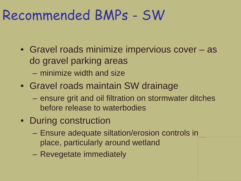
Recommended BMPs - SW
• Limit clearing within floodplain area near wetland
• Maintain 30 m vegetative buffer around watercourses/wetlands – Road and one cabin site within wetland area
• All of area around wetland previously claimed as ER. MR taken? – Must modify the eastern lot to accommodate ER
This image cannot currently be displayed.
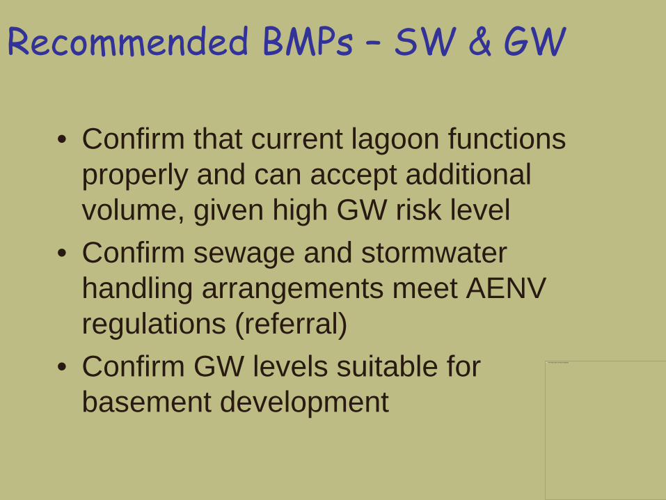
Recommended BMPs – SW & GW
• Confirm that current lagoon functions properly and can accept additional volume, given high GW risk level


![[DRAFT] Environmental Management Framework - … · [DRAFT] Environmental Management Framework ... Management System ... Contaminated land and spoil management, Biodiversity, Greenhouse](https://img.pdfslide.us/doc/110x75/5b1425c97f8b9a4d7c8b81fb/draft-environmental-management-framework-draft-environmental-management.jpg)