Embed Size (px)
Citation preview
Land-fjord interaction and the impact of changing sedimentation rates on fjord environments
– An integrated study of Arctic sediment transport from land to sea
Maria Jensen (University Centre in Svalbard, UNIS), Agnes Baltzer, University of Nantes, Kyungsik Choi (Seoul
National University), Matthias Forwick (University of Tromsø), John Howe (Scottish Marine Institute, SAMS), Katrine
Husum Norwegian Polar Institute), Sergei Korsun (Shirsov Institute of Oceanology), Douwe Maat (Royal
Netherlands Institute of Sea Research, NIOZ), Arto Miettinen (Norwegian Polar Institute), Rahul Mohan, National
Centre for Antarctic and Ocean Research, India, Caterina Morigi, Pisa University, Italy & GEUS, Denmark, Mateusz
Moskalik, Polish Academy of Sciences, Seung-Il Nam (Korea Polar Research Institute), Maarten Prins (VU
University, Amsterdam), Witold Szczucinski, Adam Mickiewicz University, Poland.
Kongsfjorden
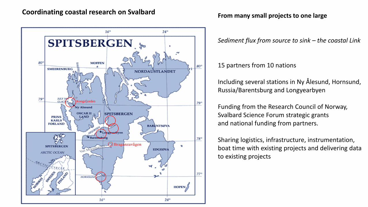
Coordinating coastal research on Svalbard From many small projects to one large Sediment flux from source to sink – the coastal Link 15 partners from 10 nations Including several stations in Ny Ålesund, Hornsund, Russia/Barentsburg and Longyearbyen Funding from the Research Council of Norway, Svalbard Science Forum strategic grants and national funding from partners. Sharing logistics, infrastructure, instrumentation, boat time with existing projects and delivering data to existing projects
Toposvalbard transect + picture of runoff
(http://toposvalbard.npolar.no/)
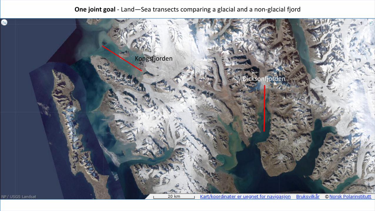
One joint goal - Land—Sea transects comparing a glacial and a non-glacial fjord
Kongsfjorden
Dicksonfjorden
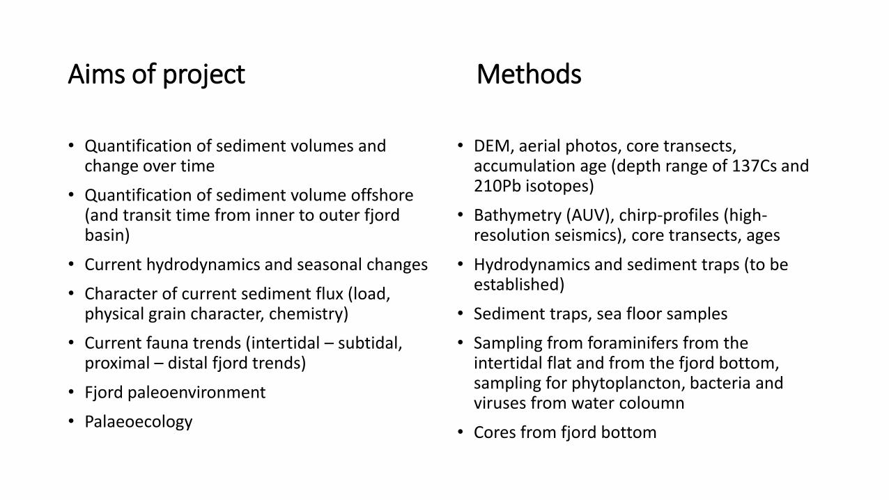
Aims of project Methods
• Quantification of sediment volumes and change over time
• Quantification of sediment volume offshore (and transit time from inner to outer fjord basin)
• Current hydrodynamics and seasonal changes
• Character of current sediment flux (load, physical grain character, chemistry)
• Current fauna trends (intertidal – subtidal, proximal – distal fjord trends)
• Fjord paleoenvironment
• Palaeoecology
• DEM, aerial photos, core transects, accumulation age (depth range of 137Cs and 210Pb isotopes)
• Bathymetry (AUV), chirp-profiles (high-resolution seismics), core transects, ages
• Hydrodynamics and sediment traps (to be established)
• Sediment traps, sea floor samples
• Sampling from foraminifers from the intertidal flat and from the fjord bottom, sampling for phytoplancton, bacteria and viruses from water coloumn
• Cores from fjord bottom
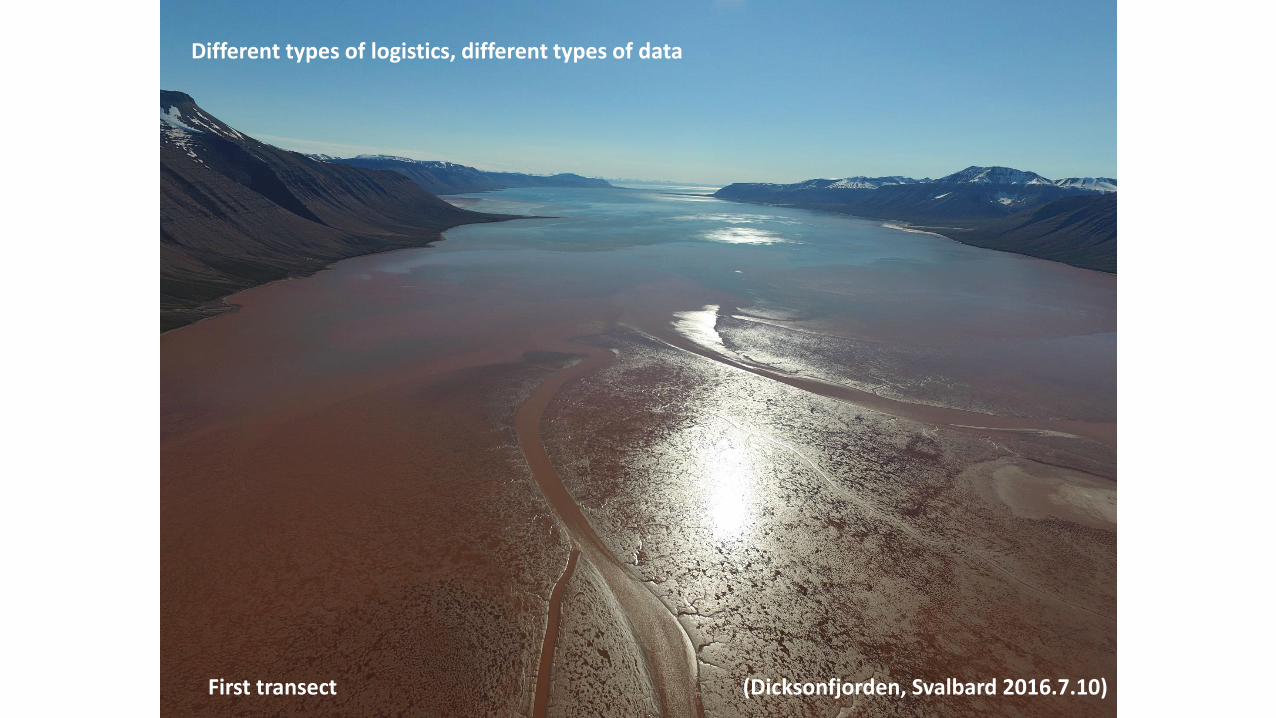
(Dicksonfjorden, Svalbard 2016.7.10)
Different types of logistics, different types of data
First transect
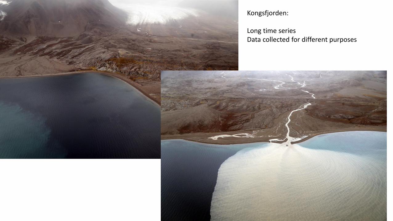
Kongsfjorden: Long time series Data collected for different purposes
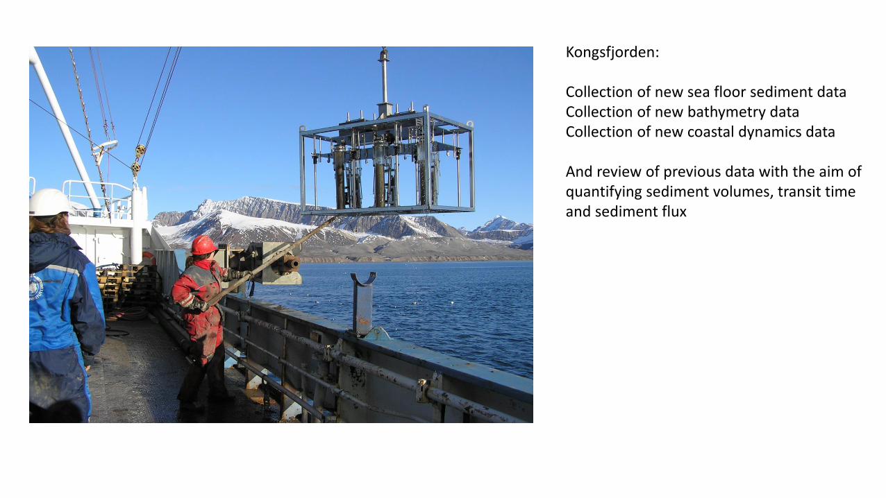
Kongsfjorden: Collection of new sea floor sediment data Collection of new bathymetry data Collection of new coastal dynamics data And review of previous data with the aim of quantifying sediment volumes, transit time and sediment flux
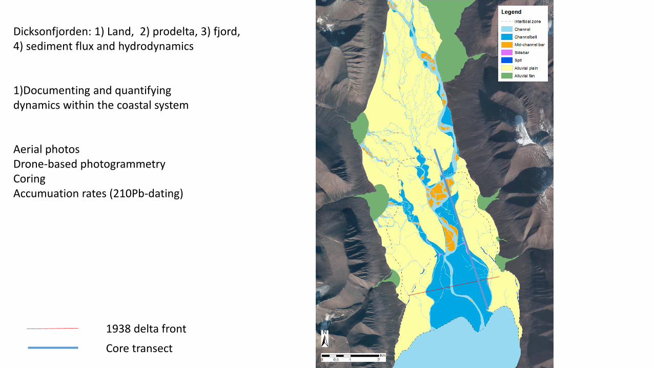
Dicksonfjorden: 1) Land, 2) prodelta, 3) fjord, 4) sediment flux and hydrodynamics 1)Documenting and quantifying dynamics within the coastal system Aerial photos Drone-based photogrammetry Coring Accumuation rates (210Pb-dating)
1938 delta front
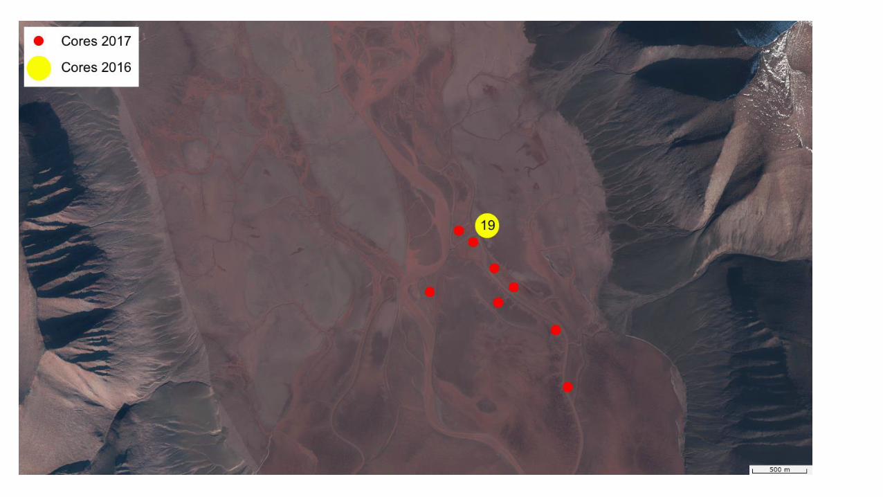
Core transect
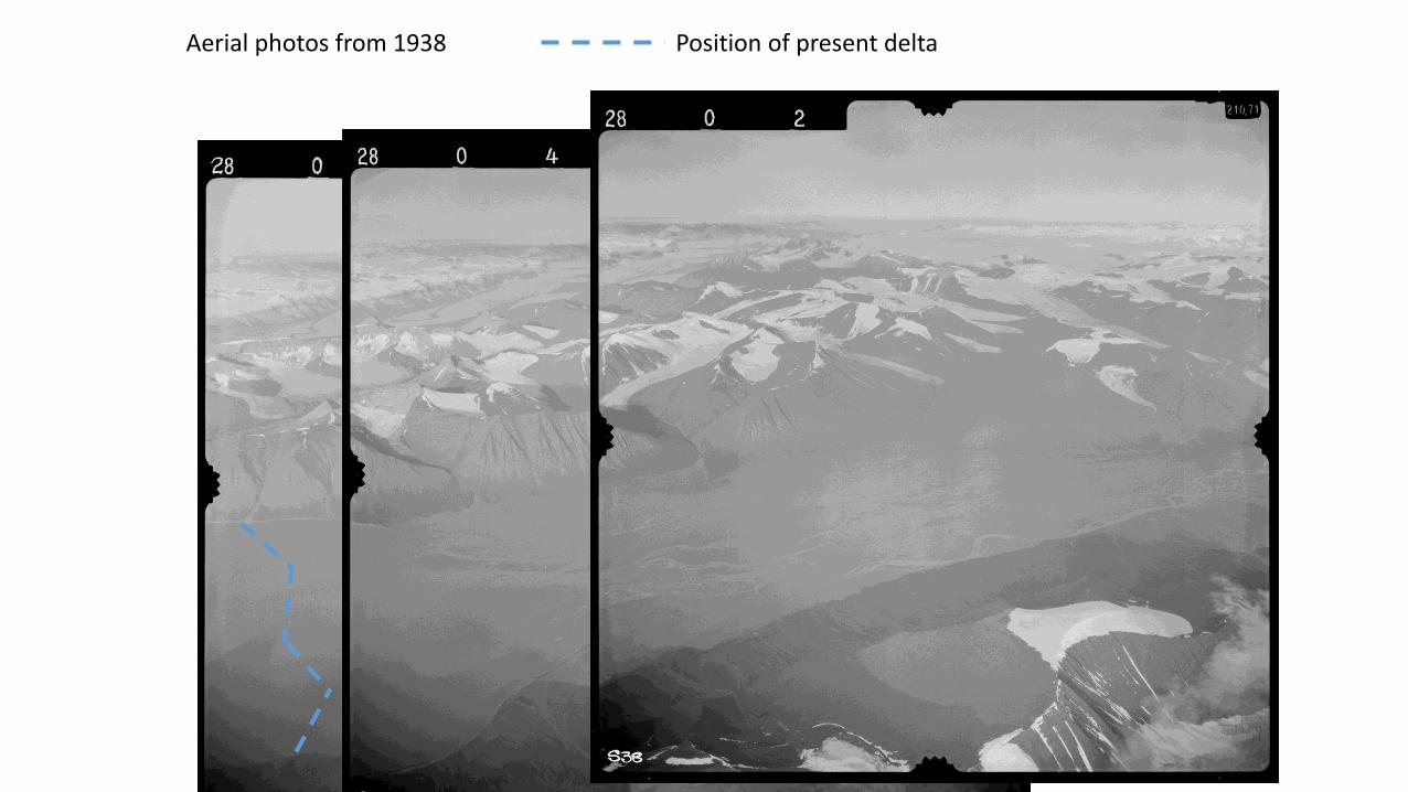
Aerial photos from 1938 Position of present delta
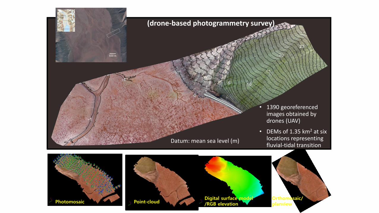
DICKSONFJORDEN in SVALBARD (drone-based photogrammetry survey)
Photomosaic Point-cloud Digital surface model /RGB elevation
Orthomosaic/ planview
• 1390 georeferenced images obtained by drones (UAV)
• DEMs of 1.35 km2 at six locations representing fluvial-tidal transition
Datum: mean sea level (m)
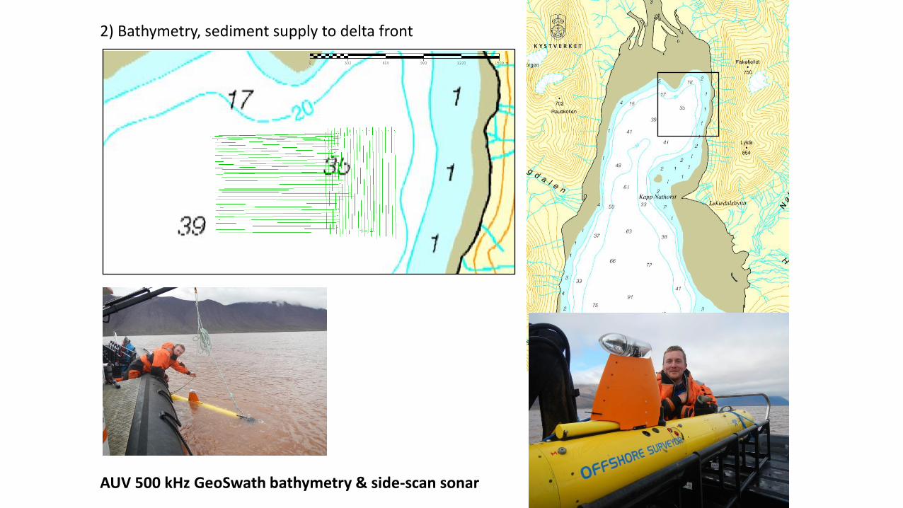
AUV 500 kHz GeoSwath bathymetry & side-scan sonar
2) Bathymetry, sediment supply to delta front
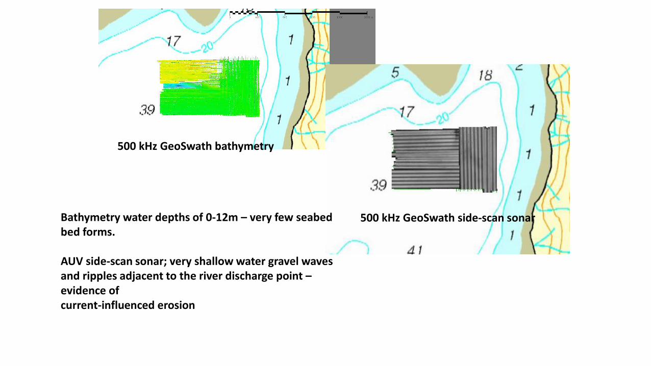
Bathymetry water depths of 0-12m – very few seabed bed forms. AUV side-scan sonar; very shallow water gravel waves and ripples adjacent to the river discharge point – evidence of current-influenced erosion
500 kHz GeoSwath bathymetry
500 kHz GeoSwath side-scan sonar
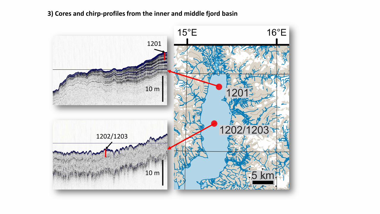
10 m
1202/1203
10 m
1201
3) Cores and chirp-profiles from the inner and middle fjord basin
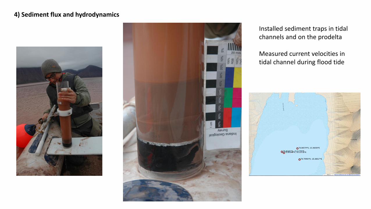
4) Sediment flux and hydrodynamics Installed sediment traps in tidal
channels and on the prodelta Measured current velocities in tidal channel during flood tide
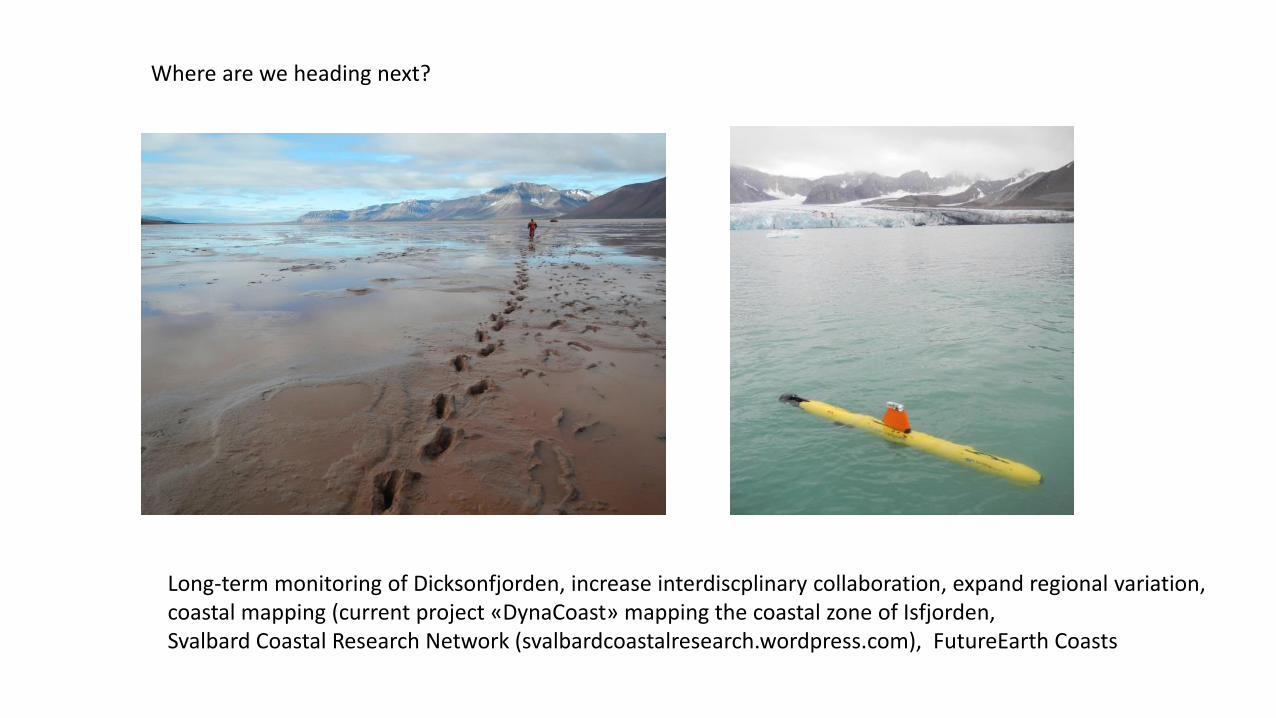
Where are we heading next?
Long-term monitoring of Dicksonfjorden, increase interdiscplinary collaboration, expand regional variation, coastal mapping (current project «DynaCoast» mapping the coastal zone of Isfjorden, Svalbard Coastal Research Network (svalbardcoastalresearch.wordpress.com), FutureEarth Coasts
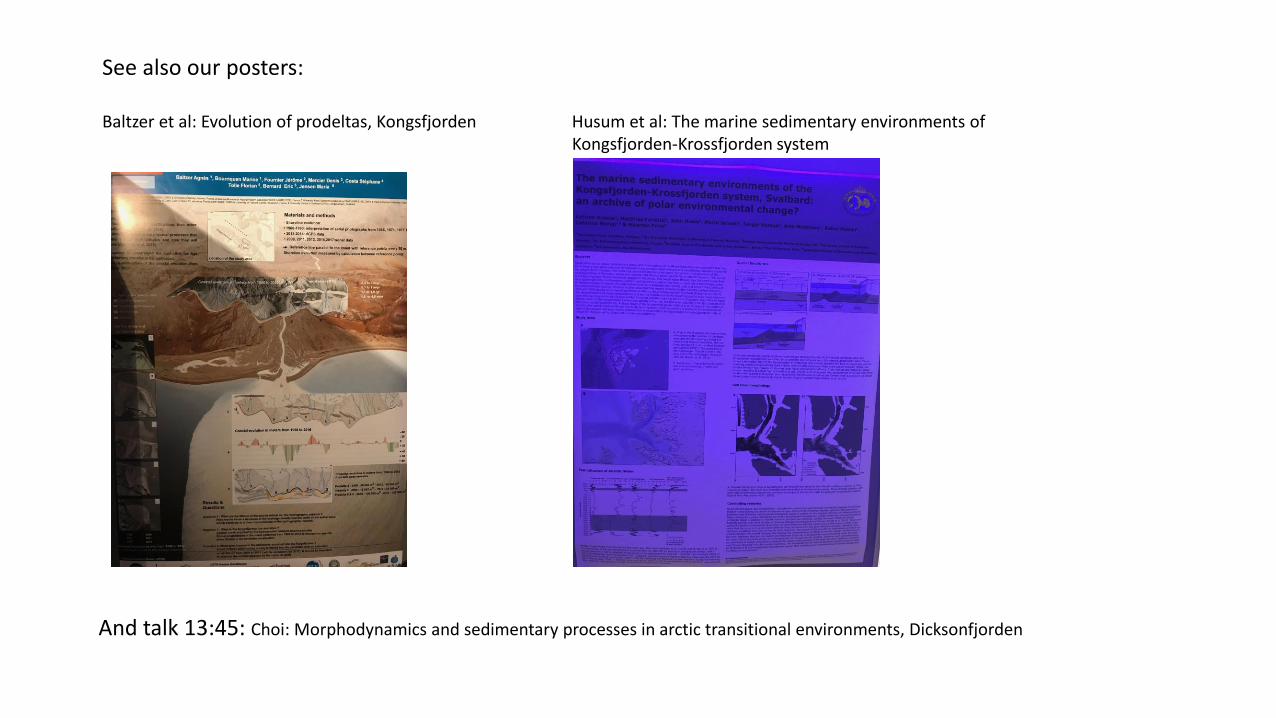
See also our posters: Baltzer et al: Evolution of prodeltas, Kongsfjorden Husum et al: The marine sedimentary environments of Kongsfjorden-Krossfjorden system
And talk 13:45: Choi: Morphodynamics and sedimentary processes in arctic transitional environments, Dicksonfjorden