Embed Size (px)
Citation preview
Land and Resource Data Warehouse Access Services
Chris SpicerHead, Access Services
Land Information Services [email protected]

Presentation Outline
• What is Land Information BC?• Objectives of the Land and Resource Data Warehouse (LRDW)• Service Architecture• LRDW Services
– Discovery Service– Distribution Service– Viewing Service– WMS Service
• WMS Connectivity Instructions• Contact Information
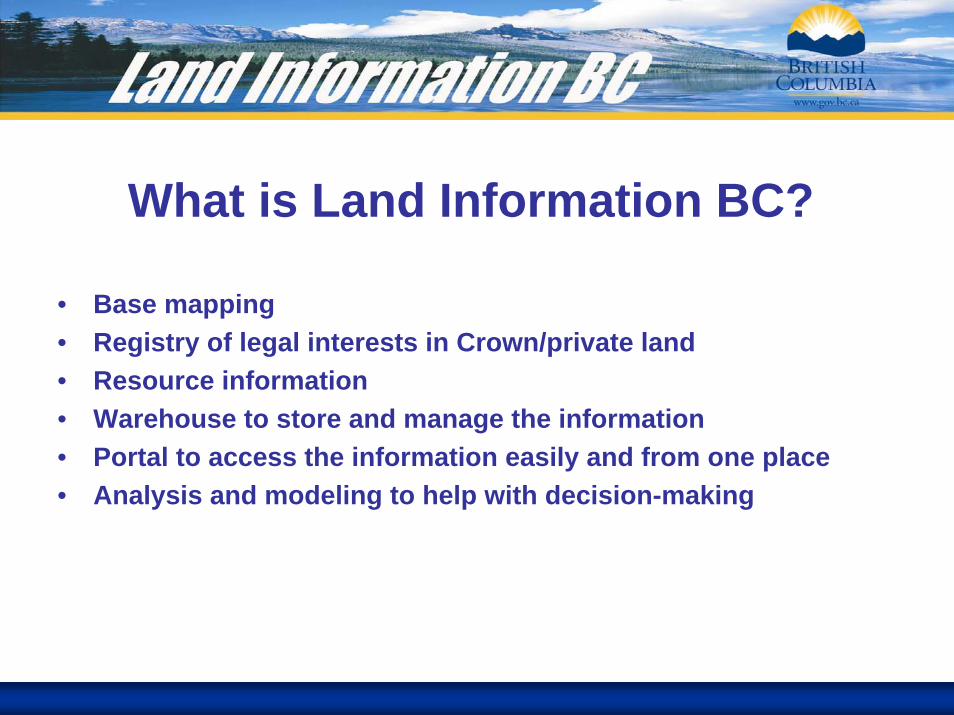
What is Land Information BC?
• Base mapping • Registry of legal interests in Crown/private land• Resource information • Warehouse to store and manage the information• Portal to access the information easily and from one place• Analysis and modeling to help with decision-making

LRDW ObjectivesSingle, current, seamless province wide view of the data
Streamline data access and delivery
Self-service capability
Eliminate duplicate data across ministries and program areas
Develop and maintain meta content for all data and information
Support decision making
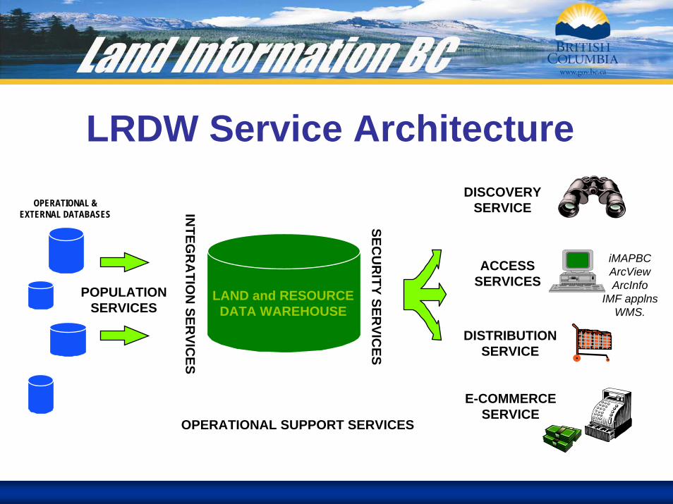
LRDW Service Architecture
LAND and RESOURCEDATA WAREHOUSE
OPERATIONAL &EXTERNAL DATABASES
POPULATIONSERVICES
INTEG
RA
TION
SERVIC
ES
OPERATIONAL SUPPORT SERVICES
SECU
RITY SER
VICES
DISCOVERYSERVICE
DISTRIBUTIONSERVICE
ACCESSSERVICES
E-COMMERCESERVICE
iMAPBCArcViewArcInfo
IMF applnsWMS.
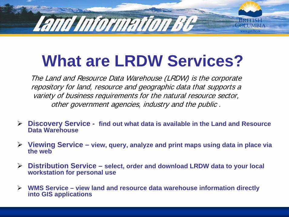
What are LRDW Services?The Land and Resource Data Warehouse (LRDW) is the corporate repository for land, resource and geographic data that supports a variety of business requirements for the natural resource sector,
other government agencies, industry and the public .
Discovery Service - find out what data is available in the Land and Resource Data Warehouse
Viewing Service – view, query, analyze and print maps using data in place via the web
Distribution Service – select, order and download LRDW data to your local workstation for personal use
WMS Service – view land and resource data warehouse information directly into GIS applications
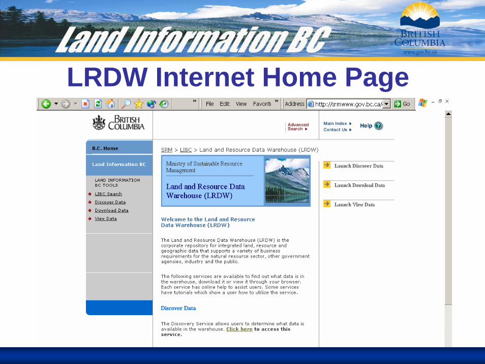
LRDW Internet Home Page

Discovery Service
GeoTec Event 2005 February 13-16
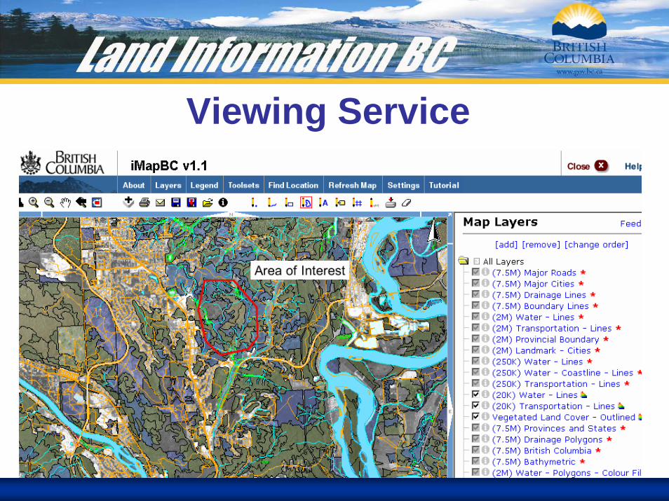
Viewing Service
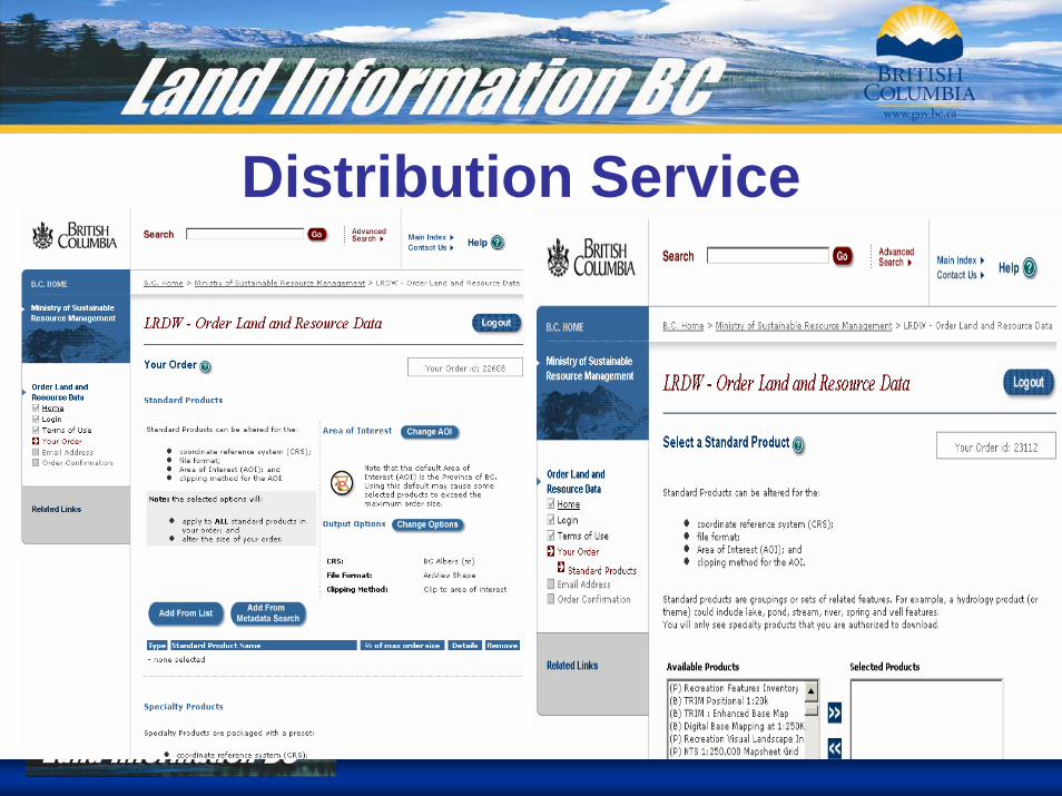
Distribution Service

WMS Service

Instructions for WMS AccessHere are the steps your users will need to take to access the LIBC WMS Service in ArcGIS 8x:
1. Download and install the WMS Connector tool for ArcGIS from the ESRI Site:
http://www.esri.com/software/opengis/ogc-download.html
2. Run the installer and follow the instructions
3. Add the Interoperability Tools to a users ArcMap session by:
i. Double clicking on an empty space in the toolbar in ArcMapii. Checking the box next to Interoperability Tools under the tool bars tab
4. Click on the Add WMS Data Button and enter the following URL:
http://libcwms.gov.bc.ca/wmsconnector/com.esri.wsit.WMSServlet/ogc_layer_service?
5. Click on Get List. A list of all layers available through the WMS connector will be listed. Select a layer and click on Add Data.
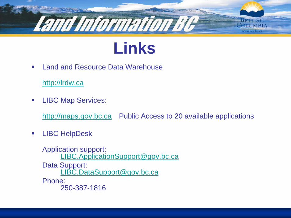
LinksLand and Resource Data Warehouse
http://lrdw.ca
LIBC Map Services:
http://maps.gov.bc.ca Public Access to 20 available applications
LIBC HelpDesk
Application support:[email protected]
Data Support:[email protected]
Phone:250-387-1816