Embed Size (px)
Citation preview
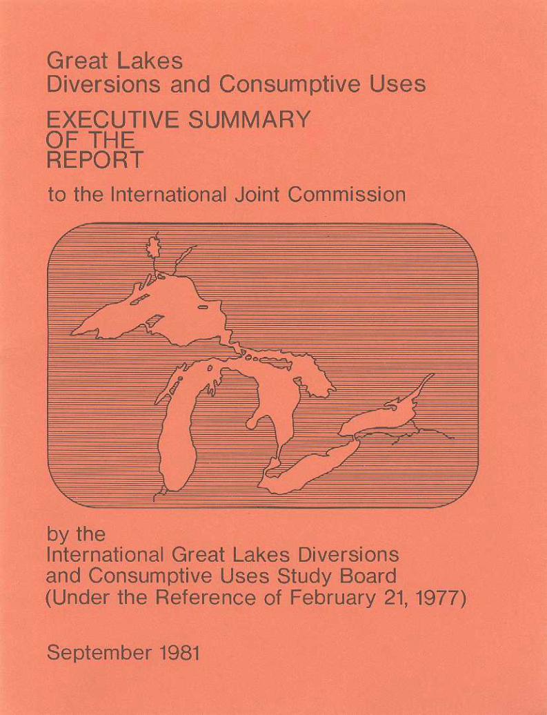
Great Lakes Diversions and Consumptive Uses
EXECUTIVE SUMMARY OF THE REPORT
to the
International Joint Commission
by the
International Great Lakes Diversions and Consumptive Uses Study Board
(Under the Reference of February 21, 1977)
September 1981

0 Minister of Supply and Services Canada 1982
Cat. No. En 37-6/1982-1 E
ISBN 0-662-12022-1
EXECUTIVE SUNMARY
Introduction
By a Reference from the Governments of the United States and Canada, dated February 21, 1977, the International Joint Commission (IJC) was "requested to examine into and report upon the following matters which have, or may have, material effects on water levels and flows of the Basin, including the international and Canadian reaches of the St. Lawrence River:
1. Existing and reasonably foreseeable patterns of consumptive uses of Great Lakes waters;
2. Existing diversions, including the Welland Canal and the New York State Barge Canal, and federal, state or provincially sponsored or approved proposed new or changed diversions, within, into o r out of the Basin, and, in particular,
3 . Existing diversions at Chicago and at Long Lac/Ogoki, and the proposed study and demonstration program authorized by United States P.L. 94-587 affecting the rate of diversion at Chicago.".
In response, the Commission established the International Great Lakes Diversions and Consumptive Uses Study Board on May 3 , 1977, issued a Directive to it concerning the conduct of the study, and subsequently instructed it to consider the possibilities of diversion management to alleviate extreme lake levels. The Board, in turn, established a Working Committee and three Subcommittees: Diversions, Consumptive Uses, and Environmental Evaluation. In view of the fact that several basic elements of the study (notably evaluation of the economic effects of various projected hydraulic regimes on the Great Lakes) were the same as those involved in an investigation which was concurrently conducted by the International Lake Erie Regulation Study Board, the technical subcommittees of this latter Board carried out many of the computations on behalf of the Diversions and Consumptive Uses Board. This cooperation maximized t h e use of available professional resources, avoided duplication of effort and ensured comparability of data and results. In this report of the Diversions and Consumptive Uses Study, therefore, evaluation methodologies are only briefly discussed; more detailed information is given in the Lake Erie Board's report.
During the course of the study, the Board published a series of newsletters designed to keep the public informed of its progress. In 1980, the Board conducted public workshops at selected cities in the Great Lakes basin. These workshops provided further opportunities to inform the public and, through open discussion, to answer questions and elicit views concerning study techniques and emerging results. These views have been incorporated in the Board's work.
- 1 -
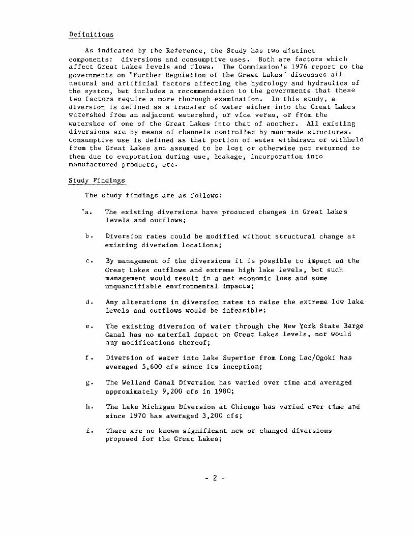
Definitions
A s indicated by the Reference, the Study has two distinct components: diversions and consumptive uses. Both are factors which affect Great Lakes levels and flows. The Commission's 1976 report to the governments on "Further Regulation of the Great Lakes" discusses all natural and artificial factors affecting the hydrology and hydraulics of the system, but includes a recommendation to the governments that these two factors require a more thorough examination. In this study, a diversion is defined as a transfer of water either into the Great Lakes watershed from an adjacent watershed, or vice versa, or from the watershed of one of the Great Lakes into that of another. All existing diversions are by means of channels controlled by man-made structures. Consumptive use is defined as that portion of water withdrawn or withheld from the Great Lakes and assumed to be lost or otherwise not returned to them due to evaporation during use, leakage, incorporation into manufactured products, etc.
Study Findings
The study findings are as follows:
a.
b.
C.
d.
e.
f.
g -
h.
i.
The existing diversions have produced changes in Great Lakes levels and outflows;
Diversion rates could be modified without structural change at existing diversion locations;
By management of the diversions it is possible to impact on the Great Lakes outflows and extreme high lake levels, but such management would result in a net economic loss and some unquantifiable environmental impacts;
Any alterations in diversion rates to raise the extreme low lake levels and outflows would be infeasible;
The existing diversion of water through the New York State Barge Canal has no material impact on Great Lakes levels, nor would any modifications thereof;
Diversion of water into Lake Superior from Long Lac/Ogoki has averaged 5,600 cfs since its inception;
The Welland Canal Diversion has varied over time and averaged approximately 9,200 cfs in 1980;
The Lake Michigan Diversion at Chicago has varied over time and since 1970 has averaged 3,200 cfs;
There are no known significant new or changed diversions proposed for the Great Lakes;
- 2 -
j . Consumptive uses of water are projected to increase from the 1975 rate of 4,900 cfs to an amount which could range from approximately 16,000 cfs to 37,000 cfs by the year 2035;
k. The consumptive uses of water reduce the net water supply to the lakes, thereby lowering lake levels, resulting in economic benefits to coastal zone interests anu losses to navigation and power interests; and,
1. Consumptive uses in the future will limit the ability of the current operational regulation plan for Lake Ontario to satisfy the criteria contained in the Commission's Orders of Approval.".
Board's Conclusions
The Board's conclusions are that:
"a. The diversion rates into, within and out of the basin cannot be altered to reduce extreme high levels on the Great Lakes without causing an overall long-term net economic loss;
b. The diversion rates into, within and out of the basin cannot feasibly be altered to increase extreme low levels on the Great Lakes during periods of low supplies;
c. Periodically, all diversions regardless of size should be monitored and their accumulated effects estimated, evaluated and reported upon so that appropriate public policies can be developed; and,
d . Consumptive uses should be periodically monitored and their impacts, along with various control strategies, studied so that appropriate public policies can be developed to minimize long-term auverse effects. ' I.
Board's Recommendations
The Board recommends that:
"a. NO further consideration be given to the concept of managing Great Lakes levels and outflows through the manipulation of the existing diversions; and,
b o The International Joint Commission, in light of conclusions (c) and (d) above, recommend to Governments that a mechanism be established for institutional consultation s o that monitoring can be undertaken and appropriate public policies can be formulated to address the potential future impacts of new o r increased diversions and consumptive uses.".
The Great Lakes Svstem
The study area encompasses the Great Lakes-St. Lawrence River system from the westerly end of Lake Superior to Trois-RiviGres on the
- 3 -
St. Lawrence River, about 80 miles downstream of Montreal. This system is bordered by eight states - Minnesota, Wisconsin, Illinois, Indiana, Michigan, Ohio, Pennsylvania and New York - and by the provinces of Ontario and Quebec. The total water surface area of the Great Lakes and their connecting channels is about 95,000 square miles. A map of the area is shown in Figure 1 and a hydraulic profile is shown in Figure 2.
Lake Superior, the uppermost and largest of the Great Lakes, discharges through the St. Marys River into Lake Huron. The outflow, through navigation, hydro-power and other facilities in the St. Marys Rapids area, is controlled by the International Lake Superior Board of Control, under the supervision of the IJC, in accordance with Regulation Plan 1977. Lakes Michigan and Huron are connected by the broad and deep Straits of Mackinac. For this reason, they stand at virtually the same level and are usually treated as one lake in hydraulic and hydrologic considerations. Lake Huron discharges through the St. Clair River, Lake St. Clair and the Detroit River into Lake Erie. This flow is unregulated and is governed by the levels of both Lake Huron and Lake Erie.
The natural outlet of Lake Erie is the Niagara River, the total flow through which is also unregulated. However, there is a control structure in the river immediately upstream o f Niagara Falls which assists in the apportionment of the flow between the water available for power generating stations and water which is required to pass over the falls in accordance with the Niagara River Treaty of 1950. This structure cannot control the outflow from Lake Erie and therefore cannot be used to regulate Lake Erie levels. The outflow from Lake Erie passes into Lake Ontario, the lowest in the chain of Great Lakes. Due to the existence of the falls, the levels of Lake Ontario have no effect on the levels of Lake Erie.
The outlet of Lake Ontario is the St. Lawrence River, in which are located the navigation locks, hydro-electric power generating stations and associated works of the St. Lawrence Seaway and Power Project. These facilities are used for the regulation of the river flow and the level of Lake Ontario, in accordance with Regulation Plan 1958D, by the International St. Lawrence River Board of Control under the supervision of the IJC. Downstream of Cornwall Island, the river is entirely within Canada. The flow passes through further power and navigation facilities into Lake St. Louis, through Montreal Harbour, and ultimately out into the Gulf of St. Lawrence.
Diversions
The diversions component of the study primarily focused on four existing major diversions:
1. The Ogoki Diversion takes water from the Ogoki River, which naturally drains through the Albany River into James Bay (at the southern end of Hudson Bay), and diverts it via Lake Nipigon and the Nipigon River into Lake Superior about 60 miles east of Thunder Bay, Ontario. The diversion is for hydro-electric power generation on the Nipigon River and the interconnecting waterways of the Great Lakes.
- 4 -
ST. MARYS RIVER-
LAKE ST. LAWRENCE at Long Sault Dam , Ont. 237.5ft.
~ LAKE ST. FRANCIS at Summertown, Ont.
r- ST. CLAIR RIVER - NIAGARA 15 1.4ft.
\ \ 600.0f
LAKE SUPE
330ft.
\ LAKES / FALLS / /
NIAGARA RIVER V
LAKE ST. LOUIS at Polnte Claire, Que.
MONTREAL HARBOUR
379 60 223 89 236 35 150 77 28 52 33 350 I - - " "cc* I
Distance in Miles
Elevat ions o f the lake sur faces a re g iven a t low water datum, expressed on International Great Lakes Datum (1955). Hor izon ta l and v e r t i c a l s c a l e s have been d i s t o r t e d t o convey visual impression.
PROFILE OF THE GREAT LAKES SYSTEM
2.
3 .
4 .
The
The Long Lac Dive r s ion connec t s t he headwa te r s o f t he Kenogami K i v e r , w h i c h a l s o o r i g i n a l l y d r a i n e d t h r o u g h t h e A l b a n y R i v e r i n t o James Bay, and d i v e r t s t h e water v i a Long Lake and t h e Aguasabon River in to Lake Super ior near Terrace Bay, O n t a r i o . The d i v e r s i o n p r o v i d e s water f o r d r i v i n g pulpwood and f o r g e n e r a t i n g h y d r o - e l e c t r i c power on the Aguasabon River and the in t e rconnec t ing wa te rways o f t he Great Lakes.
The Lake Michigan Diversion a t Ch icago t akes water o u t o f t h e Great Lakes sys t em, fo r pu rposes o f domes t i c and i ndus t r i a l water supp ly and nav iga t ion t h rough t he Ch icago San i t a ry and S h i p C a n a l , a n d d i v e r t s i t v i a t h e I l l i n o i s Waterway t o t h e M i s s i s s i p p i R i v e r a n d t h e n c e t o t h e G u l f of Mexico.
The Welland Canal Diversion takes water from Lake Erie a t P o r t C o l b o r n e , O n t a r i o , a n d d i v e r t s i t a c r o s s t h e N i a g a r a P e n i n s u l a t o Lake Ontar io a t P o r t Weller, Ontar io , thus bypass ing Lake Erie 's n a t u r a l o u t l e t t h r o u g h t h e N i a g a r a R i v e r . T h i s water i s p r i m a r i l y u s e d t o o p e r a t e t h e d e e p - d r a f t n a v i g a t i o n c a n a l a n d g e n e r a t e power a t DeCew Fa l l s .
Board a l so examined a f i f t h d i v e r s i o n , t h e New York S t a t e B a r g e Cana l , compr i s ing t he i n t e rconnec ted Champla in , Er ie , Oswego, and Cayuga-Seneca Canals. This system takes water f o r n a v i g a t i o n p u r p o s e s f r o m t h e N i a g a r a R i v e r a t Tonawanda, New York , and r e tu rns a l l of i t t o Lake Ontar io a t s e v e r a l t r i b u t a r i e s a n d t h e Oswego Cana l . Because t h i s r e l a t i v e l y small u n r e g u l a t e d f l o w i s wi thdrawn f rom the Niagara River a t a point downstream of i t s n a t u r a l h y d r a u l i c c o n t r o l , i t h a s v i r t u a l l y n o e f f e c t o n t h e l e v e l s o f L a k e Erie a n d t h e o t h e r Great Lakes. There i s , however, an impact on power; i .e. , a r e d u c t i o n o f water a v a i l a b l e f o r power g e n e r a t i o n o n t h e N i a g a r a R i v e r . N o t w i t h s t a n d i n g t h i s , n o d e t a i l e d e v a l u a t i o n o f t h i s d i v e r s i o n was unde r t aken .
The Board found no federal , s t a t e o r p r o v i n c i a l l y s p o n s o r e d o r approved proposed new o r c h a n g e d d i v e r s i o n s i n t o , w i t h i n o r o u t o f t h e b a s i n o f s u f f i c i e n t m a g n i t u d e t o h a v e a n y material e f f e c t s o n water leve ls and f lows of the bas in . However , a number of very small s u c h d i v e r s i o n s came t o t h e B o a r d ' s a t t e n t i o n d u r i n g t h e s t u d y a n d are b r i e f l y d i s c u s s e d i n t h e r e p o r t .
A d i v e r s i o n o f water o u t o f t h e Great L a k e s b a s i n i n t o a n a d j a c e n t b a s i n r e d u c e s t h e n e t water s u p p l i e s a n d h e n c e l a k e l e v e l s a n d o u t f l o w s ; a d i v e r s i o n i n t o t h e Great Lakes bas in raises them. Thus, the Long L a c / O g o k i D i v e r s i o n s c o n s t i t u t e a n i n c r e a s e i n t h e water s u p p l y t o L a k e S u p e r i o r a n d t h e r e f o r e t o a l l downstream lakes. The Lake Michigan D i v e r s i o n a t Chicago reduces the supply to Lakes Michigan-Huron and thus t o t h e r e m a i n i n g d o w n s t r e a m l a k e s . The WeJ,land C a n a l i n c r e a s e s t h e o u t l e t c a p a c i t y o f L a k e Erie. T h e s e i n c r e a s e s a n d d e c r e a s e s i n t h e n a t u r a l water s u p p l y p r o d u c e c o r r e s p o n d i n g i n c r e a s e s a n d d e c r e a s e s i n Great Lakes water l e v e l s a n d o u t f l o w s . T h e r e g u l a t i o n p l a n s i n e f f e c t o n Lake Super ior and Lake Ontar io were des igned t o accommoda te t hese d i v e r s i o n s s o as n o t t o v i o l a t e p e r t i n e n t l a k e l e v e l c r i t e r i a .
- 7 -
Basis-of-Comparison
In order to evaluate the hydrologic, economic and environmental effects of a change in the regime of Great Lakes levels and flows - whether due to consumptive uses, diversions management, regulation or any other form of intervention by man - it is first necessary to establish a base-line condition against which to measure such changes and their effects. This base-line condition is the basis-of-comparison. The actual levels and outflows during the selected period of record (1900 to 1976) cannot be used for this purpose because of physical and managerial changes that have occurred in the basin at different times over these years. Accordingly, the basis-of-comparison consists of the computed regime of levels and flows which would have prevailed, with the historic record of water supplies to the system, if present outlet channel configurations, assumed average diversion rates and present regulation plans for Lakes Superior and Ontario had existed constantly throughout the selected period of record. The average annual diversion rates were taken as 5,000 cfs at Long LacjOgoki, 3,200 cfs from Lake Michigan at Chicago, and 7,000 cfs through the Welland Canal.
During the course of the study, after the basis-of-comparison had been established, it was found that the long-term annual average of the combined Long Lac and Ogoki Diversions was actually 5,600 cfs. Also, in recent years the Welland Canal had increasea to an annual average flow exceeding 9,000 cfs, while uaily mean flows during the navigation season consistently approached canal capacity of 10,000 cfs. Accoruingly, the long-term annual average Long Lac/Ogoki Diversions rate of 5,600 cfs and an estimated future Welland Canal average annual diversion rate of 9,400 cfs were also evaluated.
Hydrologic Evaluation Methodology and Results
To determine the present effects of an existing diversion, the procedure was to calculate a second set of lake levels and outflows, using the same historic water supply record, but with the average diversion flow removed from the Board’s computer model of the Great Lakes system. Differences between this regime and the basis-of-comparison thus represent the effects of the diversion upon the system. The procedure was used similarly to calculate the effects on Great Lakes l e v e l s and outflows if a diversion flow at times were to be varied from its current average rate and, likewise, to calculate the effects of possible management scenarios involving variation of two or more diversions simultaneously. The purpose of examining alternative diversion management scenarios was to determine whether, by changing diversion flow rates, some amelioration of extreme lake levels could be achieved. As potential measures to reduce extreme high water levels, consideration was given to reducing the Long Lac/Ogoki Diversions to either 2,500 cfs or zero; increasing the Lake Michigan Diversion at Chicago to either 6,600 cfs or to its maximum possible annual average of 8,700 cfs; and increasing the Welland Canal Diversion to 9,000 cfs, which initially appeared to be the maximum possible. A s a means of raising extreme low levels on Lake Erie, and to a lesser extent upstream lakes, consideration
- 8 -
was given to a scenario in which the Welland Diversion would be decreased to 2,600 cfs by closing down power generation at the DeCew Falls plants. A decrease to zero is not a viable option since this would sever the Great Lakes shipping routes. The raising of extreme low lake levels by means of reducing the Lake Michigan Diversion at Chicago andlor increasing the Long LacIOgoki Diversions were found to be impractical options - the former due to its vital importance in supplying domestic and industrial water to the Chicago area and the latter because, when Lake Superior water supplies are abnormally low, similar hydrologic conditions usually prevail in the Albany River system and additional water is therefore unavailable for diversion to Lake Superior. It was not the mandate of the Board to consider diversion management alternatives that would require new structures or other physical modifications to change the hydraulic capacities of the diversions.
Forty-three possible management scenarios were investigated, comprising various combinations of alternative diversion flow changes. The concept adopted was that a reduction in net diversions inflow would be "triggered" when the natural water supply rises above its long-term mean value. Use of mean water supplies as a trigger mechanism, rather than mean water levels, was found to be more effective because supply changes precede and cause level changes and thus are an earlier indicator of developing hydrologic conditions.
Determination of the hydrologic impacts on the Great Lakes system of the existing diversions and of alternative diversion management scenarios involved comparisons of their regimes of levels and flows with that of the basis-of-comparison. These comparisons were made in terms of maximum, minimum and mean values, frequency of occurrence of extreme highs and lows at various times during the year (e.g., the navigation season, ice breakup in the spring, etc.) and other specific criteria governing the regulation plans for Lakes Ontario and Superior. The computed level and flow data were in turn used as an input to the economic and environmental evaluations.
The current rates of existing diversions have produced net increases in Great Lakes levels and outflows which are small in relation to their natural ranges. Their net effect has been to raise the mean levels of Lake Superior by 0.07 ft. and Lake Ontario by 0.08 ft., and to lower the mean levels of Lake Erie by 0 . 3 3 ft. and Lakes Michigan-Huron by 0.02 ft. By comparison, mean annual fluctuations in lake levels vary between 1.1 f t. on Lake Superior and 1.9 f t . on Lake Ontario.
With respect to possible alterations in diversion rates to reduce extreme high lake levels, the "maximum-effect diversion scenario" (Long LacIOgoki Diversions reduced to zero, Lake Michigan Diversion at Chicago increased to its maximum possible rate of 8,700 cfs, and the Welland Canal increased to 9,000 cfs) would lower maximum water levels by 0.10 ft. on Lake Superior, 0.57 ft. on Lakes Michigan-Huron, 0.45 ft. on Lake Erie, and 1.40 ft. on Lake Ontario. Any of the less drastic scenarios would result in smaller reductions in extreme lake levels.
- 9 -
Economic Evaluation Methodoloev and Results
Economic evaluations were carried out of the hydraulic effects on navigation, power generation, beaches and boating, and coastal zone interests. The latter includes erosion and inundation impacts on shore property. The principles underlying the evaluation techniques used are briefly as follows:
Commercial navigation generally benefits by higher water levels in the lakes and connecting channels. A decrease in mean water levels compels vessels to carry less cargo per trip, thereby increasing the total number of trips required to transport a given tonnage per year, and hence the cost of doing so . Since these economic losses could be eliminated if harbours and connecting channels were dredged deeper to offset a lowering of mean lake levels, the cost of such dredging was also evaluated .
The evaluation of the effects of a changed hydrologic regime on power generation was based on two factors. First, if the peak power load-meeting capability of Great Lakes hydro-electric generating facilities during the critical load demand period under a management scenario is less than under the basis-of-comparison, additional capacity would have to be installed, i.e., there would be an economic loss. Second, the reduction in average annual energy to each power system was evaluated in terms of the cost of obtaining equivalent energy from an alternative source.
Beaches were evaluated on the premise that changes in lake levels generate changes in beach areas and in the recreational opportunities they afford. Swimming was selected as the indicator activity; its monetary value can be estimated.
The boating evaluation involved determining the impacts on recreational boating activity, existing boating facilities, and commercial fishing. Only the United States side was studied. The monetary value was estimated as a function of the percentage of time small boats are inoperable due to water level changes, or taken as the cost of dredging to allow them to operate the same as under basis-of-comparison conditions, whichever was the least cost alternative.
The procedure for evaluating the impacts on shore property due to erosion assumed that the amount of material eroded from a bluff is directly related to the wave energy reaching the toe of the bluff. This energy is dependent on wind speed and direction, shoreline physiographic parameters, and prevailing water levels. Changes in the latter alter the rate of erosion. Monetary damages were computed as a function of the wave energy. The evaluation of inundation along the shoreline was based upon a stage-damage-frequency method which has been successfully applied to numerous river systems. The primary parameters were available recorded damage data, water levels and physiographic data. Inundation is an event type process and the evaluation procedure involved determining, on a monthly basis, the probabilities of short-term rises occurring at different mean water levels to produce peak storm water levels and consequent flooding.
- 10 -
Damages are caused to marine structures by both high and low water levels. Extreme low water increases the frequency of exposure of normally submerged untreated timber substructures, which accelerates decay and thus reduces a structure's useful life. There is a further economic detriment in the restricted access to structures due to reduced navigable depths. Extreme high water can also result in losses due to inundation of the land approach to some smaller structures, as well as possible physical damage or destruction.
With respect to water intakes for shoreline industries and communities, the effect of low lake levels is to increase pumping costs and, in the extreme, cause pump impeller cavitation. Shallow water decreases the quality of the intake water because of increased turbidity as a result of wave action transporting more bottom sediments; it also increases the risk of certain ice problems. High lake levels may erode or inundate the foundation of a lake-side plant. Of these effects, it was only possible to quantify increased pumping costs.
Of the total array of scenarios, the hydrologic results of ten were selected for economic evaluation. Of these, three were evaluations of the sensitivity of the basis-of-comparison. Of the remainder, the only one producing an overall annual net benefit is that which increases the Welland Canal flow from 7,000 to 9,000 cfs, while keeping the other diversions at their current rates; as previously noted, however, this scenario has become a fact during the course of this study. The evaluation shows benefits to coastal zone interests of about $0.6 million, power interests of about $1.0 million, and recreational beaches and boating interests (United States side below Port Huron, Michigan only) of about $0.3 million, but a loss to navigation interests of about $0.6 million, for a net benefit of about $1.3 million. The other six scenarios would produce net losses ranging from $2.8 million to $69.5 million annually. The "maximum-effect diversion scenario" would generate annual economic benefits to coastal zone interests ($6 .0 million) and recreational beach users ($1.8 million); however, it would cause economic losses to navigation ($13.8 million) , power ($61.3 million) , and recreational boating interests ($1.6 million). For this scenario, the net economic loss to the users of the system would be therefore of the order of $69 million annually.
Environmental Evaluation Methodology and Results
The environmental evaluation was limited by inadequate ecological and other relevant data. More detailed and costly environmental studies, entailing extensive field work, would not be justified unless some feasible management scenario emerged which warranted subsequent development of a positive plan of action. In any event, the Board examined the subjects of fisheries, wildlife/wetlands and water quality.
In the case of fisheries, the probable effects of the management scenarios were evaluated through a review of published literature. Emphasis was placed on identifying the requirements of the fish populations for specific nearshore habitat, especially wetlands and shallow embayments, and identifying the fish species which require, in summer, the cool water of the hypolimnion.
- I I -
A measure of the value of the lower Great Lakes fisheries was established from the value of the commercial and sport fisheries. Descriptions of the nearshore habitat were obtained from the literature, unpublished inventories and topographic sheets. Estimates of changes in wetland types, and hypolimnion changes related to water levels, were obtained from the wildlife and water quality studies.
The probable effects on wildlife were evaluted by analysis of the impacts that water level changes would have on wetlands. Shoreline wetlands in the lower Great Lakes were inventoried and classified according to seven distinctive wetland types. Listings were made of wetland-dependent birds, mammals, reptiles and amphibians found in the study area and of their habitat. Changes in water levels were related to changes in wetland areas and hence to the effects on the wildlife using them.
The water quality evaluation included an examination of the following characteristics: hypolimnion volume and oxygen resources, general lake water quality, phosphorus and turbidity concentrations, cladophora production, embayment water quality, and waste dispersion capability- Since the nearshore is the most important lake area for wildlife, fish production and various human activities, the water quality study placed emphasis on effects in these areas rather than in mid-lake.
The following summarizes the environmental evaluation. Implementation of the maximum-effect diversion scenario should not produce any significant social effects. Population growth trends would not be directly affected; however, adverse impacts on waterborne commerce and power production could induce population shifts. Hunting pressure could shift from wetland-dependent game to upland species. Non-consumptive wildlife-related recreation could experience a slight decline. Beach recreation would likely benefit by more exposed shoreline, but recreational boating could be negatively affected due to a reduction in water depth in shallow areas such as the connecting channels, harbours and bays. Adverse impacts to the sport fishery could also be incurrea by lowered water levels. Water quality would not be significantly affected.
ConsumDtive Uses
The consumptive uses component of the study involved a determination of present water withdrawals and consumptive uses, together with projections from a base year of 1975 to 2035. Withdrawal and consumption quantities were developed in a breakdown by lake basins, nations, sectors of the economy, and lake and non-lake categories (i.e., water taken directly from the lakes, or from inland sources such as tributary streams and groundwater, respectively). Seven sectors were considered: municipal, rural-domestic, manufacturing, mining, rural-stock, irrigation and thermal power generation.
Water withdrawal quantities are generally metered and provide a basis from which to derive estimates of consumptive uses. Withdrawals in 1975 were extremely large (75 ,600 cfs) in comparison with consumptive uses
- 12 -
(4,900 cfs). Consumptive uses as a percentage of withdrawals from each lake ranged from 4.8 to 10.4 percent. Lakes Michigan and Erie had by far the highest withdrawals and uses.
In developing reasonably foreseeable future projections o f withdrawals and consumptive uses, it was necessary to adopt a variety of general assumptions, based on information and advice from appropriate authorities. These assumptions related to such parameters as trends in population growth and migration, employment levels, GNP, per capita consumption, economic growth, energy use and governmental policies. Based on these assumptions, a most likely projection (MLP) was developed for each of the seven water use sectors. However, realizing that in any long-range economic forecasting even the most realistic of assumptions are debatable and become increasingly tenuous when applied further into the future, the Board also tested the sensitivity of the assumptions on the computed estimates. This was done by varying some of the more significant assumptions, within a reasonable range of possibilities, to produce alternative high and low projections and thus define a band of probable future values centered on the MLP. It is a measure of the inherent uncertainty in forecasting economic scenarios that the high and low projections of total consumptive use in the year 2035 are about +40 percent of the MLP value. -
United States municipal water use projections were based on the 1975 National Water Assessment, but with some modifications. The Canadian projections were related to population forecasts, obtained from the province of Ontario, by applying withdrawal and use coefficients. The two methods are roughly similar, despite some differences in detail, because demographic projections prepared by central statistical agencies underlie both.
In both countries, water for rural domestic use is largely drawn from wells, inland streams, reservoirs and other non-lake sources; it is relatively small and has virtually no effect on Great Lakes levels. Estimates were based on rural population forecasts and per capita rates of consumption.
The manufacturing water use sector represents the withdrawal and consumption of Great Lakes water by users traditionally considered as part of heavy industry. Such users may be either self-supplied or supplied from central systems. Manufacturing is the largest consumer of water in the basin, the abundance of water being the primary reason that this region of the United States is so heavily industrialized. The Great Lakes basin is likewise the most important industrial area in Canada. Increases in manufacturing consumptive uses indicated in this study are primarily dependent on assumptions concerning technological changes in the various industries involved and the institution of closed recycling systems for cooling and process water, in response to clean water laws, water availability and economic feasibility. The United States MLP assumed that new industries will meet the original requirements of the 1972 Clean Water Act; in contrast, the Canadian MLP held the recirculation and consumption rates constant. In most other respects, the complex modelling approaches in each country were substantially the s ame .
- 13 -
Water is used for a variety of mining processes, including metals, non-metallic minerals and mineral fuels. The Great Lakes supply about 80 percent of mining water requirements in the basin. Methodologies for developing both United States and Canadian figures were based on water use per production dollar in each mineral sector and projections were tied to each country's economic climate.
Rural stock water use refers to the withdrawal and consumption o f water for the feeding and sanitation of livestock. Consumption, which is a comparatively minor portion of the total demand on the Great Lakes basin, includes animal drinking water, evaporation from stockwater ponds and losses of cleaning and waste water. The United States methodology projected the number of different types of animals on the basis of population growth rates and presumed a direct relationship with demand. The Canadian methodology was based on per capita meat and dairy products demand .
Irrigation water, which is also a comparatively minor demand on the basin, is primarily drawn from non-lake sources. It includes the watering of crops, pastures, orchards, golf courses and public lands such as parks and forests.
In this study, water for power generation refers to that which is required for cooling purposes in thermal-electric power generating stations; consumptive use in hydro-electric generation is insignificant and has therefore not been considered. Water for thermal plant cooling currently represents the most significant demand on the Great Lakes in terms of withdrawal and, by the end of the projection period, will become the dominant type of consumption. The majority of older thermal-electric power generating plants utilize once-through condenser cooling systems having high water withdrawals and only minimal measured consumptive losses (although some additional consumption occurs due to increased evaporation of heated water after it is discharged to lakes and streams). In more recent years there has been increased use of "wet" cooling towers in the United States to dissipate waste heat via the evaporation of a portion of the water flowing through the tower. This process reduces withdrawals, but it is significantly more consumptive. Thus, as old plants are phased out and new plants are constructed, projected total water withdrawal rates for power generation will decrease, while consumptive use will substantially increase. Although new technology has provided the alternative of "dry" (air cooled-radiant heat transfer) cooling towers, the process is currently not economically viable since the cooling technology is considerably less efficient and consumes considerable energy resources.
- 14 -
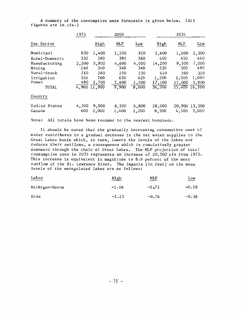
A summary o f t h e c o n s u m p t i v e u s e s f o r e c a s t s i s given below. (All f i g u r e s are i n c f s .)
Use S e c t o r
1975 2000 2035
High MLP Low High MLP Low - - e_ - - - Munic ipa l 830 1 ,400 1 ,100 910 2 ,600 1 ,600 1 ,300 Rural-Domes t i c 330 390 390 380 450 450 440 Manufactur ing 2 ,500 5 ,900 4 ,600 4 ,000 14,200 9 ,500 7 ,000 Mining 240 340 340 340 530 500 490 Rural-Stock 210 280 2 50 230 410 360 310 I r r i g a t i o n 3 5 0 700 630 620 1,200 1,000 1,000 Power 480 2,700 2,600 1,500 17,100 12,000 5,800
TOTAL 4,900 11,900 9 ,900 8 ,000 36,500 25,400 16,300
Country
Uni ted S ta tes 4 ,300 9 ,900 8 ,500 6 ,800 28 ,000 20 ,900 13 ,300 Canada 600 2,000 1,400 1,200 8,500 4,500 3,000
Note: A l l t o t a l s h a v e b e e n r o u n d e d t o t h e n e a r e s t h u n d r e d s .
It shou ld be no ted t ha t t he g radua l ly i nc reas ing consumpt ive u ses o f water c o n t r i b u t e s t o a g r a d u a l d e c r e a s e i n t h e n e t water s u p p l i e s t o t h e Great L a k e s b a s i n w h i c h , i n t u r n , l o w e r s t h e l e v e l s o f t h e l a k e s a n d r e d u c e s t h e i r o u t f l o w s , a consequence which i s c u m u l a t i v e l y g r e a t e r downward th rough t he cha in o f Great Lakes. The MLP p r o j e c t i o n o f t o t a l c o n s u m p t i v e u s e s i n 2 0 3 5 r e p r e s e n t s a n i n c r e a s e o f 2 0 , 5 0 0 c f s f r o m 1 9 7 5 . T h i s i n c r e a s e i s e q u i v a l e n t i n m a g n i t u d e t o 8 . 6 p e r c e n t o f t h e mean ou t f low o f t he S t . Lawrence R ive r . The i m p a c t s ( i n f e e t ) o n t h e mean l e v e l s o f t h e u n r e g u l a t e d l a k e s are as f o l l o w s :
Lakes High MLP - Low
Michigan-Huron -1.06 -0 73 -0.38
Erie -1 -13 -0.76 -0.38
- 15 -