Embed Size (px)
Citation preview
LAKE EFFECT SNOW
SIMULATIONJohn D McMillen
John D McMillen
LAKE BONNEVILLE
EFFECT SNOW
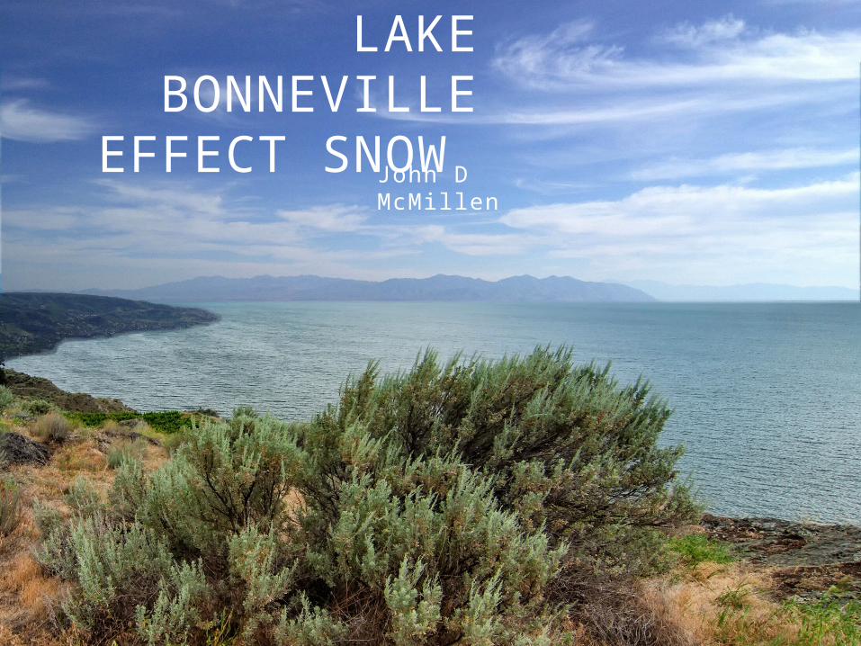
27 Oct 2010 Event Trevor Alcott
found that the simulation and by extension, the GSLE are sensitive to the terrain around the lake Downstream
terrain is a strong positive impact on production of SWE
GSLE SIMULATION
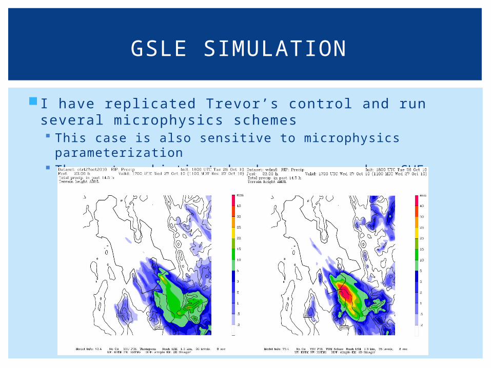
I have replicated Trevor’s control and run several microphysics schemes This case is also sensitive to microphysics parameterization The most sophisticated schemes overproduce SWE
GSLE SIMULATION
This study views the additional moisture source of Lake Bonneville as a possible sensitivity
The results are compared with existing studies of the climate of the Pleistocene over Lake Bonneville
LAKE BONNEVILLE SIMULATION
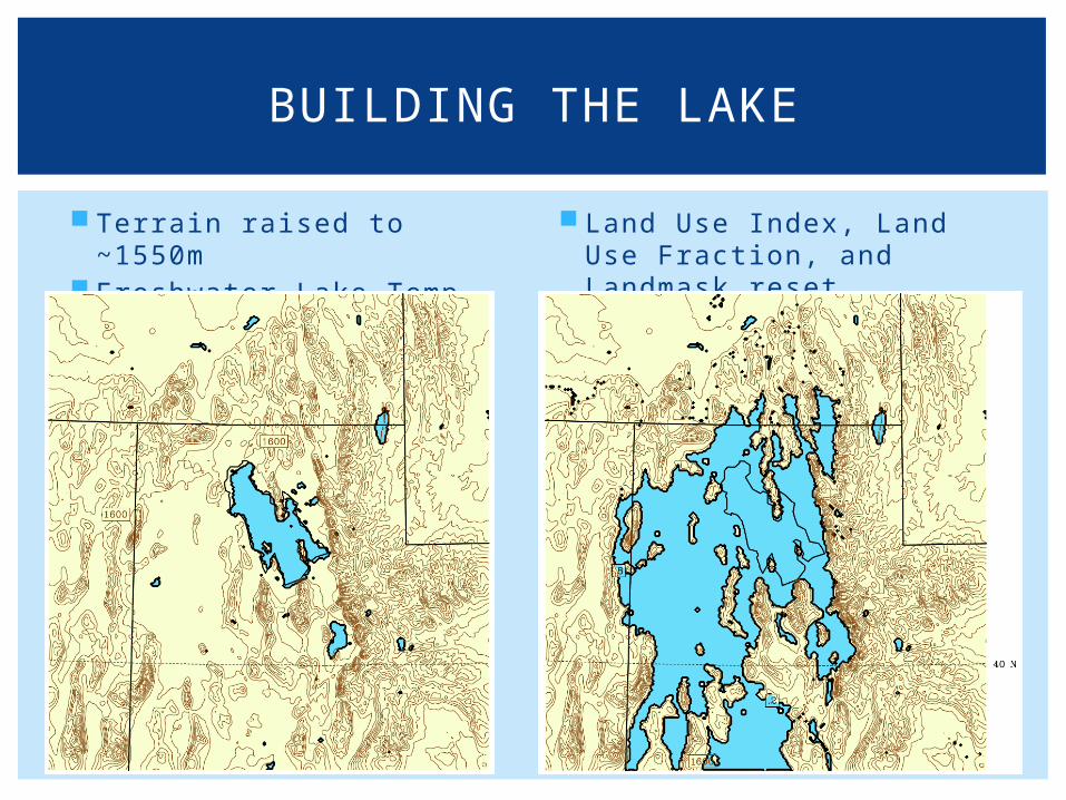
Terrain raised to ~1550m Freshwater Lake Temp
286.5 K
Land Use Index, Land Use Fraction, and Landmask reset
BUILDING THE LAKE
WRF ARW 24 hour run from 18 UTC 26 Oct 2010 to 18 UTC 27 Oct 2010
Triple nested 12, 4, 1.33 km grid spacing Lake Bonneville added in domains two and three
Physics YSU PBL NOAH LSM RRTM LW radiation and RRTMG SW radiation Simple Diffusion Kain-Fritsch Cumulus for 12, 4 km domains. No Cumulus for 1.33km domain
Microphysics Thompson
WRF DETAILS
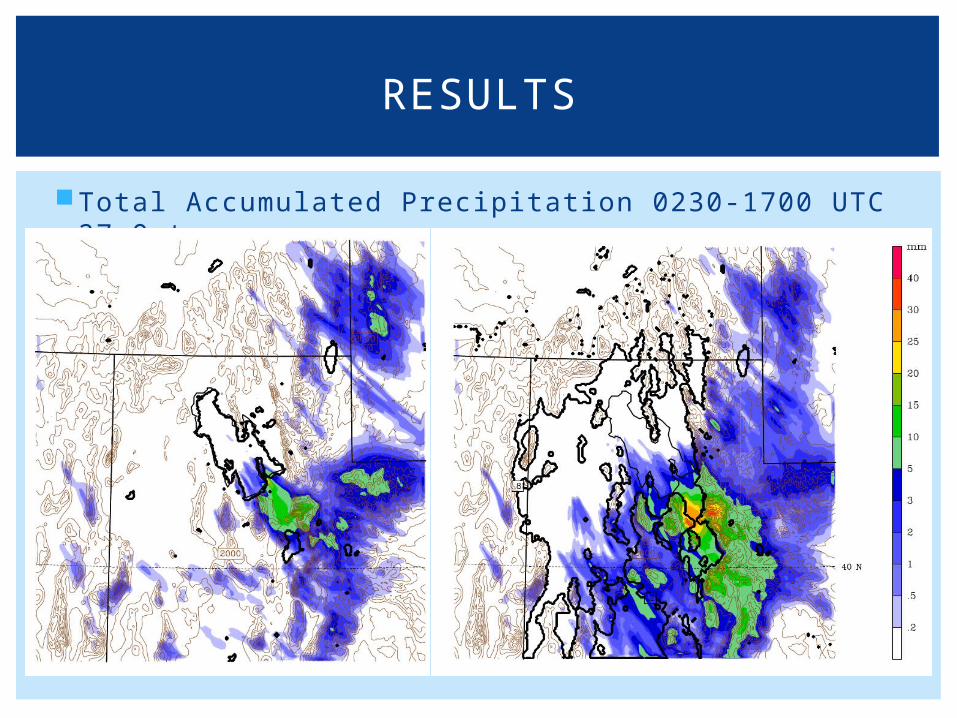
Total Accumulated Precipitation 0230-1700 UTC 27 Oct
RESULTS
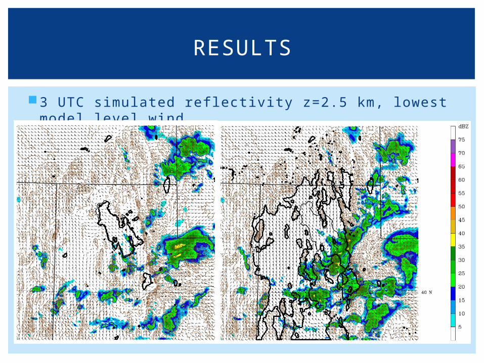
3 UTC simulated reflectivity z=2.5 km, lowest model level wind
RESULTS
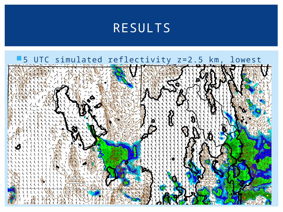
5 UTC simulated reflectivity z=2.5 km, lowest model level wind
RESULTS
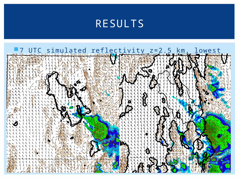
7 UTC simulated reflectivity z=2.5 km, lowest model level wind
RESULTS
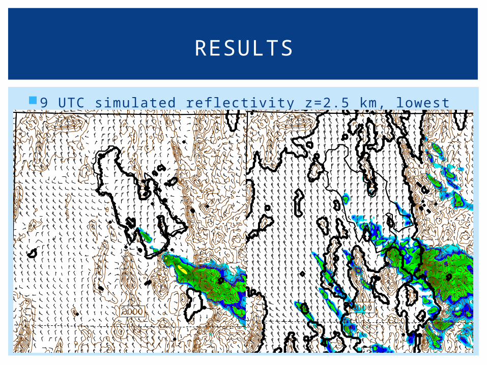
9 UTC simulated reflectivity z=2.5 km, lowest model level wind
RESULTS
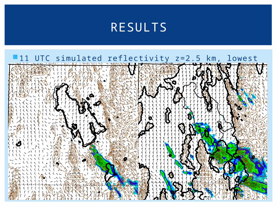
11 UTC simulated reflectivity z=2.5 km, lowest model level wind
RESULTS
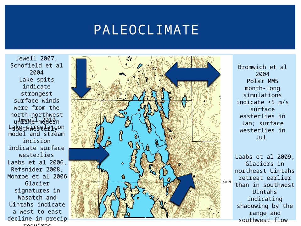
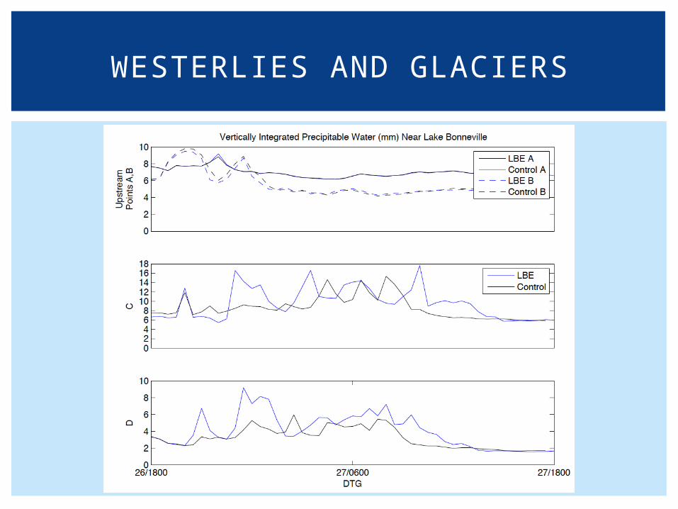
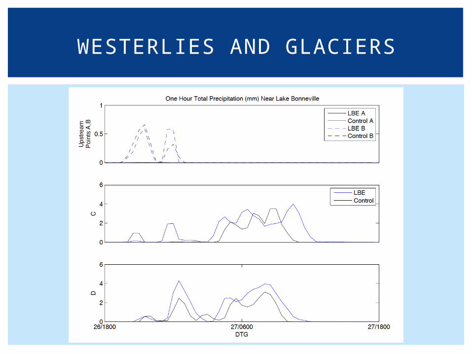
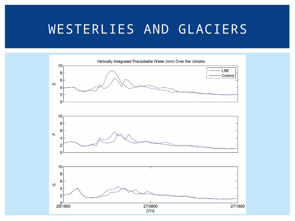
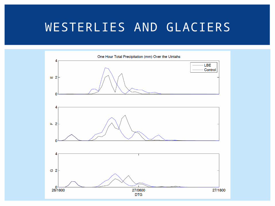
PALEOCLIMATE
Jewell 2010Lake circulation
model and stream incision indicate
surface westerlies
Jewell 2007, Schofield et al
2004Lake spits indicate strongest surface winds were from
the north-northwest unlike
modern southwesterly
Bromwich et al 2004
Polar MM5 month-long simulations indicate <5 m/s
surface easterlies in Jan; surface
westerlies in Jul
Laabs et al 2006, Refsnider 2008,
Monroe et al 2006Glacier signatures in Wasatch and Uintahs
indicate a west to east decline in precip requires
westerlies
Laabs et al 2009, Glaciers in northeast
Uintahs retreat earlier than in
southwest Uintahs indicating
shadowing by the range and southwest
flow
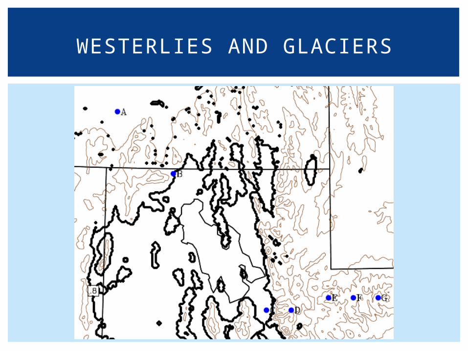
WESTERLIES AND GLACIERS
WESTERLIES AND GLACIERS
WESTERLIES AND GLACIERS
WESTERLIES AND GLACIERS
WESTERLIES AND GLACIERS
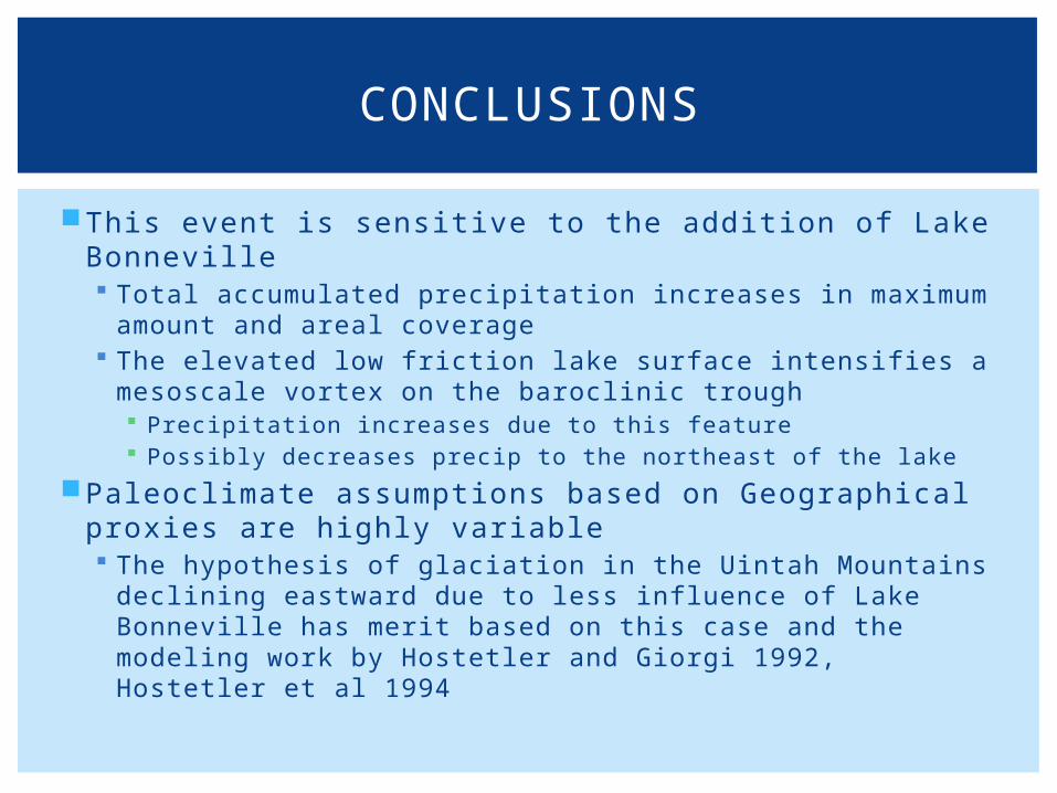
This event is sensitive to the addition of Lake Bonneville Total accumulated precipitation increases in maximum
amount and areal coverage The elevated low friction lake surface intensifies a
mesoscale vortex on the baroclinic trough Precipitation increases due to this feature Possibly decreases precip to the northeast of the lake
Paleoclimate assumptions based on Geographical proxies are highly variable The hypothesis of glaciation in the Uintah Mountains
declining eastward due to less influence of Lake Bonneville has merit based on this case and the modeling work by Hostetler and Giorgi 1992, Hostetler et al 1994
CONCLUSIONS