Embed Size (px)
Citation preview

University of Nairobi
School of Engineering
INTEGRATING GIS AND REAL ESTATE MANAGEMENT SYSTEMS TO
MARKET AND MANAGE FACILITIES ON THE WEB
BY
LABAN KARANJA NDUNGO
F56828482015
A Project submitted in partial fulfillment for the Degree of Master of Science in Geographic
Information Systems in the Department of Geospatial and Space Technology of the University
of Nairobi
July 2017
I
Declaration
I Laban Karanja Ndungo hereby declare that this project is my original work To the best of my
knowledge the work presented here has not been presented for a degree in any other Institution
of Higher Learning
LABAN KARANJA NDUNGO 04072017
Name of student Date
This project has been submitted for examination with my approval as university supervisor
J N MWENDA 4th July 2017
Name of supervisor Date
II
Dedication
This project is dedicated to my parents Dr and Mrs Machanga for their support and
encouragement in my pursuit of further studies in the field of GIS
III
Acknowledgement
First and foremost I would like to thank God for giving me life and being gracious enough to
allow me this opportunity to attain a Masterrsquos Degree in GIS I thank my supervisor Mr J N
Mwenda for his support assistance and guidance offered while preparing for and conducting my
project research I also wish to acknowledge family and friends for bearing with me while I
worked on this project
IV
Abstract
Location drives the real estate industry It is not just about finding any site but finding the best
site By analysing data around locations - demographics aerial photographs and amenities - real
estate agents and potential home owners can find ideal locations for property based on
preference Use of GIS technology is particularly fitting to the application of real estate practice
considering that property is geospatial in nature its associated attributes are plentiful and the
relevance of location is a major factor in the assigning of value to a property With the recent
explosion in the use of the Internet in Kenya mainly due to the increasing popularity of
smartphones the benefits that GIS offers in the realtor space is now capable of being placed in
the hands of millions of prospective home owners Having the right services and information
available via the Internet is an important differentiator for real estate companies Soon those
companies showing where a house is and displaying other important data such as school districts
social amenities shops crime data - using map-based viewers finders and transport links - will
be far ahead of those that do not
Real estate management and marketing on the web has been done before (Keja Hunt 2016) but
there is yet to be a web application which successfully combines data from disparate Real Estate
Management software and uses it to visualize data on a Geographic Information System on the
Web in both 2D and 3D The purpose of this project therefore was to design and develop a web
based application that integrates GIS and Real Estate Management Systems and which can be
used by a real estate company to improve its services attract prospective clientele and ultimately
contribute to the companyrsquos earnings To this end the output of this project meets a need that is
present today such as convenient house hunting on the web but also proves that real estate firms
can enhance their operations by embedding GIS web maps ndash which provide value addition to
their current systems - onto their software operations without having to overhaul their mode of
operation
V
Table of contents
Declaration I
Dedication I
Acknowledgement III
Abstract IV
Table of contents V
List of Figures VIII
List of Tables XI
ABBREVIATIONS XII
CHAPTER 1 INTRODUCTION 1
11 Background 1
12 Problem Statement 2
13 Objectives 2
14 Justification for the project 3
15 Scope of work and limitations 4
16 Study Area 5
161 Nairobi City County 5
162 Kiambu County 6
17 Organization of the Report 7
CHAPTER 2 LITERATURE REVIEW 8
21 The Housing Situation in Kenyarsquos Urban Areas 8
22 Cloud Computing and Web GIS 11
23 Web 20 and Web Mapping Technologies 16
24 Kenya and the Online Retail Market 17
CHAPTER 3 MATERIALS AND METHODS 27
31 Background 27
32 Web Application Development 28
321 Determination of Factors Considered in choosing housing 30
33 Data Collection 32
34 GIS Data Clean up and Publishing 34
VI
35 Creating the Real Estate Management System 36
351 Web linkage Implementation 41
352 Creation of Public Facing Web Application 42
CHAPTER 4 RESULTS AND ANALYSIS 52
41 A Tour of the Real Estate Manager Application 52
411 General CRUD procedures on the system 54
412 Managing Apartments 57
413 Managing the apartment from the GIS Platform 63
42 A Tour of the Public Facing Web Application 65
421 Lifestyle Data 68
422 Find a Home 69
423 Nearby Facilities 72
424 Change map background 74
425 Bookmarked Locations 74
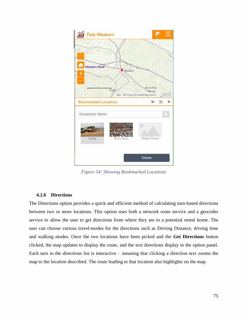
426 Directions 75
427 Share 76
43 Analysis of Results 78
44 Challenges Encountered 79
441 Challenges in simulating a Real Estate Management platform 79
441 Challenges in obtaining Lifestyle Data Overlay data 80
442 Challenges in creation of the Public Facing Web application 80
CHAPTER 5 CONCLUSION AND RECOMMENDATIONS 81
51 Conclusion 81
52 Recommendations 82
References 84
APPENDICES 88
Appendix A 88
The process of publishing a feature GIS Service 88
Appendix B 94
Creation of Real Estate Management RDBMS in SQL Server Express 2016 94
Appendix C 95
VII
SQL commands that created the database schema skeleton 95
Appendix D 100
Schema of the Rental ApartmentReal Estate Management Database 100
RentApartment Database Documentation 100
Appendix E 102
A method to add data to a GIS web service using an ASPNET MVC Controller action 102
Appendix F 105
A method to edit a GIS web service using an ASPNET MVC Controller action 105
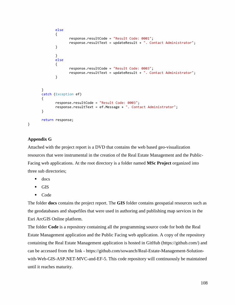
Appendix G 108
VIII
List of Figures
Figure 1 The Project Study Area 6
Figure 2 Percentage of housing units completed for sale by type 10
Figure 3 Cloud Computing Service Models 13
Figure 4 An implementation of Web GIS 15
Figure 5 Web GIS supporting the Enterprise 15
Figure 6 Knight Frank Real Estate Search 20
Figure 7 Searching for a rental house on Jumia 21
Figure 8 Property Details on Jumia Search Portal 22
Figure 9 House hunting with KejaHunt 23
Figure 10 Textbook approach to Property Listing 24
Figure 11 Flowchart showing the Project Process 31
Figure 12 E-R Model Diagram of the Real Estate Management Application 38
Figure 13 Model View Controller (MVC) architecture 40
Figure 14 Linking the GIS Platform to the Real Estate Platform (Solution Architecture) 41
Figure 15 The ArcGIS Online Platform 44
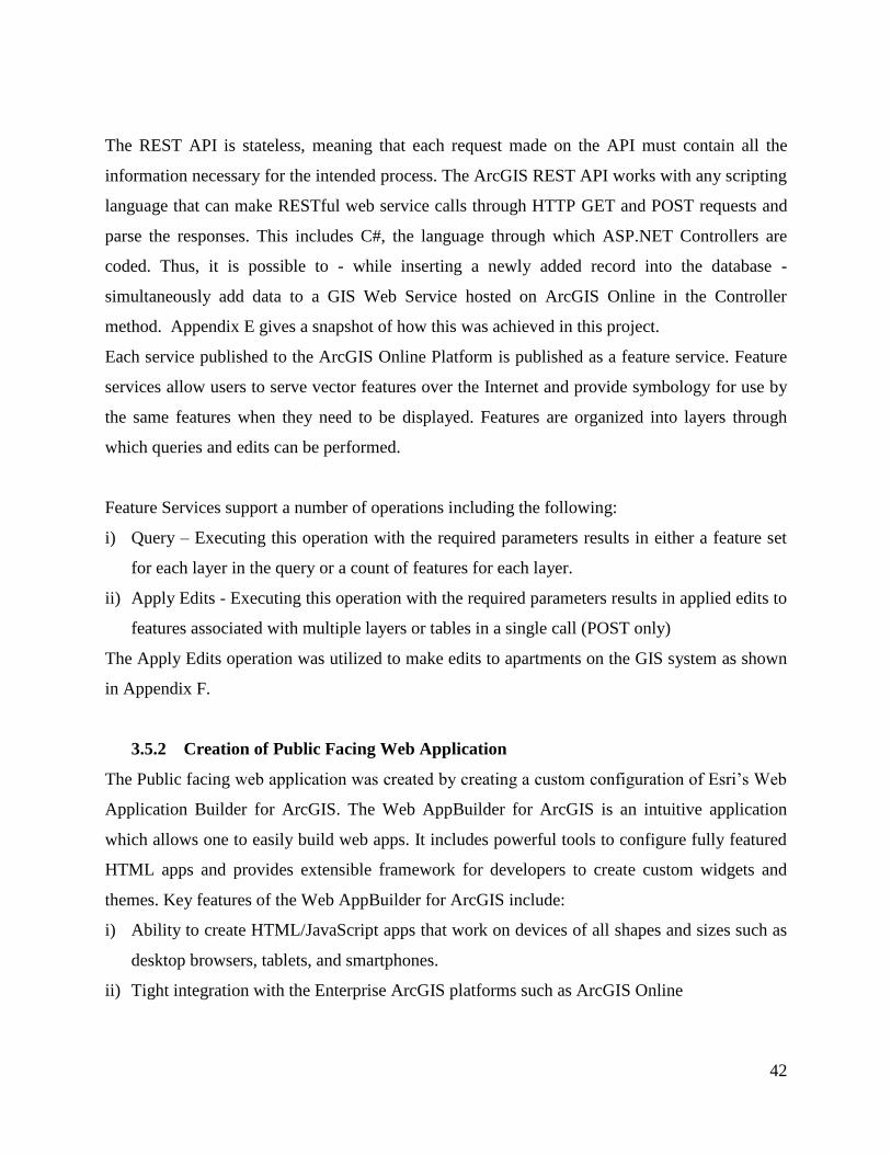
Figure 16 Web App Builder download folder and startup file 45
Figure 17 Node JS server running 46
Figure 18 Web App Builder Startup 47
Figure 19 Web AppBuilder Start Page 48
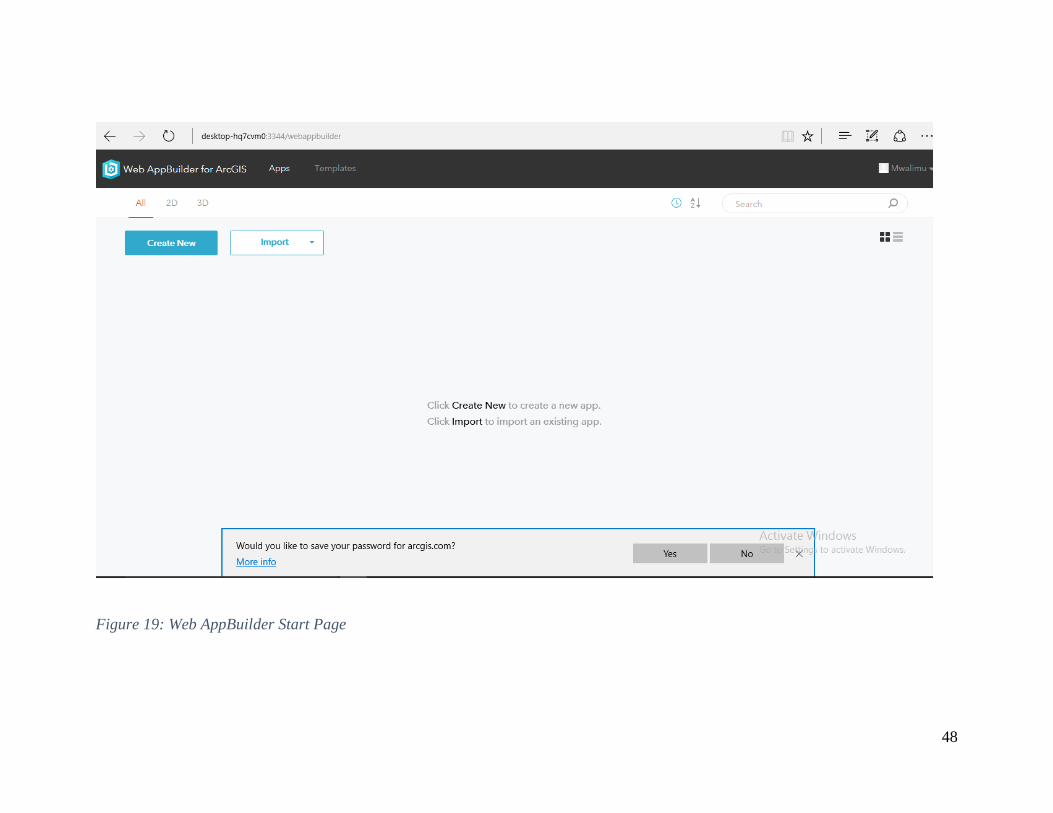
Figure 20 Making a choice of Web AppBuilder 49
Figure 21 Naming and describing the application 49
Figure 22 WYSIWYG Configuration Page 51
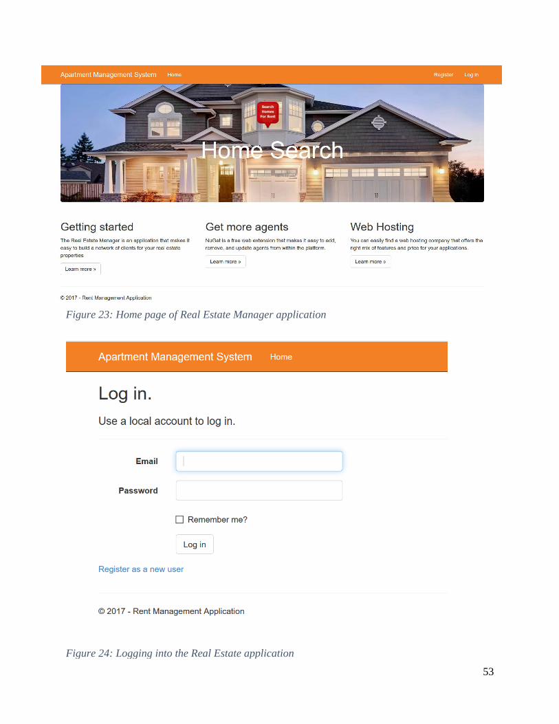
Figure 23 Home page of Real Estate Manager application 53
Figure 24 Logging into the Real Estate application 53
Figure 25 Logged in view of the Home page 54
Figure 26 Agent Details page 54
Figure 27 Create operation for Agents 55
Figure 28 Edit operation for Agents 56
Figure 29 Delete operation for Agents 56
IX
Figure 30 Viewing apartment details 57
Figure 31 Apartment Basics Section 58
Figure 32 Apartment Details Section 59
Figure 33 Apartment Location Picker 60
Figure 34 Apartment Added 61
Figure 35 Viewing the entry from the Web GIS Platform 62
Figure 36 Apartment Audit Trail 63
Figure 37 Adding on-site photos and editing details through Collector for ArcGIS 64
Figure 38 The Collector for ArcGIS app interface 64
Figure 39 On-site photos attached to GIS feature (Rental Apartment) 65
Figure 40 Public Facing Application Splash Screen 66
Figure 41 First look at application after the splash screen 66
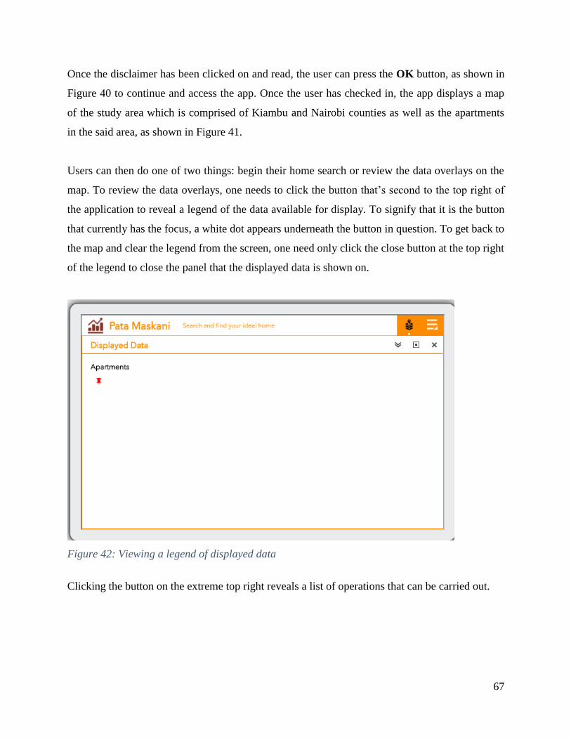
Figure 42 Viewing a legend of displayed data 67
Figure 43 Viewing application options 68
Figure 44 Lifestyle Data Overlays 69
Figure 46 Results from the GIS Query 70
Figure 45 Querying the GIS platform 70
Figure 48 Displaying result on map 71
Figure 47 Displaying result detail 71
Figure 49 Looking at detail of nearby facilities 72
Figure 50 Searching for nearby facilities 72
Figure 52 Viewing directions to a facility on the map 73
Figure 51 Getting directions to a facility 73
Figure 53 Changing the Map Background 74
Figure 54 Showing Bookmarked Locations 75
Figure 55 The Directions Panel 76
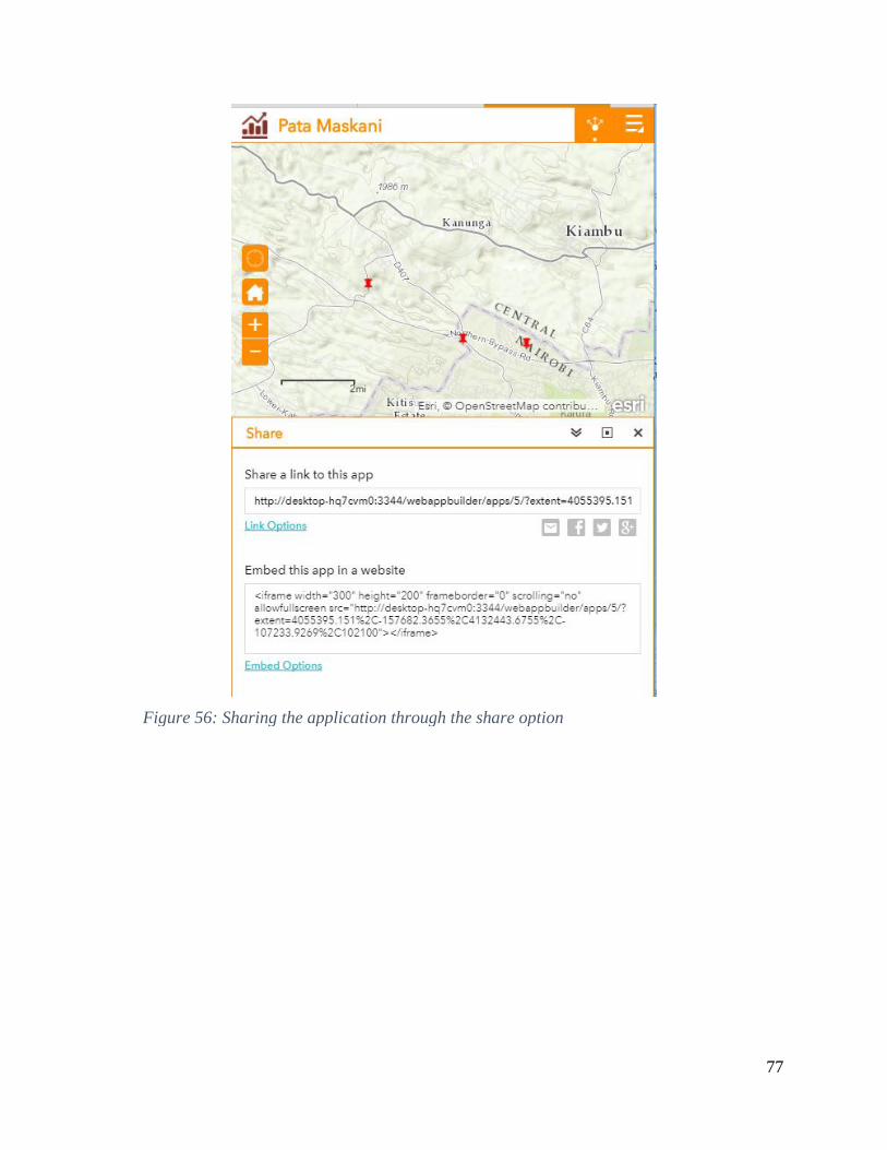
Figure 56 Sharing the application through the share option 77
Figure 57 Signing into GIS Platform 88
Figure 58 Signing in Page 89
Figure 59 Sharing as a Service 89
Figure 60 Choosing the Publish option 90
X
Figure 61 Publish Dialog 90
Figure 62 Service Editor Dialog 91
Figure 63 Adding Item Descriptions 92
Figure 64 Sharing Options 93
Figure 65 Successful Publish 93
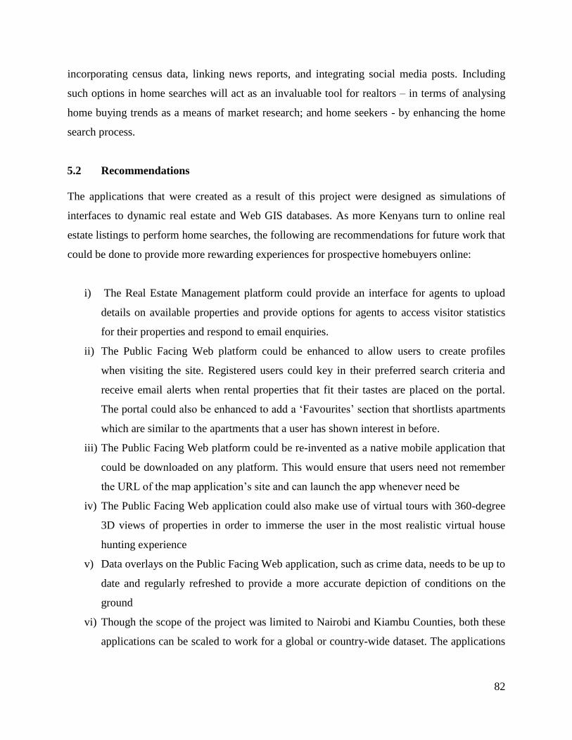
Figure 66 Web Application Development Published Service 94
XI
List of Tables
Table 1 Project Data Sources 32
Table 2Web Mapping Services Used 33
Table 3 GeoAnalytics Services Employed 34
Table 4 Feature Services created for the Public Facing application 35
XII
ABBREVIATIONS API Application Programming Interface
ASPNET Active Server Pages Dot Net
CAK Communications Authority of Kenya
CRUD Create-Read-Update-Delete
CSS Cascading Style Sheets
CSV Comma Separated Values
DBMS Database Management System
DDL Data Definition Language
EF Entity Framework
E-R Entity Relationship
Esri Environmental Systems Research Institute
FK Foreign Key
GIS Geographic Information Systems
HTML Hypertext Markup Language
HTTP Hypertext Transfer Protocol
JSON Java Script Object Notation
KNBS Kenya National Bureau of Statistics
KODI Kenya Open Data Initiative
MLPP Ministry of Lands and Physical Planning
MVC Model View Controller
NGO Non-Governmental Organization
PAAS Platform as A Service
REST Representation State Transfer
SQL Structured Query Language
URL Uniform Resource Locator
WHO World Health Organization
WYSIWYG What You See Is What You Get
XML eXtensible Mark-up Language
1
CHAPTER 1 INTRODUCTION
11 Background
A picture may be worth a thousand words but maps tell stories A map is defined as a
representation of selected characteristics of a geographical location usually drawn on a flat
surface (National Geographic 2006) Maps speak to the viewer by exposing their many
relationships between their constituent features If the data within a map is known to be
authoritative its testimony is unquestionable making it a powerfully persuasive tool In a fiercely
competitive market such as the real estate market this could prove to be the difference between
making a sale and being unable to do so
The real estate industry is based on finding the best site for a housing property at the best price
By analyzing data around locations such as the demographics of the area aerial photographs and
amenities surrounding the area real estate agents and potential home owners can find ideal
locations for property based on preference A Geographic Information System (GIS) captures
analyzes and displays data in a visual spatial context In essence the product of a GIS is a map
(Donlon 2007) Use of GIS technology is particularly fitting to the application of real estate
practice considering that property is geospatial in nature its associated attributes are plentiful
and that location is a key aspect of determining the suitability of a piece of property GIS helps
the real estate industry analyze report map and model the merits of one site or location over
another From identifying the best site for purchase for new commercial development to
matching a home buyerrsquos decision criteria to managing a property portfolio GIS delivers the
answers realtors and potential home owners need to make the best choice (Esri 2006)
With the recent explosion in the use of the Internet in Kenya mainly due to the increasing
popularity of smartphones the benefits that GIS offers in the realtor space are now capable of
being placed in the hands of millions of prospective home owners This transformational
architecture - termed Web GIS (Fu and Sun 2011) - opens existing tools and existing ways of
implementing GIS integrates them and simplifies everything It allows users to take their
systems of spatial record traditional server and desktop technologies and integrate them into a
2
system of systems - at the same time creating a system of engagement meaning users are
connected through devices and applications that feed into one GIS portal
Having the right services and information available via the Internet is an important differentiator
for real estate companies Soon those companies showing where a house is and displaying other
important data such as school districts social amenities shops crime data - using map-based
viewers finders and transport links - will be far ahead of those that do not The purpose of this
project therefore is to design and develop a web based GIS application that can be used by a real
estate company to improve its services entice prospective clientele and ultimately contribute to
the companyrsquos revenue
12 Problem Statement
Real estate management has been done before (Keja Hunt 2016) but there is yet to be a Kenya-
centric web application which successfully combines data from disparate Real Estate
Management software and uses it to visualize data on a Geographic Information System on the
web in both 2D and 3D (SoftKenyacom 2016) To this end this project meets the present day
needs of the common populace such as assisting in finding a convenient place of shelter and
proves that real estate firms can make proper use of GIS web maps to enhance their services
without having to overhaul their current systems
13 Objectives
Service oriented architectures in GIS now make it possible to hide the technical details of
datasets by exposing them through standard web browsers making them available to wider
audiences at a fraction of the cost In turn these architectures allow the GIS to support cross-
functional enterprise applications aimed at entire business processes
The main objective of the project is to design and develop a web platform that successfully
integrates property data stored in a relational database to a Web GIS platform that utilizes service
oriented architectures The project will endeavor to fulfill the following specific objectives
3
i) Investigate how Real Estate Management is currently conducted by commercial firms
ii) Design a model for an integrated Web GIS rental home search solution for commercial
rental firms
iii) Establish a real estate geographic information database with rental apartment data
iv) Establish linkage between geographical attribute information and tabular based data that
is present on real estate management software platforms through a web service
v) Expose the data on these two disparate platforms on a prototype web application that
utilizes the best of both platforms and allows realistic visualization of properties and
buildings in 2D and 3D and which can be viewed on any device at any time
14 Justification for the project
A new house is said by some to define a new phase in a personrsquos life (Canaan 2017) Making a
choice on the apartment or home one will live in determines the routine and lifestyle that one
will have for the duration of habitation Studies show that housing conditions influence
individualrsquos outcome in health education socio-political participation and labour participation
among other aspects of life (WHO 1989) It is therefore important that one makes the right
choice in such a matter While making a housing choice various aspects of housing are generally
considered such as its location dwelling type tenure form age and quality (Smith 1988) These
household choices are influenced by the prices of housing services the income of the individuals
searching and a host of other factors such as household size life cycle government regulations
among others (Musyoka 2012)
Kenyans are used to locating and assessing properties in the old-fashioned way phone calls and
personal visits This is slowly and definitely changing with the aforementioned penetration of
Internet usage and the success of online retail platforms such as OLX and Jumia (formerly
Lamudi Kenya) ndash both of which rank within the top 25 sites visited by Kenyans in the year 2016
(Alexacom 2017) Both sites among many others offer online real estate search - allowing
prospective residential property buyers to sort listed properties interactively based on desired
elements These elements typically address features wanted within a home such as the dwellings
4
size number of bedrooms and bathrooms whether a garage or swimming pool is included and
other furnishings
Equally important in considering the ideal home is to find the ideal location Length of the
commute time crime frequency proximity to cultural and retail options and the location of
desired schools are all vital factors in ensuring a comfortable life in the new home at the new
location While some websites are beginning to address this concern by including small overlays
within a propertys webpage none overtly considers that the home buying process may not start
with the selection of home features but by determining the best-fit neighborhood in
conjunction with the aforementioned features (Dowling 2014)
Real estate agents that present detailed information on available homes and land can realize
increased interest in their properties and thus increased sales (Benjamin 2005) This project
attempts to create an easy to navigate and understand web platform that provides the capability
for users to filter apartments for rent by diverse select criteria and which allows realtors to
combine the property feature data they currently possess with spatial location attributes for better
management and marketing of their properties In so doing this project aims to assist two
categories of people
i The home shopper - by allowing buyers to research neighborhoods as simply as many
websites currently allow general property research
ii The realtor ndash by providing commercial real estate companies with an efficient and honest
marketing tool for shopping the properties in their catalog as well as managing them
15 Scope of work and limitations
The research conducted for this project was focused on creating a web platform through which
the following actions can take place
i) Individuals seeking rental homes can display residential areas that not only fit their ideal
features but which also satisfy their desired neighborhood features
ii) Realtors can manage data on the properties which they have put up for rent and integrate
their management data with the spatial data they have
5
The web platform that is created will have the following basic functionality
i) A Web Application interface with a detailed map of the study area flanked by side panels
with property information and GIS layer toggles
ii) A backend data management portal through which realtors manage their property data
and upload new property data to both a relational database and a GIS database
iii) A GIS Web portal that is used to manage the spatial data that informs the location of the
properties
Creating such a platform will entail the following
i) Creating a GIS database of rental properties and buildings which are managed by the
realtors
ii) Creating a relational database of the rental property data for the non-spatial attribute data
of the properties to simulate a real estate management information system
iii) Creation of a non-public web service platform that can update both databases
simultaneously to have synchronized databases
iv) Creation of a public user facing map driven interface for the househome hunters to carry
out their searches
The programming effort in this project resulted in a web GIS application that integrates existing
real estate property data with related city and neighborhood data for the selected study area into
an interactive local mapping website
16 Study Area
The study area was limited to Nairobi and Kiambu Counties since these were the areas in which
many realtors seemed to be offering houses for rent over the period of the project These
counties are also relatively highly urbanized in relation to the rest of the country and therefore
tend to register the most demand for urban housing
161 Nairobi City County
Nairobi City (which is Kenyarsquos capital and largest city) and its surroundings form the Nairobi
County Nairobi is the most populous city in East Africa with a current estimated population of
about 3 million According to the 2009 Census in the administrative area of Nairobi the
population of Nairobi County stood at 3138369 people within a surface area of 695 square
6
kilometers Geographically Nairobi County is located approximately between latitudes 1deg10primeS
and 1deg27primeS in the North ndash South direction Longitudinally it extends from 36deg40primeE to 37deg0primeE in
the East-West direction
162 Kiambu County
Kiambu County is a county in the former Central Province of Kenya Its capital is Kiambu and
its largest town is Thika The county is adjacent to the northern border of Nairobi County and
has a population of 1623282 as per the 2009 Kenya Population and Housing Census The
county is 40 rural and 60 urban owing to Nairobis consistent growth northwards
Geographically the county lies between latitudes 00deg 25 and 10deg 20 South of the Equator and
Longitude 36deg 31 and 37deg 15 East
Figure 1 The Project Study Area
7
17 Organization of the Report
The project report is organized in five chapters The first chapter provides background
information on the role of location in making real estate purchase or rental choices It also briefly
introduces the use of GIS and more specifically makes a case for how Web GIS may be
instrumental in the creation of applications that bridge the worlds of real estate management and
GIS Chapter Two contains literature review that dwells on the emergence of online real estate
search applications the emerging web mapping technologies that are currently being used within
these applications and their role in marketing rental apartments for Kenyarsquos expanding higher
middle class which generally shops for housing that suits different household needs (Cytonn
Investments 2016)
Chapter Three contains literature on the materials and methodology used including The Study
Area Data Collection exercises Database Design Implementation and Deployment of both the
Real Estate and Web Real Estate Search applications that resulted from this project Chapter
Four looks at the results attained from the use of both applications and gives screenshots of the
applicationsrsquo output and examines how the application process works Chapter Five is the last
chapter of the project report and brings it to a conclusion while providing recommendations on
how this project can be followed up on
8
CHAPTER 2 LITERATURE REVIEW
21 The Housing Situation in Kenyarsquos Urban Areas
Housing is ensconced as a basic human right in the Kenya Constitution and therefore the
realization of the right to housing for every citizen must be pursued in order to realize Kenyarsquos
2020 vision for housing and urbanisation for lsquoan adequately and decently housed nation in a
sustainable environmentrsquo Apart from being a right housing contributes greatly to the socio-
economic development of the country due to its backward and forward linkages (KNBS 2014)
Housing provides the basic human necessity of shelter and has important implications on
household functionality productivity and social harmony (Musyoka 2012) The type of housing
one is exposed influences that individualrsquos outcome in health education socio-political
participation and labour participation among other aspects of life (WHO 1989) For this reason
the choice of house or home for many households is typically one of the most carefully made
decisions and especially so in urban areas Kenya is currently experiencing rapid population
growth even with fertility rates in Kenya being on the decline (KNBS 2015) Urban areas are
enduring the most of this population explosion mainly due to rural urban migration and natural
population growth leading to an upsurge in demand for housing in the urban areas
The urban population in Kenya is projected to grow by over 50 per cent by 2033 at the
urbanization rate of 42 per cent (KNBS 2010) Urbanization is normally associated with
significant economic and social benefits since urban centres tend to be centres of growth in
economic activities and functions The City of Nairobi for instance contributes 60 per cent of
Kenyarsquos Gross Domestic Product (GDP) with only 8 per cent of the countryrsquos population (Dafe
2009) Similarly Nairobi and Mombasa may have only 10 per cent of the national population
but contribute a whopping 40 per cent of wage earnings in the country (World Bank 2011) Even
so urbanization has its challenges chief among them the provision of basic infrastructure
services to support the urban socio-economic fabric Supply of decent urban housing especially
for low-income households is severely lacking in Kenyarsquos major urban areas It is estimated that
Kenyan urban areas experience a demand of 250000 housing units per annum and a provision of
50000 per annum ndash leaving a deficit of 200000 units per annum (MLPP 2016)
9
Thus Kenyarsquos population growth rate and demographic patterns as well as the rate of
urbanization provide necessary stimulation for household demand for urban housing (Musyoka
2012) Even though the government is committed to ensuring provision of adequate shelter for
all Kenyans as stipulated in various policy documents it is simply unable to meet the demand
and thus concentrates its activities to the small-scale provision of housing for civil servants as
well as slum upgrading This is in keeping with the national housing policy that champions for a
lsquomarket-enablingrsquo approach of infrastructure provision and land use planning by leaving the
provision of housing to the private sector Though it is yet to bridge the gap in demand the
private sector has taken up the challenge with great fervour resulting in commercial real estate
business recording the highest rates of growth at 141 compared to 101 in financial services
and 71 growth in agriculture Real Estate has also constantly outperformed other asset classes
in terms of returns on investment regularly returning 25 per annum compared to an average of
10 per annum in the traditional asset classes (Cytonn Investments 2016)
Continued growth in the sector is expected to grow on the back of improved macroeconomic
conditions sustainable high returns and a changing operational landscape as developers strive to
satisfy the high housing deficit This is further assisted by an increase in the number of middle
class population with sufficient disposable income and an increased rate of urbanisation at 44
The types of housing units built by housing developers tell an interesting story about which units
developers are most excited about The graph below captures the number of housing units
completed in 2010 and 2011 as recorded by (KNBS 2014)
10
Source (KNBS 2010)
Figure 2 Percentage of housing units completed for sale by type
Rental flats can be seen to take the biggest share of housing units completed for sale and rent in
both years at 822 757 and 308 and 771 per cent respectively Building rental flats is big
business and this shows in the willingness of developers to put up rental flats Even so high
financing costs negatively affect the supply of houses within urban counties such as Nairobi
County especially due to lack of availability of development land which results in relatively
high prices This has forced housing developers to search for land elsewhere
Due to rapidly improving infrastructure infrastructural developments such as improved roads the
SGR electrification and ICT satellite towns are now opening up for housing development New
developments are now being seen in areas such as Athi River Mlolongo and Ruaka targeting the
new middle class and promising all types of amenities In the context of rental apartments
housing can be viewed as a consumable service Landlords provide shelter as a service to willing
households who base their decision to pay for a set of housing services on social and
demographic needs (Piyush Tiwari 1997) With 80 per cent of Kenyarsquos urban dwellers being
11
tenants and 447 per cent of monthly household income being spent on housing related costs
including rent and utilities (KNBS 2015) the rental retail market is poised to be one of the more
profitable sectors of service industry in the country
22 Cloud Computing and Web GIS
Cloud Computing is described by NIST (National Institute of Standards and Technology) ndash a
body which promotes the US economy and public welfare by providing technical leadership for
the nationrsquos measurement and standards infrastructure (NIST 2011) ndash as follows
ldquoCloud computing is a model for enabling ubiquitous convenient on-demand network access to
a shared pool of configurable computing resources (for example networks servers storage
applications and services) that can be rapidly provisioned and released with minimal
management effort or service provider interactionrdquo
Cloud computing provides technological capabilities mdash that would otherwise be only available
off-premise mdash on demand as a service via the Internet Consumers of these services need not
own assets in the cloud model but pay for them on a per-use basis In essence they rent the
physical infrastructure and applications within a shared architecture (Kouyoumjian 2010) Cloud
offerings range from data storage to end-user Web applications to other focused computing
services Cloud computing differs from traditional computing by providing a scalable and elastic
architecture Cloud computing supports the ability to dynamically scale up and quickly scale
down offering consumers highly reliable cloud services quick response times and the flexibility
to handle extreme demand fluctuations Cloud computing also supports multi-tenancy meaning
that a system offered on the cloud can be pooled as a resource that is shared by many
organizations or individuals Cloud vendors are able to use virtualization technology to convert
one server into many virtual machines thus maximizing hardware capacity and allowing
customers to leverage economies of scale
Three base service models are available using cloud services
i) Software as a Service (SaaS) - End-user applications delivered as a service rather than
as traditional on-premises software The most commonly referenced example of SaaS is
12
Salesforcecom which provides a customer relationship management (CRM) system
accessible via the Internet (Kouyoumjian 2010)
ii) Platform as a Service (PaaS) ndash An application platform on which developers can build
and deploy custom applications Solutions provided in this tier range from APIs and tools
to database and business process management systems to security integration allowing
developers to build applications and run them on the infrastructure that the cloud vendor
owns and maintains Microsofts Windows Azure platform services best exemplify PaaS
solutions (Kouyoumjian 2010)
iii) Infrastructure as a Service (IaaS) - Encompasses the hardware and technology for
computing power storage operating systems or other infrastructure delivered as off-
premises on-demand services rather than as dedicated on-site resources such as the
Amazon Elastic Compute Cloud (Amazon EC2) or Amazon Simple Storage Service
(Amazon S3) (Kouyoumjian 2010)
These service models have been seen to be the preferred choice for businesses in lands where the
electrical grid is unreliable andor which lack telecommunication infrastructure Businesses such
as Cheki (Lazauskas 2013) in Kenya and Nigeria boast huge subscriber bases and are powered
by cloud servers ndash implementing the IaaS model It is also quite telling that a majority of Chekirsquos
users access the site on smartphones ndash indicating that cloud computing and mobile phone usage
are almost synonymous
The future of software is tightly coupled to the capabilities that will be offered by cloud
computing and software as a service This is especially so with data intensive software and
applications such as those which support Geographical Information Systems (GIS) The
emergence of cloud computing and the service based models has brought new possibilities in this
realm Service oriented architectures in GIS now make it possible to hide the technical details of
datasets by exposing them through standard web browsers making them available to wider
audiences at a fraction of the cost Cloud GIS services can also be deployed in environments that
can be made to scale up or down as required with the service provider only being charged for
actual usage This allows cloud clients to be confident they are consuming services from systems
that are highly reliable and flexible enough to handle large traffic fluctuations (Blower 2010)
13
Source (Kouyoumjian 2010)
Figure 3 Cloud Computing Service Models
The following key benefits of cloud based GIS are steadily driving its growth in the global
market
i) Cloud based GIS platforms allow organizations to deliver new capabilities rapidly and in
a more cost-effective manner
ii) Cloud based platforms (examples include GISCloud GeoMedia from Hexagon and
ArcGIS Online) generally employ pay-as-you-go pricing models which allow for free
trials for potential GIS service clients Since assets are rented the duty of maintaining the
physical data centers is left to the cloud vendor alleviating the customers responsibility
for software and hardware maintenance ongoing operation and support
iii) Cloud services are regularly updated if only for the vendors to keep up with the
competition and provide the best services This reinvestment in the IT architecture and
service benefits clients by ensuring that consumers are consistently provided with a
robust updated solution Cloud clients can be confident they are consuming state-of-the-
art systems that are highly reliable and flexible enough to handle large traffic
14
fluctuations An example of this would be Esri Incrsquos cloud based service ArcGIS Online
ndash which is updated close to 6 times a year ensuring that clients are on the forefront of
technology
iv) Cloud services are available 247 accessible from any browser on any device regardless
of time zone This provides faster and easier access for workers to do their jobs though it
necessitates the use of the Internet always
Cloud based GIS Computing has given birth to a transformational architecture - termed Web GIS
(Fu and Sun 2011) ndash which opens existing GIS tools and existing workflows integrates them
and simplifies everything It allows users to take their traditional server and desktop
technologies and integrate them into a system which connects users through devices and
applications that feed into one portal
As a pattern for delivering GIS capabilities the key concept behind Web GIS is that all members
of an organization can easily access and use geographic information within a collaborative
environment This ensures that staff in the organization with little or no GIS knowledge can also
benefit from and contribute to the organizations GIS platform Web GIS leverages existing GIS
investments by providing a platform for integrating GIS with other business systems and
promotes cross-organizational collaboration Consequently web GIS extends the reach of GIS to
everyone in an organization enabling better decision making
At the center of the web GIS pattern is the generic concept of a portal that represents a gateway
for accessing all spatial products in an organization The portal helps organize secure and
facilitate access to geographic information products Client applications on desktops web apps
tablets and smartphones interact with the portal to search discover and access maps and other
spatial content In the back-office infrastructure two components power the portal cloud based
GIS servers and ready-to-use content (Law 2014) It is within such a framework that the web
GIS environment supports the entire organization or the entire enterprise It makes mapping in
GIS available to everyone
15
Source (Law 2014)
Figure 4 An implementation of Web GIS
Source (Law 2014)
Figure 5 Web GIS supporting the Enterprise
16
With such a framework in place it is then possible to pinpoint the role Cloud based GIS can play
in the implementation of a Real Estate Management System with spatial capabilities
23 Web 20 and Web Mapping Technologies
ldquoWeb 20rdquo a term first coined in the late nineties (DiNucci 1999) refers to cumulative changes
in the ways software developers and end users use the Web
In his ldquoWhat is Web 20rdquo article Tim OrsquoReilly pointed out that the Web was beginning to
become characterized by exciting new applications and Web sites which exhibited specific
features (OReilly 2005) Among these features were the following
i Content generated from external sources Web 10 the original Web was
characterized by read-only content and a top-down information flow Web 20 is a read-
write Web that features an abundance of user-generated content (UGC) and a reverse
(bottom-up) information flow These Web sites exhibit dynamic content because of the
products comments and knowledge offered by other users Consequently this draws
users to the sites
ii The Web as a platform The Web is a platform for computing and software
development Among these developments are Software as a Service (SaaS) where
software capabilities are delivered as Web services or Web applications and cloud
computing where dynamically scalable and often virtualized resources are provided as a
service over the Web
iii Interactive and Responsive programming models Web 20 systems support
lightweight and easy programming models such as AJAX (Asynchronous JavaScript and
XML) which allow minimal data exchange with servers and do not require the page to be
completely redrawn each time a user changes their request This provides for responsive
Web applications which allows a single Web page to asynchronously send and receive
responses to multiple XMLJSON (JavaScript Object Notation) requests and empower
users to create new functionality by mashing up or assembling various Web sources in
creative ways
iv Data is the next ldquoinside intelrdquo Every significant Internet application is backed by a
specialized database Data is important especially when there is significant cost in
17
creating the data Companies can license unique data or aggregate data for example by
facilitating user participation Once the amount of data reaches critical mass it can be
turned into a system service (Fu amp Sun 2011)
v Software that reaches beyond a single device Web applications can be accessed by an
increasing variety of devices including Web browsers desktop clients and smart phones
stemming from advances in wireless communications
vi Rich usability Popular Web 20 applications have a graphic user interface that is easy to
use minimalistic designed and simple to navigate
These Web 20 principles now form the foundation of todayrsquos applications The geospatial
industry including both consumer Web mapping companies and professional GIS companies
seek to follow these key tenets to provide rich user experiences encouraging user participation
and in the development of lightweight APIs so users can create their own applications (Maguire
2008) Commercial Web mapping applications (also christened GeoWeb applications) such as
Google Maps ArcGIS Online Microsoft Bing Maps Mango Maps and CartoDB are good
examples of Web 20 The user interfaces are intuitive dynamic responsive and rich These
sites provide maps for mobile devices and provide services based on your location allowing you
to find facilities nearby GeoWeb 20 makes GIS not only more accessible to people in their
offices homes and on the go but also more flexible through Web-based APIs Developers can
use these APIs (application programming interfaces) to facilitate seamless integration with other
information systems
24 Kenya and the Online Retail Market
According to the Communications Authority of Kenya (CAK) Kenya has an estimated total of
232 million internet users currently with 147 million of them using the internet on their mobile
devices (CAK 2014) The continued expansion of 3G services and the increased popularity of
online transactions have expanded the datainternet market and which has continued to receive a
major boost from the mobile datainternet services With the continuous expansion of internet
connectivity more users are expected to be registered thus propelling the growth prospects of this
sub-sector even further (CAK 2014) As the growth in Internet usage in the country persists so
does the unique opportunities for growth in the retail sector Over the past five years the average
18
value of consumer spending has risen by as much as 67 making Kenya the continentrsquos fastest-
growing retail market (Oxford Business Group 2016) The rise in formal retail activity is seen
clearly by the expansion of dedicated property in major urban areas centred around Nairobi The
year 2015 saw a near tripling of Nairobirsquos modern retail space with close to 170000 square
metres of new leasable area coming on-line This rise in capital investment ndash combined with
encouraging fundamentals such as an urban population that the UN expects will rise by 28m
over the next five years to reach 147m by 2020 ndash has led to Kenya being singled out as a hot real
estate prospect in several recent publications (Oxford Business Group 2016)
In the developed world online real estate searches are a popular and practical means to shop for
properties for rent purchase or lease In February 2014 316 million visitors in the US went to
an online real estate website from their desktop computer Those numbers do not necessarily
indicate a homebuyer or a unique visitor - they may have been realtors other home sellers or
real estate website developers - but they do suggest a viable business model Online research was
not confined to the desktop computer the two largest websites Zillowcom and Truliacom
estimated that mobile device users accounted for almost half their website traffic (Hagey 2014)
Kenyans however are used to locating and assessing properties in the old-fashioned way phone
calls and personal visits This is slowly and definitely changing with the aforementioned
penetration of Internet usage and the success of online retail platforms such as OLX and Jumia ndash
both of which rank within the top 25 sites visited by Kenyans in the year 2016 (Alexacom
2017) Both sites offer online real estate search allowing prospective residential property buyers
to sort listed properties interactively based on desired elements These elements typically address
features wanted within a home such as the dwellings size number of bedrooms and bathrooms
whether a garage or swimming pool is included and other furnishings
A web-based approach to offering real estate has already began taking root in Kenya with
established real estate companies such as Knight Frank (
Figure 6Error Reference source not found) Lloyd Masika and Tysons Ltd creating websites
which display real estate offerings from multiple agencies or sellers The site with the most web
traffic in the Kenyan market is online retail giant Jumia which is ranked among the top 20 most
19
visited sites in Kenya (Alexacom 2017) The rest of the online web traffic as concerns real
estate is taken up by smaller players such as KejaHunt (Keja Hunt 2016) MySpace Properties
Ltd (MySpace Properties Kenya 2017) Ryden International (Ryden International 2017) Azizi
Realtors and HomeScope Properties Limited Of the sites mentioned only 3 of the sites listed
provide interactive maps that show available properties that the website visitor may filter based
on their specific requests
Figure 7 shows a filter on the website housejumiacoke In this example the user selects a rental
apartment in Ruaka priced between KShs 10000 and KShs 35000 From those results the
visitor can click on any interesting properties for more information photographs and listing
agent contact information as seen in Figure 8 The Jumia web experience is one of the more
unique experiences when shopping for Kenyan real estate online The embedded web map is a
feature one does not find on most Kenyan real estate sites Some of the sites actually replicate the
old-school method of house hunting but add a touch of convenience to it KejaHunt is an
example of such a site Figure 9 basically explains how KejaHunt operates ndash with surprisingly
high levels of success despite the rather manual approach
This type of approach basically substitutes a house hunter with an agent armed with the hunterrsquos
tastes in mind and charges a convenience fee for the service House details are provided by the
agent ndash who is presumed to have made an honest search for the required apartment and viewing
schedules are handed to the client Other sites tend to offer a more textbook approach to online
real estate search Sites such as rydencoke allow one to search for available properties by
filtering through a list of standard features on a web page and having the available properties
displayed as a list on the page This approach relies on a text description of the location of the
property to convey to the client how to get to it The site acts as an online brochure through
which clients can basically see listings of properties and then organize to view these properties to
get an idea of the environment around them
20
Figure 6 Knight Frank Real Estate Search
21
Figure 7 Searching for a rental house on Jumia
22
Figure 8 Property Details on Jumia Search Portal
23
Figure 9 House hunting with KejaHunt
24
Figure 10 Textbook approach to Property Listing
25
None of the websites mentioned shows any local information at least not in map form or in
otherwise readily searchable formats Instead only features pertaining to the house itself are
listed as well as the price
While the average real estate website can provide quick listings of properties that match the ideal
features that a client has in mind it lacks knowledgeable data about the surrounding area
Currently most real estate websites pay little attention to important elements in the immediate
vicinity of a property or building Is the crime rate low Are there any schools nearby How far
away from major roads or entertainment spots is desired Are there retail spots or health
facilities or playgrounds nearby These additional elements must be considered at some point
when looking for a home and ideally they should be considered early in the home search
process
Making decisions based on geography is basic to human thinking By understanding geography
and peoples relationship to location we can make informed decisions about the way we live on
our planet (Esri 2007) Having this in mind one can see why for many people finding the ideal
location comes before finding the ideal features in a home Length of the commute time crime
rates proximity to cultural and retail options and the location of desired schools are all vital
factors in ensuring a comfortable life in the new home at the new location While some websites
are beginning to address this concern by including small overlays within a propertys webpage
none overtly considers that the home buying process may not start with the selection of home
features but by determining the best-fit neighborhood in conjunction with the aforementioned
features (Dowling 2014)
Considering the fact that Nairobi residents have been found to spend 40 per cent of their income
on rent (Business Daily 2015) it would be prudent to include such factors in the search for a
home Kenyan consumers are accustomed to buying homes based on their physical
characteristics instead of lifestyle and neighborhood preferences While the number of bedrooms
and the availability of water are important features more and more people want their dwelling
26
places to truly reflect their needs aspirations and social connections and for the price they are
paying for it it should
ldquoLifestyle searchrdquo is one of the newer and more innovative ideas in residential real estate that
attempts to match the best properties with the right owners Using neighborhood attributes from
demographics to the location of schools and other civic and social amenities lifestyle search uses
spatial analysis to match buyersrsquo desires to the best property (Thompson 2011) Searching in this
manner allows consumers to localize their home searches and it supplements the realtorsrsquo
knowledge with local information and the latest socio-demographic statistics Different variables
can be considered and outcomes weighted by how viable each is in terms of meeting a personrsquos
need
A unique and intuitive web GIS application that includes the location aspect in online search for
real estate would be a more informative way of marketing properties for realtors as well as a
more efficient method of searching for prospective homes for online house hunters Such an
application should be easy to navigate offer search functionality that takes advantage of data
about a propertyrsquos surrounding area and be simple to maintain (Dowling 2014)
27
CHAPTER 3 MATERIALS AND METHODS
31 Background
The programming effort in this project resulted in two applications
i) A Private Real Estate Management Platform
This platform consists of a web application with a relational database management system
(RDBMS) backend that allows a realtor to key in data about rental apartments that are up for
sale This platform is only available to the realtor and thus one requires log in credentials to
access this bit of the platform Using this platform the realtor can enter details about the rental
apartment as well as pin it on a map in order to retrieve its coordinates and store all this data in
the RDBMS The realtor is also able to input details about various interconnected aspects or
attributes of the industry such as details concerning the agents who run the rental properties the
owners of these properties as well as the transactions that the properties are involved in This
web application basically simulates the operations of a typical Real Estate Management System
What separates this application from those currently in the market is that it is synchronized with
a commercial online Web GIS Platform (ArcGIS Online) which hosts the geographic component
of the data in the GIS platform The GIS platform is then used to create the resulting public
facing application The Real Estate Management Platform in this application was labelled as an
Apartment Management System
ii) A Public Facing Web GIS application
The Web GIS application that was developed for this project is unique in online home real estate
searches compared to current online websites This Web GIS application offers the following
information and functionality most of which are not currently found in existing real estate
websites
a) Integration of existing Real Estate property data from the Management Platform with
related city and neighbourhood data for sections of Nairobi and its environs into an
interactive mapping website
b) 2D and 3D (where applicable) views of buildings and properties
28
c) Ability to search via proximity to facilities which are of interest to people searching for
rental homes such as schools restaurants Automated Teller Machines (ATM) and malls
d) Ability to include data on recent crime incidents as a layer to assist in the choice of
optimal home search locations
e) Zoom and search
f) Directions to desired properties
These sets of functionalities set the public-facing application apart from what is currently on
offer at common online rental retail sites which do not offer any details about the environs of a
potential home These functionalities also allow the public facing application to provide home
hunters with a curated and detailed list of properties from the Real Estate Management platform
serving as a trustworthy directory of available homes for rent
The study area was limited to a subset of Nairobi and Kiambu Counties to minimize the
processing time and storage size of the various large datasets The choice of study area was
determined based on the following factors
i) Areas in which appropriate demographic datasets were available
ii) Areas within which real estate is highly sought after
iii) Areas within which realtors may have advertised property
32 Web Application Development
The research conducted for this project was based on how to display residential areas that satisfy
a homebuyerrsquos or plot seekerrsquos desired neighbourhood features by creating a web GIS
application that displays in a single webpage a detailed map of the study area flanked by side
panels where users may toggle various layers on and off for a custom display as well as filter
data based on features of the properties on offer The research also attempted to simulate how a
realtor would manage this web application from the back end and integrate with a standard Real
Estate Management System These map layers that can be toggled include basic neighborhood
data such as schools hospitals parks airports major roads and railroads
29
This project was developed primarily using tools from Esri ArcGIS Developer Platform as well
as Microsoftrsquos Visual Studio 2015 Community Edition and SQL Server 2016 Layers and data
were processed using Esri ArcMap 105 to import shapefiles to convert data from various data
formats to geodatabase and through Esrirsquos ArcGIS Online platform to web service form The
programming languages that were used included the following
i) HTML 5 and JavaScript ndash to create the interface of the web application
ii) Web AppBuilder for ArcGIS (Developer Edition)
iii) Esrirsquos ArcGIS API for JavaScript version 42 for the map viewer portion of the real estate
web application
iv) ASPNET MVC and C for the Real Estate Management application backend ndash to
retrieve and update data on the Real Estate Relational Database
All data were projected to WGS 84 - an Earth-centered Earth-fixed terrestrial reference system
and geodetic datum This is because WGS84 is based on a consistent set of constants and model
parameters that describe the Earths size shape and gravity and geomagnetic fields and is the
reference system for the Global Positioning System (GPS) It also translates well on web maps
used for consumer consumption which use the WGS 84 Web Mercator projection ndash a de facto
standard for Web Mapping Applications The final web GIS application was created using
datasets published to ArcGIScom by the author and added to a custom implementation of Esrirsquos
Web App Builder for ArcGIS (Developer Edition) which was modified with programming
written in JavaScript v320 and its associated Dojo toolkit (Dojo 2017) Notepad++ was used as
the webpage editing program The full process of creating the web application is discussed in
section named Creation of Public Facing Web Application
The flowchart in Figure 11 outlines the process that was followed to create the prototype
applications In regard to determining the most appropriate software to use in coding this project
initial research suggested that the most cost-effective way to create these applications would be
to use Open Source tools to achieve the desired ends Some of the options available for the
creation of the Web GIS application included the use of Google Maps coded with Hypertext
Markup Language 5 (HTML5) and JavaScript for the client facing end Python and MySQL or
Google Fusion Tables for the backend for server-side communication However it was later
30
found that Esris ArcGIS templates provide pre-coded web GIS applications that can be
customized more easily using JavaScript Dojo and HTML Furthermore Esri provides a free
developer platform where web designers and programmers can create and host applications and
the web services used as content in mapping applications This platform greatly reduced the time
needed to learn programming languages in order to create the Web GIS application The end
product was ultimately created through Web AppBuilder for ArcGIS - an intuitive application
that allows users to easily build fully featured HTML web apps and whose tools provide an
extensible framework for developers to create custom widgets and themes This allowed for
more concentration to be placed on the application workflow rather than on gaining detailed
programming skills required to program the web GIS application from scratch
321 Determination of Factors Considered in choosing housing
Although studies are yet to prove the exact reasons that Kenyan urbanites choose the housing
that they live in one can with a high degree of certainty infer that security and level of income
are the two most important factors to consider in choosing a rental (Preston 2013) From
discussions with random Kenyan urbanites it can be concluded that the following are factors that
affect choice of rental housing
i) Commute Times ndash This is especially so for people who work in Urban Centres but live in the
suburbs on the outskirts of the said area No one wants a long commute time to work and
everyone wants an area that has multiple means of transport available
ii) Lifestyle ndash This is especially so for the upper middle class People would like to be seen to
live in a respectable area to improve their standing socially
iii) Local Amenities ndash These include restaurants shopping and family attractions The need for
such has driven the great demand for Gated Self-Contained Communities in the Kenyan Real
Estate Market recently
iv) Health ndash For many Kenyans health is a major concern and proximity to a health institution is
an important factor to consider when searching for a home
v) Crime ndash Security of a potential home is important when trying to locate a place where one
can raise a family For this reason ndash proximity to a Police Station or Police Post is a boon for
a rental apartment
31
vi) Schools ndash For individuals with children this is a major factor It isnrsquot just about the schools
that are closest to the residence the performance of the schools also matters
Figure 11 Flowchart showing the Project Process
Determine the factors that are considered in selecting a home or a
plot
Determine and Collect data that
pertains to neighbourhood
selection
Clean the obtained data and convert it into a usable format
for a web application
GIS data to Geodatabase Feature Class format
Real Estate data to Relational Database Table format
Both aforementioned datasets to web service format
Design structure of real estate
management system
Design structure of homebuyer or plot
seeker web application
Build front facing user application and real estate management
back end
Complete and Test the Platform ie both the
fron facing user application and the Real
Estate Management driven backend
32
33 Data Collection
This process involved the identification of data required for database design and creation as well
as the development of the linkage between a working GIS System and a simulation of the Real
Estate Management System The following table details the data sources for Nairobi and Kiambu
Counties that were collated to cater for the Web GIS Application
Table 1 Project Data Sources
Layer Source Format Collection Date
Wards Unofficial (sourced from ArcGIS Online) Shapefile 2013
Constituencies Unofficial (sourced from ArcGIS Online) Shapefile 2013
County Boundaries Unofficial (sourced from ArcGIS Online) Shapefile 2013
Crime Media Non-Governmental Organizations Shapefile 2016
Primary Schools Kenya Open Data Site Shapefile 2009
Secondary Schools Kenya Open Data Site Shapefile 2009
Roads Kenya Roads Board Shapefile 2013
Railroads Esri Eastern Africa Shapefile 2010
Health Facilities Kenya Open Data Site Shapefile 2010
Financial Facilities Esri Eastern Africa Shapefile 2015
Parks and Recreation Esri Eastern Africa Shapefile 2015
Restaurants Esri Eastern Africa Shapefile 2015
Parking Esri Eastern Africa Shapefile 2015
Transportation hubs Esri Eastern Africa Shapefile 2015
Shopping hubs Esri Eastern Africa Shapefile 2015
Entertainment Spots Esri Eastern Africa Shapefile 2015
33
a) Sourcing of Publicly Available Basemap Layers
Error Reference source not found shows publicly available basemaps and reference layers
delivered as online tiled web mapping services which were identified for use as contextual
Basemap layers
Table 2Web Mapping Services Used
Web Map
Services
Rest Endpoints
Esri World
Imagery
httpservicesarcgisonlinecomArcGISrestservicesWorld_ImageryMapServer
Esri World
Street Map
httpservicesarcgisonlinecomArcGISrestservicesWorld_Street_MapMapServer
Esri World
Topographic
httpservicesarcgisonlinecomArcGISrestservicesWorld_Topo_MapMapServer
Esri Ocean
Basemap
httpservicesarcgisonlinecomArcGISrestservicesOcean_BasemapMapServer
Esri World
Light Gray
Base
httpservicesarcgisonlinecomArcGISrestservicesCanvasWorld_Light_Gray_B
aseMapServer
OpenStreetMap httptracosgeoorgmapserverwikiRenderingOsmData
Google Maps httpsmapsgoogleapiscommapsapistaticmapparameters
b) Sourcing of cloud based GeoAnalytics services
Error Reference source not found shows publicly available geo-analysis capabilities
delivered as online cloud based services Intended to simplify the workflows of developers and
GIS professionals these services operate under a credit-based usage model that offers a low
barrier to entry and allows users to pay only for what is used
34
c) Sourcing of Apartment data
Data on apartments was sourced by going through current online real estate search portals and
manually keying them into the Real Estate Management Database
Table 3 GeoAnalytics Services Employed
Web Service REST Endpoints Purpose
ArcGIS Online
Geometry
Service
httptasksarcgisonlinecomArcGISr
estservicesGeometryGeometryServer
Contains utility methods which
provide access to sophisticated
and frequently used geometric
operations
World Route
service
httproutearcgiscomarcgisrestservi
cesWorldRouteNAServer
Used to find the best way to get
from one location to another or to
visit several locations
Closest Facility
service
httproutearcgiscomarcgisrestservi
cesWorldClosestFacilityNAServerC
losestFacility_WorldsolveClosestFacil
ityparameters
Used to find closest facilities
based on a given distance
Geo-Enrichment
Service
httpgeoenricharcgiscomarcgisrest
servicesWorldgeoenrichmentserverG
eoEnrichmentf=pjson
Provides the ability to get
information about the people
places and businesses in a
specific area or within a certain
distance or drive time from a
location
34 GIS Data Clean up and Publishing
The GIS Shapefiles that were sourced were cleaned up in order to create feature classes for
publishing on Esrirsquos ArcGIS Online Platform The process of publishing is detailed in Appendix
A The following are the feature classes that were cleaned up and the definitive attributes that
they presented
35
Table 4 Feature Services created for the Public Facing application
Feature Service Feature Service Attributes
Crime Data Year Month Region County SubCounty
Town PreciseLocation IncidentType
Transport Layers
(Group Layer)
Sub-layers
Railroads ndash RailName
Major Highways ndash HighwayName
FUNC_CLASS FerryType
Secondary Highways ndash HighWayName
Streets ndash Street_NM
Primary Schools in Nairobi and Kiambu Name_of_School Level_of_Education
Secondary Schools in Nairobi and Kiambu Name_of_School Level_of_Education
Health Facility data F_Name Agency Sublocation
Nairobi and Kiambu boundaries Sub-layers
Nairobi and Kiambu Wards
Nairobi and Kiambu Constituencies
County Boundaries
Desired Facilities
(Group Layer)
Sub-layers
Parks and Recreation
Restaurants
Parking
Transportation Hubs
Automobile Maintenance
Shopping
Entertainment
Financial Institutions
36
35 Creating the Real Estate Management System
The Real Estate Management System was built to simulate a plain RDBMS (Relational Database
Management System) driven web interface This system is meant to assist a Real Estate
Management team to add and update details of rental apartments into both the GIS platform and
the RDBMS platform in one go In this way users of the Real Estate Management System will
be able to work with both GIS and RDBMS platforms without necessarily having to be GIS
proficient or database proficient The linkage between the two systems happens by way of REST
Web APIs provided by the GIS Platform To get started the Real Estate Management database
on the RDBMS had to be designed
a) Real Estate Management System Database Design
Database design is the process of producing a detailed data model of a database and simulating
how it will be represented The Real Estate database forms the foundation of all activities that
will be performed concerning rental apartments such as the adding of units into the system
updating of unit details as well as recording transactions that involve rental units By not going
through the database design process one risks having a poorly constructed database that does not
meet the userrsquos requirements resulting in duplicate missing or redundant data
The Real EstateRental Apartment database was designed to meet the feature functionality of the
web based geo-visualization tool as well as perform basic CRUD functionality as pertains to
adding and updating details on apartments being offered for rent by various agencies The
database design process was informed by the datasets that were intended for use (namely
apartment details) and the information products that are needed by the end users This ensures
that the resulting database meets user requirements has efficient data structures and retrieval
mechanisms having considered the normalization principles supports data sharing multiuser
access and editing as well as is easy to update and maintain The design process employed a 3-
step model which included External modelling Conceptual modelling and finally Logical
modelling
37
i) External Modelling
The external model is meant to identify user needs and how data should be accessed Its main
aim is to help ensure that there is a common understanding of the organizational goals technical
expertise and business processes
The potential users of the Rental Apartment Real Estate database are
a) Day to day administrative users of the Real Estate Management Platform
These will be staff members of the organization running the portal who are tasked
with the update of the database by either adding details about new apartments or
running edits on existing ones This exercise involves maintaining both spatial and
non-spatial data
b) Citizens
The general public are interested in viewing apartments for rent and making
comparisons between the various offers based on preference
ii) Conceptual Modelling
This is the synthesis of all the external models into an E-R diagram showing all entities involved
attributes and relationships as shown in Figure 12
iii) Logical Modelling
Once the conceptual model was done it was mapped onto the logical model DBMS The
following steps were carried out
a) The database was created in the SQL Server Express 2016 relational database by running
the commands detailed in Appendix B
38
Figure 12 E-R Model Diagram of the Real Estate Management Application
39
b) The DDL was created from the matching conceptual model This created the skeleton or
schema of the entities described in the conceptual model The commands that were run to
create this skeleton are shown in Appendix C Appendix D describes what the tables
created using the aforementioned SQL commands stand for (the entities that they
represent) the data that their individual attributes possess and the format in which they
are stored
b) Real Estate Management Web Interface
The Real Estate Management Web Interface was developed primarily using tools from
Microsoftrsquos Visual Studio 2015 Community Edition IDE (Integrated Development Environment)
and SQL Server Express 2016 (from whence the database was created) The web interface
application was created as an ASPNET MVC 5 application using the Entity Framework 6 and
Visual Studio 2015
NET Framework (pronounced dot net) is a software framework developed by Microsoft that runs
primarily on Microsoft Windows (Wikipedia 2016)
ASPNET is an open source web framework built and maintained by Microsoft for building
modern web apps and services with NET ASPNET creates websites based on HTML5 CSS
and JavaScript that are simple fast and can scale to millions of users (Microsoft 2017)
MVC stands for model-view-controller MVC is a pattern for developing applications that are
well architected testable and easy to maintain MVC-based applications contain
i) Models Classes that represent the data of the application and that use validation logic to
enforce business rules for that data
ii) Views Template files that your application uses to dynamically generate HTML responses
iii) Controllers Classes that handle incoming browser requests retrieve model data and then
specify view templates that return a response to the browser (Anderson 2013)
40
Source (DeMeritt 2009)
Figure 13 Model View Controller (MVC) architecture
Controller classes are invoked in response to an incoming URL request The controller class is
the file that hosts the code written to retrieve data from a database and ultimately decides what
type of response is sent back to the browser View templates are then called by the controller to
generate and format an HTML response that viewersusers see on their browsers This helps
maintain a separation of concerns between the code that actually does the work and that which
is only used for display and helps keep code clean testable and more maintainable This means
that the view can change without having to change the code that retrieves data from the database
Entity Framework (EF) is the Microsoft preferred method of data access for NET applications It
allows developers to program against a conceptual model that reflects application logic rather
than a relational model that reflects the database structure This frees applications from hard-
coded dependencies on a particular data source Entity Framework can be used together with
41
ASPNET MVC to run create read update and delete operations against entities and
relationships in the conceptual model to equivalent operations in the data source Though
working with EF typically involves creating a database from code since the Real Estate
Management database was already created a Database First approach to coding was used
meaning that model codes (classes properties) were created from the database in the project and
those classes became the link between the database and controller
351 Web linkage Implementation
Figure 14 Linking the GIS Platform to the Real Estate Platform (Solution Architecture)
In order to create linkage between the Real Estate Management Web Interface and the ArcGIS
Platform it is necessary to make use of the ArcGIS REST API The ArcGIS REST API short for
Representational State Transfer provides a simple open Web interface to services hosted by
ArcGIS Enterprise platforms ndash which include ArcGIS for Server and ArcGIS Online Resources
and operations exposed by the REST API are accessible through a hierarchy of Uniform
Resource Locators (URLs) ndash otherwise referred to as endpoints - for each GIS service published
with on the platform (Esri 2013)
42
The REST API is stateless meaning that each request made on the API must contain all the
information necessary for the intended process The ArcGIS REST API works with any scripting
language that can make RESTful web service calls through HTTP GET and POST requests and
parse the responses This includes C the language through which ASPNET Controllers are
coded Thus it is possible to - while inserting a newly added record into the database -
simultaneously add data to a GIS Web Service hosted on ArcGIS Online in the Controller
method Appendix E gives a snapshot of how this was achieved in this project
Each service published to the ArcGIS Online Platform is published as a feature service Feature
services allow users to serve vector features over the Internet and provide symbology for use by
the same features when they need to be displayed Features are organized into layers through
which queries and edits can be performed
Feature Services support a number of operations including the following
i) Query ndash Executing this operation with the required parameters results in either a feature set
for each layer in the query or a count of features for each layer
ii) Apply Edits - Executing this operation with the required parameters results in applied edits to
features associated with multiple layers or tables in a single call (POST only)
The Apply Edits operation was utilized to make edits to apartments on the GIS system as shown
in Appendix F
352 Creation of Public Facing Web Application
The Public facing web application was created by creating a custom configuration of Esrirsquos Web
Application Builder for ArcGIS The Web AppBuilder for ArcGIS is an intuitive application
which allows one to easily build web apps It includes powerful tools to configure fully featured
HTML apps and provides extensible framework for developers to create custom widgets and
themes Key features of the Web AppBuilder for ArcGIS include
i) Ability to create HTMLJavaScript apps that work on devices of all shapes and sizes such as
desktop browsers tablets and smartphones
ii) Tight integration with the Enterprise ArcGIS platforms such as ArcGIS Online
43
iii) Ability to build the apps that one needs using ready-to-use widgets and with very little
coding
iv) Creation of custom app templates
v) An extensible framework that allows developers to create widgets and themes
vi) Ability to help laymen create apps by configuration
vii) Ability to create applications that can be viewed in 3D
The Web AppBuilder for ArcGIS was configured to use services from ArcGIS Online as its
query and analysis services
a) The ArcGIS Online Platform
ArcGIS Online is an open geospatial data platform which allows geographic information to be
delivered as simple intelligent maps and information feeds With ArcGIS Online users can
upload and style geographic data create web maps interact with maps on any device and embed
maps into websites or into web-based applications (Esri 2011) ArcGIS Online is completely
cloud-based with a collaborative content management system that lets organizations manage
their geographic information in a secure and configurable environment In this way it is a Web
GIS platform that one can use to deliver authoritative maps geographic information layers and
analytics to wider audiences Audiences can consume these datasets by using lightweight clients
and custom applications on the web and on smart devices as well as desktops
ArcGIS Online provides information access using a portal application The portal is a GIS
information catalog and helps in the organization of access to information layers by making
maps and geographic information items available to others The Portal also organizes content
into galleries as information items of various kinds Through these galleries one has access to
personal content items (through the ldquoMy Contentrdquo page) to onersquos organizationrsquos items and to
items that are shared by the broad ArcGIS community The ArcGIS platform provides diverse
technology choices for creating geospatial apps These options vary in effort depending on
personal development experience and preference It is through this portal that Web AppBuilder
for ArcGIS accesses the GIS Service layer for apartments and is able to overlay the service in an
application with other GIS data layers
44
Source (Esri Eastern Africa 2013)
Figure 15 The ArcGIS Online Platform
b) Installing and Configuring the Web AppBuilder for ArcGIS (Developer Edition)
The Web AppBuilder for ArcGIS (Developer Edition) ZIP file was downloaded to a local drive
and unzipped
45
Figure 16 Web App Builder download folder and startup file
46
Figure 17 Node JS server running
47
Within the unzipped folder there existed a startupbat file The file which is a batch file is a
script that contains a number of commands which do the following
bull Start up the built in Nodejs server in a Command Prompt window as shown in Figure 17
bull Start-up Web AppBuilder in the default browser with the URL
http[yourmachinename]3344webappbuilder as shown in Figure 18Error Reference
source not found
Once a link was established to the ArcGIS Online instance from whence the GIS layers would be
fetched the Continue button was pressed to reveal the start page for the Web AppBuilder as
shown in Figure 19 The choice of web app (Default 2D application) to be created was chosen as
shown in Figure 20
Figure 18 Web App Builder Startup
48
Figure 19 Web AppBuilder Start Page
49
Figure 20 Making a choice of Web AppBuilder
The option to give the application a name and description was then offered as in the following
figure
Figure 21 Naming and describing the application
Clicking the OK button catapults the application to a WYSIWYG configuration page from where
configuration of the application for use with the previously published datasets would be done
50
As shown in Figure 22 the following tabs were used for configuration
bull The lsquoThemesrsquo tab to control the look and feel of the application
bull The lsquoMapsrsquo tab to control the content that would be used in the application
bull The lsquoWidgetrsquo tab to add functionality to the application
bull The lsquoAttributersquo tab to add details and text to the application
The following Widgets were made use of during the Configuration
bull The Bookmark Widget ndash To save memorable apartment locations for users of the
application
bull The Query Widget ndash To assist users to query apartments by their attributes
bull The BaseMap Widget ndash To allow users to switch back and forth between different
contextual backgrounds
bull The Layer List ndash To allow users to toggle on and off data layers of interest
bull The NearMe Widget ndash To allow users once zoned in to an area of interest to discover
the facilities of interest around the area how far they are from that area and how to get to
these facilities
51
Figure 22 WYSIWYG Configuration Page
52
CHAPTER 4 RESULTS AND ANALYSIS
The final web applications developed as part of this project are available at
bull http18473188130RentManager - The Real Estate Management application
bull http18473188130PataMaskani - The Public Facing Web application (Pata Maskani)
These applications provide users an opportunity to view a sample real estate management and
advertising system that could be used to show cooperation between GIS systems and asset
management systems without necessarily changing how they work currently The Real Estate
Management application labelled as Apartment Management System is a straight forward asset
management system that records entries for rental apartments and feeds them simultaneously into
the RDBMS-driven Real Estate Database as well as a GIS Platform database Once in the GIS
platform database which happens to be represented by ArcGIS Online ndash a Web GIS platform
the various applications available to the platform can be used to augment the data keyed in from
the Real Estate Management end This means that users can collect further data on the sites
through smartphones and add data to the database as well as conduct GIS analysis based on the
platform
The front facing public application allows users to make queries on the GIS platform database
and use GIS functionality to determine rental apartments that meet their feature as well as
lifestyle requirements Once a user has identified his or her ideal neighbourhoodrental home the
user can look up directions to the venue and print them up bookmark the location of these
properties for later viewing or call the agent who is providing this service for further questioning
and possible viewing possibilities
41 A Tour of the Real Estate Manager Application
The Real Estate Management Application labelled as Apartment Manager System is a
straightforward CRUD (Create-Read-Update-Delete) application The home page is an entry
page to users of the system From the top right the realtor running the system can login to the
system to begin managing properties The site is basically an entry to the platform where agents
can register themselves and expose properties for sale through the public facing application
53
Figure 23 Home page of Real Estate Manager application
Figure 24 Logging into the Real Estate application
54
Logging in to the platform exposes functionality at the top of the navigation bar as shown below
The Apartments drop-down list exposes functions to add edit update or delete any property that
has to do with apartments ndash including the apartment details the owners of various apartments
the different types of apartments the people who have rented these apartments as well as the trail
of transactions around these apartments (otherwise referred to as an apartment audit trail) The
links to the functions for managing the various types of parking spaces being monitored as well
as the details of agents that the company deals with are also provided
Figure 25 Logged in view of the Home page
411 General CRUD procedures on the system
Clicking on the Agents link on the Navigation bar opens up a page with details on existing
agents Agents here refers to real estate agents who happen to be selling apartments for rent
Apartment owners liaise with these agents to rent out their apartments and the agents register
with this portal and offer apartments for rent under their agency From this initial page one can
add edit or delete an agent
Figure 26 Agent Details page
55
These operations occur in simple interfaces such as those which regular system users would be
used to as shown in the following figures
Figure 27 Create operation for Agents
56
Figure 28 Edit operation for Agents
Figure 29 Delete operation for Agents
57
This format replicates itself throughout much of the functions in the system ndash each property
having the same number of functions available to it and having its template the same as this
The Apartments property page differs from this in that it is the page that actually connects the
GIS to the Real Estate Management system
412 Managing Apartments
Clicking on the Apartments link on the Navigation bar opens up a page with details on existing
apartments The details provided provide an easy way of going through the apartments that are
on offer
Figure 30 Viewing apartment details
Clicking on the lsquoCreate Newrsquo link at the top of the page leads the user to the page below which
allows users to key in details of the new apartment being registered This page relies on
information having been fed in from other pages in order to provide options for apartment
properties such as parking types agent names and apartment types The page is divided into 3
sections
bull Apartment Basics ndash Deals with the basic aspects of the apartment in terms of ownership
location and agency
bull Apartment Details ndash Deals with the features that the apartment possesses
bull Apartment Location Picker ndash Based on location given the person keying in the apartment
location can zoom in on a map and set the location for the apartment using a basemap
The action of picking the location on the basemap allows one to add coordinates as
attributes on the Real Estate Management database
58
Figure 31 Apartment Basics Section
59
Figure 32 Apartment Details Section
60
Figure 33 Apartment Location Picker
Clicking on the Create button syncs the data added to the web interface with the ArcGIS Online
Web GIS platform as well as places the apartment as part of the roster of items within the Real
Estate rental apartment database as shown overleaf
Edits made on apartments go virtually through the same process only that on opening the page
for a particular apartment the apartmentrsquos current details appear in the input textboxes and one
has the option to leave them as they are or to edit them and save the changes Once this addition
has been made to the Real Estate platform one can visit the online Web GIS Platform and view
the edit from a map as well
61
Figure 34 Apartment Added
62
Figure 35 Viewing the entry from the Web GIS Platform
63
The applicationrsquos use continues past adding and updating data on the platform The Apartment
Audit Trail page keeps track of all transactions involving the apartments and provides a view
through which users can monitor how an apartment has fared in terms of its appeal and how
many times it has been rented out as well as to whom
Figure 36 Apartment Audit Trail
413 Managing the apartment from the GIS Platform
Once an apartment entry has been keyed in to the GIS platform it is now available for operations
purely within the GIS platform realm One of the key operations enabled by an online Web GIS
platform such as ArcGIS Online is field data collection Using ArcGIS out of the box field data
collection app known as Collector for ArcGIS one can augment the dataset keyed in from the
office with on-site photos Using the Collector for ArcGIS app a field worker is able to visit the
newly keyed in site navigate to the said site using the GIS platform and add on-site photos to the
feature
64
Figure 38 The Collector for ArcGIS app interface
Figure 37 Adding on-site photos
and editing details through
Collector for ArcGIS
65
Edits made on this platform end up on the GIS platform and the text elements are also updated
on the Real Estate Management Database Platform GIS personnel can then see the onsite photos
on the map as shown below
Figure 39 On-site photos attached to GIS feature (Rental Apartment)
42 A Tour of the Public Facing Web Application
The Public-facing Web application is the application that will be advertised to home hunters and
will be available to the public Titled Pata Maskani a Swahili phrase for lsquoFind a Homersquo the
browser-based application initially loads a splash screen to introduce the application and provide
a disclaimer for users on the validity of information
66
Figure 40 Public Facing Application Splash Screen
Figure 41 First look at application after the splash screen
67
Once the disclaimer has been clicked on and read the user can press the OK button as shown in
Figure 40 to continue and access the app Once the user has checked in the app displays a map
of the study area which is comprised of Kiambu and Nairobi counties as well as the apartments
in the said area as shown in Figure 41
Users can then do one of two things begin their home search or review the data overlays on the
map To review the data overlays one needs to click the button thatrsquos second to the top right of
the application to reveal a legend of the data available for display To signify that it is the button
that currently has the focus a white dot appears underneath the button in question To get back to
the map and clear the legend from the screen one need only click the close button at the top right
of the legend to close the panel that the displayed data is shown on
Figure 42 Viewing a legend of displayed data
Clicking the button on the extreme top right reveals a list of operations that can be carried out
68
Figure 43 Viewing application options
421 Lifestyle Data
This option basically shows the various data overlays that one can add to the basemap in form of
a Layer List One can toggle any one of these layers on and off during the course of use of the
application All the layers have scale dependencies due to the volume of data at higher scale
levels
69
Figure 44 Lifestyle Data Overlays
422 Find a Home
This option is the one that a user will use to query the GIS platform to for apartment features
Users can query by price number of rooms and number of bathrooms Results are displayed on a
list with pertinent details on the apartments chosen The results from the query can be displayed
on the map by clicking on a particular result and minimizing the panel As can be seen from the
result details one is able to directly contact the agent and discuss renting the apartment The
photos of the rental apartment taken by the field personnel also appear as part of the apartment
details This panel thus takes care of apartment search by features
70
Figure 45 Results from the GIS Query
Figure 46 Querying the GIS platform
71
Figure 47 Displaying result on map Figure 48 Displaying result detail
72
423 Nearby Facilities
This option separates this application from most of the applications in the market Using this
option one is able to find the facilities that are nearest to the desired rental apartment Once the
panel is open the user is able to define the radius around which heshe wants to find facilities by
adjusting the slider to the desired number Once the user defines the centre of radius (most
probably the rental apartment) the panel will then list facilities that meet the distance
requirement as well as a count of the features that do so
For each of the features that meet the proximity requirement the user is able to look up the
facility detail as well as get directions to the facilityrsquos location from the desired rental apartment
Figure 50 Searching for nearby
facilities
Figure 49 Looking at detail of
nearby facilities
73
Figure 52 Getting directions to a facility Figure 51 Viewing directions to a facility on the
map
74
424 Change map background
This option presents a gallery of map backgrounds and allows a user to select one from the
gallery as the apps current map background The map background can be user-defined or from
your organization or portal
Figure 53 Changing the Map Background
425 Bookmarked Locations
This option stores a pre-defined collection of map view extents or spatial bookmarks displayed in
the app It also allows users to save a particular map extent especially if they find a rental
apartment they like and would like to come back to it after browsing through other apartments
75
Figure 54 Showing Bookmarked Locations
426 Directions
The Directions option provides a quick and efficient method of calculating turn-based directions
between two or more locations This option uses both a network route service and a geocoder
service to allow the user to get directions from where they are to a potential rental home The
user can choose various travel-modes for the directions such as Driving Distance driving time
and walking modes Once the two locations have been picked and the Get Directions button
clicked the map updates to display the route and the text directions display in the option panel
Each turn in the directions list is interactive ndash meaning that clicking a direction text zooms the
map to the location described The route leading to that location also highlights on the map
76
Figure 55 The Directions Panel
427 Share
The Share option allows a user to share the Apartment Finder app by posting it to onersquos own
social media account or by sending an email with a link or embedding it in a website or blog
This provides an easy way for the user to share the application with other people who may be
looking for an application that can help them choose a home for themselves
77
Figure 56 Sharing the application through the share option
78
43 Analysis of Results
The combination of the Real Estate Management Platform and the Pata Maskani browser app
provide a platform for the management of a real estate property as well as a marketing tool for
the properties being managed By using the Real Estate Management platform realtors would be
able to manage the non-spatial aspects of their rental properties and the agents who handle these
properties through a simple web interface that could be accessed on any smart device The
management portion of the platform allows the administrators of the portal to manage their
dealings with agents as well as gather important information by maintaining an audit trail The
Pata Maskani browser application exposes the available rental properties to the public who can
use the application to browse the properties on offer and contact the agents in charge of these
properties without the need to physically search for them Even though two platforms are being
utilized for this solution careful management of the capabilities of the platforms is exercised to
achieve synergy The details of 30 rental apartments were keyed in as the test entries for the
platform Any search performed on the platform filtered through these entries in order to produce
results
Each platform is used in such a way to capitalize on its strengths The Real Estate Management
platform is best suited for people in the office who may not be too familiar with GIS platforms
and thus is primarily a data entry and management type of platform The workers in the field
who collect data on the apartments need a simple tool to collect data with and the GIS platform ndash
ArcGIS Online - provides for this through a field data collection smartphone app named
Collector for ArcGIS The public-facing web application is interactive and responsive for users
on the go The application powered by the Web GIS platform is used to create an interactive
platform through which users can search for and find rental homes for use All they need to have
is a web browser and access to the internet to access the site and carry out their searches The
Pata Maskani web application is not affiliated with any particular agency and does not position
itself as a realtorrsquos site It functions as a realty advisor site in that the core goal of the application
is to assist the public in choosing a rental home in convenient surroundings Nairobi residents are
known to spend a large portion of their monthly earnings over 40 on housing (Business Daily
2015) and thus every rental purchase should be value for money The application achieves this
by offering to incorporate many sources of surrounding data such as road data crime data and
79
nearby facilities to assist the user in making a choice on the rental home that will suit him or her
This assists the administrators of the portal and the real estate management solution to endear
themselves to the public as a trusted brand and legitimizes other real estate related services or
products that they may have to offer
The public web application allows users to search by their preferred apartment features (such as
number of bedrooms bathrooms price and availability of amenities) but also goes a step further
and allows the user to investigate the surroundings of the apartments that meet his or her criteria
Though the application attempts to be extensive in the type of data overlays it provides for the
user there does not currently exist a substitute for visiting a potential home to experience the
house for oneself To cater for this the contacts of the required agent are provided in order for
the user to connect with the agent who is selling the desired property Even so the visualization
of data both spatial and non-spatial about rental apartments on the web platform underscores the
importance of spatial details when choosing an apartment
The deployment of the public facing web tool on a cloud platform provides for a more stable
hosting platform especially as concerns capability for high availability and scalability of the
application Public facing systems are known to fail when faced with an avalanche of users in a
short period of time (Shaw 2013) Cloud platforms provide for solutions to scale in and out
depending on usage Additionally due to the use of redundant and distributed virtual cloud
servers the effect of downtimes prevalent in systems that host applicationssolutions on premise
is minimized greatly
44 Challenges Encountered
A number of impediments affected the outcome of this project These impediments may be
categorised as follows
441 Challenges in simulating a Real Estate Management platform
The Real Estate Management platform was the first application to be embarked on The initial
intention had been to make use of an existing Real Estate Management application and link it to
a Web GIs platform Unfortunately none was forthcoming and thus the decision was made to
80
create a simulation of the same The author was not well versed in the creation of ASPNET
MVC applications and thus a steep learning curve was encountered while creating the platform
441 Challenges in obtaining Lifestyle Data Overlay data
The Lifestyle Overlay data that users of the public facing web application use to inform their
choices proved to be quite difficult to obtain ndash especially crime data which appears to be top on
the list of information which many rental home seekers would like to have about a potential
purchase The crime data that was eventually put on display was sparse and not able to give a
nuanced visualization such as a surface for the desired areas The application currently displays
dated point data as a simulation of how crime data can be used to help inform home seekers of
the surroundings of their prospective home choices
442 Challenges in creation of the Public Facing Web application
The Public Web Application was created from a configurable template provided by the ArcGIS
Online and thus did not pose a problem at the creation stage It however posed a problem as
concerns the theming This involved the need for knowledge about the use of HTML and CSS in
web application development and necessitated the use of time and effort to get it right or at the
very least ndash to an expectable standard
There also arose challenges in the use of map popups in the public facing application The logic
used to create the pop ups on the Web GIS platform did not always translate well on the web
application and thus adjustments had to be made to accommodate these discrepancies Hosting of
both the Real Estate Management and Public Facing applications also was an issue but was
solved by the use of an already existing cloud server that was made available for use
81
CHAPTER 5 CONCLUSION AND RECOMMENDATIONS
51 Conclusion
This project used two web applications ndash a Real Estate Management application and a Web GIS
powered public facing web application to conceptualize how GIS and Real Estate Management
Systems could be integrated to market and manage facilities on the web Through the Real Estate
Management System managers of the portal are able to maintain a database of rental properties
the features that dominate these properties the agents who are selling these properties as well as
an audit trail of transactions regarding these properties The same system also proved that the
data housed within such a RDBMS system could be synchronized with a Web GIS platform to
allow field operatives to keep up to date and verified records on the rental properties The Web
GIS platform allowed users to make use of geospatial functions without necessarily exposing its
complexities to the users
The project was also able to demonstrate that a Front Facing Public Web GIS powered
application that emphasizes neighbourhood features in addition to desired home amenities is a
viable approach to home buyingrenting Through this web application the public can browse
through a complete and comprehensive inventory of all the rental properties as exposed to them
through a user-friendly Web GIS interface This allows visual interpretation of the environment
around an apartment in the form of a map and consequently better-informed decision making
The results of this project confirm that the inclusion of Web GIS is indeed cutting-edge
technology in the management and marketing of real estate and as its full potential is realized
the real estate market will move to higher levels of efficiency which will enhance the Kenyan
experience as concerns house hunting However it is only through integration with currently
existing systems that this can happen
The current landscape of real estate marketing sites consists of interfaces which show an
assortment of photographs and a checklist of home amenities With applications such as the ones
discussed in this project realtors and real estate web programmers can focus on providing unique
experiences for prospective homebuyers Data on neighbourhoods could be augmented by
82
incorporating census data linking news reports and integrating social media posts Including
such options in home searches will act as an invaluable tool for realtors ndash in terms of analysing
home buying trends as a means of market research and home seekers - by enhancing the home
search process
52 Recommendations
The applications that were created as a result of this project were designed as simulations of
interfaces to dynamic real estate and Web GIS databases As more Kenyans turn to online real
estate listings to perform home searches the following are recommendations for future work that
could be done to provide more rewarding experiences for prospective homebuyers online
i) The Real Estate Management platform could provide an interface for agents to upload
details on available properties and provide options for agents to access visitor statistics
for their properties and respond to email enquiries
ii) The Public Facing Web platform could be enhanced to allow users to create profiles
when visiting the site Registered users could key in their preferred search criteria and
receive email alerts when rental properties that fit their tastes are placed on the portal
The portal could also be enhanced to add a lsquoFavouritesrsquo section that shortlists apartments
which are similar to the apartments that a user has shown interest in before
iii) The Public Facing Web platform could be re-invented as a native mobile application that
could be downloaded on any platform This would ensure that users need not remember
the URL of the map applicationrsquos site and can launch the app whenever need be
iv) The Public Facing Web application could also make use of virtual tours with 360-degree
3D views of properties in order to immerse the user in the most realistic virtual house
hunting experience
v) Data overlays on the Public Facing Web application such as crime data needs to be up to
date and regularly refreshed to provide a more accurate depiction of conditions on the
ground
vi) Though the scope of the project was limited to Nairobi and Kiambu Counties both these
applications can be scaled to work for a global or country-wide dataset The applications
83
could also be used for other types of asset management and tweaked to fit different
datasets
84
References
Alexacom (2017 January 31) Top Sites in Kenya - Alexa Retrieved July 14 2017 from
Alexacom httpwwwalexacomtopsitescountriesKE
Anderson R (2013 October 17) Adding a Controller Retrieved July 18 2017 from
docsmicrosoftcom httpsdocsmicrosoftcomen-usaspnetmvcoverviewgetting-
startedintroductionadding-a-controller
Benjamin J D (2005) Technology and Real Estate Brokerage Firm Financial Performance The
Journal of Real Estate Research 27 409-426
Blower J (2010) GIS in the cloud implementing a Web Map Service on Google App Engine
Reading University of Reading Retrieved June 17 2017
Business Daily (2015 March 17) Business Daily Economy Retrieved July 18 2017 from
Business Daily httpwwwbusinessdailyafricacomnewsCity-residents-spend-40pc-of-
income-on-rent539546-2655694-cocq01zindexhtml
Business Daily (2015 April 9) Kenya rural birth rates defy family planning drive Retrieved
from Business Daily httpwwwbusinessdailyafricacomKenya-s-poor-households-in-
child-bearing-rat-race-5395462679794-y3ojx3z-indexhtml
CAK (2014 October) Quarterly Sector Statistics Report First Quarter of the Financial Year
201415 Retrieved July 12 2017 from CAK
httpwwwcagokeimagesdownloadsSTATISTICSSector20Statistics20Report2
0Q1202014-2015pdf
Canaan P (2017 March 4) 8 Things To Consider When Renting A HouseApartment In Kenya
Retrieved from Canaan Properties httpwwwcanaanpropertiescokeblog47-8-things-
to-consider-when-renting-a-house-apartment-in-kenya
Cytonn Investments (2016 April 25) Cytonn Investments Retrieved from
httpwwwcytonncom httpwwwcytonncomdownloadResidential_Researchpdf
Dafe F (2009) No Business Like Slum Business The Political Economy of the Continued
Existence of the Slums Case Study of Nairobi London Development Studies Institute
London School of Economics
DeMeritt M (2009) Pleasing Bosses and Customers Retrieved from ArcUser Online
httpwwwesricomnewsarcuser0609aspnetmvchtml
DiNucci D (1999) Fragmented Future PRINT p 32
85
Dojo (2017) Dojo Toolkit Retrieved August 25 2017 from Dojo Toolkit
httpsdojotoolkitorg
Donlon K (2007) Using GIS to Improve the Services of a Real Estate Company Volume 10
Papers in Resource Analysis 11
Dowling J N (2014) Finding Your Best-Fit Neighborhood A Web GIS Application for Online
Residential Property Searches for Anchorage Alaska Alaska University of Southern
California Retrieved July 18 2017
Esri (2006) ESRI Brings The Geographic Advantage to Real Estate Retrieved June 14 2017
from Esri httpwwwesricomlibrarybrochurespdfsesri-real-estatepdf
Esri (2007) GIS in Real Estate Best Practices Retrieved July 18 2017 from esricom
httpwwwesricomlibrarybestpracticesreal-estatepdf
Esri (2011) Intelligent Web Maps and ArcGIS Online Retrieved from ArcNews
httpwwwesricomnewsarcnewssummer11articlesintelligent-web-maps-and-arcgis-
onlinehtml
Esri (2013) ArcGIS Server REST API - Overview Retrieved July 18 2017 from ArcGIS Server
REST API httpresourcesarcgiscomenhelprestapiref
Esri Eastern Africa (2013) Esri Eastern Africa Profile
Fu P amp Sun J (2011) Web GIS principles and applications Redlands California Esri Press
Retrieved January 24 2017
Government of Kenya (2013 March 18) Vision 2030 - Vision Retrieved from
wwwvision2030goke httpwwwvision2030gokeindexphpvision
Hagey P (2014 March 03) Zillow Trulia realtorcom now capturing 1 in 3 desktop visits in
real estate category Retrieved July 14 2017 from InMancom
httpwwwinmancom20140303zillow-trulia-realtor-com-now-capturing-1-in-3-
desktop-visits-in-real-estate-category
Keja Hunt (2016) Retrieved January 23 2017 from Keja Hunt httpkejahuntcom
KNBS (2010) Kenya 2009 Population and Housing Census Nairobi Government Printer
KNBS (2010) Kenya 2009 Population and Housing Census Nairobi Government Printer
KNBS (2014) Kenya National Housing Survey 20122013 Retrieved from
httpstatisticsknbsorke
httpstatisticsknbsorkenadaindexphpcatalog83download520
86
KNBS (2015 December) Kenya Demographic and Health Survey 2014 Retrieved July 20
2017 from Kenya National Bureau of Statistics
httpsdhsprogramcompubspdffr308fr308pdf
Kouyoumjian V (2010 January 15) The New Age of Cloud Computing and GIS Retrieved
June 6 2017 from Esri ArcWatch January 2010
httpwwwesricomnewsarcwatch0110featurehtml
Law D (2014 January) Portal for ArcGIS 101 ArcUser Retrieved June 14 2017
Lazauskas J (2013 June 4) How The Cloud Is Empowering Developing Nations Retrieved July
2 2017 from Forbes httpwwwforbescomsitescenturylink20130604how-the-
cloud-is-empowering-developing-nations
Maguire D J (2008) GeoWeb 20 and its implications for geographic information science and
technology Proceedings of the Geospatial Information and Technology Association
Conference Seattle Retrieved June 6 2017
Microsoft (2017) ASPNET Retrieved July 18 2017 from The ASPNET Site
httpswwwaspnet
MLPP (2016 April 20) HOUSING SITUATION IN KENYA Retrieved June 5 2017 from
Ministry of Lands and Physical Planning httpwwwardhigokep=121
Musyoka P K (2012) Demand for Housing in Urban Kenya The Case of Households in
Nairobi and Mombasa Counties Retrieved July 24 2017 from The Kenya Institute for
Public Policy Research and Analysis
httpkippraorkeindexphpoption=com_docmanamptask=doc_viewampgid=278ampItemid=
MySpace Properties Kenya (2017) Retrieved July 15 2017 from
httpmyspacepropertieskenyacom
National Geographic (2006) Map Retrieved August 29 2017 from National Geographic
httpswwwnationalgeographicorgencyclopediamap
NIST (2011 September) The NIST Definition of Cloud Computing Gaithersberg Maryland
United States of America National Institute of Standards and Technology (NIST)
Retrieved June 20 2017
OReilly T (2005 09 30) What Is Web 20 Retrieved July 2 2017 from OReilly Media
httpwwworeillycompubaweb2archivewhat-is-web-20html
87
Oxford Business Group (2016 February 12) Kenyarsquos retail sector ranks as second-most
formalised in Africa Retrieved July 14 2017 from Oxford Business Group
httpswwwoxfordbusinessgroupcomnewskenyaE28099s-retail-sector-ranks-
second-most-formalised-africa
Oxford Business Group (2016 February 12) The Report Kenya 2016 Retrieved July 14 2017
from Oxford Business Group httpswwwoxfordbusinessgroupcomkenya-2016
Piyush Tiwari J P (1997) Demand for housing in the Bombay Metropolitan Region Journal of
Policy Modeling Volume 19 Issue 3
httpwwwsciencedirectcomsciencearticlepiiS0161893896000531 Retrieved June
10 2017
Preston V I (2013) Factors influencing choice of rental houses among middle class residents
of Nairobi county Kenya Nairobi University of Nairobi Retrieved July 19 2017
Ryden International (2017) Retrieved July 16 2017 from httpwwwrydencoke
Shaw A (2013 July 4) Jay-Zrsquos lsquoMagna Carter Holy Grailrsquo Samsung app crashes at midnight
Twitter reacts Retrieved July 21 2017 from rollingoutcom
httprollingoutcom20130704jay-zs-magna-carter-holy-grail-samsung-app-crashes-at-
midnight-twitter-reacts
Smith L R (1988) Recent Developments in Economic Models of Housing Markets Journal of
Economic Literature XXVI 29-64
SoftKenyacom (2016) Property and Real Estate Companies in Kenya Retrieved July 27 2017
from SoftKenyacom httpssoftkenyacomdirectoryproperty-companies-in-kenya
Thompson H (2011 March 14) Matching Your Home To Your Lifestyle Retrieved July 18
2017 from Esri Insider httpsblogsesricomesriesri-insider20110314matching-
your-home-to-your-lifestyle
WHO (1989) Health Principles of Housing Geneva WHO
Wikipedia (2016) NET Framework Retrieved July 18 2017 from Wikipediacom
httpsenwikipediaorgwikiNET_Framework
World Bank (2011) Kenya Economic Update Turning the Tide in Turbulent Times Poverty
Reduction and Economic Management Unit Africa Region
88
APPENDICES
Appendix A
The process of publishing a feature GIS Service
(Only one service publishing instance is shown since the process remains the same for any
service)
Once your map is created on ArcMap sign into the GIS portal into which the layer will be
published
Figure 57 Signing into GIS Platform
89
Figure 58 Signing in Page
Once signed in from the File menu point to Share As and then click Service
Figure 59 Sharing as a Service
The following dialog appears A service is being published so the default choice is accepted and
Next is clicked
90
Figure 60 Choosing the Publish option
Below Choose A Connection the publisher connection is selected For the Service Name the
appropriate name is typed and then Continue is clicked
Figure 61 Publish Dialog
The Service Editor opens which allows one to set properties for a new service The first thing
done is verification that Feature Access is selected and Tiled Mapping is cleared
91
Figure 62 Service Editor Dialog
On the left side of the dialog box the Item Description is clicked and a Summary of what the
layer represents is typed and Tags added Tags are added to allow people to search for the
service easily on the ArcGIS Online GIS Portal Your summary and tags are included in the Item
Description of the new map service
92
Figure 63 Adding Item Descriptions
The Sharing tab is then clicked and the check box selected for the option to share with
whichever group of people one might want to share the service with Once this is done the
Publish button is then clicked
93
Figure 64 Sharing Options
When the Service Publishing Result message notifies one that the service has successfully
published the OK button is clicked
Figure 65 Successful Publish
This procedure ensures that the map is now published as a GIS Service Layer To see the service
layer one needs to log on to the online platform on a browser by visiting ArcGIScom entering
onersquos credentials and signing in Once signed in one can search for the dataset by typing in one
of the tags placed in the Tag section in the search box and pressing enter The dataset will be
displayed as follows
94
Figure 66 Web Application Development Published Service
Appendix B
Creation of Real Estate Management RDBMS in SQL Server Express 2016
USE [master] GO Object Database [RentManagement] Script Date 6262017 101835 PM CREATE DATABASE [RentManagement] CONTAINMENT = NONE ON PRIMARY ( NAME = NRentManagement FILENAME = NCProgram FilesMicrosoft SQL ServerMSSQL13MSSQLSERVERMSSQLDATARentManagementmdf SIZE = 8192KB MAXSIZE = UNLIMITED FILEGROWTH = 65536KB ) LOG ON ( NAME = NRentManagement_log FILENAME = NCProgram FilesMicrosoft SQL ServerMSSQL13MSSQLSERVERMSSQLDATARentManagement_logldf SIZE = 8192KB MAXSIZE = 2048GB FILEGROWTH = 65536KB ) GO ALTER DATABASE [RentManagement] SET COMPATIBILITY_LEVEL = 130 GO IF (1 = FULLTEXTSERVICEPROPERTY(IsFullTextInstalled)) begin EXEC [RentManagement][dbo][sp_fulltext_database] action = enable end GO ALTER DATABASE [RentManagement] SET ANSI_NULL_DEFAULT OFF GO ALTER DATABASE [RentManagement] SET ANSI_NULLS OFF GO ALTER DATABASE [RentManagement] SET ANSI_PADDING OFF GO ALTER DATABASE [RentManagement] SET ANSI_WARNINGS OFF GO
95
ALTER DATABASE [RentManagement] SET ARITHABORT OFF GO ALTER DATABASE [RentManagement] SET AUTO_CLOSE OFF GO ALTER DATABASE [RentManagement] SET AUTO_SHRINK OFF GO ALTER DATABASE [RentManagement] SET AUTO_UPDATE_STATISTICS ON GO ALTER DATABASE [RentManagement] SET CURSOR_CLOSE_ON_COMMIT OFF GO ALTER DATABASE [RentManagement] SET CURSOR_DEFAULT GLOBAL GO ALTER DATABASE [RentManagement] SET CONCAT_NULL_YIELDS_NULL OFF GO ALTER DATABASE [RentManagement] SET NUMERIC_ROUNDABORT OFF GO ALTER DATABASE [RentManagement] SET QUOTED_IDENTIFIER OFF GO ALTER DATABASE [RentManagement] SET RECURSIVE_TRIGGERS OFF GO ALTER DATABASE [RentManagement] SET DISABLE_BROKER GO ALTER DATABASE [RentManagement] SET AUTO_UPDATE_STATISTICS_ASYNC OFF GO ALTER DATABASE [RentManagement] SET DATE_CORRELATION_OPTIMIZATION OFF GO ALTER DATABASE [RentManagement] SET TRUSTWORTHY OFF GO ALTER DATABASE [RentManagement] SET ALLOW_SNAPSHOT_ISOLATION OFF GO ALTER DATABASE [RentManagement] SET PARAMETERIZATION SIMPLE GO ALTER DATABASE [RentManagement] SET READ_COMMITTED_SNAPSHOT OFF GO ALTER DATABASE [RentManagement] SET HONOR_BROKER_PRIORITY OFF GO ALTER DATABASE [RentManagement] SET RECOVERY FULL GO ALTER DATABASE [RentManagement] SET MULTI_USER GO ALTER DATABASE [RentManagement] SET PAGE_VERIFY CHECKSUM GO ALTER DATABASE [RentManagement] SET DB_CHAINING OFF GO ALTER DATABASE [RentManagement] SET FILESTREAM( NON_TRANSACTED_ACCESS = OFF ) GO ALTER DATABASE [RentManagement] SET TARGET_RECOVERY_TIME = 60 SECONDS GO ALTER DATABASE [RentManagement] SET DELAYED_DURABILITY = DISABLED GO EXEC syssp_db_vardecimal_storage_format NRentManagement NON GO
Appendix C
SQL commands that created the database schema skeleton
USE [RentManagement]
96
GO Object Table [dbo][Agents] Script Date 6262017 101836 PM SET ANSI_NULLS ON GO SET QUOTED_IDENTIFIER ON GO SET ANSI_PADDING ON GO CREATE TABLE [dbo][Agents]( [AgentID] [bigint] IDENTITY(11) NOT NULL [AgentName] [varchar](100) NOT NULL [AgentNumber] [varchar](20) NOT NULL CONSTRAINT [PK_Agents] PRIMARY KEY CLUSTERED ( [AgentID] ASC )WITH (PAD_INDEX = OFF STATISTICS_NORECOMPUTE = OFF IGNORE_DUP_KEY = OFF ALLOW_ROW_LOCKS = ON ALLOW_PAGE_LOCKS = ON) ON [PRIMARY] ) ON [PRIMARY] GO SET ANSI_PADDING OFF GO Object Table [dbo][ApartmentOwners] Script Date 6262017 101836 PM SET ANSI_NULLS ON GO SET QUOTED_IDENTIFIER ON GO SET ANSI_PADDING ON GO CREATE TABLE [dbo][ApartmentOwners]( [ApartmentOwnerID] [bigint] IDENTITY(11) NOT NULL [ApartmentOwnerName] [varchar](100) NOT NULL [ApartmentOwnerNumber] [varchar](15) NOT NULL [OwnerStartDate] [datetime] NOT NULL [OwnerEndDate] [datetime] NULL CONSTRAINT [PK_ApartmentOwners] PRIMARY KEY CLUSTERED ( [ApartmentOwnerID] ASC )WITH (PAD_INDEX = OFF STATISTICS_NORECOMPUTE = OFF IGNORE_DUP_KEY = OFF ALLOW_ROW_LOCKS = ON ALLOW_PAGE_LOCKS = ON) ON [PRIMARY] ) ON [PRIMARY] GO SET ANSI_PADDING OFF GO Object Table [dbo][ApartmentRentees] Script Date 6262017 101836 PM SET ANSI_NULLS ON GO SET QUOTED_IDENTIFIER ON GO SET ANSI_PADDING ON GO CREATE TABLE [dbo][ApartmentRentees]( [ApartmentRenteeID] [bigint] IDENTITY(11) NOT NULL [ApartmentRenteeName] [varchar](200) NOT NULL [ApartmentRenteeNumber] [varchar](20) NOT NULL
97
[ApartmentRenterIDNumber] [varchar](50) NOT NULL [DateOfRegistration] [datetime] NOT NULL CONSTRAINT [PK_ApartmentRentees] PRIMARY KEY CLUSTERED ( [ApartmentRenteeID] ASC )WITH (PAD_INDEX = OFF STATISTICS_NORECOMPUTE = OFF IGNORE_DUP_KEY = OFF ALLOW_ROW_LOCKS = ON ALLOW_PAGE_LOCKS = ON) ON [PRIMARY] ) ON [PRIMARY] GO SET ANSI_PADDING OFF GO Object Table [dbo][Apartments] Script Date 6262017 101836 PM SET ANSI_NULLS ON GO SET QUOTED_IDENTIFIER ON GO SET ANSI_PADDING ON GO CREATE TABLE [dbo][Apartments]( [ApartmentID] [bigint] IDENTITY(11) NOT NULL [ApartmentOwnerID] [bigint] NOT NULL [ApartmentBuildDate] [datetime] NOT NULL [ApartmentStatus] [bit] NOT NULL [NumberOfBedrooms] [int] NOT NULL [NumberOfBathrooms] [int] NOT NULL [ApartmentName] [varchar](200) NOT NULL [ParkingType] [int] NOT NULL [LocationName] [varchar](100) NOT NULL [CurrentPrice] [money] NOT NULL [ApartmentType] [int] NOT NULL [ApartmentSize] [int] NOT NULL [WaterAvailability] [bit] NOT NULL [ElectricityAvailability] [bit] NOT NULL [Latitude] [float] NULL [Longitude] [float] NULL [Floor] [int] NULL [BuildingFloors] [int] NOT NULL [BuildingComplexName] [varchar](100) NULL CONSTRAINT [PK_Apartments] PRIMARY KEY CLUSTERED ( [ApartmentID] ASC )WITH (PAD_INDEX = OFF STATISTICS_NORECOMPUTE = OFF IGNORE_DUP_KEY = OFF ALLOW_ROW_LOCKS = ON ALLOW_PAGE_LOCKS = ON) ON [PRIMARY] ) ON [PRIMARY] GO SET ANSI_PADDING OFF GO Object Table [dbo][ApartmentStatusTrail] Script Date 6262017 101836 PM SET ANSI_NULLS ON GO SET QUOTED_IDENTIFIER ON GO CREATE TABLE [dbo][ApartmentStatusTrail]( [ApartmentStatusTrailID] [int] IDENTITY(11) NOT NULL [ApartmentID] [bigint] NOT NULL
98
[ApartmentRenteeID] [bigint] NOT NULL [AgentInvolved] [bigint] NOT NULL [StartDate] [datetime] NOT NULL [EndDate] [datetime] NOT NULL CONSTRAINT [PK_ApartmentStatusTrail] PRIMARY KEY CLUSTERED ( [ApartmentStatusTrailID] ASC )WITH (PAD_INDEX = OFF STATISTICS_NORECOMPUTE = OFF IGNORE_DUP_KEY = OFF ALLOW_ROW_LOCKS = ON ALLOW_PAGE_LOCKS = ON) ON [PRIMARY] ) ON [PRIMARY] GO Object Table [dbo][ApartmentType] Script Date 6262017 101836 PM SET ANSI_NULLS ON GO SET QUOTED_IDENTIFIER ON GO SET ANSI_PADDING ON GO CREATE TABLE [dbo][ApartmentType]( [ApartmentTypeID] [int] IDENTITY(11) NOT NULL [ApartmentTypeName] [varchar](100) NOT NULL [ApartmentTypeDescription] [varchar](250) NOT NULL CONSTRAINT [PK_ApartmentType] PRIMARY KEY CLUSTERED ( [ApartmentTypeID] ASC )WITH (PAD_INDEX = OFF STATISTICS_NORECOMPUTE = OFF IGNORE_DUP_KEY = OFF ALLOW_ROW_LOCKS = ON ALLOW_PAGE_LOCKS = ON) ON [PRIMARY] ) ON [PRIMARY] GO SET ANSI_PADDING OFF GO Object Table [dbo][ParkingTypes] Script Date 6262017 101837 PM SET ANSI_NULLS ON GO SET QUOTED_IDENTIFIER ON GO SET ANSI_PADDING ON GO CREATE TABLE [dbo][ParkingTypes]( [ParkingTypeID] [int] IDENTITY(11) NOT NULL [ParkingTypeName] [varchar](200) NOT NULL [ParkingSpots] [int] NOT NULL [ParkingSecurity] [varchar](20) NOT NULL CONSTRAINT [PK_ParkingTypes] PRIMARY KEY CLUSTERED ( [ParkingTypeID] ASC )WITH (PAD_INDEX = OFF STATISTICS_NORECOMPUTE = OFF IGNORE_DUP_KEY = OFF ALLOW_ROW_LOCKS = ON ALLOW_PAGE_LOCKS = ON) ON [PRIMARY] ) ON [PRIMARY] GO SET ANSI_PADDING OFF GO Object Table [dbo][Photos] Script Date 6262017 101837 PM SET ANSI_NULLS ON
99
GO SET QUOTED_IDENTIFIER ON GO SET ANSI_PADDING ON GO CREATE TABLE [dbo][Photos]( [PhotoID] [bigint] IDENTITY(11) NOT NULL [PhotoName] [varchar](200) NOT NULL [ApartmentID] [bigint] NOT NULL [PhotoSection] [varchar](50) NOT NULL CONSTRAINT [PK_Photos] PRIMARY KEY CLUSTERED ( [PhotoID] ASC )WITH (PAD_INDEX = OFF STATISTICS_NORECOMPUTE = OFF IGNORE_DUP_KEY = OFF ALLOW_ROW_LOCKS = ON ALLOW_PAGE_LOCKS = ON) ON [PRIMARY] ) ON [PRIMARY] GO SET ANSI_PADDING OFF GO ALTER TABLE [dbo][Apartments] ADD CONSTRAINT [DF_Apartments_WaterAvailability] DEFAULT (True) FOR [WaterAvailability] GO ALTER TABLE [dbo][Apartments] ADD CONSTRAINT [DF_Apartments_ElectricityAvailability] DEFAULT (False) FOR [ElectricityAvailability] GO ALTER TABLE [dbo][Apartments] WITH CHECK ADD CONSTRAINT [FK_Apartments_ApartmentOwnerID] FOREIGN KEY([ApartmentOwnerID]) REFERENCES [dbo][ApartmentOwners] ([ApartmentOwnerID]) GO ALTER TABLE [dbo][Apartments] CHECK CONSTRAINT [FK_Apartments_ApartmentOwnerID] GO ALTER TABLE [dbo][Apartments] WITH CHECK ADD CONSTRAINT [FK_Apartments_ApartmentType] FOREIGN KEY([ApartmentType]) REFERENCES [dbo][ApartmentType] ([ApartmentTypeID]) GO ALTER TABLE [dbo][Apartments] CHECK CONSTRAINT [FK_Apartments_ApartmentType] GO ALTER TABLE [dbo][Apartments] WITH CHECK ADD CONSTRAINT [FK_Apartments_ParkingType] FOREIGN KEY([ParkingType]) REFERENCES [dbo][ParkingTypes] ([ParkingTypeID]) GO ALTER TABLE [dbo][Apartments] CHECK CONSTRAINT [FK_Apartments_ParkingType] GO ALTER TABLE [dbo][ApartmentStatusTrail] WITH CHECK ADD CONSTRAINT [FK_ApartmentStatusTrail_AgentInvolved] FOREIGN KEY([AgentInvolved]) REFERENCES [dbo][Agents] ([AgentID]) GO ALTER TABLE [dbo][ApartmentStatusTrail] CHECK CONSTRAINT [FK_ApartmentStatusTrail_AgentInvolved] GO ALTER TABLE [dbo][ApartmentStatusTrail] WITH CHECK ADD CONSTRAINT [FK_ApartmentStatusTrail_ApartmentID] FOREIGN KEY([ApartmentID]) REFERENCES [dbo][Apartments] ([ApartmentID]) GO ALTER TABLE [dbo][ApartmentStatusTrail] CHECK CONSTRAINT [FK_ApartmentStatusTrail_ApartmentID] GO
100
ALTER TABLE [dbo][ApartmentStatusTrail] WITH CHECK ADD CONSTRAINT [FK_ApartmentStatusTrail_ApartmentRenteeID] FOREIGN KEY([ApartmentRenteeID]) REFERENCES [dbo][ApartmentRentees] ([ApartmentRenteeID]) GO ALTER TABLE [dbo][ApartmentStatusTrail] CHECK CONSTRAINT [FK_ApartmentStatusTrail_ApartmentRenteeID] GO ALTER TABLE [dbo][Photos] WITH CHECK ADD CONSTRAINT [FK_Photos_ApartmentID] FOREIGN KEY([ApartmentID]) REFERENCES [dbo][Apartments] ([ApartmentID]) GO ALTER TABLE [dbo][Photos] CHECK CONSTRAINT [FK_Photos_ApartmentID] GO USE [master] GO ALTER DATABASE [RentManagement] SET READ_WRITE GO
Appendix D
Schema of the Rental ApartmentReal Estate Management Database
RentApartment Database Documentation
ApartmentOwners
This table houses details of people who own apartments
Field Description Type Default Other
ApartmentOwnerID Identifying number of Apartment Owner
bigint PK
ApartmentOwnerName Name of apartment owner string
ApartmentOwnerNumber Mobile phone number of apartment owner
varchar(15)
OwnerStartDate When did the owner of the apartment register with the service
date
OwnerEndDate When did the owner of the apartment deregister with the service
date NULLABLE
Apartments
Field Description Type Default Other
ApartmentID Identifying number of Apartment
bigint PK
ApartmentOwnerID Relating the Apartment with the owner table
bigint FK
ApartmentBuildDate When was the apartment built
date
ApartmentStatus Is the apartment rented or nah
bit
101
Field Description Type Default Other
NumberOfBedrooms How many bedrooms does the apartment possess
int
NumberOfBathrooms How many bathrooms does the apartment possess
int
ApartmentName Name of the apartment varchar(200)
ParkingType What type of parking is available for the owner of the apartment
int FK
LocationName Name of the apartments location
varchar(100)
CurrentPrice What is the current price of the aprtment
money
ApartmentType Relating Apartment with the type table
int FK
ApartmentSize Size of the apartment int
ApartmentType
Field Description Type Default Other
ApartmentTypeID Identifying Apartment type int PK
ApartmentTypeName Name of Apartment Type varchar(100)
ApartmentTypeDescription Description of the Apartment Type
varchar((250)
ParkingTypes
Field Description Type Default Other
ParkingTypeID Identifying number of the Parking type
int PK
ParkingTypeName Name of the Parking type varchar(200)
ParkingSpots Number of Parking Spaces per apartment
int
ParkingSecurity Public or private parking varchar(20)
ApartmentStatusTrail
Field Description Type Default Other
ApartmentStatusTrailID Identifying number of Apartment Status trail
int PK
ApartmentID Relating Apartment with the status trail
bigint FK
ApartmentRenteeID Relating Status trail with the person who rented the apartment
bigint FK
AgentInvolved Indentifying agent involved in transaction
bigint FK
StartDate Date of renting apartment date
102
Field Description Type Default Other
EndDate End date of aparting rent date
ApartmentRentees
Field Description Type Default Other
ApartmentRenteeID Identifying the ID of a renting person
bigint PK
ApartmentRenteeName Whats the renting entitys name
varchar(200)
ApartmentRenteeNumber Whats the renting entitys pphone number
varchar(20)
ApartmentRenterIDNumber Whats the renting entitys ID Number
varchar(50)
DateOfRegistration Date of apartment rent registration
date
Agents
Field Description Type Default Other
AgentID Identifying the Agent who sold an apartment
bigint PK
AgentName Whats the agents name varchar(100)
AgentNumber Whats the agents phone number
varchar(20)
Photos
Field Description Type Default Other
PhotoID Identifying a particular photo for an apartment
bigint PK
PhotoName Name of the photo of the apartment
varchar(200)
ApartmentID Relating with the apartment bigint FK
PhotoSection Identifying the section of the photo for an apartment
varchar(50)
Appendix E
A method to add data to a GIS web service using an ASPNET MVC Controller action
The method below adds an apartment to the database but only if it is added to the GIS database
first ndash ensuring both systems are kept in sync
POST ApartmentsCreate To protect from overposting attacks please enable the specific properties you want to bind to for more details see httpgomicrosoftcomfwlinkLinkId=317598 [HttpPost]
103
[ValidateAntiForgeryToken] public ActionResult Create([Bind(Include = ApartmentIDApartmentOwnerIDApartmentBuildDateApartmentStatusNumberOfBedroomsNumberOfBathroomsApartmentNameParkingTypeLocationNameCurrentPriceApartmentTypeApartmentSizeWaterAvailabilityElectricityAvailabilityLatitudeLongitudeFloorBuildingFloorsBuildingComplexName)] Apartment apartment) if (ModelStateIsValid) Add to GIS Database if (GetWithParams(karanjamwalimu Arc9oln apartment)resultCodeEquals(Result Code 0000)) Add to database dbApartmentsAdd(apartment) dbSaveChanges() return RedirectToAction(Index) else return HttpNotFound() ViewBagApartmentOwnerID = new SelectList(dbApartmentOwners ApartmentOwnerID ApartmentOwnerName apartmentApartmentOwnerID) ViewBagApartmentType = new SelectList(dbApartmentTypes ApartmentTypeID ApartmentTypeName apartmentApartmentType) ViewBagParkingType = new SelectList(dbParkingTypes ParkingTypeID ParkingTypeName apartmentParkingType) return View(apartment)
The following method (GetWithParams) is the actual method that keys in data to the GIS
database (hosted online on ArcGIS Online)
public Result GetWithParams(string username string password Apartment apart)
try
Get the Portal in question AGOL currentPortal = new AGOL(username password) define the feature service in question var featureServiceURL = httpservicesarcgiscomp2yM6iU800nr9nECarcgisrestservicesApartmentsFeatureServer define the URL for querying the feature service based on the plot number var queryURL = featureServiceURL + 0query define the URL for adding a feature in the Feature Service
104
var updateURL = featureServiceURL + 0addFeatures var tokenz = currentPortalToken Create Features Name Value Collection var updateData = new NameValueCollection() updateData[token] = tokenz updateData[f] = json long currentID = dbApartmentsMax(v =gt vApartmentID) + 1 string jsonf = [geometry + x + apartLongitudeToString() + + y + apartLatitudeToString() + + attributes ApartmentID + currentIDToString() + ApartmentOwnerID + apartApartmentOwnerIDToString() + ApartmentBuildDate + apartApartmentBuildDateToShortDateString() + ApartmentStatus + apartApartmentStatusToString() + NumberOfBedrooms + apartNumberOfBedroomsToString() + NumberOfBathrooms + apartNumberOfBathroomsToString() + ApartmentName + apartApartmentName + ParkingType + apartParkingTypeToString() + LocationName + apartLocationName + CurrentPrice + apartCurrentPriceToString() + ApartmentType + apartApartmentTypeToString() + ApartmentSize + apartApartmentSizeToString() + WaterAvailability + apartWaterAvailabilityToString() + ElectricityAvailability + apartElectricityAvailabilityToString() + Floor + apartFloorToString() + BuildingFloors + apartBuildingFloorsToString() + BuildingComplexName + apartBuildingComplexName + FromDatabase + Y + + spatialReference + wkid 4326 + ] updateData[features] = jsonf string updateResult = getQueryResponse(updateData updateURL) Report back on the feature - whether added or not var uObj = JsonConvertDeserializeObject(updateResult) as JObject if ((JArray)uObj[updateResults] = null) JArray ufeatures = (JArray)uObj[updateResults] string boolResult = ((JObject)ufeatures[0])[success]ToString() responseresultText = updateResult if (boolResult == True)
105
responseresultCode = Result Code 0000 responseresultText = OK Feature number + ((JObject)ufeatures[0])[objectId]ToString() + successfully updated
else
responseresultCode = Result Code 0001 responseresultText = updateResult + Contact Administrator
else
responseresultCode = Result Code 0003 responseresultText = updateResult + Contact Administrator
catch (Exception ef)
responseresultCode = Result Code 0003 responseresultText = efMessage + Contact Administrator
return response
Appendix F
A method to edit a GIS web service using an ASPNET MVC Controller action
The method below adds an apartment to the database but only if it is added to the GIS database
first ndash ensuring both systems are kept in sync
public ActionResult Edit(long id) if (id == null) return new HttpStatusCodeResult(HttpStatusCodeBadRequest) Apartment apartment = dbApartmentsFind(id) if (apartment == null) return HttpNotFound() ViewBagApartmentOwnerID = new SelectList(dbApartmentOwners ApartmentOwnerID ApartmentOwnerName apartmentApartmentOwnerID) ViewBagApartmentType = new SelectList(dbApartmentTypes ApartmentTypeID ApartmentTypeName apartmentApartmentType) ViewBagParkingType = new SelectList(dbParkingTypes ParkingTypeID ParkingTypeName apartmentParkingType) return View(apartment)
106
The following method (GetWithParams) is the actual method that keys in data to the GIS
database (hosted online on ArcGIS Online)
public Result GetWithParams(string username string password Apartment apart)
try
Get the Portal in question AGOL currentPortal = new AGOL(username password) define the feature service in question var featureServiceURL = httpservicesarcgiscomp2yM6iU800nr9nECarcgisrestservicesApartmentsFeatureServer define the URL for querying the feature service based on the plot number var queryURL = featureServiceURL + 0query define the URL for updating a feature in the Feature Service var updateURL = featureServiceURL + 0updateFeatures get token from GIS portal var tokenz = currentPortalToken
var queryData = new NameValueCollection() queryData[where] = ApartmentID = + id + queryData[outFields] = queryData[token] = tokenz queryData[f] = json string queryResult = getQueryResponse(queryData queryURL) var jObj = JsonConvertDeserializeObject(queryResult) as JObject JArray features = (JArray)jObj[features] if(features == null) responseresultCode = Result Code 0004 responseresultText = jObj[error][details]ToString()Replace(rn stringEmpty) return response if (featuresCount == 0) responseresultCode = Result Code 0002 responseresultText = ApartmentID + id + not present in the rental GIS database return response string jsonGeom = ((JObject)features[0])[geometry]ToString()
Create Features Name Value Collection
107
var updateData = new NameValueCollection() updateData[token] = tokenz updateData[f] = json long currentID = id string jsonf = [geometry + x + apartLongitudeToString() + + y + apartLatitudeToString() + + attributes ApartmentID + currentIDToString() + ApartmentOwnerID + apartApartmentOwnerIDToString() + ApartmentBuildDate + apartApartmentBuildDateToShortDateString() + ApartmentStatus + apartApartmentStatusToString() + NumberOfBedrooms + apartNumberOfBedroomsToString() + NumberOfBathrooms + apartNumberOfBathroomsToString() + ApartmentName + apartApartmentName + ParkingType + apartParkingTypeToString() + LocationName + apartLocationName + CurrentPrice + apartCurrentPriceToString() + ApartmentType + apartApartmentTypeToString() + ApartmentSize + apartApartmentSizeToString() + WaterAvailability + apartWaterAvailabilityToString() + ElectricityAvailability + apartElectricityAvailabilityToString() + Floor + apartFloorToString() + BuildingFloors + apartBuildingFloorsToString() + BuildingComplexName + apartBuildingComplexName + FromDatabase + Y + + spatialReference + wkid 4326 + ] updateData[features] = jsonf string updateResult = getQueryResponse(updateData updateURL) Report back on the feature - whether added or not var uObj = JsonConvertDeserializeObject(updateResult) as JObject if ((JArray)uObj[updateResults] = null) JArray ufeatures = (JArray)uObj[updateResults] string boolResult = ((JObject)ufeatures[0])[success]ToString() responseresultText = updateResult if (boolResult == True)
responseresultCode = Result Code 0000 responseresultText = OK Feature number + ((JObject)ufeatures[0])[objectId]ToString() + successfully updated
108
else
responseresultCode = Result Code 0001 responseresultText = updateResult + Contact Administrator
else
responseresultCode = Result Code 0003 responseresultText = updateResult + Contact Administrator
catch (Exception ef)
responseresultCode = Result Code 0003 responseresultText = efMessage + Contact Administrator
return response
Appendix G
Attached with the project report is a DVD that contains the web based geo-visualization
resources that were instrumental in the creation of the Real Estate Management and the Public-
Facing web applications At the root directory is a folder named MSc Project organized into
three sub directories
docs
GIS
Code
The folder docs contains the project report The GIS folder contains geospatial resources such as
the geodatabases and shapefiles that were used in authoring and publishing map services in the
Esri ArcGIS Online platform
The folder Code is a repository containing all the programming source code for both the Real
Estate Management application and the Public Facing web application A copy of the repository
containing the Real Estate Management application is hosted in GitHub (httpsgithubcom) and
can be accessed from the link - httpsgithubcomsowanchReal-Estate-Management-Solution-
with-Web-GIS-ASPNET-MVC-and-EF-5 This code repository will continuously be maintained
until it reaches maturity

I
Declaration
I Laban Karanja Ndungo hereby declare that this project is my original work To the best of my
knowledge the work presented here has not been presented for a degree in any other Institution
of Higher Learning
LABAN KARANJA NDUNGO 04072017
Name of student Date
This project has been submitted for examination with my approval as university supervisor
J N MWENDA 4th July 2017
Name of supervisor Date
II
Dedication
This project is dedicated to my parents Dr and Mrs Machanga for their support and
encouragement in my pursuit of further studies in the field of GIS
III
Acknowledgement
First and foremost I would like to thank God for giving me life and being gracious enough to
allow me this opportunity to attain a Masterrsquos Degree in GIS I thank my supervisor Mr J N
Mwenda for his support assistance and guidance offered while preparing for and conducting my
project research I also wish to acknowledge family and friends for bearing with me while I
worked on this project
IV
Abstract
Location drives the real estate industry It is not just about finding any site but finding the best
site By analysing data around locations - demographics aerial photographs and amenities - real
estate agents and potential home owners can find ideal locations for property based on
preference Use of GIS technology is particularly fitting to the application of real estate practice
considering that property is geospatial in nature its associated attributes are plentiful and the
relevance of location is a major factor in the assigning of value to a property With the recent
explosion in the use of the Internet in Kenya mainly due to the increasing popularity of
smartphones the benefits that GIS offers in the realtor space is now capable of being placed in
the hands of millions of prospective home owners Having the right services and information
available via the Internet is an important differentiator for real estate companies Soon those
companies showing where a house is and displaying other important data such as school districts
social amenities shops crime data - using map-based viewers finders and transport links - will
be far ahead of those that do not
Real estate management and marketing on the web has been done before (Keja Hunt 2016) but
there is yet to be a web application which successfully combines data from disparate Real Estate
Management software and uses it to visualize data on a Geographic Information System on the
Web in both 2D and 3D The purpose of this project therefore was to design and develop a web
based application that integrates GIS and Real Estate Management Systems and which can be
used by a real estate company to improve its services attract prospective clientele and ultimately
contribute to the companyrsquos earnings To this end the output of this project meets a need that is
present today such as convenient house hunting on the web but also proves that real estate firms
can enhance their operations by embedding GIS web maps ndash which provide value addition to
their current systems - onto their software operations without having to overhaul their mode of
operation
V
Table of contents
Declaration I
Dedication I
Acknowledgement III
Abstract IV
Table of contents V
List of Figures VIII
List of Tables XI
ABBREVIATIONS XII
CHAPTER 1 INTRODUCTION 1
11 Background 1
12 Problem Statement 2
13 Objectives 2
14 Justification for the project 3
15 Scope of work and limitations 4
16 Study Area 5
161 Nairobi City County 5
162 Kiambu County 6
17 Organization of the Report 7
CHAPTER 2 LITERATURE REVIEW 8
21 The Housing Situation in Kenyarsquos Urban Areas 8
22 Cloud Computing and Web GIS 11
23 Web 20 and Web Mapping Technologies 16
24 Kenya and the Online Retail Market 17
CHAPTER 3 MATERIALS AND METHODS 27
31 Background 27
32 Web Application Development 28
321 Determination of Factors Considered in choosing housing 30
33 Data Collection 32
34 GIS Data Clean up and Publishing 34
VI
35 Creating the Real Estate Management System 36
351 Web linkage Implementation 41
352 Creation of Public Facing Web Application 42
CHAPTER 4 RESULTS AND ANALYSIS 52
41 A Tour of the Real Estate Manager Application 52
411 General CRUD procedures on the system 54
412 Managing Apartments 57
413 Managing the apartment from the GIS Platform 63
42 A Tour of the Public Facing Web Application 65
421 Lifestyle Data 68
422 Find a Home 69
423 Nearby Facilities 72
424 Change map background 74
425 Bookmarked Locations 74
426 Directions 75
427 Share 76
43 Analysis of Results 78
44 Challenges Encountered 79
441 Challenges in simulating a Real Estate Management platform 79
441 Challenges in obtaining Lifestyle Data Overlay data 80
442 Challenges in creation of the Public Facing Web application 80
CHAPTER 5 CONCLUSION AND RECOMMENDATIONS 81
51 Conclusion 81
52 Recommendations 82
References 84
APPENDICES 88
Appendix A 88
The process of publishing a feature GIS Service 88
Appendix B 94
Creation of Real Estate Management RDBMS in SQL Server Express 2016 94
Appendix C 95
VII
SQL commands that created the database schema skeleton 95
Appendix D 100
Schema of the Rental ApartmentReal Estate Management Database 100
RentApartment Database Documentation 100
Appendix E 102
A method to add data to a GIS web service using an ASPNET MVC Controller action 102
Appendix F 105
A method to edit a GIS web service using an ASPNET MVC Controller action 105
Appendix G 108
VIII
List of Figures
Figure 1 The Project Study Area 6
Figure 2 Percentage of housing units completed for sale by type 10
Figure 3 Cloud Computing Service Models 13
Figure 4 An implementation of Web GIS 15
Figure 5 Web GIS supporting the Enterprise 15
Figure 6 Knight Frank Real Estate Search 20
Figure 7 Searching for a rental house on Jumia 21
Figure 8 Property Details on Jumia Search Portal 22
Figure 9 House hunting with KejaHunt 23
Figure 10 Textbook approach to Property Listing 24
Figure 11 Flowchart showing the Project Process 31
Figure 12 E-R Model Diagram of the Real Estate Management Application 38
Figure 13 Model View Controller (MVC) architecture 40
Figure 14 Linking the GIS Platform to the Real Estate Platform (Solution Architecture) 41
Figure 15 The ArcGIS Online Platform 44
Figure 16 Web App Builder download folder and startup file 45
Figure 17 Node JS server running 46
Figure 18 Web App Builder Startup 47
Figure 19 Web AppBuilder Start Page 48
Figure 20 Making a choice of Web AppBuilder 49
Figure 21 Naming and describing the application 49
Figure 22 WYSIWYG Configuration Page 51
Figure 23 Home page of Real Estate Manager application 53
Figure 24 Logging into the Real Estate application 53
Figure 25 Logged in view of the Home page 54
Figure 26 Agent Details page 54
Figure 27 Create operation for Agents 55
Figure 28 Edit operation for Agents 56
Figure 29 Delete operation for Agents 56
IX
Figure 30 Viewing apartment details 57
Figure 31 Apartment Basics Section 58
Figure 32 Apartment Details Section 59
Figure 33 Apartment Location Picker 60
Figure 34 Apartment Added 61
Figure 35 Viewing the entry from the Web GIS Platform 62
Figure 36 Apartment Audit Trail 63
Figure 37 Adding on-site photos and editing details through Collector for ArcGIS 64
Figure 38 The Collector for ArcGIS app interface 64
Figure 39 On-site photos attached to GIS feature (Rental Apartment) 65
Figure 40 Public Facing Application Splash Screen 66
Figure 41 First look at application after the splash screen 66
Figure 42 Viewing a legend of displayed data 67
Figure 43 Viewing application options 68
Figure 44 Lifestyle Data Overlays 69
Figure 46 Results from the GIS Query 70
Figure 45 Querying the GIS platform 70
Figure 48 Displaying result on map 71
Figure 47 Displaying result detail 71
Figure 49 Looking at detail of nearby facilities 72
Figure 50 Searching for nearby facilities 72
Figure 52 Viewing directions to a facility on the map 73
Figure 51 Getting directions to a facility 73
Figure 53 Changing the Map Background 74
Figure 54 Showing Bookmarked Locations 75
Figure 55 The Directions Panel 76
Figure 56 Sharing the application through the share option 77
Figure 57 Signing into GIS Platform 88
Figure 58 Signing in Page 89
Figure 59 Sharing as a Service 89
Figure 60 Choosing the Publish option 90
X
Figure 61 Publish Dialog 90
Figure 62 Service Editor Dialog 91
Figure 63 Adding Item Descriptions 92
Figure 64 Sharing Options 93
Figure 65 Successful Publish 93
Figure 66 Web Application Development Published Service 94
XI
List of Tables
Table 1 Project Data Sources 32
Table 2Web Mapping Services Used 33
Table 3 GeoAnalytics Services Employed 34
Table 4 Feature Services created for the Public Facing application 35
XII
ABBREVIATIONS API Application Programming Interface
ASPNET Active Server Pages Dot Net
CAK Communications Authority of Kenya
CRUD Create-Read-Update-Delete
CSS Cascading Style Sheets
CSV Comma Separated Values
DBMS Database Management System
DDL Data Definition Language
EF Entity Framework
E-R Entity Relationship
Esri Environmental Systems Research Institute
FK Foreign Key
GIS Geographic Information Systems
HTML Hypertext Markup Language
HTTP Hypertext Transfer Protocol
JSON Java Script Object Notation
KNBS Kenya National Bureau of Statistics
KODI Kenya Open Data Initiative
MLPP Ministry of Lands and Physical Planning
MVC Model View Controller
NGO Non-Governmental Organization
PAAS Platform as A Service
REST Representation State Transfer
SQL Structured Query Language
URL Uniform Resource Locator
WHO World Health Organization
WYSIWYG What You See Is What You Get
XML eXtensible Mark-up Language
1
CHAPTER 1 INTRODUCTION
11 Background
A picture may be worth a thousand words but maps tell stories A map is defined as a
representation of selected characteristics of a geographical location usually drawn on a flat
surface (National Geographic 2006) Maps speak to the viewer by exposing their many
relationships between their constituent features If the data within a map is known to be
authoritative its testimony is unquestionable making it a powerfully persuasive tool In a fiercely
competitive market such as the real estate market this could prove to be the difference between
making a sale and being unable to do so
The real estate industry is based on finding the best site for a housing property at the best price
By analyzing data around locations such as the demographics of the area aerial photographs and
amenities surrounding the area real estate agents and potential home owners can find ideal
locations for property based on preference A Geographic Information System (GIS) captures
analyzes and displays data in a visual spatial context In essence the product of a GIS is a map
(Donlon 2007) Use of GIS technology is particularly fitting to the application of real estate
practice considering that property is geospatial in nature its associated attributes are plentiful
and that location is a key aspect of determining the suitability of a piece of property GIS helps
the real estate industry analyze report map and model the merits of one site or location over
another From identifying the best site for purchase for new commercial development to
matching a home buyerrsquos decision criteria to managing a property portfolio GIS delivers the
answers realtors and potential home owners need to make the best choice (Esri 2006)
With the recent explosion in the use of the Internet in Kenya mainly due to the increasing
popularity of smartphones the benefits that GIS offers in the realtor space are now capable of
being placed in the hands of millions of prospective home owners This transformational
architecture - termed Web GIS (Fu and Sun 2011) - opens existing tools and existing ways of
implementing GIS integrates them and simplifies everything It allows users to take their
systems of spatial record traditional server and desktop technologies and integrate them into a
2
system of systems - at the same time creating a system of engagement meaning users are
connected through devices and applications that feed into one GIS portal
Having the right services and information available via the Internet is an important differentiator
for real estate companies Soon those companies showing where a house is and displaying other
important data such as school districts social amenities shops crime data - using map-based
viewers finders and transport links - will be far ahead of those that do not The purpose of this
project therefore is to design and develop a web based GIS application that can be used by a real
estate company to improve its services entice prospective clientele and ultimately contribute to
the companyrsquos revenue
12 Problem Statement
Real estate management has been done before (Keja Hunt 2016) but there is yet to be a Kenya-
centric web application which successfully combines data from disparate Real Estate
Management software and uses it to visualize data on a Geographic Information System on the
web in both 2D and 3D (SoftKenyacom 2016) To this end this project meets the present day
needs of the common populace such as assisting in finding a convenient place of shelter and
proves that real estate firms can make proper use of GIS web maps to enhance their services
without having to overhaul their current systems
13 Objectives
Service oriented architectures in GIS now make it possible to hide the technical details of
datasets by exposing them through standard web browsers making them available to wider
audiences at a fraction of the cost In turn these architectures allow the GIS to support cross-
functional enterprise applications aimed at entire business processes
The main objective of the project is to design and develop a web platform that successfully
integrates property data stored in a relational database to a Web GIS platform that utilizes service
oriented architectures The project will endeavor to fulfill the following specific objectives
3
i) Investigate how Real Estate Management is currently conducted by commercial firms
ii) Design a model for an integrated Web GIS rental home search solution for commercial
rental firms
iii) Establish a real estate geographic information database with rental apartment data
iv) Establish linkage between geographical attribute information and tabular based data that
is present on real estate management software platforms through a web service
v) Expose the data on these two disparate platforms on a prototype web application that
utilizes the best of both platforms and allows realistic visualization of properties and
buildings in 2D and 3D and which can be viewed on any device at any time
14 Justification for the project
A new house is said by some to define a new phase in a personrsquos life (Canaan 2017) Making a
choice on the apartment or home one will live in determines the routine and lifestyle that one
will have for the duration of habitation Studies show that housing conditions influence
individualrsquos outcome in health education socio-political participation and labour participation
among other aspects of life (WHO 1989) It is therefore important that one makes the right
choice in such a matter While making a housing choice various aspects of housing are generally
considered such as its location dwelling type tenure form age and quality (Smith 1988) These
household choices are influenced by the prices of housing services the income of the individuals
searching and a host of other factors such as household size life cycle government regulations
among others (Musyoka 2012)
Kenyans are used to locating and assessing properties in the old-fashioned way phone calls and
personal visits This is slowly and definitely changing with the aforementioned penetration of
Internet usage and the success of online retail platforms such as OLX and Jumia (formerly
Lamudi Kenya) ndash both of which rank within the top 25 sites visited by Kenyans in the year 2016
(Alexacom 2017) Both sites among many others offer online real estate search - allowing
prospective residential property buyers to sort listed properties interactively based on desired
elements These elements typically address features wanted within a home such as the dwellings
4
size number of bedrooms and bathrooms whether a garage or swimming pool is included and
other furnishings
Equally important in considering the ideal home is to find the ideal location Length of the
commute time crime frequency proximity to cultural and retail options and the location of
desired schools are all vital factors in ensuring a comfortable life in the new home at the new
location While some websites are beginning to address this concern by including small overlays
within a propertys webpage none overtly considers that the home buying process may not start
with the selection of home features but by determining the best-fit neighborhood in
conjunction with the aforementioned features (Dowling 2014)
Real estate agents that present detailed information on available homes and land can realize
increased interest in their properties and thus increased sales (Benjamin 2005) This project
attempts to create an easy to navigate and understand web platform that provides the capability
for users to filter apartments for rent by diverse select criteria and which allows realtors to
combine the property feature data they currently possess with spatial location attributes for better
management and marketing of their properties In so doing this project aims to assist two
categories of people
i The home shopper - by allowing buyers to research neighborhoods as simply as many
websites currently allow general property research
ii The realtor ndash by providing commercial real estate companies with an efficient and honest
marketing tool for shopping the properties in their catalog as well as managing them
15 Scope of work and limitations
The research conducted for this project was focused on creating a web platform through which
the following actions can take place
i) Individuals seeking rental homes can display residential areas that not only fit their ideal
features but which also satisfy their desired neighborhood features
ii) Realtors can manage data on the properties which they have put up for rent and integrate
their management data with the spatial data they have
5
The web platform that is created will have the following basic functionality
i) A Web Application interface with a detailed map of the study area flanked by side panels
with property information and GIS layer toggles
ii) A backend data management portal through which realtors manage their property data
and upload new property data to both a relational database and a GIS database
iii) A GIS Web portal that is used to manage the spatial data that informs the location of the
properties
Creating such a platform will entail the following
i) Creating a GIS database of rental properties and buildings which are managed by the
realtors
ii) Creating a relational database of the rental property data for the non-spatial attribute data
of the properties to simulate a real estate management information system
iii) Creation of a non-public web service platform that can update both databases
simultaneously to have synchronized databases
iv) Creation of a public user facing map driven interface for the househome hunters to carry
out their searches
The programming effort in this project resulted in a web GIS application that integrates existing
real estate property data with related city and neighborhood data for the selected study area into
an interactive local mapping website
16 Study Area
The study area was limited to Nairobi and Kiambu Counties since these were the areas in which
many realtors seemed to be offering houses for rent over the period of the project These
counties are also relatively highly urbanized in relation to the rest of the country and therefore
tend to register the most demand for urban housing
161 Nairobi City County
Nairobi City (which is Kenyarsquos capital and largest city) and its surroundings form the Nairobi
County Nairobi is the most populous city in East Africa with a current estimated population of
about 3 million According to the 2009 Census in the administrative area of Nairobi the
population of Nairobi County stood at 3138369 people within a surface area of 695 square
6
kilometers Geographically Nairobi County is located approximately between latitudes 1deg10primeS
and 1deg27primeS in the North ndash South direction Longitudinally it extends from 36deg40primeE to 37deg0primeE in
the East-West direction
162 Kiambu County
Kiambu County is a county in the former Central Province of Kenya Its capital is Kiambu and
its largest town is Thika The county is adjacent to the northern border of Nairobi County and
has a population of 1623282 as per the 2009 Kenya Population and Housing Census The
county is 40 rural and 60 urban owing to Nairobis consistent growth northwards
Geographically the county lies between latitudes 00deg 25 and 10deg 20 South of the Equator and
Longitude 36deg 31 and 37deg 15 East
Figure 1 The Project Study Area
7
17 Organization of the Report
The project report is organized in five chapters The first chapter provides background
information on the role of location in making real estate purchase or rental choices It also briefly
introduces the use of GIS and more specifically makes a case for how Web GIS may be
instrumental in the creation of applications that bridge the worlds of real estate management and
GIS Chapter Two contains literature review that dwells on the emergence of online real estate
search applications the emerging web mapping technologies that are currently being used within
these applications and their role in marketing rental apartments for Kenyarsquos expanding higher
middle class which generally shops for housing that suits different household needs (Cytonn
Investments 2016)
Chapter Three contains literature on the materials and methodology used including The Study
Area Data Collection exercises Database Design Implementation and Deployment of both the
Real Estate and Web Real Estate Search applications that resulted from this project Chapter
Four looks at the results attained from the use of both applications and gives screenshots of the
applicationsrsquo output and examines how the application process works Chapter Five is the last
chapter of the project report and brings it to a conclusion while providing recommendations on
how this project can be followed up on
8
CHAPTER 2 LITERATURE REVIEW
21 The Housing Situation in Kenyarsquos Urban Areas
Housing is ensconced as a basic human right in the Kenya Constitution and therefore the
realization of the right to housing for every citizen must be pursued in order to realize Kenyarsquos
2020 vision for housing and urbanisation for lsquoan adequately and decently housed nation in a
sustainable environmentrsquo Apart from being a right housing contributes greatly to the socio-
economic development of the country due to its backward and forward linkages (KNBS 2014)
Housing provides the basic human necessity of shelter and has important implications on
household functionality productivity and social harmony (Musyoka 2012) The type of housing
one is exposed influences that individualrsquos outcome in health education socio-political
participation and labour participation among other aspects of life (WHO 1989) For this reason
the choice of house or home for many households is typically one of the most carefully made
decisions and especially so in urban areas Kenya is currently experiencing rapid population
growth even with fertility rates in Kenya being on the decline (KNBS 2015) Urban areas are
enduring the most of this population explosion mainly due to rural urban migration and natural
population growth leading to an upsurge in demand for housing in the urban areas
The urban population in Kenya is projected to grow by over 50 per cent by 2033 at the
urbanization rate of 42 per cent (KNBS 2010) Urbanization is normally associated with
significant economic and social benefits since urban centres tend to be centres of growth in
economic activities and functions The City of Nairobi for instance contributes 60 per cent of
Kenyarsquos Gross Domestic Product (GDP) with only 8 per cent of the countryrsquos population (Dafe
2009) Similarly Nairobi and Mombasa may have only 10 per cent of the national population
but contribute a whopping 40 per cent of wage earnings in the country (World Bank 2011) Even
so urbanization has its challenges chief among them the provision of basic infrastructure
services to support the urban socio-economic fabric Supply of decent urban housing especially
for low-income households is severely lacking in Kenyarsquos major urban areas It is estimated that
Kenyan urban areas experience a demand of 250000 housing units per annum and a provision of
50000 per annum ndash leaving a deficit of 200000 units per annum (MLPP 2016)
9
Thus Kenyarsquos population growth rate and demographic patterns as well as the rate of
urbanization provide necessary stimulation for household demand for urban housing (Musyoka
2012) Even though the government is committed to ensuring provision of adequate shelter for
all Kenyans as stipulated in various policy documents it is simply unable to meet the demand
and thus concentrates its activities to the small-scale provision of housing for civil servants as
well as slum upgrading This is in keeping with the national housing policy that champions for a
lsquomarket-enablingrsquo approach of infrastructure provision and land use planning by leaving the
provision of housing to the private sector Though it is yet to bridge the gap in demand the
private sector has taken up the challenge with great fervour resulting in commercial real estate
business recording the highest rates of growth at 141 compared to 101 in financial services
and 71 growth in agriculture Real Estate has also constantly outperformed other asset classes
in terms of returns on investment regularly returning 25 per annum compared to an average of
10 per annum in the traditional asset classes (Cytonn Investments 2016)
Continued growth in the sector is expected to grow on the back of improved macroeconomic
conditions sustainable high returns and a changing operational landscape as developers strive to
satisfy the high housing deficit This is further assisted by an increase in the number of middle
class population with sufficient disposable income and an increased rate of urbanisation at 44
The types of housing units built by housing developers tell an interesting story about which units
developers are most excited about The graph below captures the number of housing units
completed in 2010 and 2011 as recorded by (KNBS 2014)
10
Source (KNBS 2010)
Figure 2 Percentage of housing units completed for sale by type
Rental flats can be seen to take the biggest share of housing units completed for sale and rent in
both years at 822 757 and 308 and 771 per cent respectively Building rental flats is big
business and this shows in the willingness of developers to put up rental flats Even so high
financing costs negatively affect the supply of houses within urban counties such as Nairobi
County especially due to lack of availability of development land which results in relatively
high prices This has forced housing developers to search for land elsewhere
Due to rapidly improving infrastructure infrastructural developments such as improved roads the
SGR electrification and ICT satellite towns are now opening up for housing development New
developments are now being seen in areas such as Athi River Mlolongo and Ruaka targeting the
new middle class and promising all types of amenities In the context of rental apartments
housing can be viewed as a consumable service Landlords provide shelter as a service to willing
households who base their decision to pay for a set of housing services on social and
demographic needs (Piyush Tiwari 1997) With 80 per cent of Kenyarsquos urban dwellers being
11
tenants and 447 per cent of monthly household income being spent on housing related costs
including rent and utilities (KNBS 2015) the rental retail market is poised to be one of the more
profitable sectors of service industry in the country
22 Cloud Computing and Web GIS
Cloud Computing is described by NIST (National Institute of Standards and Technology) ndash a
body which promotes the US economy and public welfare by providing technical leadership for
the nationrsquos measurement and standards infrastructure (NIST 2011) ndash as follows
ldquoCloud computing is a model for enabling ubiquitous convenient on-demand network access to
a shared pool of configurable computing resources (for example networks servers storage
applications and services) that can be rapidly provisioned and released with minimal
management effort or service provider interactionrdquo
Cloud computing provides technological capabilities mdash that would otherwise be only available
off-premise mdash on demand as a service via the Internet Consumers of these services need not
own assets in the cloud model but pay for them on a per-use basis In essence they rent the
physical infrastructure and applications within a shared architecture (Kouyoumjian 2010) Cloud
offerings range from data storage to end-user Web applications to other focused computing
services Cloud computing differs from traditional computing by providing a scalable and elastic
architecture Cloud computing supports the ability to dynamically scale up and quickly scale
down offering consumers highly reliable cloud services quick response times and the flexibility
to handle extreme demand fluctuations Cloud computing also supports multi-tenancy meaning
that a system offered on the cloud can be pooled as a resource that is shared by many
organizations or individuals Cloud vendors are able to use virtualization technology to convert
one server into many virtual machines thus maximizing hardware capacity and allowing
customers to leverage economies of scale
Three base service models are available using cloud services
i) Software as a Service (SaaS) - End-user applications delivered as a service rather than
as traditional on-premises software The most commonly referenced example of SaaS is
12
Salesforcecom which provides a customer relationship management (CRM) system
accessible via the Internet (Kouyoumjian 2010)
ii) Platform as a Service (PaaS) ndash An application platform on which developers can build
and deploy custom applications Solutions provided in this tier range from APIs and tools
to database and business process management systems to security integration allowing
developers to build applications and run them on the infrastructure that the cloud vendor
owns and maintains Microsofts Windows Azure platform services best exemplify PaaS
solutions (Kouyoumjian 2010)
iii) Infrastructure as a Service (IaaS) - Encompasses the hardware and technology for
computing power storage operating systems or other infrastructure delivered as off-
premises on-demand services rather than as dedicated on-site resources such as the
Amazon Elastic Compute Cloud (Amazon EC2) or Amazon Simple Storage Service
(Amazon S3) (Kouyoumjian 2010)
These service models have been seen to be the preferred choice for businesses in lands where the
electrical grid is unreliable andor which lack telecommunication infrastructure Businesses such
as Cheki (Lazauskas 2013) in Kenya and Nigeria boast huge subscriber bases and are powered
by cloud servers ndash implementing the IaaS model It is also quite telling that a majority of Chekirsquos
users access the site on smartphones ndash indicating that cloud computing and mobile phone usage
are almost synonymous
The future of software is tightly coupled to the capabilities that will be offered by cloud
computing and software as a service This is especially so with data intensive software and
applications such as those which support Geographical Information Systems (GIS) The
emergence of cloud computing and the service based models has brought new possibilities in this
realm Service oriented architectures in GIS now make it possible to hide the technical details of
datasets by exposing them through standard web browsers making them available to wider
audiences at a fraction of the cost Cloud GIS services can also be deployed in environments that
can be made to scale up or down as required with the service provider only being charged for
actual usage This allows cloud clients to be confident they are consuming services from systems
that are highly reliable and flexible enough to handle large traffic fluctuations (Blower 2010)
13
Source (Kouyoumjian 2010)
Figure 3 Cloud Computing Service Models
The following key benefits of cloud based GIS are steadily driving its growth in the global
market
i) Cloud based GIS platforms allow organizations to deliver new capabilities rapidly and in
a more cost-effective manner
ii) Cloud based platforms (examples include GISCloud GeoMedia from Hexagon and
ArcGIS Online) generally employ pay-as-you-go pricing models which allow for free
trials for potential GIS service clients Since assets are rented the duty of maintaining the
physical data centers is left to the cloud vendor alleviating the customers responsibility
for software and hardware maintenance ongoing operation and support
iii) Cloud services are regularly updated if only for the vendors to keep up with the
competition and provide the best services This reinvestment in the IT architecture and
service benefits clients by ensuring that consumers are consistently provided with a
robust updated solution Cloud clients can be confident they are consuming state-of-the-
art systems that are highly reliable and flexible enough to handle large traffic
14
fluctuations An example of this would be Esri Incrsquos cloud based service ArcGIS Online
ndash which is updated close to 6 times a year ensuring that clients are on the forefront of
technology
iv) Cloud services are available 247 accessible from any browser on any device regardless
of time zone This provides faster and easier access for workers to do their jobs though it
necessitates the use of the Internet always
Cloud based GIS Computing has given birth to a transformational architecture - termed Web GIS
(Fu and Sun 2011) ndash which opens existing GIS tools and existing workflows integrates them
and simplifies everything It allows users to take their traditional server and desktop
technologies and integrate them into a system which connects users through devices and
applications that feed into one portal
As a pattern for delivering GIS capabilities the key concept behind Web GIS is that all members
of an organization can easily access and use geographic information within a collaborative
environment This ensures that staff in the organization with little or no GIS knowledge can also
benefit from and contribute to the organizations GIS platform Web GIS leverages existing GIS
investments by providing a platform for integrating GIS with other business systems and
promotes cross-organizational collaboration Consequently web GIS extends the reach of GIS to
everyone in an organization enabling better decision making
At the center of the web GIS pattern is the generic concept of a portal that represents a gateway
for accessing all spatial products in an organization The portal helps organize secure and
facilitate access to geographic information products Client applications on desktops web apps
tablets and smartphones interact with the portal to search discover and access maps and other
spatial content In the back-office infrastructure two components power the portal cloud based
GIS servers and ready-to-use content (Law 2014) It is within such a framework that the web
GIS environment supports the entire organization or the entire enterprise It makes mapping in
GIS available to everyone
15
Source (Law 2014)
Figure 4 An implementation of Web GIS
Source (Law 2014)
Figure 5 Web GIS supporting the Enterprise
16
With such a framework in place it is then possible to pinpoint the role Cloud based GIS can play
in the implementation of a Real Estate Management System with spatial capabilities
23 Web 20 and Web Mapping Technologies
ldquoWeb 20rdquo a term first coined in the late nineties (DiNucci 1999) refers to cumulative changes
in the ways software developers and end users use the Web
In his ldquoWhat is Web 20rdquo article Tim OrsquoReilly pointed out that the Web was beginning to
become characterized by exciting new applications and Web sites which exhibited specific
features (OReilly 2005) Among these features were the following
i Content generated from external sources Web 10 the original Web was
characterized by read-only content and a top-down information flow Web 20 is a read-
write Web that features an abundance of user-generated content (UGC) and a reverse
(bottom-up) information flow These Web sites exhibit dynamic content because of the
products comments and knowledge offered by other users Consequently this draws
users to the sites
ii The Web as a platform The Web is a platform for computing and software
development Among these developments are Software as a Service (SaaS) where
software capabilities are delivered as Web services or Web applications and cloud
computing where dynamically scalable and often virtualized resources are provided as a
service over the Web
iii Interactive and Responsive programming models Web 20 systems support
lightweight and easy programming models such as AJAX (Asynchronous JavaScript and
XML) which allow minimal data exchange with servers and do not require the page to be
completely redrawn each time a user changes their request This provides for responsive
Web applications which allows a single Web page to asynchronously send and receive
responses to multiple XMLJSON (JavaScript Object Notation) requests and empower
users to create new functionality by mashing up or assembling various Web sources in
creative ways
iv Data is the next ldquoinside intelrdquo Every significant Internet application is backed by a
specialized database Data is important especially when there is significant cost in
17
creating the data Companies can license unique data or aggregate data for example by
facilitating user participation Once the amount of data reaches critical mass it can be
turned into a system service (Fu amp Sun 2011)
v Software that reaches beyond a single device Web applications can be accessed by an
increasing variety of devices including Web browsers desktop clients and smart phones
stemming from advances in wireless communications
vi Rich usability Popular Web 20 applications have a graphic user interface that is easy to
use minimalistic designed and simple to navigate
These Web 20 principles now form the foundation of todayrsquos applications The geospatial
industry including both consumer Web mapping companies and professional GIS companies
seek to follow these key tenets to provide rich user experiences encouraging user participation
and in the development of lightweight APIs so users can create their own applications (Maguire
2008) Commercial Web mapping applications (also christened GeoWeb applications) such as
Google Maps ArcGIS Online Microsoft Bing Maps Mango Maps and CartoDB are good
examples of Web 20 The user interfaces are intuitive dynamic responsive and rich These
sites provide maps for mobile devices and provide services based on your location allowing you
to find facilities nearby GeoWeb 20 makes GIS not only more accessible to people in their
offices homes and on the go but also more flexible through Web-based APIs Developers can
use these APIs (application programming interfaces) to facilitate seamless integration with other
information systems
24 Kenya and the Online Retail Market
According to the Communications Authority of Kenya (CAK) Kenya has an estimated total of
232 million internet users currently with 147 million of them using the internet on their mobile
devices (CAK 2014) The continued expansion of 3G services and the increased popularity of
online transactions have expanded the datainternet market and which has continued to receive a
major boost from the mobile datainternet services With the continuous expansion of internet
connectivity more users are expected to be registered thus propelling the growth prospects of this
sub-sector even further (CAK 2014) As the growth in Internet usage in the country persists so
does the unique opportunities for growth in the retail sector Over the past five years the average
18
value of consumer spending has risen by as much as 67 making Kenya the continentrsquos fastest-
growing retail market (Oxford Business Group 2016) The rise in formal retail activity is seen
clearly by the expansion of dedicated property in major urban areas centred around Nairobi The
year 2015 saw a near tripling of Nairobirsquos modern retail space with close to 170000 square
metres of new leasable area coming on-line This rise in capital investment ndash combined with
encouraging fundamentals such as an urban population that the UN expects will rise by 28m
over the next five years to reach 147m by 2020 ndash has led to Kenya being singled out as a hot real
estate prospect in several recent publications (Oxford Business Group 2016)
In the developed world online real estate searches are a popular and practical means to shop for
properties for rent purchase or lease In February 2014 316 million visitors in the US went to
an online real estate website from their desktop computer Those numbers do not necessarily
indicate a homebuyer or a unique visitor - they may have been realtors other home sellers or
real estate website developers - but they do suggest a viable business model Online research was
not confined to the desktop computer the two largest websites Zillowcom and Truliacom
estimated that mobile device users accounted for almost half their website traffic (Hagey 2014)
Kenyans however are used to locating and assessing properties in the old-fashioned way phone
calls and personal visits This is slowly and definitely changing with the aforementioned
penetration of Internet usage and the success of online retail platforms such as OLX and Jumia ndash
both of which rank within the top 25 sites visited by Kenyans in the year 2016 (Alexacom
2017) Both sites offer online real estate search allowing prospective residential property buyers
to sort listed properties interactively based on desired elements These elements typically address
features wanted within a home such as the dwellings size number of bedrooms and bathrooms
whether a garage or swimming pool is included and other furnishings
A web-based approach to offering real estate has already began taking root in Kenya with
established real estate companies such as Knight Frank (
Figure 6Error Reference source not found) Lloyd Masika and Tysons Ltd creating websites
which display real estate offerings from multiple agencies or sellers The site with the most web
traffic in the Kenyan market is online retail giant Jumia which is ranked among the top 20 most
19
visited sites in Kenya (Alexacom 2017) The rest of the online web traffic as concerns real
estate is taken up by smaller players such as KejaHunt (Keja Hunt 2016) MySpace Properties
Ltd (MySpace Properties Kenya 2017) Ryden International (Ryden International 2017) Azizi
Realtors and HomeScope Properties Limited Of the sites mentioned only 3 of the sites listed
provide interactive maps that show available properties that the website visitor may filter based
on their specific requests
Figure 7 shows a filter on the website housejumiacoke In this example the user selects a rental
apartment in Ruaka priced between KShs 10000 and KShs 35000 From those results the
visitor can click on any interesting properties for more information photographs and listing
agent contact information as seen in Figure 8 The Jumia web experience is one of the more
unique experiences when shopping for Kenyan real estate online The embedded web map is a
feature one does not find on most Kenyan real estate sites Some of the sites actually replicate the
old-school method of house hunting but add a touch of convenience to it KejaHunt is an
example of such a site Figure 9 basically explains how KejaHunt operates ndash with surprisingly
high levels of success despite the rather manual approach
This type of approach basically substitutes a house hunter with an agent armed with the hunterrsquos
tastes in mind and charges a convenience fee for the service House details are provided by the
agent ndash who is presumed to have made an honest search for the required apartment and viewing
schedules are handed to the client Other sites tend to offer a more textbook approach to online
real estate search Sites such as rydencoke allow one to search for available properties by
filtering through a list of standard features on a web page and having the available properties
displayed as a list on the page This approach relies on a text description of the location of the
property to convey to the client how to get to it The site acts as an online brochure through
which clients can basically see listings of properties and then organize to view these properties to
get an idea of the environment around them
20
Figure 6 Knight Frank Real Estate Search
21
Figure 7 Searching for a rental house on Jumia
22
Figure 8 Property Details on Jumia Search Portal
23
Figure 9 House hunting with KejaHunt
24
Figure 10 Textbook approach to Property Listing
25
None of the websites mentioned shows any local information at least not in map form or in
otherwise readily searchable formats Instead only features pertaining to the house itself are
listed as well as the price
While the average real estate website can provide quick listings of properties that match the ideal
features that a client has in mind it lacks knowledgeable data about the surrounding area
Currently most real estate websites pay little attention to important elements in the immediate
vicinity of a property or building Is the crime rate low Are there any schools nearby How far
away from major roads or entertainment spots is desired Are there retail spots or health
facilities or playgrounds nearby These additional elements must be considered at some point
when looking for a home and ideally they should be considered early in the home search
process
Making decisions based on geography is basic to human thinking By understanding geography
and peoples relationship to location we can make informed decisions about the way we live on
our planet (Esri 2007) Having this in mind one can see why for many people finding the ideal
location comes before finding the ideal features in a home Length of the commute time crime
rates proximity to cultural and retail options and the location of desired schools are all vital
factors in ensuring a comfortable life in the new home at the new location While some websites
are beginning to address this concern by including small overlays within a propertys webpage
none overtly considers that the home buying process may not start with the selection of home
features but by determining the best-fit neighborhood in conjunction with the aforementioned
features (Dowling 2014)
Considering the fact that Nairobi residents have been found to spend 40 per cent of their income
on rent (Business Daily 2015) it would be prudent to include such factors in the search for a
home Kenyan consumers are accustomed to buying homes based on their physical
characteristics instead of lifestyle and neighborhood preferences While the number of bedrooms
and the availability of water are important features more and more people want their dwelling
26
places to truly reflect their needs aspirations and social connections and for the price they are
paying for it it should
ldquoLifestyle searchrdquo is one of the newer and more innovative ideas in residential real estate that
attempts to match the best properties with the right owners Using neighborhood attributes from
demographics to the location of schools and other civic and social amenities lifestyle search uses
spatial analysis to match buyersrsquo desires to the best property (Thompson 2011) Searching in this
manner allows consumers to localize their home searches and it supplements the realtorsrsquo
knowledge with local information and the latest socio-demographic statistics Different variables
can be considered and outcomes weighted by how viable each is in terms of meeting a personrsquos
need
A unique and intuitive web GIS application that includes the location aspect in online search for
real estate would be a more informative way of marketing properties for realtors as well as a
more efficient method of searching for prospective homes for online house hunters Such an
application should be easy to navigate offer search functionality that takes advantage of data
about a propertyrsquos surrounding area and be simple to maintain (Dowling 2014)
27
CHAPTER 3 MATERIALS AND METHODS
31 Background
The programming effort in this project resulted in two applications
i) A Private Real Estate Management Platform
This platform consists of a web application with a relational database management system
(RDBMS) backend that allows a realtor to key in data about rental apartments that are up for
sale This platform is only available to the realtor and thus one requires log in credentials to
access this bit of the platform Using this platform the realtor can enter details about the rental
apartment as well as pin it on a map in order to retrieve its coordinates and store all this data in
the RDBMS The realtor is also able to input details about various interconnected aspects or
attributes of the industry such as details concerning the agents who run the rental properties the
owners of these properties as well as the transactions that the properties are involved in This
web application basically simulates the operations of a typical Real Estate Management System
What separates this application from those currently in the market is that it is synchronized with
a commercial online Web GIS Platform (ArcGIS Online) which hosts the geographic component
of the data in the GIS platform The GIS platform is then used to create the resulting public
facing application The Real Estate Management Platform in this application was labelled as an
Apartment Management System
ii) A Public Facing Web GIS application
The Web GIS application that was developed for this project is unique in online home real estate
searches compared to current online websites This Web GIS application offers the following
information and functionality most of which are not currently found in existing real estate
websites
a) Integration of existing Real Estate property data from the Management Platform with
related city and neighbourhood data for sections of Nairobi and its environs into an
interactive mapping website
b) 2D and 3D (where applicable) views of buildings and properties
28
c) Ability to search via proximity to facilities which are of interest to people searching for
rental homes such as schools restaurants Automated Teller Machines (ATM) and malls
d) Ability to include data on recent crime incidents as a layer to assist in the choice of
optimal home search locations
e) Zoom and search
f) Directions to desired properties
These sets of functionalities set the public-facing application apart from what is currently on
offer at common online rental retail sites which do not offer any details about the environs of a
potential home These functionalities also allow the public facing application to provide home
hunters with a curated and detailed list of properties from the Real Estate Management platform
serving as a trustworthy directory of available homes for rent
The study area was limited to a subset of Nairobi and Kiambu Counties to minimize the
processing time and storage size of the various large datasets The choice of study area was
determined based on the following factors
i) Areas in which appropriate demographic datasets were available
ii) Areas within which real estate is highly sought after
iii) Areas within which realtors may have advertised property
32 Web Application Development
The research conducted for this project was based on how to display residential areas that satisfy
a homebuyerrsquos or plot seekerrsquos desired neighbourhood features by creating a web GIS
application that displays in a single webpage a detailed map of the study area flanked by side
panels where users may toggle various layers on and off for a custom display as well as filter
data based on features of the properties on offer The research also attempted to simulate how a
realtor would manage this web application from the back end and integrate with a standard Real
Estate Management System These map layers that can be toggled include basic neighborhood
data such as schools hospitals parks airports major roads and railroads
29
This project was developed primarily using tools from Esri ArcGIS Developer Platform as well
as Microsoftrsquos Visual Studio 2015 Community Edition and SQL Server 2016 Layers and data
were processed using Esri ArcMap 105 to import shapefiles to convert data from various data
formats to geodatabase and through Esrirsquos ArcGIS Online platform to web service form The
programming languages that were used included the following
i) HTML 5 and JavaScript ndash to create the interface of the web application
ii) Web AppBuilder for ArcGIS (Developer Edition)
iii) Esrirsquos ArcGIS API for JavaScript version 42 for the map viewer portion of the real estate
web application
iv) ASPNET MVC and C for the Real Estate Management application backend ndash to
retrieve and update data on the Real Estate Relational Database
All data were projected to WGS 84 - an Earth-centered Earth-fixed terrestrial reference system
and geodetic datum This is because WGS84 is based on a consistent set of constants and model
parameters that describe the Earths size shape and gravity and geomagnetic fields and is the
reference system for the Global Positioning System (GPS) It also translates well on web maps
used for consumer consumption which use the WGS 84 Web Mercator projection ndash a de facto
standard for Web Mapping Applications The final web GIS application was created using
datasets published to ArcGIScom by the author and added to a custom implementation of Esrirsquos
Web App Builder for ArcGIS (Developer Edition) which was modified with programming
written in JavaScript v320 and its associated Dojo toolkit (Dojo 2017) Notepad++ was used as
the webpage editing program The full process of creating the web application is discussed in
section named Creation of Public Facing Web Application
The flowchart in Figure 11 outlines the process that was followed to create the prototype
applications In regard to determining the most appropriate software to use in coding this project
initial research suggested that the most cost-effective way to create these applications would be
to use Open Source tools to achieve the desired ends Some of the options available for the
creation of the Web GIS application included the use of Google Maps coded with Hypertext
Markup Language 5 (HTML5) and JavaScript for the client facing end Python and MySQL or
Google Fusion Tables for the backend for server-side communication However it was later
30
found that Esris ArcGIS templates provide pre-coded web GIS applications that can be
customized more easily using JavaScript Dojo and HTML Furthermore Esri provides a free
developer platform where web designers and programmers can create and host applications and
the web services used as content in mapping applications This platform greatly reduced the time
needed to learn programming languages in order to create the Web GIS application The end
product was ultimately created through Web AppBuilder for ArcGIS - an intuitive application
that allows users to easily build fully featured HTML web apps and whose tools provide an
extensible framework for developers to create custom widgets and themes This allowed for
more concentration to be placed on the application workflow rather than on gaining detailed
programming skills required to program the web GIS application from scratch
321 Determination of Factors Considered in choosing housing
Although studies are yet to prove the exact reasons that Kenyan urbanites choose the housing
that they live in one can with a high degree of certainty infer that security and level of income
are the two most important factors to consider in choosing a rental (Preston 2013) From
discussions with random Kenyan urbanites it can be concluded that the following are factors that
affect choice of rental housing
i) Commute Times ndash This is especially so for people who work in Urban Centres but live in the
suburbs on the outskirts of the said area No one wants a long commute time to work and
everyone wants an area that has multiple means of transport available
ii) Lifestyle ndash This is especially so for the upper middle class People would like to be seen to
live in a respectable area to improve their standing socially
iii) Local Amenities ndash These include restaurants shopping and family attractions The need for
such has driven the great demand for Gated Self-Contained Communities in the Kenyan Real
Estate Market recently
iv) Health ndash For many Kenyans health is a major concern and proximity to a health institution is
an important factor to consider when searching for a home
v) Crime ndash Security of a potential home is important when trying to locate a place where one
can raise a family For this reason ndash proximity to a Police Station or Police Post is a boon for
a rental apartment
31
vi) Schools ndash For individuals with children this is a major factor It isnrsquot just about the schools
that are closest to the residence the performance of the schools also matters
Figure 11 Flowchart showing the Project Process
Determine the factors that are considered in selecting a home or a
plot
Determine and Collect data that
pertains to neighbourhood
selection
Clean the obtained data and convert it into a usable format
for a web application
GIS data to Geodatabase Feature Class format
Real Estate data to Relational Database Table format
Both aforementioned datasets to web service format
Design structure of real estate
management system
Design structure of homebuyer or plot
seeker web application
Build front facing user application and real estate management
back end
Complete and Test the Platform ie both the
fron facing user application and the Real
Estate Management driven backend
32
33 Data Collection
This process involved the identification of data required for database design and creation as well
as the development of the linkage between a working GIS System and a simulation of the Real
Estate Management System The following table details the data sources for Nairobi and Kiambu
Counties that were collated to cater for the Web GIS Application
Table 1 Project Data Sources
Layer Source Format Collection Date
Wards Unofficial (sourced from ArcGIS Online) Shapefile 2013
Constituencies Unofficial (sourced from ArcGIS Online) Shapefile 2013
County Boundaries Unofficial (sourced from ArcGIS Online) Shapefile 2013
Crime Media Non-Governmental Organizations Shapefile 2016
Primary Schools Kenya Open Data Site Shapefile 2009
Secondary Schools Kenya Open Data Site Shapefile 2009
Roads Kenya Roads Board Shapefile 2013
Railroads Esri Eastern Africa Shapefile 2010
Health Facilities Kenya Open Data Site Shapefile 2010
Financial Facilities Esri Eastern Africa Shapefile 2015
Parks and Recreation Esri Eastern Africa Shapefile 2015
Restaurants Esri Eastern Africa Shapefile 2015
Parking Esri Eastern Africa Shapefile 2015
Transportation hubs Esri Eastern Africa Shapefile 2015
Shopping hubs Esri Eastern Africa Shapefile 2015
Entertainment Spots Esri Eastern Africa Shapefile 2015
33
a) Sourcing of Publicly Available Basemap Layers
Error Reference source not found shows publicly available basemaps and reference layers
delivered as online tiled web mapping services which were identified for use as contextual
Basemap layers
Table 2Web Mapping Services Used
Web Map
Services
Rest Endpoints
Esri World
Imagery
httpservicesarcgisonlinecomArcGISrestservicesWorld_ImageryMapServer
Esri World
Street Map
httpservicesarcgisonlinecomArcGISrestservicesWorld_Street_MapMapServer
Esri World
Topographic
httpservicesarcgisonlinecomArcGISrestservicesWorld_Topo_MapMapServer
Esri Ocean
Basemap
httpservicesarcgisonlinecomArcGISrestservicesOcean_BasemapMapServer
Esri World
Light Gray
Base
httpservicesarcgisonlinecomArcGISrestservicesCanvasWorld_Light_Gray_B
aseMapServer
OpenStreetMap httptracosgeoorgmapserverwikiRenderingOsmData
Google Maps httpsmapsgoogleapiscommapsapistaticmapparameters
b) Sourcing of cloud based GeoAnalytics services
Error Reference source not found shows publicly available geo-analysis capabilities
delivered as online cloud based services Intended to simplify the workflows of developers and
GIS professionals these services operate under a credit-based usage model that offers a low
barrier to entry and allows users to pay only for what is used
34
c) Sourcing of Apartment data
Data on apartments was sourced by going through current online real estate search portals and
manually keying them into the Real Estate Management Database
Table 3 GeoAnalytics Services Employed
Web Service REST Endpoints Purpose
ArcGIS Online
Geometry
Service
httptasksarcgisonlinecomArcGISr
estservicesGeometryGeometryServer
Contains utility methods which
provide access to sophisticated
and frequently used geometric
operations
World Route
service
httproutearcgiscomarcgisrestservi
cesWorldRouteNAServer
Used to find the best way to get
from one location to another or to
visit several locations
Closest Facility
service
httproutearcgiscomarcgisrestservi
cesWorldClosestFacilityNAServerC
losestFacility_WorldsolveClosestFacil
ityparameters
Used to find closest facilities
based on a given distance
Geo-Enrichment
Service
httpgeoenricharcgiscomarcgisrest
servicesWorldgeoenrichmentserverG
eoEnrichmentf=pjson
Provides the ability to get
information about the people
places and businesses in a
specific area or within a certain
distance or drive time from a
location
34 GIS Data Clean up and Publishing
The GIS Shapefiles that were sourced were cleaned up in order to create feature classes for
publishing on Esrirsquos ArcGIS Online Platform The process of publishing is detailed in Appendix
A The following are the feature classes that were cleaned up and the definitive attributes that
they presented
35
Table 4 Feature Services created for the Public Facing application
Feature Service Feature Service Attributes
Crime Data Year Month Region County SubCounty
Town PreciseLocation IncidentType
Transport Layers
(Group Layer)
Sub-layers
Railroads ndash RailName
Major Highways ndash HighwayName
FUNC_CLASS FerryType
Secondary Highways ndash HighWayName
Streets ndash Street_NM
Primary Schools in Nairobi and Kiambu Name_of_School Level_of_Education
Secondary Schools in Nairobi and Kiambu Name_of_School Level_of_Education
Health Facility data F_Name Agency Sublocation
Nairobi and Kiambu boundaries Sub-layers
Nairobi and Kiambu Wards
Nairobi and Kiambu Constituencies
County Boundaries
Desired Facilities
(Group Layer)
Sub-layers
Parks and Recreation
Restaurants
Parking
Transportation Hubs
Automobile Maintenance
Shopping
Entertainment
Financial Institutions
36
35 Creating the Real Estate Management System
The Real Estate Management System was built to simulate a plain RDBMS (Relational Database
Management System) driven web interface This system is meant to assist a Real Estate
Management team to add and update details of rental apartments into both the GIS platform and
the RDBMS platform in one go In this way users of the Real Estate Management System will
be able to work with both GIS and RDBMS platforms without necessarily having to be GIS
proficient or database proficient The linkage between the two systems happens by way of REST
Web APIs provided by the GIS Platform To get started the Real Estate Management database
on the RDBMS had to be designed
a) Real Estate Management System Database Design
Database design is the process of producing a detailed data model of a database and simulating
how it will be represented The Real Estate database forms the foundation of all activities that
will be performed concerning rental apartments such as the adding of units into the system
updating of unit details as well as recording transactions that involve rental units By not going
through the database design process one risks having a poorly constructed database that does not
meet the userrsquos requirements resulting in duplicate missing or redundant data
The Real EstateRental Apartment database was designed to meet the feature functionality of the
web based geo-visualization tool as well as perform basic CRUD functionality as pertains to
adding and updating details on apartments being offered for rent by various agencies The
database design process was informed by the datasets that were intended for use (namely
apartment details) and the information products that are needed by the end users This ensures
that the resulting database meets user requirements has efficient data structures and retrieval
mechanisms having considered the normalization principles supports data sharing multiuser
access and editing as well as is easy to update and maintain The design process employed a 3-
step model which included External modelling Conceptual modelling and finally Logical
modelling
37
i) External Modelling
The external model is meant to identify user needs and how data should be accessed Its main
aim is to help ensure that there is a common understanding of the organizational goals technical
expertise and business processes
The potential users of the Rental Apartment Real Estate database are
a) Day to day administrative users of the Real Estate Management Platform
These will be staff members of the organization running the portal who are tasked
with the update of the database by either adding details about new apartments or
running edits on existing ones This exercise involves maintaining both spatial and
non-spatial data
b) Citizens
The general public are interested in viewing apartments for rent and making
comparisons between the various offers based on preference
ii) Conceptual Modelling
This is the synthesis of all the external models into an E-R diagram showing all entities involved
attributes and relationships as shown in Figure 12
iii) Logical Modelling
Once the conceptual model was done it was mapped onto the logical model DBMS The
following steps were carried out
a) The database was created in the SQL Server Express 2016 relational database by running
the commands detailed in Appendix B
38
Figure 12 E-R Model Diagram of the Real Estate Management Application
39
b) The DDL was created from the matching conceptual model This created the skeleton or
schema of the entities described in the conceptual model The commands that were run to
create this skeleton are shown in Appendix C Appendix D describes what the tables
created using the aforementioned SQL commands stand for (the entities that they
represent) the data that their individual attributes possess and the format in which they
are stored
b) Real Estate Management Web Interface
The Real Estate Management Web Interface was developed primarily using tools from
Microsoftrsquos Visual Studio 2015 Community Edition IDE (Integrated Development Environment)
and SQL Server Express 2016 (from whence the database was created) The web interface
application was created as an ASPNET MVC 5 application using the Entity Framework 6 and
Visual Studio 2015
NET Framework (pronounced dot net) is a software framework developed by Microsoft that runs
primarily on Microsoft Windows (Wikipedia 2016)
ASPNET is an open source web framework built and maintained by Microsoft for building
modern web apps and services with NET ASPNET creates websites based on HTML5 CSS
and JavaScript that are simple fast and can scale to millions of users (Microsoft 2017)
MVC stands for model-view-controller MVC is a pattern for developing applications that are
well architected testable and easy to maintain MVC-based applications contain
i) Models Classes that represent the data of the application and that use validation logic to
enforce business rules for that data
ii) Views Template files that your application uses to dynamically generate HTML responses
iii) Controllers Classes that handle incoming browser requests retrieve model data and then
specify view templates that return a response to the browser (Anderson 2013)
40
Source (DeMeritt 2009)
Figure 13 Model View Controller (MVC) architecture
Controller classes are invoked in response to an incoming URL request The controller class is
the file that hosts the code written to retrieve data from a database and ultimately decides what
type of response is sent back to the browser View templates are then called by the controller to
generate and format an HTML response that viewersusers see on their browsers This helps
maintain a separation of concerns between the code that actually does the work and that which
is only used for display and helps keep code clean testable and more maintainable This means
that the view can change without having to change the code that retrieves data from the database
Entity Framework (EF) is the Microsoft preferred method of data access for NET applications It
allows developers to program against a conceptual model that reflects application logic rather
than a relational model that reflects the database structure This frees applications from hard-
coded dependencies on a particular data source Entity Framework can be used together with
41
ASPNET MVC to run create read update and delete operations against entities and
relationships in the conceptual model to equivalent operations in the data source Though
working with EF typically involves creating a database from code since the Real Estate
Management database was already created a Database First approach to coding was used
meaning that model codes (classes properties) were created from the database in the project and
those classes became the link between the database and controller
351 Web linkage Implementation
Figure 14 Linking the GIS Platform to the Real Estate Platform (Solution Architecture)
In order to create linkage between the Real Estate Management Web Interface and the ArcGIS
Platform it is necessary to make use of the ArcGIS REST API The ArcGIS REST API short for
Representational State Transfer provides a simple open Web interface to services hosted by
ArcGIS Enterprise platforms ndash which include ArcGIS for Server and ArcGIS Online Resources
and operations exposed by the REST API are accessible through a hierarchy of Uniform
Resource Locators (URLs) ndash otherwise referred to as endpoints - for each GIS service published
with on the platform (Esri 2013)
42
The REST API is stateless meaning that each request made on the API must contain all the
information necessary for the intended process The ArcGIS REST API works with any scripting
language that can make RESTful web service calls through HTTP GET and POST requests and
parse the responses This includes C the language through which ASPNET Controllers are
coded Thus it is possible to - while inserting a newly added record into the database -
simultaneously add data to a GIS Web Service hosted on ArcGIS Online in the Controller
method Appendix E gives a snapshot of how this was achieved in this project
Each service published to the ArcGIS Online Platform is published as a feature service Feature
services allow users to serve vector features over the Internet and provide symbology for use by
the same features when they need to be displayed Features are organized into layers through
which queries and edits can be performed
Feature Services support a number of operations including the following
i) Query ndash Executing this operation with the required parameters results in either a feature set
for each layer in the query or a count of features for each layer
ii) Apply Edits - Executing this operation with the required parameters results in applied edits to
features associated with multiple layers or tables in a single call (POST only)
The Apply Edits operation was utilized to make edits to apartments on the GIS system as shown
in Appendix F
352 Creation of Public Facing Web Application
The Public facing web application was created by creating a custom configuration of Esrirsquos Web
Application Builder for ArcGIS The Web AppBuilder for ArcGIS is an intuitive application
which allows one to easily build web apps It includes powerful tools to configure fully featured
HTML apps and provides extensible framework for developers to create custom widgets and
themes Key features of the Web AppBuilder for ArcGIS include
i) Ability to create HTMLJavaScript apps that work on devices of all shapes and sizes such as
desktop browsers tablets and smartphones
ii) Tight integration with the Enterprise ArcGIS platforms such as ArcGIS Online
43
iii) Ability to build the apps that one needs using ready-to-use widgets and with very little
coding
iv) Creation of custom app templates
v) An extensible framework that allows developers to create widgets and themes
vi) Ability to help laymen create apps by configuration
vii) Ability to create applications that can be viewed in 3D
The Web AppBuilder for ArcGIS was configured to use services from ArcGIS Online as its
query and analysis services
a) The ArcGIS Online Platform
ArcGIS Online is an open geospatial data platform which allows geographic information to be
delivered as simple intelligent maps and information feeds With ArcGIS Online users can
upload and style geographic data create web maps interact with maps on any device and embed
maps into websites or into web-based applications (Esri 2011) ArcGIS Online is completely
cloud-based with a collaborative content management system that lets organizations manage
their geographic information in a secure and configurable environment In this way it is a Web
GIS platform that one can use to deliver authoritative maps geographic information layers and
analytics to wider audiences Audiences can consume these datasets by using lightweight clients
and custom applications on the web and on smart devices as well as desktops
ArcGIS Online provides information access using a portal application The portal is a GIS
information catalog and helps in the organization of access to information layers by making
maps and geographic information items available to others The Portal also organizes content
into galleries as information items of various kinds Through these galleries one has access to
personal content items (through the ldquoMy Contentrdquo page) to onersquos organizationrsquos items and to
items that are shared by the broad ArcGIS community The ArcGIS platform provides diverse
technology choices for creating geospatial apps These options vary in effort depending on
personal development experience and preference It is through this portal that Web AppBuilder
for ArcGIS accesses the GIS Service layer for apartments and is able to overlay the service in an
application with other GIS data layers
44
Source (Esri Eastern Africa 2013)
Figure 15 The ArcGIS Online Platform
b) Installing and Configuring the Web AppBuilder for ArcGIS (Developer Edition)
The Web AppBuilder for ArcGIS (Developer Edition) ZIP file was downloaded to a local drive
and unzipped
45
Figure 16 Web App Builder download folder and startup file
46
Figure 17 Node JS server running
47
Within the unzipped folder there existed a startupbat file The file which is a batch file is a
script that contains a number of commands which do the following
bull Start up the built in Nodejs server in a Command Prompt window as shown in Figure 17
bull Start-up Web AppBuilder in the default browser with the URL
http[yourmachinename]3344webappbuilder as shown in Figure 18Error Reference
source not found
Once a link was established to the ArcGIS Online instance from whence the GIS layers would be
fetched the Continue button was pressed to reveal the start page for the Web AppBuilder as
shown in Figure 19 The choice of web app (Default 2D application) to be created was chosen as
shown in Figure 20
Figure 18 Web App Builder Startup
48
Figure 19 Web AppBuilder Start Page
49
Figure 20 Making a choice of Web AppBuilder
The option to give the application a name and description was then offered as in the following
figure
Figure 21 Naming and describing the application
Clicking the OK button catapults the application to a WYSIWYG configuration page from where
configuration of the application for use with the previously published datasets would be done
50
As shown in Figure 22 the following tabs were used for configuration
bull The lsquoThemesrsquo tab to control the look and feel of the application
bull The lsquoMapsrsquo tab to control the content that would be used in the application
bull The lsquoWidgetrsquo tab to add functionality to the application
bull The lsquoAttributersquo tab to add details and text to the application
The following Widgets were made use of during the Configuration
bull The Bookmark Widget ndash To save memorable apartment locations for users of the
application
bull The Query Widget ndash To assist users to query apartments by their attributes
bull The BaseMap Widget ndash To allow users to switch back and forth between different
contextual backgrounds
bull The Layer List ndash To allow users to toggle on and off data layers of interest
bull The NearMe Widget ndash To allow users once zoned in to an area of interest to discover
the facilities of interest around the area how far they are from that area and how to get to
these facilities
51
Figure 22 WYSIWYG Configuration Page
52
CHAPTER 4 RESULTS AND ANALYSIS
The final web applications developed as part of this project are available at
bull http18473188130RentManager - The Real Estate Management application
bull http18473188130PataMaskani - The Public Facing Web application (Pata Maskani)
These applications provide users an opportunity to view a sample real estate management and
advertising system that could be used to show cooperation between GIS systems and asset
management systems without necessarily changing how they work currently The Real Estate
Management application labelled as Apartment Management System is a straight forward asset
management system that records entries for rental apartments and feeds them simultaneously into
the RDBMS-driven Real Estate Database as well as a GIS Platform database Once in the GIS
platform database which happens to be represented by ArcGIS Online ndash a Web GIS platform
the various applications available to the platform can be used to augment the data keyed in from
the Real Estate Management end This means that users can collect further data on the sites
through smartphones and add data to the database as well as conduct GIS analysis based on the
platform
The front facing public application allows users to make queries on the GIS platform database
and use GIS functionality to determine rental apartments that meet their feature as well as
lifestyle requirements Once a user has identified his or her ideal neighbourhoodrental home the
user can look up directions to the venue and print them up bookmark the location of these
properties for later viewing or call the agent who is providing this service for further questioning
and possible viewing possibilities
41 A Tour of the Real Estate Manager Application
The Real Estate Management Application labelled as Apartment Manager System is a
straightforward CRUD (Create-Read-Update-Delete) application The home page is an entry
page to users of the system From the top right the realtor running the system can login to the
system to begin managing properties The site is basically an entry to the platform where agents
can register themselves and expose properties for sale through the public facing application
53
Figure 23 Home page of Real Estate Manager application
Figure 24 Logging into the Real Estate application
54
Logging in to the platform exposes functionality at the top of the navigation bar as shown below
The Apartments drop-down list exposes functions to add edit update or delete any property that
has to do with apartments ndash including the apartment details the owners of various apartments
the different types of apartments the people who have rented these apartments as well as the trail
of transactions around these apartments (otherwise referred to as an apartment audit trail) The
links to the functions for managing the various types of parking spaces being monitored as well
as the details of agents that the company deals with are also provided
Figure 25 Logged in view of the Home page
411 General CRUD procedures on the system
Clicking on the Agents link on the Navigation bar opens up a page with details on existing
agents Agents here refers to real estate agents who happen to be selling apartments for rent
Apartment owners liaise with these agents to rent out their apartments and the agents register
with this portal and offer apartments for rent under their agency From this initial page one can
add edit or delete an agent
Figure 26 Agent Details page
55
These operations occur in simple interfaces such as those which regular system users would be
used to as shown in the following figures
Figure 27 Create operation for Agents
56
Figure 28 Edit operation for Agents
Figure 29 Delete operation for Agents
57
This format replicates itself throughout much of the functions in the system ndash each property
having the same number of functions available to it and having its template the same as this
The Apartments property page differs from this in that it is the page that actually connects the
GIS to the Real Estate Management system
412 Managing Apartments
Clicking on the Apartments link on the Navigation bar opens up a page with details on existing
apartments The details provided provide an easy way of going through the apartments that are
on offer
Figure 30 Viewing apartment details
Clicking on the lsquoCreate Newrsquo link at the top of the page leads the user to the page below which
allows users to key in details of the new apartment being registered This page relies on
information having been fed in from other pages in order to provide options for apartment
properties such as parking types agent names and apartment types The page is divided into 3
sections
bull Apartment Basics ndash Deals with the basic aspects of the apartment in terms of ownership
location and agency
bull Apartment Details ndash Deals with the features that the apartment possesses
bull Apartment Location Picker ndash Based on location given the person keying in the apartment
location can zoom in on a map and set the location for the apartment using a basemap
The action of picking the location on the basemap allows one to add coordinates as
attributes on the Real Estate Management database
58
Figure 31 Apartment Basics Section
59
Figure 32 Apartment Details Section
60
Figure 33 Apartment Location Picker
Clicking on the Create button syncs the data added to the web interface with the ArcGIS Online
Web GIS platform as well as places the apartment as part of the roster of items within the Real
Estate rental apartment database as shown overleaf
Edits made on apartments go virtually through the same process only that on opening the page
for a particular apartment the apartmentrsquos current details appear in the input textboxes and one
has the option to leave them as they are or to edit them and save the changes Once this addition
has been made to the Real Estate platform one can visit the online Web GIS Platform and view
the edit from a map as well
61
Figure 34 Apartment Added
62
Figure 35 Viewing the entry from the Web GIS Platform
63
The applicationrsquos use continues past adding and updating data on the platform The Apartment
Audit Trail page keeps track of all transactions involving the apartments and provides a view
through which users can monitor how an apartment has fared in terms of its appeal and how
many times it has been rented out as well as to whom
Figure 36 Apartment Audit Trail
413 Managing the apartment from the GIS Platform
Once an apartment entry has been keyed in to the GIS platform it is now available for operations
purely within the GIS platform realm One of the key operations enabled by an online Web GIS
platform such as ArcGIS Online is field data collection Using ArcGIS out of the box field data
collection app known as Collector for ArcGIS one can augment the dataset keyed in from the
office with on-site photos Using the Collector for ArcGIS app a field worker is able to visit the
newly keyed in site navigate to the said site using the GIS platform and add on-site photos to the
feature
64
Figure 38 The Collector for ArcGIS app interface
Figure 37 Adding on-site photos
and editing details through
Collector for ArcGIS
65
Edits made on this platform end up on the GIS platform and the text elements are also updated
on the Real Estate Management Database Platform GIS personnel can then see the onsite photos
on the map as shown below
Figure 39 On-site photos attached to GIS feature (Rental Apartment)
42 A Tour of the Public Facing Web Application
The Public-facing Web application is the application that will be advertised to home hunters and
will be available to the public Titled Pata Maskani a Swahili phrase for lsquoFind a Homersquo the
browser-based application initially loads a splash screen to introduce the application and provide
a disclaimer for users on the validity of information
66
Figure 40 Public Facing Application Splash Screen
Figure 41 First look at application after the splash screen
67
Once the disclaimer has been clicked on and read the user can press the OK button as shown in
Figure 40 to continue and access the app Once the user has checked in the app displays a map
of the study area which is comprised of Kiambu and Nairobi counties as well as the apartments
in the said area as shown in Figure 41
Users can then do one of two things begin their home search or review the data overlays on the
map To review the data overlays one needs to click the button thatrsquos second to the top right of
the application to reveal a legend of the data available for display To signify that it is the button
that currently has the focus a white dot appears underneath the button in question To get back to
the map and clear the legend from the screen one need only click the close button at the top right
of the legend to close the panel that the displayed data is shown on
Figure 42 Viewing a legend of displayed data
Clicking the button on the extreme top right reveals a list of operations that can be carried out
68
Figure 43 Viewing application options
421 Lifestyle Data
This option basically shows the various data overlays that one can add to the basemap in form of
a Layer List One can toggle any one of these layers on and off during the course of use of the
application All the layers have scale dependencies due to the volume of data at higher scale
levels
69
Figure 44 Lifestyle Data Overlays
422 Find a Home
This option is the one that a user will use to query the GIS platform to for apartment features
Users can query by price number of rooms and number of bathrooms Results are displayed on a
list with pertinent details on the apartments chosen The results from the query can be displayed
on the map by clicking on a particular result and minimizing the panel As can be seen from the
result details one is able to directly contact the agent and discuss renting the apartment The
photos of the rental apartment taken by the field personnel also appear as part of the apartment
details This panel thus takes care of apartment search by features
70
Figure 45 Results from the GIS Query
Figure 46 Querying the GIS platform
71
Figure 47 Displaying result on map Figure 48 Displaying result detail
72
423 Nearby Facilities
This option separates this application from most of the applications in the market Using this
option one is able to find the facilities that are nearest to the desired rental apartment Once the
panel is open the user is able to define the radius around which heshe wants to find facilities by
adjusting the slider to the desired number Once the user defines the centre of radius (most
probably the rental apartment) the panel will then list facilities that meet the distance
requirement as well as a count of the features that do so
For each of the features that meet the proximity requirement the user is able to look up the
facility detail as well as get directions to the facilityrsquos location from the desired rental apartment
Figure 50 Searching for nearby
facilities
Figure 49 Looking at detail of
nearby facilities
73
Figure 52 Getting directions to a facility Figure 51 Viewing directions to a facility on the
map
74
424 Change map background
This option presents a gallery of map backgrounds and allows a user to select one from the
gallery as the apps current map background The map background can be user-defined or from
your organization or portal
Figure 53 Changing the Map Background
425 Bookmarked Locations
This option stores a pre-defined collection of map view extents or spatial bookmarks displayed in
the app It also allows users to save a particular map extent especially if they find a rental
apartment they like and would like to come back to it after browsing through other apartments
75
Figure 54 Showing Bookmarked Locations
426 Directions
The Directions option provides a quick and efficient method of calculating turn-based directions
between two or more locations This option uses both a network route service and a geocoder
service to allow the user to get directions from where they are to a potential rental home The
user can choose various travel-modes for the directions such as Driving Distance driving time
and walking modes Once the two locations have been picked and the Get Directions button
clicked the map updates to display the route and the text directions display in the option panel
Each turn in the directions list is interactive ndash meaning that clicking a direction text zooms the
map to the location described The route leading to that location also highlights on the map
76
Figure 55 The Directions Panel
427 Share
The Share option allows a user to share the Apartment Finder app by posting it to onersquos own
social media account or by sending an email with a link or embedding it in a website or blog
This provides an easy way for the user to share the application with other people who may be
looking for an application that can help them choose a home for themselves
77
Figure 56 Sharing the application through the share option
78
43 Analysis of Results
The combination of the Real Estate Management Platform and the Pata Maskani browser app
provide a platform for the management of a real estate property as well as a marketing tool for
the properties being managed By using the Real Estate Management platform realtors would be
able to manage the non-spatial aspects of their rental properties and the agents who handle these
properties through a simple web interface that could be accessed on any smart device The
management portion of the platform allows the administrators of the portal to manage their
dealings with agents as well as gather important information by maintaining an audit trail The
Pata Maskani browser application exposes the available rental properties to the public who can
use the application to browse the properties on offer and contact the agents in charge of these
properties without the need to physically search for them Even though two platforms are being
utilized for this solution careful management of the capabilities of the platforms is exercised to
achieve synergy The details of 30 rental apartments were keyed in as the test entries for the
platform Any search performed on the platform filtered through these entries in order to produce
results
Each platform is used in such a way to capitalize on its strengths The Real Estate Management
platform is best suited for people in the office who may not be too familiar with GIS platforms
and thus is primarily a data entry and management type of platform The workers in the field
who collect data on the apartments need a simple tool to collect data with and the GIS platform ndash
ArcGIS Online - provides for this through a field data collection smartphone app named
Collector for ArcGIS The public-facing web application is interactive and responsive for users
on the go The application powered by the Web GIS platform is used to create an interactive
platform through which users can search for and find rental homes for use All they need to have
is a web browser and access to the internet to access the site and carry out their searches The
Pata Maskani web application is not affiliated with any particular agency and does not position
itself as a realtorrsquos site It functions as a realty advisor site in that the core goal of the application
is to assist the public in choosing a rental home in convenient surroundings Nairobi residents are
known to spend a large portion of their monthly earnings over 40 on housing (Business Daily
2015) and thus every rental purchase should be value for money The application achieves this
by offering to incorporate many sources of surrounding data such as road data crime data and
79
nearby facilities to assist the user in making a choice on the rental home that will suit him or her
This assists the administrators of the portal and the real estate management solution to endear
themselves to the public as a trusted brand and legitimizes other real estate related services or
products that they may have to offer
The public web application allows users to search by their preferred apartment features (such as
number of bedrooms bathrooms price and availability of amenities) but also goes a step further
and allows the user to investigate the surroundings of the apartments that meet his or her criteria
Though the application attempts to be extensive in the type of data overlays it provides for the
user there does not currently exist a substitute for visiting a potential home to experience the
house for oneself To cater for this the contacts of the required agent are provided in order for
the user to connect with the agent who is selling the desired property Even so the visualization
of data both spatial and non-spatial about rental apartments on the web platform underscores the
importance of spatial details when choosing an apartment
The deployment of the public facing web tool on a cloud platform provides for a more stable
hosting platform especially as concerns capability for high availability and scalability of the
application Public facing systems are known to fail when faced with an avalanche of users in a
short period of time (Shaw 2013) Cloud platforms provide for solutions to scale in and out
depending on usage Additionally due to the use of redundant and distributed virtual cloud
servers the effect of downtimes prevalent in systems that host applicationssolutions on premise
is minimized greatly
44 Challenges Encountered
A number of impediments affected the outcome of this project These impediments may be
categorised as follows
441 Challenges in simulating a Real Estate Management platform
The Real Estate Management platform was the first application to be embarked on The initial
intention had been to make use of an existing Real Estate Management application and link it to
a Web GIs platform Unfortunately none was forthcoming and thus the decision was made to
80
create a simulation of the same The author was not well versed in the creation of ASPNET
MVC applications and thus a steep learning curve was encountered while creating the platform
441 Challenges in obtaining Lifestyle Data Overlay data
The Lifestyle Overlay data that users of the public facing web application use to inform their
choices proved to be quite difficult to obtain ndash especially crime data which appears to be top on
the list of information which many rental home seekers would like to have about a potential
purchase The crime data that was eventually put on display was sparse and not able to give a
nuanced visualization such as a surface for the desired areas The application currently displays
dated point data as a simulation of how crime data can be used to help inform home seekers of
the surroundings of their prospective home choices
442 Challenges in creation of the Public Facing Web application
The Public Web Application was created from a configurable template provided by the ArcGIS
Online and thus did not pose a problem at the creation stage It however posed a problem as
concerns the theming This involved the need for knowledge about the use of HTML and CSS in
web application development and necessitated the use of time and effort to get it right or at the
very least ndash to an expectable standard
There also arose challenges in the use of map popups in the public facing application The logic
used to create the pop ups on the Web GIS platform did not always translate well on the web
application and thus adjustments had to be made to accommodate these discrepancies Hosting of
both the Real Estate Management and Public Facing applications also was an issue but was
solved by the use of an already existing cloud server that was made available for use
81
CHAPTER 5 CONCLUSION AND RECOMMENDATIONS
51 Conclusion
This project used two web applications ndash a Real Estate Management application and a Web GIS
powered public facing web application to conceptualize how GIS and Real Estate Management
Systems could be integrated to market and manage facilities on the web Through the Real Estate
Management System managers of the portal are able to maintain a database of rental properties
the features that dominate these properties the agents who are selling these properties as well as
an audit trail of transactions regarding these properties The same system also proved that the
data housed within such a RDBMS system could be synchronized with a Web GIS platform to
allow field operatives to keep up to date and verified records on the rental properties The Web
GIS platform allowed users to make use of geospatial functions without necessarily exposing its
complexities to the users
The project was also able to demonstrate that a Front Facing Public Web GIS powered
application that emphasizes neighbourhood features in addition to desired home amenities is a
viable approach to home buyingrenting Through this web application the public can browse
through a complete and comprehensive inventory of all the rental properties as exposed to them
through a user-friendly Web GIS interface This allows visual interpretation of the environment
around an apartment in the form of a map and consequently better-informed decision making
The results of this project confirm that the inclusion of Web GIS is indeed cutting-edge
technology in the management and marketing of real estate and as its full potential is realized
the real estate market will move to higher levels of efficiency which will enhance the Kenyan
experience as concerns house hunting However it is only through integration with currently
existing systems that this can happen
The current landscape of real estate marketing sites consists of interfaces which show an
assortment of photographs and a checklist of home amenities With applications such as the ones
discussed in this project realtors and real estate web programmers can focus on providing unique
experiences for prospective homebuyers Data on neighbourhoods could be augmented by
82
incorporating census data linking news reports and integrating social media posts Including
such options in home searches will act as an invaluable tool for realtors ndash in terms of analysing
home buying trends as a means of market research and home seekers - by enhancing the home
search process
52 Recommendations
The applications that were created as a result of this project were designed as simulations of
interfaces to dynamic real estate and Web GIS databases As more Kenyans turn to online real
estate listings to perform home searches the following are recommendations for future work that
could be done to provide more rewarding experiences for prospective homebuyers online
i) The Real Estate Management platform could provide an interface for agents to upload
details on available properties and provide options for agents to access visitor statistics
for their properties and respond to email enquiries
ii) The Public Facing Web platform could be enhanced to allow users to create profiles
when visiting the site Registered users could key in their preferred search criteria and
receive email alerts when rental properties that fit their tastes are placed on the portal
The portal could also be enhanced to add a lsquoFavouritesrsquo section that shortlists apartments
which are similar to the apartments that a user has shown interest in before
iii) The Public Facing Web platform could be re-invented as a native mobile application that
could be downloaded on any platform This would ensure that users need not remember
the URL of the map applicationrsquos site and can launch the app whenever need be
iv) The Public Facing Web application could also make use of virtual tours with 360-degree
3D views of properties in order to immerse the user in the most realistic virtual house
hunting experience
v) Data overlays on the Public Facing Web application such as crime data needs to be up to
date and regularly refreshed to provide a more accurate depiction of conditions on the
ground
vi) Though the scope of the project was limited to Nairobi and Kiambu Counties both these
applications can be scaled to work for a global or country-wide dataset The applications
83
could also be used for other types of asset management and tweaked to fit different
datasets
84
References
Alexacom (2017 January 31) Top Sites in Kenya - Alexa Retrieved July 14 2017 from
Alexacom httpwwwalexacomtopsitescountriesKE
Anderson R (2013 October 17) Adding a Controller Retrieved July 18 2017 from
docsmicrosoftcom httpsdocsmicrosoftcomen-usaspnetmvcoverviewgetting-
startedintroductionadding-a-controller
Benjamin J D (2005) Technology and Real Estate Brokerage Firm Financial Performance The
Journal of Real Estate Research 27 409-426
Blower J (2010) GIS in the cloud implementing a Web Map Service on Google App Engine
Reading University of Reading Retrieved June 17 2017
Business Daily (2015 March 17) Business Daily Economy Retrieved July 18 2017 from
Business Daily httpwwwbusinessdailyafricacomnewsCity-residents-spend-40pc-of-
income-on-rent539546-2655694-cocq01zindexhtml
Business Daily (2015 April 9) Kenya rural birth rates defy family planning drive Retrieved
from Business Daily httpwwwbusinessdailyafricacomKenya-s-poor-households-in-
child-bearing-rat-race-5395462679794-y3ojx3z-indexhtml
CAK (2014 October) Quarterly Sector Statistics Report First Quarter of the Financial Year
201415 Retrieved July 12 2017 from CAK
httpwwwcagokeimagesdownloadsSTATISTICSSector20Statistics20Report2
0Q1202014-2015pdf
Canaan P (2017 March 4) 8 Things To Consider When Renting A HouseApartment In Kenya
Retrieved from Canaan Properties httpwwwcanaanpropertiescokeblog47-8-things-
to-consider-when-renting-a-house-apartment-in-kenya
Cytonn Investments (2016 April 25) Cytonn Investments Retrieved from
httpwwwcytonncom httpwwwcytonncomdownloadResidential_Researchpdf
Dafe F (2009) No Business Like Slum Business The Political Economy of the Continued
Existence of the Slums Case Study of Nairobi London Development Studies Institute
London School of Economics
DeMeritt M (2009) Pleasing Bosses and Customers Retrieved from ArcUser Online
httpwwwesricomnewsarcuser0609aspnetmvchtml
DiNucci D (1999) Fragmented Future PRINT p 32
85
Dojo (2017) Dojo Toolkit Retrieved August 25 2017 from Dojo Toolkit
httpsdojotoolkitorg
Donlon K (2007) Using GIS to Improve the Services of a Real Estate Company Volume 10
Papers in Resource Analysis 11
Dowling J N (2014) Finding Your Best-Fit Neighborhood A Web GIS Application for Online
Residential Property Searches for Anchorage Alaska Alaska University of Southern
California Retrieved July 18 2017
Esri (2006) ESRI Brings The Geographic Advantage to Real Estate Retrieved June 14 2017
from Esri httpwwwesricomlibrarybrochurespdfsesri-real-estatepdf
Esri (2007) GIS in Real Estate Best Practices Retrieved July 18 2017 from esricom
httpwwwesricomlibrarybestpracticesreal-estatepdf
Esri (2011) Intelligent Web Maps and ArcGIS Online Retrieved from ArcNews
httpwwwesricomnewsarcnewssummer11articlesintelligent-web-maps-and-arcgis-
onlinehtml
Esri (2013) ArcGIS Server REST API - Overview Retrieved July 18 2017 from ArcGIS Server
REST API httpresourcesarcgiscomenhelprestapiref
Esri Eastern Africa (2013) Esri Eastern Africa Profile
Fu P amp Sun J (2011) Web GIS principles and applications Redlands California Esri Press
Retrieved January 24 2017
Government of Kenya (2013 March 18) Vision 2030 - Vision Retrieved from
wwwvision2030goke httpwwwvision2030gokeindexphpvision
Hagey P (2014 March 03) Zillow Trulia realtorcom now capturing 1 in 3 desktop visits in
real estate category Retrieved July 14 2017 from InMancom
httpwwwinmancom20140303zillow-trulia-realtor-com-now-capturing-1-in-3-
desktop-visits-in-real-estate-category
Keja Hunt (2016) Retrieved January 23 2017 from Keja Hunt httpkejahuntcom
KNBS (2010) Kenya 2009 Population and Housing Census Nairobi Government Printer
KNBS (2010) Kenya 2009 Population and Housing Census Nairobi Government Printer
KNBS (2014) Kenya National Housing Survey 20122013 Retrieved from
httpstatisticsknbsorke
httpstatisticsknbsorkenadaindexphpcatalog83download520
86
KNBS (2015 December) Kenya Demographic and Health Survey 2014 Retrieved July 20
2017 from Kenya National Bureau of Statistics
httpsdhsprogramcompubspdffr308fr308pdf
Kouyoumjian V (2010 January 15) The New Age of Cloud Computing and GIS Retrieved
June 6 2017 from Esri ArcWatch January 2010
httpwwwesricomnewsarcwatch0110featurehtml
Law D (2014 January) Portal for ArcGIS 101 ArcUser Retrieved June 14 2017
Lazauskas J (2013 June 4) How The Cloud Is Empowering Developing Nations Retrieved July
2 2017 from Forbes httpwwwforbescomsitescenturylink20130604how-the-
cloud-is-empowering-developing-nations
Maguire D J (2008) GeoWeb 20 and its implications for geographic information science and
technology Proceedings of the Geospatial Information and Technology Association
Conference Seattle Retrieved June 6 2017
Microsoft (2017) ASPNET Retrieved July 18 2017 from The ASPNET Site
httpswwwaspnet
MLPP (2016 April 20) HOUSING SITUATION IN KENYA Retrieved June 5 2017 from
Ministry of Lands and Physical Planning httpwwwardhigokep=121
Musyoka P K (2012) Demand for Housing in Urban Kenya The Case of Households in
Nairobi and Mombasa Counties Retrieved July 24 2017 from The Kenya Institute for
Public Policy Research and Analysis
httpkippraorkeindexphpoption=com_docmanamptask=doc_viewampgid=278ampItemid=
MySpace Properties Kenya (2017) Retrieved July 15 2017 from
httpmyspacepropertieskenyacom
National Geographic (2006) Map Retrieved August 29 2017 from National Geographic
httpswwwnationalgeographicorgencyclopediamap
NIST (2011 September) The NIST Definition of Cloud Computing Gaithersberg Maryland
United States of America National Institute of Standards and Technology (NIST)
Retrieved June 20 2017
OReilly T (2005 09 30) What Is Web 20 Retrieved July 2 2017 from OReilly Media
httpwwworeillycompubaweb2archivewhat-is-web-20html
87
Oxford Business Group (2016 February 12) Kenyarsquos retail sector ranks as second-most
formalised in Africa Retrieved July 14 2017 from Oxford Business Group
httpswwwoxfordbusinessgroupcomnewskenyaE28099s-retail-sector-ranks-
second-most-formalised-africa
Oxford Business Group (2016 February 12) The Report Kenya 2016 Retrieved July 14 2017
from Oxford Business Group httpswwwoxfordbusinessgroupcomkenya-2016
Piyush Tiwari J P (1997) Demand for housing in the Bombay Metropolitan Region Journal of
Policy Modeling Volume 19 Issue 3
httpwwwsciencedirectcomsciencearticlepiiS0161893896000531 Retrieved June
10 2017
Preston V I (2013) Factors influencing choice of rental houses among middle class residents
of Nairobi county Kenya Nairobi University of Nairobi Retrieved July 19 2017
Ryden International (2017) Retrieved July 16 2017 from httpwwwrydencoke
Shaw A (2013 July 4) Jay-Zrsquos lsquoMagna Carter Holy Grailrsquo Samsung app crashes at midnight
Twitter reacts Retrieved July 21 2017 from rollingoutcom
httprollingoutcom20130704jay-zs-magna-carter-holy-grail-samsung-app-crashes-at-
midnight-twitter-reacts
Smith L R (1988) Recent Developments in Economic Models of Housing Markets Journal of
Economic Literature XXVI 29-64
SoftKenyacom (2016) Property and Real Estate Companies in Kenya Retrieved July 27 2017
from SoftKenyacom httpssoftkenyacomdirectoryproperty-companies-in-kenya
Thompson H (2011 March 14) Matching Your Home To Your Lifestyle Retrieved July 18
2017 from Esri Insider httpsblogsesricomesriesri-insider20110314matching-
your-home-to-your-lifestyle
WHO (1989) Health Principles of Housing Geneva WHO
Wikipedia (2016) NET Framework Retrieved July 18 2017 from Wikipediacom
httpsenwikipediaorgwikiNET_Framework
World Bank (2011) Kenya Economic Update Turning the Tide in Turbulent Times Poverty
Reduction and Economic Management Unit Africa Region
88
APPENDICES
Appendix A
The process of publishing a feature GIS Service
(Only one service publishing instance is shown since the process remains the same for any
service)
Once your map is created on ArcMap sign into the GIS portal into which the layer will be
published
Figure 57 Signing into GIS Platform
89
Figure 58 Signing in Page
Once signed in from the File menu point to Share As and then click Service
Figure 59 Sharing as a Service
The following dialog appears A service is being published so the default choice is accepted and
Next is clicked
90
Figure 60 Choosing the Publish option
Below Choose A Connection the publisher connection is selected For the Service Name the
appropriate name is typed and then Continue is clicked
Figure 61 Publish Dialog
The Service Editor opens which allows one to set properties for a new service The first thing
done is verification that Feature Access is selected and Tiled Mapping is cleared
91
Figure 62 Service Editor Dialog
On the left side of the dialog box the Item Description is clicked and a Summary of what the
layer represents is typed and Tags added Tags are added to allow people to search for the
service easily on the ArcGIS Online GIS Portal Your summary and tags are included in the Item
Description of the new map service
92
Figure 63 Adding Item Descriptions
The Sharing tab is then clicked and the check box selected for the option to share with
whichever group of people one might want to share the service with Once this is done the
Publish button is then clicked
93
Figure 64 Sharing Options
When the Service Publishing Result message notifies one that the service has successfully
published the OK button is clicked
Figure 65 Successful Publish
This procedure ensures that the map is now published as a GIS Service Layer To see the service
layer one needs to log on to the online platform on a browser by visiting ArcGIScom entering
onersquos credentials and signing in Once signed in one can search for the dataset by typing in one
of the tags placed in the Tag section in the search box and pressing enter The dataset will be
displayed as follows
94
Figure 66 Web Application Development Published Service
Appendix B
Creation of Real Estate Management RDBMS in SQL Server Express 2016
USE [master] GO Object Database [RentManagement] Script Date 6262017 101835 PM CREATE DATABASE [RentManagement] CONTAINMENT = NONE ON PRIMARY ( NAME = NRentManagement FILENAME = NCProgram FilesMicrosoft SQL ServerMSSQL13MSSQLSERVERMSSQLDATARentManagementmdf SIZE = 8192KB MAXSIZE = UNLIMITED FILEGROWTH = 65536KB ) LOG ON ( NAME = NRentManagement_log FILENAME = NCProgram FilesMicrosoft SQL ServerMSSQL13MSSQLSERVERMSSQLDATARentManagement_logldf SIZE = 8192KB MAXSIZE = 2048GB FILEGROWTH = 65536KB ) GO ALTER DATABASE [RentManagement] SET COMPATIBILITY_LEVEL = 130 GO IF (1 = FULLTEXTSERVICEPROPERTY(IsFullTextInstalled)) begin EXEC [RentManagement][dbo][sp_fulltext_database] action = enable end GO ALTER DATABASE [RentManagement] SET ANSI_NULL_DEFAULT OFF GO ALTER DATABASE [RentManagement] SET ANSI_NULLS OFF GO ALTER DATABASE [RentManagement] SET ANSI_PADDING OFF GO ALTER DATABASE [RentManagement] SET ANSI_WARNINGS OFF GO
95
ALTER DATABASE [RentManagement] SET ARITHABORT OFF GO ALTER DATABASE [RentManagement] SET AUTO_CLOSE OFF GO ALTER DATABASE [RentManagement] SET AUTO_SHRINK OFF GO ALTER DATABASE [RentManagement] SET AUTO_UPDATE_STATISTICS ON GO ALTER DATABASE [RentManagement] SET CURSOR_CLOSE_ON_COMMIT OFF GO ALTER DATABASE [RentManagement] SET CURSOR_DEFAULT GLOBAL GO ALTER DATABASE [RentManagement] SET CONCAT_NULL_YIELDS_NULL OFF GO ALTER DATABASE [RentManagement] SET NUMERIC_ROUNDABORT OFF GO ALTER DATABASE [RentManagement] SET QUOTED_IDENTIFIER OFF GO ALTER DATABASE [RentManagement] SET RECURSIVE_TRIGGERS OFF GO ALTER DATABASE [RentManagement] SET DISABLE_BROKER GO ALTER DATABASE [RentManagement] SET AUTO_UPDATE_STATISTICS_ASYNC OFF GO ALTER DATABASE [RentManagement] SET DATE_CORRELATION_OPTIMIZATION OFF GO ALTER DATABASE [RentManagement] SET TRUSTWORTHY OFF GO ALTER DATABASE [RentManagement] SET ALLOW_SNAPSHOT_ISOLATION OFF GO ALTER DATABASE [RentManagement] SET PARAMETERIZATION SIMPLE GO ALTER DATABASE [RentManagement] SET READ_COMMITTED_SNAPSHOT OFF GO ALTER DATABASE [RentManagement] SET HONOR_BROKER_PRIORITY OFF GO ALTER DATABASE [RentManagement] SET RECOVERY FULL GO ALTER DATABASE [RentManagement] SET MULTI_USER GO ALTER DATABASE [RentManagement] SET PAGE_VERIFY CHECKSUM GO ALTER DATABASE [RentManagement] SET DB_CHAINING OFF GO ALTER DATABASE [RentManagement] SET FILESTREAM( NON_TRANSACTED_ACCESS = OFF ) GO ALTER DATABASE [RentManagement] SET TARGET_RECOVERY_TIME = 60 SECONDS GO ALTER DATABASE [RentManagement] SET DELAYED_DURABILITY = DISABLED GO EXEC syssp_db_vardecimal_storage_format NRentManagement NON GO
Appendix C
SQL commands that created the database schema skeleton
USE [RentManagement]
96
GO Object Table [dbo][Agents] Script Date 6262017 101836 PM SET ANSI_NULLS ON GO SET QUOTED_IDENTIFIER ON GO SET ANSI_PADDING ON GO CREATE TABLE [dbo][Agents]( [AgentID] [bigint] IDENTITY(11) NOT NULL [AgentName] [varchar](100) NOT NULL [AgentNumber] [varchar](20) NOT NULL CONSTRAINT [PK_Agents] PRIMARY KEY CLUSTERED ( [AgentID] ASC )WITH (PAD_INDEX = OFF STATISTICS_NORECOMPUTE = OFF IGNORE_DUP_KEY = OFF ALLOW_ROW_LOCKS = ON ALLOW_PAGE_LOCKS = ON) ON [PRIMARY] ) ON [PRIMARY] GO SET ANSI_PADDING OFF GO Object Table [dbo][ApartmentOwners] Script Date 6262017 101836 PM SET ANSI_NULLS ON GO SET QUOTED_IDENTIFIER ON GO SET ANSI_PADDING ON GO CREATE TABLE [dbo][ApartmentOwners]( [ApartmentOwnerID] [bigint] IDENTITY(11) NOT NULL [ApartmentOwnerName] [varchar](100) NOT NULL [ApartmentOwnerNumber] [varchar](15) NOT NULL [OwnerStartDate] [datetime] NOT NULL [OwnerEndDate] [datetime] NULL CONSTRAINT [PK_ApartmentOwners] PRIMARY KEY CLUSTERED ( [ApartmentOwnerID] ASC )WITH (PAD_INDEX = OFF STATISTICS_NORECOMPUTE = OFF IGNORE_DUP_KEY = OFF ALLOW_ROW_LOCKS = ON ALLOW_PAGE_LOCKS = ON) ON [PRIMARY] ) ON [PRIMARY] GO SET ANSI_PADDING OFF GO Object Table [dbo][ApartmentRentees] Script Date 6262017 101836 PM SET ANSI_NULLS ON GO SET QUOTED_IDENTIFIER ON GO SET ANSI_PADDING ON GO CREATE TABLE [dbo][ApartmentRentees]( [ApartmentRenteeID] [bigint] IDENTITY(11) NOT NULL [ApartmentRenteeName] [varchar](200) NOT NULL [ApartmentRenteeNumber] [varchar](20) NOT NULL
97
[ApartmentRenterIDNumber] [varchar](50) NOT NULL [DateOfRegistration] [datetime] NOT NULL CONSTRAINT [PK_ApartmentRentees] PRIMARY KEY CLUSTERED ( [ApartmentRenteeID] ASC )WITH (PAD_INDEX = OFF STATISTICS_NORECOMPUTE = OFF IGNORE_DUP_KEY = OFF ALLOW_ROW_LOCKS = ON ALLOW_PAGE_LOCKS = ON) ON [PRIMARY] ) ON [PRIMARY] GO SET ANSI_PADDING OFF GO Object Table [dbo][Apartments] Script Date 6262017 101836 PM SET ANSI_NULLS ON GO SET QUOTED_IDENTIFIER ON GO SET ANSI_PADDING ON GO CREATE TABLE [dbo][Apartments]( [ApartmentID] [bigint] IDENTITY(11) NOT NULL [ApartmentOwnerID] [bigint] NOT NULL [ApartmentBuildDate] [datetime] NOT NULL [ApartmentStatus] [bit] NOT NULL [NumberOfBedrooms] [int] NOT NULL [NumberOfBathrooms] [int] NOT NULL [ApartmentName] [varchar](200) NOT NULL [ParkingType] [int] NOT NULL [LocationName] [varchar](100) NOT NULL [CurrentPrice] [money] NOT NULL [ApartmentType] [int] NOT NULL [ApartmentSize] [int] NOT NULL [WaterAvailability] [bit] NOT NULL [ElectricityAvailability] [bit] NOT NULL [Latitude] [float] NULL [Longitude] [float] NULL [Floor] [int] NULL [BuildingFloors] [int] NOT NULL [BuildingComplexName] [varchar](100) NULL CONSTRAINT [PK_Apartments] PRIMARY KEY CLUSTERED ( [ApartmentID] ASC )WITH (PAD_INDEX = OFF STATISTICS_NORECOMPUTE = OFF IGNORE_DUP_KEY = OFF ALLOW_ROW_LOCKS = ON ALLOW_PAGE_LOCKS = ON) ON [PRIMARY] ) ON [PRIMARY] GO SET ANSI_PADDING OFF GO Object Table [dbo][ApartmentStatusTrail] Script Date 6262017 101836 PM SET ANSI_NULLS ON GO SET QUOTED_IDENTIFIER ON GO CREATE TABLE [dbo][ApartmentStatusTrail]( [ApartmentStatusTrailID] [int] IDENTITY(11) NOT NULL [ApartmentID] [bigint] NOT NULL
98
[ApartmentRenteeID] [bigint] NOT NULL [AgentInvolved] [bigint] NOT NULL [StartDate] [datetime] NOT NULL [EndDate] [datetime] NOT NULL CONSTRAINT [PK_ApartmentStatusTrail] PRIMARY KEY CLUSTERED ( [ApartmentStatusTrailID] ASC )WITH (PAD_INDEX = OFF STATISTICS_NORECOMPUTE = OFF IGNORE_DUP_KEY = OFF ALLOW_ROW_LOCKS = ON ALLOW_PAGE_LOCKS = ON) ON [PRIMARY] ) ON [PRIMARY] GO Object Table [dbo][ApartmentType] Script Date 6262017 101836 PM SET ANSI_NULLS ON GO SET QUOTED_IDENTIFIER ON GO SET ANSI_PADDING ON GO CREATE TABLE [dbo][ApartmentType]( [ApartmentTypeID] [int] IDENTITY(11) NOT NULL [ApartmentTypeName] [varchar](100) NOT NULL [ApartmentTypeDescription] [varchar](250) NOT NULL CONSTRAINT [PK_ApartmentType] PRIMARY KEY CLUSTERED ( [ApartmentTypeID] ASC )WITH (PAD_INDEX = OFF STATISTICS_NORECOMPUTE = OFF IGNORE_DUP_KEY = OFF ALLOW_ROW_LOCKS = ON ALLOW_PAGE_LOCKS = ON) ON [PRIMARY] ) ON [PRIMARY] GO SET ANSI_PADDING OFF GO Object Table [dbo][ParkingTypes] Script Date 6262017 101837 PM SET ANSI_NULLS ON GO SET QUOTED_IDENTIFIER ON GO SET ANSI_PADDING ON GO CREATE TABLE [dbo][ParkingTypes]( [ParkingTypeID] [int] IDENTITY(11) NOT NULL [ParkingTypeName] [varchar](200) NOT NULL [ParkingSpots] [int] NOT NULL [ParkingSecurity] [varchar](20) NOT NULL CONSTRAINT [PK_ParkingTypes] PRIMARY KEY CLUSTERED ( [ParkingTypeID] ASC )WITH (PAD_INDEX = OFF STATISTICS_NORECOMPUTE = OFF IGNORE_DUP_KEY = OFF ALLOW_ROW_LOCKS = ON ALLOW_PAGE_LOCKS = ON) ON [PRIMARY] ) ON [PRIMARY] GO SET ANSI_PADDING OFF GO Object Table [dbo][Photos] Script Date 6262017 101837 PM SET ANSI_NULLS ON
99
GO SET QUOTED_IDENTIFIER ON GO SET ANSI_PADDING ON GO CREATE TABLE [dbo][Photos]( [PhotoID] [bigint] IDENTITY(11) NOT NULL [PhotoName] [varchar](200) NOT NULL [ApartmentID] [bigint] NOT NULL [PhotoSection] [varchar](50) NOT NULL CONSTRAINT [PK_Photos] PRIMARY KEY CLUSTERED ( [PhotoID] ASC )WITH (PAD_INDEX = OFF STATISTICS_NORECOMPUTE = OFF IGNORE_DUP_KEY = OFF ALLOW_ROW_LOCKS = ON ALLOW_PAGE_LOCKS = ON) ON [PRIMARY] ) ON [PRIMARY] GO SET ANSI_PADDING OFF GO ALTER TABLE [dbo][Apartments] ADD CONSTRAINT [DF_Apartments_WaterAvailability] DEFAULT (True) FOR [WaterAvailability] GO ALTER TABLE [dbo][Apartments] ADD CONSTRAINT [DF_Apartments_ElectricityAvailability] DEFAULT (False) FOR [ElectricityAvailability] GO ALTER TABLE [dbo][Apartments] WITH CHECK ADD CONSTRAINT [FK_Apartments_ApartmentOwnerID] FOREIGN KEY([ApartmentOwnerID]) REFERENCES [dbo][ApartmentOwners] ([ApartmentOwnerID]) GO ALTER TABLE [dbo][Apartments] CHECK CONSTRAINT [FK_Apartments_ApartmentOwnerID] GO ALTER TABLE [dbo][Apartments] WITH CHECK ADD CONSTRAINT [FK_Apartments_ApartmentType] FOREIGN KEY([ApartmentType]) REFERENCES [dbo][ApartmentType] ([ApartmentTypeID]) GO ALTER TABLE [dbo][Apartments] CHECK CONSTRAINT [FK_Apartments_ApartmentType] GO ALTER TABLE [dbo][Apartments] WITH CHECK ADD CONSTRAINT [FK_Apartments_ParkingType] FOREIGN KEY([ParkingType]) REFERENCES [dbo][ParkingTypes] ([ParkingTypeID]) GO ALTER TABLE [dbo][Apartments] CHECK CONSTRAINT [FK_Apartments_ParkingType] GO ALTER TABLE [dbo][ApartmentStatusTrail] WITH CHECK ADD CONSTRAINT [FK_ApartmentStatusTrail_AgentInvolved] FOREIGN KEY([AgentInvolved]) REFERENCES [dbo][Agents] ([AgentID]) GO ALTER TABLE [dbo][ApartmentStatusTrail] CHECK CONSTRAINT [FK_ApartmentStatusTrail_AgentInvolved] GO ALTER TABLE [dbo][ApartmentStatusTrail] WITH CHECK ADD CONSTRAINT [FK_ApartmentStatusTrail_ApartmentID] FOREIGN KEY([ApartmentID]) REFERENCES [dbo][Apartments] ([ApartmentID]) GO ALTER TABLE [dbo][ApartmentStatusTrail] CHECK CONSTRAINT [FK_ApartmentStatusTrail_ApartmentID] GO
100
ALTER TABLE [dbo][ApartmentStatusTrail] WITH CHECK ADD CONSTRAINT [FK_ApartmentStatusTrail_ApartmentRenteeID] FOREIGN KEY([ApartmentRenteeID]) REFERENCES [dbo][ApartmentRentees] ([ApartmentRenteeID]) GO ALTER TABLE [dbo][ApartmentStatusTrail] CHECK CONSTRAINT [FK_ApartmentStatusTrail_ApartmentRenteeID] GO ALTER TABLE [dbo][Photos] WITH CHECK ADD CONSTRAINT [FK_Photos_ApartmentID] FOREIGN KEY([ApartmentID]) REFERENCES [dbo][Apartments] ([ApartmentID]) GO ALTER TABLE [dbo][Photos] CHECK CONSTRAINT [FK_Photos_ApartmentID] GO USE [master] GO ALTER DATABASE [RentManagement] SET READ_WRITE GO
Appendix D
Schema of the Rental ApartmentReal Estate Management Database
RentApartment Database Documentation
ApartmentOwners
This table houses details of people who own apartments
Field Description Type Default Other
ApartmentOwnerID Identifying number of Apartment Owner
bigint PK
ApartmentOwnerName Name of apartment owner string
ApartmentOwnerNumber Mobile phone number of apartment owner
varchar(15)
OwnerStartDate When did the owner of the apartment register with the service
date
OwnerEndDate When did the owner of the apartment deregister with the service
date NULLABLE
Apartments
Field Description Type Default Other
ApartmentID Identifying number of Apartment
bigint PK
ApartmentOwnerID Relating the Apartment with the owner table
bigint FK
ApartmentBuildDate When was the apartment built
date
ApartmentStatus Is the apartment rented or nah
bit
101
Field Description Type Default Other
NumberOfBedrooms How many bedrooms does the apartment possess
int
NumberOfBathrooms How many bathrooms does the apartment possess
int
ApartmentName Name of the apartment varchar(200)
ParkingType What type of parking is available for the owner of the apartment
int FK
LocationName Name of the apartments location
varchar(100)
CurrentPrice What is the current price of the aprtment
money
ApartmentType Relating Apartment with the type table
int FK
ApartmentSize Size of the apartment int
ApartmentType
Field Description Type Default Other
ApartmentTypeID Identifying Apartment type int PK
ApartmentTypeName Name of Apartment Type varchar(100)
ApartmentTypeDescription Description of the Apartment Type
varchar((250)
ParkingTypes
Field Description Type Default Other
ParkingTypeID Identifying number of the Parking type
int PK
ParkingTypeName Name of the Parking type varchar(200)
ParkingSpots Number of Parking Spaces per apartment
int
ParkingSecurity Public or private parking varchar(20)
ApartmentStatusTrail
Field Description Type Default Other
ApartmentStatusTrailID Identifying number of Apartment Status trail
int PK
ApartmentID Relating Apartment with the status trail
bigint FK
ApartmentRenteeID Relating Status trail with the person who rented the apartment
bigint FK
AgentInvolved Indentifying agent involved in transaction
bigint FK
StartDate Date of renting apartment date
102
Field Description Type Default Other
EndDate End date of aparting rent date
ApartmentRentees
Field Description Type Default Other
ApartmentRenteeID Identifying the ID of a renting person
bigint PK
ApartmentRenteeName Whats the renting entitys name
varchar(200)
ApartmentRenteeNumber Whats the renting entitys pphone number
varchar(20)
ApartmentRenterIDNumber Whats the renting entitys ID Number
varchar(50)
DateOfRegistration Date of apartment rent registration
date
Agents
Field Description Type Default Other
AgentID Identifying the Agent who sold an apartment
bigint PK
AgentName Whats the agents name varchar(100)
AgentNumber Whats the agents phone number
varchar(20)
Photos
Field Description Type Default Other
PhotoID Identifying a particular photo for an apartment
bigint PK
PhotoName Name of the photo of the apartment
varchar(200)
ApartmentID Relating with the apartment bigint FK
PhotoSection Identifying the section of the photo for an apartment
varchar(50)
Appendix E
A method to add data to a GIS web service using an ASPNET MVC Controller action
The method below adds an apartment to the database but only if it is added to the GIS database
first ndash ensuring both systems are kept in sync
POST ApartmentsCreate To protect from overposting attacks please enable the specific properties you want to bind to for more details see httpgomicrosoftcomfwlinkLinkId=317598 [HttpPost]
103
[ValidateAntiForgeryToken] public ActionResult Create([Bind(Include = ApartmentIDApartmentOwnerIDApartmentBuildDateApartmentStatusNumberOfBedroomsNumberOfBathroomsApartmentNameParkingTypeLocationNameCurrentPriceApartmentTypeApartmentSizeWaterAvailabilityElectricityAvailabilityLatitudeLongitudeFloorBuildingFloorsBuildingComplexName)] Apartment apartment) if (ModelStateIsValid) Add to GIS Database if (GetWithParams(karanjamwalimu Arc9oln apartment)resultCodeEquals(Result Code 0000)) Add to database dbApartmentsAdd(apartment) dbSaveChanges() return RedirectToAction(Index) else return HttpNotFound() ViewBagApartmentOwnerID = new SelectList(dbApartmentOwners ApartmentOwnerID ApartmentOwnerName apartmentApartmentOwnerID) ViewBagApartmentType = new SelectList(dbApartmentTypes ApartmentTypeID ApartmentTypeName apartmentApartmentType) ViewBagParkingType = new SelectList(dbParkingTypes ParkingTypeID ParkingTypeName apartmentParkingType) return View(apartment)
The following method (GetWithParams) is the actual method that keys in data to the GIS
database (hosted online on ArcGIS Online)
public Result GetWithParams(string username string password Apartment apart)
try
Get the Portal in question AGOL currentPortal = new AGOL(username password) define the feature service in question var featureServiceURL = httpservicesarcgiscomp2yM6iU800nr9nECarcgisrestservicesApartmentsFeatureServer define the URL for querying the feature service based on the plot number var queryURL = featureServiceURL + 0query define the URL for adding a feature in the Feature Service
104
var updateURL = featureServiceURL + 0addFeatures var tokenz = currentPortalToken Create Features Name Value Collection var updateData = new NameValueCollection() updateData[token] = tokenz updateData[f] = json long currentID = dbApartmentsMax(v =gt vApartmentID) + 1 string jsonf = [geometry + x + apartLongitudeToString() + + y + apartLatitudeToString() + + attributes ApartmentID + currentIDToString() + ApartmentOwnerID + apartApartmentOwnerIDToString() + ApartmentBuildDate + apartApartmentBuildDateToShortDateString() + ApartmentStatus + apartApartmentStatusToString() + NumberOfBedrooms + apartNumberOfBedroomsToString() + NumberOfBathrooms + apartNumberOfBathroomsToString() + ApartmentName + apartApartmentName + ParkingType + apartParkingTypeToString() + LocationName + apartLocationName + CurrentPrice + apartCurrentPriceToString() + ApartmentType + apartApartmentTypeToString() + ApartmentSize + apartApartmentSizeToString() + WaterAvailability + apartWaterAvailabilityToString() + ElectricityAvailability + apartElectricityAvailabilityToString() + Floor + apartFloorToString() + BuildingFloors + apartBuildingFloorsToString() + BuildingComplexName + apartBuildingComplexName + FromDatabase + Y + + spatialReference + wkid 4326 + ] updateData[features] = jsonf string updateResult = getQueryResponse(updateData updateURL) Report back on the feature - whether added or not var uObj = JsonConvertDeserializeObject(updateResult) as JObject if ((JArray)uObj[updateResults] = null) JArray ufeatures = (JArray)uObj[updateResults] string boolResult = ((JObject)ufeatures[0])[success]ToString() responseresultText = updateResult if (boolResult == True)
105
responseresultCode = Result Code 0000 responseresultText = OK Feature number + ((JObject)ufeatures[0])[objectId]ToString() + successfully updated
else
responseresultCode = Result Code 0001 responseresultText = updateResult + Contact Administrator
else
responseresultCode = Result Code 0003 responseresultText = updateResult + Contact Administrator
catch (Exception ef)
responseresultCode = Result Code 0003 responseresultText = efMessage + Contact Administrator
return response
Appendix F
A method to edit a GIS web service using an ASPNET MVC Controller action
The method below adds an apartment to the database but only if it is added to the GIS database
first ndash ensuring both systems are kept in sync
public ActionResult Edit(long id) if (id == null) return new HttpStatusCodeResult(HttpStatusCodeBadRequest) Apartment apartment = dbApartmentsFind(id) if (apartment == null) return HttpNotFound() ViewBagApartmentOwnerID = new SelectList(dbApartmentOwners ApartmentOwnerID ApartmentOwnerName apartmentApartmentOwnerID) ViewBagApartmentType = new SelectList(dbApartmentTypes ApartmentTypeID ApartmentTypeName apartmentApartmentType) ViewBagParkingType = new SelectList(dbParkingTypes ParkingTypeID ParkingTypeName apartmentParkingType) return View(apartment)
106
The following method (GetWithParams) is the actual method that keys in data to the GIS
database (hosted online on ArcGIS Online)
public Result GetWithParams(string username string password Apartment apart)
try
Get the Portal in question AGOL currentPortal = new AGOL(username password) define the feature service in question var featureServiceURL = httpservicesarcgiscomp2yM6iU800nr9nECarcgisrestservicesApartmentsFeatureServer define the URL for querying the feature service based on the plot number var queryURL = featureServiceURL + 0query define the URL for updating a feature in the Feature Service var updateURL = featureServiceURL + 0updateFeatures get token from GIS portal var tokenz = currentPortalToken
var queryData = new NameValueCollection() queryData[where] = ApartmentID = + id + queryData[outFields] = queryData[token] = tokenz queryData[f] = json string queryResult = getQueryResponse(queryData queryURL) var jObj = JsonConvertDeserializeObject(queryResult) as JObject JArray features = (JArray)jObj[features] if(features == null) responseresultCode = Result Code 0004 responseresultText = jObj[error][details]ToString()Replace(rn stringEmpty) return response if (featuresCount == 0) responseresultCode = Result Code 0002 responseresultText = ApartmentID + id + not present in the rental GIS database return response string jsonGeom = ((JObject)features[0])[geometry]ToString()
Create Features Name Value Collection
107
var updateData = new NameValueCollection() updateData[token] = tokenz updateData[f] = json long currentID = id string jsonf = [geometry + x + apartLongitudeToString() + + y + apartLatitudeToString() + + attributes ApartmentID + currentIDToString() + ApartmentOwnerID + apartApartmentOwnerIDToString() + ApartmentBuildDate + apartApartmentBuildDateToShortDateString() + ApartmentStatus + apartApartmentStatusToString() + NumberOfBedrooms + apartNumberOfBedroomsToString() + NumberOfBathrooms + apartNumberOfBathroomsToString() + ApartmentName + apartApartmentName + ParkingType + apartParkingTypeToString() + LocationName + apartLocationName + CurrentPrice + apartCurrentPriceToString() + ApartmentType + apartApartmentTypeToString() + ApartmentSize + apartApartmentSizeToString() + WaterAvailability + apartWaterAvailabilityToString() + ElectricityAvailability + apartElectricityAvailabilityToString() + Floor + apartFloorToString() + BuildingFloors + apartBuildingFloorsToString() + BuildingComplexName + apartBuildingComplexName + FromDatabase + Y + + spatialReference + wkid 4326 + ] updateData[features] = jsonf string updateResult = getQueryResponse(updateData updateURL) Report back on the feature - whether added or not var uObj = JsonConvertDeserializeObject(updateResult) as JObject if ((JArray)uObj[updateResults] = null) JArray ufeatures = (JArray)uObj[updateResults] string boolResult = ((JObject)ufeatures[0])[success]ToString() responseresultText = updateResult if (boolResult == True)
responseresultCode = Result Code 0000 responseresultText = OK Feature number + ((JObject)ufeatures[0])[objectId]ToString() + successfully updated
108
else
responseresultCode = Result Code 0001 responseresultText = updateResult + Contact Administrator
else
responseresultCode = Result Code 0003 responseresultText = updateResult + Contact Administrator
catch (Exception ef)
responseresultCode = Result Code 0003 responseresultText = efMessage + Contact Administrator
return response
Appendix G
Attached with the project report is a DVD that contains the web based geo-visualization
resources that were instrumental in the creation of the Real Estate Management and the Public-
Facing web applications At the root directory is a folder named MSc Project organized into
three sub directories
docs
GIS
Code
The folder docs contains the project report The GIS folder contains geospatial resources such as
the geodatabases and shapefiles that were used in authoring and publishing map services in the
Esri ArcGIS Online platform
The folder Code is a repository containing all the programming source code for both the Real
Estate Management application and the Public Facing web application A copy of the repository
containing the Real Estate Management application is hosted in GitHub (httpsgithubcom) and
can be accessed from the link - httpsgithubcomsowanchReal-Estate-Management-Solution-
with-Web-GIS-ASPNET-MVC-and-EF-5 This code repository will continuously be maintained
until it reaches maturity