Embed Size (px)
Citation preview
www.environment.sa.gov.au
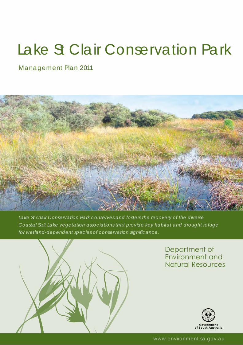
Lake St Clair Conservation ParkManagement Plan 2011
www.environment.sa.gov.au
Lake St Clair Conservation Park conserves and fosters the recovery of the diverse
Coastal Salt Lake vegetation associations that provide key habitat and drought refuge
for wetland-dependent species of conservation significance.
Minister’s foreword
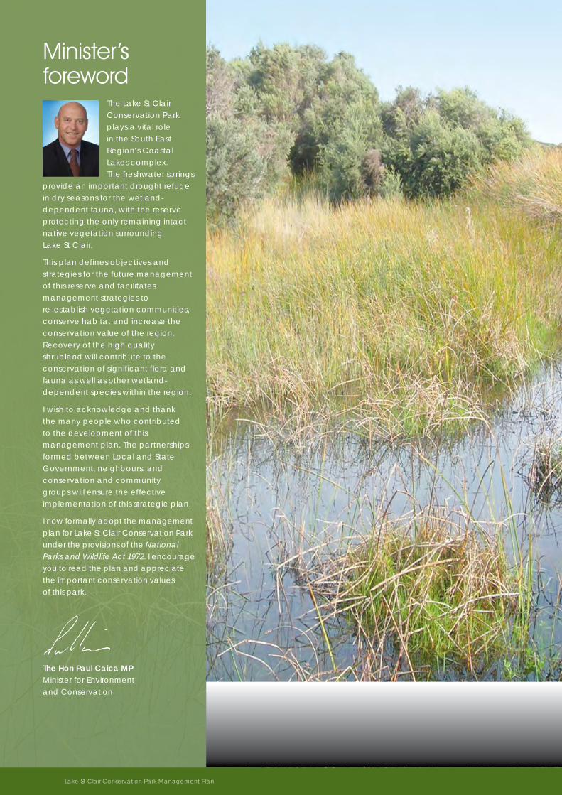
The Lake St Clair Conservation Park plays a vital role in the South East Region’s Coastal Lakes complex. The freshwater springs
provide an important drought refuge in dry seasons for the wetland-dependent fauna, with the reserve protecting the only remaining intact native vegetation surrounding Lake St Clair.
This plan defines objectives and strategies for the future management of this reserve and facilitates management strategies to re-establish vegetation communities, conserve habitat and increase the conservation value of the region. Recovery of the high quality shrubland will contribute to the conservation of significant flora and fauna as well as other wetland-dependent species within the region.
I wish to acknowledge and thank the many people who contributed to the development of this management plan. The partnerships formed between Local and State Government, neighbours, and conservation and community groups will ensure the effective implementation of this strategic plan.
I now formally adopt the management plan for Lake St Clair Conservation Park under the provisions of the National Parks and Wildlife Act 1972. I encourage you to read the plan and appreciate the important conservation values of this park.
The Hon Paul Caica MP Minister for Environment and Conservation
2 Lake St Clair Conservation Park Management Plan
Directions for managementLake St Clair Conservation Park encompasses one of the South East’s
regionally significant freshwater wetlands. Management of the area as
a park provides opportunities for community partnerships to protect
these unique wetland habitats into the future.
The management plan for Lake St Clair Conservation Park sets directions for management of the park and was prepared in consultation with park neighbours, experts and the regional community. Through this process a shared vision has been identified and management strategies established. How these strategies are prioritised, implemented and delivered is coordinated by the Department of Environment and Natural Resources (DENR) on an annual basis.
This management plan seeks to provide strategic direction and support flexibility for operational choice. The high level management objectives and strategies will also allow for adaptability in the future management of this park.
This management plan meets the requirements of section 38 of the National Parks and Wildlife Act 1972.
Park significance and purpose . . . . . . . . . . . . . . . . . . . . . 1
Area profile . . . . . . . . . . . . . . . . . . . . . . . . . . . . . . . . . . . . . 2
Management themes and priorities . . . . . . . . . . . . . . . . . 3
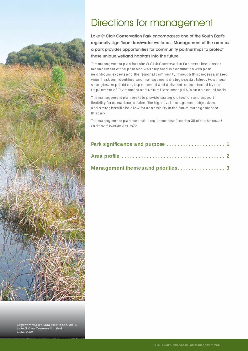
Regenerating wetland area in Section 95, Lake St Clair Conservation Park. DENR 2009.
Lake St Clair Conservation Park Management Plan 3
Park significance and purposeConservation begins with understanding what we are protecting.
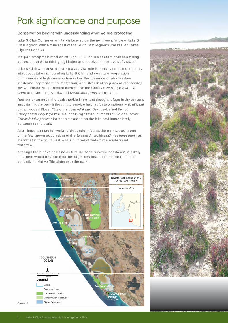
Lake St Clair Conservation Park is located on the north-east fringe of Lake St Clair lagoon, which forms part of the South East Region’s Coastal Salt Lakes (Figures 1 and 2).
The park was proclaimed on 29 June 2006. The 189 hectare park has mining access under State mining legislation and receives minor levels of visitation.
Lake St Clair Conservation Park plays a vital role in conserving part of the only intact vegetation surrounding Lake St Clair and consists of vegetation communities of high conservation value. The presence of Silky Tea-tree shrubland (Leptospermum lanigerum) and Silver Banksia (Banksia marginata) low woodland is of particular interest as is the Chaffy Saw-sedge (Gahnia filum) and Creeping Brookweed (Samolus repens) sedgeland.
Freshwater springs in the park provide important drought refuge in dry seasons. Importantly, the park is thought to provide habitat for two nationally significant birds: Hooded Plover (Thinornis rubricollis) and Orange-bellied Parrot (Neophema chrysogaster). Nationally significant numbers of Golden Plover (Pluvialis fulva) have also been recorded on the lake bed immediately adjacent to the park.
As an important site for wetland-dependent fauna, the park supports one of the few known populations of the Swamp Antechinus (Antechinus minimus maritima) in the South East, and a number of waterbirds, waders and waterfowl.
Although there have been no cultural heritage surveys undertaken, it is likely that there would be Aboriginal heritage sites located in the park. There is currently no Native Title claim over the park.
SOUTHERNOCEAN
ROBE
BEACHPORT
NORA CREINA
Little Dip (CP)
Beachport (CP)
Lake Robe (GR)
Woakwine (CR)
Lake St Clair (CP)
Guichen Bay (CP)
PenguinIsland (CP)
LAKE GEORGE
LAKE ELIZA
LAKE ST CLAIR
LAKE HAWDON NORTH
LAKE HAWDON SOUTH (CP)
LegendLakes
Drainage Lines
Conservation Parks
Conservation Reserves
Game Reserves
Coastal Salt Lakes of theSouth East Region
0 2 4 6 81
Kilomet er s
±
Location Map
Figure 1.
1 Lake St Clair Conservation Park Management Plan
Setting the management directionLake St Clair Conservation Park will be managed to conserve and foster the recovery of the diverse Coastal Salt Lake vegetation associations that provide key habitat and drought refuge for wetland-dependent species of conservation significance.
What are we protecting?Lake St Clair Conservation Park was proclaimed to conserve the largest remaining example of intact native vegetation around Lake St Clair. The reserve has the following conservation values:
• Wetlands, remnant vegetation, and rare and threatened species and communities;
• Ecosystems and vegetation associations of regional significance;
• Habitat for flora and fauna species of National, State and Regional conservation significance, including Swamp Antechinus; and
• Nationally significant numbers of Golden Plover.
What are the challenges?The challenges to conservation of Lake St Clair Conservation Park include:
• Regional and local drainage of wetlands and watercourses, and altered groundwater regimes;
• Invasion of weed species, especially pasture grasses and bridal creeper (Asparagus asparagoides);
• Impact of introduced fauna on native fauna and flora; and
• Fire management.
LAKE ST CLAIR
Lake St Clair (CP)
Little Dip (CP)
EUROBODALLA
NORA CREINA
Conservation Parks
Vegetation Heritage Agreements
Roads
±1 0 10.5
Kilomet er s
Figure 2: Location of Lake St Clair Conservation Park on the eastern shoreline of the lake bed.
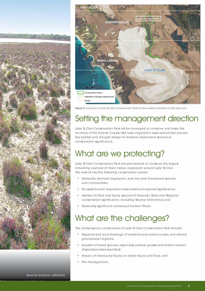
Samphire shrubland. DENR 2009.
Lake St Clair Conservation Park Management Plan 2
Objectives and Strategies
Enhance and increase the area of habitat for wetland-dependent species occurring within the park
• Continue to liaise with park neighbours, volunteers and research organisations to coordinate wetland conservation and monitoring activities
• Continue to manipulate surface water drains within the park to restore the natural hydrology of the area
• Support monitoring of wetland-dependent species in the park and connected private land to assess the success of conservation activities
• Monitor weed presence and control weeds as required
• Develop and implement a fire management plan for the park, with a focus on investigating the use of prescribed burning for ecological management
Management themes and prioritiesThis section of the plan discusses the important issues within each theme and sets out objectives and strategies for management
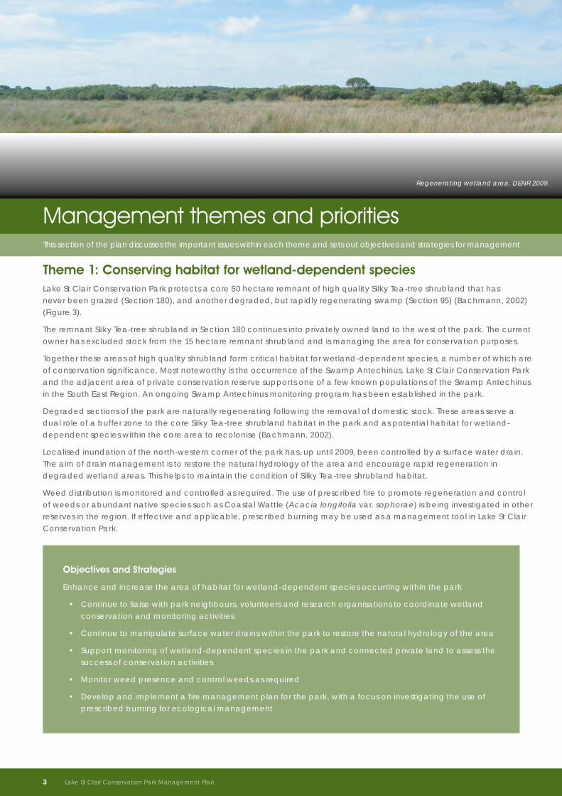
Theme 1: Conserving habitat for wetland-dependent speciesLake St Clair Conservation Park protects a core 50 hectare remnant of high quality Silky Tea-tree shrubland that has never been grazed (Section 180), and another degraded, but rapidly regenerating swamp (Section 95) (Bachmann, 2002) (Figure 3).
The remnant Silky Tea-tree shrubland in Section 180 continues into privately owned land to the west of the park. The current owner has excluded stock from the 15 hectare remnant shrubland and is managing the area for conservation purposes.
Together these areas of high quality shrubland form critical habitat for wetland-dependent species, a number of which are of conservation significance. Most noteworthy is the occurrence of the Swamp Antechinus. Lake St Clair Conservation Park and the adjacent area of private conservation reserve supports one of a few known populations of the Swamp Antechinus in the South East Region. An ongoing Swamp Antechinus monitoring program has been established in the park.
Degraded sections of the park are naturally regenerating following the removal of domestic stock. These areas serve a dual role of a buffer zone to the core Silky Tea-tree shrubland habitat in the park and as potential habitat for wetland-dependent species within the core area to recolonise (Bachmann, 2002).
Localised inundation of the north-western corner of the park has, up until 2009, been controlled by a surface water drain. The aim of drain management is to restore the natural hydrology of the area and encourage rapid regeneration in degraded wetland areas. This helps to maintain the condition of Silky Tea-tree shrubland habitat.
Weed distribution is monitored and controlled as required. The use of prescribed fire to promote regeneration and control of weeds or abundant native species such as Coastal Wattle (Acacia longifolia var. sophorae) is being investigated in other reserves in the region. If effective and applicable, prescribed burning may be used as a management tool in Lake St Clair Conservation Park.
Regenerating wetland area. DENR 2009.
3 Lake St Clair Conservation Park Management Plan
Theme 2: Re-establishing regionally threatened vegetation communitiesAs well as conserving significant wetland habitat, Lake St Clair Conservation Park is an important park for protecting and re-establishing regional biodiversity. The park is an important linkage in the Lake Frome-Canunda District coastal ecosystem and recognised as a key biodiversity area (Croft et al., 1999). Two regionally endangered and two regionally vulnerable vegetation communities occur within Lake St Clair Conservation Park (Figure 3). Of particular concern is the Dryland Tea-tree (Melaleuca lanceolata) / Drooping Sheoak (Allocasuarina verticillata) low woodland, which has a significantly reduced range in the South East. Lake St Clair Conservation Park provides an opportunity to re-establish this threatened vegetation community and DENR has actively sought to re-establish Drooping Sheoaks. However, attempts to revegetate parts of the park by direct seeding Drooping Sheoak have been only partially successful, with recruited plants being heavily grazed.
Rabbits (Oryctolagus cuniculus), domestic stock and kangaroos (Macropus spp.) all pose a grazing threat to native vegetation, restoration projects, pastures and crops. The removal of domestic stock from the park, and some reduction in the numbers of rabbits since the release of the Calici virus, has reduced these threats to native vegetation within the park. However, kangaroo numbers have increased in some areas of the South East where blocks of native vegetation adjoin cleared and agricultural land (Croft et al., 1999). DENR will assess kangaroo populations in the park in comparison to the surrounding landscape. It is essential for DENR to work with surrounding neighbours to determine kangaroo densities both inside and outside the park, and collaboratively deliver adaptive management approaches to grazing threats.
Vegetation exclosures and survey sites have been established to monitor regeneration success and the effects of grazing in the park. Continued monitoring and the analysis of results are essential to evaluate the success of management activities on regeneration and determine the impacts of grazing to conservation values of the park.
If research and monitoring determines that an overpopulation of kangaroos in Lake St Clair Conservation Park is affecting the conservation values of the park, including native vegetation and natural regeneration, kangaroo population control programs may be implemented. Such programs may include a variety of management options. Based on assessment of all available population control methods, culling will only be conducted if it is considered the only practical option.
Objectives and Strategies
Assist the re-establishment of regionally threatened vegetation communities by monitoring and assessing the impacts of grazing
• Monitor vegetation condition and establishment of seedlings in revegetated areas within the park to determine the effect of grazing
• Monitor kangaroo populations in the park and liaise with neighbours to ascertain outside park kangaroo densities
• Ensure that adaptive management programs are developed for the park (including a kangaroo management program), if an assessment identifies that an overpopulation of kangaroos is affecting the conservation values of the park
Lake St Clair Conservation Park Management Plan 4
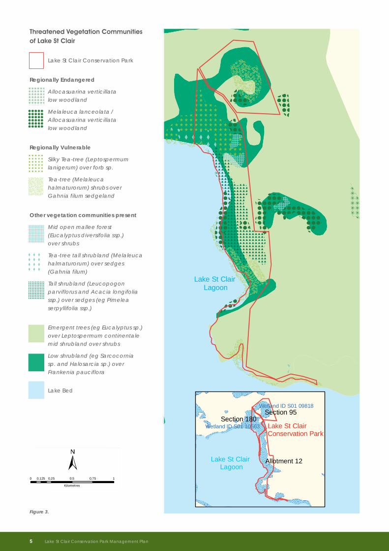
Lake St Clair Lagoon
Threatened Vegetation Communities of Lake St Clair
0 0.25 0.5 0.75 10.125
Kilometres
Figure 3
Melaleuca lanceolata / Allocasurina verticillata low woodland
Mid open mallee forest (Eucalyptus diversifolia sp.) over shrubs
Silky Tea-tree (Leptospermum lanigerum) over forb sp.
Tea-tree Melaleuca halmaturorum shrubsover Gahnia filum sedgeland
Tea-tree tall shrubland (Melaleuca halmaturorum) over sedges (Gahnia filum)
Tall shrubland (Leucopogon parviflorus and Acacia longifolia ssp.) over sedges (eg Pimelea serpyllifolia sp).
Allocasuarina verticillata low woodland
Emergent trees (eg Eucalyptus sp.) over Leptospermum continentale mid shrubland over shrubs
Low shrubland (eg Sarcocornia sp.and Halosarcia sp.) over Frankenia pauciflora
Lake St Clair Conservation Park
Lake Bed
Regionally Endangered
Regionally Vulnerable
Other vegetation communities present
Lake St Clair Conservation Park
Lake St Clair Lagoon
Section 95Wetland ID S01 09818
Section 180Wetland ID S01 10563
Allotment 12
Lake St Clair Lagoon
Threatened Vegetation Communities of Lake St Clair
0 0.25 0.5 0.75 10.125
Kilometres
Figure 3
Melaleuca lanceolata / Allocasurina verticillata low woodland
Mid open mallee forest (Eucalyptus diversifolia sp.) over shrubs
Silky Tea-tree (Leptospermum lanigerum) over forb sp.
Tea-tree Melaleuca halmaturorum shrubsover Gahnia filum sedgeland
Tea-tree tall shrubland (Melaleuca halmaturorum) over sedges (Gahnia filum)
Tall shrubland (Leucopogon parviflorus and Acacia longifolia ssp.) over sedges (eg Pimelea serpyllifolia sp).
Allocasuarina verticillata low woodland
Emergent trees (eg Eucalyptus sp.) over Leptospermum continentale mid shrubland over shrubs
Low shrubland (eg Sarcocornia sp.and Halosarcia sp.) over Frankenia pauciflora
Lake St Clair Conservation Park
Lake Bed
Regionally Endangered
Regionally Vulnerable
Other vegetation communities present
Lake St Clair Conservation Park
Lake St Clair Lagoon
Section 95Wetland ID S01 09818
Section 180Wetland ID S01 10563
Allotment 12
Figure 3.
Threatened Vegetation Communities of Lake St Clair
Lake St Clair Conservation Park
Regionally Endangered
Allocasuarina verticillata low woodland
Melaleuca lanceolata / Allocasuarina verticillata low woodland
Regionally Vulnerable
Silky Tea-tree (Leptospermum lanigerum) over forb sp.
Tea-tree (Melaleuca halmaturorum) shrubs over Gahnia filum sedgeland
Other vegetation communities present
Mid open mallee forest (Eucalyptus diversifolia ssp.) over shrubs
Tea-tree tall shrubland (Melaleuca halmaturorum) over sedges (Gahnia filum)
Tall shrubland (Leucopogon parviflorus and Acacia longifolia ssp.) over sedges (eg Pimelea serpyllifolia ssp.)
Emergent trees (eg Eucalyptus sp.) over Leptospermum continentale mid shrubland over shrubs
Low shrubland (eg Sarcocornia sp. and Halosarcia sp.) over Frankenia pauciflora
Lake Bed
5 Lake St Clair Conservation Park Management Plan
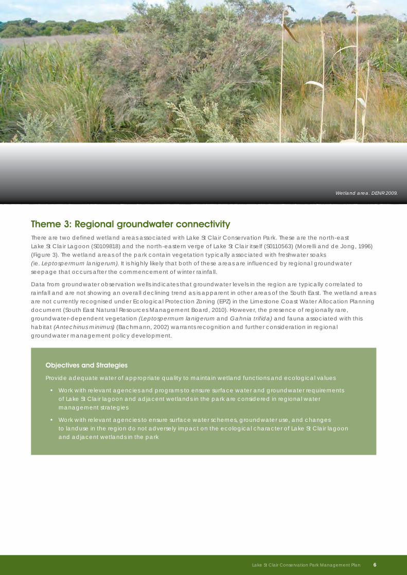
Theme 3: Regional groundwater connectivityThere are two defined wetland areas associated with Lake St Clair Conservation Park. These are the north-east Lake St Clair Lagoon (S0109818) and the north-eastern verge of Lake St Clair itself (S0110563) (Morelli and de Jong, 1996) (Figure 3). The wetland areas of the park contain vegetation typically associated with freshwater soaks (ie. Leptospermum lanigerum). It is highly likely that both of these areas are influenced by regional groundwater seepage that occurs after the commencement of winter rainfall.
Data from groundwater observation wells indicates that groundwater levels in the region are typically correlated to rainfall and are not showing an overall declining trend as is apparent in other areas of the South East. The wetland areas are not currently recognised under Ecological Protection Zoning (EPZ) in the Limestone Coast Water Allocation Planning document (South East Natural Resources Management Board, 2010). However, the presence of regionally rare, groundwater-dependent vegetation (Leptospermum lanigerum and Gahnia trifida) and fauna associated with this habitat (Antechinus minimus) (Bachmann, 2002) warrants recognition and further consideration in regional groundwater management policy development.
Objectives and Strategies
Provide adequate water of appropriate quality to maintain wetland functions and ecological values
• Work with relevant agencies and programs to ensure surface water and groundwater requirements of Lake St Clair lagoon and adjacent wetlands in the park are considered in regional water management strategies
• Work with relevant agencies to ensure surface water schemes, groundwater use, and changes to landuse in the region do not adversely impact on the ecological character of Lake St Clair lagoon and adjacent wetlands in the park
Wetland area. DENR 2009.
Lake St Clair Conservation Park Management Plan 6
Objectives and Strategies
Ensure the conservation values of the park are augmented by strategic land additions
• Assess the conservation and management value of land, including Lake St Clair lagoon, for additions to the park
Manage visitor access to protect the conservation values of the park
• Restrict vehicle access to the park to essential management activities and encourage minimum impact visitor activities such as walking and bird-watching
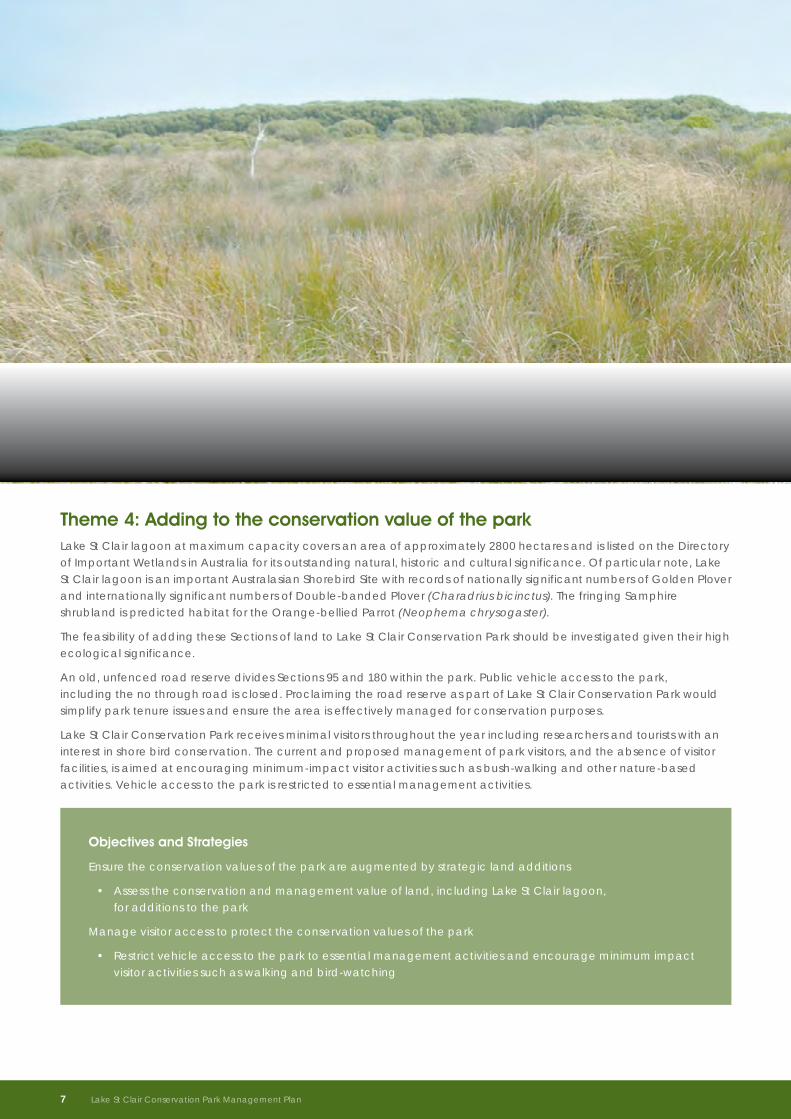
Theme 4: Adding to the conservation value of the parkLake St Clair lagoon at maximum capacity covers an area of approximately 2800 hectares and is listed on the Directory of Important Wetlands in Australia for its outstanding natural, historic and cultural significance. Of particular note, Lake St Clair lagoon is an important Australasian Shorebird Site with records of nationally significant numbers of Golden Plover and internationally significant numbers of Double-banded Plover (Charadrius bicinctus). The fringing Samphire shrubland is predicted habitat for the Orange-bellied Parrot (Neophema chrysogaster).
The feasibility of adding these Sections of land to Lake St Clair Conservation Park should be investigated given their high ecological significance.
An old, unfenced road reserve divides Sections 95 and 180 within the park. Public vehicle access to the park, including the no through road is closed. Proclaiming the road reserve as part of Lake St Clair Conservation Park would simplify park tenure issues and ensure the area is effectively managed for conservation purposes.
Lake St Clair Conservation Park receives minimal visitors throughout the year including researchers and tourists with an interest in shore bird conservation. The current and proposed management of park visitors, and the absence of visitor facilities, is aimed at encouraging minimum-impact visitor activities such as bush-walking and other nature-based activities. Vehicle access to the park is restricted to essential management activities.
7 Lake St Clair Conservation Park Management Plan
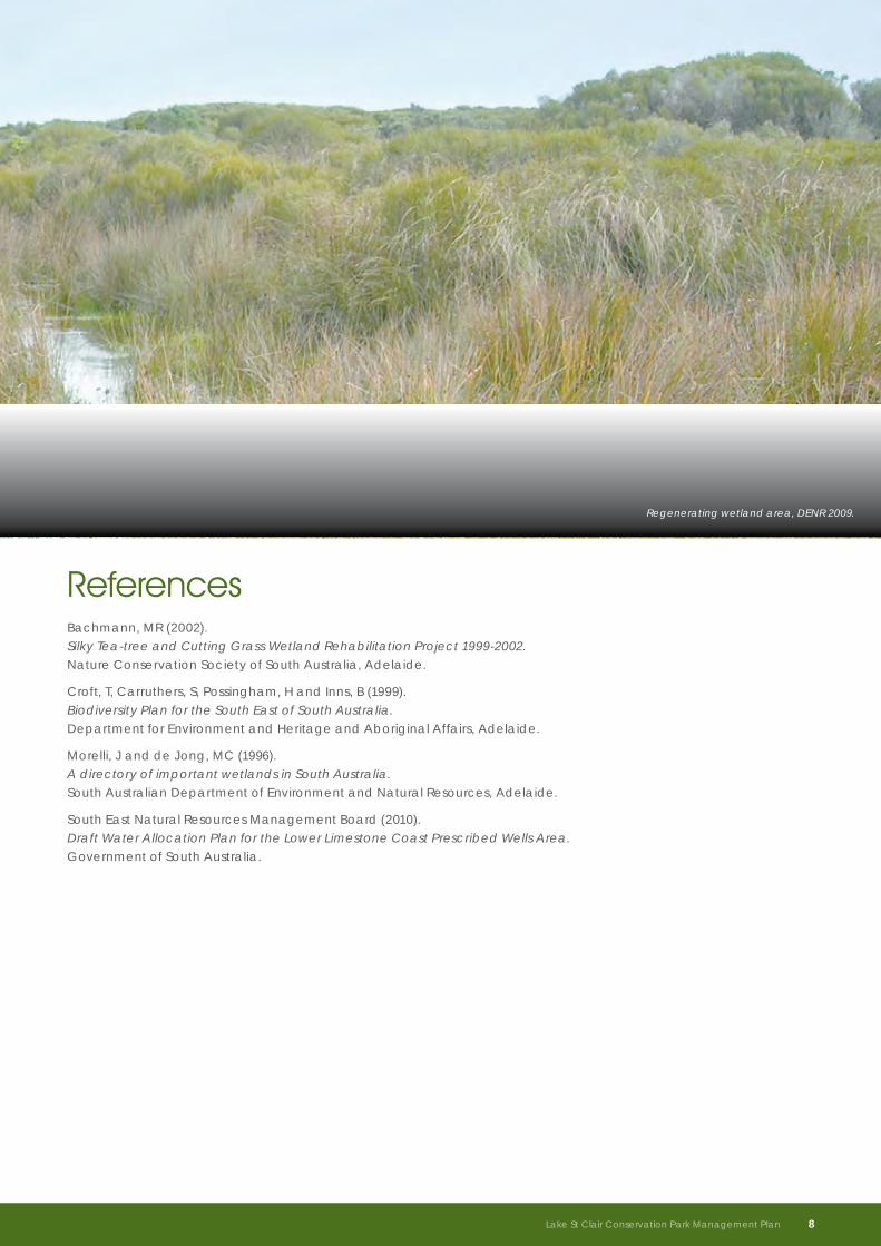
Regenerating wetland area, DENR 2009.
Lake St Clair Conservation Park Management Plan 8
ReferencesBachmann, MR (2002). Silky Tea-tree and Cutting Grass Wetland Rehabilitation Project 1999-2002. Nature Conservation Society of South Australia, Adelaide.
Croft, T, Carruthers, S, Possingham, H and Inns, B (1999). Biodiversity Plan for the South East of South Australia. Department for Environment and Heritage and Aboriginal Affairs, Adelaide.
Morelli, J and de Jong, MC (1996). A directory of important wetlands in South Australia. South Australian Department of Environment and Natural Resources, Adelaide.
South East Natural Resources Management Board (2010). Draft Water Allocation Plan for the Lower Limestone Coast Prescribed Wells Area. Government of South Australia.
For further information please contact:Department of Environment and Natural Resources Phone Information Line (08) 8204 1910, or see SA White Pages for your local Department of Environment and Natural Resources office. Online information available at: www.environment.sa.gov.au
Permissive Licence© State of South Australia through the Department of Environment and Natural Resources. Apart from fair dealings and other uses permitted by the Copyright Act 1968 (Cth), no part of this publication may be reproduced, published, communicated, transmitted, modified or commercialised without the prior written approval of the Department of Environment and Natural Resources.
Written requests for permission should be addressed to: Communications and Community Engagement Branch, Department of Environment and Natural Resources, GPO Box 1047 Adelaide SA 5001
DisclaimerWhile reasonable efforts have been made to ensure the contents of this publication are factually correct, the Department of Environment and Natural Resources makes no representations and accepts no responsibility for the accuracy, completeness or fitness for any particular purpose of the contents, and shall not be liable for any loss or damage that may be occasioned directly or indirectly through the use of or reliance on the contents of this publication.
Reference to any company, product or service in this publication should not be taken as a Departmental endorsement of the company, product or service.
© Department of Environment and Natural Resources Published September 2011 | ISBN: 978-1-921800-26-9 | FIS: 91004