Embed Size (px)
Citation preview
EMERGING TECHNOLOGIES FOR TRAFFIC MODELING USING BLUETOOTH AND CELLULAR ENABLED DATA COLLECTION
KTT Auto21
UNIVERSITY OF MANITOBAECEBOB MCLEOD
PART I
A Serious Games Framework
TRAFFIC MODELING USING CELL PHONE DATA
Ryan Neighbour PhD Student – ECE University of
Manitoba
Research Interests Agent Based Modeling
Disease Spread Modeling Traffic Modeling Artificial Life
Procedural Content Generation
More Importantly!

Outline
Introduction/Useful Data Software Simulation Construction Simulation Environment Agent Behaviour Shortcomings Initial Validation and Results Conclusions and Future Work

Problem
Vehicle, pedestrian, infrastructure interactions complex
Highly stochastic dynamical system How do we go about modeling this
type of system?

Useful Data
>24M cell phone subscriptions in Canada in 2010
Locational cellular data both abundant and inexpensive to gather Infrastructure already in place Service provide or OEM
Use this data to model urban population movement and infrastructure changes

Solutions?
Differential Equation style models Well vetted Can be difficult to
understand/communicate Unable to capitalize on emerging data
sources Agent Based Model
Easy to construct/understand “correct by construction” Emerging data is agent based

Our Direction
We choose ABM as the cell phone data is relatively simple
to integrate into agent behaviour It is easy to extend it to other areas of
research

Agent Based Model
Consist of: Autonomous agents that can interact in
some way An Environment where the agents exist
Cellular Data
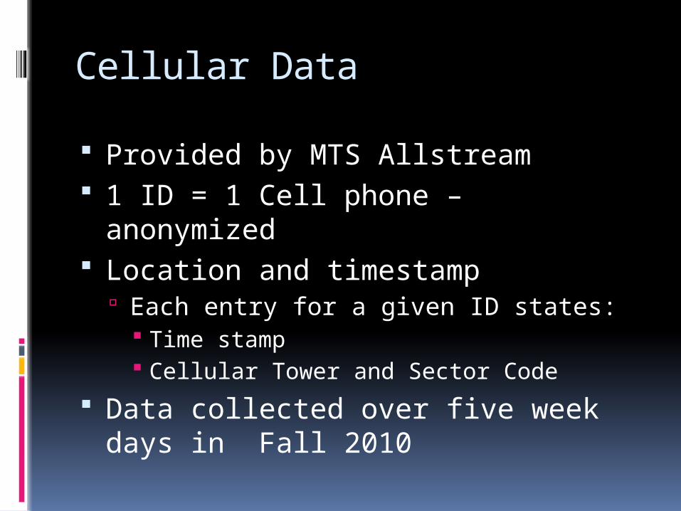
Provided by MTS Allstream 1 ID = 1 Cell phone – anonymized Location and timestamp
Each entry for a given ID states: Time stamp Cellular Tower and Sector Code
Data collected over five week days in Fall 2010
Software
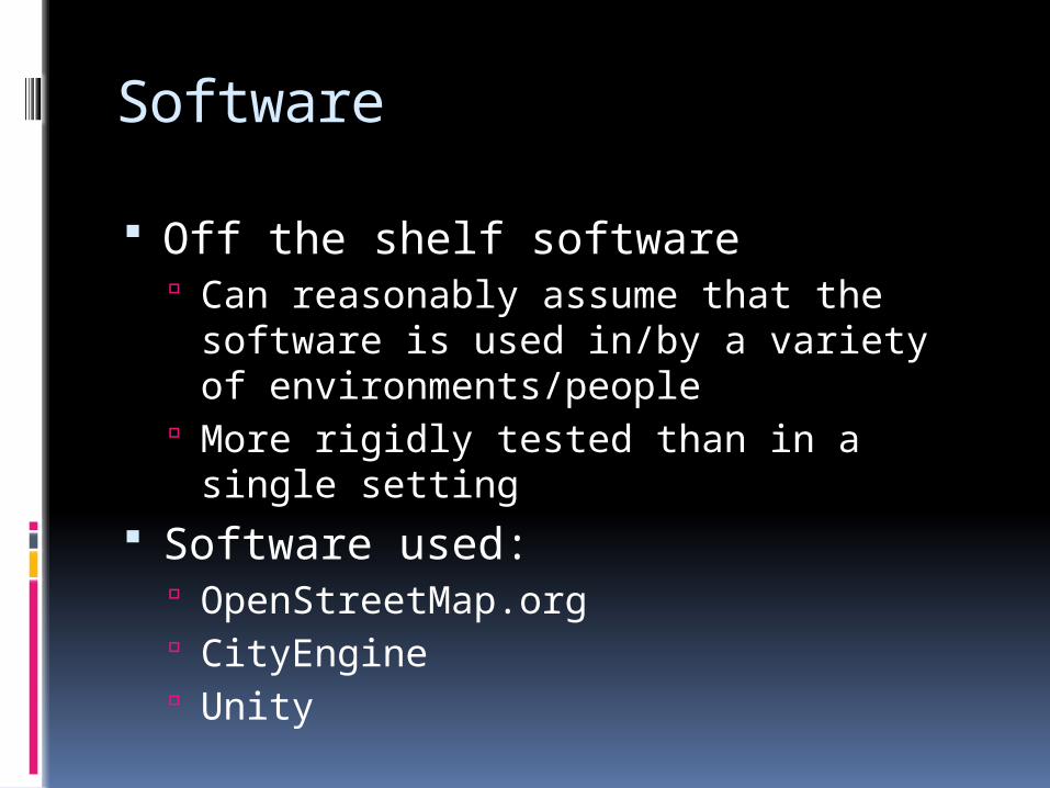
Off the shelf software Can reasonably assume that the
software is used in/by a variety of environments/people
More rigidly tested than in a single setting
Software used: OpenStreetMap.org CityEngine Unity
OpenStreetMap.org
OSM is to Google Maps what Wikipedia is to Encyclopedia Britannica Collaborative Free

CityEngine
Developed by Esri Uses procedural modeling to quickly
create highly detailed 3D urban environments
Cities can be created from scratch or using existing GIS Data Artificial or real
Unity
Created by Unity Technologies Game engine and authoring tool Multiplatform
Mac OS X/Windows/Web iOS/Android Xbox 360/Wii/PlayStation 3
Unity
Engine code is closed source C++ User code written using the MONO
Framework C# Boo (Python variant) UnityScript (JavaScript variant)
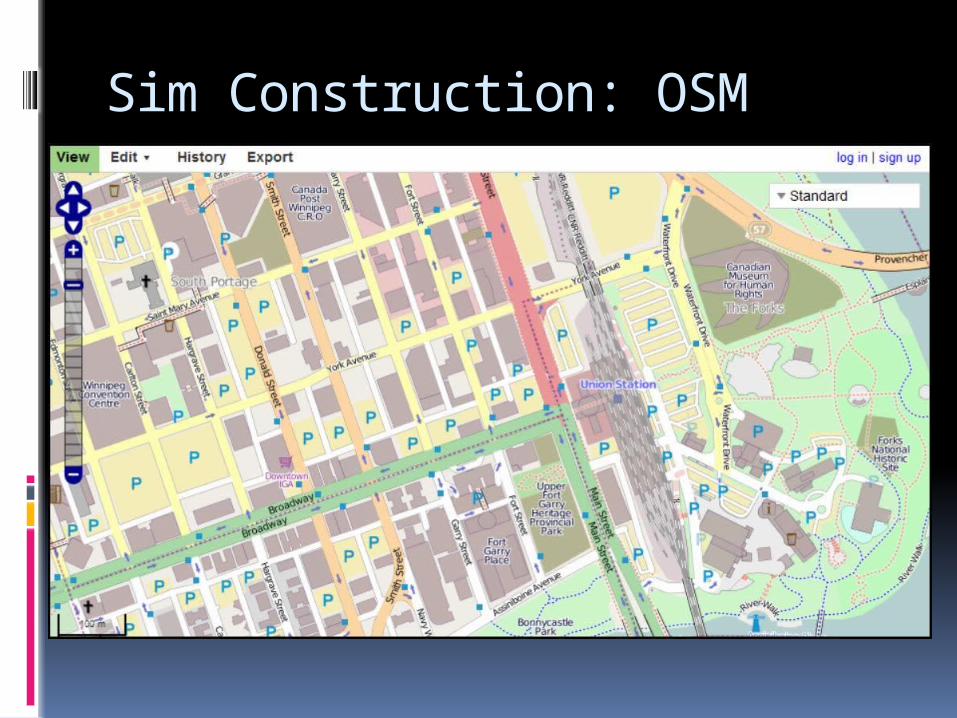
Sim Construction: OSM
<Insert Images of OSM>

Sim Construction: OSM
Data is available in several formats We use XML Human readable/editable Too much info, needs to be filtered
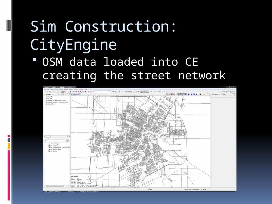
Sim Construction: CityEngine OSM data loaded into CE creating the
street network

Sim Construction: CityEngine Zoning maps used to guide building
construction
Sim Construction: CityEngine Generated 3D model exported along
with street network
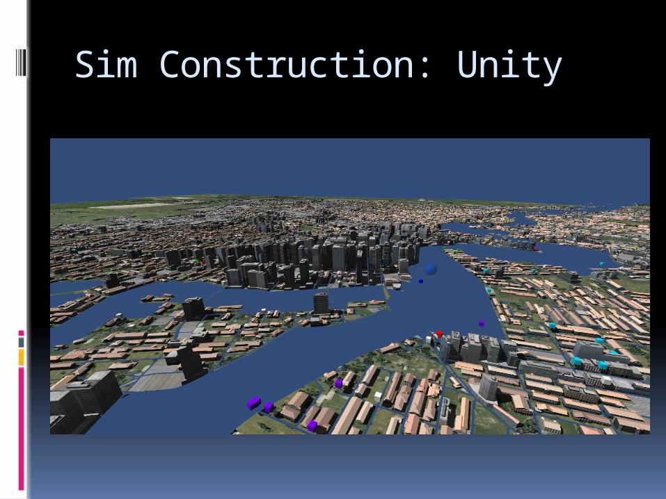
Sim Construction: Unity
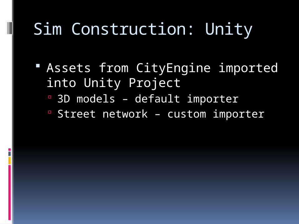
Assets from CityEngine imported into Unity Project 3D models – default importer Street network – custom importer
Sim Construction: Unity
Simulation Environment
Environment Street network treated as a graph
Vertex – intersection Edge – street
Streets are weighted up or down to mimic throughput and capacity main thoroughfares have low weight,
residential streets have higher weights

Simulation Environment Environment
Cell Tower Sectors Act as containers for intersections Intersections owned by nearest tower
Agent Behaviour
Agents Travel on the street network
A* – dynamic Pre-computed – static

Agent Behaviour
Movement governed by cellular data Cellular data contains a sector and
timestamp per entry Choose random intersection within a
sector Leave early enough to arrive on time

Agent Behaviour
Two modes Vehicular
Used when target destination is above a threshold distance
Pedestrian Used when not in Vehicular mode Traverse the street graph while remaining
in the given sector In Pedestrian mode, agents may enter any
institution they pass

Agent Behaviour

Shortcomings
No Pedestrian/Vehicle interaction Missing Data
No speed limit/capacity data No traffic control system data Holes in cellular data
Phone is off Phone is unable to reach a tower
Only Winnipeg (one provider)
Simulation Validation
Baseline Simulations Seed ~25000 agents with cellular data
in a 1-1 pairing Data collected over five week days in Fall
2010

Simulation Validation
Global Validation Compare data with the Winnipeg Area
Travel Survey from 2009 Local Validation
Compare data with traffic counts collected at seven Winnipeg bridges (2011)

Simulation Validation
Good ingress/egress

Simulation Validation
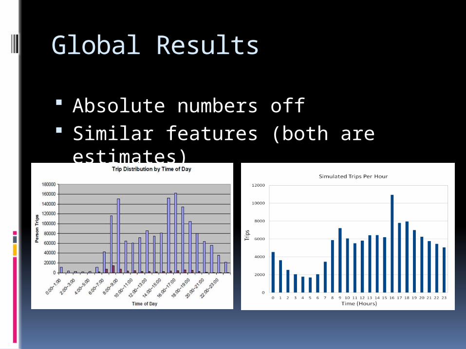
Global Results
Absolute numbers off Similar features (both are estimates)
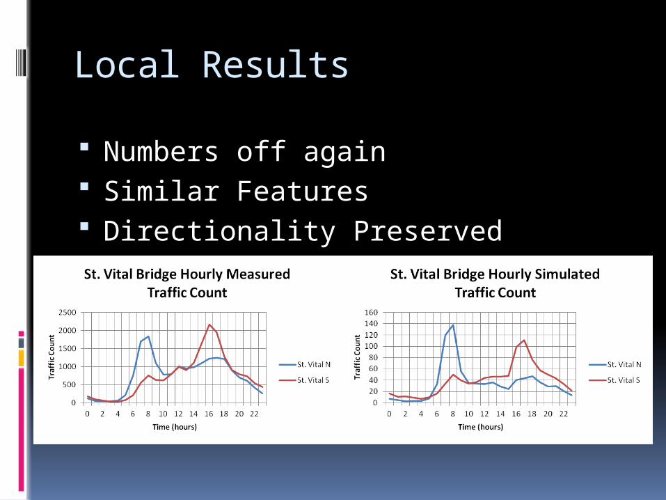
Local Results
Numbers off again Similar Features Directionality Preserved

Local Results
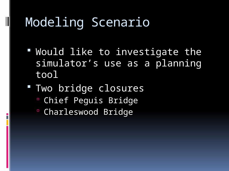
Modeling Scenario
Would like to investigate the simulator’s use as a planning tool
Two bridge closures Chief Peguis Bridge Charleswood Bridge

Modeling Scenario
Only St. James Bridge had significant changes.
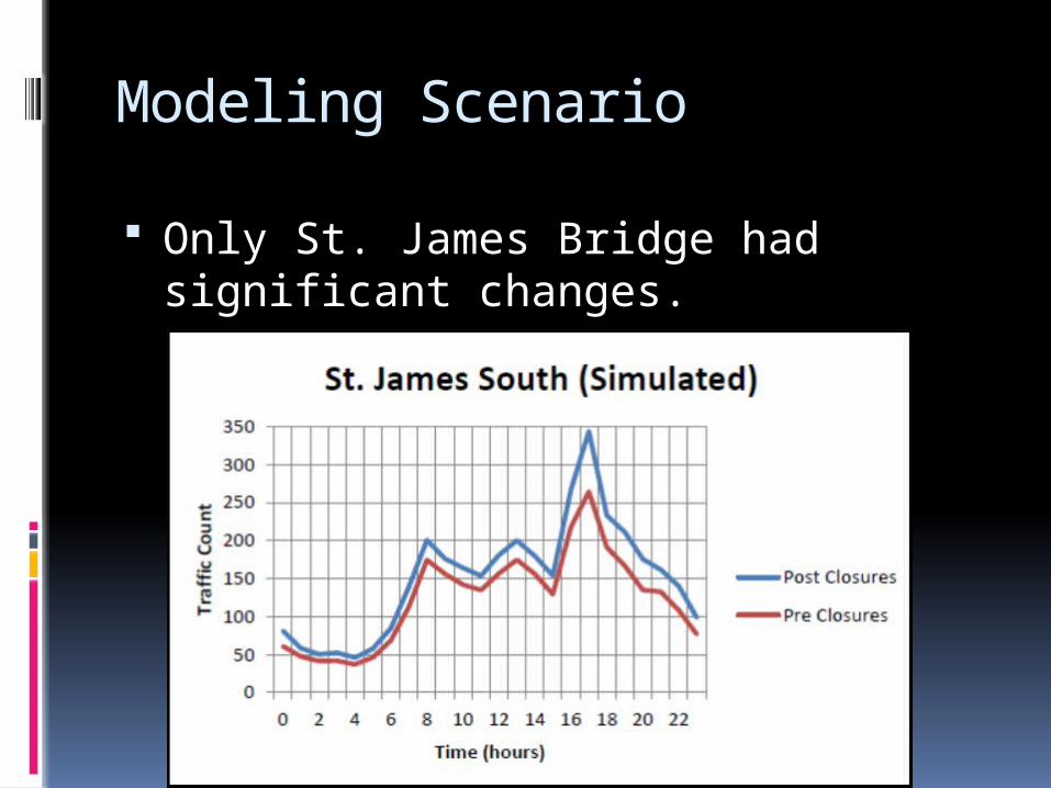
Modeling Scenario
Only St. James Bridge had significant changes.

Part 1: Conclusions
Initial results promising Cellular Data
Ease of collection/use Data interpretation needs work
Bus or car? Simulation
Shows similar features to surveyed/field collected data
Developed very quickly Data driven systems very extensible

Future Work
Fill in the gaps “Wayness” Speed limits/Capacity Traffic Control
Add more game-centric features to allow users to better interact with the simulation in real time
Part II
AUGMENTING TRAFFIC MODELING USING BLUETOOTH DATA
B. Demianyk, J. Benevides, M.Sc.
M. Friesen, R. Jacob, B.Sc.
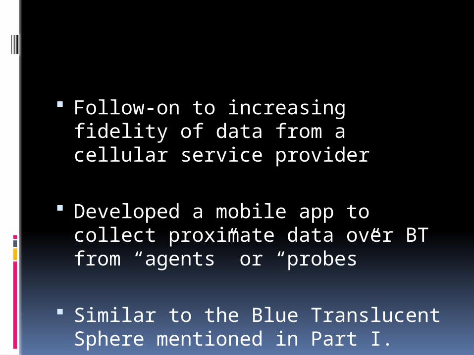
Follow-on to increasing fidelity of data from a cellular service provider
Developed a mobile app to collect proximate data over BT from “agents” or “probes”
Similar to the Blue Translucent Sphere mentioned in Part I.
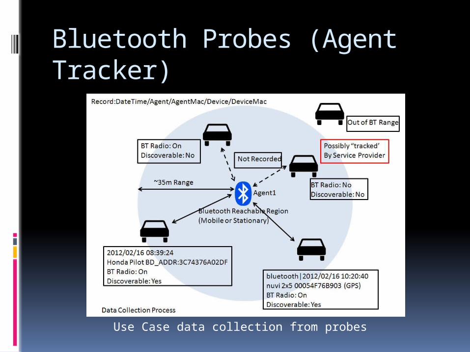
Bluetooth Probes (Agent Tracker)
Use Case data collection from probes

Potential to collect lots of data. Good(Excellent) proxy for
people/vehicles As mentioned Health Canada reports
that there were 24 million cell phone users by the end of 2010, representing approximately 72% of Canada’s population
Not to mention other BT devices Not limited to service provider
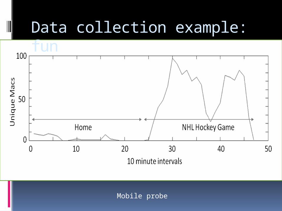
Data collection example: fun
Mobile probe
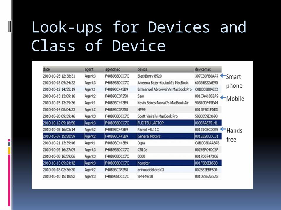
Look-ups for Devices and Class of Device
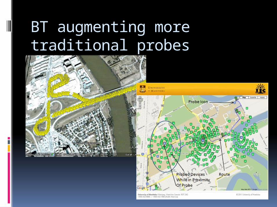
BT augmenting more traditional probes

Experiment at FG Bridge
Mechanical Counter
Stationary Probe

Part 2: Summary
There is some opportunity to improve the data collection of probes for proximity data collection. (augment other sources) Generate trajectories
Challenges are having enough probes. Probe uptake Perceived benefit to participation
Opportunities
Incredible modeling potential with combined service provider data.
VSNs ???
Commercial opportunities, public works and city planning.
Other opportunities outside of auto information sector.
Youtube: For fun/reference Real crazy www.youtube.com/watch?v=RjrEQaG
5jPM
Game Engine (Early stage) www.youtube.com/watch?v=mUee-tF
v1uE