Embed Size (px)
Citation preview
5/5/2015
1
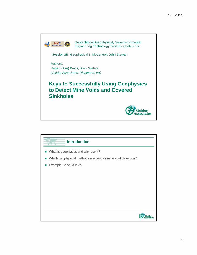
Keys to Successfully Using Geophysics to Detect Mine Voids and Covered Sinkholes
Geotechnical, Geophysical, GeoenvironmentalEngineering Technology Transfer Conference
Session 2B: Geophysical 1, Moderator: John Stewart
Authors:
Robert (Kim) Davis, Brent Waters
(Golder Associates, Richmond, VA)
Introduction
What is geophysics and why use it?
Which geophysical methods are best for mine void detection?
Example Case Studies
5/5/2015
2
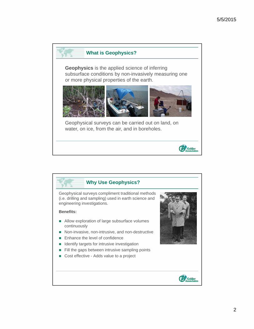
What is Geophysics?
Geophysics is the applied science of inferring subsurface conditions by non-invasively measuring one or more physical properties of the earth.
Geophysical surveys can be carried out on land, on water, on ice, from the air, and in boreholes.
Why Use Geophysics?
Geophysical surveys compliment traditional methods (i.e. drilling and sampling) used in earth science and engineering investigations.
Benefits:
Allow exploration of large subsurface volumes continuously
Non-invasive, non-intrusive, and non-destructive
Enhance the level of confidence
Identify targets for intrusive investigation
Fill the gaps between intrusive sampling points
Cost effective - Adds value to a project
5/5/2015
3
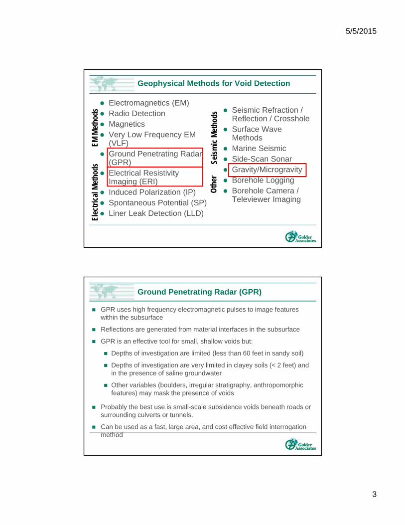
Geophysical Methods for Void Detection
Electromagnetics (EM) Radio Detection Magnetics Very Low Frequency EM
(VLF) Ground Penetrating Radar
(GPR) Electrical Resistivity
Imaging (ERI) Induced Polarization (IP) Spontaneous Potential (SP) Liner Leak Detection (LLD)
Seismic Refraction / Reflection / Crosshole
Surface Wave Methods
Marine Seismic Side-Scan Sonar Gravity/Microgravity Borehole Logging Borehole Camera /
Televiewer Imaging
EM M
etho
dsEl
ectr
ical
Met
hods
Seis
mic
Met
hods
Oth
er
Ground Penetrating Radar (GPR)
GPR uses high frequency electromagnetic pulses to image features within the subsurface
Reflections are generated from material interfaces in the subsurface
GPR is an effective tool for small, shallow voids but:
Depths of investigation are limited (less than 60 feet in sandy soil)
Depths of investigation are very limited in clayey soils (< 2 feet) and in the presence of saline groundwater
Other variables (boulders, irregular stratigraphy, anthropomorphic features) may mask the presence of voids
Probably the best use is small-scale subsidence voids beneath roads or surrounding culverts or tunnels.
Can be used as a fast, large area, and cost effective field interrogation method
5/5/2015
4
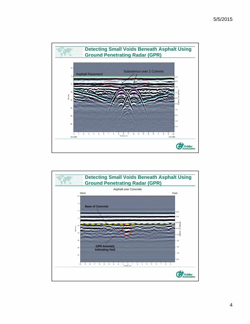
Detecting Small Voids Beneath Asphalt Using Ground Penetrating Radar (GPR)
15+280 15+260
Subsidence over 2 CulvertsAsphalt Pavement
Detecting Small Voids Beneath Asphalt Using Ground Penetrating Radar (GPR)
West East
Asphalt over Concrete
GPR AnomalyIndicating Void
Base of Concrete
5/5/2015
5
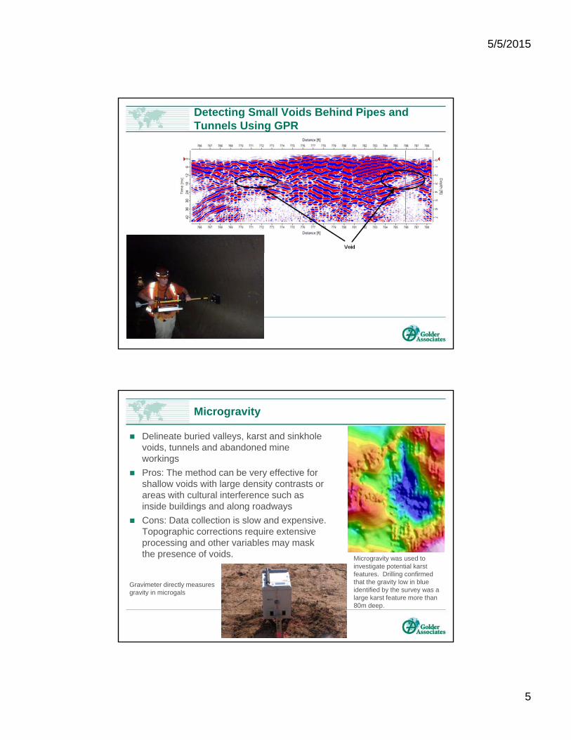
Detecting Small Voids Behind Pipes and Tunnels Using GPR
Microgravity
Delineate buried valleys, karst and sinkhole voids, tunnels and abandoned mine workings
Pros: The method can be very effective for shallow voids with large density contrasts or areas with cultural interference such as inside buildings and along roadways
Cons: Data collection is slow and expensive. Topographic corrections require extensive processing and other variables may mask the presence of voids. Microgravity was used to
investigate potential karst features. Drilling confirmed that the gravity low in blue identified by the survey was a large karst feature more than 80m deep.
Gravimeter directly measures gravity in microgals
5/5/2015
6
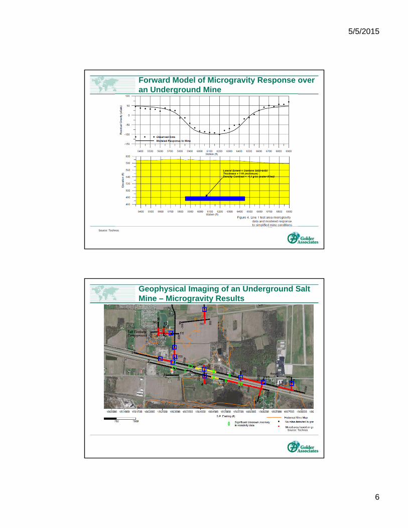
Forward Model of Microgravity Response over an Underground Mine
Source: Technos
Geophysical Imaging of an Underground Salt Mine – Microgravity Results
Source: Technos
5/5/2015
7
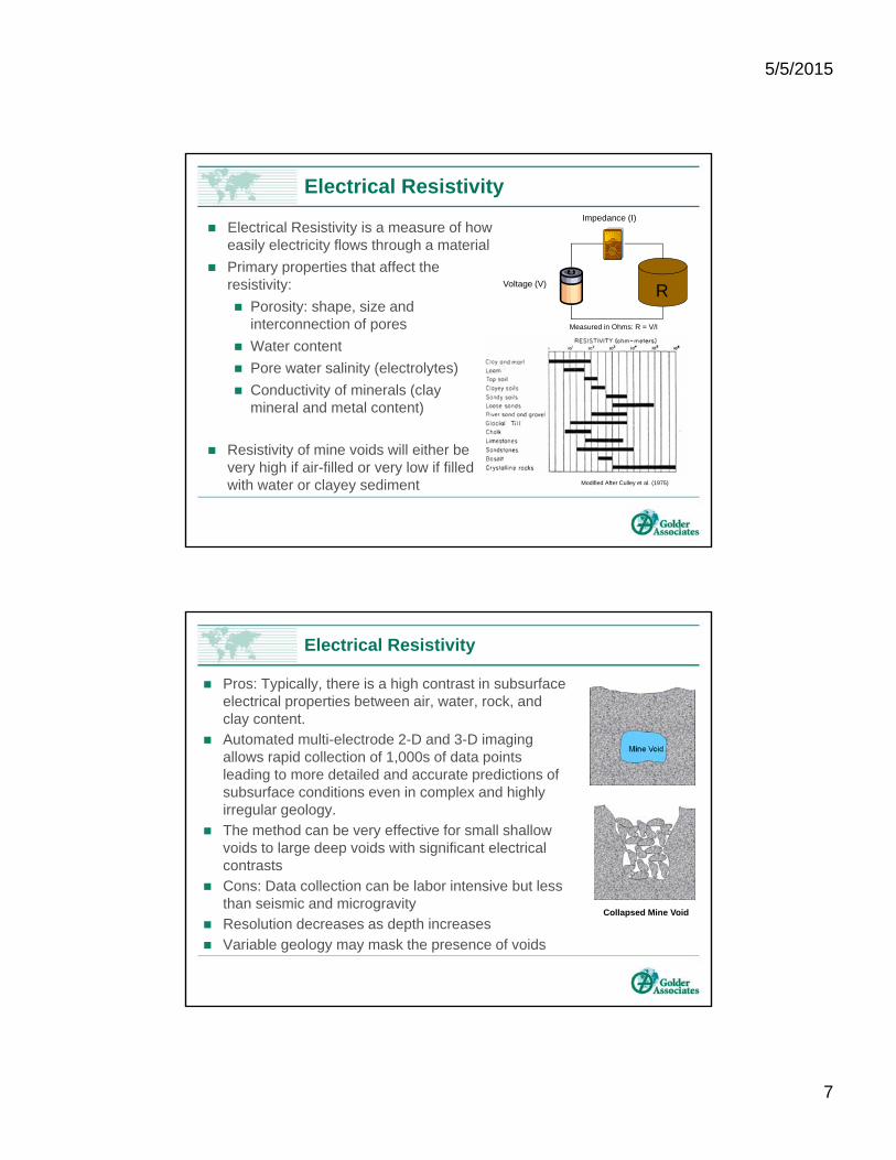
Electrical Resistivity is a measure of how easily electricity flows through a material
Primary properties that affect the resistivity:
Porosity: shape, size and interconnection of pores
Water content
Pore water salinity (electrolytes)
Conductivity of minerals (clay mineral and metal content)
Resistivity of mine voids will either be very high if air-filled or very low if filled with water or clayey sediment
Measured in Ohms: R = V/I
RVoltage (V)
Impedance (I)
Modified After Culley et al. (1975)
Electrical Resistivity
Electrical Resistivity
Pros: Typically, there is a high contrast in subsurface electrical properties between air, water, rock, and clay content.
Automated multi-electrode 2-D and 3-D imaging allows rapid collection of 1,000s of data points leading to more detailed and accurate predictions of subsurface conditions even in complex and highly irregular geology.
The method can be very effective for small shallow voids to large deep voids with significant electrical contrasts
Cons: Data collection can be labor intensive but less than seismic and microgravity
Resolution decreases as depth increases
Variable geology may mask the presence of voids
Collapsed Mine Void
5/5/2015
8
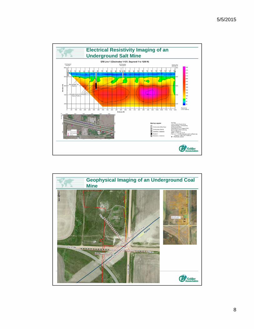
Electrical Resistivity Imaging of an Underground Salt Mine
Geophysical Imaging of an Underground Coal Mine
5/5/2015
9
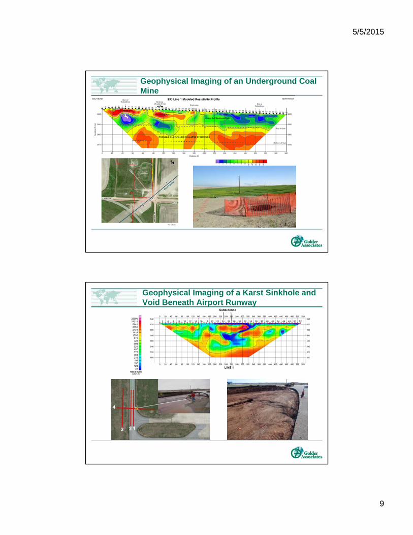
Geophysical Imaging of an Underground Coal Mine
Geophysical Imaging of a Karst Sinkhole and Void Beneath Airport Runway
5/5/2015
10
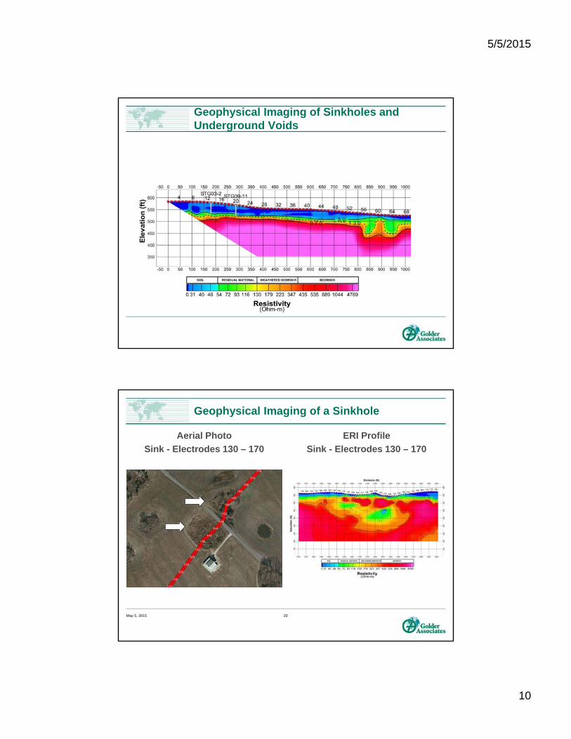
Geophysical Imaging of Sinkholes and Underground Voids
Aerial Photo
Sink - Electrodes 130 – 170
ERI Profile
Sink - Electrodes 130 – 170
Geophysical Imaging of a Sinkhole
May 5, 2015 20
5/5/2015
11
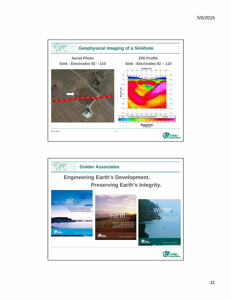
Aerial Photo
Sink - Electrodes 92 – 110
ERI Profile
Sink - Electrodes 92 – 110
Geophysical Imaging of a Sinkhole
May 5, 2015 21
Engineering Earth’s Development.
Preserving Earth’s Integrity.
Golder Associates