Embed Size (px)
Citation preview
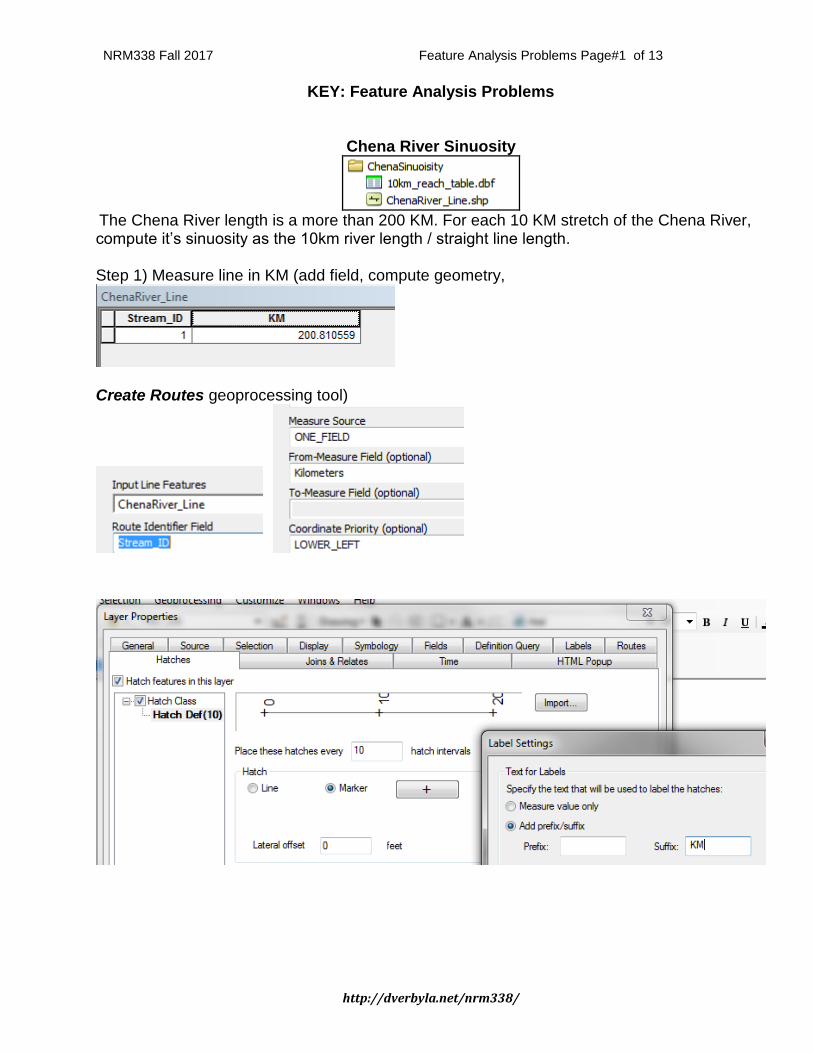
NRM338 Fall 2017 Feature Analysis Problems Page#1 of 13
http://dverbyla.net/nrm338/
KEY: Feature Analysis Problems
Chena River Sinuosity
The Chena River length is a more than 200 KM. For each 10 KM stretch of the Chena River, compute it’s sinuosity as the 10km river length / straight line length. Step 1) Measure line in KM (add field, compute geometry,
Create Routes geoprocessing tool)
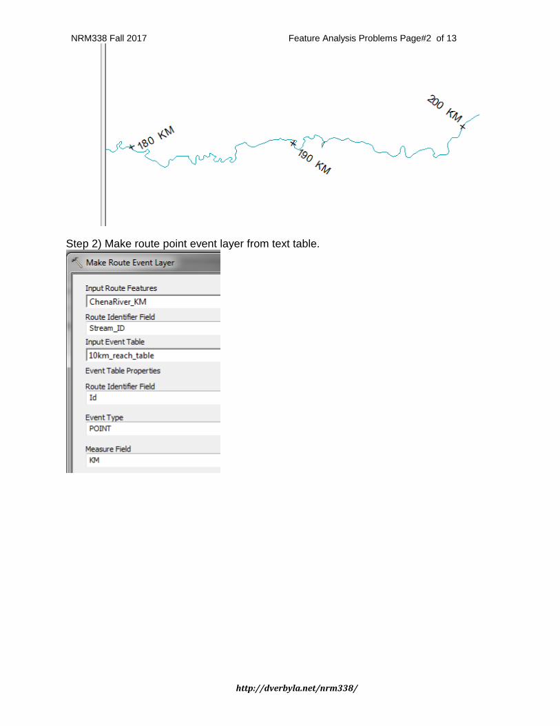
NRM338 Fall 2017 Feature Analysis Problems Page#2 of 13
http://dverbyla.net/nrm338/
Step 2) Make route point event layer from text table.
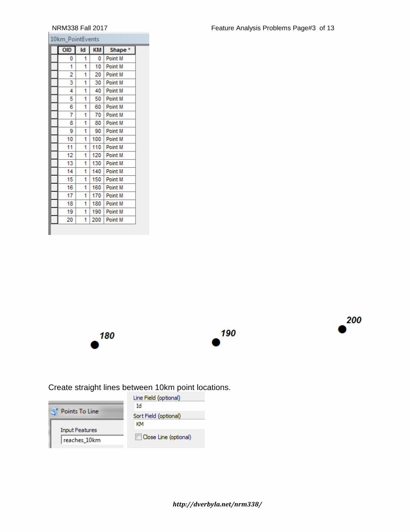
NRM338 Fall 2017 Feature Analysis Problems Page#3 of 13
http://dverbyla.net/nrm338/
Create straight lines between 10km point locations.
NRM338 Fall 2017 Feature Analysis Problems Page#4 of 13
http://dverbyla.net/nrm338/
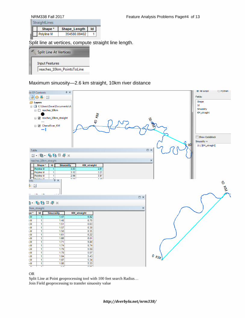
Split line at vertices, compute straight line length.
Maximum sinuosity—2.6 km straight, 10km river distance
OR
Split Line at Point geoprocessing tool with 100 feet search Radius…
Join Field geoprocessing to transfer sinuosity value
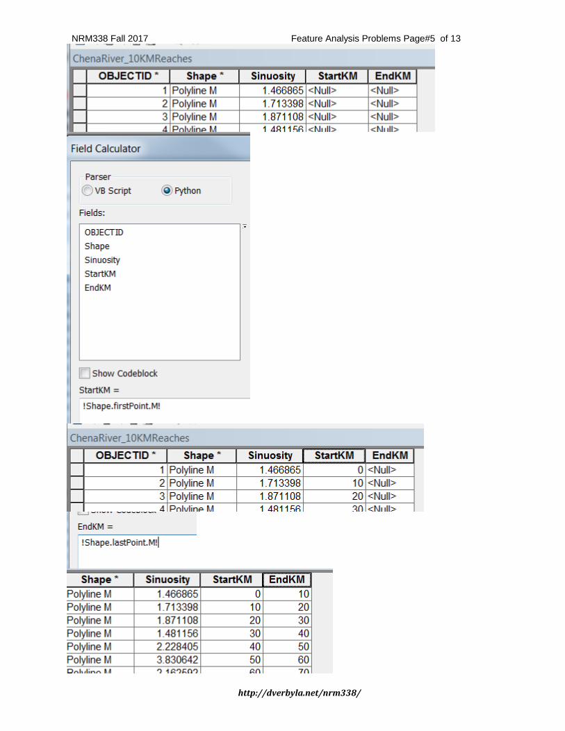
NRM338 Fall 2017 Feature Analysis Problems Page#5 of 13
http://dverbyla.net/nrm338/
NRM338 Fall 2017 Feature Analysis Problems Page#6 of 13
http://dverbyla.net/nrm338/
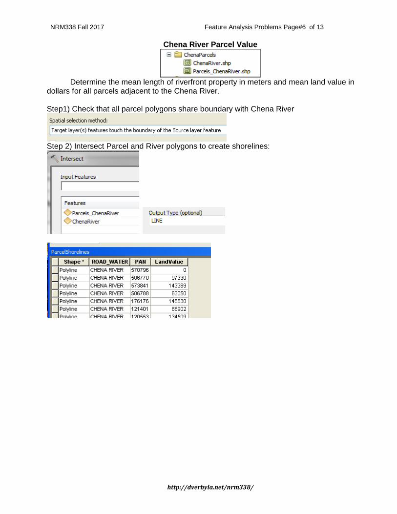
Chena River Parcel Value
Determine the mean length of riverfront property in meters and mean land value in dollars for all parcels adjacent to the Chena River. Step1) Check that all parcel polygons share boundary with Chena River
Step 2) Intersect Parcel and River polygons to create shorelines:
NRM338 Fall 2017 Feature Analysis Problems Page#7 of 13
http://dverbyla.net/nrm338/
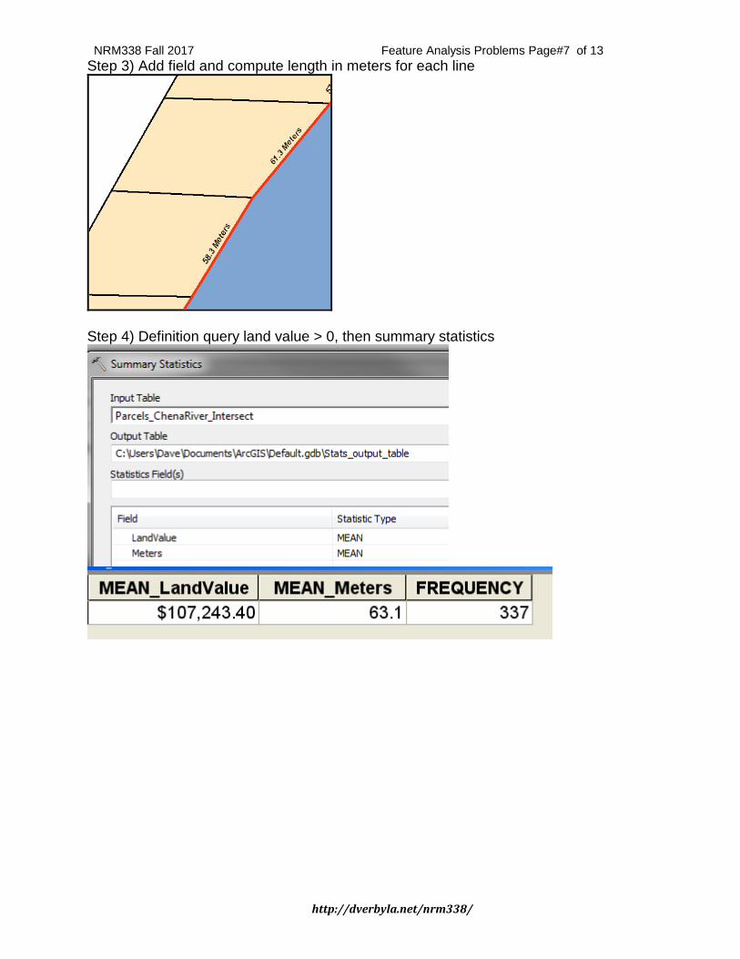
Step 3) Add field and compute length in meters for each line
Step 4) Definition query land value > 0, then summary statistics
NRM338 Fall 2017 Feature Analysis Problems Page#8 of 13
http://dverbyla.net/nrm338/
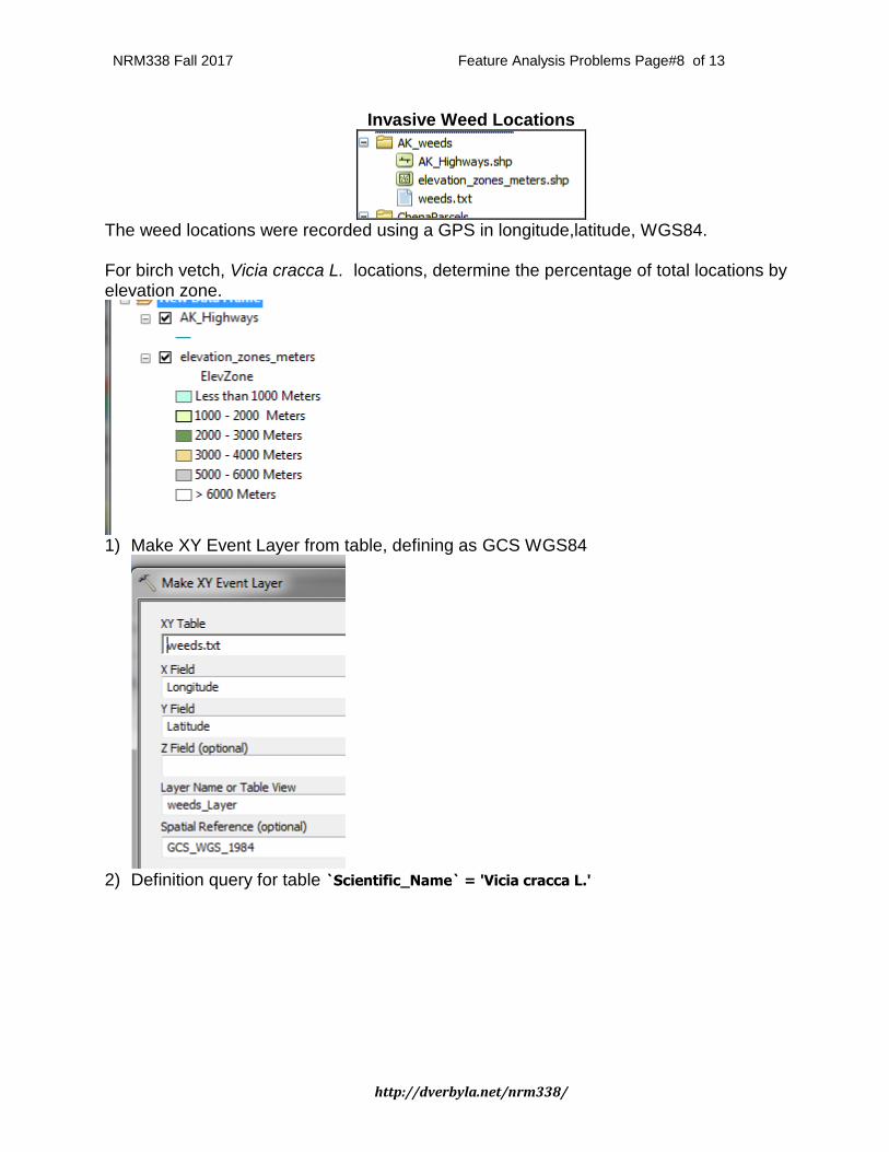
Invasive Weed Locations
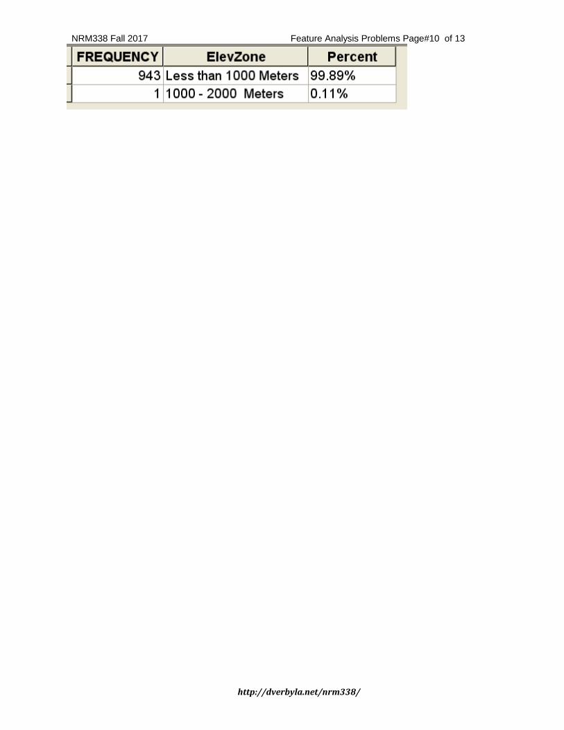
The weed locations were recorded using a GPS in longitude,latitude, WGS84. For birch vetch, Vicia cracca L. locations, determine the percentage of total locations by elevation zone.
1) Make XY Event Layer from table, defining as GCS WGS84
2) Definition query for table `Scientific_Name` = 'Vicia cracca L.'
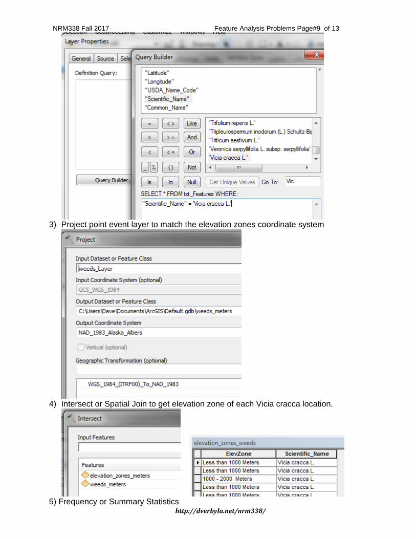
NRM338 Fall 2017 Feature Analysis Problems Page#9 of 13
http://dverbyla.net/nrm338/
3) Project point event layer to match the elevation zones coordinate system
4) Intersect or Spatial Join to get elevation zone of each Vicia cracca location.
5) Frequency or Summary Statistics
NRM338 Fall 2017 Feature Analysis Problems Page#10 of 13
http://dverbyla.net/nrm338/
NRM338 Fall 2017 Feature Analysis Problems Page#11 of 13
http://dverbyla.net/nrm338/
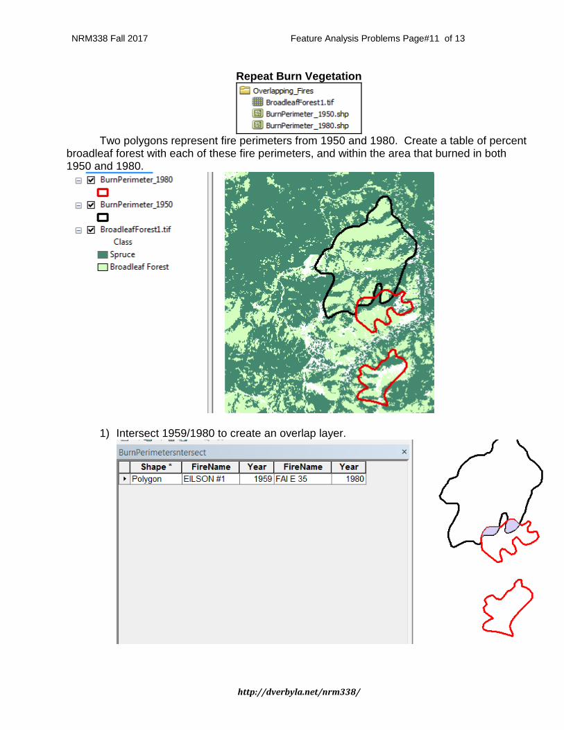
Repeat Burn Vegetation
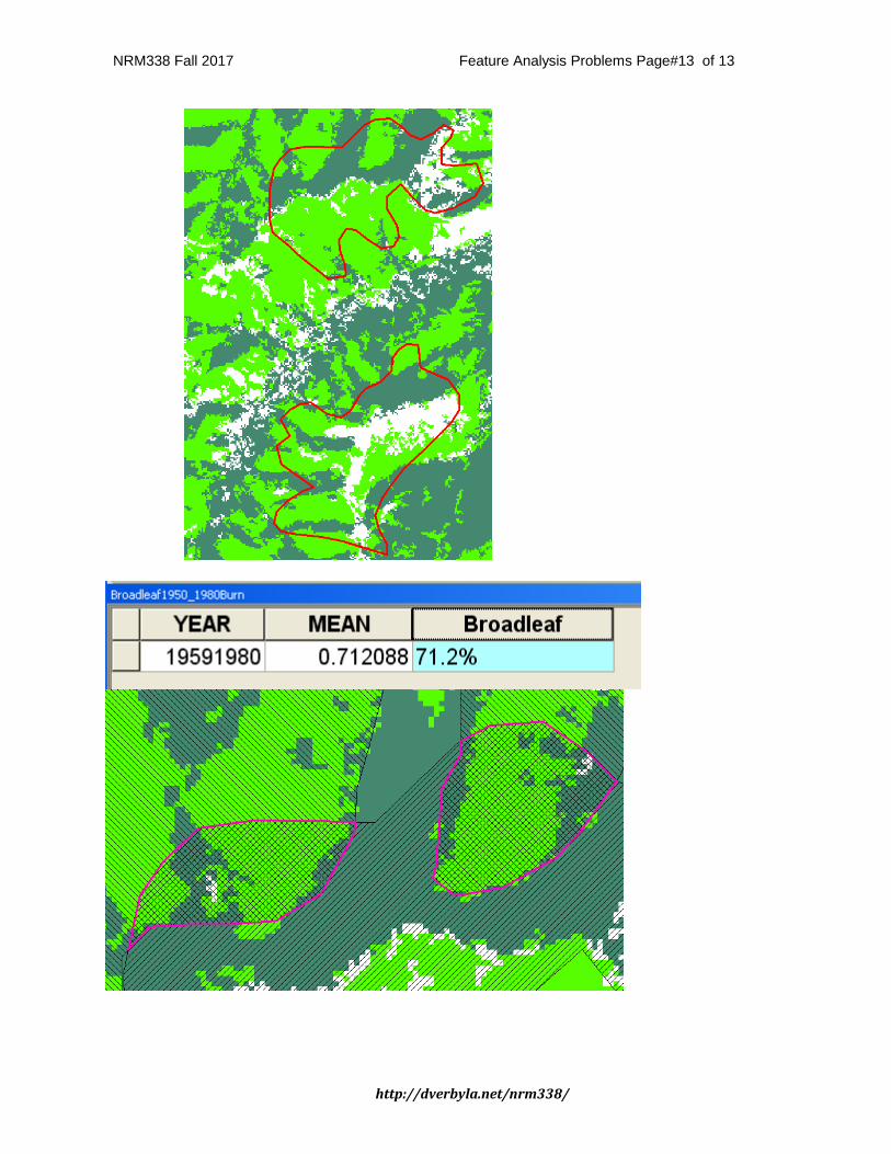
Two polygons represent fire perimeters from 1950 and 1980. Create a table of percent broadleaf forest with each of these fire perimeters, and within the area that burned in both 1950 and 1980.
1) Intersect 1959/1980 to create an overlap layer.
NRM338 Fall 2017 Feature Analysis Problems Page#12 of 13
http://dverbyla.net/nrm338/
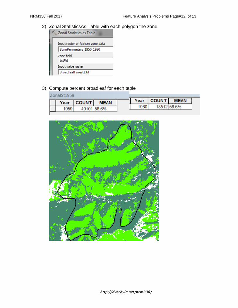
2) Zonal StatisticsAs Table with each polygon the zone.
3) Compute percent broadleaf for each table
NRM338 Fall 2017 Feature Analysis Problems Page#13 of 13
http://dverbyla.net/nrm338/