Embed Size (px)
Citation preview
1
bKarst TopographyPaper Model
Grade Level: Grades 9-12
Lesson Objectives: Students will• Learn about karst topography including sinkholes, caves, and springs • Recognize that karst terrains are integrated systems and are vulnerable to human activities• Understand the movement of water in underground systems
Timeframe: • Two class sessions for introducing the concepts and building the model
Materials: • Scissors• Glue or tape• Color pencils, crayons, or markers• Cave pattern
Learn more about caves and karst;
visit the NPS Cave and Karst Programwww.nature.nps.gov/geology/caves/index.cfm
U.S. Department of InteriorU.S. Geological SurveyNational Park Service
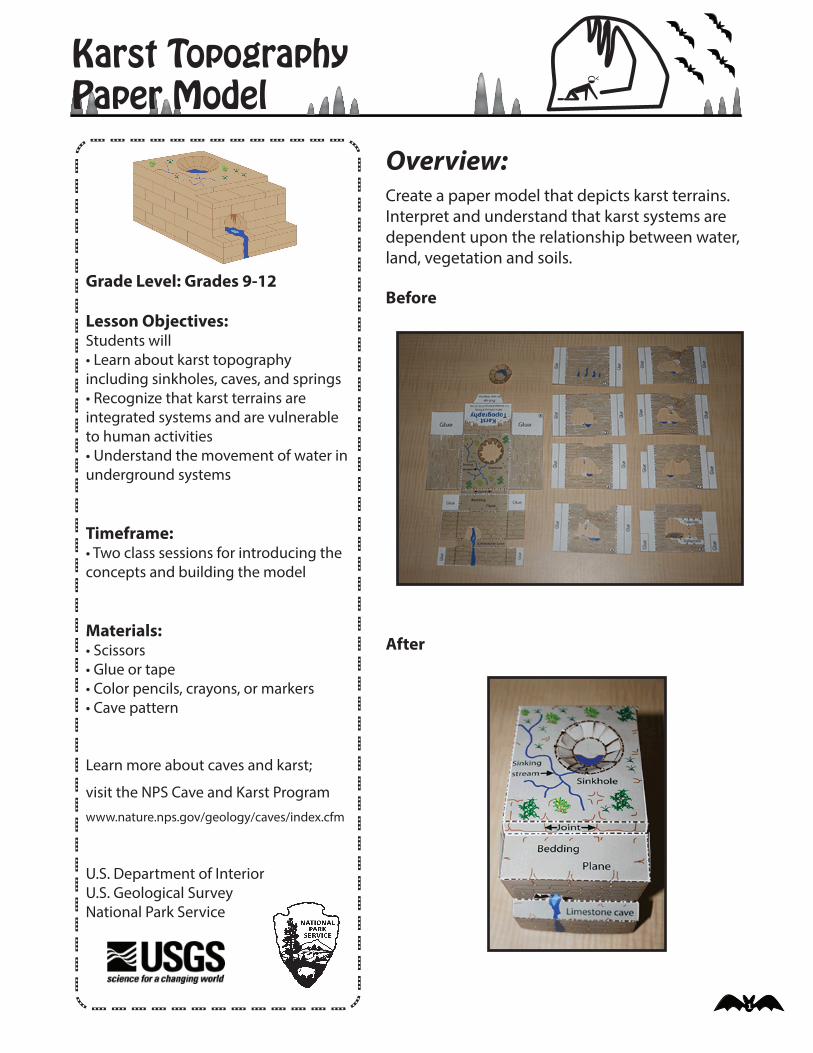
Overview:Create a paper model that depicts karst terrains. Interpret and understand that karst systems are dependent upon the relationship between water, land, vegetation and soils.
Before
After
2
Karst TopographyPaper Model continued...
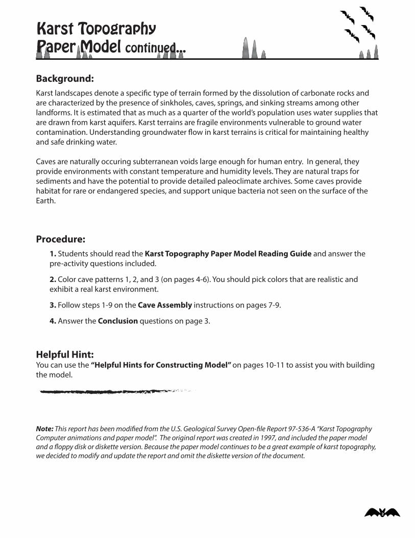
Background: Karst landscapes denote a speci�c type of terrain formed by the dissolution of carbonate rocks and are characterized by the presence of sinkholes, caves, springs, and sinking streams among other landforms. It is estimated that as much as a quarter of the world’s population uses water supplies that are drawn from karst aquifers. Karst terrains are fragile environments vulnerable to ground water contamination. Understanding groundwater �ow in karst terrains is critical for maintaining healthy and safe drinking water.
Caves are naturally occuring subterranean voids large enough for human entry. In general, they provide environments with constant temperature and humidity levels. They are natural traps for sediments and have the potential to provide detailed paleoclimate archives. Some caves provide habitat for rare or endangered species, and support unique bacteria not seen on the surface of the Earth.
Procedure: 1. Students should read the Karst Topography Paper Model Reading Guide and answer the pre-activity questions included.
2. Color cave patterns 1, 2, and 3 (on pages 4-6). You should pick colors that are realistic and exhibit a real karst environment.
3. Follow steps 1-9 on the Cave Assembly instructions on pages 7-9.
4. Answer the Conclusion questions on page 3.
Helpful Hint: You can use the “Helpful Hints for Constructing Model” on pages 10-11 to assist you with building the model.
Note: This report has been modi�ed from the U.S. Geological Survey Open-�le Report 97-536-A “Karst Topography Computer animations and paper model”. The original report was created in 1997, and included the paper model and a �oppy disk or diskette version. Because the paper model continues to be a great example of karst topography, we decided to modify and update the report and omit the diskette version of the document.
3
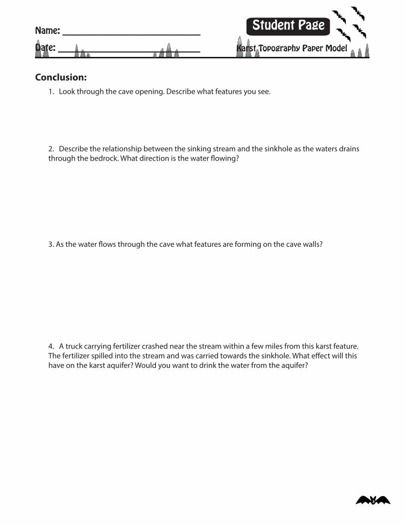
Conclusion:1. Look through the cave opening. Describe what features you see.
2. Describe the relationship between the sinking stream and the sinkhole as the waters drains through the bedrock. What direction is the water �owing?
3. As the water �ows through the cave what features are forming on the cave walls?
4. A truck carrying fertilizer crashed near the stream within a few miles from this karst feature. The fertilizer spilled into the stream and was carried towards the sinkhole. What e�ect will this have on the karst aquifer? Would you want to drink the water from the aquifer?
Name: ________________________________
Date: _________________________________
Student Page
Karst Topography Paper Model
4
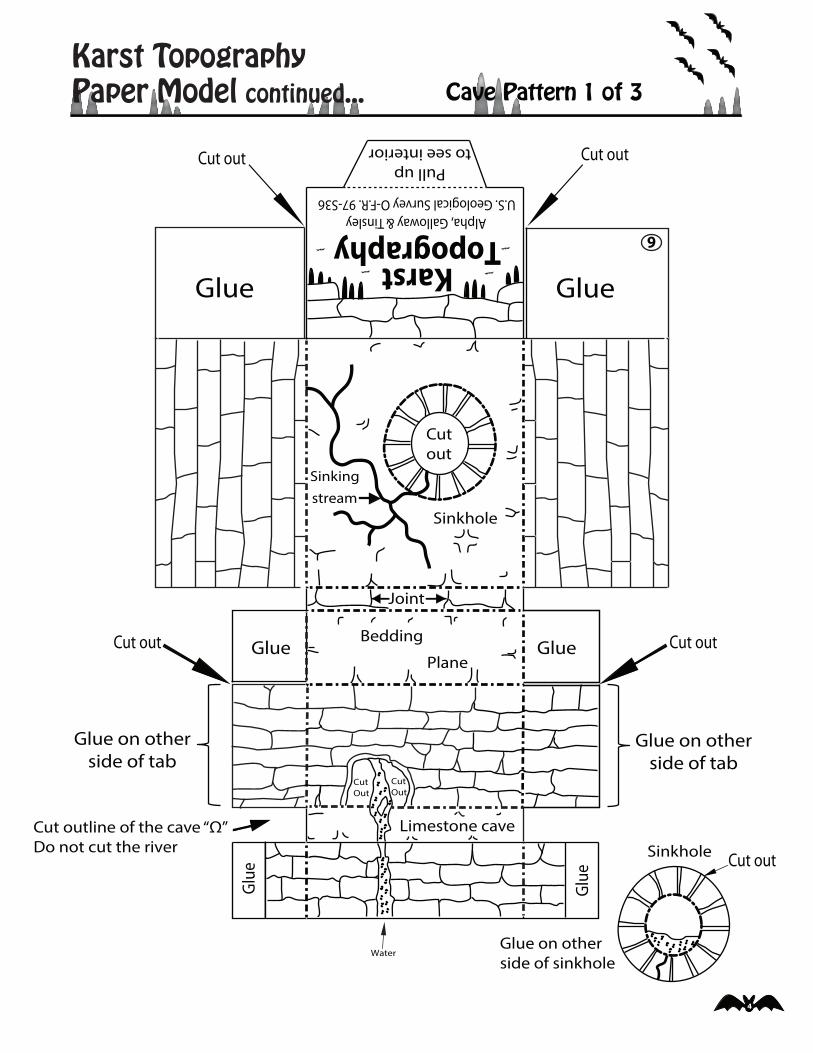
Karst TopographyPaper Model continued... Cave Pattern 1 of 3
GlueGlue
GlueGlue
Limestone cave
Glue on other side of sinkhole
Glue
Glue
Joint
Plane
Bedding
Sinkhole
Sinkingstream
Pull upto see interior
CutOut
CutOut
Alpha, Galloway & TinsleyU.S. Geological Survey O-F.R. 97-S36
KarstTopography
Cut outline of the cave “Ω”Do not cut the river
Glue on otherside of tab
Glue on otherside of tab
9
Cutout
Water
Sinkhole Cut out
Cut out Cut out
Cut out Cut out
5
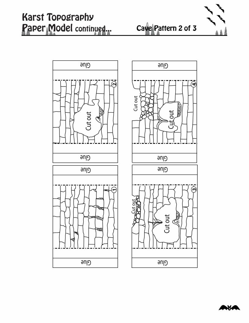
Karst TopographyPaper Model continued... Cave Pattern 2 of 3
Glue
Glue
1
Glue
Glue
2
Cut o
ut
Glue
Glue
Cut
out
4
Cut o
ut
Glue
Glue
Cut
out
3
Cut o
ut
6
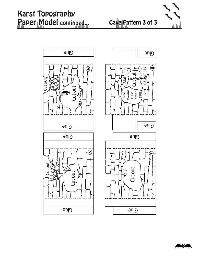
Karst TopographyPaper Model continued... Cave Pattern 3 of 3
Glue
Glue
Cut o
utCu
t out
Glue
Glue
Stal
actit
es
Stal
agm
ites
Fold
fow
ard
Glu
e ot
her
si
de
78
Glue
Glue
Cut o
utCut
out
5
Glue
Cut o
ut
Glue
Cut
out
6
7
Karst TopographyPaper Model continued...
Glue
6
Cut outGlue
Cut out
5
Glue
Glue
Cut out
Cut out
Glue
Glue
1
Glue
GlueCut out
2
Glue
Glue
Cut out
4
Cut out
Glue
Glue
Cut out
3
Cut out
Glue
7
Glue Cut out Cut out
Glue
Glue
8
Stalactites
Stalagmites
FoldfowardGlue other side
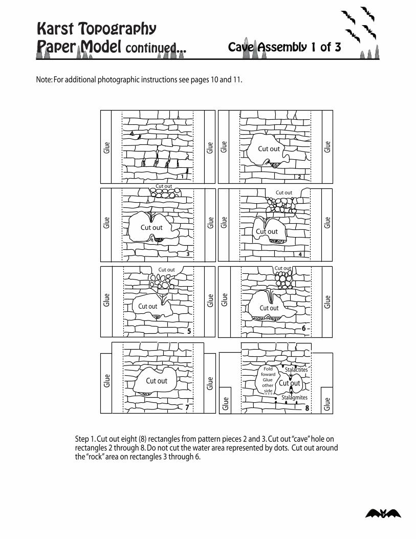
Cave Assembly 1 of 3
Step 1. Cut out eight (8) rectangles from pattern pieces 2 and 3. Cut out “cave” hole on rectangles 2 through 8. Do not cut the water area represented by dots. Cut out around the “rock” area on rectangles 3 through 6.
Note: For additional photographic instructions see pages 10 and 11.
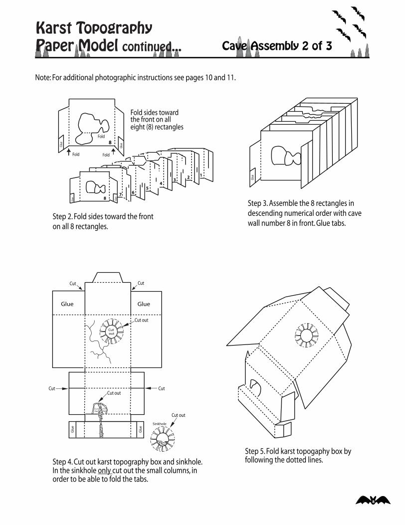
8
Karst TopographyPaper Model continued... Cave Assembly 2 of 3
Note: For additional photographic instructions see pages 10 and 11.
Fold sides toward the front on all eight (8) rectangles
Step 2. Fold sides toward the fronton all 8 rectangles.
Step 3. Assemble the 8 rectangles in descending numerical order with cave wall number 8 in front. Glue tabs.
Step 4. Cut out karst topography box and sinkhole.In the sinkhole only cut out the small columns, in order to be able to fold the tabs.
Step 5. Fold karst topogaphy box byfollowing the dotted lines.
123
45
7 68
Glue Glue
8
GlueGl
ue
Fold
Fold Fold
Glue
GlueGlue
Glue
Glue
Sinkhole
outCut
CutOut
CutOut
Cut Cut
Cut out
Cut
Cut out
Cut out
Cut
9
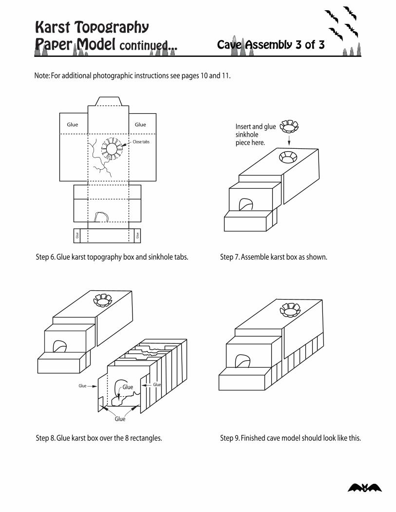
Karst TopographyPaper Model continued... Cave Assembly 3 of 3
Note: For additional photographic instructions see pages 10 and 11.
GlueGlue
Glue
Glue
Close tabs
Step 6. Glue karst topography box and sinkhole tabs.
Insert and gluesinkhole piece here.
Step 7. Assemble karst box as shown.
Glue
Glue
GlueGlue
Step 8. Glue karst box over the 8 rectangles. Step 9. Finished cave model should look like this.
10
Karst TopographyPaper Model continued...
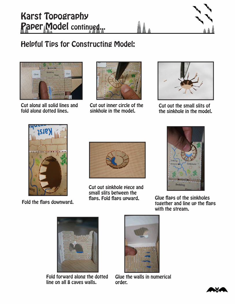
Helpful Tips for Constructing Model:
Cut along all solid lines and fold along dotted lines.
Cut out inner circle of the sinkhole in the model.
Cut out the small slits of the sinkhole in the model.
Fold the �aps downward.
Cut out sinkhole piece and small slits between the �aps. Fold �aps upward. Glue �aps of the sinkholes
together and line up the �aps with the stream.
Fold forward along the dotted line on all 8 caves walls.
Glue the walls in numerical order.
11
Karst TopographyPaper Model continued...
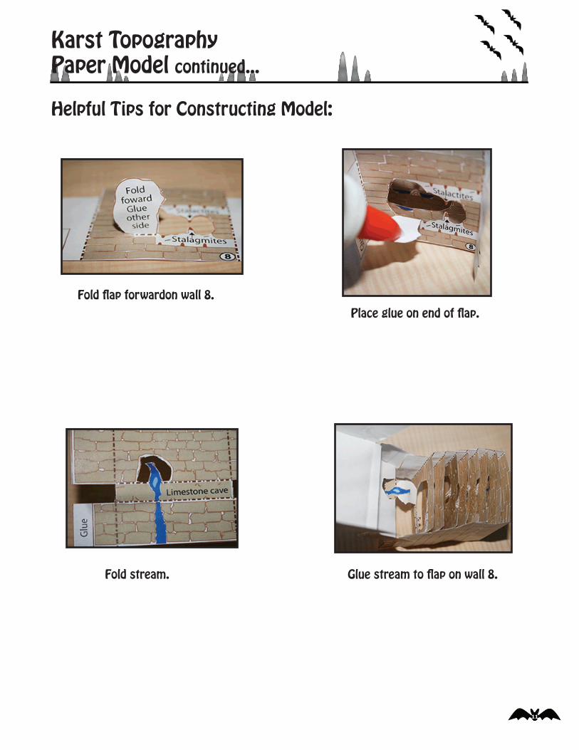
Helpful Tips for Constructing Model:
Fold �ap forwardon wall 8. Place glue on end of �ap.
Fold stream. Glue stream to �ap on wall 8.