Embed Size (px)
Citation preview
JWMP Update Draft Report
Bosworth Botanical Consulting Team
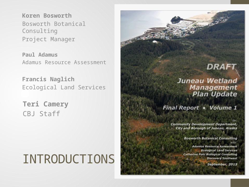
INTRODUCTIONS
Koren BosworthBosworth Botanical ConsultingProject Manager
Paul AdamusAdamus Resource Assessment
Francis NaglichEcological Land Services
Teri CameryCBJ Staff
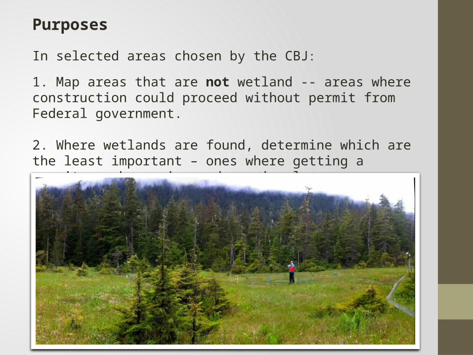
Purposes
In selected areas chosen by the CBJ:
1. Map areas that are not wetland -- areas where construction could proceed without permit from Federal government.
2. Where wetlands are found, determine which are the least important – ones where getting a permit may be easier and require less compensation.
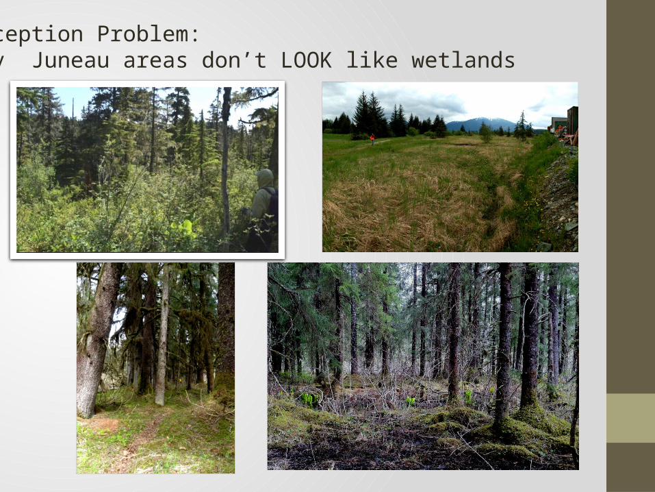
Perception Problem: Many Juneau areas don’t LOOK like wetlands
Key Facts:
• Construction in wetlands is not forbidden absolutely, but for the past 40 years most has required a Federal permit.
•Federal procedures for determining what is or is not a wetland has existed for almost 30 years and has withstood legal and scientific challenge.
• The fact that a city has few growth options other than building in wetlands does not guarantee leniency.
• The permitting agency (US Army Corps of Engineers) encourages regional and watershed-scale approaches to wetlands planning (Federal Rule 332.1.e). This study implemented such an approach.
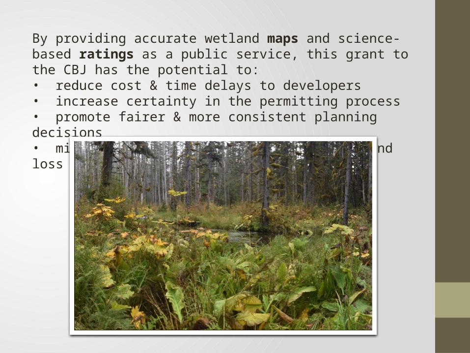
By providing accurate wetland maps and science-based ratings as a public service, this grant to the CBJ has the potential to:• reduce cost & time delays to developers• increase certainty in the permitting process• promote fairer & more consistent planning decisions• minimize environmental damages from wetland loss
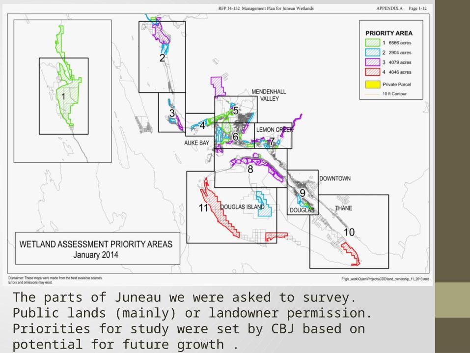
The parts of Juneau we were asked to survey. Public lands (mainly) or landowner permission. Priorities for study were set by CBJ based on potential for future growth .
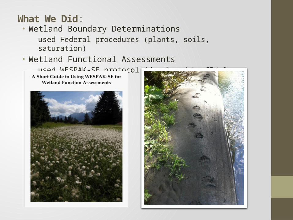
What We Did:• Wetland Boundary Determinations
used Federal procedures (plants, soils, saturation)
• Wetland Functional Assessmentsused WESPAK-SE protocol (developed by CBJ & SEAL Trust)
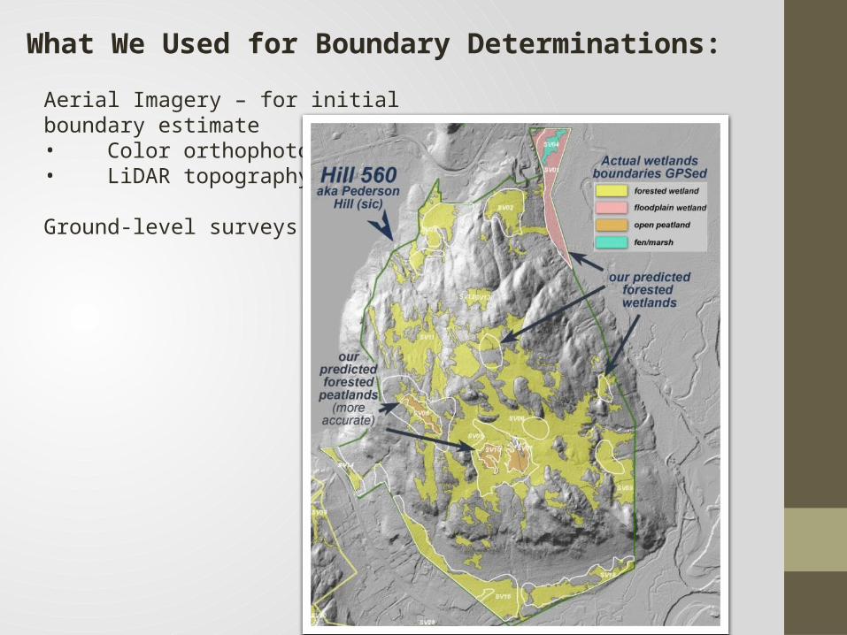
Aerial Imagery – for initial boundary estimate• Color orthophotos• LiDAR topography
Ground-level surveys
What We Used for Boundary Determinations:
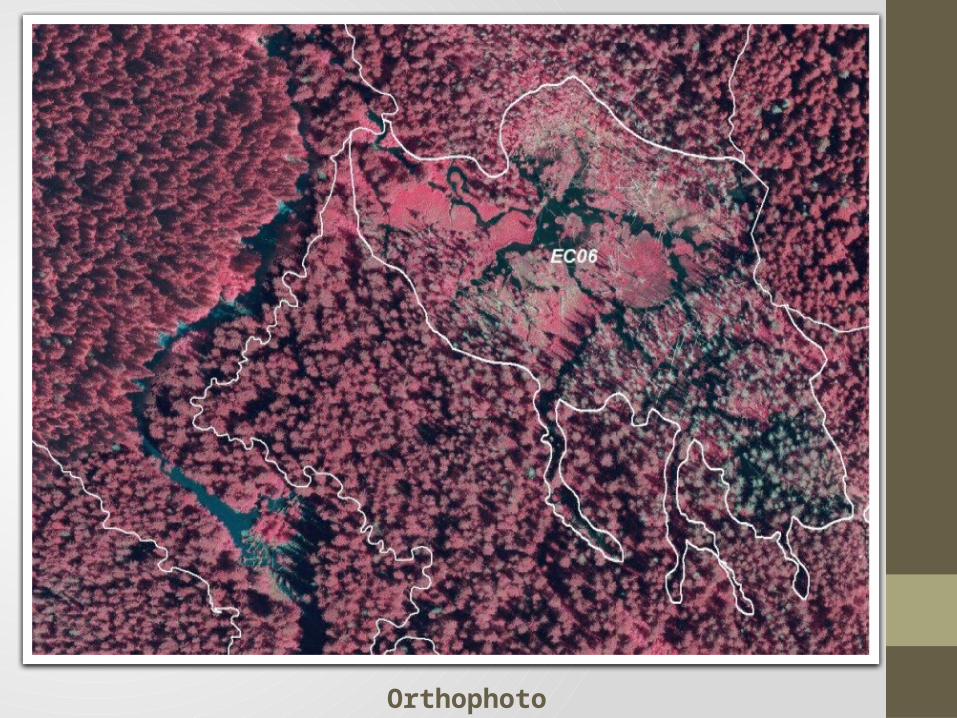
Orthophoto
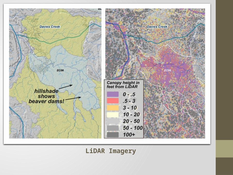
LiDAR Imagery
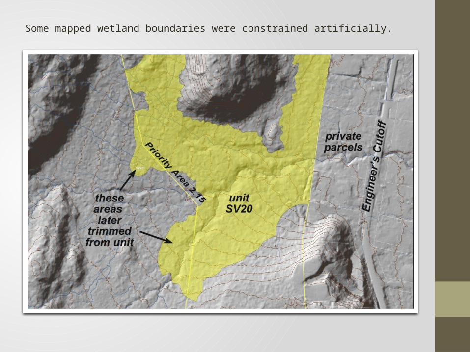
Some mapped wetland boundaries were constrained artificially.
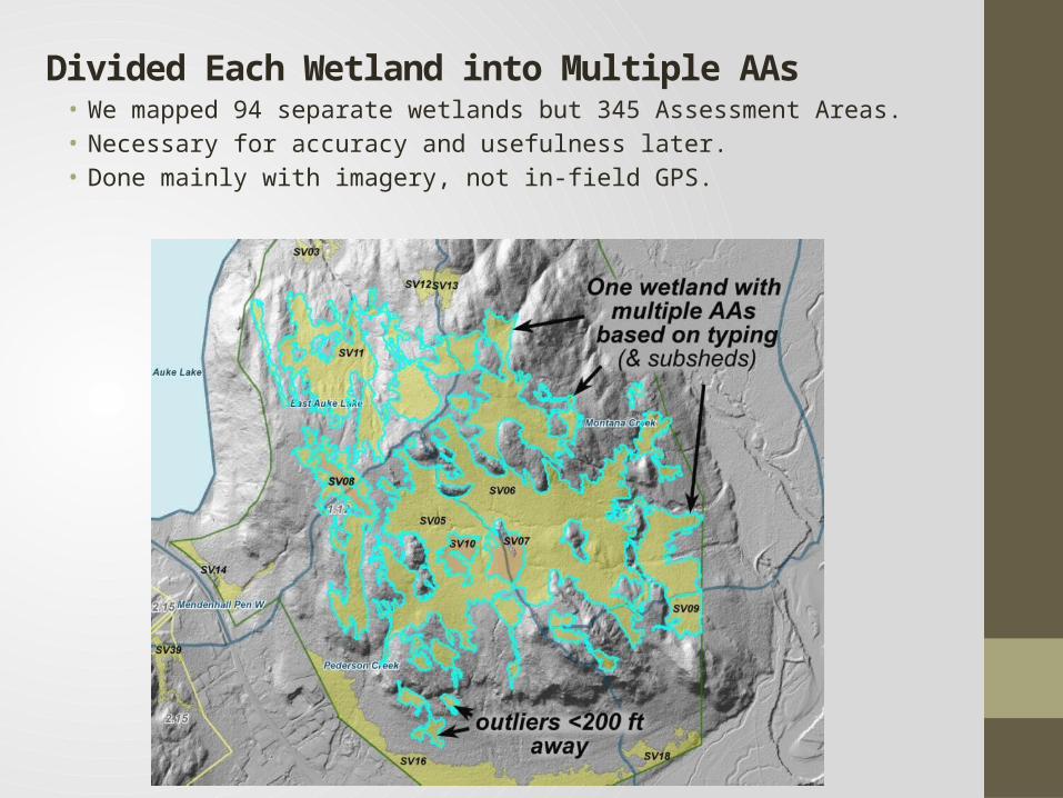
Divided Each Wetland into Multiple AAs• We mapped 94 separate wetlands but 345 Assessment Areas.• Necessary for accuracy and usefulness later.• Done mainly with imagery, not in-field GPS.
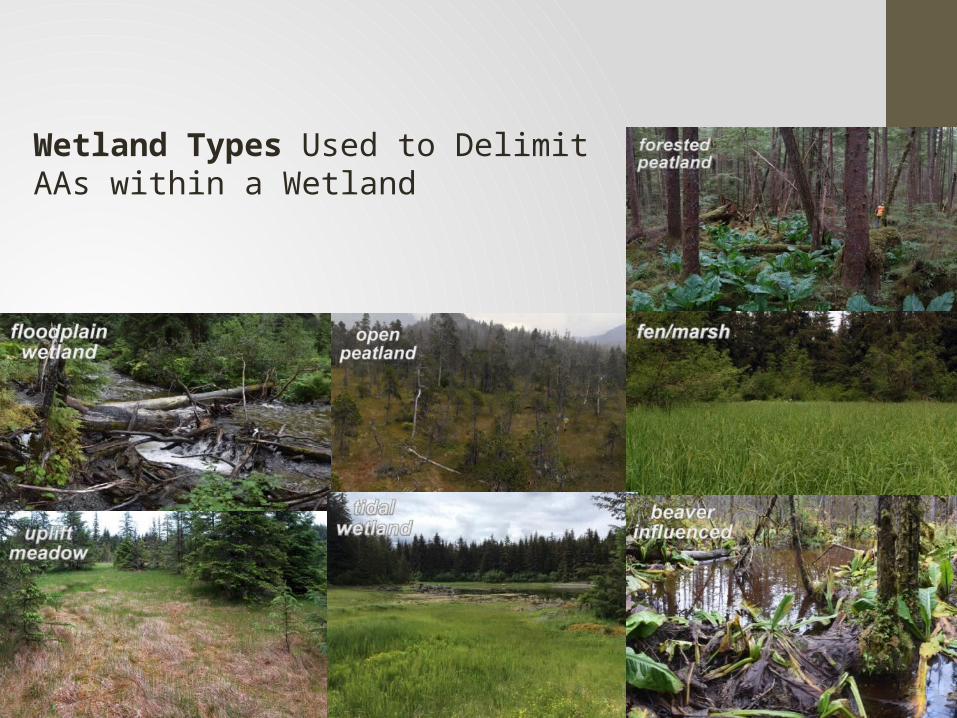
Wetland Types Used to Delimit AAs within a Wetland
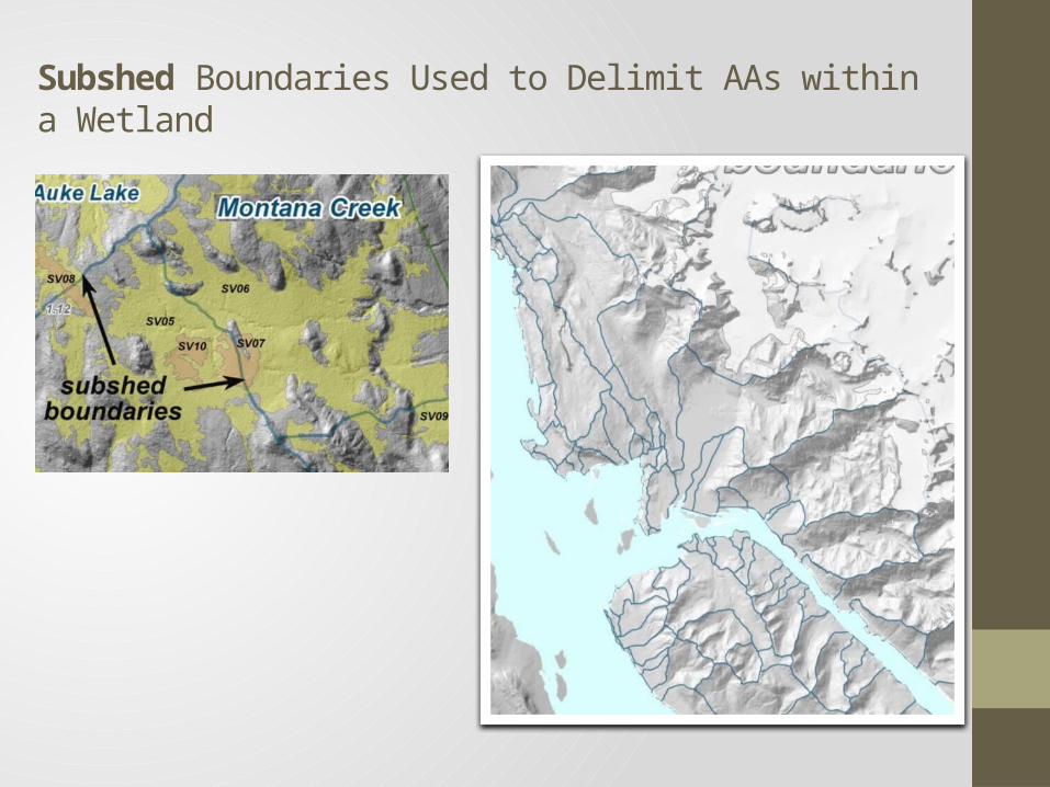
Subshed Boundaries Used to Delimit AAs within a Wetland
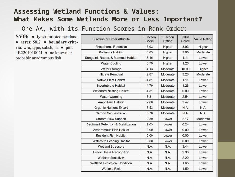
Assessing Wetland Functions & Values: What Makes Some Wetlands More or Less Important?
One AA, with its Function Scores in Rank Order:
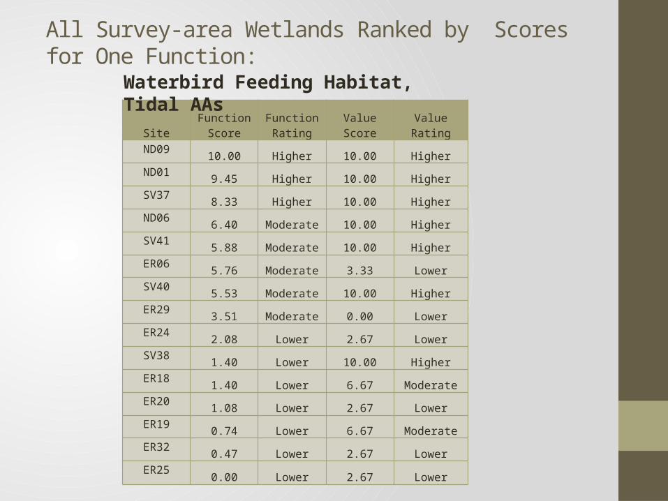
All Survey-area Wetlands Ranked by Scores for One Function:
SiteFunction
ScoreFunction
Rating Value Score Value RatingND09
10.00 Higher 10.00 HigherND01
9.45 Higher 10.00 HigherSV37
8.33 Higher 10.00 HigherND06
6.40 Moderate 10.00 HigherSV41
5.88 Moderate 10.00 HigherER06
5.76 Moderate 3.33 LowerSV40
5.53 Moderate 10.00 HigherER29
3.51 Moderate 0.00 LowerER24
2.08 Lower 2.67 LowerSV38
1.40 Lower 10.00 HigherER18
1.40 Lower 6.67 ModerateER20
1.08 Lower 2.67 LowerER19
0.74 Lower 6.67 ModerateER32
0.47 Lower 2.67 LowerER25
0.00 Lower 2.67 Lower
Waterbird Feeding Habitat, Tidal AAs

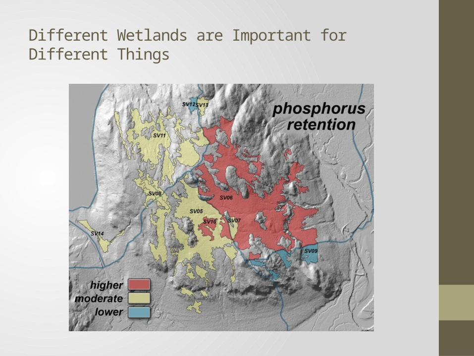
Different Wetlands are Important for Different Things
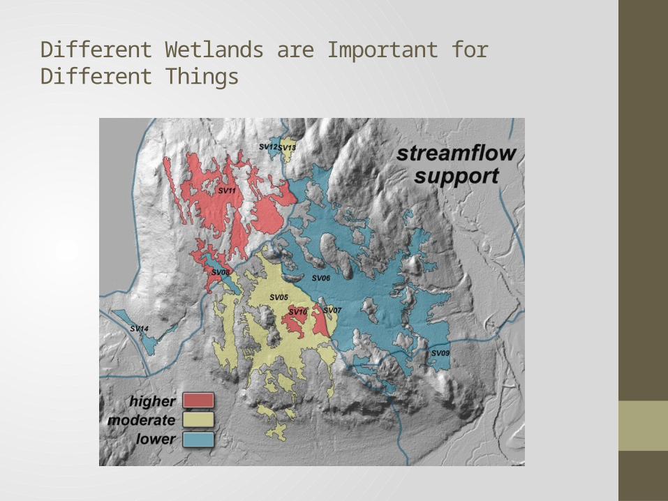
Different Wetlands are Important for Different Things
Different Wetlands are Important for Different Things
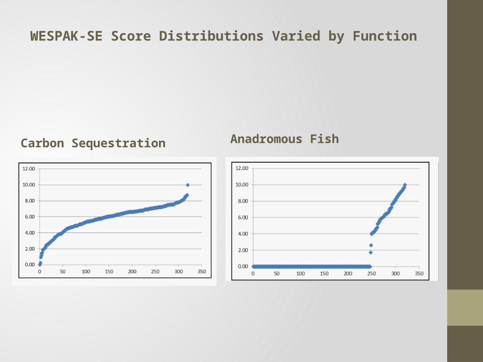
WESPAK-SE Score Distributions Varied by Function
Anadromous FishCarbon Sequestration
Options for Categorizing AAs• Bosworth team not required to categorize the AAs• Future decisions:• How many rating categories?• How to combine function and value score?• How to roll up all function-value scores into one score & rating
(per AA)?
Who Decides? Corps of Engineers, ultimately.
Input from SEAL Trust. CBJ Assembly? Others?
IMPLEMENTATION
Backdrop for Implementation• The Clean Water Act hierarchy for Corps review and permitting
in wetlands/waters:• Avoid• Minimize• Mitigate (or “replace”, “compensate”, “off-set”)
Backdrop for Implementation• The Federal Rule on Compensatory
Mitigation for Losses of Aquatic Resources (33CFR Part 332)• April 2008
• Hierarchy of Mitigation:• Restoration• Enhancement• Preservation (in certain
circumstances)
Backdrop for Implementation
• Hierarchy of Mitigation “Vehicles”• Mitigation Banks• In-Lieu Fee Programs• Permittee-Responsible Mitigation
• On-site and in-kind ranging to off-site and out-of-kind
Federal Rule
Plan Implementation Goals
1) Use the science for land-use policy and decisions2) Comply with the Federal Rule on Compensatory Mitigation
requiring a regional/watershed approach3) Provide certainty to regulators, applicants, mitigation
providers4) Protect the public interest
Proposed Options for Plan Implementation1) Planning and Educational Tool Only2) Corps of Engineers General Permit3) Local Code
Option 1: Planning and Educational Tool Only
• Only Corps manages/issues wetland permits • Wetland Review Board
(CBJ) reviews & comments on permit applications• Wetland mapping and
assessments used to inform permit process
Option 2: Corps of Engineers General Permit
• CBJ acquires Corps General Permit to manage/issue wetland permits on certain types or categories of wetlands
• Depending on the type/category, applicants either go through Corps process or CBJ Wetland Review Board process
• Wetland categories, derived from inventory, would define which process
• The General Permit is issued for five years at a time, therefore requires renewal
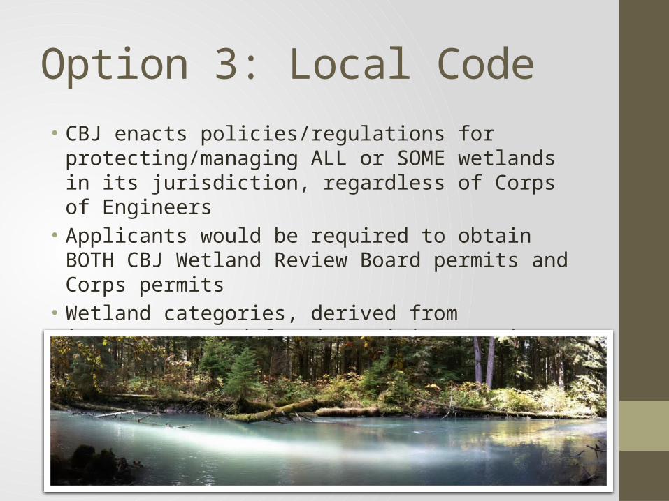
Option 3: Local Code• CBJ enacts policies/regulations for protecting/managing ALL or
SOME wetlands in its jurisdiction, regardless of Corps of Engineers
• Applicants would be required to obtain BOTH CBJ Wetland Review Board permits and Corps permits
• Wetland categories, derived from inventory, used for determining permit requirements, mitigation, functional replacement
QUESTIONS