Embed Size (px)
Citation preview
Josef G. Knoll Visiting Professorship for Development
Research
Hydrological modeling of the VII Region South using WaSiM-ETH (version 2)
Hamil Uribe
Documentation of Research: 7/2006
Copyright 2006 by Hamil Uribe. All rights reserved. Readers may make verbatim copies of this document for non-commercial purposes by any means, provided that this copyright notice appears on all such copies.
Hydrological modeling of the VII Region South using WASIM-ETH version 2
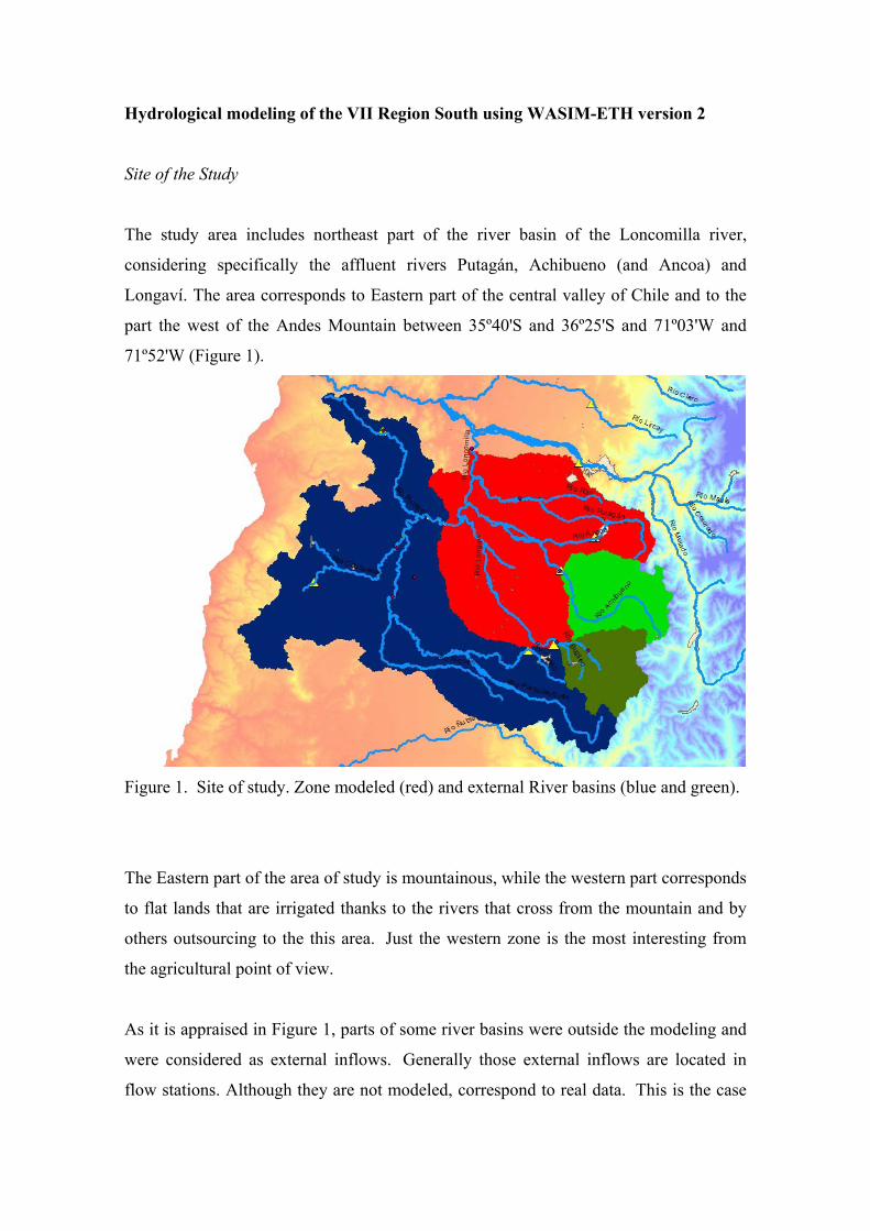
Site of the Study
The study area includes northeast part of the river basin of the Loncomilla river,
considering specifically the affluent rivers Putagán, Achibueno (and Ancoa) and
Longaví. The area corresponds to Eastern part of the central valley of Chile and to the
part the west of the Andes Mountain between 35º40'S and 36º25'S and 71º03'W and
71º52'W (Figure 1).
Figure 1. Site of study. Zone modeled (red) and external River basins (blue and green).
The Eastern part of the area of study is mountainous, while the western part corresponds
to flat lands that are irrigated thanks to the rivers that cross from the mountain and by
others outsourcing to the this area. Just the western zone is the most interesting from
the agricultural point of view.
As it is appraised in Figure 1, parts of some river basins were outside the modeling and
were considered as external inflows. Generally those external inflows are located in
flow stations. Although they are not modeled, correspond to real data. This is the case
of the high part of the Achibueno river, considered as an external flow with data of the
Achibueno station in La Recoba; in the Longaví river happen something like this, using
the Longaví station in La Quiriquina. In the river basin of the Perquilauquén river
(Figure 1 in blue) does not exist a station located exactly in the required point, for that
reason an hydrological analysis was made based on river basins transpositions to
simulate a station using real flow stations data: Perquilauquén in Quella, Cauquenes in
Desembocadura and Purapel in Nirivilo.
Information Used for the Modeling
For the modeling it is required information:
• Digital Elevation Model (DEM)
• Drainage Network
• Soil Type
• Land use
• Acuifers
• Channels Network
• Water rights
• Climatic Data
o Precipitation
o Relative Humidity
o Wind speed
o Radiation
o Air Temperature
o Hours of sun
• Well registry
• Flow Stations
• Irrigation Sectors
• Properties Layer
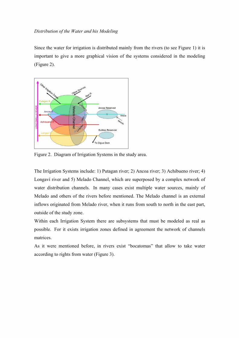
Distribution of the Water and his Modeling
Since the water for irrigation is distributed mainly from the rivers (to see Figure 1) it is
important to give a more graphical vision of the systems considered in the modeling
(Figure 2).
Figure 2. Diagram of Irrigation Systems in the study area.
The Irrigation Systems include: 1) Putagan river; 2) Ancoa river; 3) Achibueno river; 4)
Longaví river and 5) Melado Channel, which are superposed by a complex network of
water distribution channels. In many cases exist multiple water sources, mainly of
Melado and others of the rivers before mentioned. The Melado channel is an external
inflows originated from Melado river, when it runs from south to north in the east part,
outside of the study zone.
Within each Irrigation System there are subsystems that must be modeled as real as
possible. For it exists irrigation zones defined in agreement the network of channels
matrices.
As it were mentioned before, in rivers exist “bocatomas” that allow to take water
according to rights from water (Figure 3).
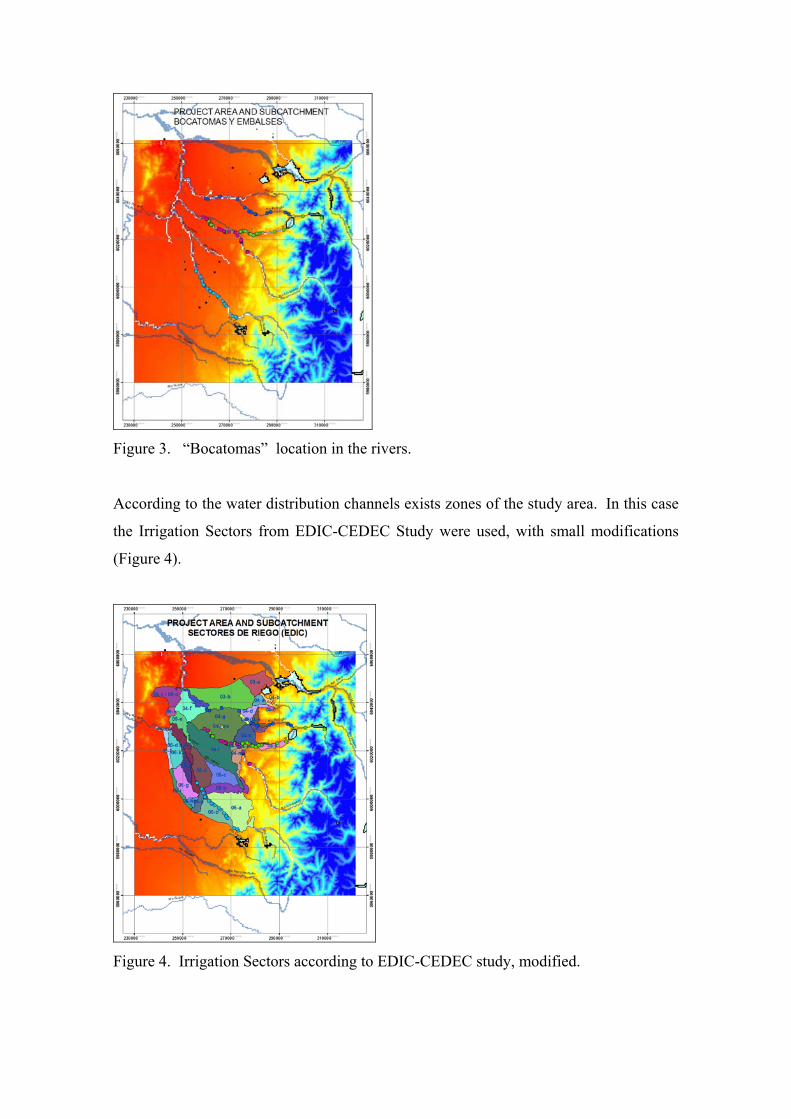
Figure 3. “Bocatomas” location in the rivers.
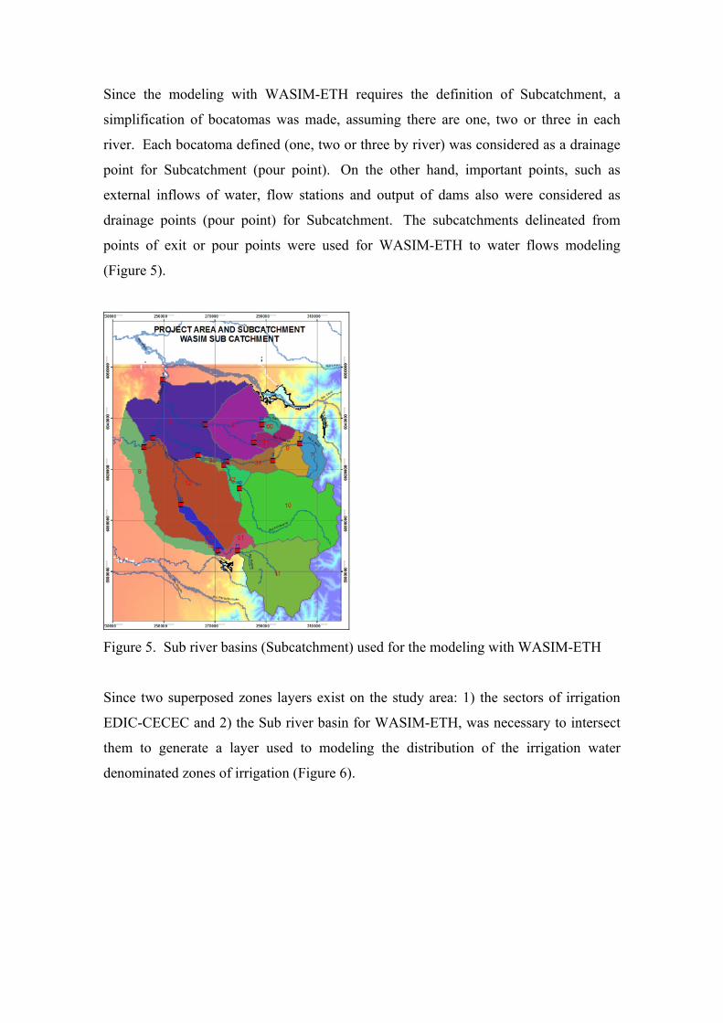
According to the water distribution channels exists zones of the study area. In this case
the Irrigation Sectors from EDIC-CEDEC Study were used, with small modifications
(Figure 4).
Figure 4. Irrigation Sectors according to EDIC-CEDEC study, modified.
Since the modeling with WASIM-ETH requires the definition of Subcatchment, a
simplification of bocatomas was made, assuming there are one, two or three in each
river. Each bocatoma defined (one, two or three by river) was considered as a drainage
point for Subcatchment (pour point). On the other hand, important points, such as
external inflows of water, flow stations and output of dams also were considered as
drainage points (pour point) for Subcatchment. The subcatchments delineated from
points of exit or pour points were used for WASIM-ETH to water flows modeling
(Figure 5).
Figure 5. Sub river basins (Subcatchment) used for the modeling with WASIM-ETH
Since two superposed zones layers exist on the study area: 1) the sectors of irrigation
EDIC-CECEC and 2) the Sub river basin for WASIM-ETH, was necessary to intersect
them to generate a layer used to modeling the distribution of the irrigation water
denominated zones of irrigation (Figure 6).
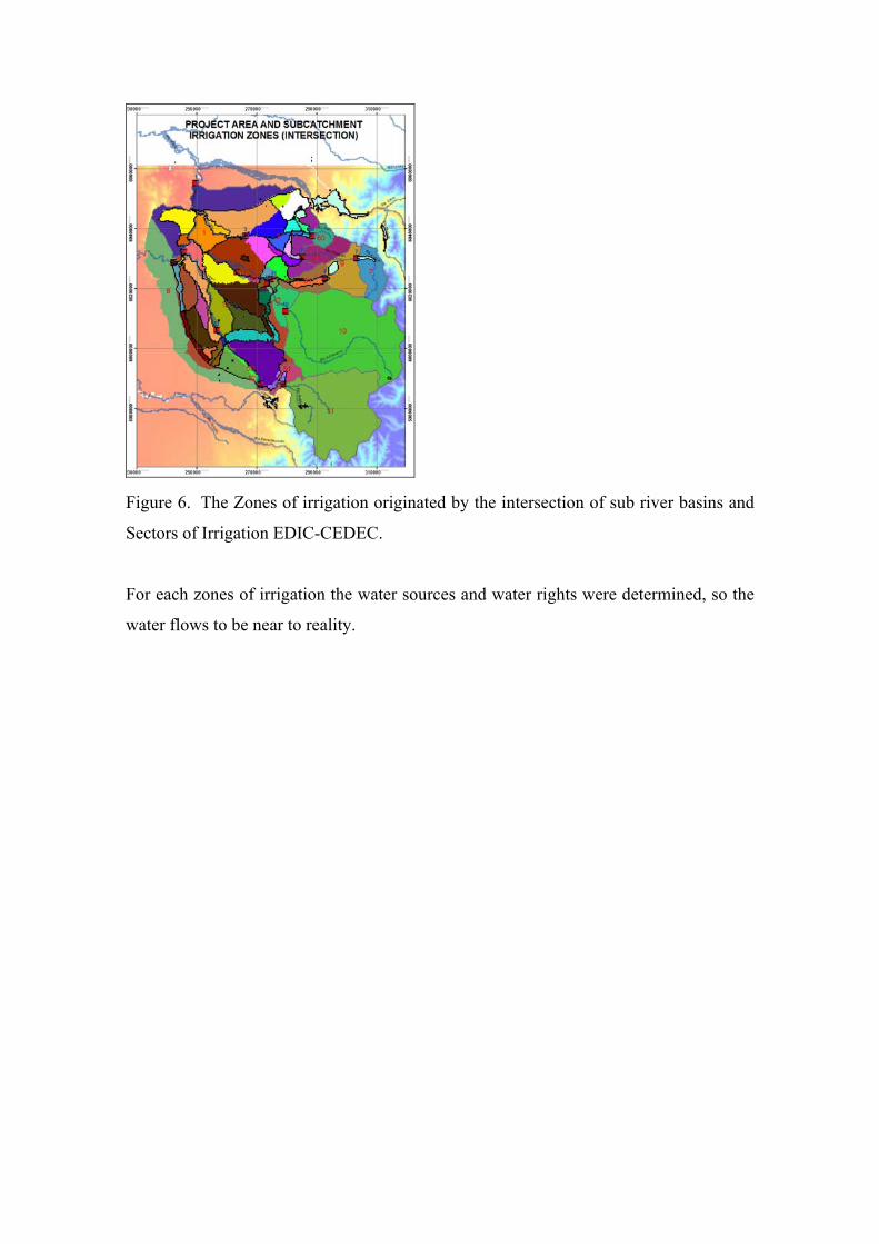
Figure 6. The Zones of irrigation originated by the intersection of sub river basins and
Sectors of Irrigation EDIC-CEDEC.
For each zones of irrigation the water sources and water rights were determined, so the
water flows to be near to reality.