Embed Size (px)
Citation preview
By Dr. Ghazi Al-Khateeb
Surveying Laboratory
By:
Dr. Ghazi Al-Khateeb
Jordan University of Science and Technology
Department of Civil Engineering
By Dr. Ghazi Al-Khateeb
1. Length of Pace Using Tape
and Odometer
By Dr. Ghazi Al-Khateeb
Length of Pace Using Tape and OdometerObjective
� The main objective of this exercise is to
determine the length of pace using distance-
measuring equipment (tools).
By Dr. Ghazi Al-Khateeb
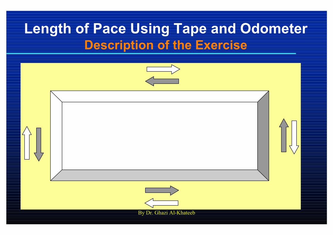
Length of Pace Using Tape and OdometerDescription of the Exercise
By Dr. Ghazi Al-Khateeb
Length of Pace Using Tape and OdometerDescription of the Exercise…
� The perimeter (circumference) of a
reasonable rectangular area inside the
university campus will be measured using
tape and odometer.
� Each side of the area will be measured in
forward and backward (opposite) directions
and recorded. The average of the two
measurements will be calculated.
By Dr. Ghazi Al-Khateeb
Length of Pace Using Tape and OdometerDescription of the Exercise…
� Each student in each group is required to
contribute in fieldwork and measurements.
� To measure the length of pace, each student
in the group will be required to walk around
the specified area to count the number of
his/her paces along each side. The number of
paces will be recorded.
By Dr. Ghazi Al-Khateeb
Length of Pace Using Tape and OdometerDescription of the Exercise…
� The average (mean) length of pace will be
calculated by dividing the average length of
perimeter by the number of paces for each
student in the group.
� The measurements in both directions for
each side should agree to within a few
centimeters. Neglect (discard)
measurements that are outside this range.
By Dr. Ghazi Al-Khateeb
Length of Pace Using Tape and OdometerLaboratory Report
� Each student in each group is required to
submit a separate laboratory report done
according to the criteria and formatting
requirements discussed previously and
documented in the course syllabus and
policies.
� Laboratory reports are due one week from
the date of the exercise/project.

By Dr. Ghazi Al-Khateeb
By Dr. Ghazi Al-Khateeb
2. Measurement of an
Obstructed Distance
By Dr. Ghazi Al-Khateeb
Measurement of an Obstructed DistanceObjective
� The main objective of this project is to
determine the distance between two points
when direct measurement is difficult or not
possible due to an obstruction between the
two points such as a river, lake, building,
tower, …etc.

By Dr. Ghazi Al-Khateeb
Measurement of an Obstructed DistanceDescription of the Exercise
A
B
D
E
C
Lake
By Dr. Ghazi Al-Khateeb
Measurement of an Obstructed DistanceDescription of the Exercise…
� Required is to compute the distance between
two points without direct measurement.
� The surveying instruments and tools to be
used in this project are tape, ranging rods
(three), and prismatic square.

By Dr. Ghazi Al-Khateeb
Measurement of an Obstructed DistanceDescription of the Exercise…
� Assume that the required distance is that
between the two points A and B shown in the
figure below.
� The first step is to select a point such as C
facing the line AB as shown in the figure.

By Dr. Ghazi Al-Khateeb
Measurement of an Obstructed DistanceDescription of the Exercise…
� From point C, a straight line CEB is
constructed using three ranging rods located
at these three points (a prismatic square is
also used for this purpose). The visual line
from point C to point B has to pass through
point E for a straight line to be constructed.
By eye, this can be checked when looking at
the three rods located at the three points C,
E, and B from point C. Check that with a
prismatic square, too.

By Dr. Ghazi Al-Khateeb
Measurement of an Obstructed DistanceDescription of the Exercise…
� The distances CB and CE are measured using
a tape.
� Using the tape, the distance between point C
and point A (CA) is also measured.
By Dr. Ghazi Al-Khateeb
Measurement of an Obstructed DistanceDescription of the Exercise…
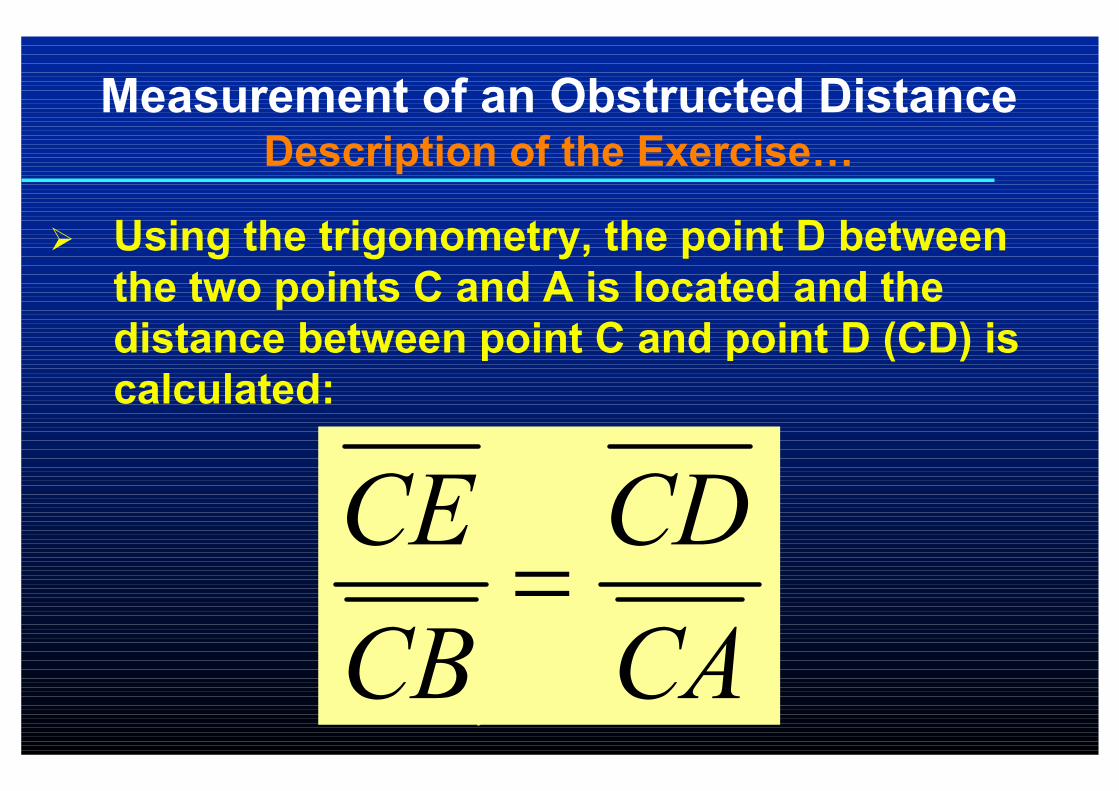
� Using the trigonometry, the point D between
the two points C and A is located and the
distance between point C and point D (CD) is
calculated:
CA
CD
CB
CE=
By Dr. Ghazi Al-Khateeb
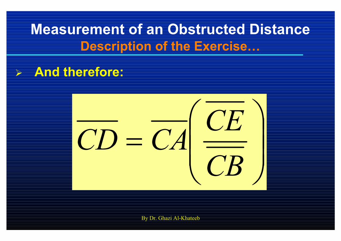
Measurement of an Obstructed DistanceDescription of the Exercise…
� And therefore:
=
CB
CECACD
By Dr. Ghazi Al-Khateeb
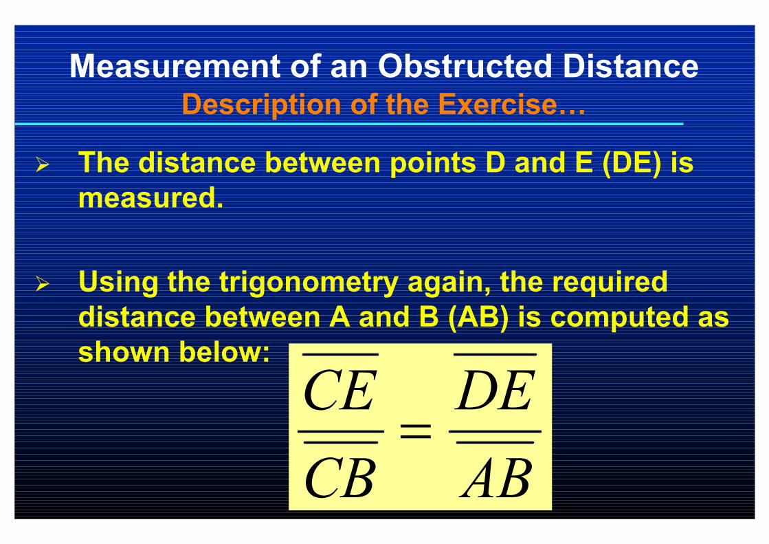
Measurement of an Obstructed DistanceDescription of the Exercise…
� The distance between points D and E (DE) is
measured.
� Using the trigonometry again, the required
distance between A and B (AB) is computed as
shown below:
AB
DE
CB
CE=

By Dr. Ghazi Al-Khateeb
Measurement of an Obstructed DistanceDescription of the Exercise…
� Thus:
=
CE
CBDEAB
By Dr. Ghazi Al-Khateeb
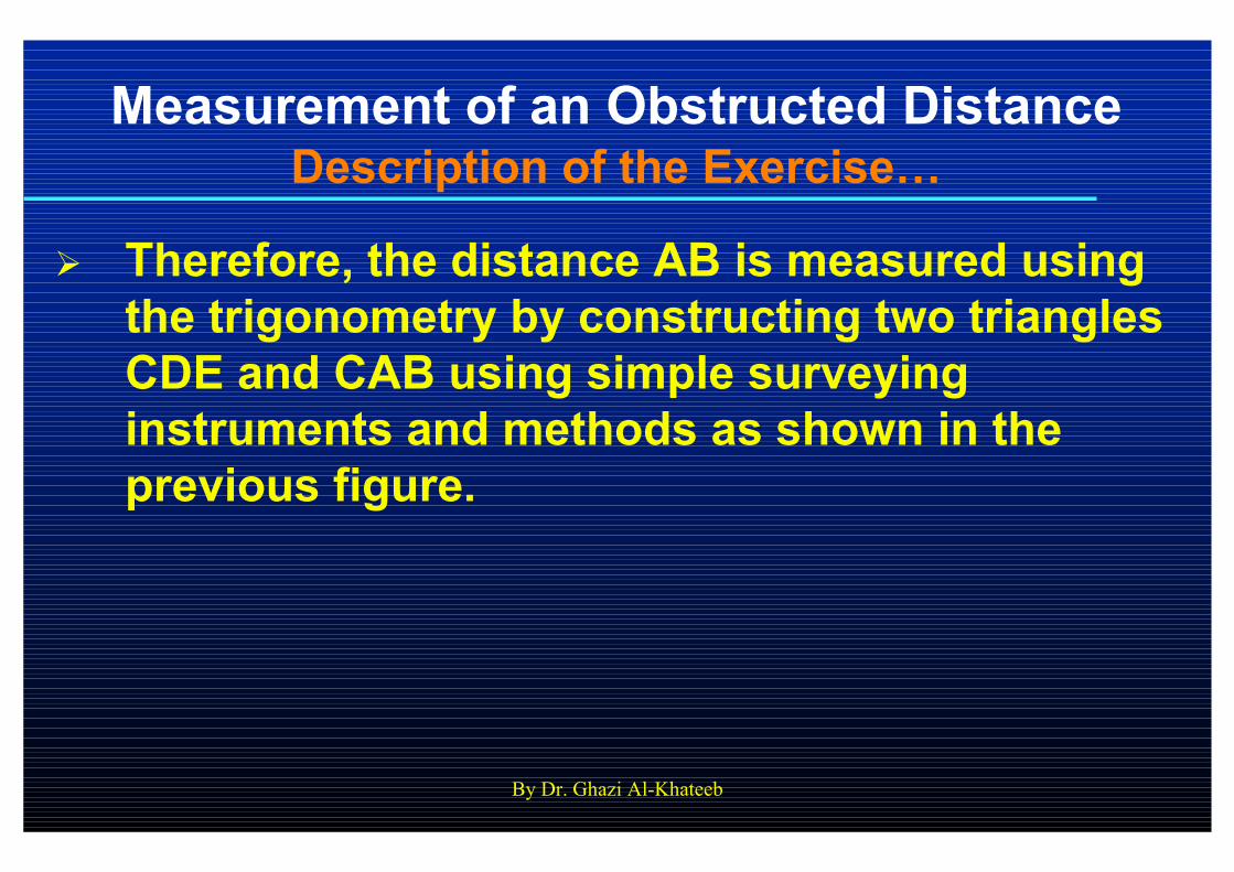
Measurement of an Obstructed DistanceDescription of the Exercise…
� Therefore, the distance AB is measured using
the trigonometry by constructing two triangles
CDE and CAB using simple surveying
instruments and methods as shown in the
previous figure.
By Dr. Ghazi Al-Khateeb
Measurement of an Obstructed DistanceLaboratory Report
� Each student in each group is required to
submit a separate laboratory report done
according to the criteria and formatting
requirements discussed previously and
documented in the course syllabus and
policies that were handed to students at the
beginning of the semester.
� Laboratory reports are due one week from
the date of this project.

By Dr. Ghazi Al-Khateeb
By Dr. Ghazi Al-Khateeb
3. Chain Surveying Project
By Dr. Ghazi Al-Khateeb
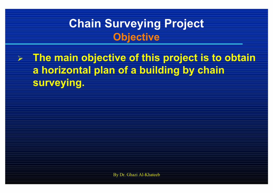
Chain Surveying ProjectObjective
� The main objective of this project is to obtain
a horizontal plan of a building by chain
surveying.

By Dr. Ghazi Al-Khateeb
Chain Surveying ProjectDescription of the Project
αααα
Building
d1 d2
αααα2
d
D
αααα1
By Dr. Ghazi Al-Khateeb
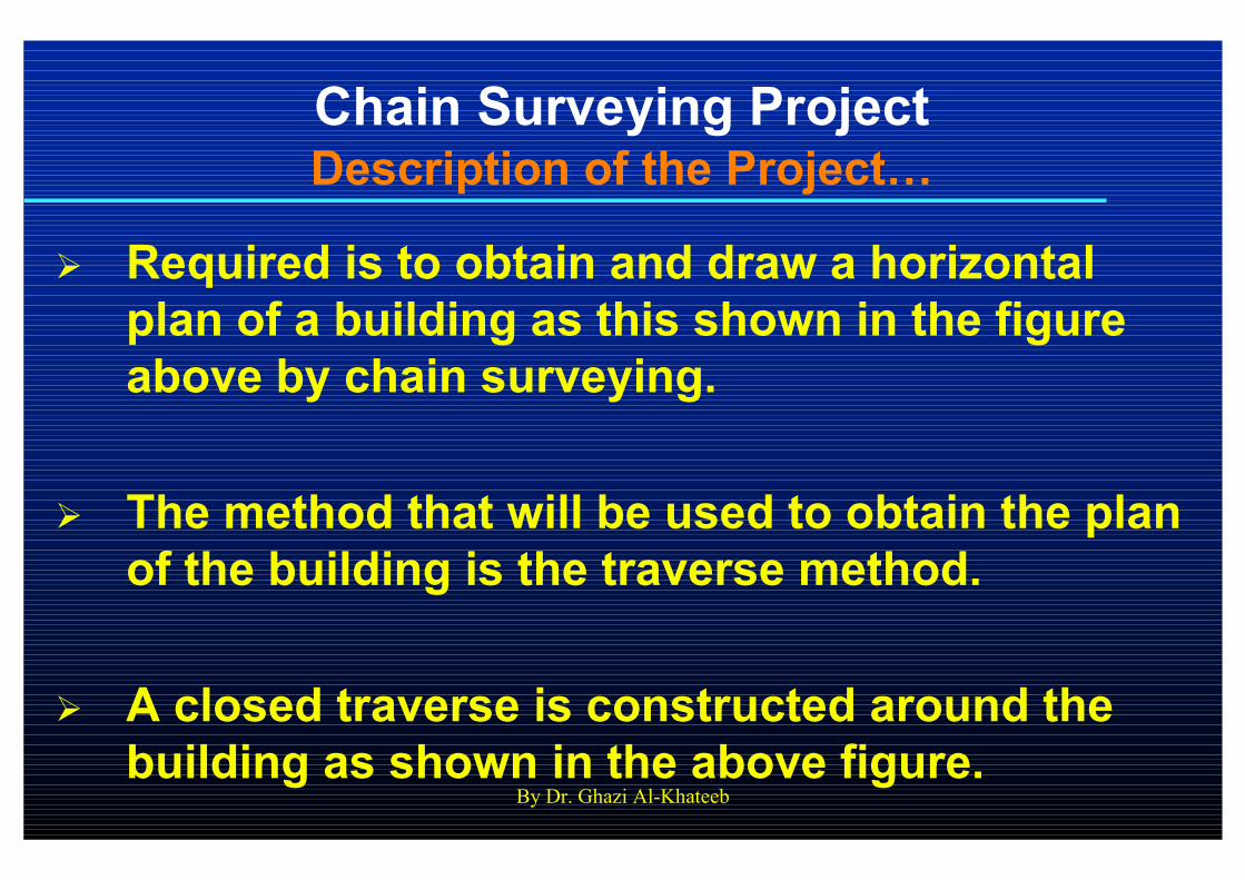
Chain Surveying ProjectDescription of the Project…
� Required is to obtain and draw a horizontal
plan of a building as this shown in the figure
above by chain surveying.
� The method that will be used to obtain the plan
of the building is the traverse method.
� A closed traverse is constructed around the
building as shown in the above figure.

By Dr. Ghazi Al-Khateeb
Chain Surveying ProjectDescription of the Project…
� All the corners of the building are located with
reference to the traverse lines in the four sides
using any of four basic methods (pair of ties
method, offset method, polar method, and
intersection method).
� The pair of ties method depends on taking the
measurement of two distances from the point
to be surveyed to a traverse line (base line).
By Dr. Ghazi Al-Khateeb
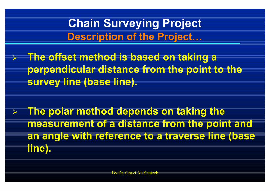
Chain Surveying ProjectDescription of the Project…
� The offset method is based on taking a
perpendicular distance from the point to the
survey line (base line).
� The polar method depends on taking the
measurement of a distance from the point and
an angle with reference to a traverse line (base
line).
By Dr. Ghazi Al-Khateeb
Chain Surveying ProjectDescription of the Project…
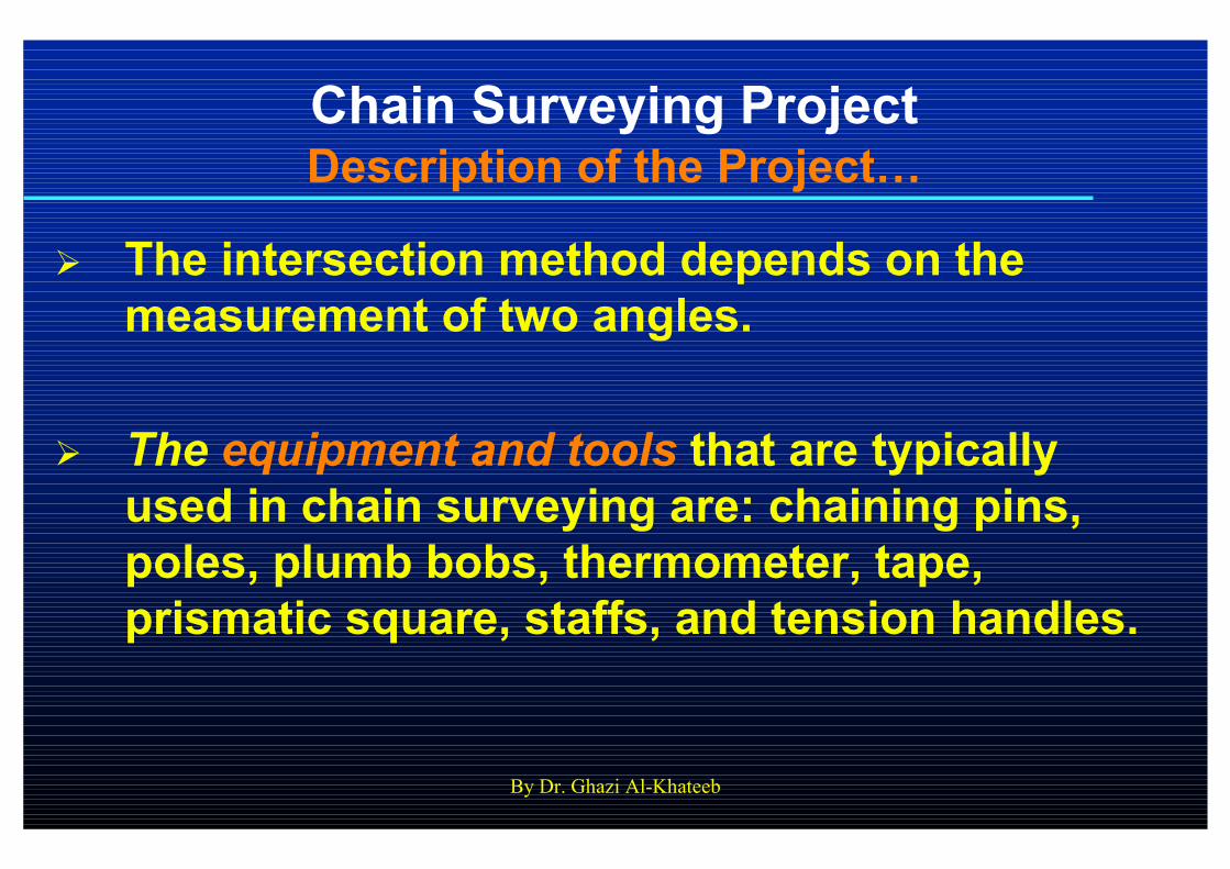
� The intersection method depends on the
measurement of two angles.
� The equipment and tools that are typically
used in chain surveying are: chaining pins,
poles, plumb bobs, thermometer, tape,
prismatic square, staffs, and tension handles.

By Dr. Ghazi Al-Khateeb
Chain Surveying ProjectDescription of the Project…
� Note #1: Try to tie most of the corner points of
the building to the base lines of the traverse.
� Note #2: The theodolite equipment will not be
used in this project to measure the angles.
Therefore, not all of the four methods
described above can be used here. Only two of
the methods that require distance
measurement (the pair of ties method and the
offset method) can be used.
By Dr. Ghazi Al-Khateeb
Chain Surveying ProjectLaboratory Report
� Each student in each group is required to
submit a separate laboratory report done
according to the criteria and formatting
requirements discussed previously and
documented in the course syllabus and
policies.
� A horizontal map should be plotted on an A3
paper sheet. Each student in the group is
required to submit a separate map.
By Dr. Ghazi Al-Khateeb
Chain Surveying ProjectLaboratory Report…
� Laboratory reports are due one week from
the date of the exercise/project.

By Dr. Ghazi Al-Khateeb

By Dr. Ghazi Al-Khateeb
4. Construction of a Contour
Map
By Dr. Ghazi Al-Khateeb
Construction of a Contour MapObjectives
� To get enough training and practice on the
level instrument.
� To learn how to conduct the different
calculations and analysis from a leveling
session including elevations.
� To learn how to draw a contour map for an
area using leveling techniques.
By Dr. Ghazi Al-Khateeb
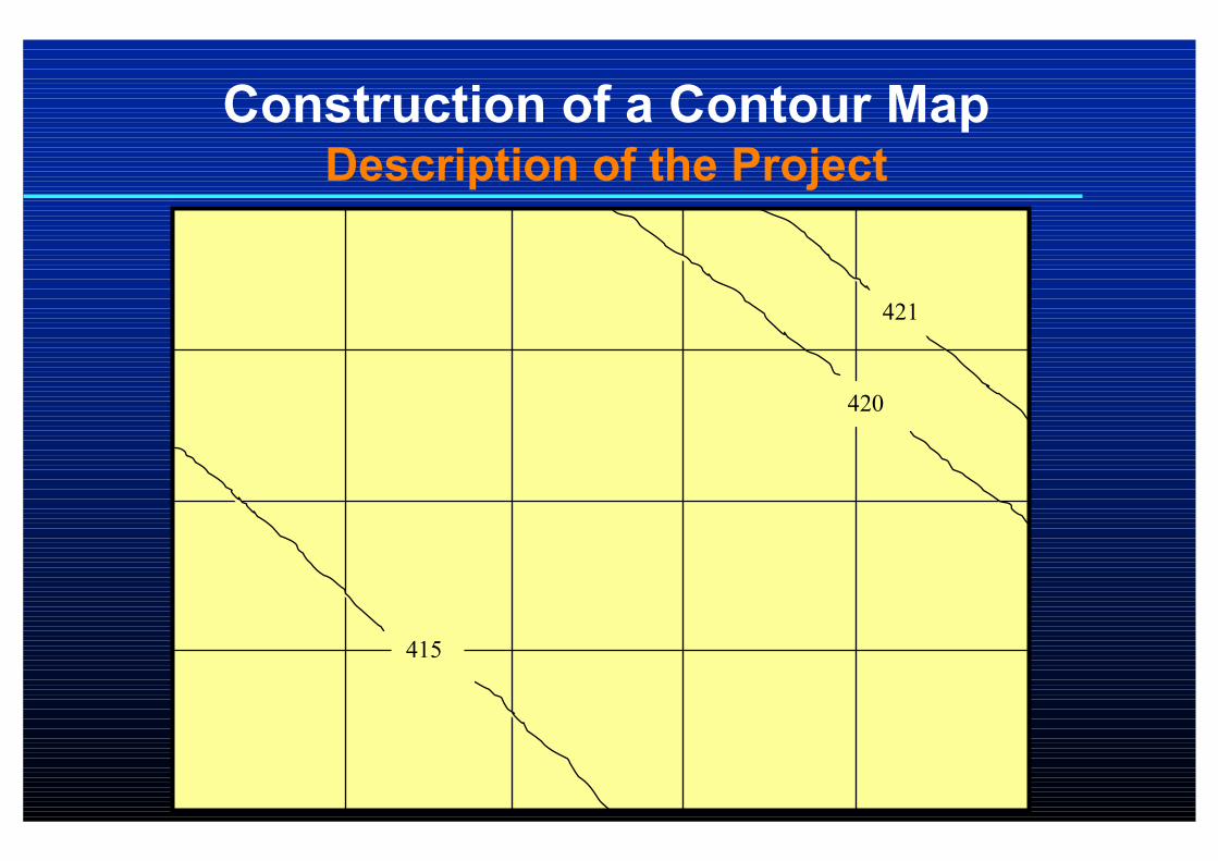
Construction of a Contour MapDescription of the Project
415
420
421
By Dr. Ghazi Al-Khateeb
Construction of a Contour MapDescription of the Project…
� Required is to draw a contour map of a
selected area as shown in the figure above.
� The first step is to divide the area into smaller
squares (blocks) to look like a grid system.
Each square is about 10 ×××× 10 m in area.
� The elevation at each corner of the grid is
determined.

By Dr. Ghazi Al-Khateeb
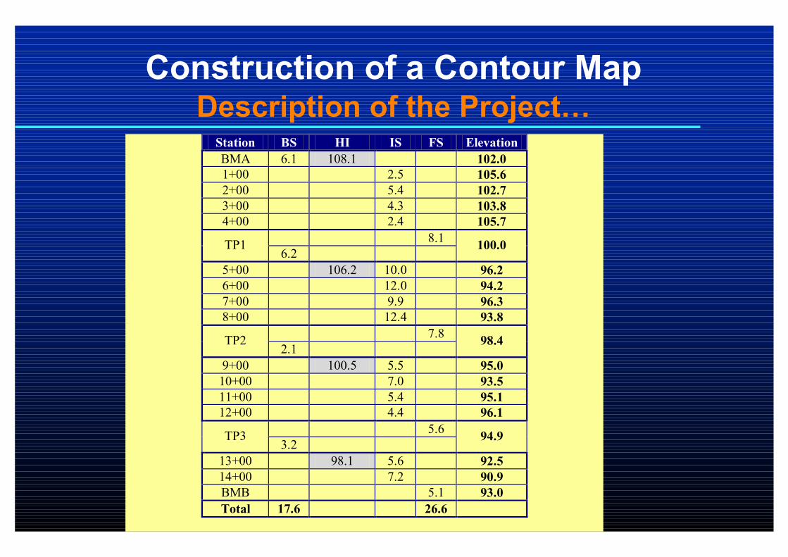
Construction of a Contour MapDescription of the Project…
� The following example shows the calculations
from a leveling session.
� A contour line is a line joining points of equal
elevations (altitudes).
� The contour interval is the difference in
elevation between two successive contour
lines.
By Dr. Ghazi Al-Khateeb
Construction of a Contour MapDescription of the Project…Station BS HI IS FS Elevation
BMA 6.1 108.1 102.0
1+00 2.5 105.6
2+00 5.4 102.7
3+00 4.3 103.8
4+00 2.4 105.7
8.1 TP1
6.2 100.0
5+00 106.2 10.0 96.2
6+00 12.0 94.2
7+00 9.9 96.3
8+00 12.4 93.8
7.8 TP2
2.1 98.4
9+00 100.5 5.5 95.0
10+00 7.0 93.5
11+00 5.4 95.1
12+00 4.4 96.1
5.6 TP3
3.2 94.9
13+00 98.1 5.6 92.5
14+00 7.2 90.9
BMB 5.1 93.0
Total 17.6 26.6
By Dr. Ghazi Al-Khateeb
Construction of a Contour MapDescription of the Project…
� In this project, a contour interval will be
selected as the maximum elevation minus the
minimum elevation divided by 10.
� Points with the same elevations will be joined
to construct a contour line.

By Dr. Ghazi Al-Khateeb
Construction of a Contour MapDescription of the Project…
� Contour lines coincide with the corners of the
grid system are easy to plot since the
elevations of the corners are measured.
By Dr. Ghazi Al-Khateeb
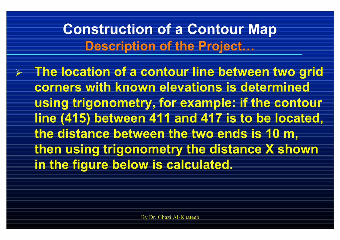
Construction of a Contour MapDescription of the Project…
� The location of a contour line between two grid
corners with known elevations is determined
using trigonometry, for example: if the contour
line (415) between 411 and 417 is to be located,
the distance between the two ends is 10 m,
then using trigonometry the distance X shown
in the figure below is calculated.
By Dr. Ghazi Al-Khateeb
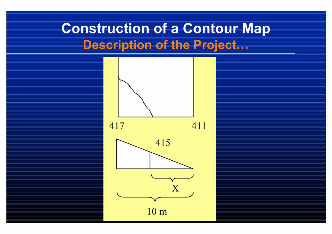
Construction of a Contour MapDescription of the Project…
411 417
415
10 m
X
By Dr. Ghazi Al-Khateeb
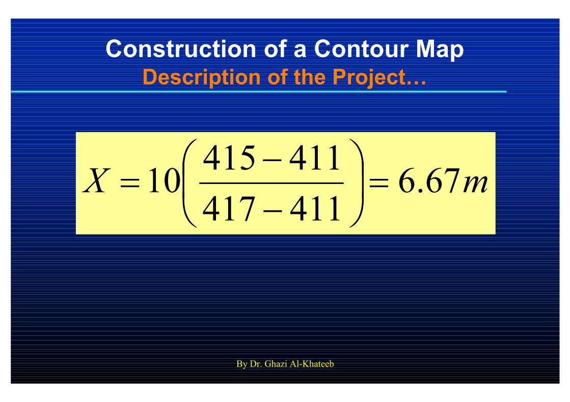
Construction of a Contour MapDescription of the Project…
mX 67.6411417
41141510 =
−−
=
By Dr. Ghazi Al-Khateeb
Construction of a Contour MapDescription of the Project…
� Using the above procedure, all contour lines
on the map will be located and plotted.
� Finally, a contour map will be constructed for
the entire area.
By Dr. Ghazi Al-Khateeb
Construction of a Contour MapLaboratory Report
� Each student in each group is required to
submit a separate laboratory report done
according to the criteria and formatting
requirements discussed previously and
documented in the course syllabus and
policies.
� A contour map should be plotted on an A3
paper sheet. Contour values should be
shown as in the figure above.

By Dr. Ghazi Al-Khateeb
Construction of a Contour MapLaboratory Report…
� Laboratory reports are due one week from
the date of the exercise/project.

By Dr. Ghazi Al-Khateeb

By Dr. Ghazi Al-Khateeb
5. Measurement of the Length
(Width) of an Obstructed
Building Using the Theodolite
By Dr. Ghazi Al-Khateeb
The Theodolite ProjectObjectives
� The main objective of this project is to obtain
the length of a building without direct
measurement of the dimension due to an
obstruction in the way of measurement.
By Dr. Ghazi Al-Khateeb
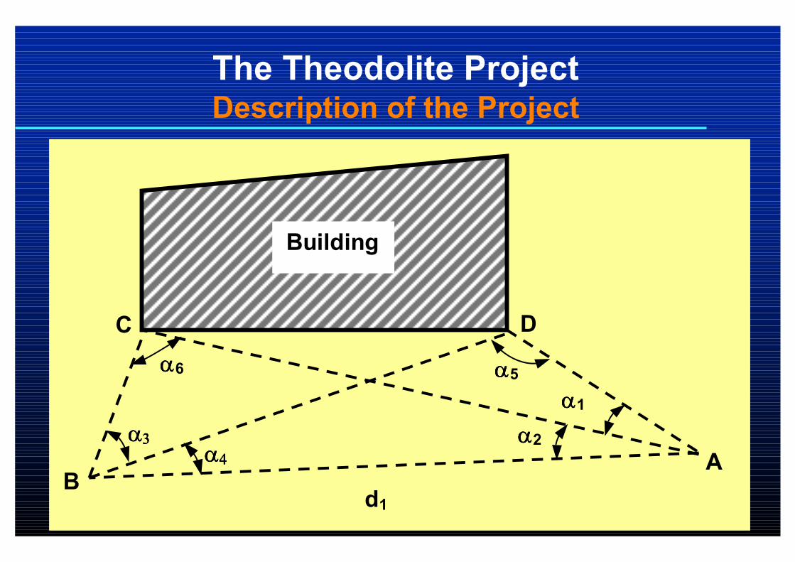
The Theodolite ProjectDescription of the Project
αααα4444
αααα1
Building
d1
A B
D
αααα2
C
αααα3333
αααα5 αααα6

By Dr. Ghazi Al-Khateeb
The Theodolite ProjectDescription of the Project…
� Required is to obtain the length of a building
without direct measurement using the
theodolite.
� The horizontal angle between the two ends of
the targeted building side (C and D) is
measured from a fixed point A as shown in the
above figure (angle αααα1111)))).

By Dr. Ghazi Al-Khateeb
The Theodolite ProjectDescription of the Project…
� The horizontal angle between C and B (angle
αααα2222)))) is also measured.
� The horizontal angle between the two ends of
the building side (C and D) from point B (angle
αααα3333)))) is measured.
By Dr. Ghazi Al-Khateeb
The Theodolite ProjectDescription of the Project…
� From point B (another point outside the
building area), another horizontal angle is also
measured using the theodolite between the
other end of the building side (point D in the
figure above) and the first selected fixed point,
A (angle αααα4444)))).
� The length between A and B is measured (d1).
By Dr. Ghazi Al-Khateeb
The Theodolite ProjectDescription of the Project…
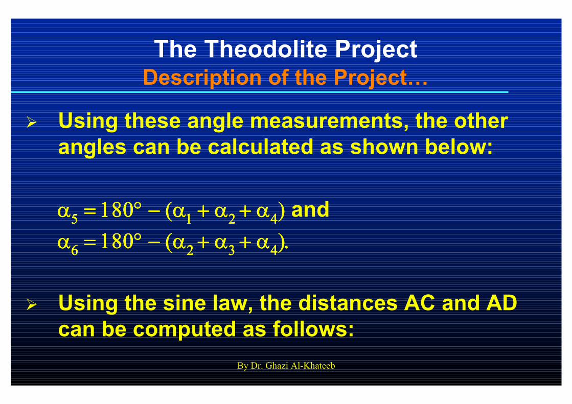
� Using these angle measurements, the other
angles can be calculated as shown below:
αααα5555 = 180= 180= 180= 180°°°° −−−− (α(α(α(α1 1 1 1 + α+ α+ α+ α2 2 2 2 + α+ α+ α+ α4444)))) and
αααα6666 = 180= 180= 180= 180°°°° −−−− (α(α(α(α2 2 2 2 + α+ α+ α+ α3 3 3 3 + α+ α+ α+ α4444).).).).
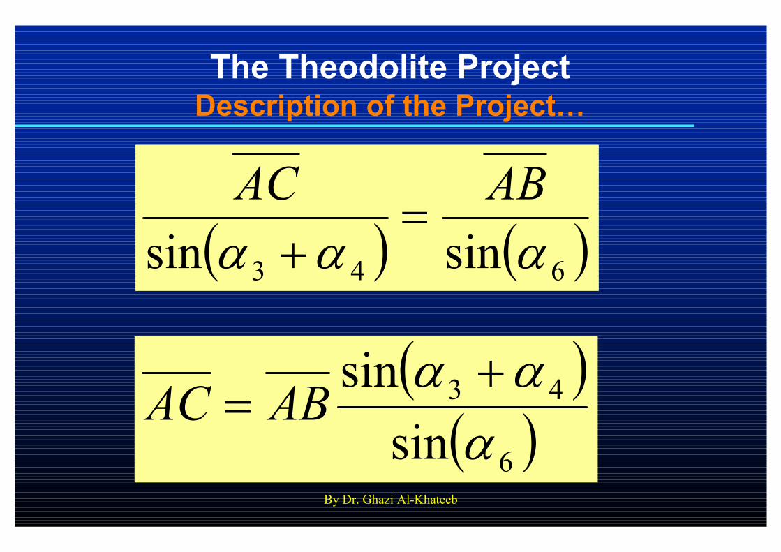
� Using the sine law, the distances AC and AD
can be computed as follows:
By Dr. Ghazi Al-Khateeb
The Theodolite ProjectDescription of the Project…
( ) ( )643 sinsin αααABAC
=+
( )( )6
43
sin
sin
ααα +
= ABAC

By Dr. Ghazi Al-Khateeb
The Theodolite ProjectDescription of the Project…
( ) ( )54 sinsin ααABAD
=
( )( )5
4
sin
sin
αα
ABAD =
By Dr. Ghazi Al-Khateeb
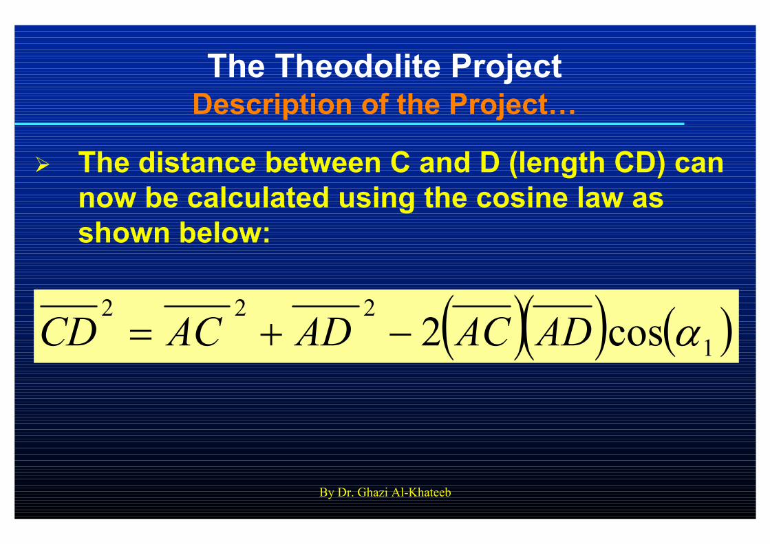
The Theodolite ProjectDescription of the Project…
� The distance between C and D (length CD) can
now be calculated using the cosine law as
shown below:
( )( ) ( )1222
cos2 αADACADACCD −+=
By Dr. Ghazi Al-Khateeb
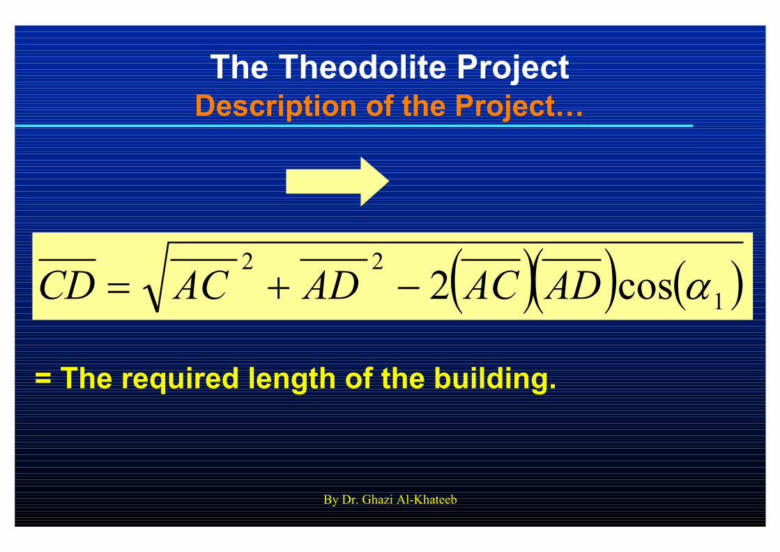
The Theodolite ProjectDescription of the Project…
( )( ) ( )122
cos2 αADACADACCD −+=
= The required length of the building.
By Dr. Ghazi Al-Khateeb
The Theodolite ProjectLaboratory Report
� Each student in each group is required to
submit a separate laboratory report done
according to the criteria and formatting
requirements discussed previously and
documented in the course syllabus and
policies that were handed to students at the
beginning of the semester.
� Laboratory reports are due one week from
the date of the exercise/project.

By Dr. Ghazi Al-Khateeb