Embed Size (px)
Citation preview
NCT Maintenance GISJesse Mourer
Advisor: Jan Wallgrün

Background
The Problem
Current Systems
Goals and Objectives
Methodology
Application Description
Project Time Line
Anticipated Results
Problems Encountered
Overview
NCT a 4,600 mile hiking trail◦ Bismarck North Dakota to Finger Lakes New York
Focusing on North Country Trail National Scenic trail◦ Butler County PA
My family has been very involved for several years in trail development and maintenance.◦ 280 miles in PA◦ 40 miles in Butler County◦ 4 miles adopted
Confronted with many of the maintenance problems encountered
Background
Many Hiking trails maintained by volunteer groups
Communicating with a large diverse group to perform maintenance
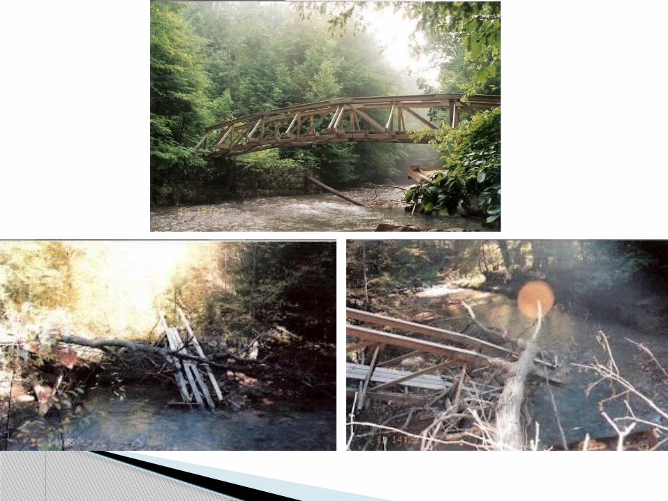
Small problems can turn into large ones with out immediate attention
No good system for hikers or volunteers to report problems
No way for hikers to know what they may encounter
The Problem
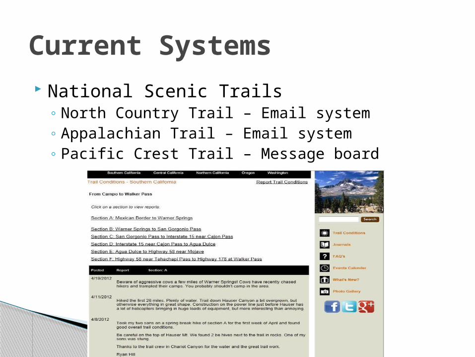
National Scenic Trails◦ North Country Trail – Email system◦ Appalachian Trail – Email system◦ Pacific Crest Trail – Message board
Current Systems
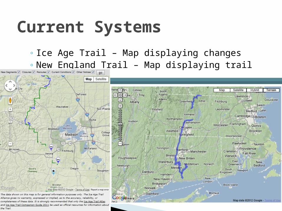
◦ Ice Age Trail – Map displaying changes◦ New England Trail – Map displaying trail
Current Systems
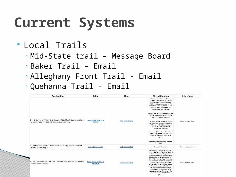
Local Trails◦ Mid-State trail – Message Board◦ Baker Trail – Email◦ Alleghany Front Trail - Email◦ Quehanna Trail - Email
Current Systems
Develop a web mapping app for NCT◦ Butler County
Allow hikers to report areas in need of maintenance
Immediately notify the volunteer responsible for maintenance in that area◦ Allows other volunteers to see the area of concern
Alert hikers of possible problems Increase the web presence of NCT
◦ Let the hikers feel vested in the trail
Goals and Objectives
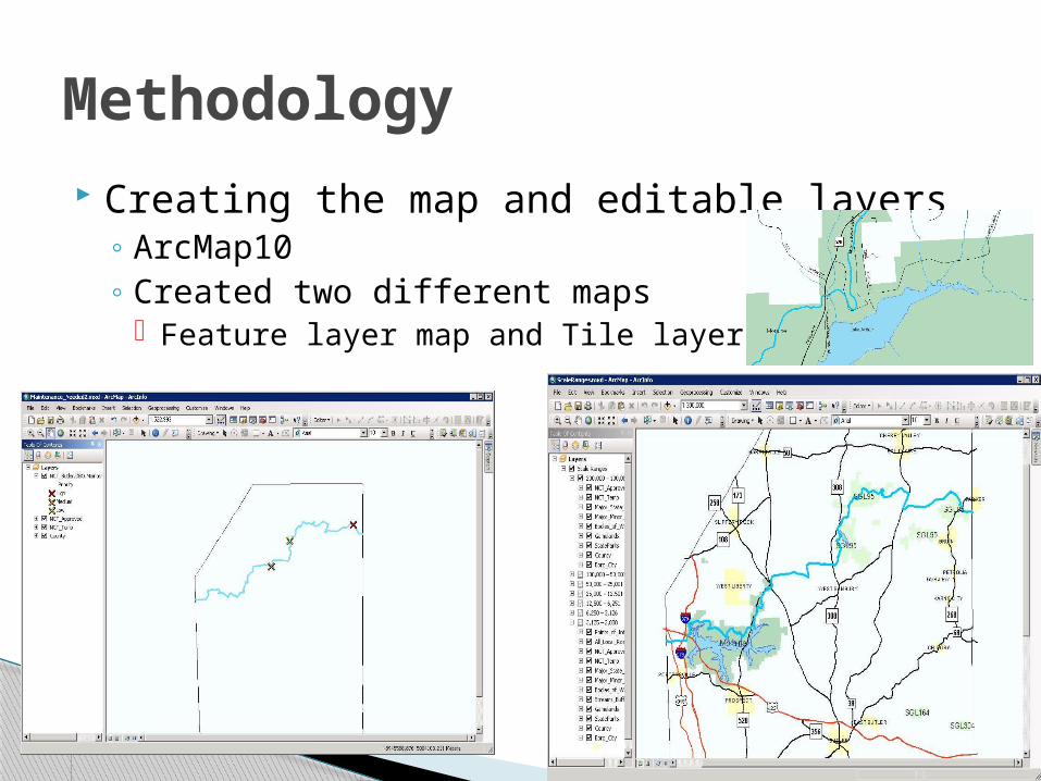
Creating the map and editable layers◦ ArcMap10◦ Created two different maps
Feature layer map and Tile layer map
Methodology

Publishing the Map◦ Flexviewer
Methodology
Create a web page for hosting the map
Beta testing for the mapping app◦ Will work with the butler chapter of the NCT
Questionnaire of users◦ Determine benefits and difficulties encountered
Rework the system
Re-launch the system
Questionnaire of users◦ Determine if problems have been addressed
Methodology
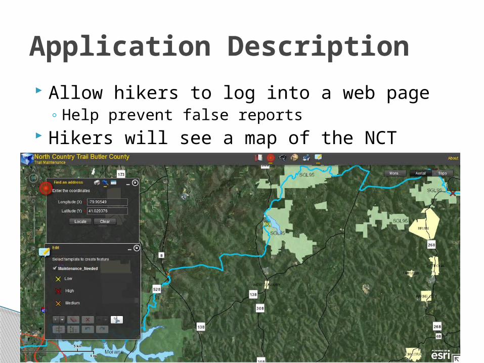
Allow hikers to log into a web page◦ Help prevent false reports
Hikers will see a map of the NCT
Application Description
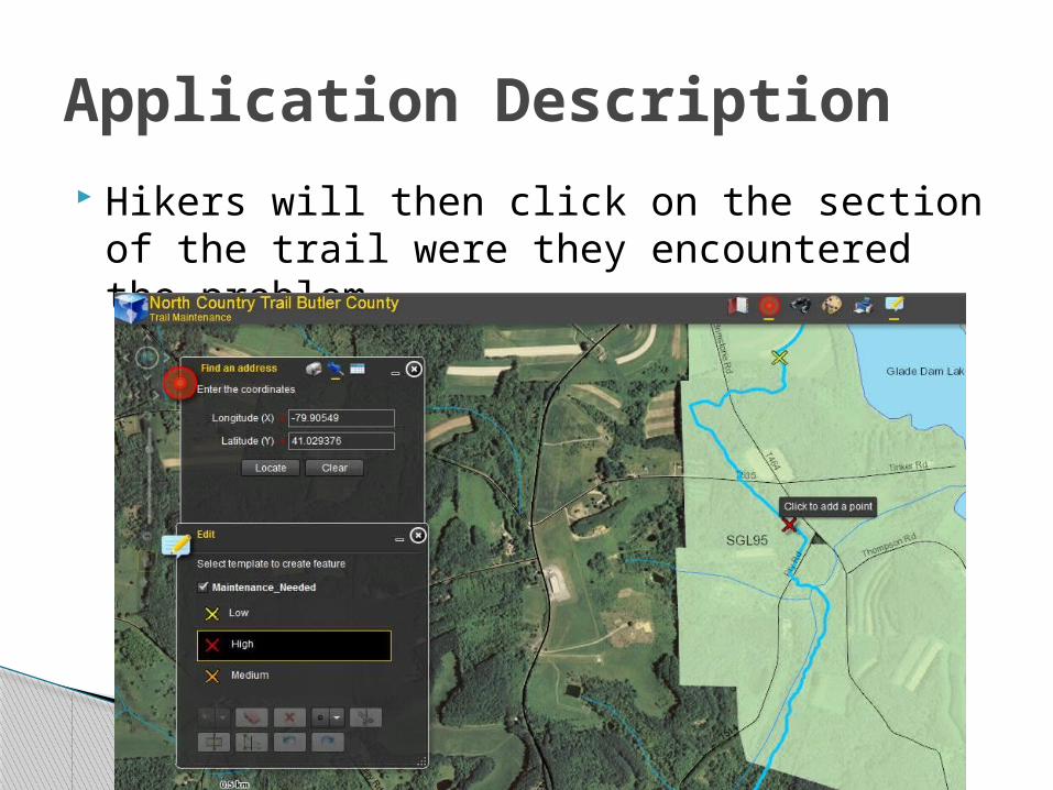
Hikers will then click on the section of the trail were they encountered the problem
Application Description
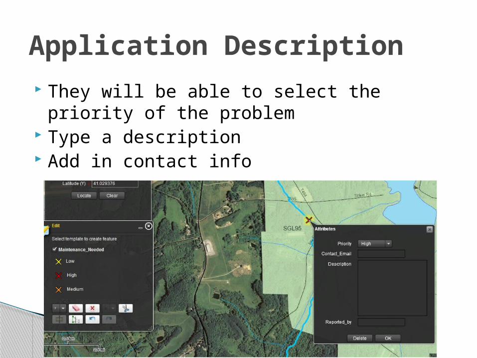
They will be able to select the priority of the problem
Type a description Add in contact info
Application Description
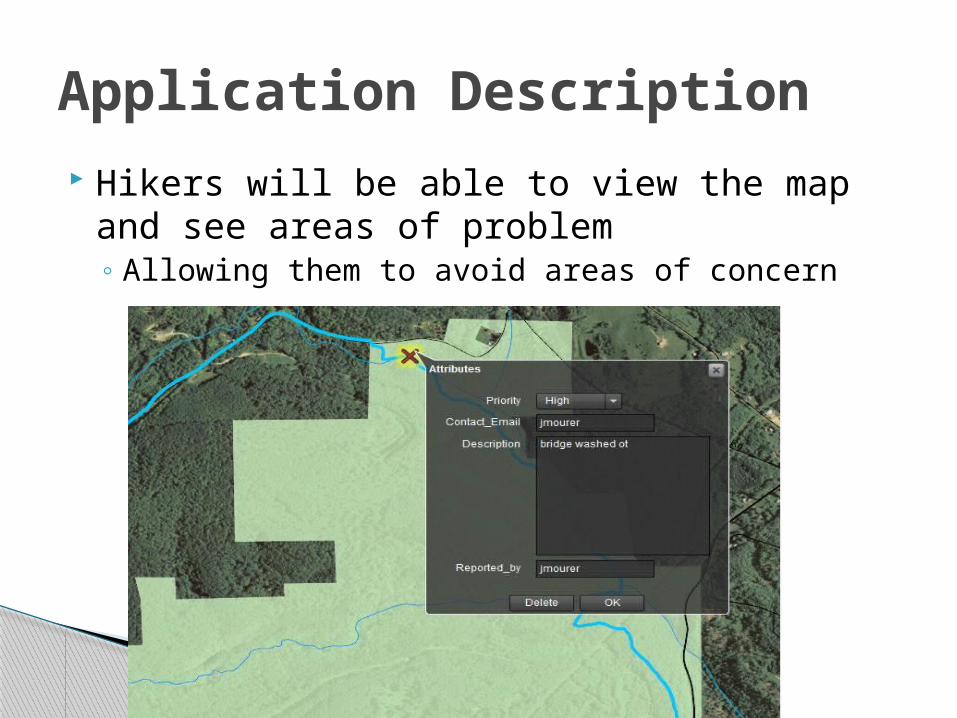
Hikers will be able to view the map and see areas of problem◦ Allowing them to avoid areas of concern
Application Description
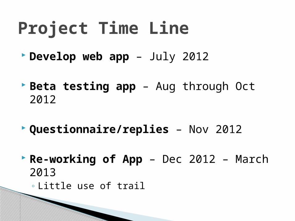
Develop web app – July 2012
Beta testing app – Aug through Oct 2012
Questionnaire/replies – Nov 2012
Re-working of App – Dec 2012 – March 2013◦ Little use of trail
Project Time Line
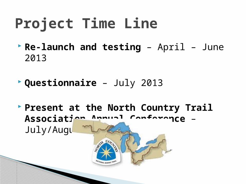
Re-launch and testing – April – June 2013
Questionnaire – July 2013
Present at the North Country Trail Association Annual Conference – July/August 2013
Project Time Line
Speed the process of trail maintenance More convenient way of reporting trail
problems Allow volunteers to determine the location
of problems Volunteers working on more than just their
sections Other chapters in PA and other states
utilizing the system
Anticipated Results
Problems Encountered E-mail trail adopters
◦ An automatic e-mail is sent ◦ Trouble doing this using flexviewer
Funding◦ Declining Funding for NPS
100 Million in 2011 Highest cut in Construction
◦ Declining Funding in Membership and Donations
Questions?
Thank you