Embed Size (px)
Citation preview
Jefferson County Kansas GIS 503 Delaware Street Oskaloosa, Kansas 66066 Web Map Development Contact: Kirk Webb, GIS Specialist ‐ 785‐863‐2173 [email protected] ______________________________________________________________________________
Step 1 ‐ Type in a name, address number, street name, street type or
city and click the 'Search' button or hit return. Note: All text and
dropdown boxes are optional. You can fill in only one field or all of
them to narrow your search for an address location.
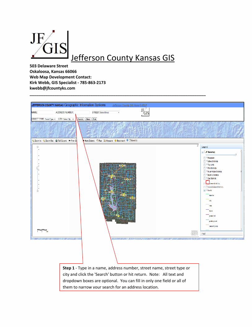
Step 2 ‐ A grid table will appear. Click on the Street Number of the address you are
looking for and a popup window will open at the location on the map. If the search was
broad there will be multiple addresses and you may have to use the scroll bar at the right
of the table to find the address you are looking for.
Step 3 ‐ Click the 'Zoom to' link in the popup window and the map will zoom in close to the location.
Use your mouse wheel to zoom out incrementally if you feel that it has zoomed too close to the
address point.
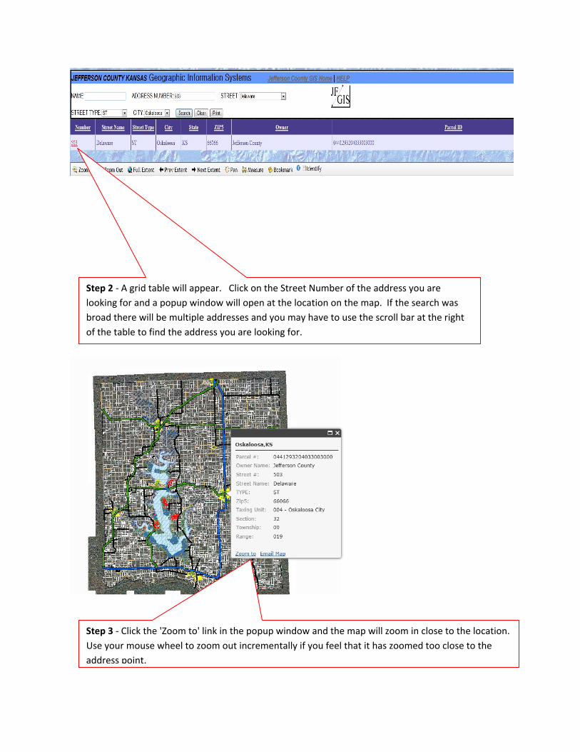
Identify Addresses and Parcels
You can identify addresses by simply checking the 'Identify' tool with your mouse then click on a red dot to
produce a popup that contains address, ownership and other information about the address. Uncheck the Identify
checkbox when you are finished to stop the pop‐ups from appearing.
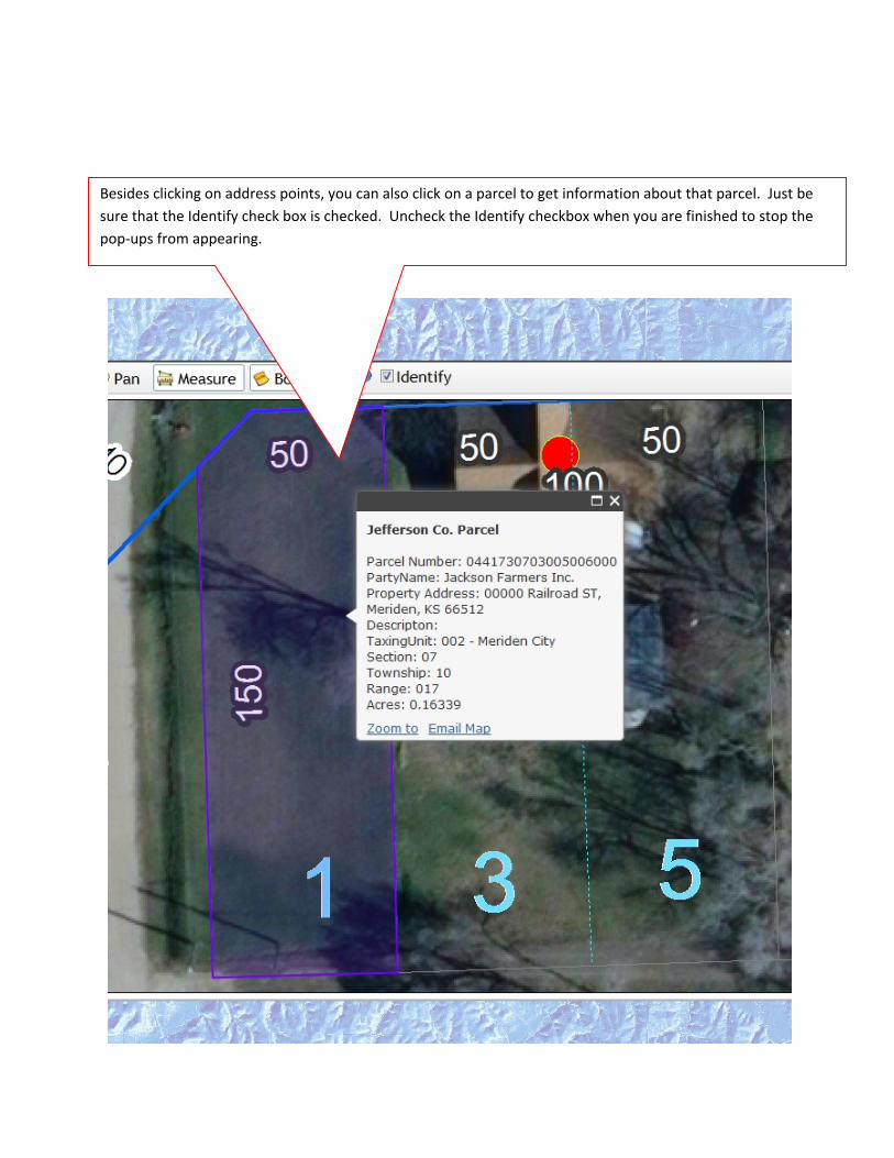
Besides clicking on address points, you can also click on a parcel to get information about that parcel. Just be
sure that the Identify check box is checked. Uncheck the Identify checkbox when you are finished to stop the
pop‐ups from appearing.
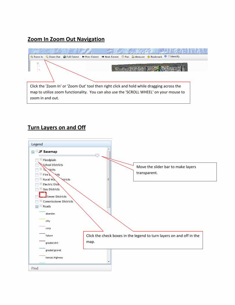
Zoom In Zoom Out Navigation
Turn Layers on and Off
Click the 'Zoom In' or 'Zoom Out' tool then right click and hold while dragging across the
map to utilize zoom functionality. You can also use the 'SCROLL WHEEL' on your mouse to
zoom in and out.
Click the check boxes in the legend to turn layers on and off in the
map.
Move the slider bar to make layers
transparent.
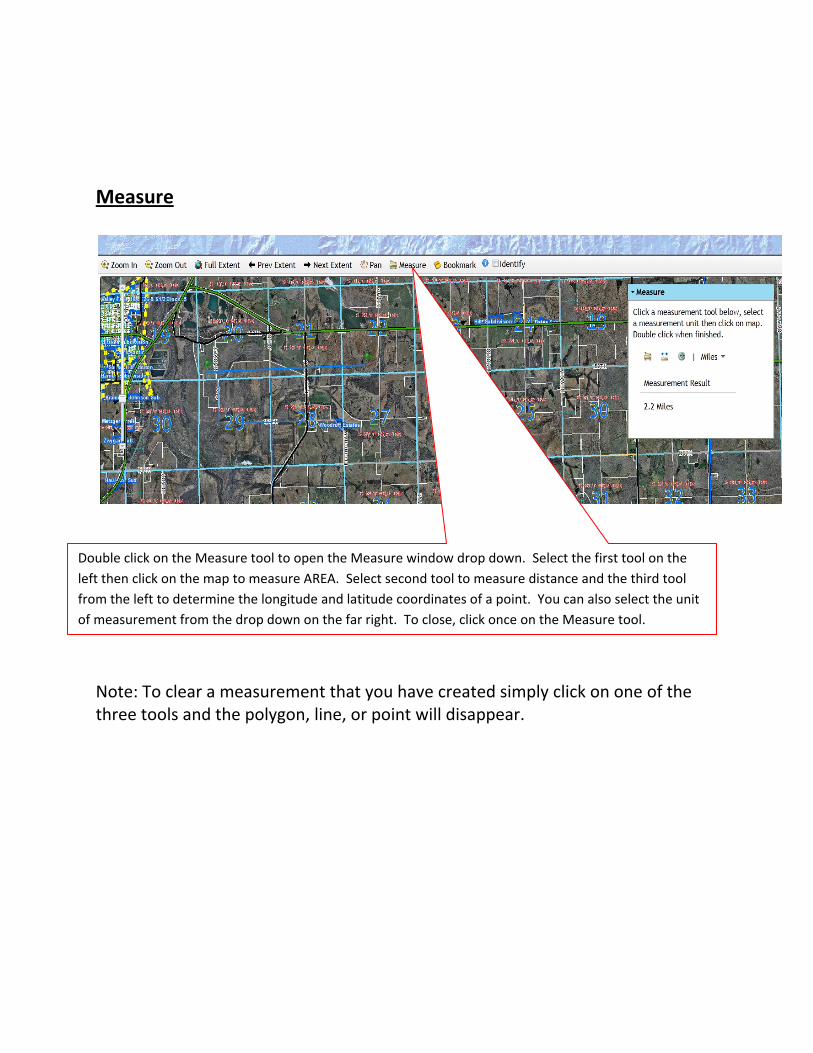
Measure
Note: To clear a measurement that you have created simply click on one of the three tools and the polygon, line, or point will disappear.
Double click on the Measure tool to open the Measure window drop down. Select the first tool on the
left then click on the map to measure AREA. Select second tool to measure distance and the third tool
from the left to determine the longitude and latitude coordinates of a point. You can also select the unit
of measurement from the drop down on the far right. To close, click once on the Measure tool.
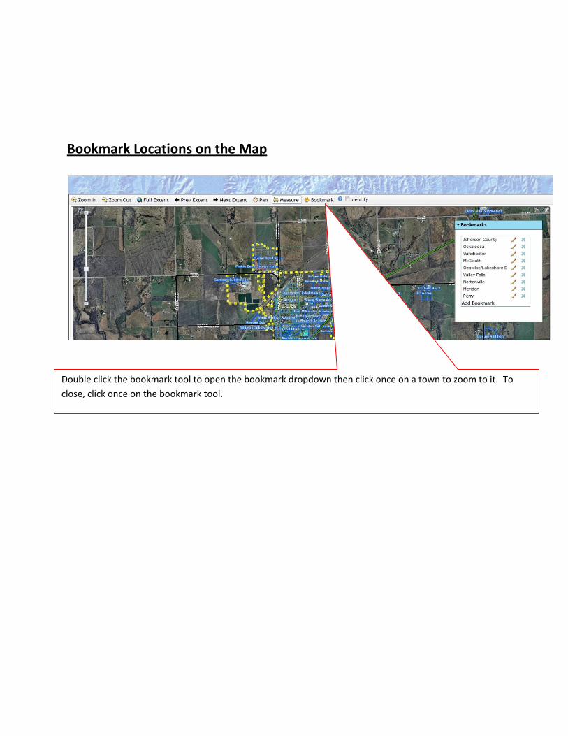
Bookmark Locations on the Map
Double click the bookmark tool to open the bookmark dropdown then click once on a town to zoom to it. To
close, click once on the bookmark tool.

Type in any keyword or number such
as a parcel number, name, or anything
associated with a parcel or address.
Then click the 'Search' button.
Next, click on a row in the table and the map will automatically
zoom to the location of the associated parcel.
Click on the 'Find' tab to open the
keyword search box.
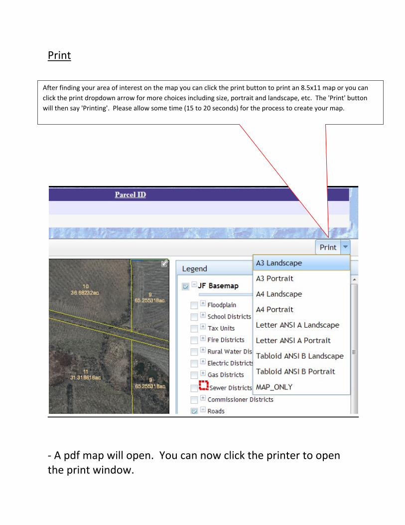
‐ A pdf map will open. You can now click the printer to open the print window.
After finding your area of interest on the map you can click the print button to print an 8.5x11 map or you can
click the print dropdown arrow for more choices including size, portrait and landscape, etc. The 'Print' button
will then say 'Printing'. Please allow some time (15 to 20 seconds) for the process to create your map.
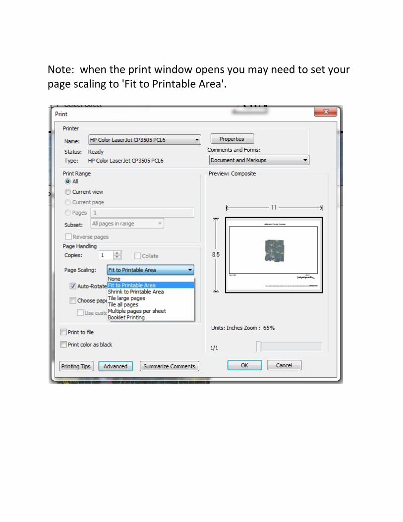
Note: when the print window opens you may need to set your page scaling to 'Fit to Printable Area'.