Embed Size (px)
Citation preview
E-ISSN: 2278–179X
JECET; December 12- February 2013; Vol.2.No.1, 114-128.
Journal of Environmental Science, Computer Science and
Engineering & Technology An International Peer Review E-3 Journal of Sciences and Technology
Available online at www.jecet.org
Environmental Science
Research Article
JECET; December 12- February 2013; Vol.2.No.1, 114-128 114
Water Status and Problems in India
C. P. Kumar
Scientist ’F’, National Institute of Hydrology, Roorkee – 247667 (Uttarakhand)
Received: 21 January 2013; Revised: 31 January 2013; Accepted: 5 February 2013
Abstract: The surface water and groundwater resources of the country play a major role in agriculture, hydropower generation, livestock production, industrial activities, forestry, fisheries, navigation, recreational activities, etc. Traditionally, India has been an agriculture-based economy. Hence, development of irrigation to increase agricultural production for making the country self-sustained and for poverty alleviation has been of crucial importance for the planners. The rainfall in India shows great variations, unequal seasonal distribution, still more unequal geographical distribution and the frequent departures from the normal. In view of the existing status of water resources and increasing demands of water for meeting the requirements of the rapidly growing population of the country as well as the problems that are likely to arise in future, a holistic, well-planned long-term strategy needed for sustainable water resources management in India.
Keywords: National Water Policy, Irrigation Commission, hydropower, National Commission, afforestation or deforestation, urbanization
INTRODUCTION
Water resources of a country constitute one of its vital assets. India receives annual precipitation of about 4000 km3. The rainfall in India shows very high spatial and temporal variability and paradox of the situation is that Mousinram near Cherrapunji, which receives the highest rainfall in the world, also suffers
Water... C. P. Kumar
JECET; December 12- February 2013; Vol.2.No.1, 114-128 115
from a shortage of water during the non-rainy season, almost every year. The total average annual flow per year for the Indian rivers is estimated as 1869 km3. The total annual replenishable groundwater resources are assessed as 431 km3. The annual utilizable surface water and groundwater resources of India are estimated as 690 km3 and 396 km3 per year respectively.
The surface water and groundwater resources of the country play a major role in agriculture, hydropower generation, livestock production, industrial activities, forestry, fisheries, navigation, recreational activities, etc. According to National Water Policy (2002) in the planning and operation of systems, water allocation priorities should be broadly as: (i) drinking water, (ii) irrigation, (iii) hydropower, (iv) ecology, (v) agro-industries and non-agricultural industries, and (vi) navigation.
Traditionally, India has been an agriculture-based economy. Hence, development of irrigation to increase agricultural production for making the country self-sustained and for poverty alleviation has been of crucial importance for the planners. Accordingly, the irrigation sector is assigned a very high priority in the 5-year plans. Giant schemes like the Bhakra Nangal, Hirakud, Damodar Valley, Nagarjunasagar, Rajasthan Canal project, etc. were taken up to increase irrigation potential and maximize agricultural production. Long-term planning has to account for the growth of population.
With rapid growing population and improving living standards, the pressure on our water resources is increasing and per capita availability of water resources is reducing day by day. Due to spatial and temporal variability in precipitation, the country faces the problem of flood and drought syndrome. Over-exploitation of groundwater is leading to reduction of low flows in the rivers, declining of the groundwater resources, and salt-water intrusion in aquifers of the coastal areas. Over canal-irrigation in some of the command areas has resulted in waterlogging and salinity problem. The quality of surface water and groundwater resources is also deteriorating because of increasing pollutant loads from point and non-point sources. The climate change expected to affect precipitation and water availability.
Rainfall and River System: Most of the rainfall in India takes place under the influence of South West monsoon between June to September except in Tamil Nadu where it is under the influence of North-East monsoon during October and November. The rainfall in India shows great variations, unequal seasonal distribution, still more unequal geographical distribution and the frequent departures from the normal. It generally exceeds 1000 mm in areas to the East of Longitude 78 degree. It extends to 2500 mm along almost the entire West Coast and Western Ghats and over most of Assam and Sub-Himalayan West Bengal. The Peninsula has large areas of rainfall less than 600 mm with pockets of even 500 mm.
India is a land of many rivers and mountains. Its geographical area of about 329 MHa is criss-crossed by a large number of small and big rivers, some of them figuring amongst the mighty rivers of the world. The rivers and mountains have a greater significance in the history of Indian cultural development, religious and spiritual life. It may not be an exaggeration to say that the rivers are the heart and soul of Indian life. India is a union of States with a federal set up. Politically, the country is divided into 28 States and 7 Union Territories. A major part of India’s population is rural and agriculturally oriented for whom the rivers are the source of their prosperity.
India blessed with many rivers. Twelve of them classified as major rivers whose total catchment area is 252.8 million hectare (MHa). Of the major rivers, the Ganga - Brahmaputra Meghana system is the biggest with catchment area of about 110 MHa which is more than 43 percent of the catchment area of all the major rivers in the country.
The other major rivers with catchment area more than 10 MHa are Indus (32.1 MHa), Godavari (31.3 MHa), Krishna (25.9 MHa) and Mahanadi (14.2 MHa). The catchment area of medium rivers is about 25 MHa and Subernarekha with 1.9 MHa catchment area is the largest river among the medium rivers in the country.
Water... C. P. Kumar
JECET; December 12- February 2013; Vol.2.No.1, 114-128 116
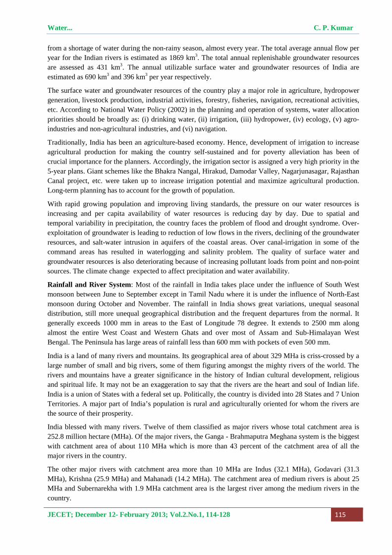
Average annual water availability in various river basins is given in the following table.
S. No.
Name of the River Basin Average annual availability (Cubic Km/Year)
1. Indus (up to Border) 73.31 2. (a) Ganga 525.02
(b) Brahmaputra ,Barak & Others 585.60 3. Godavari 110.54 4. Krishna 78.12 5. Cauvery 21.36 6. Pennar 6.32 7. East Flowing Rivers Between Mahanadi & Pennar 22.52 8. East Flowing Rivers Between Pennar and Kanyakumari 16.46 9. Mahanadi 66.88 10. Brahmani & Baitarni 28.48 11. Subernarekha 12.37 12. Sabarmati 3.81 13. Mahi 11.02 14. West Flowing Rivers of Kutch, Sabarmati including Luni 15.10 15. Narmada 45.64 16. Tapi 14.88 17. West Flowing Rivers from Tapi to Tadri 87.41 18. West Flowing Rivers from Tadri to Kanyakumari 113.53 19. Area of Inland drainage in Rajasthan desert NEGLIGIBLE 20. Minor River Basins draining into Bangladesh & Burma 31.00 Total 1869.35
Water... C. P. Kumar
JECET; December 12- February 2013; Vol.2.No.1, 114-128 117
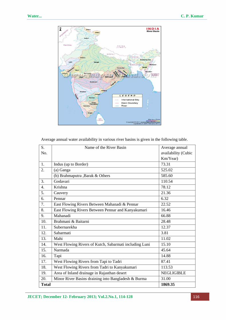
Man’s Influence on Hydrological Cycle: The hydrological cycle is being modified quantitatively and qualitatively in most of the river basins of our country as a result of the developmental activities such as construction of dams and reservoirs, land use change, irrigation, etc. Such human activities affecting the hydrological regime can be classified into four major groups: (i) activities which affect river runoff by diverting water from rivers, lakes, and reservoirs or by groundwater extraction, (ii) activities modifying the river channels, e.g. construction of reservoirs and ponds, levees and river training, channel dredging, etc. (iii) activities due to which runoff and other water balance components are modified due to impacts of basin surface e.g. agricultural practices, drainage of swamps, afforestation or deforestation, urbanization, etc. and (iv) activities which may induce climate changes at regional or global scale, e.g. modifying the composition of atmosphere by increasing the ‘greenhouse’ gases or by increased evaporation caused by large scale water projects. For understanding these effects appropriately, hydrological modelling approaches have to be adopted.
Water Resources Management in India: In view of the existing status of water resources and increasing demands of water for meeting the requirements of the rapidly growing population of the country as well as the problems that are likely to arise in future, a holistic, well-planned long-term strategy is needed for sustainable water resources management in India. The water resources management practices may be based on increasing the water supply and managing the water demand under the stressed water availability conditions. Data monitoring, processing, storage, retrieval and dissemination constitute the very important aspects of the water resources management. These data may be utilized not only for management but also for the planning and design of the water resources structures. In addition to these, now-a-days decision support systems are being developed for providing the necessary inputs to the decision makers for water resources management. Also, knowledge sharing, people’s participation, mass communication and capacity building are essential for effective water resources management. Some important aspects of such strategies are described as follows.
Water... C. P. Kumar
JECET; December 12- February 2013; Vol.2.No.1, 114-128 118
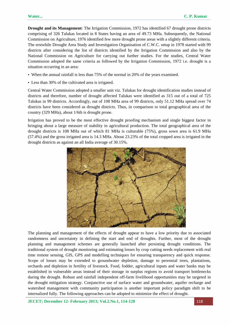
Drought and its Management: The Irrigation Commission, 1972 has identified 67 drought prone districts comprising of 326 Talukas located in 8 States having an area of 49.73 MHa. Subsequently, the National Commission on Agriculture, 1976 identified few more drought prone areas with a slightly different criteria. The erstwhile Drought Area Study and Investigation Organisation of C.W.C. setup in 1978 started with 99 districts after considering the list of districts identified by the Irrigation Commission and also by the National Commission on Agriculture for carrying out further studies. For the studies, Central Water Commission adopted the same criteria as followed by the Irrigation Commission, 1972 i.e. drought is a situation occurring in an area:
• When the annual rainfall is less than 75% of the normal in 20% of the years examined.
• Less than 30% of the cultivated area is irrigated.
Central Water Commission adopted a smaller unit viz. Talukas for drought identification studies instead of districts and therefore, number of drought affected Talukas were identified as 315 out of a total of 725 Talukas in 99 districts. Accordingly, out of 108 MHa area of 99 districts, only 51.12 MHa spread over 74 districts have been considered as drought districts. Thus, in comparison to total geographical area of the country (329 MHa), about 1/6th is drought prone.
Irrigation has proved to be the most effective drought proofing mechanism and single biggest factor in bringing about a large measure of stability in agricultural production. The total geographical area of the drought districts is 108 MHa out of which 81 MHa is culturable (75%), gross sown area is 61.9 MHa (57.4%) and the gross irrigated area is 14.3 MHa. About 23.23% of the total cropped area is irrigated in the drought districts as against an all India average of 30.15%.
The planning and management of the effects of drought appear to have a low priority due to associated randomness and uncertainty in defining the start and end of droughts. Further, most of the drought planning and management schemes are generally launched after persisting drought conditions. The traditional system of drought monitoring and estimating losses by crop cutting needs replacement with real time remote sensing, GIS, GPS and modelling techniques for ensuring transparency and quick response. Scope of losses may be extended to groundwater depletion, damage to perennial trees, plantations, orchards and depletion in fertility of livestock. Food, fodder, agricultural inputs and water banks may be established in vulnerable areas instead of their storage in surplus regions to avoid transport bottlenecks during the drought. Robust and rainfall independent off-farm livelihood opportunities may be targeted in the drought mitigation strategy. Conjunctive use of surface water and groundwater, aquifer recharge and watershed management with community participation is another important policy paradigm shift to be internalized fully. The following approaches can be adopted to minimize the effect of drought.
Water... C. P. Kumar
JECET; December 12- February 2013; Vol.2.No.1, 114-128 119
� Larger thrust for watershed development under Drought Prone Area Program.
� Dry land farming and water resource development. Instead of capital intensive engineering works for soil and moisture conservation, encourage simple and low cost structures which can be completed in a short time with the help of local skills.
� Dovetail crop production activities into the watershed project along with soil conservation activities.
� Take up large scale dry land farming demonstrations.
� Limited irrational and over exploitation of groundwater resources.
� Undertake research on the efficacy and economics of sprinkler and drip irrigation systems.
� Construction of suitable water harvesting structures for the purpose of conservation and optimal use of surface water and recharge of underground aquifers.
� Renovation and restoration of old tanks/farm ponds in the villages.
� Afforestation and pasture development.
� Animal husbandry and fodder development.
� People's participation in drought proofing.
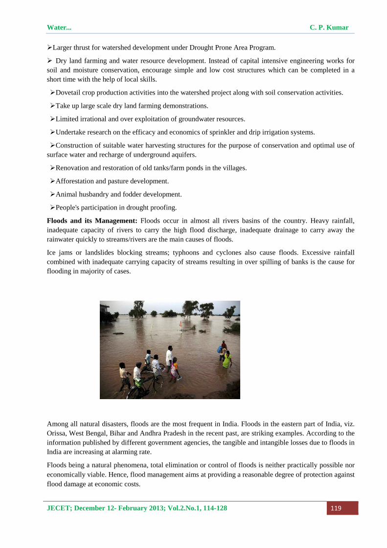
Floods and its Management: Floods occur in almost all rivers basins of the country. Heavy rainfall, inadequate capacity of rivers to carry the high flood discharge, inadequate drainage to carry away the rainwater quickly to streams/rivers are the main causes of floods.
Ice jams or landslides blocking streams; typhoons and cyclones also cause floods. Excessive rainfall combined with inadequate carrying capacity of streams resulting in over spilling of banks is the cause for flooding in majority of cases.
Among all natural disasters, floods are the most frequent in India. Floods in the eastern part of India, viz. Orissa, West Bengal, Bihar and Andhra Pradesh in the recent past, are striking examples. According to the information published by different government agencies, the tangible and intangible losses due to floods in India are increasing at alarming rate.
Floods being a natural phenomena, total elimination or control of floods is neither practically possible nor economically viable. Hence, flood management aims at providing a reasonable degree of protection against flood damage at economic costs.
Water... C. P. Kumar
JECET; December 12- February 2013; Vol.2.No.1, 114-128 120
In India, systematic planning for flood management commenced with the Five Year Plans, particularly with the launching of National Program of Flood Management in 1954. During the last few decades, different methods of flood protection, structural as well as non-structural, have been adopted in different states depending upon the nature of the problem and local conditions. Structural measures include storage reservoirs, flood embankments, drainage channels, anti-erosion works, channel improvement works, detention basins etc. and non-structural measures include flood forecasting, flood plain zoning, flood proofing, disaster preparedness etc.
Rashtriya Barh Ayog (RBA) constituted by the Government of India in 1976 carried out an extensive analysis to estimate the flood-affected area in the country. RBA in its report in 1980 has assessed the area liable to floods as 40 million hectares. It was determined by summing up the maximum area affected by floods in any one year in each state during the period from 1953 to 1978 for which data was analyzed by the Ayog. This sum has been corrected for the area that was provided with protection at that time and for the protected area that got affected due to failure of protection works during the period under analysis to arrive at the total area liable to floods in the country as per break-up given below.
State Area liable to Floods
(Million Ha.)
1. Andhra Pradesh 1.39
2. Assam 3.15
3. Bihar 4.26
4. Gujarat 1.39
5. Haryana 2.35
6. Himachal Pradesh 0.23
7. Jammu & Kashmir 0.08
8. Karnataka 0.02
9. Kerala 0.87
10. Madhya Pradesh 0.26
11. Maharashtra 0.23
12. Manipur 0.08
13. Meghalaya 0.02
14. Orissa 1.40
15. Punjab 3.70
16. Rajasthan 3.26
17. Tamil Nadu 0.45
18. Tripura 0.33
19. Uttar Pradesh 7.336
20. West Bengal 2.65
21. Delhi 0.05
22. Pondichery 0.01
Total 33.516
Water... C. P. Kumar
JECET; December 12- February 2013; Vol.2.No.1, 114-128 121
Flood forecasting has been recognized as one of the most important, reliable and cost-effective non-structural measures for flood management. Recognizing the crucial role it can play, Central Water Commission, Ministry of Water Resources has set up a network of forecasting stations covering all important flood prone inter-state rivers. The forecasts issued by these stations are used to alert the public and to enable the administrative and engineering agencies of the States/UT's to take appropriate measures. Central Water Commission started flood-forecasting services in 1958 with the setting up of its first forecasting station on Yamuna at Delhi Railway Bridge.
The National Flood Control Program was launched in 1954 for the first time, in the country. Since then, sizeable progress has been made in the flood protection measures. Nearly one third of the flood prone area had been afforded reasonable protection by 1976. During the period of two decades, considerable experience had also been gained in planning, implementation and performance of the flood protection and control measures. Advancement in technology had taken place not only in India but also in the world over. It, therefore, became necessary to conduct an in depth study of the country’s approach and programs of flood control measures and formulation of a flood control policy. It required detailed study of various problems concerned with flood control measures and aspects like soil conservation and afforestation. The Government of India, therefore, decided to set up the Rashtriya Barh Ayog (National Flood Commission) in 1976 to evolve a coordinated, integrated and scientific approach to the flood control problems in the country and to draw out a national plan fixing priorities for implementation in the future.
Though the RBA report was submitted in 1980 and accepted by Government, not much progress has been made in the implementation of its recommendations. As such, Ministry of Water Resources set up an Expert Committee in 2001 to review the implementation of recommendations of Rashtriya Barh Ayog (RBA). The Committee which was to identify the bottlenecks faced by the State Governments in its implementation and to examine and suggest measures for implementation of RBA recommendations for effective flood management in the country, has since submitted its report. The report of the committee is under examination in the Ministry of Water Resources.
Groundwater Resources: The behavior of groundwater in the Indian sub-continent is highly complicated due to the occurrence of diversified geological formations with considerable lithological and chronological variations, complex tectonic framework, climatological dissimilarities and various hydro-chemical conditions. Studies carried out over the years have revealed that aquifer groups in alluvial / soft rocks even transcend the surface basin boundaries. Broadly, two groups of rock formations have been identified depending on characteristically different hydraulics of groundwater, viz. porous formations and fissured formations.
The groundwater resources of the country have been estimated for freshwater based on the guidelines and recommendations of the GEC-1997. The total annual replenishable groundwater resources of the country have been estimated as 431 billion cubic meter (BCM) or km3. Keeping 35 BCM for natural discharge, the net annual groundwater availability for the entire country is 396 BCM. The annual groundwater draft is 243 BCM out of which 221 BCM is for irrigation use and 22 BCM is for domestic and industrial use.
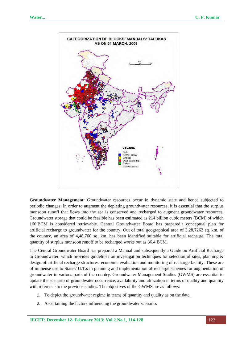
The stage of groundwater development in the country is 61%. The development of groundwater in different areas of the country has not been uniform. Highly intensive development of groundwater in certain areas in the country has resulted in over exploitation leading to decline in the levels of groundwater and sea water intrusion in coastal areas. Out of 5842 numbers of assessment administrative units (Blocks/Taluks/Mandals/Watershed), 802 units are “overexploited”, 169 units are “critical”, 523 units are “semi-critical”, 4277 units are “safe” and 71 units are “saline”.
Water... C. P. Kumar
JECET; December 12- February 2013; Vol.2.No.1, 114-128 122
Groundwater Management: Groundwater resources occur in dynamic state and hence subjected to periodic changes. In order to augment the depleting groundwater resources, it is essential that the surplus monsoon runoff that flows into the sea is conserved and recharged to augment groundwater resources. Groundwater storage that could be feasible has been estimated as 214 billion cubic meters (BCM) of which 160 BCM is considered retrievable. Central Groundwater Board has prepared a conceptual plan for artificial recharge to groundwater for the country. Out of total geographical area of 3,28,7263 sq. km. of the country, an area of 4,48,760 sq. km. has been identified suitable for artificial recharge. The total quantity of surplus monsoon runoff to be recharged works out as 36.4 BCM.
The Central Groundwater Board has prepared a Manual and subsequently a Guide on Artificial Recharge to Groundwater, which provides guidelines on investigation techniques for selection of sites, planning & design of artificial recharge structures, economic evaluation and monitoring of recharge facility. These are of immense use to States/ U.T.s in planning and implementation of recharge schemes for augmentation of groundwater in various parts of the country. Groundwater Management Studies (GWMS) are essential to update the scenario of groundwater occurrence, availability and utilization in terms of quality and quantity with reference to the previous studies. The objectives of the GWMS are as follows:
1. To depict the groundwater regime in terms of quantity and quality as on the date.
2. Ascertaining the factors influencing the groundwater scenario.
Water... C. P. Kumar
JECET; December 12- February 2013; Vol.2.No.1, 114-128 123
3. Identification of problems and issues pertaining to groundwater and provide suitable object oriented management strategy for implementation.
4. To update the existing database on groundwater regime.
5. To demarcate the groundwater worthy areas.
6. To recommend suitable follow up action/ remedial measures/ administrative and technical measures for the specific problems.
Priority is given to “Over-Exploited” and critical areas, hard rock area, coastal area, drought prone area, naturally contaminated area, urban area, water logged area etc.
Conjunctive Use of Surface Water and Groundwater: Large canal infrastructure network for providing irrigation has been the prime goal of the Government of India, since the first five-year plan, which continued up to seventh five-year plan. In some of the irrigation project commands such as Sarda Sahayak in UP, Gandak in Bihar, Chambal in Rajasthan, Nagarjuna Sagar in Andhra Pradesh, Ghataprabha and Malaprabha in Karnataka etc., problems of waterlogging are being faced. The main reason for excessive use of surface water as compared to groundwater is its much lower price for irrigation as compared to the cost incurred in using groundwater.
Waterlogging problems could be overcome if conjunctive use of surface water and groundwater is made. Groundwater utilization for irrigation in waterlogged areas can help to lower the groundwater table and reclaim the affected soil. Over-exploitation of groundwater in areas like Mehsana in Gujarat; parts of Meeurt and Varanasi districts in Uttar Pradesh, Coimbatore in Tamil Nadu and Karnal district in Haryana etc. have resulted in mining of groundwater. Many research workers have focused the causes of waterlogging. Several groundwater flow-modelling studies have focused on assessing the waterlogged areas and measures to control problems of waterlogging and salinization. It is desirable that the irrigation needs for fulfilling crop water requirements should be satisfied by judicious utilization of available canal water in conjunction with groundwater to keep the water table within the acceptable range. Thus, the optimal conjunctive use of the region’s surface and groundwater resources would help in minimizing the problems of waterlogging and groundwater mining.
Water Conservation and Rainwater Harvesting: Water conservation implies improving the availability of water through augmentation by means of storage of water in surface reservoirs, tanks, soil and groundwater zone. It emphasizes the need to modify the space and time availability of water to meet the demands. This concept also highlights the need for judicious use of water. There is a great potential for better conservation and management of water resources in its various uses. On the demand side, a variety of economic, administrative and community-based measures can help conserve water. Also, it is necessary to control the growth of population since large population is putting massive stress on all natural resources.
Since agriculture accounts for about 69% of all water withdrawn, the greatest potential for conservation lies in increasing irrigation efficiencies. Just a 10% improvement in irrigation efficiency could conserve enough water to double the amount available for drinking. In India, sprinkler irrigation is being adopted in Haryana, Rajasthan, Uttar Pradesh, Karnataka, Gujarat and Maharashtra. The use of sprinkler irrigation saves about 56% of water for the winter crops of bajra and jowar, while for cotton, the saving is about 30% as compared to the traditional gravity irrigation. An important supplement to conservation is to minimize the wastage of water. In urban water supply, for example, almost 30% of the water is wasted due to leakages, carelessness, etc. while most metro cities face deficit in supply of water. It is, therefore, imperative to prevent wastage. In industries also, there is a scope for economy in the use of water. Prices of water for all uses should be fixed, keeping in mind its economic value, control of wastage, and the ability
Water... C. P. Kumar
JECET; December 12- February 2013; Vol.2.No.1, 114-128 124
of users to pay. As water is becoming scarcer, pricing will be an important factor in avoiding wastage and ensuring optimal use.
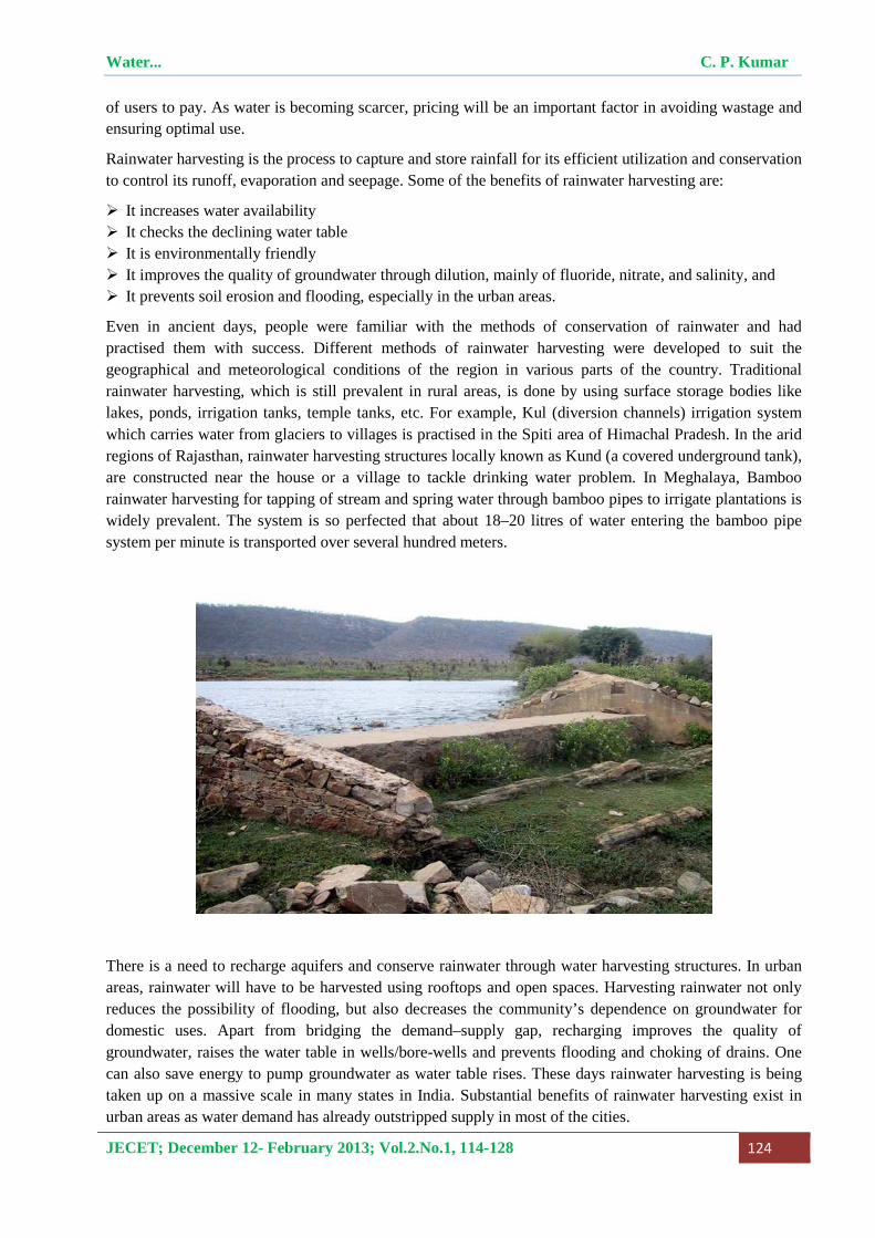
Rainwater harvesting is the process to capture and store rainfall for its efficient utilization and conservation to control its runoff, evaporation and seepage. Some of the benefits of rainwater harvesting are:
� It increases water availability � It checks the declining water table � It is environmentally friendly � It improves the quality of groundwater through dilution, mainly of fluoride, nitrate, and salinity, and � It prevents soil erosion and flooding, especially in the urban areas.
Even in ancient days, people were familiar with the methods of conservation of rainwater and had practised them with success. Different methods of rainwater harvesting were developed to suit the geographical and meteorological conditions of the region in various parts of the country. Traditional rainwater harvesting, which is still prevalent in rural areas, is done by using surface storage bodies like lakes, ponds, irrigation tanks, temple tanks, etc. For example, Kul (diversion channels) irrigation system which carries water from glaciers to villages is practised in the Spiti area of Himachal Pradesh. In the arid regions of Rajasthan, rainwater harvesting structures locally known as Kund (a covered underground tank), are constructed near the house or a village to tackle drinking water problem. In Meghalaya, Bamboo rainwater harvesting for tapping of stream and spring water through bamboo pipes to irrigate plantations is widely prevalent. The system is so perfected that about 18–20 litres of water entering the bamboo pipe system per minute is transported over several hundred meters.
There is a need to recharge aquifers and conserve rainwater through water harvesting structures. In urban areas, rainwater will have to be harvested using rooftops and open spaces. Harvesting rainwater not only reduces the possibility of flooding, but also decreases the community’s dependence on groundwater for domestic uses. Apart from bridging the demand–supply gap, recharging improves the quality of groundwater, raises the water table in wells/bore-wells and prevents flooding and choking of drains. One can also save energy to pump groundwater as water table rises. These days rainwater harvesting is being taken up on a massive scale in many states in India. Substantial benefits of rainwater harvesting exist in urban areas as water demand has already outstripped supply in most of the cities.

Water... C. P. Kumar
JECET; December 12- February 2013; Vol.2.No.1, 114-128 125
Water Quality Conservation: India is endowed with diverse geological formations from oldest achaeans to recent alluviums and characterized by varying climatic conditions in different parts of the country. The natural chemical content of groundwater is influenced by depth of the soils and sub-surface geological formations through which groundwater remains in contact. In general, greater part of the country, groundwater is of good quality and suitable for drinking, agricultural or industrial purposes. Groundwater in shallow aquifers is generally suitable for use for different purposes and is mainly of Calcium Bicarbonate and mixed type. However, other types of water are also available including Sodium-Chloride water. The quality in deeper aquifers also varies from place to place and is generally found suitable for common uses. There is salinity problem in the coastal tracts and high incidence of fluoride, arsenic, iron & heavy metals etc. in isolated pockets have also been reported. The main groundwater quality problems in India are as follows.
Salinity: Salinity in groundwater can be of broadly categorized into two types, i.e. inland salinity and coastal salinity
Inland Salinity : Inland salinity in groundwater is prevalent mainly in the arid and semi-arid regions of Rajasthan, Haryana, Punjab and Gujarat, Uttar Pradesh, Delhi, Andhra Pradesh, Maharashtra, Karnataka and Tamil Nadu. There are several places in Rajasthan and southern Haryana where EC values of groundwater is quite high making water non-potable. In some areas of Rajasthan and Gujarat, groundwater salinity is so high that the well water is directly used for salt manufacturing by solar evaporation. Inland salinity is also caused due to practice of surface water irrigation without consideration of groundwater status. The gradual rise of groundwater levels with time has resulted in water logging and heavy evaporation in semi-arid regions lead to salinity problem in command areas.
Coastal Salinity: The Indian subcontinent has a dynamic coast line of about 7500 km length. It stretches from Rann of Kutch in Gujarat to Konkan and Malabar coast to Kanyakumari in the south to northwards along the Coromandal coast to Sunderbans in West Bengal. The western coast is characterized by wide continental shelf and is marked by backwaters and mud flats while the eastern coast has a narrow continental shelf and is characterized by deltaic and estuarine land forms. Groundwater in coastal areas occurs under unconfined to confined conditions in a wide range of unconsolidated and consolidated formations. Normally, saline water bodies owe their origin to entrapped sea water (connate water), sea water ingress, leachates from navigation canals constructed along the coast, leachates from salt pans etc. In India, salinity problems have been observed in a number of places in most of the coastal states of the country. Problem of salinity ingress has been conspicuously noticed in Minjur area of Tamil Nadu and Mangrol – Chorwad- Porbander belt along the Saurashtra coast. Under Hydrology Project (Phase-II), National Institute of Hydrology, Roorkee has taken-up a purpose driven study related to seawater intrusion in Minsar river basin in Porbandar district of Gujarat.
Water... C. P. Kumar
JECET; December 12- February 2013; Vol.2.No.1, 114-128 126
Fluoride: 85% of rural population of the country uses groundwater for drinking and domestic purposes. High concentration of fluoride in groundwater beyond the permissible limit of 1.5 mg/l poses the health problem. The occurrences of fluoride beyond permissible limit (> 1.5 mg/l) has been observed based on the chemical analysis of water samples collected from the groundwater observation wells.
Arsenic: The occurrence of arsenic in groundwater was first reported in 1980 in West Bengal. In West Bengal, 79 blocks in 8 districts have arsenic beyond the permissible limit of 0.05 mg/l. The most affected districts are on the eastern side of Bhagirathi river in the districts of Malda, Murshidabad, Nadia, North 24 Parganas and South 24 Parganas and western side of the districts of Howrah, Hugli and Bardhman. The occurrence of arsenic in groundwater is mainly in the intermediate aquifers upto the depth of 100 m. The deeper aquifers are free from arsenic contamination. Apart from West Bengal, arsenic contamination in groundwater has been found in the states of Bihar, Chhattisgarh, Uttar Pradesh and Assam. Arsenic in groundwater has been reported in 15 districts In Bihar, 9 districts in U.P. and one district each in Chhatisgarh and Assam states. The occurrence of arsenic in the states of Bihar, West Bengal and Uttar Pradesh is in alluvium formation but in the state of Chhattisgarh, it is in the volcanic rocks exclusively confined to N-S trending Dongargarh-Kotri ancient rift zone. It has also been reported in Dhemaji district of Assam.
Iron: High concentration of iron (>1.0 mg/l) in groundwater has been observed in more than 1.1 lakh habitations in the country. Groundwater contaminated by iron has been reported from the states of Andhra Pradesh, Assam, Bihar, Chhattisgarh, Goa, Gujarat, Haryana, J&K, Jharkhand, Karnataka, Kerala, Madhya Pradesh, Maharashtra, Manipur, Meghalaya, Orissa, Punjab, Rajasthan, Tamil Nadu, Tripura, Uttar Pradesh, West Bengal and UT of Andaman & Nicobar.
Nitrate: Nitrate is a very common constituent in the groundwater, especially in shallow aquifers. The source is mainly from anthropogenic activities. High concentration of nitrate in water beyond the permissible limit of 45 mg/l causes health problems. High nitrate concentration in groundwater in India has been found in almost all hydrogeological formations.
Implementation of water pollution prevention strategies and restoration of ecological systems are integral components of all development plans. To preserve our water and environment, we need to make systematic changes in the way we grow our food, manufacture the goods, and dispose off the waste. In India, agriculture is the biggest user and polluter of water. If pollution by agriculture is reduced, it would improve water quality and would also eliminate cost incurred for treatment of diseases. Like all other inputs, there is an optimal quantity of fertilizer for given conditions and excess application does not improve the crop yield. Pricing of fertilizers and pesticides as well as appropriate legislation to regulate their use will also go a long way in stopping indiscriminate use. Industries need to carefully treat their waste discharges. Manufacturers may reduce water pollution by reusing materials and chemicals and switching over to less toxic alternatives. Industrial symbiosis, in which the unusable wastes from one product/firm become the input for another, is an attractive solution. Also, there is a need to encourage reductions or replacement of toxic chemicals, possibly through fiscal measures.
Urban Water Supply and Sanitation: The urban water supply and sanitation sector in the country is suffering from inadequate levels of service, an increasing demand-supply gap, poor sanitary conditions and deteriorating financial and technical performance. Supply of water is highly erratic and unreliable. Transmission and distribution networks are old and poorly maintained, and generally of a poor quality. Consequently physical losses are typically high, ranging from 25 to over 50 per cent. Low pressures and intermittent supplies allow back siphoning, which results in contamination of water in the distribution network. Water is typically available for only 2-8 hours a day in most Indian cities. The situation is even worse in summer when water is available only for a few minutes, sometimes not at all.
Water... C. P. Kumar
JECET; December 12- February 2013; Vol.2.No.1, 114-128 127
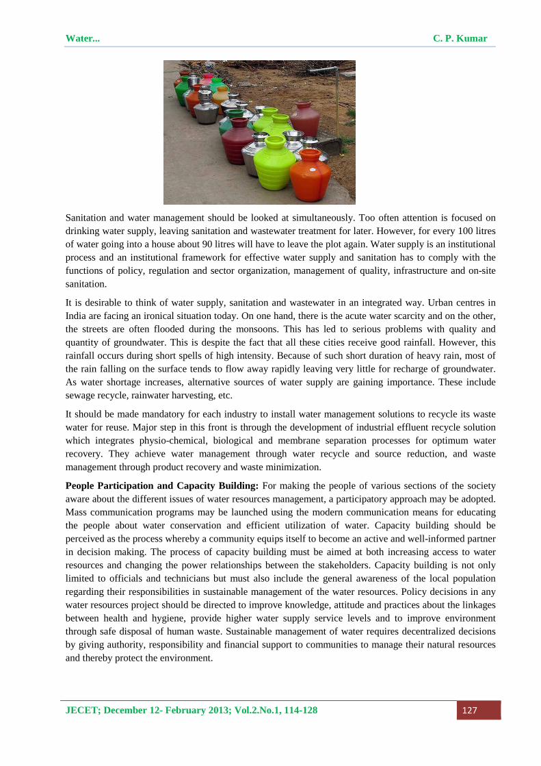
Sanitation and water management should be looked at simultaneously. Too often attention is focused on drinking water supply, leaving sanitation and wastewater treatment for later. However, for every 100 litres of water going into a house about 90 litres will have to leave the plot again. Water supply is an institutional process and an institutional framework for effective water supply and sanitation has to comply with the functions of policy, regulation and sector organization, management of quality, infrastructure and on-site sanitation.
It is desirable to think of water supply, sanitation and wastewater in an integrated way. Urban centres in India are facing an ironical situation today. On one hand, there is the acute water scarcity and on the other, the streets are often flooded during the monsoons. This has led to serious problems with quality and quantity of groundwater. This is despite the fact that all these cities receive good rainfall. However, this rainfall occurs during short spells of high intensity. Because of such short duration of heavy rain, most of the rain falling on the surface tends to flow away rapidly leaving very little for recharge of groundwater. As water shortage increases, alternative sources of water supply are gaining importance. These include sewage recycle, rainwater harvesting, etc.
It should be made mandatory for each industry to install water management solutions to recycle its waste water for reuse. Major step in this front is through the development of industrial effluent recycle solution which integrates physio-chemical, biological and membrane separation processes for optimum water recovery. They achieve water management through water recycle and source reduction, and waste management through product recovery and waste minimization.
People Participation and Capacity Building: For making the people of various sections of the society aware about the different issues of water resources management, a participatory approach may be adopted. Mass communication programs may be launched using the modern communication means for educating the people about water conservation and efficient utilization of water. Capacity building should be perceived as the process whereby a community equips itself to become an active and well-informed partner in decision making. The process of capacity building must be aimed at both increasing access to water resources and changing the power relationships between the stakeholders. Capacity building is not only limited to officials and technicians but must also include the general awareness of the local population regarding their responsibilities in sustainable management of the water resources. Policy decisions in any water resources project should be directed to improve knowledge, attitude and practices about the linkages between health and hygiene, provide higher water supply service levels and to improve environment through safe disposal of human waste. Sustainable management of water requires decentralized decisions by giving authority, responsibility and financial support to communities to manage their natural resources and thereby protect the environment.
Water... C. P. Kumar
JECET; December 12- February 2013; Vol.2.No.1, 114-128 128
REFERENCES
1. Amrit Deorah, Water Problem in India and How to Solve it, http://www.ezilon.com/articles/articles/1766/1/Water-Problem-in-India-and-How-to-Solve-it , Published 06/12/2006.
2. Central Ground Water Board, Dynamic Ground Water Resources of India (as on 31 March 2009), Ministry of Water Resources, Government of India, November 2011, 225p.
3. Ministry of Water Resources (Government of India) Website, http://mowr.gov.in/
4. National Water Policy, Ministry of Water Resources, New Delhi, 2002.
5. Rakesh Kumar, R. D. Singh, K. D. Sharma, Water Resources of India, Current Science, Vol. 89, No. 5, 10 September 2005, pp. 794-811.
*Correspondence Author: C. P. Kumar; Scientist ’F’, National Institute of Hydrology,
Roorkee – 247667 (Uttarakhand)


![[moves] - the king of fighters · 202 Shiki Koto Tsuki You 707 Shiki KomaHoFuri 75 Shiki Kai 114 Shiki Ara Kami 114 Shiki Ara Kami 128 Shiki Kono Kizu 114 Shiki Ara Kami / 128 Shiki](https://img.pdfslide.us/doc/110x75/5f7edeebb088ea730e4997f5/moves-the-king-of-fighters-202-shiki-koto-tsuki-you-707-shiki-komahofuri-75.jpg)


![L'Illustration. [September 2, 1899. Vol. 114, No. 2949.]](https://img.pdfslide.us/doc/110x75/617179595f1df711e1701c80/lillustration-september-2-1899-vol-114-no-2949.jpg)