Embed Size (px)
Citation preview
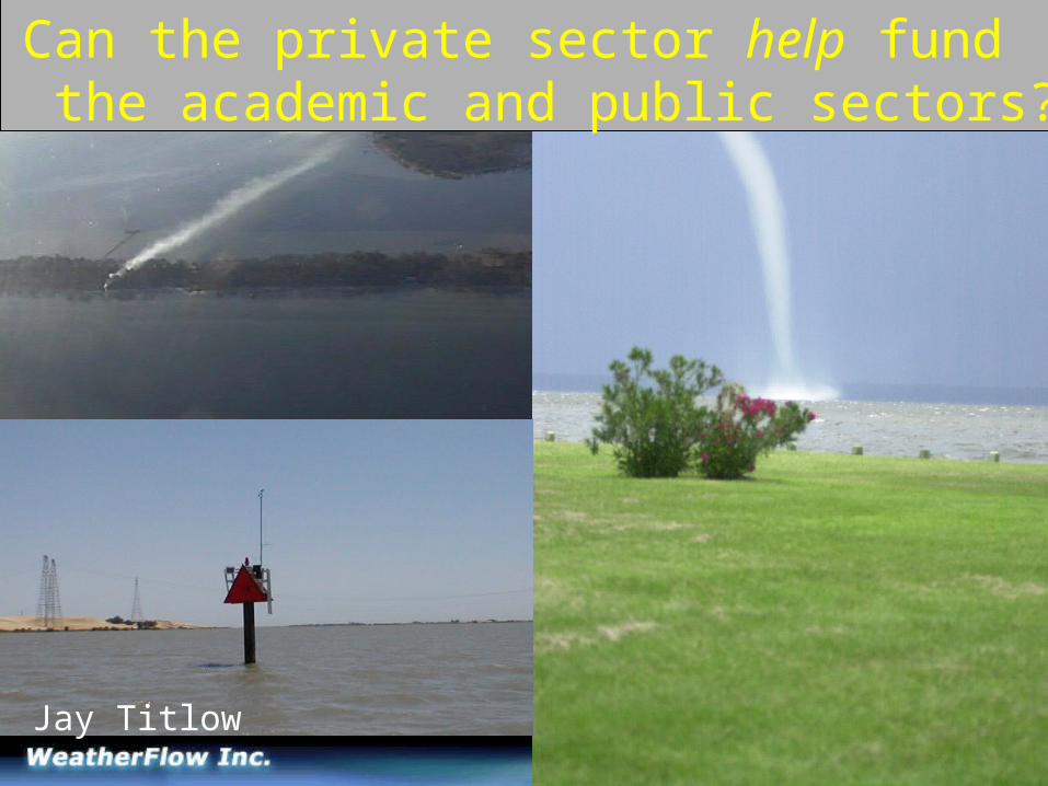
Jay Titlow
Can the private sector help fund the academic and public sectors?
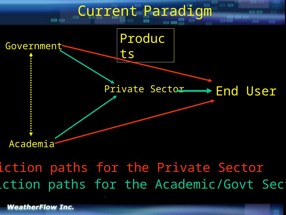
Current Paradigm
End UserPrivate Sector
Academia
GovernmentProducts
Friction paths for the Private SectorFriction paths for the Academic/Govt Sectors
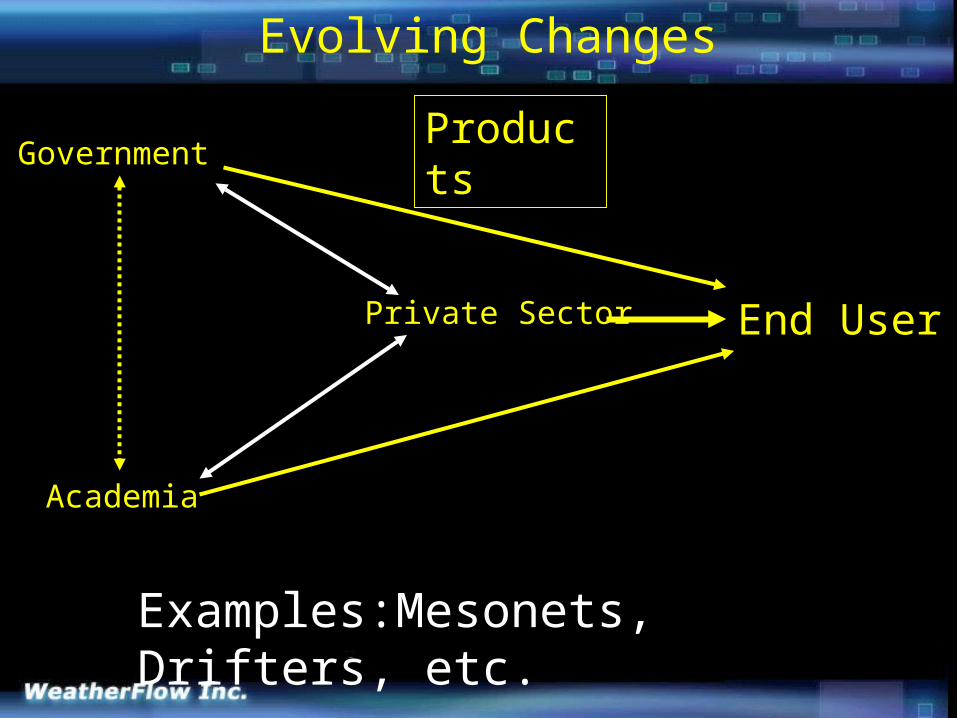
Evolving Changes
GovernmentProducts
End UserPrivate Sector
Academia
Examples:Mesonets, Drifters, etc.
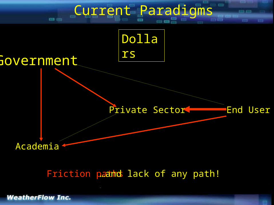
Current Paradigms
Mot
End UserPrivate Sector
Academia
Government
Dollars
Friction paths …and lack of any path!
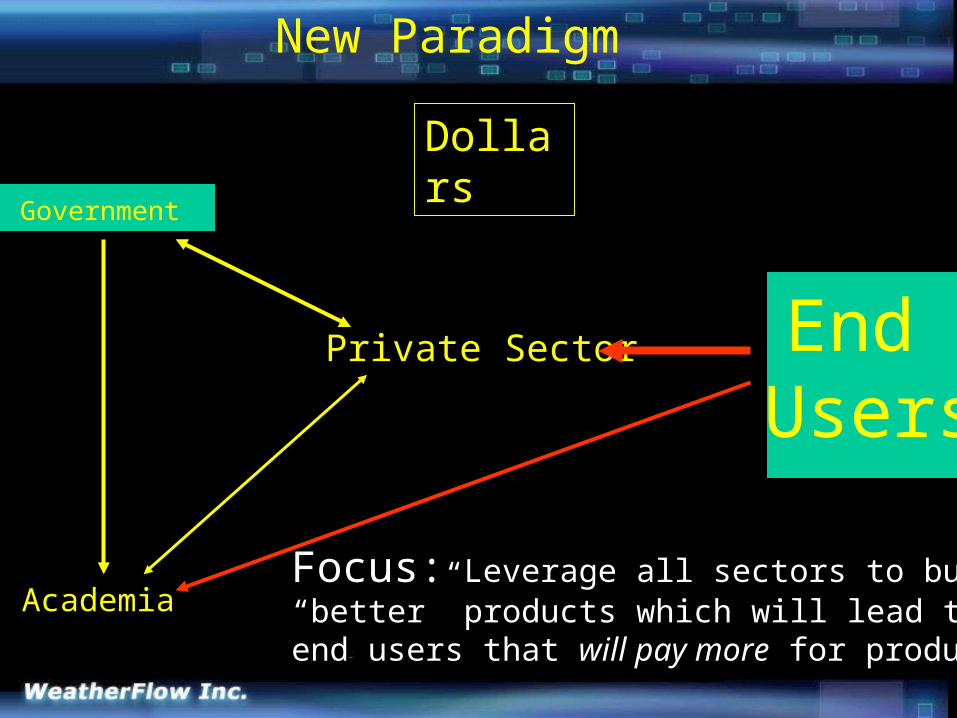
New Paradigm
End Users
Private Sector
Academia
Government
Dollars
Focus: Leverage all sectors to build“better” products which will lead to moreend users that will pay more for products.
Started in 1987, A national mesonet and marine forecast service geared for the recreational sailor.
Key: Since inception, charges for data when competition is free.
…so, just how can the private sector help fund the academic and public sectors?
Case Study: WeatherFlow’s Potential Contributions
Data source for NWS (sites are located where existing sensors are not).
Public/academic benefits:A) Mesonet
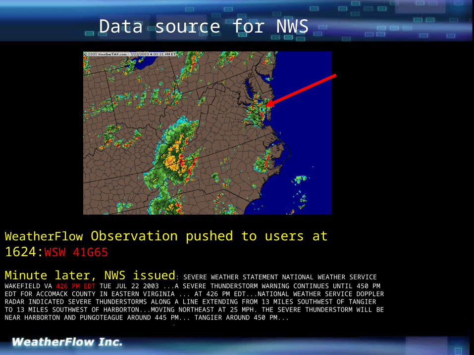
WeatherFlow Observation pushed to users at 1624:WSW 41G65
Minute later, NWS issued: SEVERE WEATHER STATEMENT NATIONAL WEATHER SERVICE WAKEFIELD VA 426 PM EDT TUE JUL 22 2003 ...A SEVERE THUNDERSTORM WARNING CONTINUES UNTIL 450 PM EDT FOR ACCOMACK COUNTY IN EASTERN VIRGINIA ... AT 426 PM EDT...NATIONAL WEATHER SERVICE DOPPLER RADAR INDICATED SEVERE THUNDERSTORMS ALONG A LINE EXTENDING FROM 13 MILES SOUTHWEST OF TANGIER TO 13 MILES SOUTHWEST OF HARBORTON...MOVING NORTHEAST AT 25 MPH. THE SEVERE THUNDERSTORM WILL BE NEAR HARBORTON AND PUNGOTEAGUE AROUND 445 PM... TANGIER AROUND 450 PM...
Data source for NWS
Data source for NWS (sites are located where existing sensors are not).
Public/academic benefits:A) Mesonet
Data source for Academia (cost of accessing data from mesonet a fraction of cost of going solo).
Data source for USCG SAR activities.

“Coast Guard Group Hampton Roads is responsible for maritime search planning in Virginia's tidal waters and 200 miles out to sea. The SAR (Search and Rescue) controllers have a need for wind data in order to predict the area to which a distressed craft might drift while disabled. I believe that your sites offer a significant advantage to these controllers within lower Chesapeake Bay. The NOAA PORTS system is useful, but its sensor locations are oriented toward the needs of larger ships. Most Coast Guard SAR cases involve recreational craft in areas of the bay not normally used by commercial shipping. Your sensors give our people a much better picture of local winds.” Norman G Heller US Coast Guard Auxiliary Command Duty Officer Group Hampton Roads
Data for Search & Rescue
Data source for NWS (sites are located where existing sensors are not).
Public/academic benefits:A) Mesonet
Data source for Academia (cost of accessing data from mesonet a fraction of cost of going solo).
Data source for USCG SAR activities.
Data source for DHS,EM.

WITHOUT
WITH
HPAC OutputOct 22, 2002 @ 6pm
NWS only
NWS and WeatherFlow
* Place sites where they will reveal the intricacies of the mesoclimate, not at the nearest airport.
DATA for Homeland Defense

Data source for NWS (sites are located where existing sensors are not).
Evolving portal for new instruments.
Public/academic benefits:A) Mesonet
Employment sources for grads.
Data source for Academia (cost of accessing data from mesonet a fraction of cost of going solo).
Data source for USCG SAR activities.
Data source for DHS,EM.
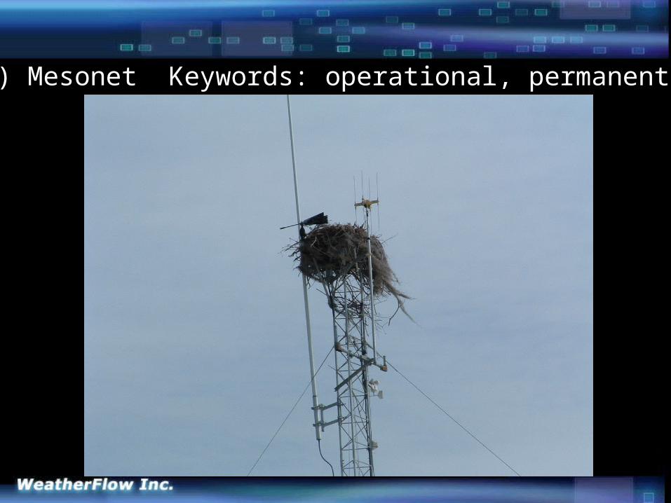
A) Mesonet Keywords: operational, permanent.
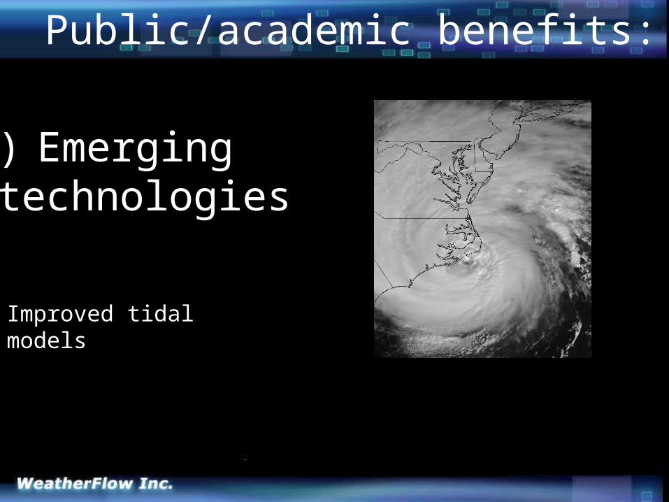
Public/academic benefits:
B) Emerging technologies
Improved tidal models
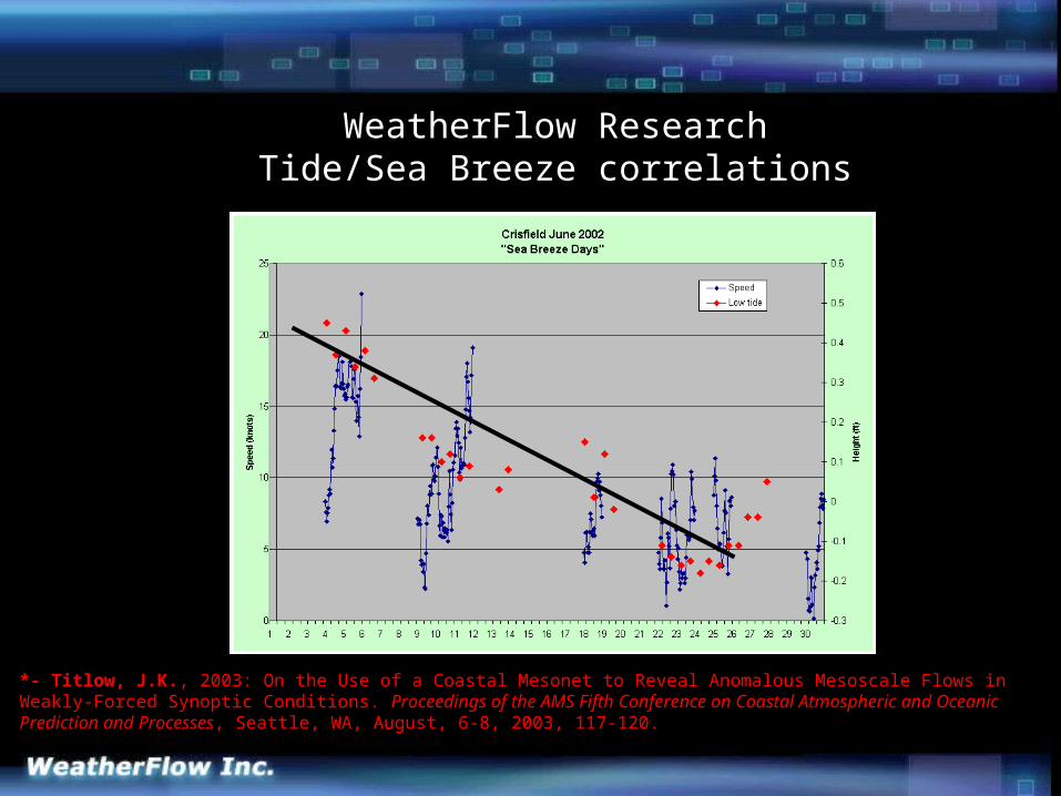
*- Titlow, J.K., 2003: On the Use of a Coastal Mesonet to Reveal Anomalous Mesoscale Flows in Weakly-Forced Synoptic Conditions. Proceedings of the AMS Fifth Conference on Coastal Atmospheric and Oceanic Prediction and Processes , Seattle, WA, August, 6-8, 2003, 117-120.
WeatherFlow ResearchTide/Sea Breeze correlations

Public/academic benefits:
B) Emerging technologies
Mesoscale meteorological models
Improved tidal models
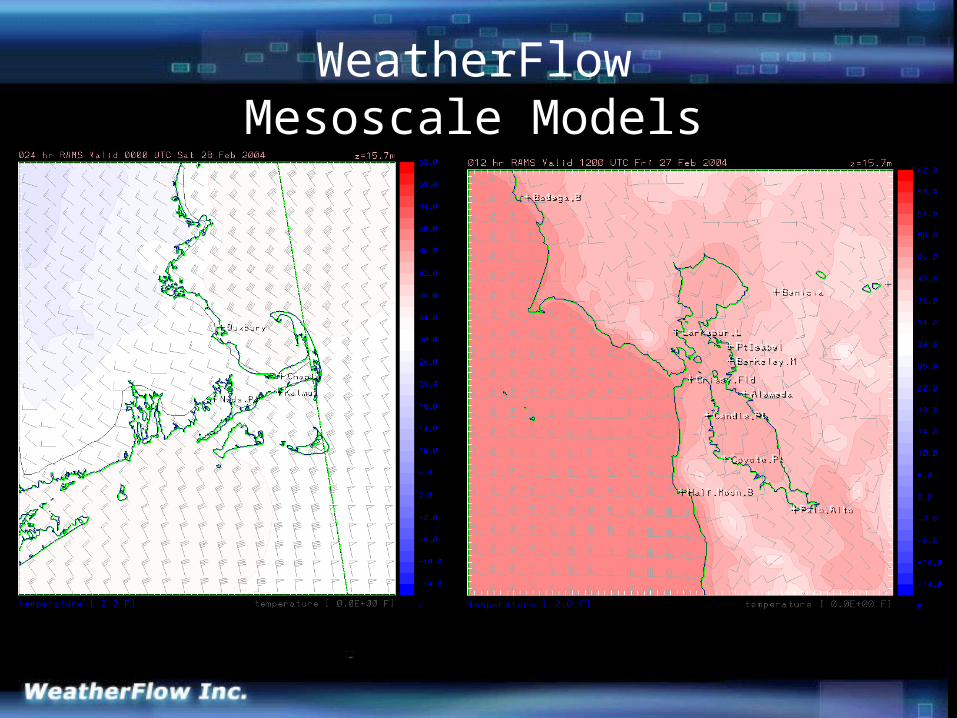
WeatherFlowMesoscale Models
Public/academic benefits:
B) Emerging technologies
Mesoscale meteorological models
NOS Estuary Modeling (Sea Nettle maps in Chesapeake Bay.)
Improved tidal models
Remote sensing advancements (QuikSCAT, SeaWIFS)
Improved wave modeling (NOAA WaveWatch III)
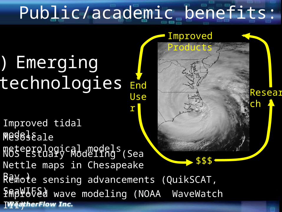
EndUser Research
Improved Products
$$$
Public/academic benefits:
B) Emerging delivery methods:Web sites: Raise visibility of academic/ government sensors ( e.g. NOAA PORTS).
Web sites: Provide an instant captive audience for research projects (e.g., NOS Sea Nettle maps in Chesapeake Bay).
E-mail/text message alerts: Important variables are pushed to clients(e.g., wind alerts sent to Chesapeake Bay Bridge Tunnel Police trigger closures and transport restrictions) .

Page Views
Portal for emerging technologies
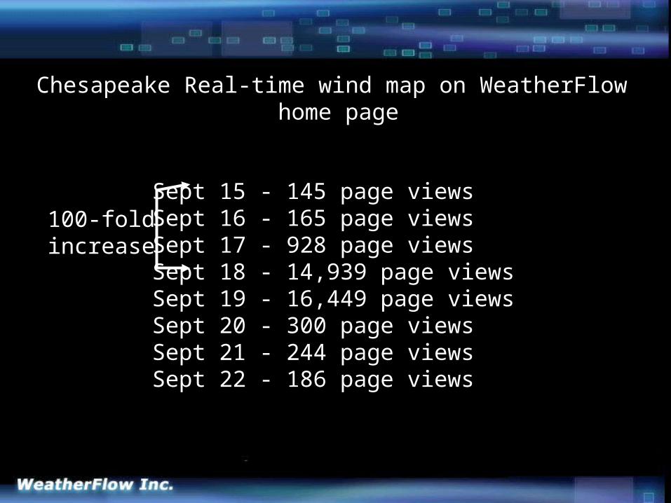
Sept 15 - 145 page viewsSept 16 - 165 page viewsSept 17 - 928 page viewsSept 18 - 14,939 page viewsSept 19 - 16,449 page viewsSept 20 - 300 page viewsSept 21 - 244 page viewsSept 22 - 186 page views
Sept 15 - 145 page viewsSept 16 - 165 page viewsSept 17 - 928 page viewsSept 18 - 14,939 page viewsSept 19 - 16,449 page viewsSept 20 - 300 page viewsSept 21 - 244 page viewsSept 22 - 186 page views
Sept 15 - 145 page viewsSept 16 - 165 page viewsSept 17 - 928 page viewsSept 18 - 14,939 page viewsSept 19 - 16,449 page viewsSept 20 - 300 page viewsSept 21 - 244 page viewsSept 22 - 186 page views
Sept 15 - 145 page viewsSept 16 - 165 page viewsSept 17 - 928 page viewsSept 18 - 14,939 page viewsSept 19 - 16,449 page viewsSept 20 - 300 page viewsSept 21 - 244 page viewsSept 22 - 186 page views
Sept 15 - 145 page viewsSept 16 - 165 page viewsSept 17 - 928 page viewsSept 18 - 14,939 page viewsSept 19 - 16,449 page viewsSept 20 - 300 page viewsSept 21 - 244 page viewsSept 22 - 186 page views
Chesapeake Real-time wind map on WeatherFlow home page
100-foldincrease
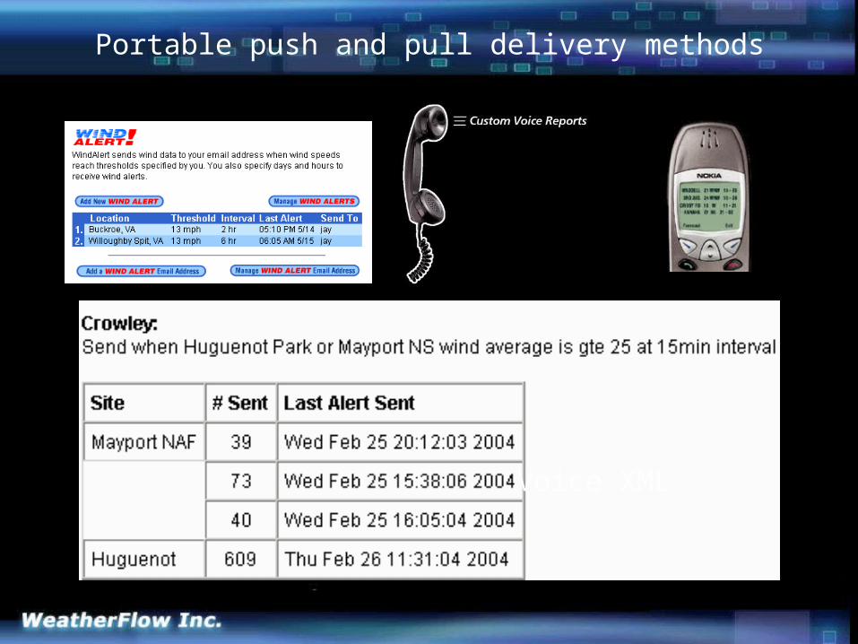
Voice XML
Portable push and pull delivery methods
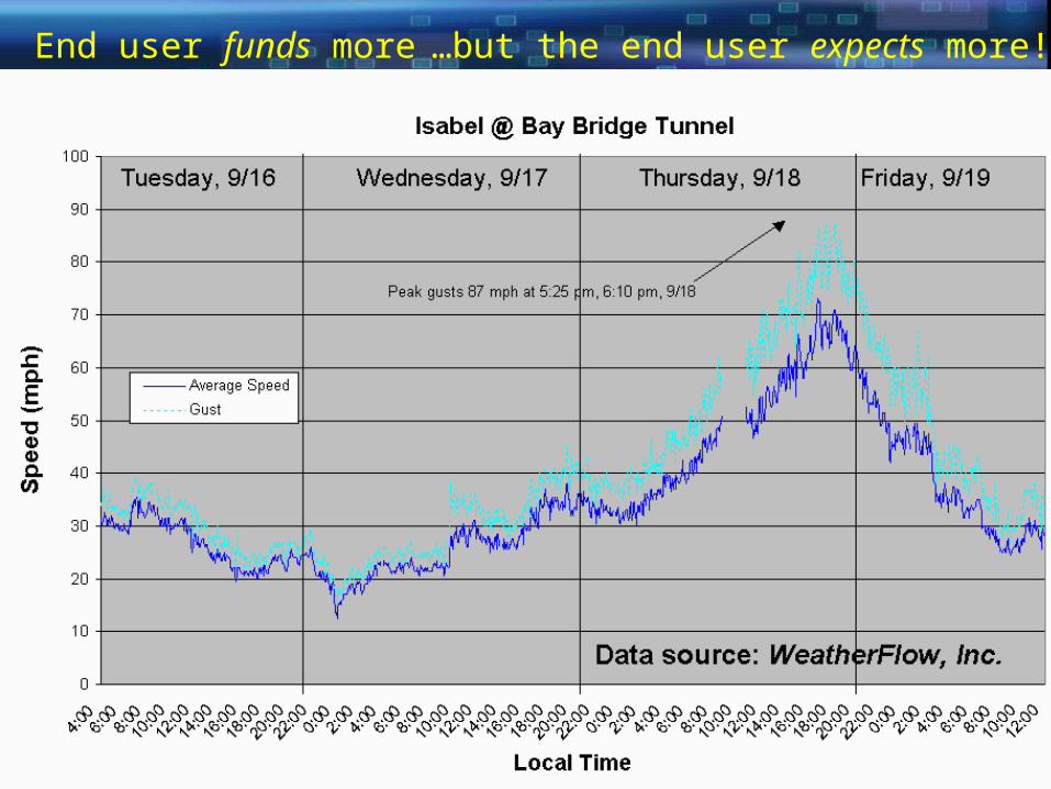
End user funds more …but the end user expects more!
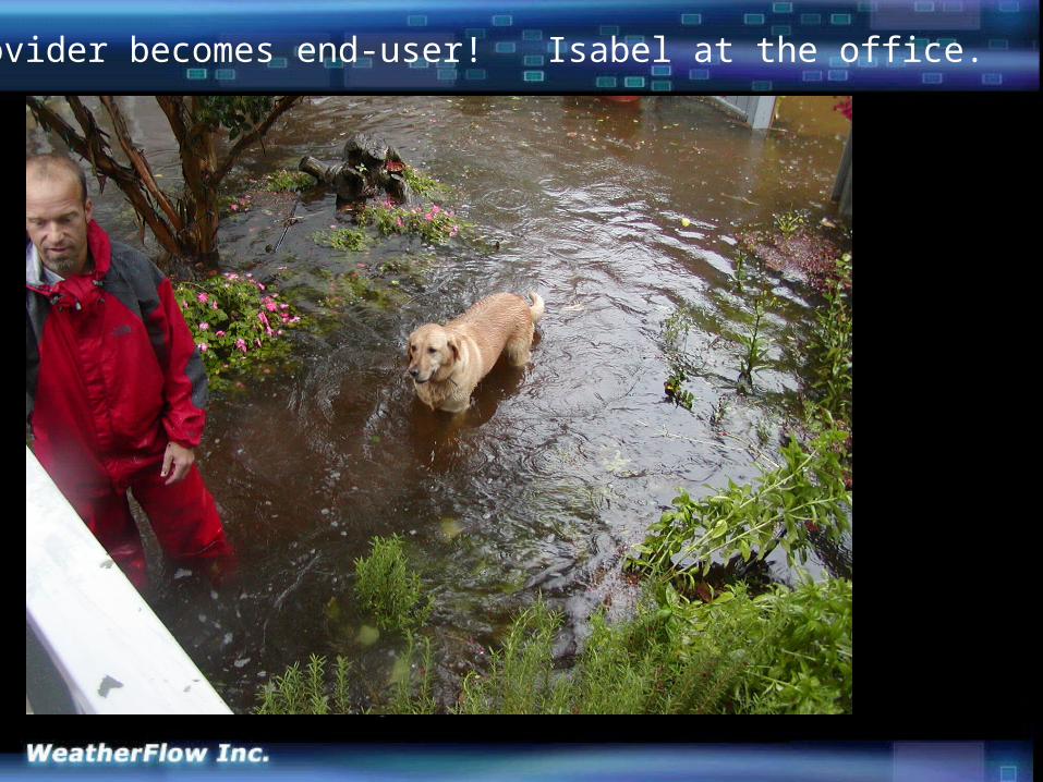
Provider becomes end-user! Isabel at the office.