Embed Size (px)
Citation preview
PICTURE ROCKS MULTIMODAL TRANSPORTATION STUDY Technical Advisory Committee (TAC) Meeting No. 2 Notes
Tuesday, January 21, 2014
10:00 am - 11:30 am
MEETING ATTENDEES: Matt Carpenter, ADOT Multimodal Planning (Project Manager)
Jeff Martinelli, Saguaro National Park
Bill Strickler, Pima County Department of Transportation-Traffic
Paki Rico, Arizona Department of Transportation
Katharine Hardy, Pima Association of Governments/Regional Transportation Authority
James McGinnis, Pima Association of Governments/Regional Transportation Authority
Consultant Team: Brent Crowther, Kimley-Horn and Associates
Matt Farmen, Kimley-Horn and Associates
MEETING PURPOSE: Review Contents of Working Paper No. 1
Solicit TAC input on Working Paper No. 1
Provide update on Public Outeach Events
Discuss schedule and next steps
Meeting Summary:
1. INTRODUCTIONS
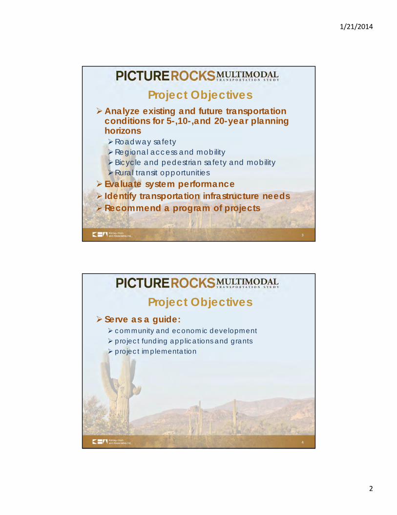
B. Crowther reviewed the study purpose. He stated that the planning horizons are 5, 10 and 20 year with respect:
transportation safety, multimodal mobility, and transit,.
The document will be used as a guide to recommend projects for funding and to provide project justification.
2. Working Paper No. 1 Overview
The purpose of Working Paper No. 1 is to document transportation needs through a review of current data, previous
transit analysis, crash studies, census data and environmental analysis. Other key input are stakeholder interviews and
public input through the upcoming public open house which will be held in February.
B. Crowther reviewed information on the PowerPoint slides (slides are attached to meeting notes).
Current and Future Conditions
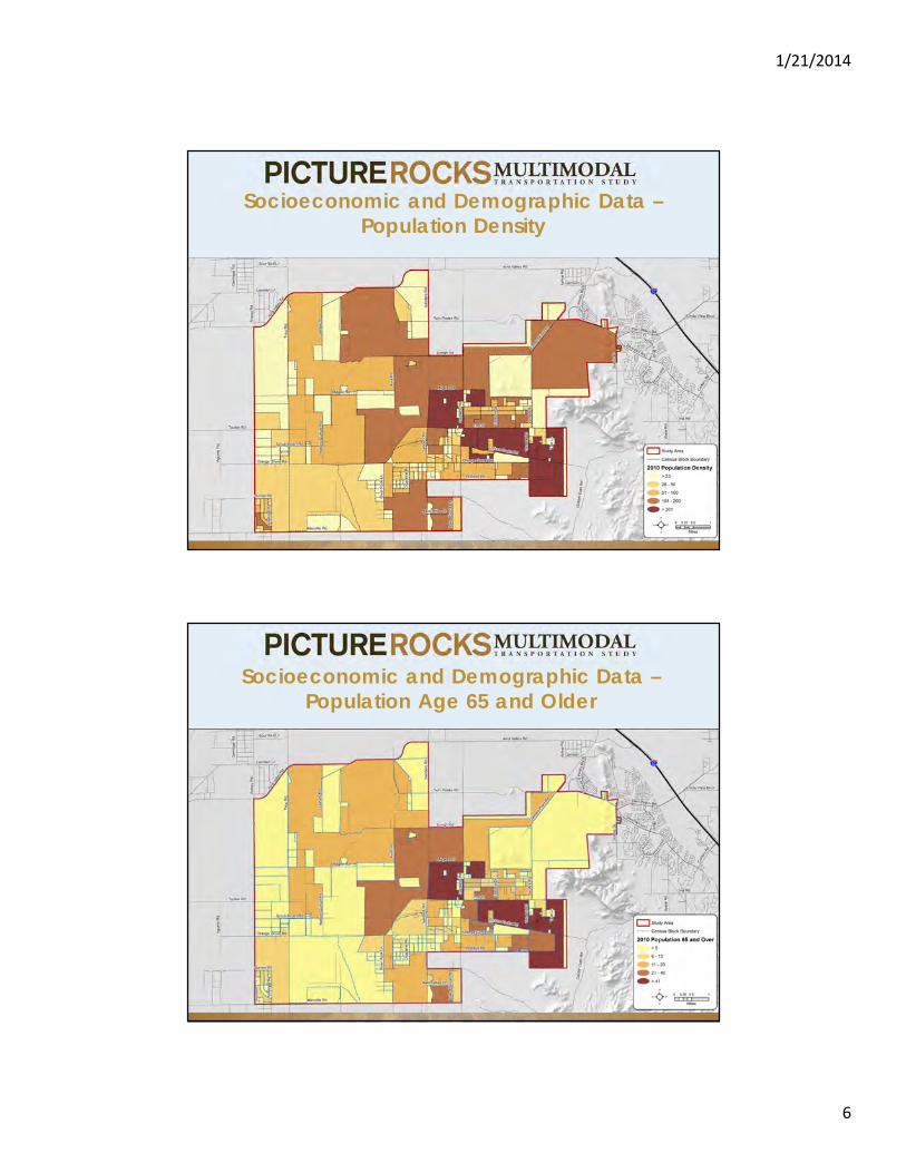
The study area is consistent with Picture Rocks Census Designated Place (CDP). The population within the area is located
in a concentrated area due to topographical features such as the flood plain. Community features include schools,
churches, a fire station and a commercial hub at Sandario and Picture Rocks. Picture Rocks residents travel to Marana
for commercial services, and other services such as medical care. Transit service to Tucson is also available from
Marana.
Action item: show commercial area at Sandario/Picture Rocks Road on the community features map
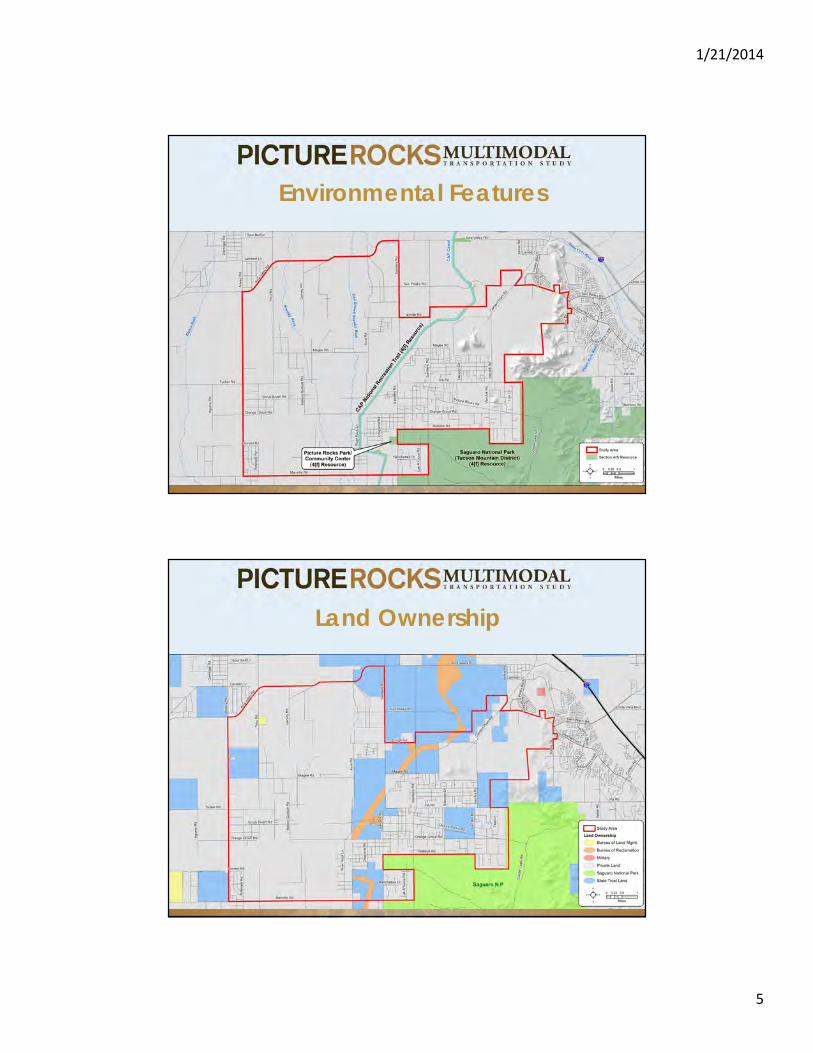
Land ownership is largely private residential with large portions of State Trust Land throughout and along the CAP.
Input from State Land Department is that it will not be developed in the foreseeable future because of a lack of access to
sewer and utilities.
Population density is largely located near the intersection of Sandario Road and Picture Rocks and is shown in dark red
on the population density map.
The environmental issues such as the desert tortoise and where wildlife linkages can be were discussed. Identified
Section 4f properties are parks, trails, community center and Saguaro National Park.
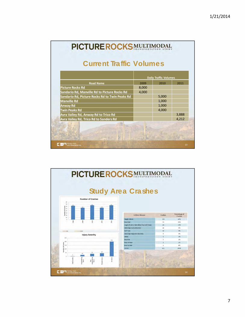
Traffic count data was collected. The counts show a modest to relatively flat growth in traffic. B. Strickler stated that
this is consistent region-wide and statewide during the recession. However, it looks as if some 2013 counts are
beginning to show an increase again. There are no additional current counts available in the Picture Rocks area.
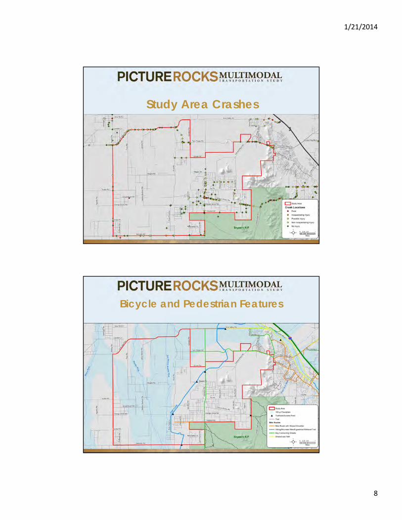
B. Crowther stated that crash data summaries did not include the crashes on Picture Rocks Road that occurred east of
outside of the study area. The data shows that the number of crashes has been relatively consistent in the range of 60
crashes per year with 3 fatal crashes over the 5 year period (excludes crashes on Picture Rocks Road east of the study
area).
Action item: M. Carpenter asked about nighttime crashes. We will add a summary of night time vs. daytime crashes to
the analysis.
B. Strickler stated that the area is popular for motorcycles and there a high percentage of “serious injury “ and fatalities
are motorcyclists.
Action item: Create a separate table of crashes by motor vehicle type (motor cycle).
B. Crowther provided an overview of the current bicycle/pedestrian and transit facilities in the area. Designated bike
routes are near Rudasill and Sanders Road. No other bicycle and pedestrian facilities are in the area other than the CAP
trail.
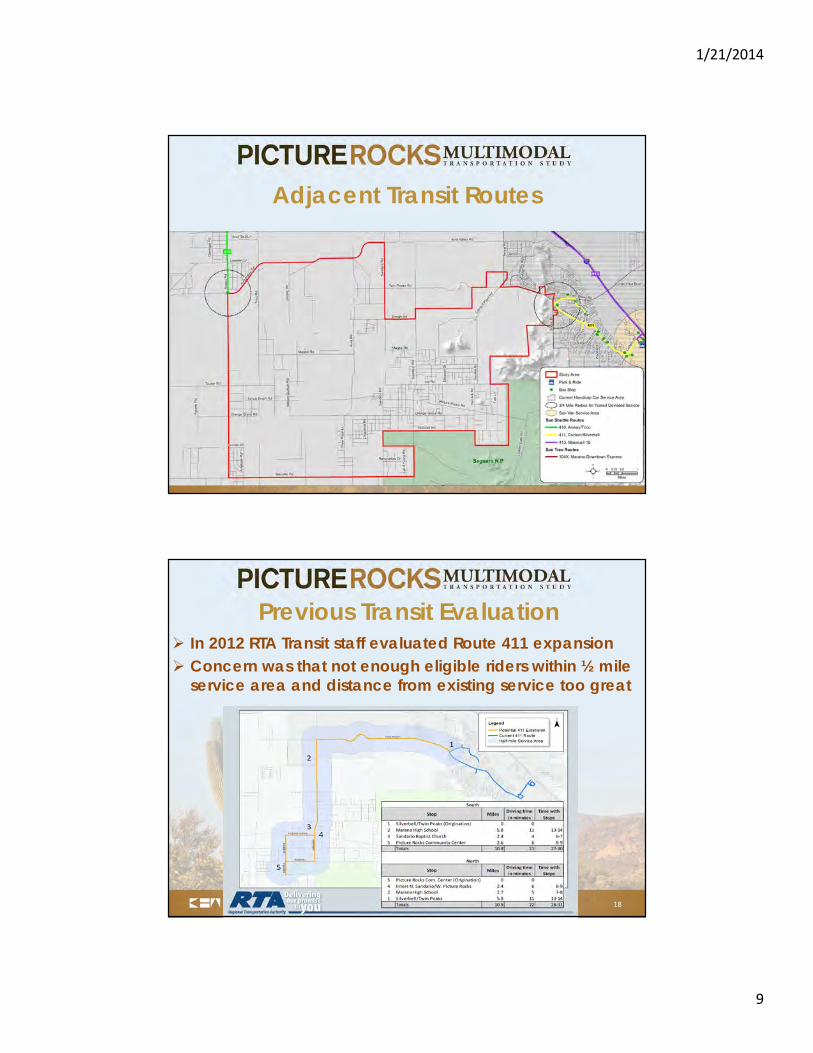
The closest transit routes are 410 and 411 to the north and the east in Marana. Expansion of the 411 transit route was
considered by PAG. A key challenge is the mileage that passes through vacant land makes it a very inefficient and
expensive extension.
The PAG transit evaluation made short term and mid-term recommendations including for a volunteer driver program.
K. Hardy said that the volunteer driver program is up and running.
B. Crowther asked if there is any feedback on how the volunteer program is going.
B. Crowther asked if there is an update or progress regarding a ride share van pool program.
K. Hardy had not heard anything but can look into it. She has heard that the volunteer program has more volunteers
than are needed and more volunteers than riders.
M. Carpenter asked if there are any new RTA transit projects planned for this area. K. Hardy said that there are not any
new transit projects planned in Picture Rocks.
B. Crowther reviewed the methodology used for estimating transit needs. The methodology is consistent with other
methodologies used statewide for rural transit programs. The methodology uses 2010 Census as well as from the
American Community Survey.
The analysis showed the total need for transportation services is just over 1000 persons and projected 90 one way daily
passenger trips. These numbers appear low considering the 500 response on survey and the high population not
commuting. The analysis shows that this would be a low ridership service.
Stakeholder Interviews
B. Crowther reviewed stakeholder input received from the stakeholder interviews. Across the board, stakeholders
identified several common issues. These include safety, transit service, and roadway maintenance.
Safety: PCDOT has long-term plans for safety shoulders on Picture Rocks Road and Sandario Road, a 3 lane section on
Sandario Road with turn lanes, and long term goals to mitigate geometric constraints on Picture Rocks and Sandario.
The long term projects are within the RTP but not in the TIP.
Transit: Stakeholders identified that transit service is needed to access jobs, shopping and education. There is a desire
to connect the community to Route 411. Marana school district requested designated school bus turnouts on Sandario
Road.
Roadways: Most development in the area is wildcat lot splitting and was constructed without public infrastructure and
providing public improvements. Pima County does not adopt roadways into the maintenance system unless they are
constructed to County standards.
Bicycle and pedestrian: Sandario is a popular recreation route. There are trailheads to Saguaro National Park on
Sandario that are unmarked. People don’t know they are designated trails.
Transportation Needs
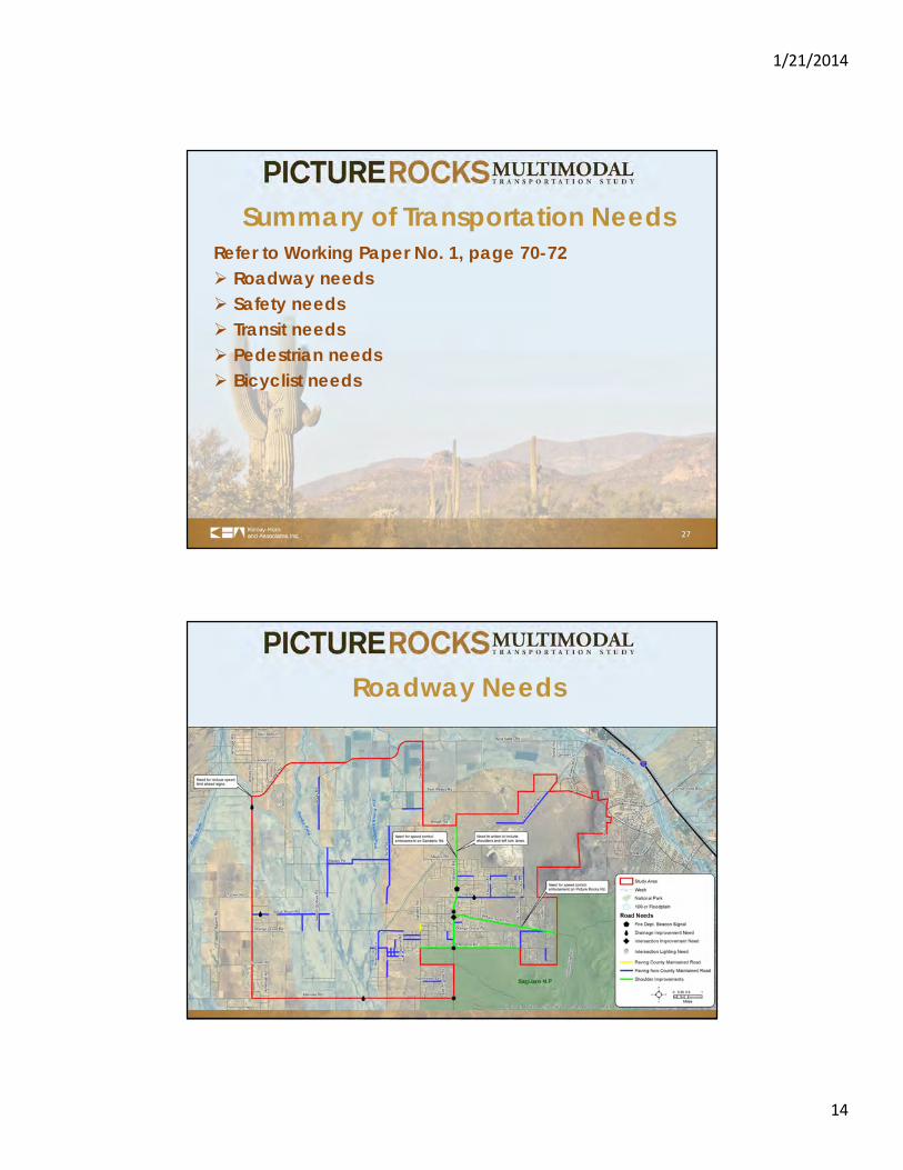
B. Crowther reviewed key roadway needs. These are outlined in greater detail in Working Paper No. 1.
Key roadway needs: Speed control and enforcement on Picture Rocks, Sandario, and Anway Road. A 3-lane section on
Sandario Road is needed. All-weeather roadway crossings are needed. Safety shoulders and geometric improvements
are needed. There are several unimproved roads that are impassable during inclement weather.
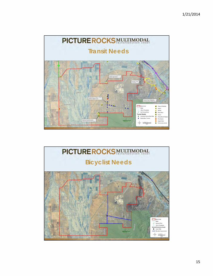
Transit Needs: Potential transit destinations and park and ride locations include Picture Rocks Community Center,
Church on Sandario Road, Marana High School. People need to connect to the Route 411 and the Continental Ranch
Shopping Center. This will enable them to connect to express routes to the Tucson metro area.
M. Carpenter asked if a transfer point and circulator route in Picture Rocks is an option. K. Hardy said that was
considered in the PAG study and it was determined that an additional vehicle would be required to maintain headway
which is 30 minutes.
Bicycle Needs: Shoulders are needed on major corridors. Formal pedestrian crossings are needed at Sandario
Road/Picture Rocks Road.
K. Hardy said that road conditions are an issue for transit and having proper vehicles to navigate the roads would be an
issue for demand-responsive transit. They would have better information on who they are serving.
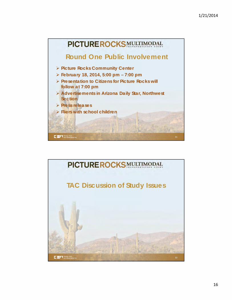
3. Public Outreach Phase 1
A public meeting will be on Tuesday February 18, 2014 at the Picture Rocks Community Center from 5:00 pm to 7:00 pm.
There will be a presentation to the Picture Rocks Community Association from 7:00 pm to 8:00 pm. Advertisements will
be published in the northwest section of the Daily Star as well as press releases to the Desert Times and Northwest
Explorer. Citizens for Picture Rocks volunteered to distribute flyers for the public meeting. Pam Moseley is coordinating
with the Marana School District to send information out with students.
4. TAC Open Discussion of Study Issues
The question was asked about how well the methodology of estimating transit need in Picture Rocks works for this
situation. How close is this methodology to other transit programs that have been implemented that used this
methodology?
M. Carpenter said that in terms of the scoping of what we are trying to do, it is comparable to other small rural area
transit analysis ADOT has conducted elsewhere. The identified small transit need identified through the methodology
would be of concern with regard to Federal funding.
It may be beneficial to show comparable routes from elsewhere in the state and the associated need and demand.
With regards to the type of transit service that could be provided, it would likely be a peak hour service. However, there
are examples of other areas that looked low in the analysis and turned out to be successful. Examples include Gila bend
to Phoenix. Green Valley to Tucson may be another example.
Action item: Matt Carpenter will look into these comparable routes.
Action item: review social service programmatic methodology to determine if applicable. We don’t want to
overestimate, but want to understand the potential need.
J. McGinnis stated that it will be important to look at passenger trips per hour. PAG has a baseline of 2 passengers per
service hour. However, that number might change with where the route will be and stopping at different locations.
People will travel to the stops because that is easier than getting to Route 411. Would we need an additional vehicle?
PAG and Marana want to maintain 1-hour headways on Route. Running a smaller timeline such as AM and PM hours
will help with the baseline of 2 passengers per service mile. The configuration of headways on Route 411 would have to
be analyzed and the headways can’t drop below 1 hour.
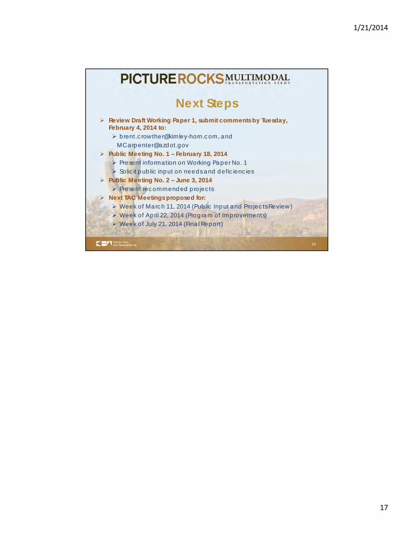
5. Next Steps/Schedule
Comments on Working Paper No. 1 are requested by February 4. Please use the provided comment matrix. After public
involvement phase one, a list of recommended projects will be developed from the information from Working Paper No.
1.
TAC Meeting No. 3 will be held the week of March 11 to discuss what was heard from the public and to present a
preliminary list of projects and recommendations.
TAC Meeting No. 4 will be held the week of April 22 and the next working paper will be presented. This will then be
presented at the next public meeting to be tentatively scheduled in June.

1/21/2014
1
Presented to: Whom? Dennis Burns, CAPP1/21/13 Technical Advisory Committee Meeting 2
AgendaØ IntroductionsØWorking Paper 1 overviewØ Public outreach Phase 1Ø TAC discussion of study issuesØNext steps/schedule
2
1/21/2014
2
Project ObjectivesØAnalyze existing and future transportation
conditions for 5-,10-,and 20-year planninghorizonsØRoadway safetyØRegional access and mobilityØBicycle and pedestrian safety and mobilityØRural transit opportunities
Ø Evaluate system performanceØ Identify transportation infrastructure needsØRecommend a program of projects
3
Ø Serve as a guide:Ø community and economic developmentØ project funding applications and grantsØ project implementation
4
Project Objectives

1/21/2014
3
Study Area
5
Current and Future Conditions – Working Paper 1
ØWP 1 documents transportation needsidentified through:Ø Review of available data:ØCurrent and future projected trafficØTransit - public transit services in the areas, potential
demand, destinationsØCrash dataØDemographics / socioeconomic data / community featuresØEnvironmental setting
Ø Review of existing plans and studiesØ Stakeholder interviewsØ Public input (upcoming)
6

1/21/2014
4
7
Community Features
Environmental Features
8
1/21/2014
5
9
Environmental Features
Land Ownership
10
1/21/2014
6
Socioeconomic and Demographic Data –Population Density
11
Socioeconomic and Demographic Data –Population Age 65 and Older
12
1/21/2014
7
Current Traffic VolumesDaily Traffic Volumes
Road Name 2009 2010 2011Picture Rocks Rd 8,000Sandario Rd, Manville Rd to Picture Rocks Rd 4,000Sandario Rd, Picture Rocks Rd to Twin Peaks Rd 5,000Manville Rd 1,000Anway Rd 1,000Twin Peaks Rd 4,000Avra Valley Rd, Anway Rd to Trico Rd 3,888Avra Valley Rd, Trico Rd to Sanders Rd 4,212
13
14
Study Area Crashes
1/21/2014
8
15
Study Area Crashes
Bicycle and Pedestrian Features
16
1/21/2014
9
Adjacent Transit Routes
17
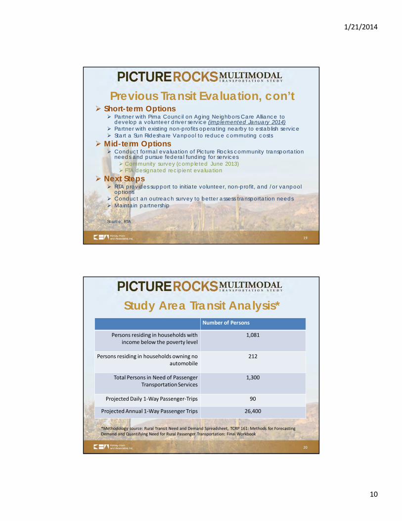
Previous Transit EvaluationØ In 2012 RTA Transit staff evaluated Route 411 expansionØ Concern was that not enough eligible riders within ½ mile
service area and distance from existing service too great
18
1/21/2014
10
Previous Transit Evaluation, con’tØ Short-term Options
Ø Partner with Pima Council on Aging Neighbors Care Alliance todevelop a volunteer driver service (implemented January 2014)
Ø Partner with existing non-profits operating nearby to establish serviceØ Start a Sun Rideshare Vanpool to reduce commuting costs
Ø Mid-term OptionsØ Conduct formal evaluation of Picture Rocks community transportation
needs and pursue federal funding for servicesØ Community survey (completed June 2013)Ø FTA designated recipient evaluation
Ø Next StepsØ RTA provides support to initiate volunteer, non-profit, and /or vanpool
optionsØ Conduct an outreach survey to better assess transportation needsØ Maintain partnership
Source: RTA
19
20
Study Area Transit Analysis*Number of Persons
Persons residing in households withincome below the poverty level
1,081
Persons residing in households owning noautomobile
212
Total Persons in Need of PassengerTransportation Services
1,300
Projected Daily 1-Way Passenger-Trips 90
Projected Annual 1-Way Passenger Trips 26,400
*Methodology source: Rural Transit Need and Demand Spreadsheet, TCRP 161: Methods for ForecastingDemand and Quantifying Need for Rural Passenger Transportation: Final Workbook

1/21/2014
11
Area StakeholdersØ Pima County, District 3 OfficeØ Pima County Sheriff’s DepartmentØ Marana Unified School DistrictØ Citizens for Picture RocksØ Picture Rocks Fire DepartmentØ Arizona State Land DepartmentØ Saguaro National ParkØ Pima County DOT Traffic Engineering Division
21
22
What We HeardØSafety on Picture Rocks Road and Sandario RoadØ Vehicle speeds are an issueØ Pima County and Saguaro National Park
Ø Collaborating on clearing/trimming project to improve sightdistance
Ø Long-term projects are in the planning stagesØ Safety shoulders on Picture Rocks Road and Sandario RoadØ 3-lane section (to provide turn lane) on Sandario Road
(Picture Rocks Road to Saguaro National Park/Rudasill)Ø Projects to mitigate geometric constraints
1/21/2014
12
23
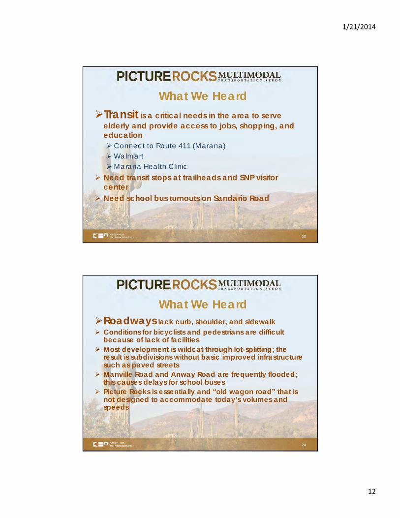
What We HeardØTransit is a critical needs in the area to serve
elderly and provide access to jobs, shopping, andeducationØConnect to Route 411 (Marana)ØWalmartØMarana Health Clinic
Ø Need transit stops at trailheads and SNP visitorcenter
Ø Need school bus turnouts on Sandario Road
24
What We HeardØRoadways lack curb, shoulder, and sidewalkØ Conditions for bicyclists and pedestrians are difficult
because of lack of facilitiesØ Most development is wildcat through lot-splitting; the
result is subdivisions without basic improved infrastructuresuch as paved streets
Ø Manville Road and Anway Road are frequently flooded;this causes delays for school buses
Ø Picture Rocks is essentially and “old wagon road” that isnot designed to accommodate today’s volumes andspeeds

1/21/2014
13
25
Road Maintenance Responsibilities
26
What We HeardØBicyclists and pedestrian facilities are
minimalØ Sandario Road is a popular recreation routeØ Walking routes to community facilities could be
established and improvedØ SNP trailheads on Sandario Road need improved
access
1/21/2014
14
27
Summary of Transportation NeedsRefer to Working Paper No. 1, page 70-72Ø Roadway needsØ Safety needsØ Transit needsØ Pedestrian needsØ Bicyclist needs
28
Roadway Needs
1/21/2014
15
29
Transit Needs
30
Bicyclist Needs
1/21/2014
16
Round One Public InvolvementØ Picture Rocks Community CenterØ February 18, 2014, 5:00 pm – 7:00 pmØ Presentation to Citizens for Picture Rocks will
follow at 7:00 pmØ Advertisements in Arizona Daily Star, Northwest
SectionØ Press releasesØ Fliers with school children
31
TAC Discussion of Study Issues
32
1/21/2014
17
Next StepsØ Review Draft Working Paper 1, submit comments by Tuesday,
February 4, 2014 to:Ø [email protected], and
[email protected]Ø Public Meeting No. 1 – February 18, 2014
Ø Present information on Working Paper No. 1Ø Solicit public input on needs and deficiencies
Ø Public Meeting No. 2 – June 3, 2014Ø Present recommended projects
Ø Next TAC Meetings proposed for:Ø Week of March 11, 2014 (Public Input and Projects Review)Ø Week of April 22, 2014 (Program of Improvements)Ø Week of July 21, 2014 (Final Report)
33