Embed Size (px)
Citation preview
Page 1 of 14
PERSONAL DATA
EDUCATION
TEACHING EXPERIENCE
RESEARCH & SPECIAL PROJECTS
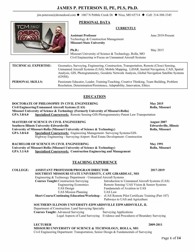
JAMES P. PETERSON II, PE, PLS, Ph.D. [email protected] 1067 N Pebble Creek Dr Nixa, MO 65714 Cell: 314-308-3345
CURRENTLY Assistant Professor June 2019-Present Technology & Construction Management Missouri State University Ph.D.: May 2015 Missouri University of Science & Technology, Rolla, MO Civil Engineering w/Focus on Unmanned Aircraft Systems
DOCTORATE OF PHILOSOPHY IN CIVIL ENGINEERING May 2015 Civil Engineering/Unmanned Aircraft Systems (UAS) Rolla, Missouri Missouri University of Science & Technology (Formerly University of Missouri-Rolla) GPA 3.8/4.0 Specialized Coursework: Remote Sensing-GIS-Photogrammetry-Patent Law-Transportation
MASTERS OF SCIENCE IN CIVIL ENGINEERING August 2007 Southern Illinois University-Edwardsville Edwardsville, Illinois University of Missouri-Rolla (Missouri University of Science & Technology) Rolla, Missouri GPA 3.8/4.0 Specialized Coursework: Engineering Management- Surveying Systems/GIS-
Highway Engineering - Surveying-Airport- Real Estate Development- Construction
BACHELOR OF SCIENCE IN CIVIL ENGINEERING May 1991 University of Missouri-Rolla (Missouri University of Science & Technology) Rolla, Missouri GPA 3.1/4.0 Specialized Coursework: Construction Engineering and Management
TECHNICAL EXPERTISE: Geomatics, Surveying, Engineering, Construction, Transportation, Remote (Close) Sensing, Unmanned Aircraft Systems (UAS), Mobile Mapping, LiDAR, Inertial Navigation, CAD, Spatial Analysis, GIS, Photogrammetry, Geodetic Network Analysis, Global Navigation Satellite Systems (GNSS).
PERSONAL SKILLS: Passionate Educator, Leader, Training/Teaching, Creative Thinking, Team Building, Problem Resolution, Determination/Persistence, Adaptability, Innovation, Ethics.
ADJUNCT PROFESSOR 2007-2017 SOUTHERN ILLINOIS UNIVERSITY-EDWARDSVILLE EDWARDSVILLE, IL Department of Construction: Land Surveying Specialty
Courses Taught: Advanced Surveying Surveying Applications Legal Aspects of Land Surveying Evidence and Procedures of Boundary Surveying
LECTURER 2009-2011 MISSOURI UNIVERSITY OF SCIENCE & TECHNOLOGY, ROLLA, MO Civil Engineering Department: Transportation, Senior Design & Fundamentals of Surveying
COLLEGE: ASSISTANT PROFESSOR/PROGRAM DIRECTOR 2017-2019 SOUTHEST MISSOURI STATE UNIVERSITY, CAPE GIRARDEAU, MO Engineering & Technoogy Department - Unmanned Aircraft Systems
Courses Taught: Construction Surveying Introduction to Unmanned Aircraft Systems (UAS) Engineering Economics Remote Sensing/ UAS Vision & Sensor Systems
UAS Design Fundametals of Avaition in UAS UAS Mission Planning UAS Law
Short Course/Continuing Education/Workshop : sUAS Remote Pilot Certificate Training (Part 107) Pathways to UAS and Agriculture

Page 2 of 14
EXPERIMENTAL PROGRAM TO STIMULATE COMPETITIVE RESEARCH (EPSCoR): Enhancing Missouri's capacity to model and respond to the effects of climate change on plants and communities at a local scale. EPSCoR research and educational programs will improve science and engineering capabilities that will benefit urban and rural Missourians from all regions and all economic levels.
FUNDED by the NATIONAL SCIENCE FOUNDATION (NSF) UNMANNED AIRCRAFT SYSTEMS (UAS) DOMAIN EXPERT August 2014 to Present
• Five Year Program w/ $20 Million Funding ($250,000) Lead by the Danforth Institute in collaboration with University of Missouri, Missouri University of Science Technology, Saint Louis University, and Washington University
• Seed Funded Project w/$50,000 through Missouri State University Agriculture (See below)
Missouri Transect: The Missouri Transect: Climate, Plants and Community is a statewide collaborative research effort to understand how climate variability impacts plants and communities in Missouri. As the UAS domain expert, I am developing and deploying UAS imaging and remote-sensing technologies of sufficient resolution to understand individual plant physiological and population-level phenotypes in response to environmental variation. Fixed-wing and rotary platforms are being used to collect imagery as small as 1-3 cm ground sample distance and will be used for phenotyping of plants in field settings. UAS platforms are performing high-overlap image collection using several imaging technologies including Color-infrared (CIR), Near-infrared (NIR), Red-edge (RE), Normalized Difference Vegetation Index (NDVI), Hyperspectral, and thermal imaging.
UNMANNED AIRCRAFT SYSTEMS (UAS) DOMAIN EXPERT June 2016 to 2017 Two Year Program w/ Seed Funding from EPSCoR/MO Transect Collaboration with Missouri State University (MSU), Springfield, MO 2 year program w/$50,000
Journagan Ranch: Part of the Darr School of Agriculture, MSU, and has 3,300 acres of land with a small tract used for raising cattle and operation facilities. It has natural timberland, hills, streams and grassland with diverse microclimates and soil conditions. Wild Vitis species (grapevines), black walnut (Juglans nigra), and pecan (Carya illinoinesnsis) have been chosen as indicator species for monitoring vegetative growth. Research Goal(s): is to develop accurate and reliable methods of estimating and monitoring vegetative response of selected wild grape and tree species to regional and localized fluctuations in climate and seasonality. Specific objectives of research are to: (1) Collect hyperspectral imagery and aerial photos through an unmanned aircraft system (UAS) (2) Derive vegetative metrics from the UAS-based sensor system, includes canopy height off the ground, species identification, canopy cover or crown closure, foliage growth, and hyperspectral vegetation indices; (3) Validate vegetative metrics derived from remote sensing techniques with ground reference data and cross-validation of estimates from developed models; and (4) Develop a spatial-temporal model to correlate with local temperature and precipitation, so that this model can be used to retrieve and assess vegetation responses in the context of long-term climate changes.

Page 3 of 14
RESEARCH & SPECIAL PROJECTS CONTINUED
UNMANNED AIRCRAFT SYSTEMS (UAS) RINCIPAL INVESTIGATOR 2018-Present FUNDED by United States Department of Agriculture (USDA), Natural Resource and Conservation Service (NRCS) One Year Program $50,000 with Optional Second Year (Add $50,000) Southeast Missouri Region: A sample of approximately 10 locations in the region that present a variety of types of highly erodible lands (HEL) and wetlands and of specific interest to the agencies. The Miller Wetland Reserve is a 27.22-acre property near Scott City, MO.
David M. Barton Agriculture Research Center: This facility can be used for a controlled environment as one of the sample locations to evaluate HEL and crop residue. The sample location consists of 252 acres (100 ha) featuring emerging technologies in irrigated row-crop production. The row-crop component is based on a 100 acre (40 ha) land-graded field having the latest technology involving controlled sub-surface drainage and irrigation. Row crop research primarily involves soybean (Glycine max L. Merr.) and corn (Zea mays L.) production, illustrating emerging technologies and production methods.
Research Goals: includes the use of Unmanned Aircraft Systems (UAS) for the United States Department of Agriculture (USDA), Natural Resource and Conservation Service (NRCS), other stakeholders, and those specifically located on and/or nearby highly erodible land (HEL) in cropland and wetlands. Research will be conducted to develop technology to assist the agencies listed above on the efficient use of UAS for enhancing conservation compliance on highly erodible land (HEL) and wetlands.
Figure 1 DJI Mavic 2 Pro vs. Zoom Figure 2 Sensefly eBee X and Alienware Devices

Page 4 of 14
RESEARCH & SPECIAL PROJECTS CONTINUED
Unmanned Aerial Systems: Remote Sensing, Surveying & Mapping from an Unmanned Aerial System (UAS). An
UAS is a small aerial vehicle operating in an autonomous mode (autopilot) used for remote observation. I have been evaluating the use of UAS as a supplement and/or replacement to traditional mapping methods. During my evaluation I began consulting for Gatewing, the leading manufacturer of UAS located in Ghent, Belgium. I have been specifically focused on the applications for UAS for engineering, mapping, surveying, mining, & materials with a focus on transportation. I am trained to operate a UAS and performed product demonstrations and training. I worked on adapting existing software to accommodate these needs.
Mobile Mapping: Survey, Mapping, and Transportation Asset Collection from a mobile platform. A mobile mapper is a moving platform that uses kinematic GNSS, inertial measuring unit (IMU), laser scanners, and cameras. Utilized a development agreement with Trimble and Applanix. I had already integrated the use of tripod-based laser scanners when the opportunity to evaluate the Applanix LandMark mobile mapping system presented itself. During this evaluation, I developed custom workflows for providing department of transportation survey deliverables from mobile LiDAR data. I also participated in the Federal Highway Administrations Mobile Mapping Rodeo. At this rodeo, we collected roadway asset data for a test site in Fairfax, VA. The use of semi-automatic feature extraction from LiDAR and photogrammetry was used for rapid feature extraction from imagery and LiDAR. I was then hired by Trimble as a consultant to further advance the workflows that I had developed specifically for mobile surveying. I visited many end users to evaluate their needs for this technology. I have specific experience in Western Australia evaluating the use of a mobile mapper in this mining rich area.
PROJECTS:
Gatewing - Newmont Mining UAS mapping, 3D Modeling Gatewing - UAS demonstration to U.S. Coast Guard Academy, New London, CT Gatewing - UAS Demonstration to U.S. Naval Facilities Command (NAFAC), Jacksonville, FL Mobile Mapping demonstration with Rio Tinto in Perth, Australia Trimble- Trimble Trident Analyst software development for mobile surveying of transportation
infrastructure Federal Bureau of Investigation (FBI) – 2009 Presidential Inauguration Parade Route, mobile mapping
collection Federal Highway Administrations Mobile Mapping Rodeo in Fairfax, Virginia Illinois Department of Transportation; Mobile Mapping - first mobile mapping corridor project USACE GEOFidelis West Coast Base Mapping & USACE/DOD Buckeye Boundary survey of largest parcel of ground ever bought by the State of Illinois Disposal of over ½ million
acres of property for Arch Minerals United States Forest Service Surveys – Shawnee National Forest Infrastructure Design of Naples, Italy Naval Base Permitting Design, and Surveying of new Coal Mining Operations, Knight Hawk Coal, Kline Resources Construction of Metrolink Light Rail Facilities

Page 5 of 14
PROFESSIONAL REGISTRATIONS & ACTIVITES PROFESSIONAL Professional Engineer: Illinois #50712, Missouri #27630, Arizona #49438 REGISTRATIONS Professional Land Surveyor: Missouri #2732, Illinois #003397, Arizona #50505 Able to sit for Certified Photogrammetrist
Able to apply and/or reciprocity for any state for PE, PLS. PROFESSIONAL Illinois Society of Professional Engineers Illinois Professional Land Surveyors Association ORGANIZATIONS Engineers Club of St. Louis Missouri Society of Professional Land Surveyors American Society for Photogrammetry American Society of Civil Engineers/NSPE
and Remote Sensing COMMITTEES SEMO Student Recruitment Committee SEMO UAS Academic Advisory Board Chair HONORS/AWARDS FIRST Robotics Competition Judge Robotics Club Advisor
Missouri Statewide GPS/VRS Selection SIU-E Construction/Survey Academic Advisory Board UMR Outstanding Civil Engineer-1991 Chi Epsilon-Vice President-1991
Reece Civil Engineering Scholarship UMR Varsity Football/Varsity Letterman’s Club High Ability Tuition Scholarship UMR Intramural Sports-Basketball, Tennis & Volleyball ELK’s Student/Athlete Scholarship UMR Honor Roll 3 Semesters/High Honor Roll-1Semester

Page 6 of 14
PROFESSIONAL EXPERIENCE
GATEWAY GEOSPATIAL – GEOSPATAL MAPPING COMPANY St. Louis, MO OWNER/GEOSPATIAL MANAGER September 2015 – 2017 Started unmanned aircraft systems (UAS) research, development and services for geospatial mapping. Market development of UAS geospatial services. Refined unique workflows for computer vision processing of UAS imagery. Generated 3D models of terrain and structures. Refined operation and procedures for safe operation of UAS in the National Airspace (NAS). Improved sensor integration of hyperspectral cameras, metric and non-metric cameras, LiDAR, inertial measuring units (IMU) and video surveillance systems. SIGNIFICANT PROJECTS: UAS Imagery and 3D Terrain of National Geospatial
Intelligence Agency (NGA) Site.
Above is a point cloud containing 21 million points extracted from a UAS image collection of athletic fields.
SURDEX – PHOTOGRAMMETRIC MAPPING COMPANY Chesterfield, MO DIRECTOR OF UNMANNED SYSTEMS AND SURVEYING April 2014 to September 2015 Gross Revenue $20 Million Directed unmanned aircraft systems (UAS) research and development for geospatial mapping. Focused on market development of UAS geospatial services. Developed unique workflows for computer vision processing of UAS imagery. Performed pilot projects of UAS imagery that created 3D models of terrain and structures. Created operation and procedures for safe operation of UAS in the National Airspace (NAS). Completed manufacturer’s certified training of the Altavian NOVA Block III F6500. Assessed existing sensor integration of hyperspectral cameras, metric cameras, LiDAR, and video surveillance systems. Developed program to fill industry gaps in sensor integration. Investigated the use of vertical takeoff and landing UAS for payload testing and small project sites. Professional supervision of geodetic surveying for ground control and targeting for aerial image and LiDAR collection. Performed network analysis and adjustment of Global Navigation Satellite System (GNSS) & robotic total station surveys. Determined/calculated project datums, transformations, site calibrations, grids, & coordinates. Mission planning and processing of GNSS & inertial navigation systems (INS) solutions for aerial and terrestrial collections. Performed terrain analysis, contouring, and 3D modeling. Topographic mapping and 3D modeling of static terrestrial LiDAR and imaging. Aerial and terrestrial image draping & LiDAR colorization.

Page 7 of 14
UNITED STATES ARMY CORPS OF ENGINEERS – St. Louis, MO PHOTOGRAMMETRIC CENTER OF EXPERTISE (CX) August 2012 to April 2014 TECHNICAL MANAGER Contracting Vehicle of $100 Million Managed IDIQ A-E contracts for 10 photogrammetric mapping and 3 surveying contractors. Provided rapid response, full service photogrammetric mapping support and technical capability and proficiency in all aspects of photogrammetry including: project planning and specification, A-E contracting (CONUS and OCONUS), project cost estimating, image acquisition, photogrammetric map compilation, LiDAR data collection and exploitation, photo interpretation, and GIS development. Performed due diligence and startup of unmanned aircraft systems (UAS) for the CX. Focused on development of UAS mapping services and emergency response activities. Professional supervision of geodetic and topographic surveying for hydraulic, hydrology, and emergency flood operations. Performed network analysis and adjustment of Global Navigation Satellite System (GNSS) and robotic total station surveys. Consulted hydrologic surveying department on mission planning and processing of GNSS & inertial navigation systems (INS) solutions for hydro surveys and terrestrial collections. Implemented the districts first use of real time kinematic (RTK) GNSS surveying from real time networks (RTN) for surveying activities. Increased emergency flood survey response and execution time by significant orders of magnitude. Conducted training of U.S. Army Geospatial Officer Candidates and other USACE personnel. Consulted the district on conversion of NGVD 29 and other vertical datums to NAVD88. Researched and testing of the Online Positioning User Service for Projects (OPUS Projects) that allows GNSS occupation processing and network adjustment using the National Geodetic Survey’s PAGES software.
GEOSPATIAL CONSULTANT / DOMAIN EXPERT April 2009 to Present ESP Associates: Charlotte, NC May 2012 to August 2012 Directed geospatial research and development for the Western Division. Focused on market development of geospatial services. Further developed workflows for mobile mapping of transportation infrastructure. Introduced workflows for Unmanned Aerial Systems (UAS). Performed pilot projects of aerial imagery, UAS imagery, and mobile mapping. Trimble Navigation, Ltd: Westminster, CO April 2009 to April 2012 Geospatial Domain Expert consultant for the Geospatial Division of Trimble Navigation. Expert in terrestrial and airborne LiDAR and imagery. Specifically focused on the applications of geospatial products for corridor mapping, mining, & materials. Developed workflows and software needs for terrestrial corridor mapping, i.e. mobile mapping. Developed software enhancement needs and evaluated software. Developing applications, testing, and evaluating terrestrial LiDAR and imaging hardware and software. Researched and developed technical marketing data, white papers, and presentations. Investigating automatic feature extraction from LiDAR and imagery for GIS, survey, mining, and materials. Technical sales support. Gatewing Unmanned Aerial Systems: Ghent, Belgium August 2011 to April 2012 Geospatial Domain Expert consultant for Gatewing Unmanned Aerial Systems (UAS). Expert in terrestrial and airborne LiDAR and imagery. Specifically focused on the applications for UAS for engineering, mapping, surveying, mining, & materials. Developed workflows and software needs, enhancements and beta testing. Developing applications, testing, and evaluating image processing hardware and software. Researched competitive marketing data and developed technical and marketing white papers, and presentations. Trained to operate UAS and performed product demonstrations.
Page 8 of 14
SANBORN MAP COMPANY Chesterfield, MO VICE-PRESIDENT/ASSISTANT GENERAL MANAGER April 2006 to April 2009 Region Gross Revenue $8 Million/National $50 Million Responsible for largest regional revenue of $8 Million. Developed new technology market in terrestrial LiDAR and mobile mapping. Created innovative applications through unique work flows. Delivered first mobile mapping jobs in the state of Illinois and Missouri. Developed terrestrial LiDAR workflow that significantly improved accuracy, semi-automatically extracted linear and topographic features, and generated a lightweight contour map from key points with planimetrics. Helped streamline production, specifically for Department of Defense projects such as Buckeye. Managed GIS projects. Supervised image and LiDAR collection, aerial triangulation, and surveying. Managed stereoscopic compilation and orthometric rectification of imagery. Geodetic surveying and network analysis of ground control. Determined/calculated project datums, grids, & coordinates. Mission planning and processing of GNSS & inertial navigation systems (INS) solutions for aerial and terrestrial collections. Performed terrain analysis, contouring, and 3D modeling. Implemented new aerial triangulation software and workflow. Used GIS as a tool for surveying, photogrammetry, and LiDAR. Operated, tested, and evaluated terrestrial mobile mapping platforms. Implemented quality control and quality assurance for ISO certification. Created database for project data management and tracking. Topographic mapping and 3D modeling of static terrestrial LiDAR and imaging. Aerial and terrestrial image draping and LiDAR colorization. Developed the use of photogrammetry from LiDAR intensity images, i.e. LiDAR-Grammetry. Developed techniques and procedures for LiDAR breakline enhancement using imagery and terrain analysis.
Projects & Clients: Army Corps of Engineers, Missouri Department of Natural Resources, Williams Gas Pipeline, Missouri Department of Transportation, Illinois Department of Transportation, Metropolitan St. Louis Sewer District, California Water District, Maricopa AZ Drainage District, NASCAR, Ameren, NOAA, Department of Defense Fred Weber, Cline Resources, URS Corporation, Horner and Shifrin, HDR, HNTB, Jacobs, Howard R. Green
Laser Scanning Mobile Mapping/LiDAR R&D Roadway Asset/GIS Collection Personnel Training Client Relations Marketing Financial Management Field Operations Senior Project Management Operational Management Contract Management Project Scoping AT/Airborne GPS/IMU Major Project Presentations New Technology Implementation
CROSS COUNTRY LAND SURVEYING & ENGINEERING, LTD. Marion, Illinois: May 2005 to February 2006 OWNER, CIVIL ENGINEER, SURVEYOR Murphysboro/Du Quoin, Illinois: February 1996 to September 2002 Gross Revenue $680,000 May 1996 to September 2002 Sold Business to Hurst-Rosche Engineers, Architects, & Surveyors February 2006 Purchased small surveying company and added engineering. Increased revenue from $155,000 to $680,000. Implemented GPS & Robotic Surveying methods. Surveyed largest land purchase in history by State of Illinois. Projects & Clients: City of Carbondale, Steelville, Murphysboro, DuQuoin, Percy, IL United States Forest Service/USDA, Illinois Department of Transportation, Ralston Purina Jackson County Highway Dept., White County Highway Dept., Williamson County Highway Dept., Aerial Development Morgan Commercial Structures, Wayne Fishback-Architect, J.D. Street Company Inc., Cline Resources, Hollywood Video Arch Minerals Arch/Arkland Coal Co., Consolidation Coal Co., Burger King, Forsyth Coal Co., Cellular One, Russel Minerals
Client Relations/Marketing Business Financial Management Topographic Surveys Cadastral Surveys GPS Surveys Subdivision Design Highway Engineering Record Research Route Surveying Construction Staking Storm/Sanitary/Sewer Design Plat Preparation Plans & Specifications Construction Inspection Field Operations/Planning Corner Search Advanced Survey /Geodesy Site Geometrics/Parking/Grading CEO/Secretary/Treasurer Water Design Property Surveying Bid Preparation / Bid Letting Accounting/Bookkeeping Payroll
Page 9 of 14
ENGINEERING DESIGN SOURCE, INC. Chesterfield, MO/O’Fallon, IL SURVEYING & CONSTRUCTION DEPARTMENT MANAGER September 2002 to May 2005 Departmental Gross Revenue $1.8 Million Complete surveying & construction department start-up and management. Cadastral Survey/Mapping, Global Geodetic Surveys, Property, Topographic, & Route Surveying, Record Research/Corner Search, Plat Preparation, DTM/Contour Creation, Construction Staking, Construction Inspection/Management, Field Operations/Planning. Projects & Clients: City of St. Louis, Maryland Heights, Wentzville, Hazelwood, Crestwood, MO, Grafton, IL Missouri Department of Transportation, Illinois Department of Transportation, Metropolitan St. Louis Sewer District, St. Charles County Highway Department, St. Louis Downtown Parks Airport, Lambert International Airport, Obrien & Gere, Geotechnology, URS Corporation, Horner and Shifrin, HDR, HNTB, EDM, Howard R. Green, RJN, CDM, Woolpert, Brinkmann Constructors
Department Start Up Personnel Training Client Relations Departmental Management Financial Management Field Operations/Planning Senior Project Management Project Estimating Contract Management Project Scoping Record Research GPS Surveys GIS Collection Marketing Geodetic/Cadastral Surveys QC/QA Construction Inspection Plat Preparation
BOOKER ASSOCIATES, INC. St. Louis, Missouri TRANSPORTATION-DESIGN/CONSTRUCTION ENGINEER/ SURVEYOR March 1993 to May 1996 Project Engineer, Surveyor, and Construction Inspector. Designed national and international projects Projects &Clients: City of Brentwood, St. Louis, Ollivette, Manchester, Washington, MO, Lambert International Airport Metropolitan St. Louis Sewer District, Spirit of St. Louis Airport, Missouri Dept. of Mental Health, Houston Memorial Airport Bi-State/Metrolink, Federal Aviation Administration, Lincoln University Library, Kansas DOT, Army Corps of Engineers; Altus A.F.B., OK, A.F.B.,TX, St. Louis County Hwys, Lady Luck Riverboat Casino, St. Louis County, Illinois DOT, MO Hwy & Transportation, Dept. Naval Facilities Engineering Command; Naples, Italy; Cheatham Annex, VA
Resident Engineering Engineer Quantities Costs Estimates Resolved Field Problems Highway Design Culvert design QA/QC Storm/Sanitary Sewer Design Material Testing Water Distribution Plan & Specification Change Orders Established Street Maintenance Pay Requests Cadastral Mapping CPM Scheduling Site Geometrics Parking/Grading Plans Topo Surveying Construction Staking Construction Inspection Property Strip Maps O.S.H.A. Compliance
Page 10 of 14
SPECILAIZED TRAINING, PROJECTS, & DEVELOPMENT
McCARTHY COMPANIES St. Louis, Missouri BRIDGE & HEAVY-PROJECT ENGINEER/SURVEYOR May 1991 to March 1993 Projects & Clients: Bi-State/ Metrolink-8th to Taylor & Texas Dept. of Transportation-Hwy. 59 Overpass Shop Drawing Review Construction Staking Change Orders Value Engineering Sub-contractor Coordination Supervised Material Testing Pay Requests Job Cost Accounting Operations O.S.H.A. Compliance Quantity Tracking Scheduling Quantity/Bid Estimation Project Startup/Close-out Concrete Form Work Design Tool Box Talks
CONSOLIDATED COAL COMPANY Pinckneyville, Illinois MID-CONTINENT REGION-ENGINEERING INTERN Summers 1987 to 1990 Departments: Burning Star #4 Mine Environmental & Quality Control - General Engineering- Central Testing Laboratory Quality Control/Quality Assurance Coal Production Tracking Field Supervision Surveying/Volumetric Bid Package Preparation Reclamation Planning/Design Hydrology/Erosion Control Surveying/Monitoring Property Surveying Box Cut Design C Coal Analysis & Testing Rock Blasting
NON-TRADITIONAL EXPERIENCE VISION QUEST ENTERPRISES, Inc. Sold in 2004 Southern, Illinois LAKE OF EGYPT, LLC Sold in 2001 Southern, Illinois 1998 to 2004 Focus: Urban Property Development Focus: Lake Side Property Development 20 Acre Subdivision, 14 Acre Subdivision
100 Acre Subdivision 6 Villa Development Unique Coving Subdivision Design
SPECIAL TRAINING / COMPUTER SKILLS
Altavian UAS Trained Pilot
Gatewing UAS “Train the Trainer”
Trimble UAS Master
Agisoft Photoscan
Trimble Business Center
FAA Part 107 Remote Pilot
LP 360 Global Mapper Adrupilot Mission Planner
Carlson Civil/Survey Suite
Terrsolid/Match/Modeler ENVI Leica Photogrammetry Suite
T3D Analyst Trimble Realworks
ArcMap Autocad Civil 3D
Microstation Geopak Delorme
Applanix POSPac Intergraph ISAT GravNav LP360 GeoCue

Page 11 of 14
PUBLICATIONS & SPEAKING ENGAGEMENTS CURRENT RESEARCH (Leading to Publication(s))
EPSCoR: Missouri State University (MSU);
Goerndt, Michael; Assistant Professor of Agriculture/Forestry Bradford, Tyler; Masters Seeking Graduate Student
Topic: Developing a Canopy Height Model for Small Area Estimation (SAE) of Missouri mixed hardwoods using Photogrammetric Techniques.
Target Publication: Photogrammetric Engineering & Remote Sensing (PE&RS) Topic: Modeling the Response of Missouri mixed hardwoods to Seasonal Climate Effects
with UAV-Based Hyperspectral Sensor and Aerial Photogrammetry" Target Publication: Photogrammetric Engineering & Remote Sensing (PE&RS)
Miao, Xin; Professor of Geography/Remote Sensing
Topic: Development of an algorithm for detection of individual tree detection, Target Publication: Photogrammetric Engineering & Remote Sensing (PE&RS)
Missouri University of Science & Technology (MST)
Burken, Joel; Chair and Distinguished Professor of Civil, Architectural, & Environmental Engineering Manley, Paul; Ph.D. Seeking Graduate Student
(Also serving on Graduate Committee)
Topic 1: Correlation of hyper spectral indices to plant physiology to in-situ field measurements.
Topic 2: Creation of new hyper spectral indicies by comparing plant spectra based on the different drought treatments
Target Publication: Photogrammetric Engineering & Remote Sensing (PE&RS)
Graduate Saint Louis University (SLU);
Committee(s): Sagan, Vasit; Associate Professor of GIScience
Director, IAS PhD Program / M.S. in GIScience Department of Earth & Atmospheric Sciences
Marshall, Bethany; Ph.D. Seeking Gradute Student
Topic: Comparison of nagivation grade and open source real time kinematic (RTK) global navigation satellite system (GNSS) direct georeferencing of unmanned aircraft system image collection.
Target Publication: Photogrammetric Engineering & Remote Sensing (PE&RS)

Page 12 of 14
Independent Southeast Missouri State University (SEMO) Research: Scheible, John; Prfoessor of Biology Westfall, Ben; Masters Graduate Student
Topic: Comparing native deer population densities across biologic variables and habitat Peterson, Jim; Principal Investigator Sagan, Vasit (SLU)
Topic: Comparison of nagivation grade, open source real time kinematic (RTK) global navigation satellite system (GNSS) direct georeferencing, and post processed kinematic (PPK) GNSS of unmanned aircraft system image collection.
Target Publication: Photogrammetric Engineering & Remote Sensing (PE&RS) and/or Survey & Land Information Science Journal (SaLIS)
Peterson, Jim; Principal Investigator
Topic: Map accuracy prediction and reduction of ground control points using survey grade post
processed kinematic (PPK) GNSS and inertial navigation (INS) systems from unmanned aircraft system image collection.
Target Publication: Photogrammetric Engineering & Remote Sensing (PE&RS) and/or Survey & Land Information Science Journal (SaLIS)
PUBLICATIONS: Maimaitijiang, Maitiniyazi; Peterson, James, et al. “Unmanned Aerial System (UAS)-Based Phenotyping of Soybean Using Multi-Sensor Data Fusion and Extreme Learning Machine.” ISPRS Journal of Photogrammetry and Remote Sensing, vol. 134, (2017), pp. 43–58., doi:10.1016/j.isprsjprs.2017.10.011. Peterson, James Preston II, "Unmanned aircraft systems image collection and computer vision image processing for surveying and mapping that meets professional needs" (2015). Doctoral Dissertations. 2433. http://scholarsmine.mst.edu/doctoral_dissertations/2433 Peterson, James Preston II, "Unmanned aircraft systems image collection and computer vision image processing for surveying and mapping that meets professional needs" (2015). ProQuest Dissertations And Theses; Thesis (Ph.D.)--Missouri University of Science and Technology, 2015.; Publication Number: AAT 3731407; ISBN: 9781339177991; Source: Dissertation Abstracts International, Volume: 77-02(E), Section: B.; 294 p. Slattery, K., Slattery, D., and Peterson, J. (2012). ”Road Construction Earthwork Volume Calculation Using Three-Dimensional Laser Scanning.” J. Surv. Eng., 138(2), 96–99. Horner, Leica, Peterson, James (Contributor) “Opportunities on the Move”, (2009), Article Information Submission, Sparpoint Research, Point of Beginning, March 2009. Peterson, James P. II, “Illinois Department of Transportation Survey from Terrestrial and Aerial LiDAR, Case Study”, Professional Surveyor; Aerial Mapping Supplement 2009 Dylan, Craig. R , Peterson, James P., “Updating the Lady in Black, NASCAR’s First Superspeedway”, (2008), Point of Beginning, March 2008. Wimbush, Peterson (Interview), “The Latest in Laser Scanning”, (2006), Interview Point of Beginning, October, 2006.

Page 13 of 14
SPEAKING ENGAGEMENTS: Coming Up: Trimble Dimensions 2018, Las Vegas, NV, “What You Don’t Know about Unmanned Aircraft Systems (UAS) Image Collection and Processing Can Hurt You!”. Invited guest to Trimble University Symposium. Missouri Professional Land Surveyors Association Annual Conference 2018, Lake of the Ozarks, MO, “Unmanned Aerial Systems & Surveying” State Tech, Using UAS, A Continuing Education Event 2018, Linn, MO: “Early Results from NRCS/USAD Study of UAS for Wetland management and Crop Residue” Pursuing: AUVSI Exponential, Chicago 2018; AGInfo, St. Louis 2018 Past Events State Tech, Using UAS, A Continuing Education Event, June 2018, Linn, MO: “Insight into Surveying and Mapping with UAS”, “A Case Study Using AeroPoints, “Smart” Ground Control Targets. Illinois Professional Land Surveyors Association Annual Conference, February 2017, Sprinfield, IL: “Unmanned Aircraft Systems (UAS) “Drones” Illinois Professional Land Surveyors Association Annual Conference, February 2016, Springfield, IL: “What You Don’t Know About Drones Can Hurt You” Illinois Association for Floodplain & Stormwater Management, 2015, Bloomington, IL: “The "D" Word: A look at Drones and their impact on Floodplain and Stormwater Management” Missouri Professional Land Surveyors Association Annual Conference 2013, Lake of Ozarks, MO, “Unmanned Aerial Systems & Surveying” New York Association of Professional Land Surveyors Annual Conference 2012, “LiDAR – The Technology and Applications in Surveying Practice” Western Australian Surveying and Spatial Information Conference, , June 2011, Perth, Australia “Is There Still a Future in Surveying? A discussion about surveyor’s role in the geospatial market” URISA, Surveying & Mapping Society of Georga, Mid-South ASPRS, & GITA Southeast Geospatial Conference 2010, University of Georgia, Athens, Georgia. “From Point Clouds to Answers; Automation Process for As-Built Creation” Missouri State University, December 11, 2009, Springfield, MO; Mobile & Airborne LiDAR: “Way Cool”, Beyond the “Cool” Factor: Making Money Photogrammetric Week, Stuttgart, Germany 2009 “Integrating Various Terrestrial and Aerial Sensor Data for Transportation Projects” Missouri Society of Professional Land Surveyors Workshop, May 2009, St. Charles, MO; “LiDAR Applications and How Surveyors Can Get Involved “ Trimble Dimensions 2009, Las Vegas, NV, Three Dimensional Models and Infrastructure Management from Terrestrial LiDAR/Mobile Mapping, Combining Terrestrial 3D scanning, Aerial LIDAR, & Photogrammetry
Page 14 of 14
Illinois Department of Transportation Chief of Surveys Annual Meeting 2009, Springfield, IL; Airborne LiDAR, Terrestrial LiDAR, Mobile Mapping, Roadway Asset Collection Florida Land Surveyors Association - Quarterly Meeting, 2008, Miami, FL; “Terrestrial LiDAR Applications and How Surveyors Can Get Involved” PEER REVIEW of JOURNAL ARTICLES “Incorporating Innovative Techniques in an Undergraduate Photogrammetry Course” Journal for Surveying and Land Information Science (SaLIS) Associated with the American Association for Geodetic Surveying (AAGS) and Geographic and Land Information Society (GLIS) PEER REVIEW of BOOK "LiDAR Remote Sensing and Applications" Journal for Surveying and Land Information Science (SaLIS) Associated with the American Association for Geodetic Surveying (AAGS) and Geographic and Land Information Society (GLIS)